
COLLABORATORS - Map of Chacarre
For all my readers who love maps, here's the one I drew of Chacarre and surrounding territory. As I wrote Collaborators, I kept a notebook that contained not only story ideas and flow-charts for scenes, but maps and other drawings.
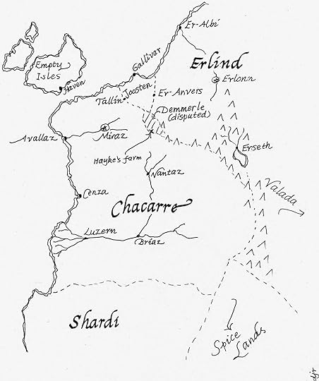
Dotted lines indicate national boundaries. Double lines indicate seacoast. Starred circles are capital cities. The Empty Isles don't have a capital city - they're not nearly organized enough to agree on one. Joosten is also known as the Drowned Lands. The area marked by parallel lines, Demmerle, has historically been part of either Chacarre or Erlind. At the time of the story, it's Chacarran.
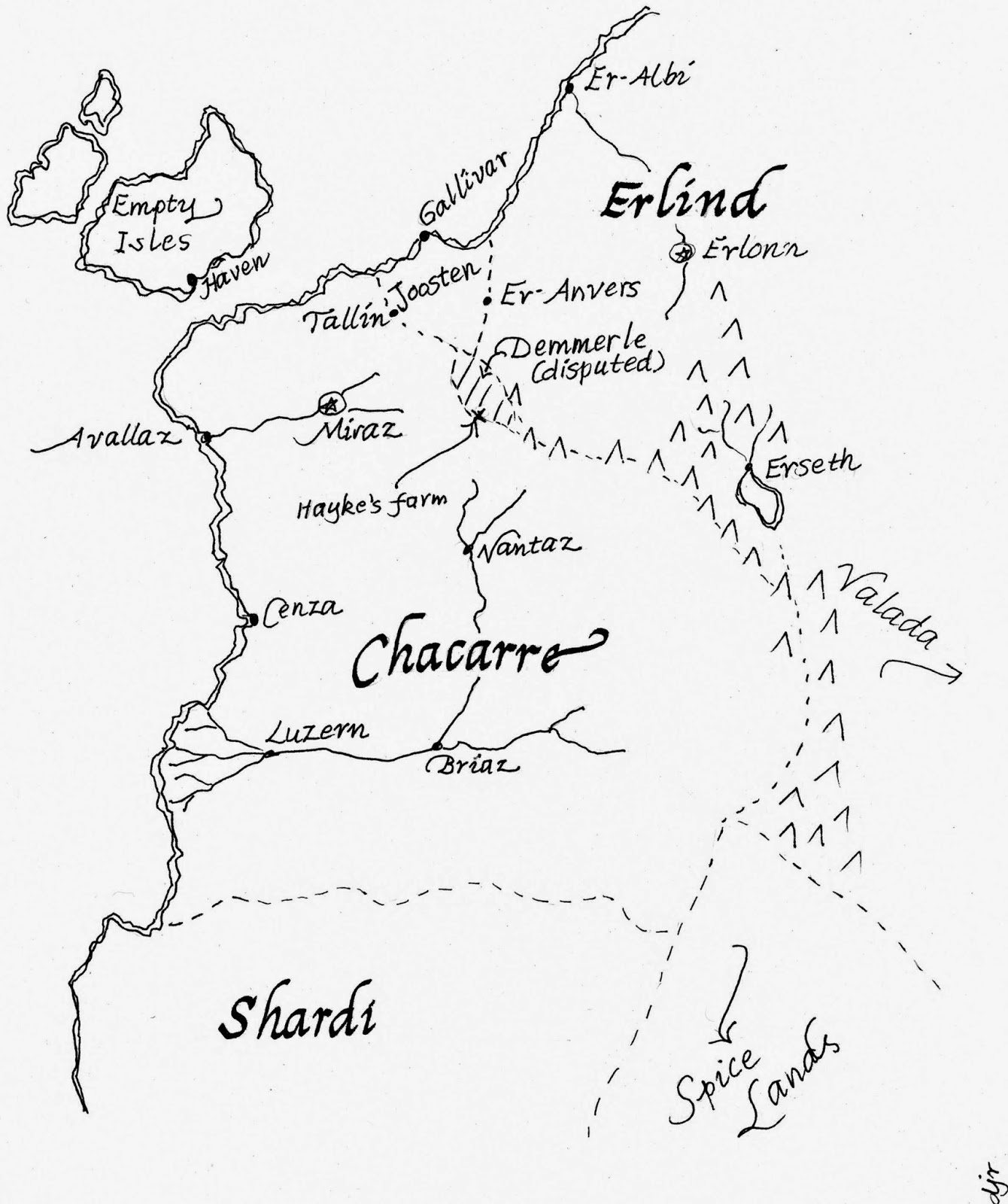
Dotted lines indicate national boundaries. Double lines indicate seacoast. Starred circles are capital cities. The Empty Isles don't have a capital city - they're not nearly organized enough to agree on one. Joosten is also known as the Drowned Lands. The area marked by parallel lines, Demmerle, has historically been part of either Chacarre or Erlind. At the time of the story, it's Chacarran.


No comments have been added yet.


