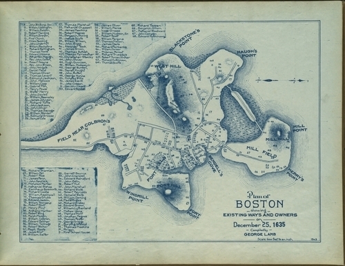
A shiny nickle to the person who can tell me why Corn Hill...
A shiny nickle to the person who can tell me why Corn Hill became Fort Hill.
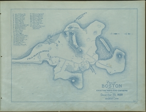
That map!
I asked my contact at the Massachusetts Historical Society if she had any leads on where to find maps of New England that I could use in Colonial Comics. She directed me to the Norman B. Leventhal Map Center at the Boston Public Library which has a HUGE database of historical maps from around the world and I believe I’ll be spending the rest of my week there.
So many wonderful, wonderful maps. The one above is the original plan of Boston from 1630. I love how it points out who will own what lands. Winthrop gets top-billing, of course.
I am trying to wrap my head around one particular aspect of this map and that’s Corn Hill. According to Nathaniel Philbrick’s Mayflower, Corn Hill was the place where the Pilgrims stumbled across a reserve of Wampanoag corn seed that was buried in the ground. But that was in Provincetown, when they were looking for a place to settle, before making their way to Plimoth. I found another map of Boston from 1635 (below) that labeled the same area Fort Hill.
I must know the reason behind the name change!