Hidden Treasure
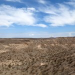
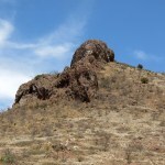
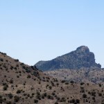
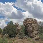
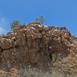
For months, I’d been studying topo maps of mid-elevation mountains straddling our border with Arizona. One of my most memorable hikes had ascended a dramatic rock spire at the edge of that range. I approach it from the south, where it begins in low hills beside our famous river. Trending north, these hills get higher and rockier, peaking at 6,555 feet. Then, with no topographical interruption, the mountains get a new name, continuing north, gaining another 500 feet in peak elevation, until the mountainous area spreads and eventually acquires two or three other names.
The southern part is all cattle range and can only be accessed by long gravel roads up a vast alluvial bench lined with creosote bush. The maps show that the mountains themselves were mined extensively in the past, resulting in a bewildering maze of mine roads and 4wd tracks. Where the southern mountains transition into the higher northern mountains, there’s a small wilderness area containing a box canyon with cliffs nearly a thousand feet tall. This area is so far off the radar of hikers and outdoor enthusiasts that the only info I could find online was from the 2009 trip report of a prolific hiker from Phoenix, more than 200 miles away. His photos were spectacular.
But he didn’t provide clear directions on how to get there. My mapping platform suggests that you can drive over the range from south to north, but doesn’t show any side roads leading to the box canyon. Older topo maps show 4wd tracks approaching the mouth of the canyon from two directions, but I suspected all those old roads and tracks, built decades ago for now-abandoned mines, would be sketchy at best. There was only one way to find out.
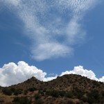
The high temp at home was forecast to be in the mid-80s, but in monsoon season clouds or even rain can cool things off quickly. Not knowing the quality of those roads, I had some concern about clay turning to deep, sticky mud. The ranch road up the alluvial bench leaves the paved highway at an elevation of 3,700 feet, where the high would approach 100 degrees, but the road across the mountains tops out closer to 6,000 feet, where afternoon temps should be comfortable, and hopefully I would find a shady spot to hang out.
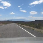
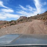
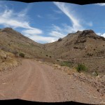
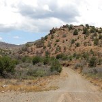
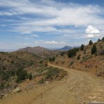
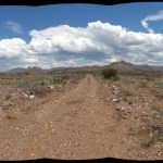
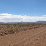
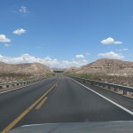
The road up the bench was well-graded and the gravel fine enough that I didn’t even have to deflate my tires, until it entered the foothills and became rockier.
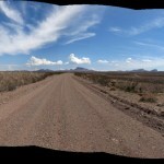
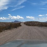
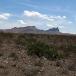
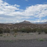
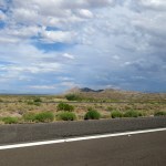
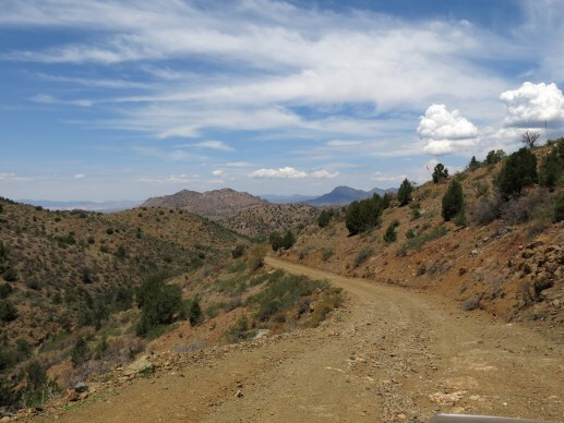
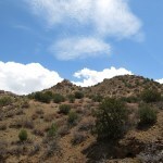
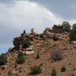
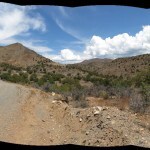
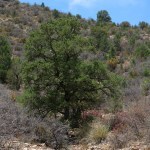
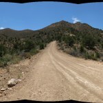
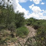
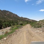
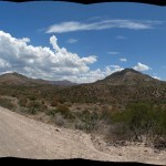
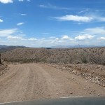
The line of outlying peaks, all of which I dream of climbing, features spires of solid rock at their crests, and with the growing monsoon clouds behind them they looked even taller and more dramatic. The slopes here are dotted with small junipers and honey mesquite. The road got rockier, and I deflated my tires for a softer ride, but I was surprised to find that the surface remained well-maintained and wide enough for two vehicles in most places, looking more like one of those touristy “backcountry scenic drives”.
As I approached a blind rise, a 2-person UTV suddenly shot over the rise toward me, going so fast it almost left the ground, then corrected at the last minute to miss me by inches. I waved to the driver and passenger, but they had their hands full avoiding a wreck. That turned out to be the only other vehicle I passed in two hours of traversing the range.
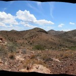
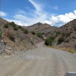
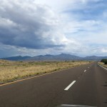
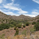
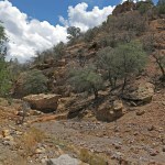
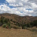
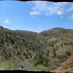
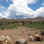
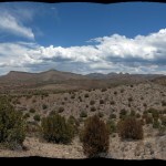
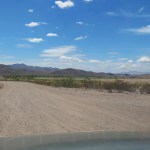
The views got better the farther I went. After winding past the first line of rocky peaks, I entered an area of interior basins lined with colorful rock and lusher vegetation. The washes hosted coyote willows and even small stands of narrowleaf cottonwoods. I could see a lone ranch back up the nicest-looking side canyon. You could see the potential for washouts whenever the road crossed a wash, but, again to my surprise, the county was clearly maintaining this as an essential right of way.
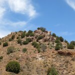
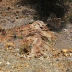
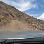
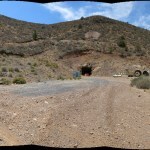
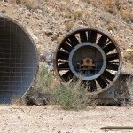
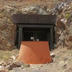
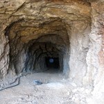
Based on the topo map, I’d expected to have difficulty sorting out a maze of roads, but on the ground, there was only one through road showing the lion’s share of vehicle tracks, with only an occasional little-used side road. And the main road eventually began climbing toward the peak, where I encountered a shocking spread of mining facilities, installations, equipment, ruins, and debris from several generations going back to the nineteenth century, and apparently still in use.
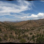
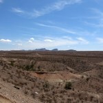
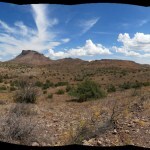
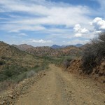
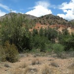
Past here is where the next named mountain range began. The north slope of the peak was lined with pinyon pine, the mountains ahead were both higher and more forested, and the views even more spectacular. I had stumbled upon hidden treasure, a beautiful, unexpected, remote landscape almost in my backyard.
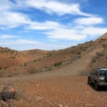
Beside precipitous drop-offs, the road descended steeply from the peak into a hidden valley lined with rocky ridges, with monsoon clouds still building to the east and south.
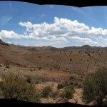
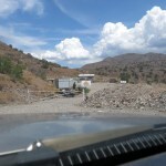
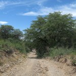
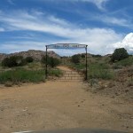
At the bottom of that hidden valley, a lush basin appeared on my right, stretching back to the base of the taller mountains. I passed a ranch road blocked by a tall, fancy gate, then the road plunged across a wide, deep wash, with the ruins of another ranch on the opposite bank.
The road continued north on the bank of that big wash, which hosted a canopy of tall sycamores and narrowleaf cottonwoods. Rounding the foot of an outlying ridge, I came to another ranch road blocked by a gate with an even fancier and more unlikely arch. I began to suspect the hidden area had actually been discovered and colonized by rich folks, but when I looked it up later, I learned this is a Buddhist retreat center. And according to the old topo maps, it’s also the route to the box canyon – now privatized by monks?
Throughout this stretch of road, I had been expecting to find a turnoff for the box canyon, and I had stopped repeatedly to study my topo maps, but they only left me more confused. On the entire drive, I hadn’t found anyplace shady to pull over and hang out, so all I could do was keep going. It was such beautiful country, I could hardly complain.
Eventually the road left the mountains and began crossing the alluvial bench back toward the river valley, upstream of where it had started. I returned to the Mormon farming village and had a late enchilada lunch, then decided to continue east to spend the night in the railroad town on the interstate.
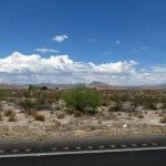
The next phase of the drive took me past more favorite high-desert hiking areas, down into the low-desert river basin at under 3,000 feet, and finally back up through foothills of the tallest sky island, to arrive at 4,200 feet in the railroad town. A big loop, a lot of driving on a hot day, but rewarding. I feel like I’ve still only scratched the surface of those hidden mountains, and will be back for more.