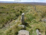
A well weathered, named boundary stone, named ‘The Folly’ on the 1856 OS map. At one time it marked the boundary between the Civil Parishes of Commondale to the west and Danby to the east and prior to that it marked the boundary of the Ancient Parishes of Guisborough to the west and Danby to the east.
Published on May 09, 2025 06:39


