
Google Earth Captured Satellite Image of Moses Crossing Red Sea!
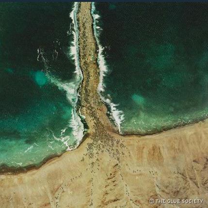 Moses leading Israel through the Red Sea
The guys at Glue Society (Warning: not all of their stuff is edifying) have provided some unique Google Earth shots from biblical times including the creation of the Garden of Eden, the Crucifixion, the landing of Noah’s Ark on Mount Ararat and now (to the left) Moses Crossing the Red Sea.
You can see them here but you will need to sign in.
However, for some who were born yesterday, these are not real Google Earth satellite images, they are actually a couple of pictures God added to the back of the Bible when he dropped it down from heaven.
 Three crosses in Jerusalem in 30 AD
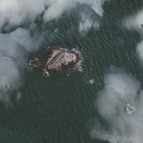 Noah’s Ark landing on Mount Ararat
The post Google Earth Captured Satellite Image of Moses Crossing Red Sea! appeared first on Defenders of the Catholic Faith.


No comments have been added yet.
Stephen K. Ray's Blog

- Stephen K. Ray's profile
- 27 followers
Stephen K. Ray isn't a Goodreads Author
(yet),
but they
do have a blog,
so here are some recent posts imported from
their feed.

