
Lightning Up
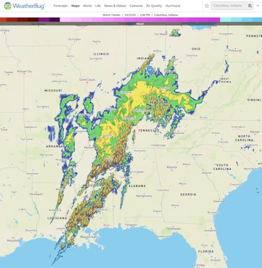
What you see above is a line of storms that is moving northeastward from southern Louisiana across all of Mississippi, western Tennessee, all of Kentucky, southern Indiana (where I am), and western Ohio. It is provided by Weatherbug. If you go there and slide the Weather Overlay up to the Storm Tracker view, the map will now see, in addition to colors for densities of rain, symbols for lightning and the paths of the heaviest storm cells, which are all currently in Mississippi and Tennessee.
This is a storm that has been edging eastward out of the Mississippi Valley and has already killed at least seventeen people. It is also full of tornadoes. There is a good chance some of those are happening here:
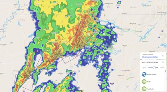
Note the brown wedge-shaped polygons. Those are storm paths.
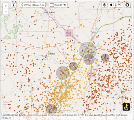
LightningMaps.org is another useful resource. Zoom in and it will show each lightning bolt, plus growing (and fading) circles around the bolt, displaying the spread of thunder. (By the way, not all lightning strikes ground, and many bolts stretch through and between thunderclouds.) Here’s Tupelo, Mississippi, a moment ago as I write this (3 PM Eastern time):
Oh, and one more:
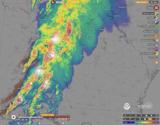
That’s here at Windy.com. The white areas are live lightning, with sound effects. Eastern Alabama is getting hit hard right now (11:45 PM Eastern). Big thanks to Tanya Weiman in the comments below for pointing me to it. I was already a Windy fan, but didn’t know about this feature.
I just noticed that it’s also on the Windy app, under “Weather Radar.” It’s free. Go get it.


Doc Searls's Blog

- Doc Searls's profile
- 11 followers

