
On the Palisades and Eaton Fires
We’re watching KABC/7 from Los Angeles, live on our Roku TV (which has it among hundreds of “Live TV” channels), and in a browser on this laptop. One screen grab:
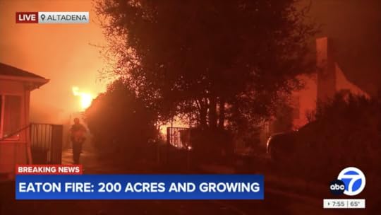 KABC/7 live coverage of the Palisades fire, and the new one a Eaton Canyon in Altadena.
Fire.ca.gov has much information, and maps. Here’s one for the Palisades fire:
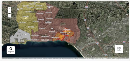 Current perimeters and evacuation areas for the Palisades Fire, via CalFire. It has since expanded to San Vicente Boulevard in Santa Monica.
Winds are so strong that there is no fire fighting on the front as it moves east and southeast. Gusts are up to 85 miles per hour.
Here is a screenshot of Google Earth, with visualized data from MODIS and VIIRS satellites, which pass over regions (such as this one) of Earth fourteen times a day on polar orbits:
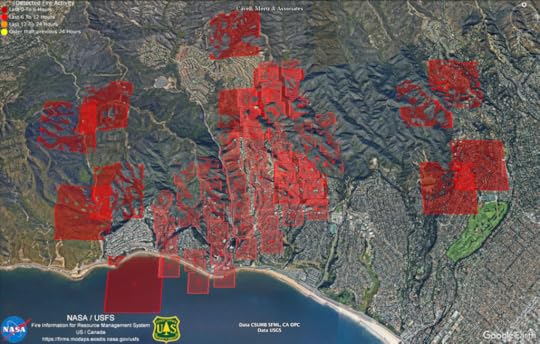 Fire detection by MODIS (the big squares) and VIIRS (the small ones), as of about 8 PM Pacific on January 7, 2025.
NASA has that data here. Look at the row titled “USA (Conterminous) and Hawaii.”
I am using Google Earth Pro. Other versions are available. See here.
More links:
BlueskyFacebookThreadsXitterNow at 8:33pm: Palisades Charter High School, (aka Pali and Pali High) with many famous alumni, just burned to the ground.


Doc Searls's Blog

- Doc Searls's profile
- 11 followers

