On Scratch Maps and Map Scraps
My friend Doc is reading The Twice-Drowned Saint. This is thrilling. I AM THRILLED whenever anybody reads ANYTHING of mine, and doubly thrilled if it’s one of those books that I uneasily think is “not for everyone.” (That’s pretty much all of my books.) (Not that ANY book is for EVERYONE.)
Don’t get me wrong. I adore The Twice-Drowned Saint. It’s the book about which my editor, Mike Allen, taught me one of my most useful phrases: “I stand by the work.” That’s hard to say. Harder to do. So many doubts. SO MANY DOUBTS. But I know… I know that I learned so much writing it.
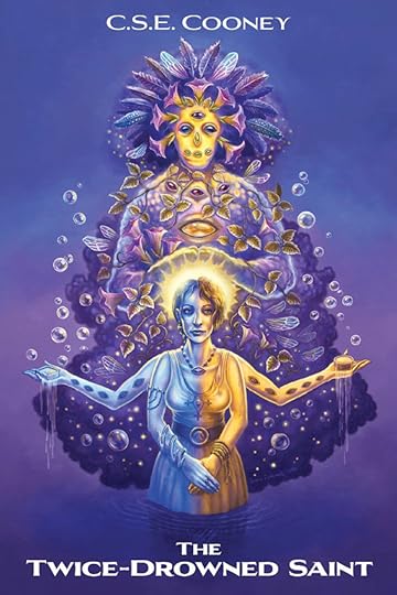 Our gorgeous cover by artist Lasse Paldanius!
I know that it was, at the date it was written, one of my most ambitious structures. A novella that grew to be too big for its britches, but nonetheless still felt like a novella rather than a novel at 65,000 words. That liminal, boundary-defying darling. I know that I did so much research for it–about building with salt structures, about ice, about alpine rescue; I even interviewed someone who used to do it! Robert Peterson! The absolute darling! He read over the work and let me know what I needed to tweak.
My friend Magill, who knows everything about movies and the history of movies and about filmmaking helped me with some of the cinematic stuff. I structured every chapter as different shots of a camera, since the main character thinks in movies.
But I also think the work is dense. And maybe I let some threads fall? I don’t even know! Every time I read it I’m pleasantly surprised it’s not the mess it was just two drafts before. That’s the thing about final drafts. They’re not the ones that LIVE IN MY HEAD.
I am rambling. What I meant to say is: Doc is reading The Twice-Drowned Saint, and was interested in making a map of Gelethel. He asked me if I had one. I mean… I HAD one. I could almost remember it. The trouble is… which notebook is it in?
Thankfully, I’d digitized that one. So after a search for “Twice-Drowned Saint Notes and Cuts,” I found it, copied and pasted into that document! Thank you, past Claire.
 The most glorious Phoebe Ashcroft’s fan art of Alizar the Eleven-Eyed from The Twice-Drowned Saint.
But in the search for that map, I found several others.
You all probably know by now that most of my stories, short and long, take place on the same world Athe. But depending on where you are on the world, and when you are in its time line, it’s going to have different rules, different gods, different ways of operating. If one whole continent, and the different countries on it, shares certain magical or religious beliefs, even with variations, it will operate more cohesively than a continent of scattered city-states that worship vastly different deities. Like, say, a city that, for example, is run by angels who went and murdered their god. (Ahem, The Twice-Drowned Saint.)
I didn’t intentionally do this when I started writing short stories. I just thought it was funny. Little secret giggles for myself. I didn’t think, twenty years later, there’d be interconnected novel worlds that I’d then have to justify to CLOSE READERS. Sorry, mi enjambre. I’m just not that awesome a tactician. More of a practical joker, but mostly playing jokes on myself.
Anyhow, I thought I’d share these bad maps with you. Because they’re hilarious.
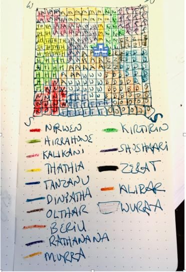 Rough map of Gelethel
Yeah, I don’t know why I wrote “S” when I meant “E” for east, but that’s my scrap maps for you.
The city of Gelethel is diamond-shaped, but I made a square because that was easier on grid paper. I just turned it slightly so the top of the square was North.
And what is that shape in the middle? Is that the salt palace? What was I thinking? I probably made the map during an early draft anyway. Maybe things changed.
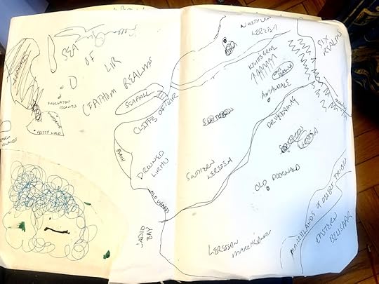 Map of Seafall, Drowned Lirhu, Doornwald, Amandale, etc… from Bone Swans, Dark Breakers, The Witch in the Almond Tree, my WIP Fiddle, and my short story in Uncanny Magazine: “From the Archives of the Museum of Eerie Skins, an Account.”
See Kywit’s Grove on there?
See the Six Realms in the Northeast corner? I don’t know that I ever call them the Six Realms in the Saint Death book, maybe because I kept thinking I’d SURELY come up with a better name if I tried, but then it didn’t become important because they’re not, at present in the Saint Death books, unified at all, but that’s where Liriat, Rook, Quadiíb, Damahrash, Leech, and Skakmaht all are.
See the bottom right–Southeast–that says “Eastern Bellisaar”? That’s where “Godmother Lizard” (Black Gate Magazine), “Life on the Sun” (Bone Swans), and The Twice-Drowned Saint take place. It’s also where, if I ever write it, Zilch: A Tale of Nea the Nephilim will take place. (Or was it “Nea the Knighter”? All I know is that the main title is called Zilch, and it’s about Nea, who makes a brief but important appearance in The Twice-Drowned Saint.
Speaking of the so-called “Six Realms” see below. (Dang it. Now I HAVE to think of a better name for that continent. Once it’s unified. I wonder when THAT happens in its long history? Does it ever become a democratic republic, do you think? Or a meritocracy, like Quadiíb?)
…But, look. I can read my own map (sort of). If you count Kalestis and Umrys-by-the-Sea, as well as LOWER Quadiíb, it’s more like NINE realms anyway. DO I ever count Kalestis? (I remember using Kalestis for SOMETHING, but maybe that was in a former draft, or a WIP. I shall have to do a search.)
In the Saint Death books, Damahrash is still sort of a Rookish satellite anyway. It would be considered part of Rook? Maybe Kalestis is formed later? And Quadiíb is thought of as just Quadiíb, at least by the Lirians, even though Higher and Lower Quadiíb are very different entities, governmentally speaking.
So I suppose it COULD HAVE BEEN six, and later in the timeline becomes nine. Or vice versa.
Why even, fantasy novel?
I don’t really sit here answering questions about the world until a certain stage in a given draft.
Except books are… cumulative. And one’s oeuvre becomes this great spiraling accretion disk, with yours truly as the black hole at its center.
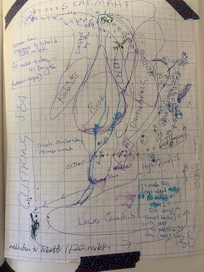 At some point, for Saint Death’s Herald, I had to figure out how far the character could travel in a day, and what each square of the grid represented, mileage-wise. Then I had to answer the following questions: “How fast does an undead flying tiger rug fly?” “How fast does a dragon fly?” “How fast does a sky house fly?” LOL.
And, obviously (it’s just becoming obvious to me now), between the Bone Swans/Dark Breakers continent and the Saint Death continent, there’s not just those weird squiggle mountains, but also “The Glistring Sea.” It must be so, because I’ve written it in.
Seriously, smalls, don’t take these maps to heart. Like the pirate says, it’s “more what you’d call ‘guidelines.'”
But I’ll leave you with ONE LAST ONE. I didn’t end up using this one as much. It was EARLY Saint Death’s Herald draft for Witch Queen’s City, in Leech. In fact, my research led me to model it off Castellfollit de la Roca in Catalonia, but here’s the map before the research:
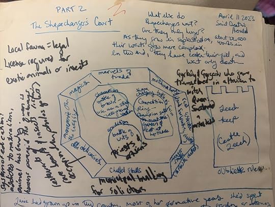 Early ideas for Witch Queen’s City, in Leech (now called “Taquathura” to be respectful to the skinchangers who live there).
Anyway. That’s all. I just wanted to share it with you. It’s funny… looking at them all together like that. These are scraps from ACROSS THE YEARS. I am very haphazard about this sort of thing. And only when someone like Anthony John Woo approaches me about adapting my world for his 5e D&D campaign, or Doc wants me to make me AN ACTUAL MAP do I start considering the notebooks and notebooks full of this stuff.
So there. Have a present.


