Hike to the Bob Webber Cabin Site-Pine Creek Gorge
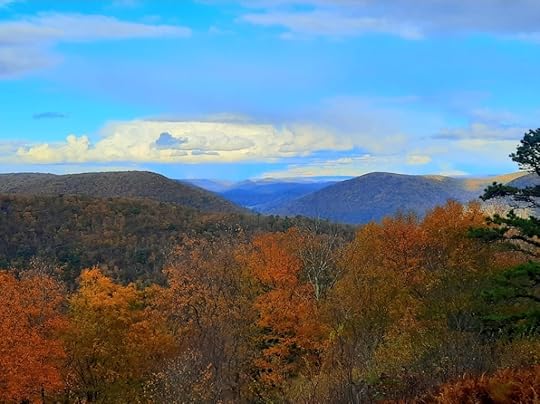
 View behind Webber Cabin Site
Length: About 5 miles
Blazes: Gas Line Trail is unblazed (there are old blue blazes), Black Forest Trail (BFT) is orange
Difficulty: Easy to moderate
Highlights: Four fantastic views, site of the Webber cabin, gravesite of Dotty and Bob Webber.
Issues: Gas Line Trail is brushy and can be a little hard to follow east of the cabin site.
Parking: Large lot at forestry buildings. 41.468441, -77.566021
Description: Bob Webber was a PA hiking icon, building, routing, and maintaining many trails in the Pine Creek Gorge, including the famous Golden Eagle and Black Forest Trails. He’d cut trees with an axe and led many hikes. He lived in a cabin with his wife Dotty on the rim of the gorge, a few miles from the nearest road. They lived a simple life that was dedicated to the outdoors and introducing people to the beauty of Pine Creek. Their legacy and spirit live on in the gorge they loved so much.
After the Webbers died, their cabin was moved to the PA Lumber Museum. There is a monument at the cabin site, which I’ve been told is the Webbers’ burial site.
As a result, this hike has the feel of a pilgrimage.
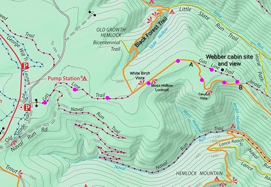
From the parking area, turn right on the road and reach a T. Go straight on the gated Gas Line Trail. This trail is obvious and may have old blue blazes, it follows an old woods road. Reach the BFT and go straight, pass two excellent views. Reach Point A, veer left on Gas Line Trail where the BFT goes right. Gas Line is obvious and descends. Reach a large campsite on the right, to the left is the Webber cabin site with the memorial. You will see old stone paths being reclaimed by vegetation. It is a place to honor a couple who dedicated their lives serving the public. A path goes behind the site to a great view of the gorge. Gillespie Point is in the distance.
The one issue on this hike is the Gas Line Trail just past (east of) the cabin site, it gets brushy and the trail can be a little hard to see, but it’s there. The trail is less established and descends an old grade to the BFT (Point B). Turn right onto the BFT and climb to beautiful Canyon Vista. Reach Point A and retrace your steps, passing the other two vistas.
 Pink/purple is my route. Gas Line Trail gets brushy east of the cabin site.
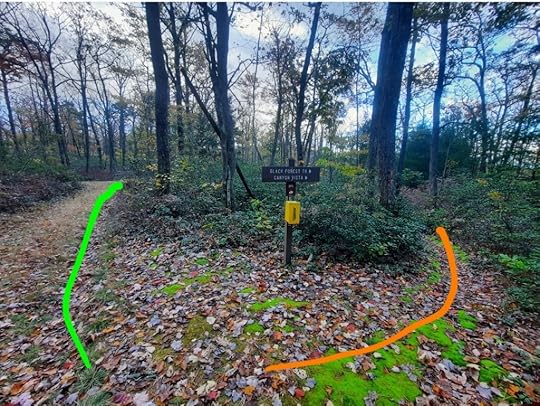
 Point A. Gas Line is to the left, BFT to the right.
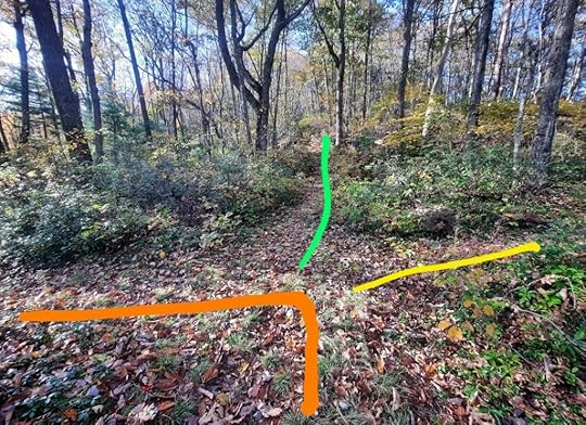
 Point B. Gas Line is green, BFT is orange. Jerald Trail is yellow.
View this post on InstagramA post shared by Jeff Mitchell-Outdoors Author (@hiking_mitch)
View this post on InstagramA post shared by Jeff Mitchell-Outdoors Author (@hiking_mitch)
Jeff Mitchell's Blog
- Jeff Mitchell's profile
- 3 followers


