Ketchum Run/Alpine Vista Loop-Loyalsock State Forest
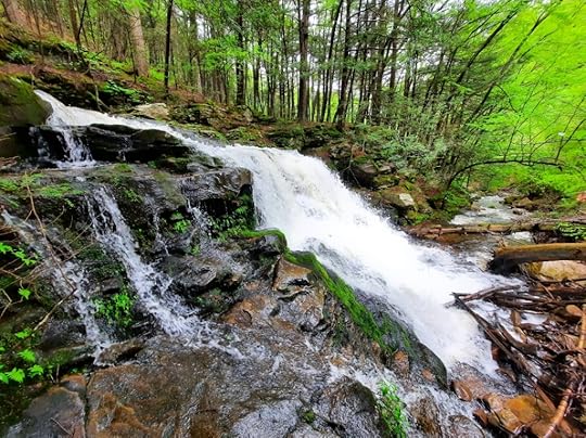
 Lee’s Falls
Length: About 3.5 miles with side hike to Lee’s Falls and the chasm.
Highlights: vistas, waterfalls, gorges, beautiful creek, wildflowers
Parking: Pull off parking at 41.456740, -76.628424. Coal Mine Road is gated in winter.
Trail conditions: Trails are well blazed and easy to follow. The old forest road is obvious, but not blazed. Loyalsock Trail (LT) has yellow/red circular placards. Expect wet areas and steep terrain.
Difficulty: Terrain is rugged. I’d say moderate to difficult.
Direction of travel: For first time visitors, I think counterclockwise is easier to navigate.
Description: This is the perfect dayhike loop in the Loyalsock State Forest. I’m surprised it’s not more popular. Ketchum Run is a gem in the Loyalsock, a place of incredible beauty. However, dayhiking it was a challenge. People either did a 9 mile loop from High Knob Road, or did an out and back from either High Knob or Coal Mine Roads. This loop is perfect, showcasing the highlights of this special place. What more could you want? Two waterfalls, two vistas, beautiful streams and gorges, hemlocks. This hike gives a lot of bang for your buck.
From the pull off parking, with your back to the pull off, go left on Coal Mine Road. Reach a sign for the LT, go left. Reach stunning Alpine Vista with a dry campsite. Follow the edge of the gorge and make a steep descent to equally beautiful Lower Alpine Vista. Snakes are often here in hot weather. This part of the trail is often wet. Continue on a somewhat steep descent to Ketchum Run on the LT (don’t take the ladder bypass trail if you want to see Rode Falls).
Reach Ketchum Run and the beauty of this place is apparent. Rode Falls and its famous ladder comes into view. Climb the ladder and climb away from the creek via switchbacks. At the top, notice a blue blazed trail on the left. That is the route, but I highly recommend a side hike down to Lee’s Falls and the stunning gorge/chasm just upstream of the falls. The gorge/chasm is a few hundred feet long. Turn around before a fern glade.
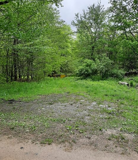
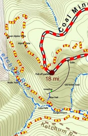
Follow the blue trail a short distance and reach an old forest road. The old road is not blazed, but is obvious. Cross a meadow. Follow the road on a steady climb back up to Coal Mine Road, at the gate. Turn left on Coal Mine Road back to the car. I’m not sure why the blue trail isn’t marked all the way to Coal Mine Road, hopefully it will be in the future.
 This is the gate as shown on the map.
 From the pull off parking, hike counterclockwise on the LT, to the blue trail, old forest road, to Coal Mine Road. Also be sure to do the side hike down to Lee’s Falls and the gorge/chasm along the LT. Red/yellow on the map is the LT.
 View this post on InstagramA post shared by Jeff Mitchell-Outdoors Author (@hiking_mitch)
View this post on InstagramA post shared by Jeff Mitchell-Outdoors Author (@hiking_mitch)
View this post on InstagramA post shared by Jeff Mitchell-Outdoors Author (@hiking_mitch)
View this post on InstagramA post shared by Jeff Mitchell-Outdoors Author (@hiking_mitch)
Jeff Mitchell's Blog
- Jeff Mitchell's profile
- 3 followers


