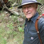
Sweaty Canyon
I’d been waiting all summer for the weather to cool off enough so I could hike the canyon trail over in Arizona that had finally been cleared. According to the forecast, it still wouldn’t be cool enough, but we’d been having monsoon weather for past week, and I was hoping I’d have cloud cover, and possibly even rain, in the afternoon, to cool things off.
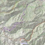
Over the past four years, I’ve been exploring every trail that climbs from the accessible northeast basin of the range, through the wilderness area to the 9,000 foot crest. Every trail, that is, except this one – so this was now my holy grail.
I’d actually tried it a year and a half ago, and found the final 1.3 mile stretch seriously impassable. But a professional trail crew had finally cleared it this year – twelve years after the 2011 wildfire.
Not only would this complete my exploration of the northern canyons, but it would be the longest hike I’d ever done in this range. What limits me is the distance from home – the long drive means less hours available to hike. So today I would leave early.
About thirty miles south of town, a pronghorn crossed the highway in front of me. Hadn’t seen one for a few years – I took it as a good omen.
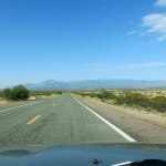
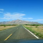
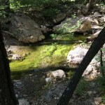
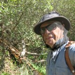
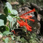
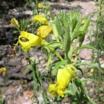
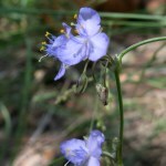
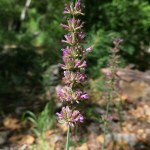
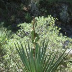
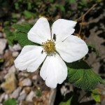
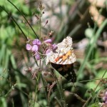
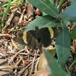
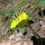
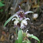
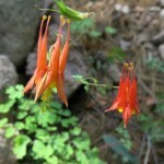
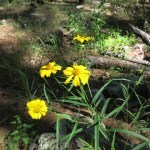
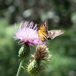
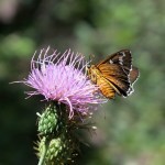
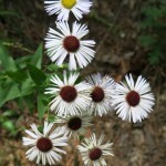
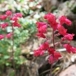
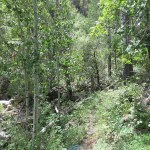
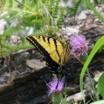
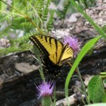
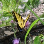
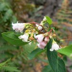
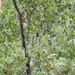
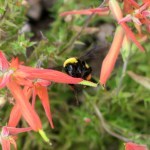
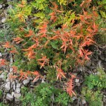
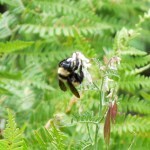
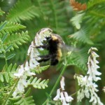
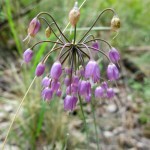
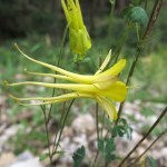
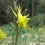
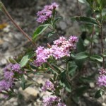
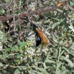
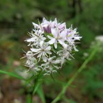
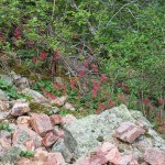
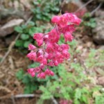
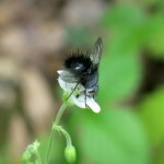
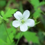
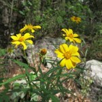
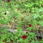
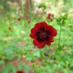
Despite the early start, air temperature was already in the 80s when I reached the 5,240 foot trailhead at 8:30 am. And despite our summer-long drought, and the fact that the creek started out bone-dry, I was soaked with sweat and swarmed by flies within the first mile. These northern canyons hold moisture – from our wet winter and a few rains in June – and unlike in our canyons back home, I found an impressive display of wildflowers and pollinators.
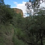
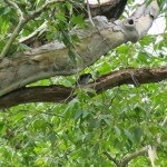
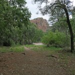
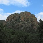
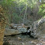
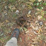
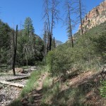
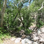
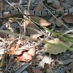
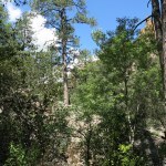
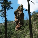
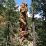
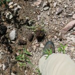
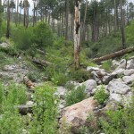
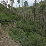
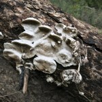
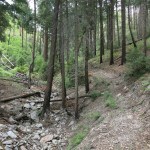
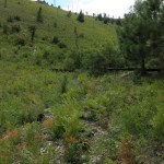
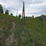
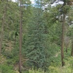
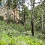
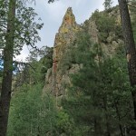
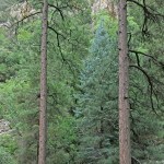
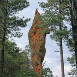
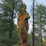
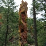
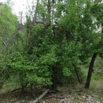
One or more bears had preceded me on the trail this morning, leaving scat all the way up. The first stretch is a steady four-mile ramble at a shallow grade, under red cliffs and spires, through riparian forest dominated by sycamore, cypress, ponderosa pine, and oak. The creek was running intermittently, but often choked with algae. I saw no human tracks anywhere – presumably the heat’s been keeping hikers away.
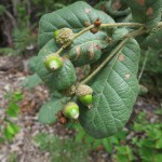
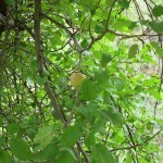
There’s supposed to be an apple tree on the trail about three miles in, but I hadn’t found it before and didn’t find it this time either. The heat combined with humidity were really exhausting and discouraging.
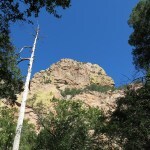
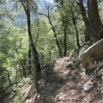
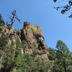
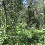
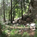
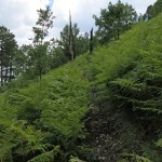
Moving slower than usual due to the heat, I finally reached the junction where the big side canyon comes in from the west. Beyond here, the trail becomes very rocky and very steep, climbing continuously at an average grade of 21% for the next three miles, but it also enters dense mixed-conifer forest that provides more shade. Scattered clouds were forming so I was hopeful for cooling temps.
But it was so muggy, even occasional shade failed to provide relief. I couldn’t remember when I’d been this physically miserable on a hike. The only things that redeemed it for me were the beautiful forest, the rock formations, the flowers and the pollinators.
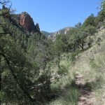
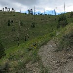
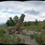
Finally, after a mile and a half, I reached the end of the forest and the edge of the burn scar. It was taking me much longer than expected, and I hated to think I might fail to reach the crest.
I had to at least confirm that the upper trail was accessible. On my previous attempt, I’d gotten lost in a deeply eroded ravine choked with deadfall and regrowth. The ravine remained a nasty place, but big cairns on each side showed where to cross, and clear tread continued on the opposite side.
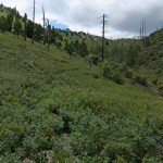
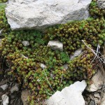
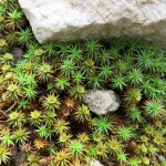
This restored trail had already been colonized by annuals, responding to moisture that remained in the soil from last winter. But I quickly learned to just ignore the annuals, striding through them as if they didn’t exist. I could see the narrow drainage above this burn scar, where a band of forest had escaped the fire. That was my next destination – I’d failed to bring a map, but assumed it led straight to the crest.
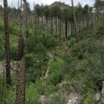
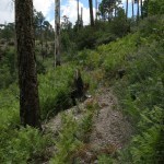
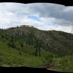
Cloud cover was now almost complete, and the air temperature was dropping, but I kept sweating just as hard. I was relieved to reach the intact forest, only to discover it led to upper slopes that had been completely cleared by fire. The ground here was white gravel, and as far as the eye can see, it was blanketed with ferns and thorny locust, in some places shoulder-high. The trail showed as only a vague disturbance in the dense vegetation.
In this treeless landscape, that 21% grade felt Sisyphean. From my perspective, I couldn’t tell how near I was to the end – I assumed much of what I was looking at were false peaks. I was pushing my way through waist-high annuals, climbing a seemingly endless series of long switchbacks toward the ever-darkening sky, stopping often to catch my breath.
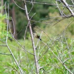
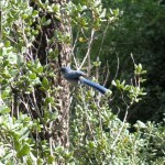
Here in this alpine burn scar where you could almost touch the clouds, wildflowers were lush and pollinators were working as hard as ever – I even saw hummingbirds.
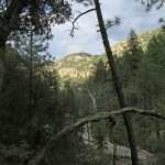
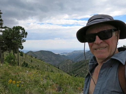
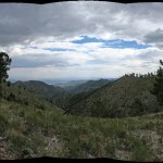
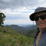
Finally I was high enough for a view east, but I wasn’t sure what I was looking at. And then it felt like the last switchback was approaching a saddle. My clothes were drenched with sweat and my whole body ached, but I’d reached the crest!
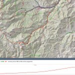
It had taken me 5-1/2 hours to go seven miles, climbing almost 4,000 feet, in tropical humidity. I’d felt a few sprinkles on the last switchback, but that would be it for the day. I was rewarded with a view into a new watershed, but this saddle wasn’t a place to linger. And I had to make much better time on the way back, to reach the cafe, burrito and beer before 6 pm closing.
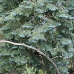
I expected to be cooler on the way down, but even the effort of descending kept me hot and sweaty. I’d allocated nine hours for the entire hike, and I thought that would leave me plenty of time, so I made plenty of stops, especially enjoying the sight of a couple of beautiful Englemann spruce trees, isolated here in one of their southernmost habitats.
I’d been drinking plenty of water and adding electrolyte supplement, but in the next two miles the leg cramps hit, eventually paralyzing me. I rested, I stretched, I pushed through them, but they took a half hour to subside. And air temperature was rising as I descended.
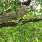
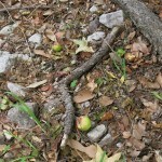
Suddenly I noticed three apples on the ground beside the trail. Then I looked up – the famous apple tree was right next to me! I never would’ve noticed it if I hadn’t seen the apples on the ground first.
Finally, within the last two miles, I took off my shirt and rinsed both it and my hat in the stream. It didn’t stop me from sweating but it felt better having a shirt soaked with creek water instead of sweat! I arrived at the vehicle with just enough time to change clothes and drive to the cafe right before closing.