
Long-term review: CalTopo || My go-to mapping & GPS navigation platform
Let me sound old for a minute. When planning the Sea-to-Sea Route in early-2004, I relied on USGS 30- x 60-minute paper maps at 1:100,000 scale to plot, measure, and follow a 700-mile route across North Dakota and Montana to link the North Country and Continental Divide Trails. Two years later, when planning the Great Western Loop, I was thrilled to discover the relatively high-tech National Geographic TOPO! software, in which I could digitally create another 700-mile route between the Grand Canyon and Pacific Crest Trail and then print custom maps of stitched-together USGS 7.5-minute quadrangles. Rounding out my navigational toolkit was an altimeter watch and magnetic compass.
(If I was a real old-timer, I could tell you about mail-ordering quads or sifting through drawers of them at my local outdoor retailer, or even using a sextant, but I just missed out on that.)
With paper maps and TOPO!, I was able to get it done. But by comparison the modern backpacker has a bounty of more user-friendly and more feature-rich mapping and navigation technologies, including Gaia GPS, AllTrails, Guthook, Backcountry Navigator, and others.
Long-term review: CalTopoMy own platform-of-choice has become CalTopo, and I think it’s now the clear winner for those who have similar needs.
At home, I use the CalTopo website to plan personal and guided trips — specifically, to measure distances and vertical, insert helpful annotations, and draw in unmapped trails and routes;Also at home, I use the website’s print feature to export multi-page print-ready PDF’s that I carry into the field; and,In the field, I use the CalTopo app to help me navigate (via GPS) and as a backup map library.The website and app are synced in real-time (or when the phone has a connection again). So when I edit an existing map or create a new map on one device, it updates to the other. I need not export GPX files (or similar) between platforms — it’s an all-in-one solution, desktop and mobile.
A subscription is required, ranging from free to $100 per year, with most users probably being content with the Mobile ($20/year) or Pro ($50/year) levels. Personally, I have a Pro account, and if I dropped down I’d miss the printing options (11×17 paper and 300 dpi) and Sentinel satellite imagery, plus the parcel data during hunting season.
In full disclosure, CalTopo provides me with this Pro membership, and it also offers free two-month Pro memberships to my guided clients so that we can teach participants how to plan routes at home and to use a GPS app in the field. I wouldn’t get too skeptical based on this admission though — I use CalTopo nearly everyday, and if it wasn’t top-shelf it’d have to offer a lot more than “free” to get my endorsement.
CalTopo desktopI transitioned to CalTopo in about 2013. TOPO! had been discontinued and was not compatible with the newest version of Windows, and I was increasingly comfortable with cloud-based services like Gmail and Google Drive.
At the time, CalTopo was just a website, and it was functionally comparable to TOPO!. But founder Matt Jacobs was constantly making upgrades — more tools, more map layers and overlays, and an improved file-saving and file-sharing system. It felt like a better product nearly every time that I logged on.
 Screenshot of our “guide map” for Grand Staircase-Escalante, which is loaded with information about routes, water sources, camps, and archaeological sites. I give each guide a printed version of this map for field use, and have them download the GeoJson file into their own app.
To plan custom routes and create custom maps, I add objects like markers and lines (both available in dozens of colors and styles), and organize these objects in folders. Lines can be snapped-to existing trails or created off-trail; distances and vertical profiles are available.
I can toggle between multiple map and imagery layers. Most often I use USGS 7.5-minute scans, the FS Topo 2016 map, and Landsat. But in the early-season, I’ll look at the Sentinel satellite imagey for current snowpack; during the fire season, I turn on the Fire Activity overlay; and just for fun, I like looking at historical topographic maps from the early-1900’s.
Once I’m happy with my map, I create a print-ready multi-page PDF of it using CalTopo’s print function, then upload the file to FedEx Office. Refer to my exporting and printing specs for more details.
 Paper maps of the Brooks Range, marked up in and exported from CalTopo, and then printed by FedEx OfficeCalTopo app
The CalTopo app was released in 2018, but until last season I continued to use Gaia GPS. CalTopo lacked aesthetic refinement and was missing important features, and I also just hadn’t taken the time to learn it.
But the CalTopo app has arrived — it now offers all the functionality that I need from a GPS tool, and it has a very intuitive system for downloading maps for offline use. Sealing the deal is its convenience: I can load and edit my maps at home on a desktop computer, in the field on my smartphone, or on my couch using a tablet.
 My “guide map” for Escalante, pulled up in the CalTopo app
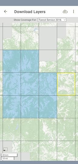 An intuitive system for downloading map tiles for offline use.CalTopo versus Gaia GPS
My recommendation for many years was to use CalTopo at home and Gaia GPS in the field, and have the platforms talk to each other by exporting and importing GPX files between them. The comparative strengths of each platform reflected their histories — CalTopo started as a website and later launched an app, and Gaia GPS started as an app and later built out its website.
However, I’ve now migrated fully to CalTopo for home and the field.
For route planning at home, the Gaia GPS website is functional. However, its print feature is a deal-breaker for me — it exports one-page PDF’s only. For those who use their phone exclusively in the field, this may be an acceptable ommission. But each year I print hundreds of paper mapsets between two and twenty pages, and it’d take hours to manually combine one-page maps into multi-page sets before sending them over to FedEx Office.
Less importantly, I’m not a fan of Gaia’s folder-based organizational system. I always struggle to create a dedicated map for an area or route that doesn’t get polluted by waypoints and tracks that I’ve created previously for other projects.
Lastly, I’ll add that I’m concerned about the future of Gaia GPS. In February 2021 it was acquired by Outside (formerly Outdoor Pocket Media), which also has purchased Backpacker, Trail Runner, Warren Miller, and VeloNews. Gaia will be part of its Outdoor+ subscription ($99 per year); for now it’s still available as a standalone app.
Will Gaia GPS remain focused, nimble, and innovative? Or will it fade into oblivion if its team is gutted (founder Andrew Johnson has already resigned), if its new owners fail to understand marketplace changes caused by new technologies or the competition, or if the parent company encounters financial difficulties.
CalTopo versus OnX BackcountryThis year OnX Backcountry has made a play for the outdoor market, partly by buying the loyalty of outdoor influencers.
Let me save its marketing team some time: Don’t bother contacting me. I’ve looked at the product, and it does not fulfill my needs. Also, I find it mystifying why multi-sport users (e.g. a hiker that also hunts, like me) need to buy subscriptions to multiple apps to get all the data that we want. In comparison, CalTopo and Gaia offer everything in one package.
CalTopo versus Guthook GuidesFor popular (and, now, even not-so-popular) long-distance trails, Guthook Guides is the way to go. It offers trail-specific information like data charts, real-time water reports, and town services, whereas CalTopo has none of that (and no plans to add any of it).
If and when a thru-hiker graduates to more unique and adventurous DIY itineraries, which are not supported by Guthook, he or she should check out CalTopo.
CalTopo versus AllTrailsAround the same time that National Geographic discontinued TOPO!, it partnered with AllTrails, leading me to think that it had settled on a replacement.
But AllTrails had a different vision. It’s not a platform for power users who want to create custom routes and maps like TOPO! was and CalTopo is. Instead, its an extensive database of user-submitted hikes that other users can replicate, review, post comments about, and share photos of. AllTrails is a good resoure for beginner-level hikes and overnights, but it’s not optimized for endeavors more involved than that.
The post Long-term review: CalTopo || My go-to mapping & GPS navigation platform appeared first on Andrew Skurka.


