
Early Polar Maps and Exploration
The ancient world's mythologies regarding a magnetic mountain, four directional rivers, and other more fantastical features at the North Pole are shockingly consistent, but what did the earliest known explorers, historians and cartographers have to say about the subject? Pytheas, the earliest recorded explorer of the North Pole in the 4th century BC, claimed to discover an island he called "Thule," the farthest northern land, and gave an account sounding straight out of ancient mythology. In his lost book entitled "On the Ocean," Pytheas wrote, “the island was more than forty thousand stadia, and in this region there was no longer either land properly so-called, or sea, or air, but a kind of substance concreted from all these elements, resembling a sea-lungs - a thing which, the earth, the sea, and all the elements are held in suspension; and this is a sort of bond to hold all together, which you can neither walk nor sail upon.” Pytheas claimed upon reaching the northern-most point accessible, that land, air, and water somehow became like one substance similar to a jelly-fish and was completely impassable.
Little remains of Pytheas' original account, but second-hand sources like Strabo inform us regarding the inhabitants of the surrounding northern islands, “he says that, of the animals and domesticated fruits, there is an utter dearth of some and scarcity of others, and that the people live on millet and other herbs, and on fruits and roots; and where there are grain and honey, the people get their beverage also, from them. As for the grain, he says - since they have no pure sunshine - they pound it out in large storehouses, after first gathering in the ears thither; for the threshing floors become useless because of this lack of sunshine and because of the rains.”
Pliny the Elder also wrote of Pytheas’ journey in his Naturalis Historia (IV.16) stating that, “on summer days the sun approached nearer to the top of the world; owing to a natural circuit of light the underlying parts of the earth have continuous days for six months at a time, and continuous nights when the sun has withdrawn in the opposite direction towards winter. Pytheas of Mareilles writes that this occurs in the island of Thule, 6 days voyage north from Britain. Pytheas states that north of Britain the tides rise 80 cubits. The most remote of all is Thule, in which we have pointed out there are no nights at midsummer when the sun is passing through the sign of the Crab, and on the other hand no days at midwinter; indeed some writers think this is the case for periods of six months at a time without a break. One day’s sail from Thule is the frozen ocean called by some the Cronian Sea.”
“The earliest voyage to the north is that claimed for Pytheus, the distinguished Phenician astronomer and geographer of Marseilles, who flourished 320 B.C. His works were extant in the fifth century, but are no longer found. Pliny and Eratosthenes gave full credit to his narrations, though Strabo shows great hostility to Pytheus, whose accounts he refused to receive, saying that he made ‘use of his acquaintance with astronomy and mathematics to fabricate his false narrative.’ Pliny, however, with more reason, thought that he employed his knowledge in practical exploration. The latest editor of Strabo does not share in his author’s doubt. According to Pliny and others, Pytheus sailed through the Straits of Gibraltar, making his way north to the British isles, whither it was the custom of his countrymen to resort, and, after traveling over England on foot, proceeded northward to a place called ‘Thule,’ six days’ sail from the northern part of Britain.” -Benjamin Franklin DeCosta, "Inventio Fortunata, Arctic Exploration With An Account of Nicholas of Lynn" (4)

Even before the 4th century BC, similar claims were made by ancient Greek and Roman poets and historians like Pindar, Herodotus, Hesoid, Homer, (then later Virgil and Cicero) regarding "Hyperborea" and the "Hyperboreans," meaning the place/people "beyond the north wind." They said the people of Hyperborea were giants who lived for over a thousand years and enjoyed lives of perfect happiness. In another lost book written in the 4th century BC, Hecataeus of Abdera collated all the known stories written about the Hyperboreans. Diodorus Siculus references this lost work stating that, "In the regions beyond the land of the Celts there lies in the ocean an island no smaller than Sicily. This island, the account continues, is situated in the north and is inhabited by the Hyperboreans, who are called by that name because their home is beyond the point whence the north wind (Boreas) blows; and the island is both fertile and productive of every crop, and has a temperate climate."
 The classical Greek poet Pindar wrote that, "Never the muse is absent from their ways: lyres clash and flutes cry and everywhere maiden choruses whirling. Neither disease nor bitter old age is mixed in their sacred blood; far from labor and battle they live." And reminiscent of Pytheas' strange account Pindar stated that, "neither by ship nor on foot would you find the marvellous road to the assembly of the Hyperboreans."
Similar to Thule and Hyperborea, the Celts also had their northern terrestrial paradise known as "Avalon." St. Brandan, son of Finhlogho, a famous saint of the Irish church, who died in 576 AD, was allegedly the first to reach this land during a sea voyage to the North. Similar to other ancient accounts, St. Brandan mentioned a fountain with four directional streams, and claimed there were "magnificent castles and castle halls lighted with self-luminous stones and adorned with all manner of precious jewels, surpassing decription."
 In 1035 AD Archbishop Adalbert, the vicar of Scandinavia, sent a team of Frisian nobles to explore the northern polar region after which Adam of Bremen recorded their experiences in the book, "Gesta Hammaburgensis Ecclesiae Pontificum." Similar to accounts of the Hyperboreans, the Frisian explorers claimed to reach an island where they encountered giant human beings living in caves and underground hollows. The giants' domiciles were adorned in gold and precious metals which some of the Frisians stupidly attempted to steal and were swiftly chased back to their boats, minus one of their comrades caught by a giant who "in a twinkling tore him to pieces before their eyes."
 They never reached the North Pole or a magnetic mountain, but did encounter an incredible feature long-alleged to surround them. Ancient Norse legend states that a gigantic violent maelstrom (whirlpool) known as "Hvergelmir" or "the World's Well," surrounds the polar mountain and via four, six-hour daily cycles of pushing and pulling through subterranian channels, cause the rising and falling of tides on Earth. Adam of Bremen recounts the Frisian explorer's deadly encounter with this "abysmal chasm," as such: "of a sudden they fell into that numbing ocean’s dark mist which could hardly be penetrated with the eyes. And behold, the current of the fluctuating ocean whirled back to its mysterious fountainhead and with most furious impetuosity drew the unhappy sailors, who in their despair now thought only of death, on to chaos; this they say is the ‘abysmal chasm’ - that deep in which report has it that all the back flow of the sea, which appears to decrease, is absorbed and in turn revomited, as the mounting fluctuation is usually described. As the partners were imploring the mercy of God to receive their souls, the backward thrust of the sea carried away some of their ships, but its forward ejection threw the rest far behind the others. Freed thus by the timely help of God from the instant peril they had had before their eyes, they seconded the flood by rowing with all their might."
 Besides the Norse legends of Hvergelmir, historical records of this "World Well" can be found as early as the 8th century AD when Paulus Diaconus or "Paul the Deacon," Benedictine monk, scribe and historian of the Lombards wrote in his Historia Langobardorum that, "not far from the shore, where the ocean extends without bounds, is that very deep abyss of waters which we commonly call the ocean's navel. It is said twice a day to suck the waves into itself, and to spew them out again; as is proved to happen along all these coasts, where the waves rush in and go back again with fearful rapidity. By the whirlpool of which we have spoken it is asserted that ships are often drawn in with such rapidity that they seem to resemble the flight of arrows through the air; and sometimes they are lost in the gulf with a very frightful destruction. Often just as they are about to go under, they are brought back again by a sudden shock of the waves, and they are sent out again thence with the same rapidity with which they were drawn in."
Giraldus Cambrensis or "Gerald of Wales," archdeacon of Brecon, historian, and royal clerk to King Henry II, wrote in his 1188 work "Topographia Hibernica" that, "Not far from the islands, towards the north, there is an astonishing whirlpool in the sea, towards which there is a set current of the waves from all quarters, until, pouring themselves into nature’s secret recesses, they are swallowed up, as it were, in the abyss. Should a vessel chance to pass in that direction, it is caught and drawn along by the force of the waves, and sucked by the vortex without chance of escape. There are four of these whirlpools in the ocean, described by philosophers as existing in the four different quarters of the world; whence it has been conjectured that the currents of the sea, as well as the winds, are regulated, by fixed principles."
The whirlpool was also mentioned in another late 12th century work "Historia Norwegiae," where the author, an anonymous Norwegian monk gives a particularly detailed description, stating: "The greatest of all whirlpools is to be found there, which engulfs the strongest ships, sucking them in at ebb tide and spewing out their fragments with a belch at flood tide ... There is a very deep abyss in the earth itself and alongside it are open-mouthed caverns containing winds which are said to be brought forth by the breathing of the water, and these are the breath of gales. Indeed, by their breathing these winds draw to them the waters of the sea through hidden passages in the earth; they shut them up in the vaults of the abyss, and then by the same force drive them out again, causing sea-surges, spates and the whirling of waterspouts. Earthquakes also occur and various discharges of vapour and conflagration, for when the winds’ breath, held in the cheeks of earth, presses to burst out, it shakes the foundation of the world with a dreadful roaring and forces it to tremble. So when the winds’ breath contends with fire in the earth’s interior, then even in mid-ocean the depths are fissured and smoky exhalations and sulphurous flames are seen to emerge."
By the 13th century A.D. the idea of a magnetic mountain at the North Pole was widely known enough that Italian poet Guido Guinizelli actually used it as a simile for the power of his woman's love. The section from his poem "Madonna, The Fine Love I Give you," translated reads, "In that land beneath the North Wind / are the magnetic mountains / which transmit to the air their power / to attract the iron, but because it is far away / it needs help from a similar stone / to make the compass needle / turn towards the pole star."
In the 14th century two lost books "Inventio Fortunata" by Nicholas de Lynn and "The Itinerium" of Jacobus Cnoyen mention the magnetic mountain, four directional rivers, and encircling whirlpool said to change every 6 hours causing the tides, comparing them to the “breath of God” at the “naval of the Earth,” inhaling and exhaling the great seas. Many citations from the two books are made by more modern sources, but surviving copies have unfortunately all been lost to antiquity.

Nicholas de Lynn was an English Minorite friar of Oxford, a mathematician, astronomer and explorer who lived from 1330 to 1390. He was fascinated by the astrolabe and actually produced several of them for patrons and his own personal use. John of Gaunt, Duke of Lancaster, even comissioned Nicholas to produce an astrolabe and a "Kalendarium" of complete astronomical tables covering 1387 to 1463 which were later used to create nautical almanacs. For this Nicholas became famously known as "The Man with the Astrolabe," and was even complimented and lauded as an astronomical genius by Geoffrey Chaucer in his "Treatise on the Astrolabe." His esteem as a knowledgable astronomer and navigator soon reached King Edward III who in the early 1360s sent Nicholas and a team of ships to explore the Arctic.
“The work by which Nicholas of Lynn will longest be remembered is not now to be found. Its disappearance under any circumstances is not a matter of surprise, since of many important works once well known no copy remains today, while of others there are only one or two examples. Unfortunately, we know almost as little about the voyages made from Lynn by the fellow townsmen of Nicholas as about the book in question. Many hardy mariners sailed from the port of Lynn, but of their enterprise at the north only the most scanty memorials remain. It is nevertheless clear that their activity was appreciated by Edward III, while their neighbors of Blakeney were several times favored by that king on account of their superior merit.” -Benjamin Franklin DeCosta, "Inventio Fortunata, Arctic Exploration With An Account of Nicholas of Lynn" (19)
 What we know about Nicholas de Lynn, his polar explorations, and his lost book now come from existing citations and quotations from his contemporaries and readers. One such man was Jacobus Cnoyen, a Dutch explorer who composed a book of travel epics in Flemish, also lost to antiquity, but quoted and re-printed in later works still available. Cnoyen is referenced as learning from "the Minorite" (Nicholas de Lynn) that "large parts of the polar indrawing sea did not freeze over in winter." Speaking of Nicholas, Cnoyen wrote, "the priest who had the astrolabe related to the kind of Norway that in 1360 AD there had come to these Northern Islands an English Minorite from Oxford who was a good astronomer. Leaving the rest of the party who had come to the Islands, he journeyed further through the whole of the North and put into writing all the wonders of those islands, and gave the King of England this book, which he called in Latin Inventio Fortunatae, which book began at latitude 54 degrees, continuing to the Pole."
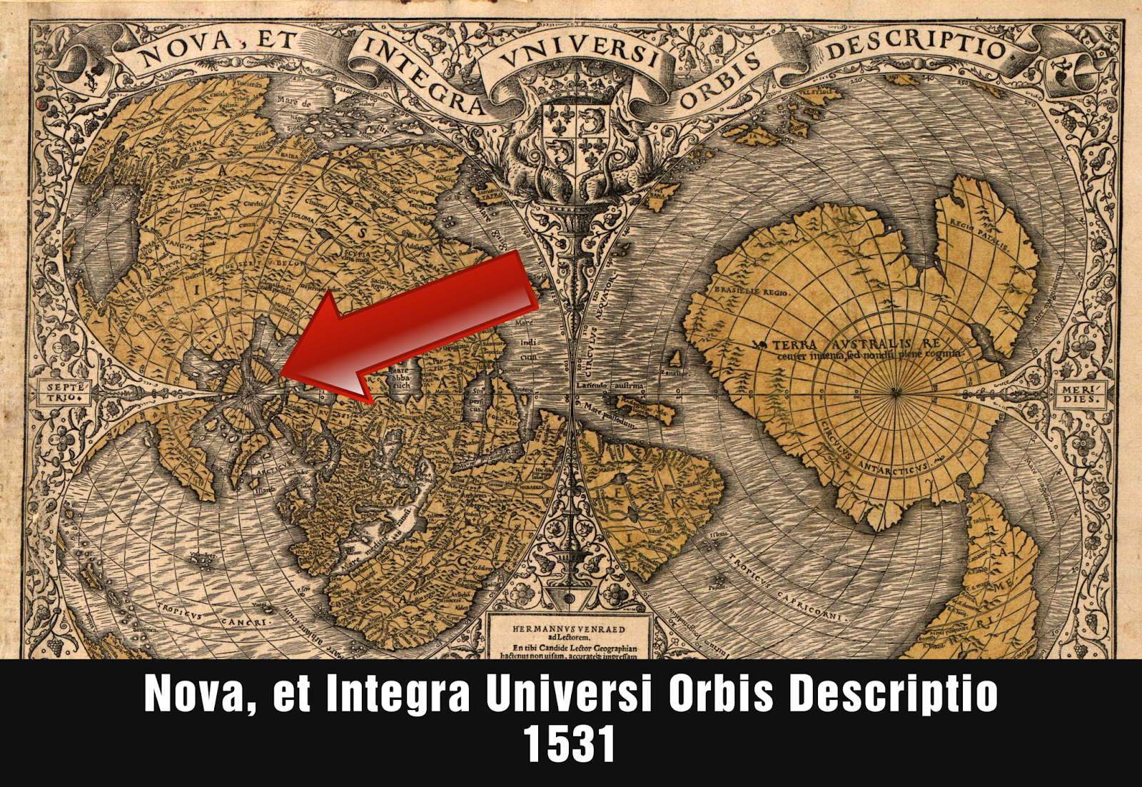
  Both Nicholas and Cnoyen's books contained a detailed map of the Arctic derived from Nicholas' journeys which included a magnetic mountain at the North Pole, 4 directional streams, encircling whirlpool, and surrounding islands. Luckily for posterity, a version of this map still survives to this day because it was used for Johannes Ruysch's 1508 map of the world and later reproduced in detail and published in 1595 by the most well-known cartographer in history, responsible for the most popular maps ever created, Gerardus Mercator.
 On the legend of Ruysch's map Nicholas de Lynn's Inventio Fortunata is referenced as it's source, stating that, "It is written in the Book of the Fortunate Discovery that, under the Arctic Pole, there is a high magnetic rock 33 German miles in circumference. A surging sea surrounds this rock, as if the water were discharged downward from a vase through an opening to four mouths below. Around are islands, of which two are inhabited. Mountains vast and wide surround these islands, 24 of which deny habitation to man." Another inscription on Ruysch's map describes the incredible magnetic effect of the polar lodestone mountain, stating, "Here the ship's compass loses its property, and no vessel with iron on board is able to get away."
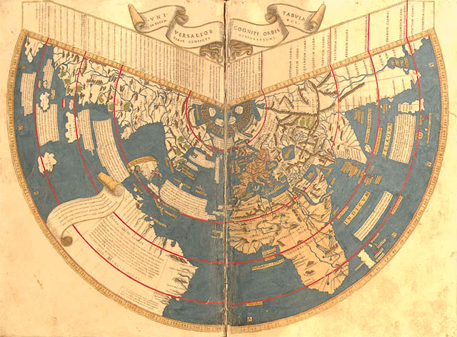
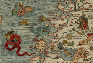
"A world map by Johannes Ruysch, the Universalior cogniti orbis tabula, published in an edition of Ptolemy's Geographia in Rome in 1508, shows four islands around the North Pole; two (the one north of Greenland and its opposite across the Pole) are labeled "Insula Deserta"; the one north of Europe is that of the Hyperboreans; and the one north of America is labeled "Aronphei." He labels the waters within the four islands as the "Mare Sugenum," and speaks of a violent whirlpool that sucks the incoming waters down into the earth; in addition, his map shows a ring of small, very mountainous islands around the four islands, which numerous islands Ruysch says are uninhabited." -Chet Van Duzer, "The Mythic Geography of the Northern Polar Regions"
“This would seem to indicate that the book written by Nicholas of Lynn was known to the mapmaker, while, also, it may have been known at Rome. It is evident that the polar region was drawn more or less in accordance with some plan by Nicholas, which was combined with later material. Around the magnetic rock, immediately under the pole, are four islands, ‘Aronphei,’ ‘Insvla deserta,’ ‘Hyperborei Evropa’ and ‘Insvle Deserta.’ Outside of these islands are smaller and mountainous islands, arranged in a semi-circle, while the peninsula of ‘Pilapelanti,’ with its base resting upon Europe, pushes out into this druidic arrangement of islands, bearing up what is intended to represent a church, with the legend ‘Sacte Odulfi.’ Eastward of this peninsula is the ‘Provicia obscura,’ and the ‘Marc Svgenvm.’ Westward of ‘Bergi extrema’ another peninsula enters the groups of islands, which is pierced by ‘planora de Berga’ at the extreme west. The ‘Mare Svgenvm’ also fills the west. South of ‘Grvenlant’ is ‘Terra Nova,’ or New Foundland. From the ‘Mare Svgenvm’ the water flows northward through the four openings into the polar basin. The arrangement is curious, yet not wholly without resemblance to what is found in nature; for what is called the polar basin is fed by several vast streams pouring into it from the warm regions at the south. These streams also create counter currents, which flow southward, bearing enormous quantities of the heaviest ice." -Benjamin Franklin DeCosta, "Inventio Fortunata, Arctic Exploration With An Account of Nicholas of Lynn" (22)
Swedish historian Olaus Magnus wrote of both the magnetic mountain and surrounding whirlpool in his 1555 work "Historia de Gentibus Septentrionalibus" (A Description of the Northern Peoples) stating it to be a well-known fact that ships in the north must be built with wooden pegs, as iron nails would be pulled out by the northern lodestone mountain, and that, "between Roest and Lofoten is so great an abyss, or rather Charybdis, that it suddenly swamps and swallows up in an instant those mariners who incautiously approach. Pieces of wreckage are very seldom thrown up again, and if they come to light, the hard material shows such signs of wear and chafing through being dashed against the rocks, that it looks as if it were covered with rough wool."

Just two years later in 1557, English explorer Anthony Jenkinson also wrote of the whirlpool, saying, "Note that there is between the said Rost Islands and Lofoot, a whirle poole called Malestrand, which from halfe ebbe untill halfe flood, maketh such a terrible noise, that it shaketh the ringes in the doores of the inhabitants houses of the sayd islands tenne miles off. Also if there commeth any whale within the current of the same, they make a pitifull crie. Moreover, if great trees be carried into it by force of streams, and after with the ebbe be cast out againe, the ends and boughs of them have bene so beaten, that they are like the stalkes of hempe that is bruised."
A few decades later in 1591, Schönneböl, a man who was sheriff of Lofoten and Vesteralen for over twenty years, wrote a similar description claiming that, "Iron rings on house doors are shaken hither and thither by the rushing of the current. Whales who cannot go forward on account of the strong stream, give a great cry and then are gone. And great trees, spruce or fir, which disappear in this current, and when at last they come up again, then all the boughs, all the roots and all the bark is torn off, and it is shaped as though it had been cut with a sharp axe."
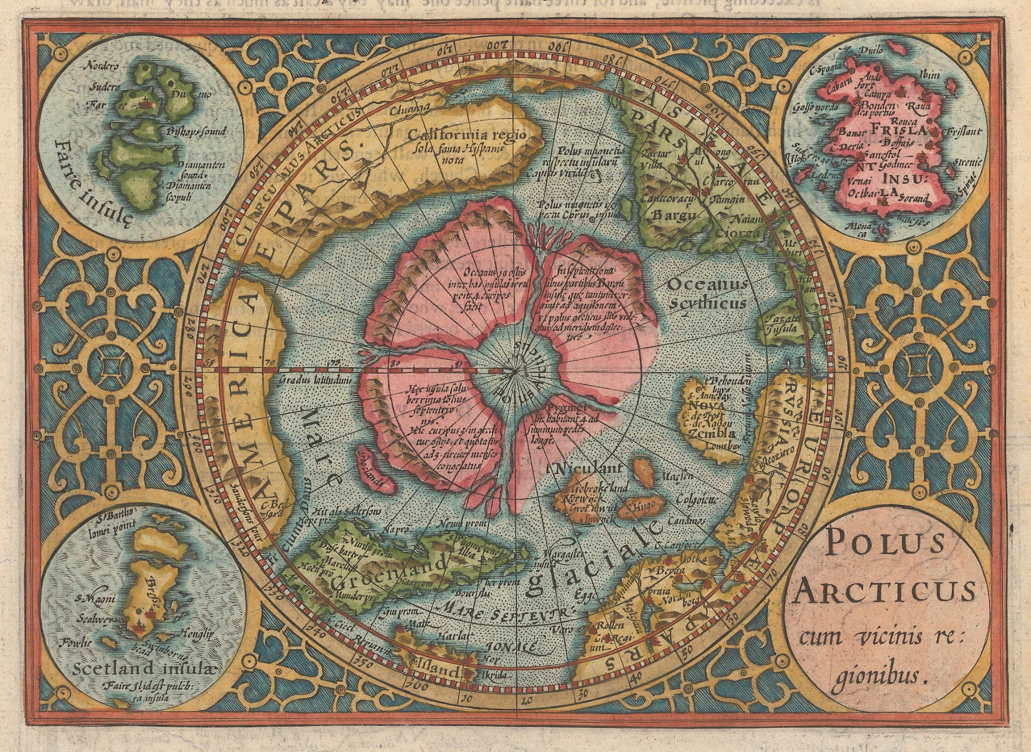
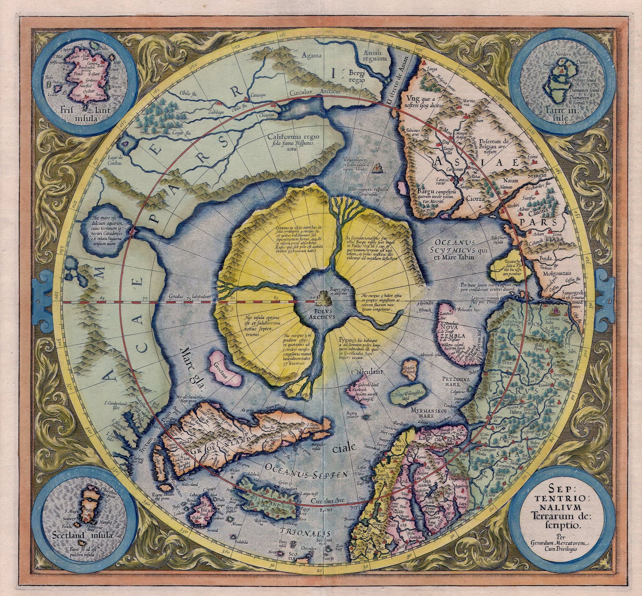
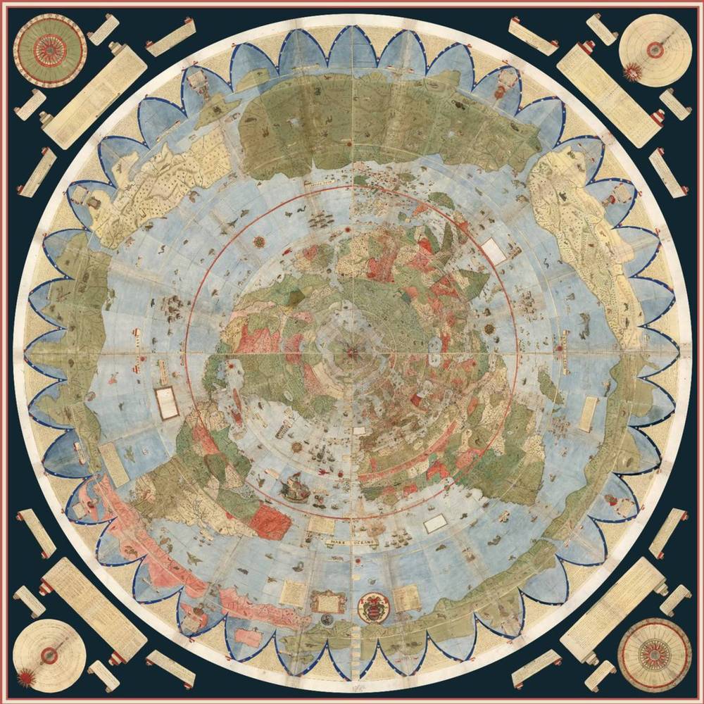
The most famous map-maker who ever lived and likely the only person in the history of cartography to become a household name, Gerardus Mercator, known for his meticulous accuracy and responsible for the popular "Mercator projection," lived from 1512 to 1594 and created hundreds of detailed maps. The year after his death in 1595 his family compiled his life's work into an Atlas which included never before released reproductions of Nicholas de Lynn's maps of the polar regions, specifically the "Septentrionalium Terrarum Descriptio." This incredible map shows the polar magnetic mountain "said to be the highest in the world," named "Rupes Nigra," encircling whirlpool, 4 directional rivers, and surrounding islands in fine detail along with several revealing inscriptions.
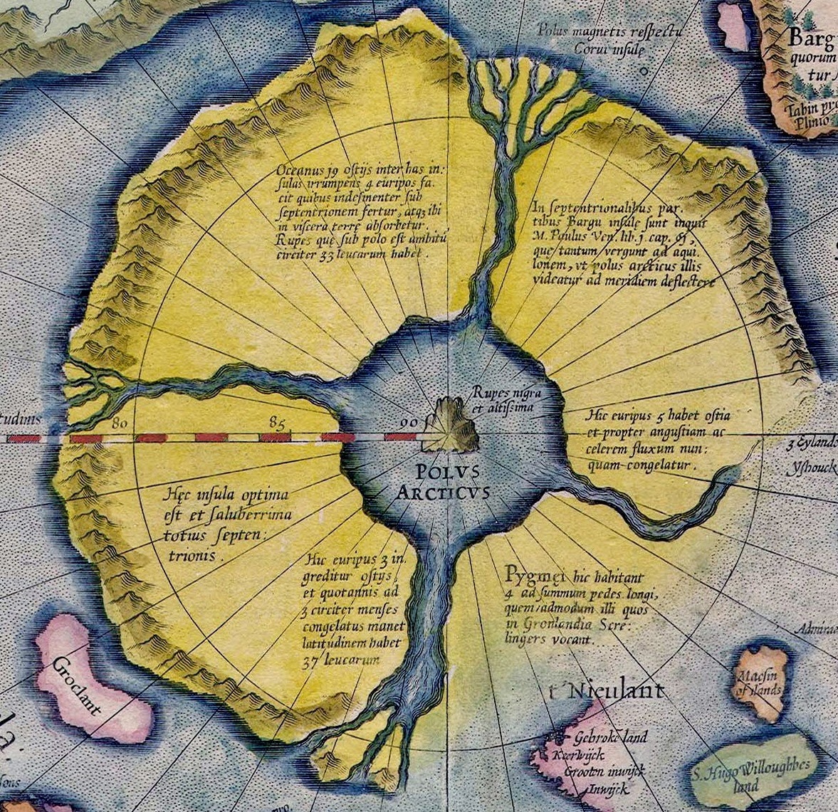
"The map shows a North Pole that is very unfamiliar to modern eyes. At the center of the map, and right at the Pole, stands a huge black mountain; this mountain was made of lodestone, and was the source of the earth's magnetic field. The central mountain is surrounded by open water, and then further out by four large islands that form a ring around the Pole. The largest of these islands perhaps 700 by 1100 miles, and they all have high mountains along their southern rims. These islands are separated by four large inward-flowing rivers, which are aligned as if to the four points of the compass - though of course there is no north, east, or west at the North Pole: every direction from this center is south. Mercator's notes inform us that the waters of the oceans are carried northward to the Pole through these rivers with great force, such that no wind could make a ship sail against the current. The waters then disappear into an enormous whirlpool beneath the mountain at the Pole, and are absorbed into the bowels of the earth. Mercator also tells us that four-foot tall Pygmies inhabit the island closest to Europe." -Chet Van Duzer, "The Mythic Geography of the Northern Polar Regions"
 In another inscription made on the map, Mercator informs the reader further regarding the great whirlpool, stating that, "a monstrous gulf in the sea towards which from all sides the billows of the sea coming from remote parts converge and run together as though brought there by conduit, pouring into these mysterious abysses of nature, they are as though devoured thereby and, should it happen that a vessel pass there, it is seized and drawn away with such powerful violence of the waves that this hungry force immediately swallows it up never to appear again."
 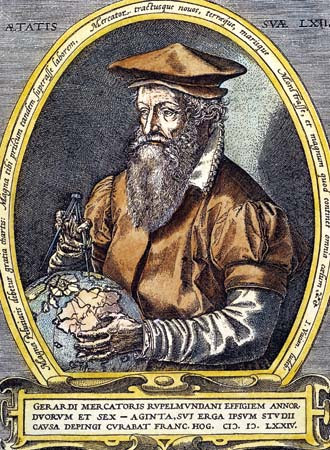 Gerardus Mercator studied at the University of Louvain in 1549 where he met and befriended another very influential figure of his time, John Dee, astronomer / astrologer and advisor to Queen Elizabeth I. Dee was convinced that a route to the Indies could be found through the Northwest Passage and while attempting to interest Queen Elizabeth to support an expedition, he contacted Mercator for more information. In Mercator's 1577 letter back to Dee we learn he copied verbatim from Jacobus Cnoyen's Itinerium stating that, “In the midst of the four countries is a whirlpool, into which there empty these four indrawing Seas which divide the North. And the water rushes round and descends into the Earth just as if one were pouring it through a filter funnel. It is four degrees wide on every side of the Pole, that is to say eight degrees altogether. Except that right under the Pole there lies a bare Rock in the midst of the Sea. Its circumference is almost 33 French miles, and it is all of magnetic Stone. And is as high as the clouds, so the Priest said, who had received the astrolabe from this Minorite in exchange for a Testament. And the Minorite himself had heard that one can see all round it from the Sea, and that it is black and glistening. And nothing grows thereon, for there is not so much as a handful of soil on it. This is word for word everything that I copied out of this author years ago.”
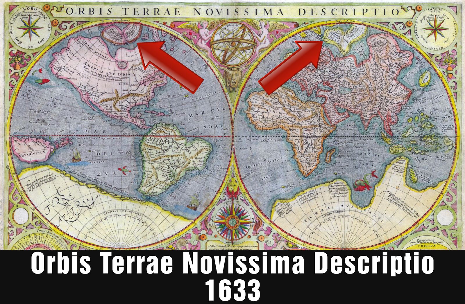
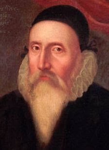 As late as the mid-17th century, aspects of these polar phenomena continued appearing in cartography and cosmography. The "euripi" or 4 indrawing streams, were included or alluded to in Linschoten's 1595 map, the Ortelius of 1599, Quod's Fascicvlvs Geographicvs of 1608, Hondius' 1619 map, Purchas' map of 1625, and in Heylin's 1659 Cosmographie he wrote about the Rupes Nigra and surrounding whirlpool and euripi, stating that, "Under the Arctick Pole is said to be a Black Rock of wonderous height, about 33 leagues in compass; the Land adjoining being torn by the sea into four great islands. For the Ocean violently breaking through it, and disgorging itself by 19 channels, maketh four Euripi, or fierce Whirlpools, by which the waters are finally carried towards the North, and these swallowed into the Bowels of the Earth. That Eurpius or Whirlpool which is made by the Scythic Ocean, hath five Inlets, and by reason of his strait passage, and violent course, is never frozen: the other on the back of Greenland being 37 leagues long, hath three inlets, and remaineth frozen three months yearly. Between these two lieth an Island, on the North of Lappia and Biarmia, inhabited as they say by Pygmies, the tallest of them not above four foot high. A certain Scholer of Oxford reporteth, that these four Euripi are carried with such furious violence towards some Gulf, in which they are finally swallowed up, that no ship is able with never so strong a Gale to stem the Current and yet there is never so strong a wind as to blow a windmill."
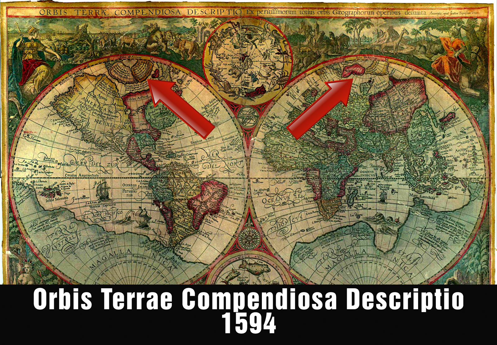
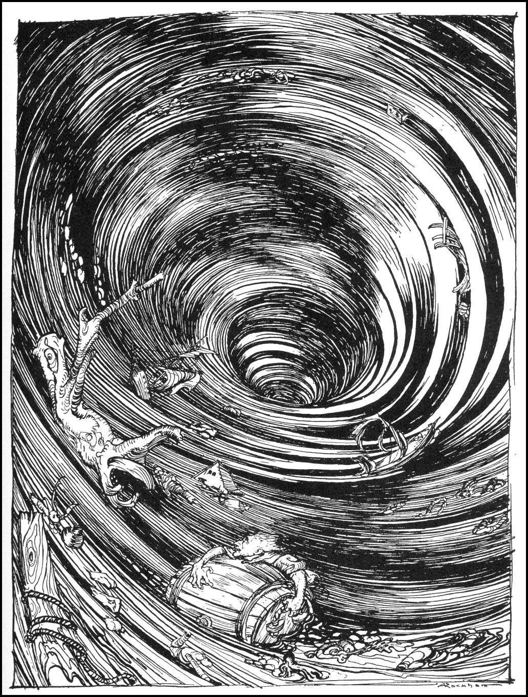
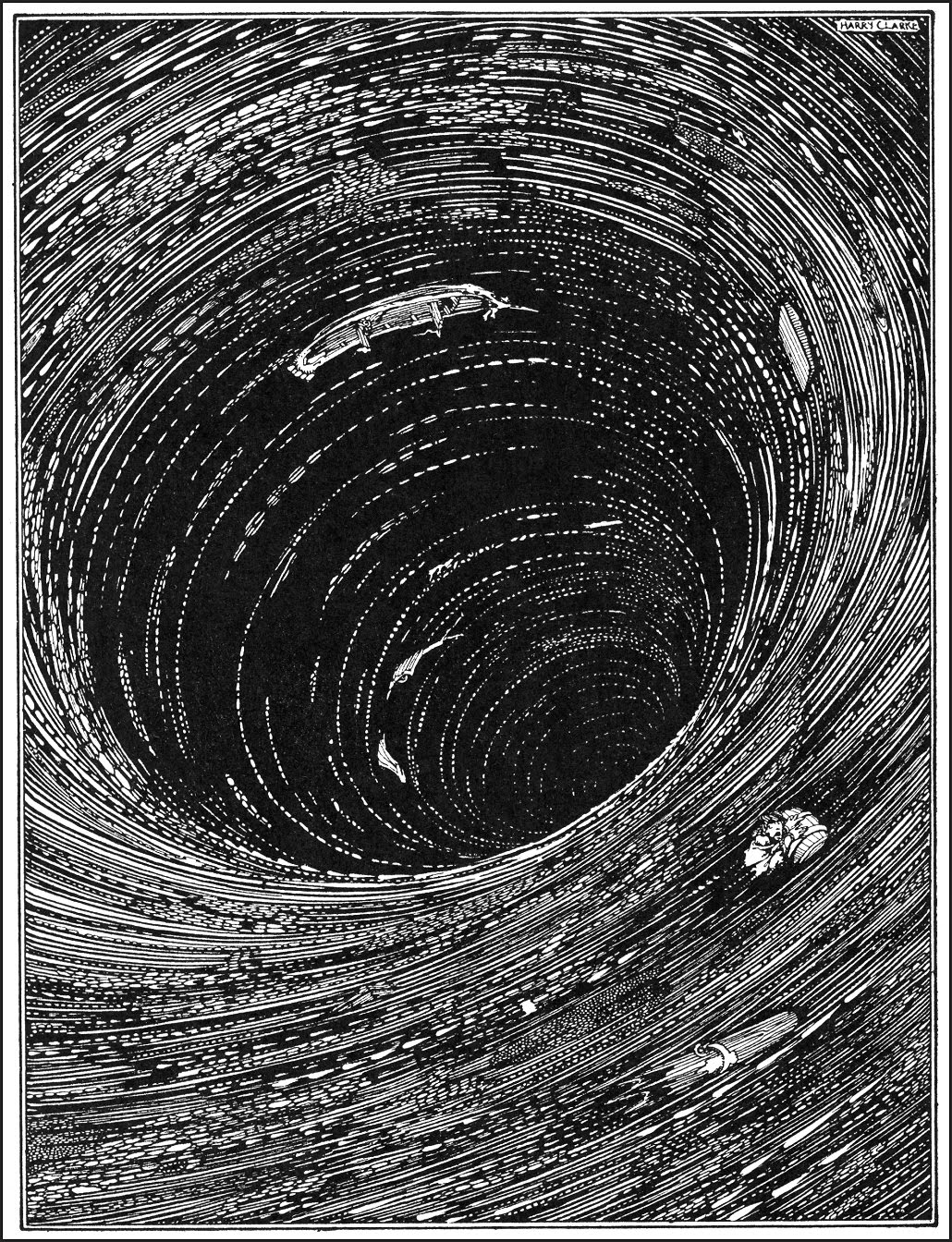
There is modern circumstantial evidence that lends strong credence to this idea as well. The largest publicly-known maelstrom in the world is called Saltstraumen just North of the Arctic circle in Norway, where 400 million cubic meters of water pass through a 3km long, 150-meter wide strait reaching speeds of 10 meters per second. Similar to legends of Hvergelmir, this Northern whirlpool actually arises exactly 4 times per day, every 6 hours, along with the shifting of the tides! In fact, the majority of naturally occuring whirlpools in the world, including the famous Naruto whirlpools in Japan, form 4 times per day, every 6 hours, as the tides change.

If the entire ancient world's mythologies along with early explorers, historians and cartographers all shared similar accounts of a polar magnetic mountain, encircling whirlpool, four directional streams, and surrounding islands occupied by giants and/or pygmies, why is it that no modern accounts of the North Pole have a single mention of any such thing? How is it possible for such consistency in polar geography to exist throughout the ancient world? Why have all of these features suddenly disappeared from modern maps? Were the ancients all completely mistaken with regards to the North Pole, or are we now in modern times the victims of a concerted cover-up, and being deceived about what is really at the Pole?
 Buy Flatlantis Now in Paperback, eBook, or ePub


 Insightful and informative as always. The people are plugged into a lie and the lie is reinforced over and over. It's as though no one is paying attention to anything and at the same time, everyone believes that they are. Crazy times. I do appreciate all of your effort and your hard work, so thank you.
 Totally agree, and of course you're very welcome, thanks so much Jane!


