
Snowpocalypse 2019: Expected “summer” conditions in the High Sierra & southern Rockies
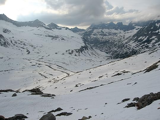

Extensive snow coverage on the north side of Mather Pass, looking towards Palisade Lakes, after a very wet winter. Taken June 28, 2006.
California, Oregon, Nevada, and the Four Corners states have been drenched this winter, with snowpacks now about 150 percent of their normals. If you have scheduled backpacking trips in the High Sierra or southern Rockies in June or July, and to a lesser degree August, here is some reading for you:
1. Today on my Outside blog I just published a new article, “What Epic Snowpack Means for Summer 2019 in the West.” It details the snowpack, predicts likely conditions, and describes critical gear and skills.
2. When PCT and JMT hikers were losing their $hit in spring 2017, when the snowpack was negligibly greater than it is this year, I posted a six-part tutorial on backpacking in early-season conditions. I have not updated it since, but I’ve read it through and it’s just as relevant today as it was two years ago.
I’ve also started a public map, High Sierra Creek Hazards, that pinpoints known problem spots and potential workarounds. I’m thinking that I’ll pair this with a public datasheet (i.e. spreadsheet) and make both available for public download. To start, I think it makes sense to focus on the PCT/JMT, but I’d like to expand it to the high routes and to no-routes as well.
The post Snowpocalypse 2019: Expected “summer” conditions in the High Sierra & southern Rockies appeared first on Andrew Skurka.


