Almost done (and now available): Yosemite High Route Guide


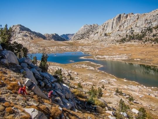
Rock Island Lake, a rarely visited alpine basin
I had self-imposed a deadline of March 1 for publishing the Yosemite High Route Guide, knowing that backpackers are making their summertime plans (and in some cases have already made them).
The Guide is not yet complete — it’s about 85 percent of the way there — but today I’m releasing it anyway so that it can be put to use, especially its planning resources. The Yosemite High Route Guide is available for immediate download.
After I complete the remaining 15 percent sometime this month, I will send to all customers a new download link for the missing files or for the fully completed Guide (especially if I end up tweaking anything in the “finished” 85 percent portion). Expect another update in Fall 2019 based on guided trips on the route this July.
The current edition, which I’ve designated 1.0, includes the following materials:
“Guidebook — Part 1: Before you go” includes essential preparatory information (e.g. permits, travel, regulations, scheduling) that is supplementary to the existing online information;
Annotated topographic maps for the Core Route, all twelve Approach Routes, and eight recommended Section-Hikes;
Datasheets for the Core Route, all twelve Approach Routes, five Alternate Routes, six featured Thru-Hikes, and eight recommended Section-Hikes; and a,
Rudimentary GPX file to help find trailheads and download maps for off-line use.
The current edition does NOT yet include Part 2 and Part 3 of the Guidebook, which will have route descriptions for the Core Route, Approach Routes, Alternates, and Section-Hikes. I’m working on these documents now, but they’re not ready for prime-time. Thankfully, they’re not necessary in planning a thru- or section-hike of the Yosemite High Route.
Samples of these resources can be found here.
I’m frustrated that I’m not yet done with the Guide — I don’t like missing deadlines, and just as much I’d like to move on to other projects. But I’m satisfied with the current quality of the materials, and I’d rather that Part 2 and Part 3 of the Guidebook be late but good (instead of on-time but shoddy).
Partly responsible for the delay are the multiple revisions that I made to the route’s fundamental structure. Ultimately, I identified a 94-mile Core Route that is consistently world-class: it’s 70 percent off-trail, gyrates 630 vertical feet per mile, and accesses rarely visited pockets of America’s third National Park.
To reach this Core Route, I’ve offered twelve Approach Routes: eight for the northern terminus, ranging from 17 to 50 miles; and, four for the southern terminus, ranging from 10 to 18 miles. All told, there are thirty-two potential thru-hiking itineraries, making it possible that no thru-hikers in 2019 will do the same route.
The post Almost done (and now available): Yosemite High Route Guide appeared first on Andrew Skurka.


