Seattle Maps 16 & 17 – Puget Sound
Two fine images of Puget Sound that I came across the other day. Protection Island now has very few trees on it and is a good place to see puffins. Note on the lower map how far south Admiralty Inlet extends. This was the original boundaries as defined by Capt. George Vancouver, who named it in May 1792. (click on images for larger size)
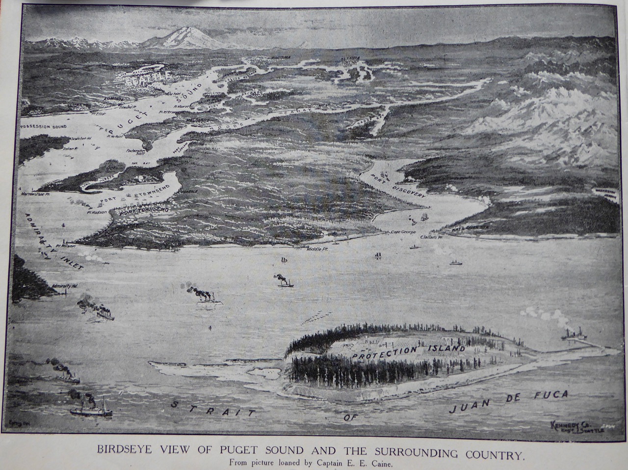 Puget Sound from the North
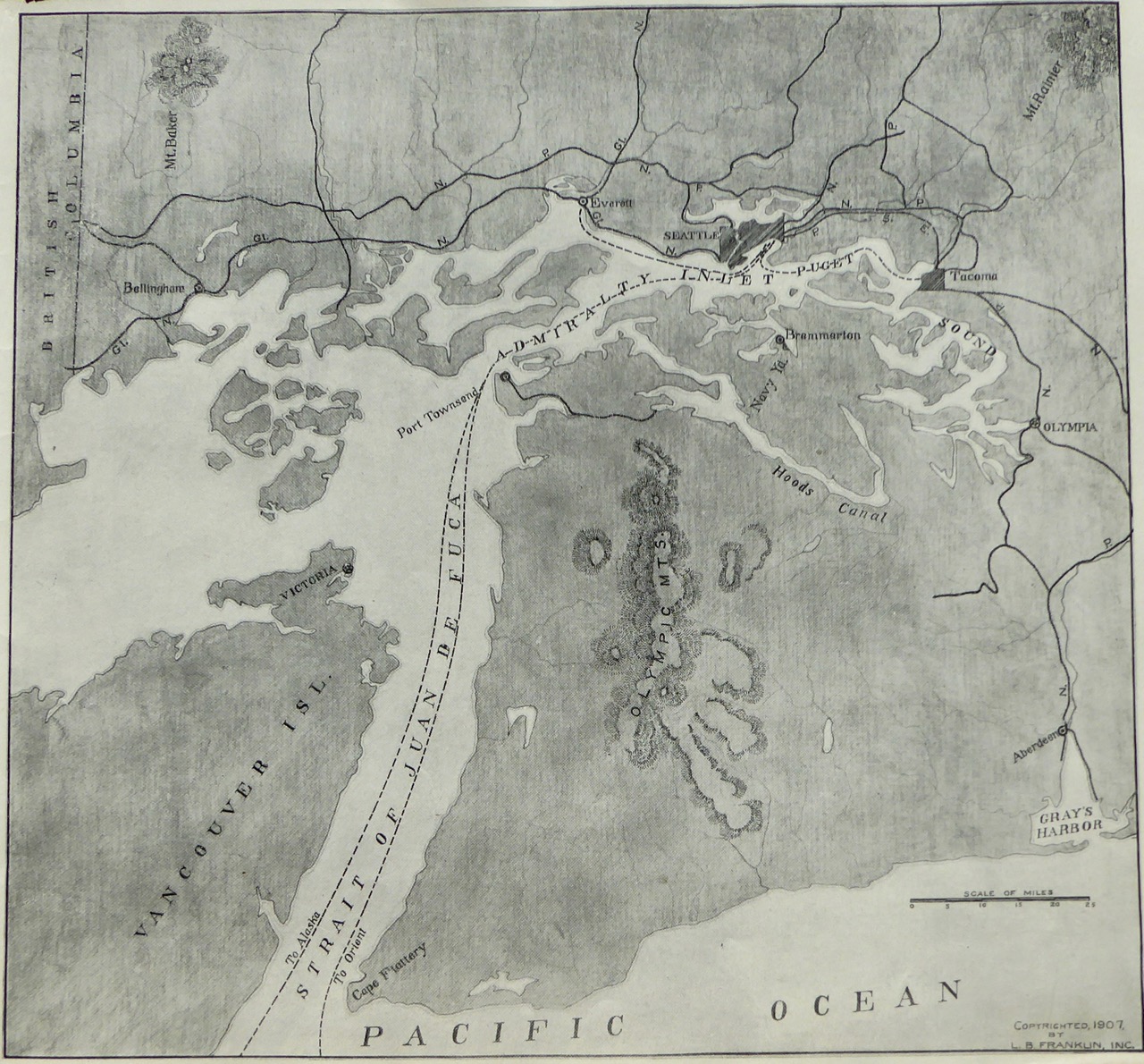 Puget Sound turned sideways with north to the left


No comments have been added yet.