Pratt River Connector Trail - #SaturdaySnapshots
From the Auburn Senior Activity Center brochure:
PRATT RIVER CONNECTOR TRAIL
MILES: 6 RATING: 2
WTA* volunteers have been working on this trail for 3 years to provide hikers safe access to the Pratt River Trail. The trail crosses the Middle Fork of the Snoqualmie River turning right to connect with the Pratt River Trail. With an elevation gain of 100 feet the hike offers a relaxing riverside ramble. There are some creek crossings to challenge balance so trekking poles are recommended.
*Washington Trails Association
Click on photos to enlarge.
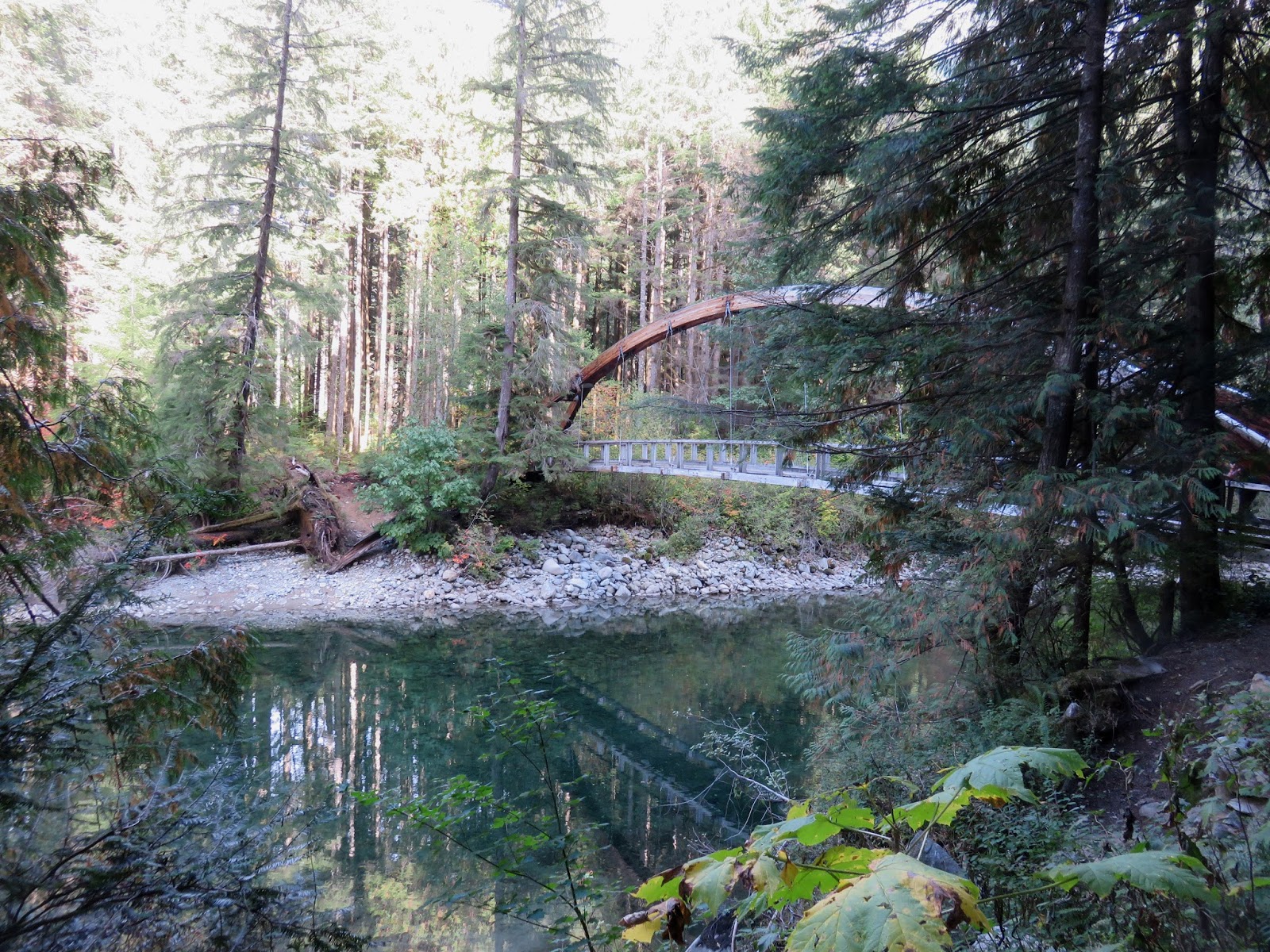
 Our hike started by crossing this beautiful bridge
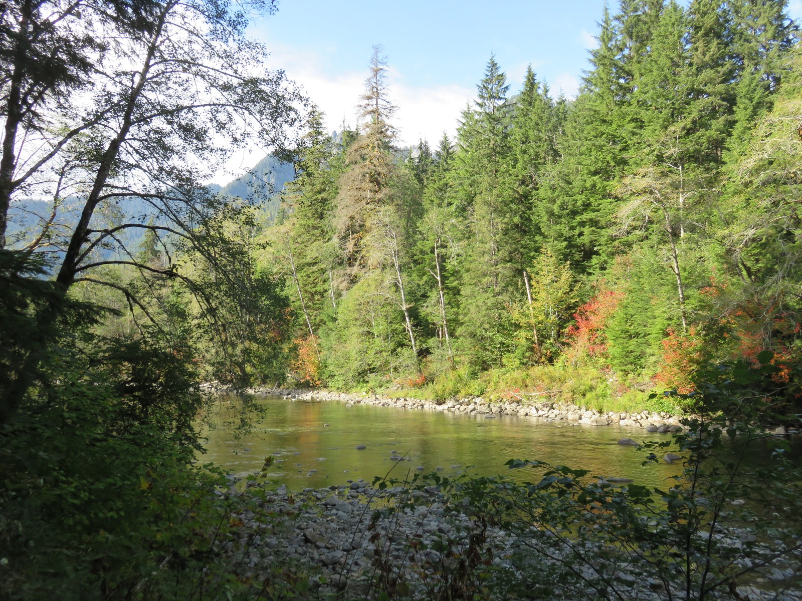
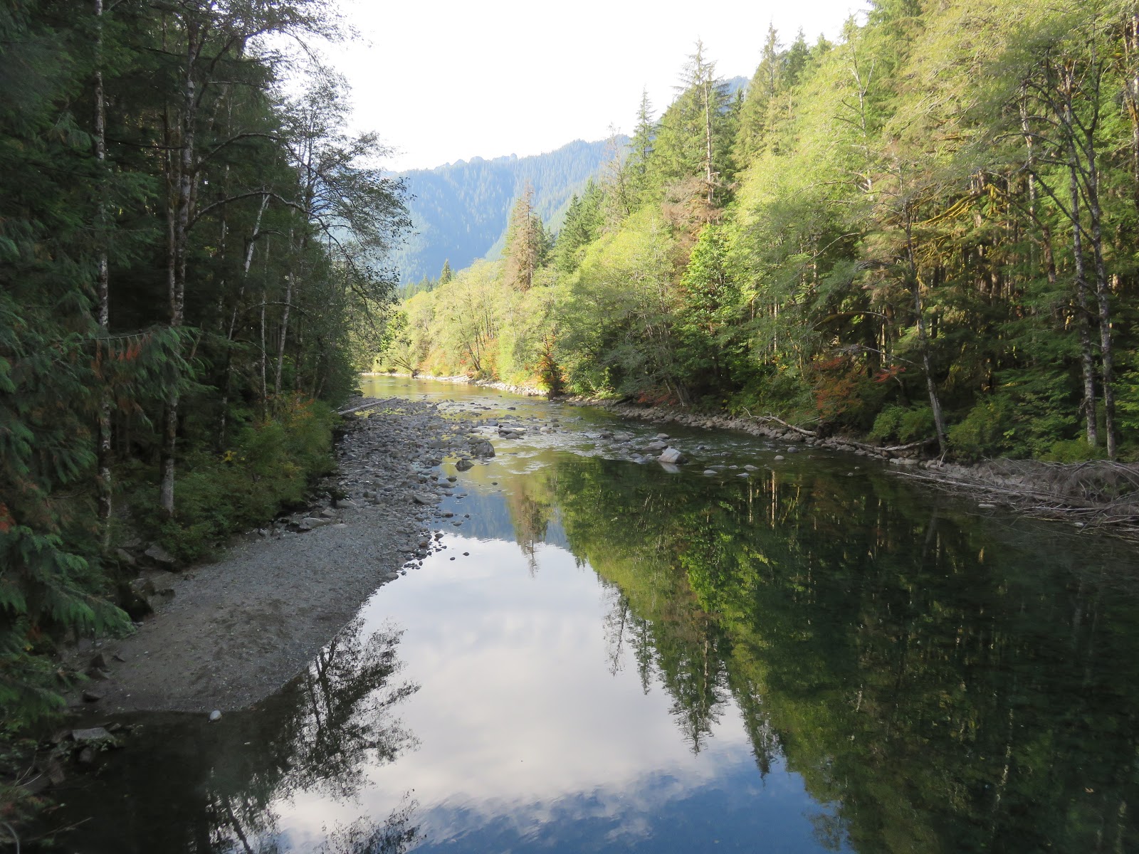
over the Middle Fork - Snoqualmie River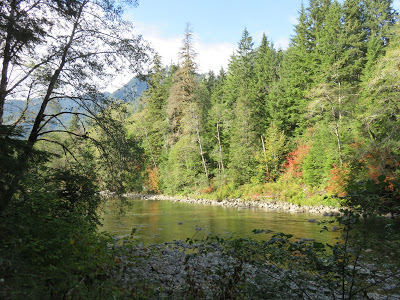 Much of the time we could see the river and
hear it in the background.
Mountains filled the horizon.
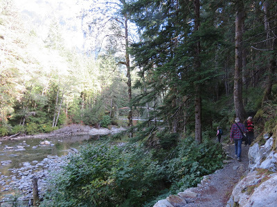
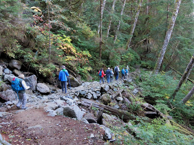 This rock path is evidence of the hard work
done by the WTA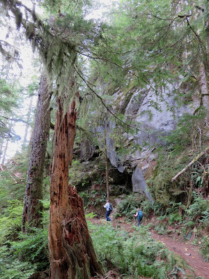 We walked past huge rock formations.
This one had a cave at its base.
The WTA built the steps on the far left.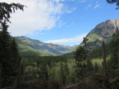 We came around a bend and stopped in awe
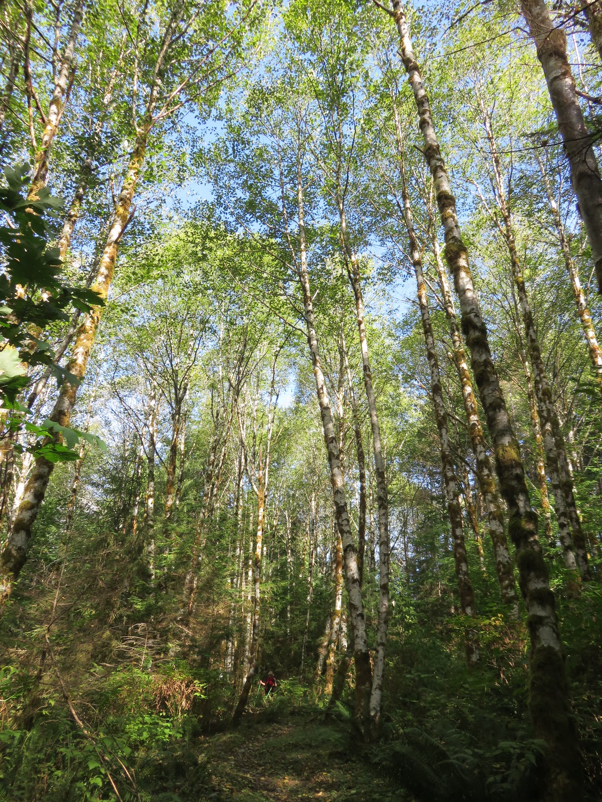
at this magnificent view. At times we walked through shaded woods.
 We hiked along the trail for three miles, stopped to
eat lunch, and then turned around and headed back.
 Back across the bridge, headed home.
More info: HERE

Saturday Snapshots is hosted by West Metro Mommy Reads.To participate in Saturday Snapshots: post a photo that you (or a friend or family member) have taken, then leave adirect link to your post in the Mister Linky on the host blogsite.
To enjoy a variety of beautiful pictures from around the world visit
West Metro Mommy Reads.
PRATT RIVER CONNECTOR TRAIL
MILES: 6 RATING: 2
WTA* volunteers have been working on this trail for 3 years to provide hikers safe access to the Pratt River Trail. The trail crosses the Middle Fork of the Snoqualmie River turning right to connect with the Pratt River Trail. With an elevation gain of 100 feet the hike offers a relaxing riverside ramble. There are some creek crossings to challenge balance so trekking poles are recommended.
*Washington Trails Association
Click on photos to enlarge.
 Our hike started by crossing this beautiful bridge
over the Middle Fork - Snoqualmie River
 Much of the time we could see the river and
hear it in the background.
Mountains filled the horizon.
 This rock path is evidence of the hard work
done by the WTA
 We walked past huge rock formations.
This one had a cave at its base.
The WTA built the steps on the far left.
 We came around a bend and stopped in awe
at this magnificent view.
 At times we walked through shaded woods.
 We hiked along the trail for three miles, stopped to
eat lunch, and then turned around and headed back.
 Back across the bridge, headed home.
More info: HERE

Saturday Snapshots is hosted by West Metro Mommy Reads.To participate in Saturday Snapshots: post a photo that you (or a friend or family member) have taken, then leave adirect link to your post in the Mister Linky on the host blogsite.
To enjoy a variety of beautiful pictures from around the world visit
West Metro Mommy Reads.


No comments have been added yet.