Walking the Southern Upland Way – Days 4-6
[image error]
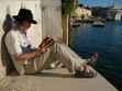
The wild hills await… K. Manwaring, 2017
And now for the section of the walk that looked the most intimidating – in my guidebook it broke it down into too insanely long sections: Bargrennan to St John’s of Dalry (24.3 miles) and St John’s to Sanquhar (26.7), but not being a complete masochist, I opted for the ‘more manageable to walk’ itinerary, which breaks the 50 plus miles of challenging walking (ranges of hills, bogs, no facilities) into three days. They were still tough, but not always for reasons expected.
Day 4 – Bargrennan to Clatteringshaw Loch (16.3 + 5)
This should have been a pleasant stroll from our fabulous campsite (so much nicer when I was able to set off in the morning without any driving involved) along the shores of the picturesque Glen Trool, but it turned into something of a nightmare. It didn’t help that it rained all day, sapping my spirits, tiring me out, and soaking everything (my back-up phone still hasn’t recovered). It was very tempting to walk straight from ‘Expedition Base-Camp’ (an utterly lovely campsite despite the midges and stencilled military-style signage) to the Glen Trool visitor centre – intersecting the walk at the Twin Bridges – and skip the first section of the walk which made me go back on myself, and added a few winding miles – but I was feeling diligent. What’s the point of doing a long-distance walk if you skip bits? Sometimes however the wendings are annoying diversions (a reroute caused by a bolshy landowner, or by a civic authority keen for the tourist dollar) and common sense should prevail. The quicker route from Glentrool was listed as an alternative in ‘wetter winter months’ and the only ‘safe and viable route’ when the River Cree and Waters of Minnoch (great names) overflow, and it was raining heavily when I set off. But … I dutifully trekked back to the bridge at Bargrennan and rejoined the route from yesterday’s end-point.
There followed some lovely riverside woodland walking – it was wet, but the trees gave me some shelter. By the time I got to Twin Bridges of Trool, it was late morning and I had a coffee and a snack at an SUW shelter. Then feeling in fine fettle I carried on.
However, this is when I went wrong – though I wasn’t to notice it for a good hour or more. Along the SUW the thistle signs are intermittent and often not where you need them. There can be long stretches along a track when there are none at all – you just have to pray you took the right turning as you trudge on, hoping for … literally … a sign. I also had at the back of my mind another alternative route that was cited as a good option in poor weather. The rain had really set in by this point and my wax jacket had reached saturation point. Not nice. I had to sit on a stump in the rain to have my sandwiches, surrounded by the No Man’s Land of a deforested section. I seemed to be on a Sustrans bike trail – so hoped that would intersect at some point with the SUW. Alas, as I slogged along the horrible gravelly track my hopes diminished. The track eventually ran out and I thought I was on the wrong side of a ridge. Being soaked to the skin and tired isn’t conducive to making the best decisions – I decided to make a traverse over the ridge, hoping to reconnect with the route. This resulted in me getting lost in a forestry plantation – not very pleasant, I assure you. It is like trying to navigate around Milton Keynes – everything looks the same. I am not one for using GPS, but in extremis the situation called for it, as I had no visual bearing on my position (unable to see the woods for the trees). The map on my dying phone however just showed a dot in a featureless expanse of green. I had to rely upon my compass and common sense. I headed east and downwards, hoping I would reach a forestry track. I kept spotting strips of white plastic tied to trees, and taking these as some kind of sign I followed them. Eventually the led me to a track – blessed hardcore! I followed this, figuring it has to come out somewhere. I would find out where I was and hitch back, for time was getting on (and I was ready to give up at that point). Amazingly, the track came out at a junction I recognised, so cursing my incompetence, I painfully retraced my steps to my lunch point, up a very steep track. I kept going from there until I spotted a SUW sign. It had taken me 2 hours to get back to this point, after an hour of being lost. So now I was running 3 hours late. I was 8 miles into the walk, with 8 miles to go … and no signal. I’d arranged to meet my partner at an obscure location at 5pm. I decided to push on. Guzzling down the rest of my coffee, and stuffing my face with a Mars bar, I went into ‘turbo’ mode with both of my walking poles out. I was angry with myself as much as anything – that and the adrenalin kept me going as I trekked away from Glen Trool through a lonely glen associated with a famous victory by Robert the Bruce; and later, with the famous biplane chase sequence in The Thirty Nine Steps by John Buchan (a nearby hamlet shared his name). My whole day had been transmogrified into a minor crisis all because of the poor signage – at a critical turning (NB Caldons), I discovered, there was the catastrophic absence of a fingerpost (the actual tiny SUW sign was hidden along the turning by foliage…). The Cicerone guidebook had failed to mention this when normally it had been reliable, flagging up important junctions. Sigh. I slogged on. Already exhausted by getting lost (which resulted in me being drenched in sweat beneath my already soaked clothes) I now had to draw upon inner reserves to keep going. Such experiences certainly test your stamina and morale, or ‘grit’ as they might call it up in Scotland. I passed a couple of teams of soggy students, enduring such delights for a Duke of Edinburgh award – later an ambulance had hurtled in their direction, so I wonder whether they came a-cropper. Some looked ill-prepared in thin jackets. The track through the lonely, exposed glen went on and on. It eventually passed Loch Dee, where I had to stop for replenishment in a midge-infested glade. Then I pushed on, aware that my partner was probably having kittens by this point. But there was nothing I could do about it (sans signal) except get there as soon as I could. This made the walking stressful as well as exhausting – but that point I had resigned myself to the whole clusterfuck of the experience. I’d never got seriously lost on a LDP before and I don’t recommend it (I normally have a good sense of direction and orienteering skills, but exhaustion doesn’t help). One upside to this – I never got lost again on the SUW, even through sections that were especially difficult to navigate. I was extra-attentive to the trail, (which is sometimes not much more than a slight indentation in the grass across miles of open moorland), taking my bearing often, and never being complacent. Other LDPs have been straight-forward to navigate, even across serious terrain (eg the West Highland Way, which crosses Rannoch Moor). Normally, it’s as plain as day, the direction you have to go in – but not the SUW! Clatteringshaws Loch seemed to take forever to reach – and my feet were killing me by then (1000 mile socks are not much use if they get wet), so I was euphorically glad to see my partner driving towards me along the last section of the trail. After 2 hours of waiting she had started to get seriously worried – and had set off in search for me. Never had I been so glad to see that metallic grey Peugot! It was certainly an adventure – but one that was easier to enjoy afterwards, thawing out in Lochinvar Inn over a hot meal and a drink. Boy, did I need a shower when I got back! I slept well that night.
Day 5 – Clatt. Loch to Stroanpatrick (15.8)
[image error]
The lonely way. One of the several fallen signposts I re-erected. K. Manwaring, 5 July 2017
Fortunately, the next two days were far more enjoyable. It didn’t rain for a start and despite the ‘path’ being poorly signed and little more than a slight indentation in the grass across wild moor-land I didn’t get lost. My compass-fu was fully functioning. I could see why so few people do the SUW – but it’s Catch 22: better signage and better maintained paths would surely result in more walkers; this would result in more tourist income for the region, warranting more investment. Perhaps it is the length and difficulty that puts people off, for other LDPs seem popular. Apparently 50,000 walkers do the West Highland Way every year – although when I did it, I only saw a half a dozen walkers a day. There were long stretches when I didn’t see anyone. The campsites weren’t that busy. On these trails you can also find solitude – it’s easy to adjust your pace to overtake some walkers if you don’t fancy chatting, although sometimes it’s nice to have a brief exchange. Today’s highlight was the lunch stop at St John’s of Dalry – a charming village with a very steep High Street and a churchyard featuring Covenanter graves. Named by the Templars (Dail Righ: ‘meadow of the king’), it was an important way-station for pilgrims en route to the Isle of Whithorn (apparently even the King would undertake this annually, as an act of atonement – which made me wonder, did walking the SUW shrive me of my ‘sins’? It certainly felt cathartic and good for the mind, body and soul). Like a pilgrim filled with enthusiasm (en theos: the god within) I sang as I went – today choosing ‘Crooked Jack’, and ‘Fathom the Bowl’ in addition to my usual walking repertoire which I dipped in and out of (‘Caledonia’; ‘Jerusalem’, etc). The headspace of today I described in my journal as ‘a wildlife corridor for the imagination’. And I saw plenty of actual wildlife too – a barn owl in broad daylight, swooping amongst the trees and a red kite, on top of the usual curious or twitchy livestock .
Day 6 – Stroanpatrick to Sanquhar (18.9)
[image error]
Ben Brack (1902 ft), K. Manwaring, 6 July 2017
Today was the longest and toughest so far – officially anyway – crossing over 7 hills, all over a 1000 ft (including the 2nd highest on the SUW). It meant for any early start and an unnecessarily stressful car journey, which threatened to mar the whole morning, but I tried to put that behind me and focus on the ‘here and now’ of the walking, the most stunning and enjoyable so far. I found my walking legs today, striding across the miles with a spring in my step. Dividing the day into quarters helped – having a break every 5 miles or so; and rewarding myself with snacks and slurps of water or coffee now and then. Long distance walking, as with an ‘endurance’ activity, is alot about the psychology, about mental as much as physical stamina. You really have to draw upon inner reserves – so one’s frame of mind at the beginning of the day is critical. It is nice to start the day in quietude. Over the SUW I found myself waking early and enjoy the simple morning ritual of making the first brew, a bowl of porridge, and preparing my flask and sandwiches for the day (and increasingly, bandaging my feet). Having a decent breakfast inside you is also essential – otherwise you soon find yourself flagging. And I needed the energy today – having to climb the following Galloway Hills: Manquhill (1381 ft); Benbrack (1902 ft); Cairn Hill & Black Hill (1863 ft); High Countam (1640 ft); Allan’s Cairn (1630 ft); Cloud Hill (1479 ft). It was good to get Benbrack out of the way in the morning – the 2nd highest summit on the SUW, it was a beast to climb, and harder than the highest (Lowther Hill, awaiting me tomorrow), as it was one continuous ‘full frontal’ slog. Once I had reached its summit, the rest became physically and psychologically easier, as I worked my way along the high country connecting them. It was fine walking . Being high up is edifying – one enjoys the efforts of one’s toil. It’s as though you are a giant, striding over the land – wearing nine mile boots.
[image error]
Striding Arch, Ben Brack, Galloway Hills, K. Manwaring, 6 July 2017
At one point I came across a stone archway, unannounced, unsigned, on the summit of Ben Brack. This was quite a surreal thing to encounter unexpectedly – emerging from the mizzle that mantled the bleak hillside. It turned out to be one of Andy Goldsworthy’s ‘Striding Arches’ – another distantly visible on a sister summit. The sculptor lives nearby, in the creative community of Moniaive, so his artworks adorn several of the summits along the SUW – these striking, bold statements stand in quiet power, holding subtle conversations with the surrounding landscape, one that has been in ‘dialogue’ with man for millennia. The solitary walker joins this conversation for a while. Walking in silence one is able to discern the whispers of time that haunt it still.
[image error]
Allan’s Cairn – Covenanter Memorial to Margaret Gracie and George Allan – eerily situated in the middle of a forestry plantation