Melissa, who is undertaking the Wind River High Route this August, asks:
What kind of cell service did you have along the route? We are planning on doing the end-to-end thru hike, and my hiking partner needs occasional wireless service for work.
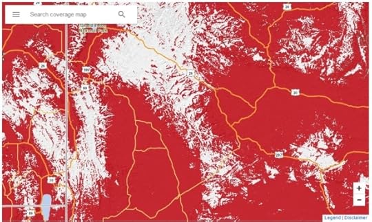
Wireless coverage along the Wind River High Route — and in the Wind River Range, more generally — is poor but possible. Your odds are best from high vantage points with unobstructed views to the high plains east or west. I’m thinking of specific spots like Wind River Peak, Raid Peak Pass, Europe Peak, and the Continental Divide between Pedestal Peak and Downs Mountain. Conversely, I wouldn’t expect coverage in deeper canyons or watersheds like East Fork or Bull Lake Creek.
As you might expect, Verizon will offer the most robust coverage from inside the range.
Cell service is insufficiently reliable for an emergency situation. For that purpose, I would recommend a PLB, satellite messenger, or satellite phone.
If you would like a more granular answer, consult the wireless coverage maps from your provider. I’ve dropped screenshots below.
Verizon
Coverage map

AT&T
Coverage map

Sprint
Coverage map

The post Reader question: Wireless service on the Wind River High Route appeared first on Andrew Skurka.
Published on May 28, 2017 05:53
