How a Map Can Make a Difference
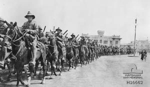
Where is this building on the map below? (Australian War Museum photo)
I’ve just found a map that makes everything clear.
I’ve only been trying to figure out the location of the YMCA camp at Zeitoun, Egypt to to the nearby ANZAC army camp for three years.
Today, while I was hunting “Suez Canal Authority Headquarters Ismailia WWI,” on Google, it turned up.
The map has nothing to do with what I hunted, but I’ll take it.
Did you hear me screaming?
The work, of course, is not done. Now I have to take the photos I have and figure out, from other clues, where things are in relation to everything else.
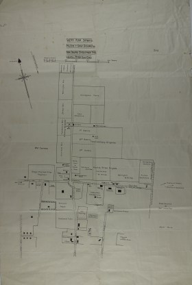
The map isn’t dated, which is challenging, but I know the New Zealand camp at Zeitoun was set up in January 1915 and operated there until July 1919, so I can’t be too far off.
Here’s the map:
Journey of the Ontagos website (https://journeyoftheotagos.wordpress....)
Here are some photos. Can you figure out where these spots are ON the map?
Digger History (http://www.diggerhistory.info/pages-c...)
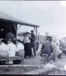
This is the Imperial School of Instruction, Zeitoun.
I don’t know what the building behind the horses in the photo at the top of the page, but it may be the same Imperial School of Instruction.
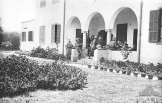
EGM compound (Wheaton Special Collections Library)
The next photo was taken from the Egyptian General Mission headquarters building–which on the map appears to be in the wrong place–it should be at the north end of the “vacant fenced” area.
The term “vacant fenced” indicates the map was drawn in 1915 because that area is the EGM compound and is where the YMCA tents were erected.
The long-roofed bungalow behind the narrow tree faces north.
I know all this because the Chambers family lived and worked on the compound from January 1916 until July 1919.
One of their friends, Miss Katherine Ashe, wrote about the compound, indicating some directions:”The little house faces due North–so that from the front the sunsets were a delight continually.”
As they lived outdoors on the veranda, they could see east and west for both the sunrise and sunsets, which everyone wrote about in glorious detail.
Oswald himself wrote that the EGM compound “happens to be in the camp lines so we will be under military guard.”
I knew they were a mile walk from where everyone caught the trolley into Ezbekieh Gardens in downtown Cairo (down the street from the world famous Shepheard’s Hotel), as well as being close to the railway station.
You can see the arrow midway on the left side of the map.
To the east, complete desert. Seeing the map, it now makes sense.
The map indicates YMCA, which suggests it was done prior to Oswald’s October 1915 arrival in Egypt. While he was there, the YMCA “hut” always was inside the compound.
Seeing the compound amid the camp suggest they probably had access to water (the water mains are clear on the map) and possibly electricity–which explains how Biddy and her helpers were able to serve cold drinks and ice cream in the canteen.
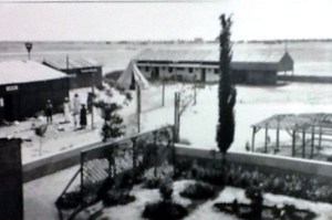
Here’s another photo, probably facing southwest? It was taken from the front of the bungalow:
This is the corner of the bungalow, circa 1915, facing southeast (Wheaton Special Collections Library)
What does it all mean?
I can write with confidence, now that I know how everything does or does not, fit together.
Of course, it also means I get to rewrite what I’ve already written now that I know the truth.
As the daughter of a geographer, I love maps.
Tweetables
Finding a map forces rewriting! Click to Tweet
Comparing maps to photos to figure out WWI locations. Click to Tweet
A long-sought map explains WWI camp information. Click to Tweet
One more photo: this one facing south, I think!
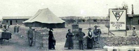
Photo courtesy Birmingham (UK) Special Collections Library: YMCA
The post How a Map Can Make a Difference appeared first on Michelle Ule, Author.