Roderick Phillips's Blog, page 32
September 16, 2013
La Paz Blues, Day 50
 La Paz, our 50th day on the road, and not one I shall remember fondly. My complete and utter failure on Parinacota remains a tremendous disappointment. I suppose that is the nature of mountaineering. It’s an unpredictable business, although I can’t help dwelling on what I did wrong and whether Sergio contributed to my failure or whether he acted in my best interests and brought me safely back to Christi. God I hate failure.
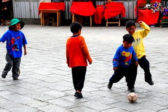
I’m also incredibly tired and my body aches interminably. I sleep late and sneak over to Andean Base Camp to return my equipment. I mumble my thanks and leave quickly, eager to avoid any protracted conversations. On the way back to the hotel, I pass some kids playing soccer in the street. They’re laughing, and shouting, and having fun, which is more than can be said for me. Christi tries to cheer me up by showing me all the stuff she has bought these last few days. Clearly her retail therapy was much more successful than my attempts at climbing. One thing I am good at, apparently, is vegging in front of the TV and in a marathon session I watch the hilarious Superbad, the quirky Along Came Polly, and the truly disturbing Hard Candy.
Tonight, for the first time during our Year of Wonder, I feel rather homesick.
The post La Paz Blues, Day 50 appeared first on Roderick Phillips.
September 15, 2013
Summit day, Day 49
Sleep fitfully until 2am. Summit day is here. Miraculously the wind dropped and it’s a perfect night: a billion stars in a silent night sky. Do a final carbo-load and then we’re off into the darkness, our headlamps providing the only light. As ordered, I plod slowly uphill through deep sand, the quiet man Sergio always 5 m ahead of me. We zigzag endlessly upwards, the pack on my back becoming gradually more unbearable. Time passes, but at least we’re making progress towards my ultimate goal. At 5 am, after 1 hr 45 min of continuous climbing, I beg for a rest. Surely we’re a third the way to the summit now. No, says Sergio we’re hiking too slowly! What? The summit is a disappointing 6 hours away, still. But we’ll make it, I state emphatically. Maybe, he mutters, and then he continues hiking in silence, always 5 m ahead of me.
I’m feeling rather deflated. I’d hoped for more advice and encouragement from Sergio and I regret not taking the Diamox this morning. But does any of that really matter? The sand is mixed with unstable rock and shale now, making each footstep treacherous. Mountaineering is bloody hard work. The sun peeps over the horizon at 6 am allowing me to actually see where I’m going – and it’s not a pretty sight. Above me is a steep scree field, below it’s loose sand and gravel. I slip and slide, two steps up and one back, while Sergio seems to glide over the ground.
At 8:30 am, after nearly 5.5 hours of climbing, we’re in sight of the much-reduced snow field, but Sergio says we’re still 4.5 hours from the top. I’m exhausted and plop down, an unfamiliar and overwhelming sense of failure beginning to creep over me. Was I naïve to suppose I could simply turn up and expect to summit a 20,000-foot mountain? Perhaps Sergio believes I’m just another arrogant Westerner. Difficult to know, though, because the man never talks. He only becomes animated when the decision is made to return to basecamp. The only hint of a silver lining is that I achieved a personal best: 18,800 feet.
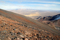
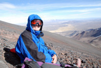
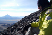
It’s a solemn drive back to La Paz, accompanied by a tremendous electrical storm over the Altiplano. Sergio has his pay day and talks happily to Claudio. I watch the storm, alone with my thoughts. Christi is both surprised and excited to see me back a day early.
The post Summit day, Day 49 appeared first on Roderick Phillips.
September 14, 2013
Sajama National Park Day 48
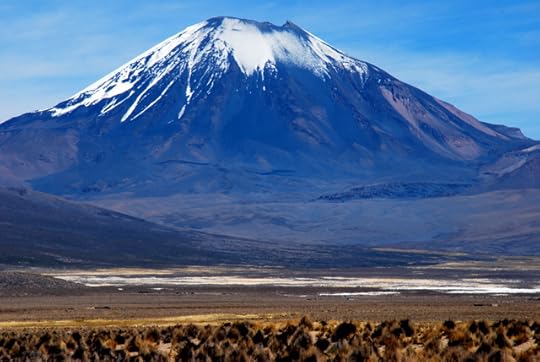
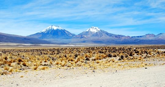
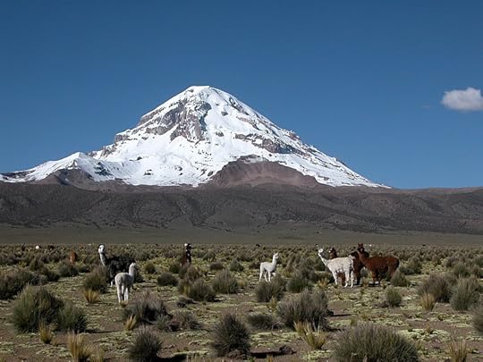
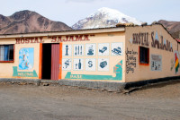
Everything for the expedition fits neatly into Sergio’s decrepit Landcruiser, including our cook, Claudio. It’s another awkward drive up and out of La Paz before we turn south and west towards Sajama National Park. The park, which lies on the border with Chile, has some beautiful scenery, including some spectacular eroded sandstone and volcanic rock formations. It’s a hard life here on the Altiplano and the Aymara eke out a living by grazing alpaca and llama. We soon get our first sight of Mt. Sajama (the highest peak in Bolivia) and eventually the twin mountains of Parinacota and Pomerape. We stop in Sajama village for lunch and to pick up two porters. Officially they should carry no more than 22 kg each, but they take 44 kg to get double pay. It’s an hour’s drive from the village over rough, desert tracks to the end of the road. Now we hike.
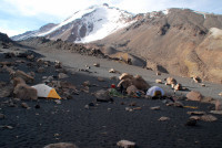
Even with the porters bearing the brunt of the equipment, my pack is much heavier than I’d anticipated. And it’s a 90-minute trek uphill through deep sand to base camp at 5,200m. My shoulders ache with the weight of the pack, but I push myself to keep up with the others. After 45 minutes hiking, we break and Sergio advises me to hike more slowly. This I do and not surprisingly I’m the last to arrive at base camp. The campsite lies 200m below the saddle that separates Mt. Parinacota and Mt. Pomerape and is surrounded by large boulders, which hopefully will provide some protection against the biting wind. My tent has yet to be erected and there’s little to suggest that anyone other than me will be doing it. This is definitely not a soft Inca trail hike, but a serious mountaineering expedition where you’re expected to pull your own weight.
Pulling my own weight lasts about 30 pathetic minutes before the porters rescue me from my own ineptitude. Later, we huddle in the food tent, eating soup, steak and pasta, and pineapple. Sergio is not the most communicative person I’ve ever met. He volunteers little information and while he does answer my questions, he’s not effusive. It’s 6-7 hrs to the top; we’ll stop hourly; wind could reach 100mph; don’t take Diamox in the morning (it’s not traditional). Bed at 8pm (nervous).

The post Sajama National Park Day 48 appeared first on Roderick Phillips.
September 13, 2013
Mt Chacaltaya, Day 47
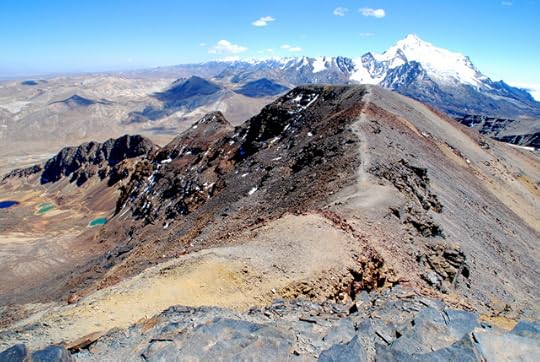
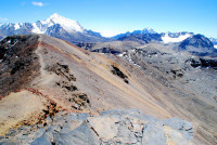
Andean Summits have insisted that I do more high altitude acclimatization before my summit attempt on Parinacota. They recommend hiking the last few thousand feet of Mt Chacaltaya, another major peak near La Paz. We hire a taxi which embarks upon an unscheduled tour of the back streets of the capital as we wind our way up out of the valley and onto the Altiplano. The roads are atrocious, and even at this early hour they are chock-a-block with vehicles of all description and local markets that have spilled out on to the thoroughfare. Although the driving is chaotic, no-one seems to get mad; everyone respects the right of their fellow citizens to use the road (although preferably behind them). The Altiplano remains starkly beautiful and above it lies Mt. Huayna Potosi and Mt. Illimani sparkling in the morning sun, while the snowless Chacaltaya has a more brooding appearance.
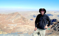
Mt Chacaltaya, formerly a ski resort, provides some of the most compelling evidence that climate change and global warming is real and happening right now. It’s glacier melted in 2004 and has yet to return. A treacherous, pot-holed road snakes its way up to the deserted ski lodge near the summit , although I’m dropped off some distance before that. Christi and the taxi driver continue to the top and watch me hike up. I don’t feel at all tired when I reach the ski lodge some 45 minutes later. The taxi driver is disappointed at the ease with which I completed the hike and insists on escorting me to the actual summit of Mt Chacaltaya at 5,390m (17,683 feet). The summit represents the highest point I’ve ever reached (beating Everest Base Camp in Tibet at 17,060 feet). Now my breathing is much more labored.
We return to La Paz in high spirits. I feel strong and acclimatized. Relax for the rest of the day, forcing myself to carbo-load. I’m taking Lariam (not because I’m worried about malaria-carrying mosquitoes at 20,000 feet, by the way, but because of an upcoming adventure) and Diamox (to aid with acclimatization) today – fingers crossed there’s no problems. Pack my bags and sleep remarkably well ahead of tomorrow’s big adventure.
The post Mt Chacaltaya, Day 47 appeared first on Roderick Phillips.
September 12, 2013
Bolivian Andes, Day 46
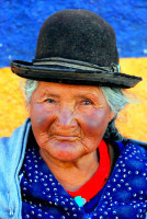
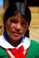
Spend the morning wondering around central La Paz, alternately trying to catch a flavor of the city and then my breath. In addition to its spectacular scenery, Bolivia has the highest percentage of indigenous people of any South American country, making it a photographic feast.
In the afternoon, it’s down to business. I tend to do – or at least to think I can do – crazy things once I start traveling. And much like my aspiration to be a scuba diver, I’m drawn to high altitude hiking. Nothing technical, you understand – I wouldn’t know what to do with a crampon or an ice axe – but being above 20,000 feet has a visceral, manly sense of accomplishment about it. And we’ve been over 15,000 feet already. What’s another few thousand feet? It’s not as if I’m planning to scale Everest or anything.
And the Bolivian Andes offers some giants. Indeed, my indefatigable Lonely Planet guidebook says that ‘one of the world’s easiest 6,000m peaks’ lies almost in the suburbs of La Paz, but Huayna Potosi (at 6,088m) is 30 feet short of the magic 20,000 feet mark (for those of us still working in the Imperial system). After a little research, however, I found a mountain that breaks the 20,000 feet barrier, Parinacota (6,348 m/20,826 feet) and a company, Andean Summits, that were willing to guide this novice to the top. The highest peak in Bolivia is actually Sajama at 6,542 m (21,463 ft), which coincidentally is immediately adjacent to Parinacota. In 2001, local Sajama villagers and Bolivian mountain guides played a soccer match at the top of Sajama to protest a decision made by FIFA (soccer’s governing body) to ban international soccer matches in La Paz. Not a lot of people know that!
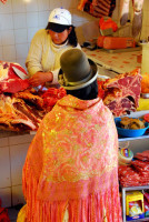
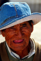
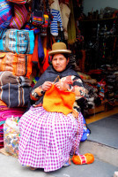
Sergio Sainz is my Andean Summits – appointed guide. He’s a slim, wiry, young guy. Mild-mannered and quiet. Not quite the rugged mountain man I’d expected, but he’s a serious professional. God knows what he thinks of my hair-brained scheme. He takes me to Andean Base Camp, which have agreed to rent me the equipment I shall need (well I couldn’t very well carry it all from San Francisco). It’s a fascinating experience selecting plastic boots, windbreaker, down jacket, gloves, harness, crampons, 4-season sleeping bag, sleep mat, goggles, head light, backpack, thick trousers, poles and a ski mask. It suddenly dawns on me, though, that this is a serious endeavor, with serious risks.
The post Bolivian Andes, Day 46 appeared first on Roderick Phillips.
September 11, 2013
Copacabana to La Paz, Day 45
Our hotel in Copacabana has only one drawback, the utilities can be intermittent. We lost electrical power for the second time during our stay last night and it has yet to return. The water is out also. I improvise quite wonderfully regarding the water. I heat the water from our hot water bottles in a pan (we have gas) so that Christi can have a strip wash. Then we use that dirty water to flush the toilets. We also boil some of our bottled water so that I can have a cup of tea, while Christi fries our eggs. Just call me MacGyver.
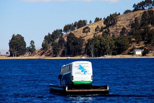
Today we move on to La Paz, the capital of Bolivia and arguably the highest capital in the world. It’s a 4-hour bus ride, which includes a ferry ride across the Tiquina Straits of Lake Titicaca. An odd thing happens once we reach the Straits: the passengers take a small ferry boat across, while the bus is bundled onto a pontoon and taken across separately. Initially, the pontoon appears to be disappearing into the center of Lake Titicaca, but the stevadores successfully bring the bus ashore.
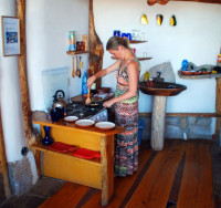
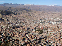
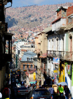
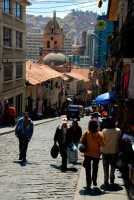
The approach to central La Paz is spectacular. It’s like being aboard a roller coaster ride that is hurtling towards the center of the earth. Okay, that might be a slight exaggeration. For a start nothing hurtles in La Paz; gridlock rules. But there is a steep descent to the valley below. And for once the poor people, who live on the Altiplano above the city and the precipitous sides of the valley, get the best views, while the rich live at the bottom. Needless to say we’ll be clinging to the sheer-walled valley with the vast majority of La Paz’s inhabitants. Our hotel, the Hostal Posada de la Abuela is a refurbished colonial house beautifully located in the heart of markets and cobbled streets at the intersection of Calle Sagárnaga and Calle Linares in the tourist section of town. And some of these cobbled streets are seriously steep – not what you need at 12,000 feet. More amazing still (to me, at least) is the speed and dexterity with which women in stiletto heels negotiate both the cobblestones and the steep gradients – all in the name of fashion.
The post Copacabana to La Paz, Day 45 appeared first on Roderick Phillips.
September 10, 2013
Isla del Sol, Lake Titicaca, Day 44
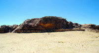
According to Inca mythology, Isla del Sol is the birthplace of Manco Capac (son of Viracocha, the creator god) and the first Inca. It is believed that Manco Capac spontaneously emerged from a prominent crag in a large sandstone outcrop in the northern end of the island known as Titikala (the Sacred Rock).
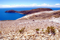
It is possible to explore Isla del Sol and the Inca ruins in one long day from Copacabana. It’s a bouncy 2-hour boat ride to the northern end of the island and the port of Cha’llapapa. After dropping us off, the boat continues to Yumani at the southern end of the island. We have 6 hours to explore the island and make it to Yumani before the boat heads back to Copacabana. We begin at the Inca site of Chicana, which is home to the Sacred Rock, although after Machu Picchu, these ruins resemble little more than a pile of rubble to me. Still, the views and the hiking are stunning and that is the main reason we are here.
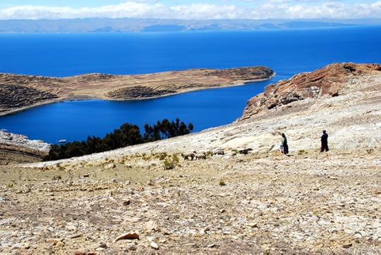
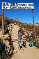
It’s a 6-mile hike from north to south along an undulating ridgeline that runs down the spine of the island at 4,000m (13,123 feet). The scenery ranges from stark and rocky in the north to a more fertile Mediterranean landscape in the south. And accompanying our hike are the exquisite sapphire-blue waters of the lake and the snow-capped peaks of the Cordillera Real. A word to the wise, at several places along the route the locals insist on charging a toll before they will allow you to continue hiking. According to our guidebook, the main industry on the island is subsistence farming (utilizing the ubiquitous agricultural terracing), ‘augmented’ by tourism. Now I know what augmented means! We even encounter two young girls (5 or 6 years of age) at the entrance to Yumani who want to charge us for entering the town. However my manly ego refuses point blank to be extorted by two tiny tots. Hiking Isla del Sol is a fantastic, if tiring, experience and we barely stumble down Las Mil Gradas (the thousand Inca steps – what is it with these guys and steps?) at Yumani in time to catch the boat back to Copacabana.

The post Isla del Sol, Lake Titicaca, Day 44 appeared first on Roderick Phillips.
September 9, 2013
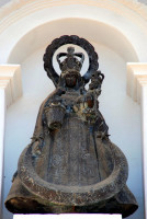
Our Lady of Copacabana, Day 43
 Our Lady of Copacabana is the patron saint of Bolivia…
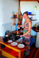
Paradise was actually a bit chilly and a bit loud last night. We could have done with one of those hairless dogs from Trujillo, but at least we had the modern equivalent: a hot water bottle. Christi is excited to have access to a kitchen today and prepares eggs, sunny-side up, for breakfast.
Afterwards we explore the center of town which is basically two streets and a square full of tourist shops and restaurants. We also identify the source of our nighttime disturbance. Packs of dogs roam freely around town and howl incessantly after dark. Unfortunately, the dogs leave lots of ‘presents’ for you to avoid and the streets (and especially the waterfront) are rife with litter – so sad. The owner of our hotel, Martin (a German), explains later that the locals don’t really see the garbage they discard. Years ago everything was biodegradable, but that isn’t the case now and the mentality of the Bolivians has yet to adapt. In fact, he says, it’s hard to convince the locals that the tourists do notice the trash.
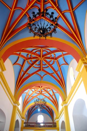
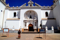
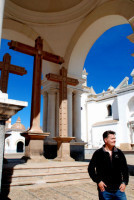
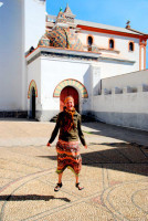
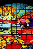
Despite its problems, Copacabana possesses an absolute gem in its midst, the 16th century cathedral which is dedicated to our Lady of Copacabana. The dazzling white façade has a Moorish influence, but even more impressive is the richly decorated vaulted ceiling painted in pastel reds, blues, and yellows. Not to mention the yellow and turquoise dome, the glorious golden altar, and the gorgeous stain glass windows. Absolutely stunning.
Back at our hotel we decide to take advantage of the hotel’s free hot tub. Unfortunately, the outside temperature is already 90oF, so we’re basically cooked twice over in less than 15 minutes. We stagger back to the shade of our room and drink pints of water to recover. And the motto of this story is: just because a hotel has a hot tub, it doesn’t mean you have to use it!
The post Our Lady of Copacabana, Day 43 appeared first on Roderick Phillips.
September 8, 2013
Puno (Peru) to Copacabana (Bolivia), Day 42
It’s a new country (Bolivia) and a new town (Copacabana) today…
The 2-hour drive beside the sapphire-blue waters of Lake Titicaca to the Peruvian border town of Yunguyo is simply stunning. And much like at the Ecuador-Peru border there is a huge market is in full swing. Before we can even find Peruvian customs and immigration, we have to negotiate this crazy market: people, animals, carts and buses all looking to move at the same time in different directions; it’s chaos. We eventually find the appropriate office and the Peruvian bureaucrats stamp our passports without even acknowledging us. The only question now is whether the Bolivian officials will grant Christi a visa. As soon as they realize she’s an American, she is taken aside and her paperwork reviewed. Even though we have a file an inch thick, there appears to be one more document to complete not to mention the US$135 visa fee, which is such a rip-off – don’t get me started. But after a final moment of hesitation, the stamp comes down and Christi is in. I follow in the blink of an eye. Yippee!
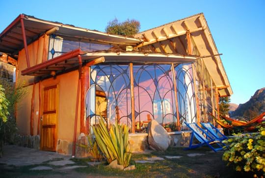
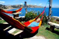
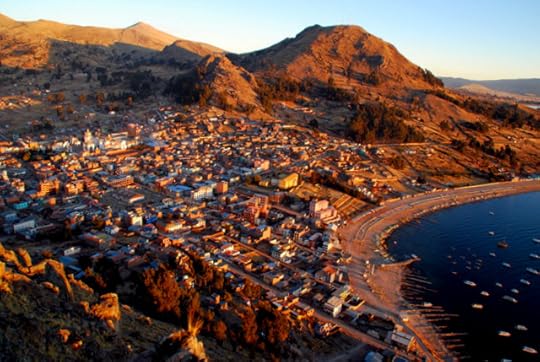
Our hotel, Las Olas, is spectacularly situated in the hills overlooking Copacabana harbor and Lake Titicaca. The area resembles the Amalfi coastline, although our million dollar view only costs 36. Our suite is equally spectacular: an upstairs bedroom with tables, chairs and even a hammock. Downstairs is a second bed, more tables and chairs, a small kitchen and a bathroom. There are plant beds in the main living area and even in the shower itself. Most impressive of all, though, are the 10-foot high windows, which afford the superb panoramic views of the harbor and the lake.
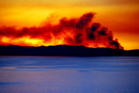
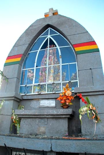
Later, we decide to view the sunset from nearby Cerro Calvario. It’s a steep hike to the top at 3,966m (13,000 feet) where a statue of the Virgin Mary of Copacabana encased in glass stares beatifically out over the lake. I say beatifically, but she might be mad as hell for all I know, because the route to the top and the summit itself is stacked with trash and adorned with graffiti. Still, the smoking sunset (there’s a fire on the far side of the lake) is magnificent.

The post Puno (Peru) to Copacabana (Bolivia), Day 42 appeared first on Roderick Phillips.
September 7, 2013
Uros Islands, Lake Titicaca, Day 41
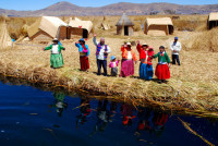
Puno sits on the shores of Lake Titicaca at an elevation of 12,500 feet. A short boat ride from town are the Uros Islands. Originally inhabited by the Uros people, this indigenous group has now interbred heavily with the Aymara (both of which were contemporaries of the Inca). The islands themselves are man-made, using totora reeds which grow abundantly around the lake. The islands actually float on Lake Titicaca and have to be anchored to stop them drifting away.
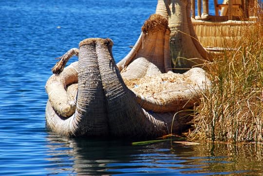
The island we visit is called Chewmi (honestly) and is home to ten families. The island has a very spongy feel to it, which makes balance a little challenging initially; in fact, it’s a bit like standing on a trampoline. Historically, totora reeds were used to construct everything on the island from the huts, to the couches, beds, and even the boats. Modern conveniences are creeping in, however: nylon rope, solar panels for electricity and solid-hulled boats, although the Head Man is proud of his luxurious ‘Mercedes-Benz’ totora reed boat and for a few extra Peruvian soles, we take a quick trip (actually a slow trip) around the nearby islands.

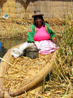
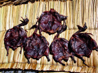


Technically the lake is a national preserve and hence killing the wildlife is illegal, but the Aymara have special permission to fish for trout and hunt for ducks. This raises two interesting questions: how do they cook the food they catch and what is their subsequent bathroom etiquette. Fires are built on a bed of stones (and carefully monitored), while the bathroom is situated on a separate island a hop, skip, and a jump away (the reeds slowly filter the waste material away, apparently). Extra care is advised, though, for that pesky nighttime call of nature and god forbid you have diarrhea or have imbibed to excess!
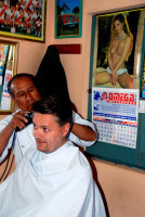
Back on dry land, I get my first hair-cut of the trip, which is excellent and so are the illuminating calendars that adorn the walls.
The post Uros Islands, Lake Titicaca, Day 41 appeared first on Roderick Phillips.

