Roderick Phillips's Blog, page 30
October 6, 2013
Quebreda de Cafayete, Day 70
The tour of the Quebreda de Cafayete consists of Christi, myself and two older women from Buenos Aries together with an English-speaking guide who drives us around in his own car. We take route 68 south initially through the lush, fertile Lerma valley which boasts a collection of small, parochial villages and farms growing tobacco and grazing cattle. We even spot a gaucho or two.
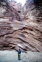
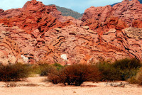
At Alemani, some 100km south of Salta, the scenery changes dramatically as we enter the Quebreda de Cafayete. Sedimentary rock is an easy target for water flowing down from the Andes, and the formations that have been created through the eons are quite spectacular. The area is also rich in minerals such as copper, iron, sulfur which add dramatic color to the spectacular scenery. In addition to the formations we see from the road, we stop to explore some of the larger, more famous ones, including Garganta del Diablo (Devil’s throat), Il Sapo (the toad), El Fraile (the friar), Los Castillos (the castles) and perhaps the most impressive of all, the water-eroded El Anfiteatro (the amphitheater).
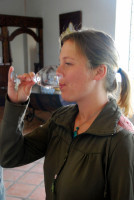
As we approach Cafayete, the countryside changes back to lush, fertile valleys and we see an abundance of vineyards. Christi samples some malbec (red) and torrontes (white) wines at the Bodega Nanni (one of only four organic wineries in Argentina) and pronounces them de-licious. Delicious enough, in fact, to buy a bottle of the malbec. Lunch is the typical tourist affair – all the people we have so far avoided are corralled into the same overly busy restaurant. I have no idea why this is, other than the guide must receive a generous kickback. Still, the steak Christi and I share is large and rather tasty.
On the long drive back to Salta, talk switches to real life subjects. I ask why we encounter so many police check points on route 68. Our guide reluctantly explains that Salta province is a key transit point for drugs coming out of Bolivia and for the trafficking of girls into prostitution – and the town seems so nice at first blush!
Blog post written by Roderick Phillips, author of Weary Heart – a gut-wrenching, heart-wrenching, laugh-wrenching tale
The post Quebreda de Cafayete, Day 70 appeared first on Roderick Phillips.
October 5, 2013
Faces of Argentina, Day 69
We ate dinner from a food-stall last night at about 11 pm, which is about the normal time people eat in these parts. What with the long journey and the late night, we enjoy a thoroughly lazy morning before beginning to explore. Salta is by far the most sophisticated town we have encountered since Cuenca, but one fact of life that we shall have to get used to during our stay in Argentina is that the locals like to smoke – anywhere, anytime. The pace of life in Salta is also very relaxed – a fact that cafes have embraced wholeheartedly. Starbucks they ain’t. Still it’s a beautiful day and we’re in no rush. We sit outside at the Van Gogh Café in the main square, Plaza 9 de Julio, watching the world go by and waiting patiently to enjoy our empanadas and cold drinks.
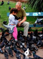
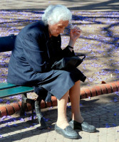
And speaking of watching the world go by, the racial mix in Argentina is very different to that of the Andean nations (Ecuador, Peru, and Bolivia). Very few indigenous people still live in Argentina; the country is a land of immigrants. Indeed, only America has received more European immigrants than Argentina. So the faces of Argentina are very familiar.
This rest day is also, unfortunately, a planning day. While Salta is a great town to visit in its own right, we also want to explore a little more of the gorgeous scenery surrounding us – particularly the Quebrada de Cafayete (to the south) and the Quebrada de Humahuaca (to the north). (Note, quebreda means ravine or canyon). A local tour agency hooks us up with two very long day trips, which will give us the merest hint of what northern Argentina has to offer.
Fortunately tour agencies are one of the few enterprises in Salta that do not take an afternoon siesta, although the rest of the town takes this break very seriously (it’s probably the only thing they are serious about). At 1 pm sharp most of Salta shuts down. The locals then enjoy a long lunch, a nap, and, well I was too polite to ask the details, but either plan on completing your errands early or be prepared for a long wait. At about 5 pm the Salteños go back to work – so you can deposit that all-important check, shop for groceries, or buy a suit any time up to 9 pm. Folks then go home, relax, shower, and get ready to go out. Restaurants begin to get busy at 10 pm and dinner is still going strong at midnight (even later on the weekends). If you are daft enough to go out for dinner at 8 pm (and we are so hungry and so indoctrinated to eat early that we can barely wait until 8 pm), you will be the only diners in the restaurant – unless some other poor sap has committed the same faux pas. On the upside there is no wait for a table and the service is pretty damn quick. Christi ‘enjoys’ roast goat, while I tuck into the more conventional Lloyd George steak. We go to bed just as Salta begins to stir.

Blog post by Roderick Phillips, author of Weary Heart – a gut-wrenching, heart-wrenching, laugh-wrenching tale
The post Faces of Argentina, Day 69 appeared first on Roderick Phillips.
October 4, 2013
San Pedro de Atacama (Chile) to Salta (Argentina), Day 68
It seems that many backpackers are attempting to escape the expensive, yet seductive, embrace of San Pedro de Atacama for Salta today and tickets are hard to come by. Christi and I are lucky to get two of the last four tickets on the Pullman company service departing at 8 am (or whenever the bus driver feels so inclined). The bus eventually departs from the waste ground behind the central plaza of San Pedro.
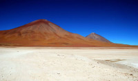
We basically repeat the same journey that brought us to San Pedro de Atacama from Bolivia, which means we have to negotiate Chilean border formalities again. These are noticeably more lax now that we’re leaving the country. Instead of taking the road north at this point, though, we turn south. In our case always to the south. We retain glimpses of the magnificent Eduardo Abaroa Andean Fauna National Reserve (particularly Laguna Blanca) for a while, but then the comfy seats, the smooth road (a blessing after Southwest Bolivia), free food, and endless movies distract us. Although we have officially left Chile, we continue to drive through Chilean desert for a few hours before we reach Argentina. And boy are those Argentinean border officials apathetic. It takes hours for the lazy sods to admit us.
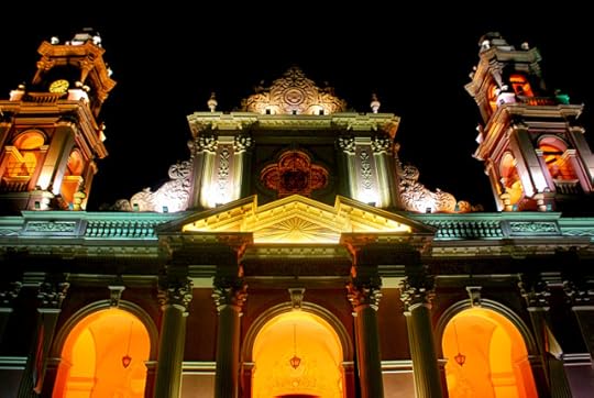
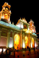
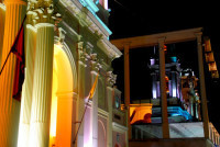
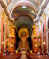
We arrive in Salta in darkness 11 hours after leaving San Pedro de Atacama. Add in the fact that Argentina is one hour ahead of Chile and you’d be forgiven for thinking that this small town would be winding down for the night. Not a bit of it! The party is just getting started. And having prized my sweaty butt away from the tenacious grip of the Pullman seat, I’m eager to join in. We head for the main square, Plaza 9 de Julio, which is absolutely buzzing with people eating and drinking at outdoor restaurants. The square also features the wonderful Iglesia Catedral de Salta, which stands out because it’s bright pink (even at night). There’s also the interesting juxtaposition of the 19th century baroque cathedral with the 21st century architecture next door.

Blog post by Roderick Phillips, author of Weary Heart – a gut-wrenching, heart-wrenching, laugh-wrenching ride
The post San Pedro de Atacama (Chile) to Salta (Argentina), Day 68 appeared first on Roderick Phillips.
October 3, 2013
San Pedro de Atacama (Chile) Day 67
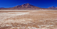
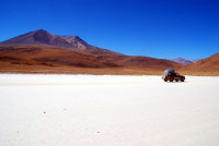
As Bolivia and Chile share a similar landscape in this area, much of the tour we have just completed has a Chilean equivalent, but the costs are much higher here. We had planned to visit the high Chilean altiplano and geyser fields, but lack of money, lack of motivation for another 4 am start, and the seductive clutches of San Pedro de Atacama keeps us tucked up in bed. (I’m hoping a few more snaps from the stunning southwest of Bolivia will keep you entertained until we get to our next destination).
Mind you, doing nothing in San Pedro is costly. Our rooms are very comfortable, but expensive (expensive by the limited scope of our budget, which is US$100 per day for both Christi and I), while the delectable dining options (dinner is a salmon stir fry for me and an Asian curry for Christi) are another budget buster. San Pedro de Atacama offers the lifestyle we crave, but can ill-afford.
We spend most of this lazy day checking e-mail, uploading photos to Picasa, and planning – actually changing – our itinerary. We had planned to fly to the capital, Santiago, and explore central Chile – notably the port and cultural capital, Valparaíso, and the surrounding wineries. All very cultured, comfortable – and expensive. The new plan is to take a bus to Salta in Northern Argentina and slowly make our way out of the Andes down towards Mendoza in the central part of the country. In fact, Mendoza lies at the same latitude as Santiago, but to the west of the Andes. We will return to Chile, but at the other end of this long, narrow country. And it won’t be a dry desert landscape then, but an environment shaped by ice and snow.
The weather cools off in San Pedro de Atacama in the evening and it’s pleasant to wander the sandy streets of this small town. No one, including us, is in a hurry and the seductive charm of the town is becoming addictive. It’s an expensive addiction, though, and tomorrow we’ll need to break the habit.
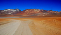
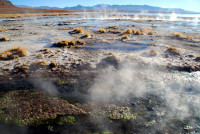
Blog post by Roderick Phillips, author of Weary Heart – a gut-wrenching, heart-wrenching, laugh-wrenching ride
The post San Pedro de Atacama (Chile) Day 67 appeared first on Roderick Phillips.
October 2, 2013
Sol de Manana geyser basin, Day 66
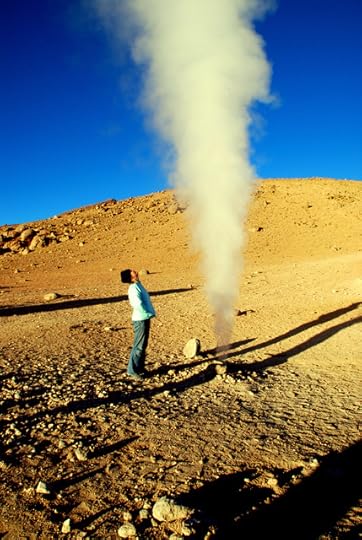
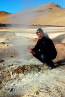
We are woken at 4.30 am and leave the hostel at 5.30 am in freezing darkness. And it’s scary driving through the desert at night. But in order to have the best experience of the Sol de Manana geyser basin (4,950m / 16,240 feet), you have to arrive by dawn. Surprisingly the area is not too crowded and we get to enjoy the majesty of the towering, hissing fumaroles, the cracked and steaming earth, and the belching mud pools relatively undisturbed.
Next up are the undeveloped Termas de Polques hot springs, which bubble at a comfortable 86oF. Some hardy bastards strip off and dive in, but I prefer to warm my hands around a mug of breakfast hot chocolate. Christi decides to roll up her trousers (and her thermals) and cautiously dips her toes in the reinvigorating sulfurous water, but not, despite my best encouragement, her aching butt.
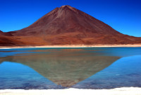
Our final destination in this little corner of heaven on earth is Laguna Verde and Mt. Licancabur (a beast at 5930m / 19,455 feet). According to our driver, Richard, when the conditions are windy (and remarkably that isn’t the case today) the lake appears green (due to a toxic combination of metals, including copper). Conversely, on calm days, such as today, the majestic cone-shaped mountain is reflected perfectly in the lake. Utterly sublime. The southwest of the country truly has to be seen to be believed. Thank you Bolivia. It has been a fantastic 3.5 weeks.
The border with Chile is surprisingly close, just around the corner (actually just around Mt. Licancabur). We are met by a mini-bus that ferries us and most of the tourists to San Pedro de Atacama (in Chile), leaving the beat-up 4WDs to race back to Uyuni. This is where the day takes a turn for the worst: Chilean customs and immigration insist on scanning the luggage from every passenger. This is an excruciatingly slow process. When we finally reach San Pedro, we quickly realize that lodging – in fact almost everything in San Pedro – is super expensive and we can’t get a bus out of this small, but very busy, town for two days. It’s a glum night.




Blog post by Roderick Phillips, author of Weary Heart, a gut-wrenching, heart-wrenching, laugh-wrenching ride
The post Sol de Manana geyser basin, Day 66 appeared first on Roderick Phillips.
October 1, 2013
Southwest Bolivia, Day 65
Southwest Bolivia is simply stunning…
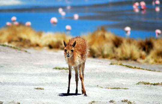
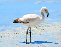
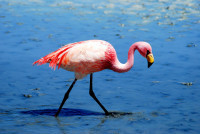
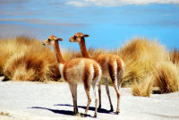
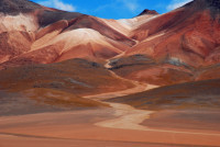
Christi and I are up and out early, exploring our surroundings as the sun rises and marveling at the length of our shadows. We eat a pretty limp breakfast of stale bread and then it’s back to the spectacular scenery: Salar Chiguana (a smaller version of the Salar de Uyuni, but with less salt) followed by Oliawi Mountain (which is spewing toxic gas from its western flank). We then take a short-cut across a borax pan to the incomparably beautiful Lake Canapa where flamingoes are pottering about in the shallow waters, indifferent to the human presence. We leave, just as the tourist convoy arrives, and lunch at nearby Lake Hedionda. Vicuñas graze along the water’s edge, while flamingoes feed relentlessly on brine shrimp. Fast fact: the oddly shaped beaks of flamingoes are specially adapted to separate mud and silt from shrimp and are used upside-down. Not a lot of people know that!
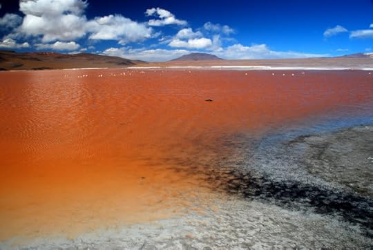
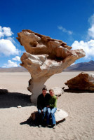
After lunch, the spectacular scenery just keeps on coming as we drive through the stunning desert of Siloli in the Eduardo Abaroa Andean Fauna National Reserve. One rock formation, in particular, Arbol de Piedra (a 22 feet tall stone tree carved by wind-blown sand) is probably the most photographed rock in the whole of Bolivia. Our last stop for the day is another jaw-dropping knockout (I’m running out of superlatives for this tour): Laguna Colorada, which is a brilliant red-colored lake (partly due to red algae and partly red clay sediment) interspersed with white borax deposits. Anyone with an interest in photography could easily spend a month in the Salar and the reserve.
The fun ends here, however. Our hostel for the night in this corner of Southwest Bolivia is truly grim. There is no heat and no showers and the toilets, well they leave a lot to be desired. Our spaghetti bolognaise dinner is terrible. Fortunately, there isn’t very much of it (although our Swiss companions thought the lack of food is a problem). Our dorm accommodation is frigid (it’s Fargo frigid). Christi wears four layers of clothing, hat, scarf, and gloves, and uses two sleeping bags plus extra blankets and she is still cold.



Blog post by Roderick Phillips, author, Weary Heart – a gut-wrenching, heart-wrenching, laugh-wrenching tale
The post Southwest Bolivia, Day 65 appeared first on Roderick Phillips.
September 30, 2013
Salar de Uyuni, Day 64
People don’t stay too long in Uyuni. It’s merely a transit point for tours of the Salar de Uyuni and Southwest Bolivia. And there are a lot of operations (of variable quality and safety records) vying for your business. Christi and I choose Cordillera Traveller for our tour. We also pay a little more for the comfortable 4-person trip, rather than the cramped 6-person version. Our compadres are two Swiss guys one of whom speaks fluent Spanish. Yippee! Our driver/guide/cook is Richard and he arrives at our hotel in a pretty beat-up Toyota Landcruiser. We leave Uyuni less than 16 hours after we arrived.
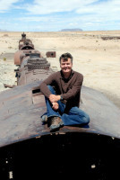
Our first stop, (along with 12 other vehicles) is a rusting, roached-out train cemetery – a relic of colonial times when Uyuni was a major train hub. Surrounding the cemetery, the Altiplano is awash with plastic bags snagged on small shrubs. It’s a sad and troubling allegory of our modern, technological world.
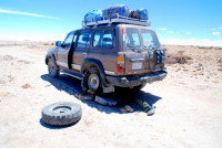
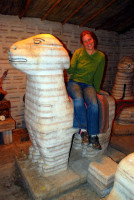
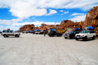
Colchani is our next stop, but along the way we encounter our first little mishap – a burst tire. Worryingly, though, Richard does not have a jack and is forced to improvise using nearby rocks to support the axle. Turns out, our delay is to our benefit as Colchani is one of those horrid tourist stops foisted upon unsuspecting tourists. We stay only long enough for lunch and a quick peek at the salt sculpture souvenirs, before finally moving on to the famous Salar de Uyuni.
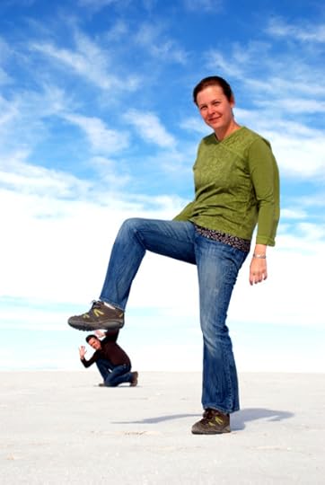
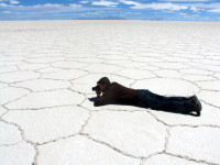
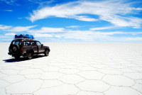
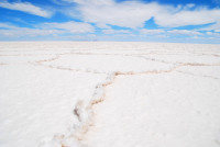
Located in the Bolivian Altiplano, the Salar de Uyuni is the largest salt lake in the world, measuring some 4,000 square miles and containing some 10 billion tons of mineral deposits (including nearly half of the world’s lithium reserves, so without Bolivia the Energizer Bunny is going nowhere). Fortunately, mining is strictly controlled enabling the Salar to retain its almost pristine appearance, particularly the beautiful geometric salt crystal formations. The landscape is mesmerizing: the Salar is stark and blindingly white, while the sky is vast and empty. And due to its extraordinary flatness and monochrome color it’s possible to distort reality (at least in our photographs).
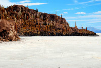
Myriad trails cross the Salar and our quiet, but knowledgeable, guide speeds along to our next point of interest: Isla de los Pescadores. The island appears to be a mirage initially, but then it resolves into a sizeable rocky outcrop festooned with giant coral cacti (the dozen other tour vehicles parked by the island are not, sadly, a mirage). A raging wind scours the island, although the cacti (some of which are 30-feet tall and more than 900 years old) don’t seem to mind too much. The needles on these furry buggers are incredibly sharp as I find out to my cost.
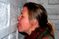
Only very reluctantly do we leave the mesmerizing Salar de Uyuni to overnight in a genuine salt hotel in the town of San Juan. The floor and walls of our room are literally made of salt, while the bed and the ceiling are reassuringly non-edible. It’s a cold night up here on the Altiplano, in the land of salt.
Blog post by Roderick Phillips, author of Weary Heart – a gut-wrenching, heart-wrenching, laugh-wrenching tale
The post Salar de Uyuni, Day 64 appeared first on Roderick Phillips.
September 29, 2013
Altiplano sunset, Day 63
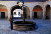
Before we depart Potosi, we just have time to visit the eclectic Casa Real de la Moneda, the former mint and now a museum. The mandatory tour begins with art from the colonial era, which is held in exquisite timber-beamed rooms with stone arches. The most famous painting housed here is La Virgen del Cerro (thought to be the work of an unknown indigenous artist). The canvas recounts the history, cruelty, power and symbolism of Cerro Rico.
The tour then switches gears and focuses on the process of minting the silver extracted from Cerro Rico into coins. The silver coins and ingots produced in Potosi were shipped by land and sea to Panama and eventually taken to Spain aboard Spanish treasure fleets for use throughout its empire. Modern day Bolivia, by contrast, no longer produces its own coins and notes – it being cheaper to import them from France, Canada, and irony of ironies, Spain.
The tour finishes on a rather somber note with a collection of military artifacts (from the Spanish Conquest to 20th century munitions) and, even more disturbing, a display of mummified babies. Surely these guys deserve a decent Christian (or animist) burial.
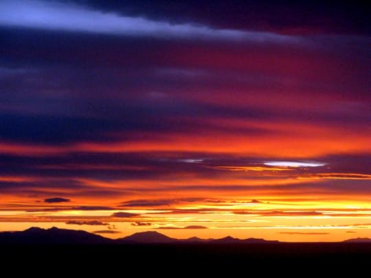
We leave Potosi on sealed road aboard a soft class Emperador bus. Half the passengers are tourists, the other half are indigenous Aymara who prefer to keep their huge bundles with them rather than stowing them in the hold of the bus (probably wise). Once outside the city, the road quickly becomes a building site as serious repairs and upgrades are in full swing. The bus driver manages the conditions heroically, successfully negotiating all manner of diversions, sand heaps, steep gradients, llamas, and other vehicles. During the odd moments when the dust settles, the scenery is actually breathtaking: crumbling shale and eroded sandstone lead to some dramatic rock formations that stand out against the bleak Altiplano. Equally dramatic are the dark, claustrophobic clouds that bear down on the wild plateau promising rain that never materializes. The altiplano sunset is stunning, which restores our sagging spirits as we finally reach Uyuni – a city in the middle of nowhere – after six long, grubby hours.

Blog post by Roderick Phillips, author of Weary Heart – a gut-wrenching, heart-wrenching, laugh-wrenching ride
The post Altiplano sunset, Day 63 appeared first on Roderick Phillips.
September 28, 2013
Cerro Rico, Potosi, Day 62
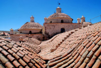
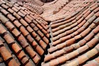
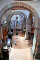
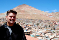
The reason tourists visit Potosi these days is to experience for themselves the brutal nature of the contemporary mining operation at Cerro Rico. Koala tours promises a very realistic experience. Before Christi and I go underground, though, we visit the beautiful monastery of San Francisco, which has wonderful roof-top views of the city and the infamous mountain.
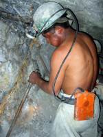
Our guide to Cerro Rico is a jovial 31 year- old Quechua guy called Efrain who speaks wonderful English. Although working for Koala tours is his main job now, he still works in the mines during the tourist off-season (December – February). We begin by kitting up in rubber boots, protective pants and jackets, and a helmet and headlamp. With more than a little trepidation we approach Candelaria, a traditional working mine where everything is done by hand. We enter through a classic mine shaft with walls supported by beams of wood while overhead tubes and wiring (for ventilation and power) dangle precariously. In addition to our protective clothing, Efrain advises to wear bandanas over our nose and mouth to reduce some of the toxic dust entering our lungs, but this makes breathing more difficult. And although we’re descending into the depths of the mine, our elevation is still around 14,500 feet. Our first stop is to pay homage to El Tio, the devil. The miners argue that they are a lot closer to hell than heaven, so appeasing Lucifer is much more important – not only to ensure safety but success as well.
The first level is not too difficult, just a little ducking here and there, but then we truly begin to scramble down to the lower levels. It’s slippery and dusty with unannounced low ceilings; sometimes we’re crawling low on our hands and knees – at other times climbing down rickety ladders. And it’s getting hotter and more claustrophobic and without the headlamps we brought with us we would be in total darkness. God forbid my light goes out now.
Occasionally we spot eerie figures in the dark pushing wagons full of ore along rail tracks. Mining is undeniably back-breaking work, but throw in the toxic dust, the altitude, the heat, and the sulfur, arsenic, and asbestos that clings to the mine shafts and Cerro Rico is nothing less than hell on earth. We finally reach the unventilated active mine face on level 4 and the temperature is approaching 100oF. We watch miners chiseling a 2-inch diameter 20-inch long hole in the rock face that will eventually be plugged with a stick of dynamite. Efrain says setting up one explosion takes 5 hours. The miners work in these conditions 10 hours a day, six days a week. The ore they recover, which is of much lower quality than that quarried during the mine’s heyday, earns them US$70 per ton from the local smelters. A group of 10 miners produce about 2 tons per day between them, grossing each miner US$15, but with overheads and taxes they net nearer to US$7 (about US170 per month).
Climbing back out of the mine is more exhausting than the descent and both Christi and I are relieved to finally escape the suffocating confines of the mountain. The air has never been fresher nor the sky appear so blue. Cerro Rico is not a place I plan on returning to anytime soon.

Blog post by Roderick Phillips, author of Weary Heart, a gut-wrenching, heart-wrenching, laugh-wrenching ride
The post Cerro Rico, Potosi, Day 62 appeared first on Roderick Phillips.
September 27, 2013
Sucre to Potosi, Day 61
We take our first non-tourist bus in Bolivia today. And once we’re aboard it trawls around Sucre until it’s full to bursting before heading south. It’s 3 hours to Potosi across the Altiplano and our traveling companions are largely indigenous Aymara. Indeed much of what we see along the way are Aymara herders grazing sheep, llama, pigs, goats, donkeys – just about every domesticated animal – on the plains. A favorite pasture grass is the evocatively named Peruvian feather grass.
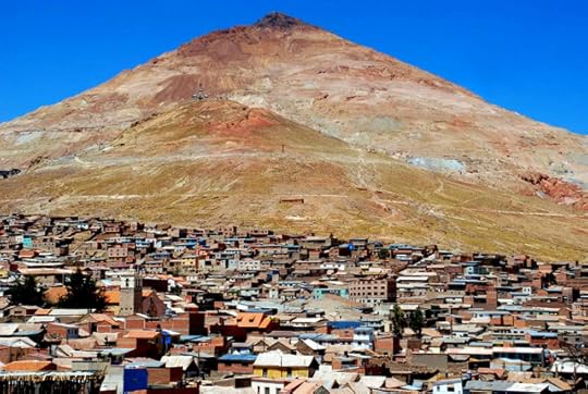
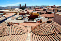
Potosi and Sucre are two very different cities. While Sucre is cultured and confident, offering a comfortable lifestyle, Potosi is working class and gritty, where life seems to be lived on the edge. Potosi is a shock after laid-back Sucre. Potosi ‘s modern-day claim to fame is that it’s the highest city in the world at 4090m (13,420 feet), but this fact hides a tragic past. In the mid-16th century, the richest silver deposits in the world were discovered in the mountain (Cerro Rico – ‘rich mountain’) that dominates the Potosi skyline and colonial masters Spain were quick to exploit the vast wealth on offer. And for 200 years, the silver produced at the Cerro Rico mine and minted in Potosi maintained the Spanish economy and the Spanish empire. The exploitation occurred on a massive scale: indigenous Indians were conscripted to work in the mines while African slaves were imported in their millions. During this time, Potosi was a larger city than either London or Paris, but it was typically a one-way ticket: 8 million people lost their lives over 450 years either from mining accidents or the toxic environment that pervaded the mines (the walls and ceilings are encrusted with sulfur, arsenic, and asbestos). Silicosis was (and remains) rampant with many miners dying of the disease before the age of 55. (Fast fact, one particular form of silicosis is Pneumonoultramicroscopicsilicovolcanoconiosis, which – at 45 letters in length – has the distinction of being the longest word in the Merriam Webster Dictionary. As an even greater aside, it’s not only miners who suffer from silicosis. People engaged in pottery making can have similar symptions – and here the disease is known as Potter’s rot. Not a lot of people know that!). Despite this harrowing fate, many children have no choice but to join the 5,000 remaining miners who eke out a living extracting the dwindling silver ore deposits from Cerro Rico. And tomorrow, for a little while, Christi and I will join them.
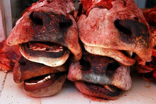
Before that though, we can’t resist a visit to the central market, watching the locals going about their daily lives. Today, however, the local sdon’t seem pleased to us or our cameras. One stall holder becomes especially animated and I think the gist of his argument is that we should leave – immediately. Before beating a hasty retreat I take a few snaps of some partly butchered animal carcasses that seem destined to be someone’s dinner tonight.

The post Sucre to Potosi, Day 61 appeared first on Roderick Phillips.


