Rob Sargeant's Blog, page 2
May 13, 2019
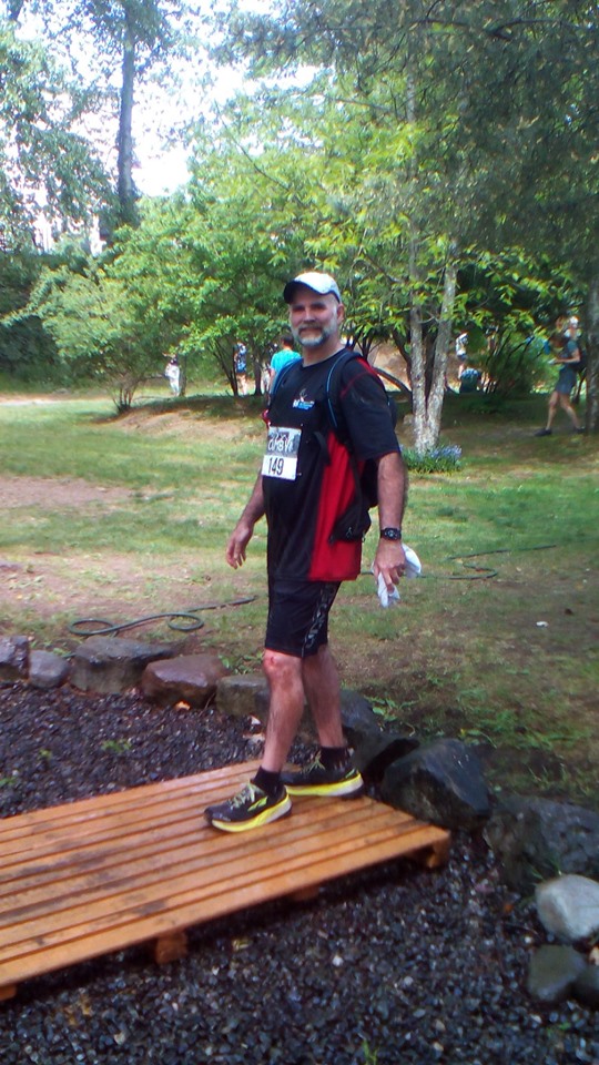
My First Cumby 25 Run
 I continued on alone, it seemed, enjoying the descent running over the roots and rocks along the trail, through the shadows of a fir tree forest, shafts of morning light would fall upon me, here, and there, until I reached aid station one, situated on a logging road, beside a wide open section of descending trail with switchbacks that led down a steep incline. I felt the heat of the day for the first time there while exposed to the sun and was glad to be back under the shade of the trees again after reaching Even Lower Vanilla. There, I met up with some other runners as we slowed, coming to a narrow wooden bridge over a swamp, and a steep embankment. We climbed this, and after scrambling across a section of rocky, gently, rolling hills, we came to a straight logging road. I checked my Garmin watch and saw that I was moving at a pace about six-to-eight minutes ahead of what I had anticipated. This cheered me up as I was about to head into a section of trail I had never run before, Swamp Monster, and Rug Burn.
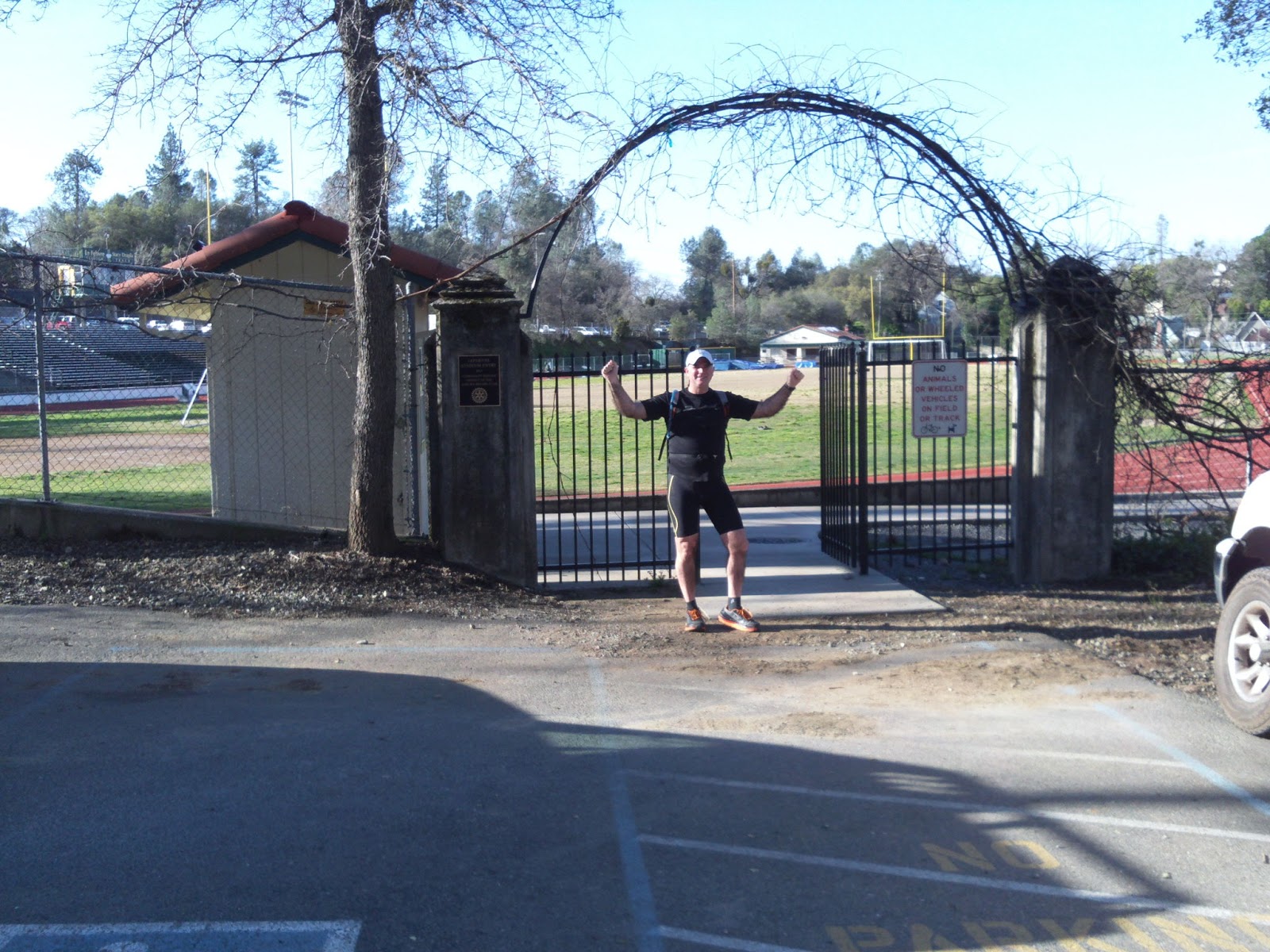
 It was near the end of Swamp Monster that I had my first fall. I tripped on a rock and went flipping head over heels onto the edge of the trail. When I attempted to stand, a shooting pain pulsed through my right calf muscle. It felt like a micro tear. A fellow racer stopped to help me up. He offered me some pickle juice he had in small plastic bottle, but I declined, telling him that I had an electrolyte mixture of my own. It was hot out on the exposed rocks of Swamp Monster, and approaching an hour-and-a-half into the race, I limped along, slowly, hoping that the calf cramp would go away as I drank mouthfuls of fluid from my hydration pack. The runner who helped me up ran with me for the next kilometer, making sure that I would be okay. With aid station two in sight my helper left, running ahead at the end of Lower Crafty Butcher. The aid station had a good selection of drinks ready to go. I took two, and dumped one cup of cold water over my head, leaving with a chocolate GU Gel in hand to sip on as I made my way up a steep incline near the start of the Two Flats trail. I encouraged myself that this was near the halfway mark, according to my Garmin watch. My right calf was still bothering me though, and every now and then I could feel a shooting pain as I descended the first part of the Rapture trail. Would I be able to carry on this way? I wondered. I stopped to walk and re-hydrate when I got to Ark trail, where it turned onto a straight section of logging road. A passing runner saw I was struggling and offered me an electrolyte jelly cube. I gladly took it, and jogged on toward Rapture cliff. It loomed ahead of me in the distance - majestic in the midday sun. I enjoyed the climb, taking in the views, slowly making my way to the top.  A refreshing breeze hit me there as I crossed the summit heading to the Kamikaze Downhill that would take me back to Rapture. I felt somewhat revived. A volunteer at the trail junction there said we had about ten more kilometers to go. I shuffled down Kamikaze taking a quick left onto Rapture and hustled along the rolling trail. I was able to keep a steady pace and was making up time, until I had my second fall. Heels over head is how I would describe it. This time when I landed I skinned my left knee and my left calf muscle cramped up. I was alone, so I had to struggle to get to my feet on my own. The cramp was bad. I could only manage to limp on to aid station three, which was fortunately close by, within 120 meters. When I arrived there, I felt like giving up. I spent about six minutes re-hydrating, pouring water over my head, refilling my hydration pouch with water. I also took two Eload Zone caps and Advils. Several runners arrived at the aid station while I was there, looking just as disheveled as I was. I figured I would continue on with six kilometers to go and see if I could work out my cramped calf muscles. If I could get back on to pace I was still within range of reaching my goal time of three-and-a-half hours. The day before I had told my wife, Olivia, to expect me at the finish line around that time. She said she would be there to cheer for me as I arrived. I continued on. I caught up with another couple of runners and was able to keep pace with them for the next four kilometers. With around two kilometers to go we came to a long downhill leading to the last section of trail. I had fifteen minutes left to get to the finish. Thankfully, I made it one minute before my three-and-a-half hour goal time. My wife was there. I gave her a high-five as I ran past her into the roped off finish area. Time sure does fly when you're having fun.


April 19, 2019
Training For The Cumby 25km
 The "Cumby 25" gets steep just after the "Teapot" trail enters the "Truffle Shuffle". I could only manage a power hike in these sections as there was a lot of loose stones, and slick rock with the rain coming down the one day. The rest of the trail system is runnable, with plenty of vertical to work the quads. Most of this is technical descent with some low lying roots and rocks.
 If it's been raining heavily the days leading up to the race, May 11th, expect to get wet while running through "The Crafty Butcher" trail segment. The day I ran in the rain I couldn't keep my feet dry there. The puddles are on top of solid rock and many of them are deeply grooved.
 The last 1/2 - 1/3 of the race is spent on "The Rapture Trail". If it's a clear day you'll be able to take in some great views as you slowly climb the "Rapture Cliff" trail. After making the rounds of the summit watch for the "Kamikazi Downhill" veering off the edge, the entrance back onto the Rapture Trail comes up quickly on the left.
The remainder of the "Rapture Trail" before you get to "Crazy Ivan" and "Tunnel Canary" crosses over three old logging access roads. A few minutes after crossing the last road you should pop out in sight of the start of "Crazy Ivan". There are two straight-aways after this where you can make up for some of the time you lost on the more technical sections of Rapture. "Two Shoes" trail is a short leg in the race. You'll see "Rapture" on your right fairly soon after getting onto it. "Rapture" will lead you back to the logging road at the top of "Sapsucker". You'll pass "Cottonwood", "Iron Curtain" and "50:1" on the way there. From there it's just a hop-skip-and-a-jump to the Access trail, heading North to "Josh's Trail", which goes back towards the start/finish.
The last 1/2 - 1/3 of the race is spent on "The Rapture Trail". If it's a clear day you'll be able to take in some great views as you slowly climb the "Rapture Cliff" trail. After making the rounds of the summit watch for the "Kamikazi Downhill" veering off the edge, the entrance back onto the Rapture Trail comes up quickly on the left.
The remainder of the "Rapture Trail" before you get to "Crazy Ivan" and "Tunnel Canary" crosses over three old logging access roads. A few minutes after crossing the last road you should pop out in sight of the start of "Crazy Ivan". There are two straight-aways after this where you can make up for some of the time you lost on the more technical sections of Rapture. "Two Shoes" trail is a short leg in the race. You'll see "Rapture" on your right fairly soon after getting onto it. "Rapture" will lead you back to the logging road at the top of "Sapsucker". You'll pass "Cottonwood", "Iron Curtain" and "50:1" on the way there. From there it's just a hop-skip-and-a-jump to the Access trail, heading North to "Josh's Trail", which goes back towards the start/finish.Race organizers may change the course slightly due to active logging in the area so the directions that I've given here are just a general guide. I ran this, wearing a triathlete pack, carrying 1.5 litres of Nuun drink, cell phone, and snacks. I'd recommend bringing this if you're running solo. Race day there'll be 3 aid stations so I'll be able to travel lighter.
October 28, 2018
Indivisible opened in 830 theaters across the USA this weekend
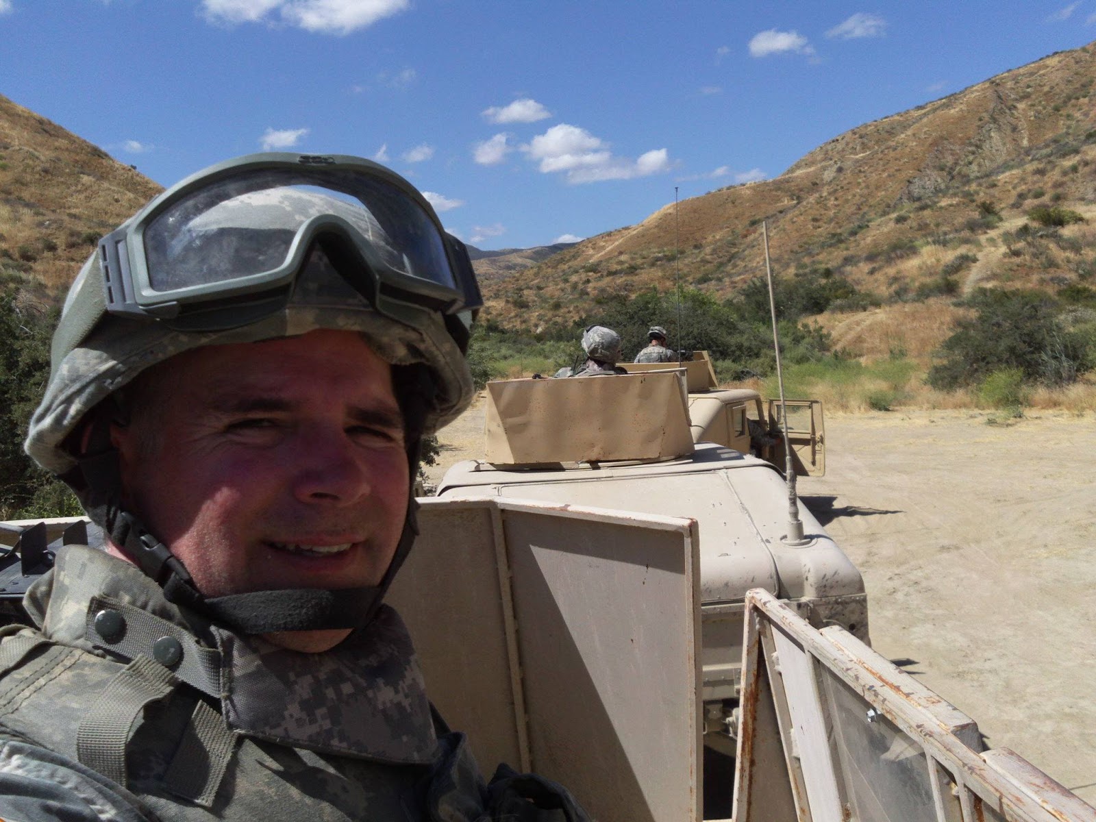
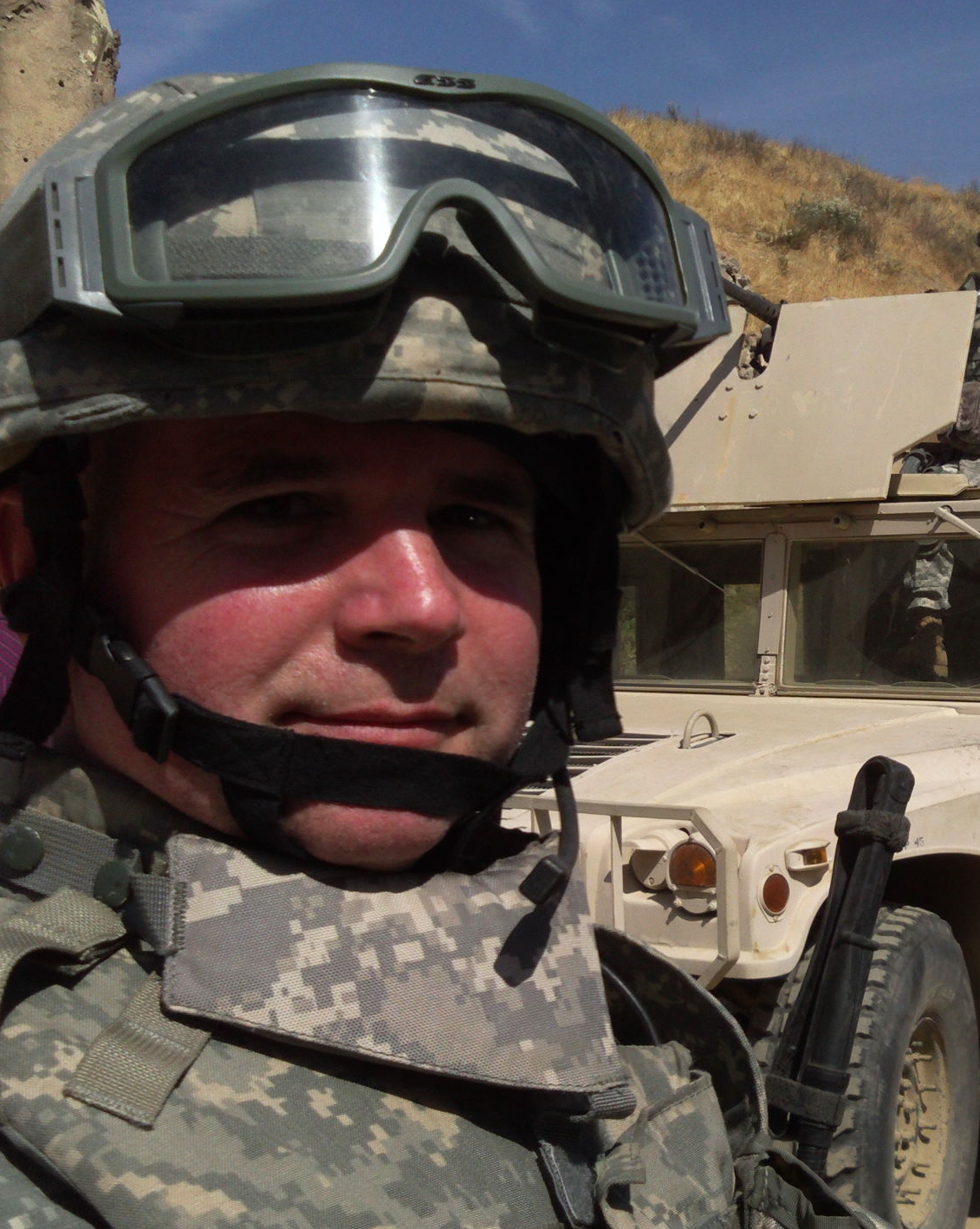
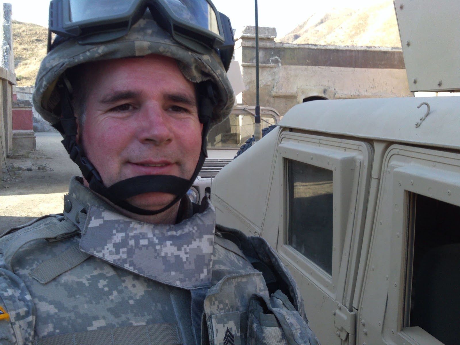 Last year in June I was in California at a studio ranch outside Hollywood for two weeks acting the part of a US Army soldier in the movie INDIVISIBLE. A lot of energy and sweat went into those days on set running around in full US Army body armor climbing in and out of Humvees. Sometimes explosions went off around us as we did this. You can read more detail about my experience including the miraculous way I was able to be involved in this in a blog I wrote back in July of 2017 HERE. Now that it's in release at 830 theaters this weekend across the USA and it's getting good reviews it feels like that work was well worth it. I was able to see an early preview in an online screening and was amazed at how the production turned out. Even though I was on set for many of the scenes that take place in Iraq, and could remember what was going on behind the scenes, I found myself emotionally caught up and moved by the film. Sarah Drew and Justin Bruening do a powerful job portraying the main characters Darren and Heather Turner. The director David Evans doesn't shy away from showing the raw realities of a war zone. He takes you into this Army chaplain's emotional ride as he deals with the suffering and loss of his brother's in arms - how it changes him while he's there and when he returns home.
I felt passionate about being involved with this production because I've had friends who have struggled with post traumatic stress (PTSD) due to what they've experienced on deployments with the military. INDIVISIBLE offers hope to those who are struggling in this way showing that healing and reconciliation is possible.

(Above, next to Humvees, My 2002 Pontiac Montana van with Syrian license plates - insurgent vehicle)
 I had such a great working experience on INDIVISIBLE I'd do another film like it again in a heartbeat.
Find out more about the movie here:INDIVISIBLE
August 12, 2018
Photo opportunity saves trail runner from bear encounter
 When I turned around to take another photo of the trail ahead, I spotted a black bear, not too far off. It was eating ripe black berries from the bushes at the side of the logging road. I took a shot of it too, and then, quietly, I backed away, moving down the steep hill I had just run up, thinking, "If I hadn't stopped to take that photo I would've had a close encounter with a black bear."
Since I was up at the summit so early, there weren't other bikers or trail runners around. I descended the mountain the same way I had come, quickly, hoping that the bear was not alerted to my presence. I checked over my shoulder a couple of times to make sure that I wasn't being followed. I was relieved when I got back to the lower trails where there were plenty of bikers and dog walkers.
Since 2015 I have been running the Cumberland Mountain trail system. I had seen posters with cougar and bear warnings, but had never had an encounter or even spotted one. I had seen evidence of them like tracks and dung. My only other encounters with bears while on trail runs were on the Pipe Line Trail north of the Stotan Falls bridge, and the Cape Scott Park trail on northern Vancouver Island. In those incidences I was making enough noise that they knew I was there, and they took off. 
January 3, 2018
Celebrated 50th birthday with a 50 mile run
 Near 5 a.m. I set off running alone from my self-serve aid station at Point Holmes, heading west along a coastal trail that wound along beside the beach. Snow fell, flashing in front of me in the brightness of the head-lamp. Heading up the edge of Lazo Road, I could see ahead about 4-5 metres, and dropped back the pace when I encountered black ice. Once onto the sidewalks on Guthrie Road I was out of the woods and had much better visibility. There were some good climbs coming up Guthrie and Pritchard Roads that took some work. At the top I was encouraged by the thought that when I switched directions for my next loop after my aid station I would be coming down the same hills. I had to take things cautiously in the dark on Knight Road as there were long sections of black ice and uneven patches of snow on its shoulders.
The sun came up on my third loop so I could take in the ocean and mountain views the route had to offer. Upon completion of this I was met at my aid station by my wife, Olivia, with a bacon and egg sandwich and veteran marathoner Ken Richardson who would pace me around to the halfway point. It was good to have someone to talk to, as this helped the miles to fly by. He gave me some advice on how to mentally move through the final 40kms. When we reached my aid station at the completion of this stage we were greeted with cheers by a group of members from the Comox Valley Road Runners. One of them asked me how long I had been training for the run and Ken Richardson answered them, "He's been training 50 years for this one." Before I left on the fifth loop though they sang "Happy Birthday" to me. They had a delicious spread of desserts and drinks laid out. I would've liked to stay longer with them to enjoy the tailgate party but I had to keep moving so my legs wouldn't cramp up.
To get through the second half of the 50 miles I mentally divided the remaining distance into aid station stops. With only two remaining, I felt a burst of energy and optimism. "I can do this," I thought. While running loop six I passed a tow truck pulling a 4x4 truck out of a ditch. It had spun off of Knight Road by Siefferts Farm Market. Black ice was still a problem in the shade. I had to be careful. Ken Richardson found me at my aid station as I was preparing to start the final 10km loop. Because he had an appointment at 4 p.m. he could only run with me for the first kilometer or so. Before turning around he encouraged me that I was in good shape to reach my goal.
 With a great sense of joy and accomplishment, as the sun set over Mount Washington, I arrived at Point Holmes. I didn't realize how cold I had become until I got home and was helped into a warm bath by my wife. I went directly from there to a bed under three blankets. I turned on the room's electric heater (unusual for me). It took me a couple of hours to calm the chills.
September 9, 2017
Cruise ship saves vacationers from Hurricane Irma's wrath.
Angelic Army Conquests: Full Trilogy
August 25, 2017
The best trail runs in the Comox Valley
The Comox Valley hosts several amazing running trails. In this blog I've attempted to rank six of my favourite ones using the following as determining factors:
1) ease of access to the trail-head;
2) difficulty of the terrain;
3) the beauty, and,
4) length of run.
TOP RANKED TRAILS
#1, Cumberland Mountain:
For the past two years I've been running The Cumberland Mountain trail on a weekly basis and I just don't get tired of it. It's always a challenge, an adventure, and leaves me whacked after running its hills for hours. I guess that's why it's number one on my list. Numerous entrances to the trail system are found at the edge of the Village of Cumberland. I prefer to park my car in the recreation centre parking lot off Dunsmuir Avenue, its main thoroughfare. From there I run down Sutton Road to the Cumberland Community Forest. Hours of challenging fun can be had running the hilly logging roads and mountain bike trails.It takes about an hour to reach the summit after ascending 1200-1400 feet. The views on a clear day are inspiring. You can run 2-5 hours through the vast Cumberland Mountain trail system. Make sure you bring extra fluids in the summer as the streams dry up and it can get hot in the back hills. Watch out for roots and rocks on the secondary trails, and make noise as bears and cougars have been spotted on some of these (I've never met any).
 #2, Riverside/Nymph Falls:
The Riverside/Nymph Falls trail system covers close to 20kms if you follow it full circle. Running along beside the edge of the Upper Puntledge River through mostly evergreen forested areas it offers many beautiful views where you will be tempted to stop and rest to enjoy the scenery. West of the Inland Island Highway the trails can be a challenge on the north side of the river especially in the rainy season. A 2-3 kilometer stretch back up toward Nymph Falls follows a narrow mountain biking trail with many wooden bridges that get frosty in the winter months. But with rolling hills, several outhouses, and well groomed pathways throughout most of it, the circuit is a pleasure to explore. Access the trail head by vehicle either through Forbidden Plateau Road, Nymph Falls Nature Park or park at the end of Powerhouse Road in Courtenay and run west beside the cement hydro tubes to the Duncan Bay Main Line Road.


 #3, Forbidden Plateau to Mount Washington:
Running this challenging trail is best done in the dryer months. During the rainy season sections of the trail are submerged by swamp and may be impassable. If you're running with a friend you can both meet up in separate vehicles either at the parking lot at the top of Forbidden Plateau or by Raven Lodge on Mount Washington. Leave one car behind and travel together in the other vehicle to the opposite end of the trail. To run this it will take 5-7 hours. There are some sections that are steep and technical with roots and rocks where your pace will be reduced to power-hiking. I usually wear a pair of gloves to protect my hands, and a camel pack with 2 litres of fluid, energy gels, and snacks.

 #4, Lazo Marsh Northeast Nature Trails:To access this trail system there's plenty of parking to be found behind Highland High School off of Guthrie Road. I like running here when I want to get in an hour or so of trail training on varied terrain. There are close to 10kms of paths winding around the Lazo Marsh Northeast Nature Trail. It's a mix of rocky, root filled, and well groomed trails. There are some good short hills to test your stamina. The surroundings are beautiful with several old growth trees in the lower sections. Watch out for dog walkers. Give them plenty of warning so their pets aren't startled.
#5, One Spot:One Spot trail is an easy, well groomed, trail that for the most part follows an old lumber railway that once bore the same name. It passes by farmland where cows and horses can be spotted. Hedge groves along the way provide shade. Running out to the end and back from the Condensory Road Bridge in Courtenay can take around 2 hours. The trail head is located near River Meadow Farms on Condensory Road. I've had to share the trail with horses on several occassions. It's best to step aside and let them pass. #6, Seal Bay Nature Park:The Seal Bay Nature Park trail is divided by Bates Road, where you will find the best place to park. Most of the trails are well groomed, and there are outhouses and directional maps stationed throughout. The circular Horse Bike Trail offers the longest run at around 7kms. But don't stop there, cross over to the east side of the trail system and take in the awesome ocean views from the trails that snake along the cliff side there. There are stairs that lead down to the beach, if you would like a challenging stair workout. The Seal Bay Nature Park trail is a great beginner trail for a road runner interested in making the transition.
CAUTION: For the Cumberland Mountain Trail and Riverside Trail systems I recommend that ear bud type music listening not be used as this may interfere with hearing oncoming mountain bikers and avoidance of wild animal encounters.
July 23, 2017
A taste of Hollywood acting as a U.S. Army soldier in the war drama INDIVISIBLE
 When I think back to last month when I had the privilege to act as a U.S. Army soldier in the film INDIVISIBLE, I am amazed at how the whole opportunity came about, and how well the shoot was completed. It began with an e-mail I received from the film's casting department on May 26th. They were looking for healthy background actors to play U.S. Army soldiers in California. The plot summary intrigued me. It was a war drama about an Army chaplain who suffers with PTSD (post traumatic stress disorder) after a long deployment to Iraq. This neurosis almost ends his marriage. Throughout my 15 year career in the Royal Canadian Air Force I have had friends with similar stories. I knew of the Director, David Evans, from the first film he made, GRACE CARD (I had watched it several times, and had been moved by its intensity and emotion). Also, Sarah Drew, the Executive Producer, was familiar to me from the movie, MOM'S NIGHT OUT. Bob Scott, known for his work on WAR ROOM, FIREPROOF, and the NASHVILLE TV Series (as camera operator) was working as the Director of Photography on the INDIVISIBLE shoot.
 The following Sunday I prayed about the casting e-mail with a friend at church and had confirmation through a vision that we shared that I should pursue this further. There were three problems though: the movie ranch where they were shooting this for ten days in June was over two-thousand kilometers away; I didn't have enough money saved up to afford the trip down south, and our unit at work was having a formal mess dinner which no one could take leave from without the submission, and approval, of a memo. I wrote up the first draft of my memo and leave pass, and submitted to my chain of command the next Tuesday. In order to make it to the first day of filming in California the latest I could leave Vancouver Island was by early Saturday morning, June 3rd. Thursday, June 1st, I got some encouraging news; I was getting a 6% pay raise, with three years back pay. I would now be able to afford the trip down to California. At work my memo went up the chain of command all the way to the Major. Friday, June 2nd, around noon, I received the signed memo and leave pass. With the encouragement of my superiors and co-workers I left for home at the end of the day, making a mental list of the items I would need for the long drive and stay in California.
The next morning, around 9:30 am, I crossed the border into the U.S.. My van was searched, and I was interviewed by a Customs and Immigration Officer who seemed to think my reason for traveling was a little odd. I showed them my approved leave pass, the e-mail inviting me to participate in the film, and the memo. These documents all backed up my story. I was approved by U.S. Cutoms to gain entry. I was happy to find out that whoever searched my van ended up fixing the automatic passenger's side window that was stuck.
Over the next twenty four hours, along with a couple of short naps, I made it all the way to a rest stop just south of San Francisco. I phoned my wife, Olivia, from there to let her know that I had made it safely that far. Seven hours later I was at a campsite near Castaic Lake, just off the I-5. It was the perfect spot; quiet, yet a short drive away from a busy truck stop with restaurants, and a 7-11 store. From there, it was a thirty-to-forty minute drive to the Blue Cloud Movie Ranch where I'd be volunteering.
I arrived to the set early on the first day of shooting. The Hollywood Catering van was setting up for breakfast outside the building that would serve as our cafeteria and holding area for actors, crew, and extras. A row of tables set up just inside the door was spread with craft foods. The smell of French toast and fresh brewed coffee wafted into the air. Four rows of Make-Up, Wardrobe, and Cast Trailers were parked in the next parking lot where I was told to leave my van. The lot filled up quickly. I was surprised to see so many crew. The 2nd Assistant Director found me and directed me to wait in the cafeteria where other volunteer actors were seated. After signing release paperwork a group of us were taken to get costumes and make-up done. Being in the Canadian Air Force my hair was already at the right length for a war drama. One of the men in our group had to get clipped.
Because I don't want to give away any spoilers in this blog, I can't go into the details of the scenes we shot over the course of the ten day shoot. I can say it was a lot of physical work. I felt that the cast and crew I worked with over the twelve-hour long days became like a family. The Director, Executive Producer, Producers, Director of Photography, and starring cast, were patient and kind to us. Though many of the scenes I was involved with were intense and emotional they would inject enough humor from time to time to keep things fun. Throughout the shoot I was honored to work alongside some veteran Hollywood actors, many with the common trait that they had acted at some point in their career in the ABC TV Series GREY'S ANATOMY. 
As volunteers we were given privileges. A big bonus was being able to eat from the Hollywood catering food truck. Freshly prepared salads and hot meals twice a day helped to get us through the long days. I especially liked 'Taco Tuesdays' when beef burritos were served. During the final days of the shoot in Santa Clarita it became very hot. Thankfully someone arranged to have natural frozen fruit Popsicle, and a freshly cut fruit, vendors stop by. As talent we felt appreciated. Sunday we had the day off so I went to CBS Studios in Studio City to meet up with an old friend, Kevin Renel, who was the best man in my wedding in Pasadena in 1990. He was part of a Christian film artists' fellowship that met for prayer and worship in a small studio on the CBS lot. Before the service started I stopped at a cafe on Ventura Blvd for a dark roast coffee and sat on the outdoor patio taking in the view of the tall palm trees that lined the street. It was nice to relax after working so many 12 hour days in a row.
The most blessed part of being involved in the INDIVISIBLE movie shoot was meeting other Christian volunteers like myself, who were invited, and felt led to serve in this production. They saw it as ministry. I was able to pray with some of them as we waited for the camera and lighting crews to set up. At times we felt God's presence on set. Hopefully this will carry over to the audience after its theatrical release in the Fall of 2018. Watch it then, and you will find out.
To sign up for e-mail updates on this movie visit here:INDIVISIBLE MOVIE

April 2, 2017
Training run on the Western States 100 Endurance Trail
 After enjoying an evening visit to the Auburn Running Company store (featuring WS100 memorabilia in its front window) and the Pub across the street on Lincoln Way, we spent the night in Motel 6 off Auburn Ravine Road.

 While there was still coolness in the morning air I set off from the stadium gate at Stadium Way and headed up Finley Street. Following Marvin Way and Robie Drive I descended to the Robie Point trail-head. With clear skies, and the early morning sun rising over the hilltops to the east I continued on running the wide Western States Terrace trails that switched back and forth into the canyon. The trail narrowed, and became much steeper after leaving the terrace. A rainy winter had the creeks and rivers filled. I ran on tree shrouded, muddy trails, pock marked with horse hooves, for the next 1/2 mile, descending into the canyon. Before long, I was back into the sun. I could see the North Fork American River below. I knew that No Hands bridge crossed this somewhere ahead, so I ran along with confidence, passing a waterfall on narrow wooden bridge. It was so beautiful, I had to stop and take a photo.
 After crossing No Hands Bridge I took a sharp right turn onto a trail that ascended up into the forest. I was starting to feel the heat so the shade was welcomed relief. Switchbacks led up the hillside until I came into a clearing that gave me a great view of the Highway 49 bridge over the North Fork American River.
On the far side of the clearing I met up with some runners headed in the opposite direction. We exchanged greetings. I noticed one of them had a two way radio strapped onto their camel pack. I had to be careful on the switchbacks beyond this as I crossed over several creeks balancing on rocks so I wouldn't get a my shoes soaked.
 Before I knew it, it was time to turn around. I was one hour and forty five minutes into the run when I arrived at an open plateau where the trail branched off in two different directions. That's where I decided to turn back. The descent back toward No Hands Bridge was fast. I felt the the midday heat near eighty degrees. I tried to imagine what the WS100 racers would feel like when they reached this point in the endurance run with one more ascent to endure, up out of the canyon, to Robie Drive. It must be a great sense of relief. I felt a taste of it as I came down Finley Street after following the small spray painted WS100 foot steps that marked the trail as it wound through the city streets to the finish. I was fifteen minutes later than I had planned getting back to the Stadium Gate. My 12 mile/three hour taste of the Western States Endurance Trail had left my legs burning. My wife treated me to a bacon cheese burger at Local Heroes in Auburn so I could get a good boost of carbs. I had booked another night at our motel knowing that I would need it to rest and recover. My foresight was true.
February 17, 2017
Authors can save time and money with Google Maps Street View
 While I wrote the trilogy, Angelic Army Conquests, I found Google Maps Street View to be a great tool for research. Using this, I was able to travel to Israel, and walk the narrow streets of Jerusalem where the climax of this post-apocalyptic adventure played out. It allowed me to accurately describe the architecture, directions, and street names, that my fictional characters encountered. While editing my first book, Lost Ark Found, I sought out the advice of experienced writers, and one of the common things I heard them say was, "Write what you know," so that's what I did. My third and fourth fictional books, Dance With Me, and, In Heaven, were set, for the most part, all on, or around, Vancouver Island. My wife, and I, would sometimes take day trips to do research at the locations on the island where my stories were set. We talked with the locals, hiked the trails, and stopped for a snack at the small town general stores. Being physically on location to do research helped to add to the authenticity of my writing. Seeing a sunset, or meeting a quirky person, can spark a bunch of creative writing ideas. But when I couldn't afford to travel to Washington D.C., the Middle East, or Koro Island in Fiji, to do research for the Angelic Army Conquests trilogy, Google Maps Street View helped me to get there.