Tim Notier's Blog, page 11
January 3, 2019
Jan 3, 2019 - Our Advice / With a Grain of Salt
By Marisa  Yes, it looks awesome: the mirror effect of the largest salt flats in the world during the wet season. But don't let the surreal image of us riding through the Salar de Uyuni in Bolivia fool you, because it has rendered our motorcycle immobile.
The amazing photographers who took this shot are our friends Kira and Brendon Hak, the fellow KTM-riding duo called the Adventure Haks. We met up with them for Christmas in Sucre, Bolivia, and then headed south together a few days before this epic failure-of-a-ride. From left to right: me, Tim, Kira, and Brendon jumping for joy. Salar de Uyuni, Bolivia. Before we got to the salt flats, we made a brief stop in Potosí, a high-altitude historic city with a very rich silver mine next to it. In fact, the mine was so lucrative in the time of the Spanish (and still produces plenty of ore), that mining towns in Mexico, Wisconsin, Missouri, and Nevada have been named after Potosí in the hopes of producing similar wealth.
Though most tourists who visit Potosí take a tour of the mine, I had a stomach bug and chose not to go. But I'm not sure how much I would've liked seeing the conditions of the workers there, since I've heard it's somewhat horrific. Luckily, the colonial center of Potosí itself turned out to be very quaint, and it was nice to walk around the pedestrian-only streets at night lit by old lamps. It almost reminded me of Paris. Ok, maybe that's a stretch, but it was nice. The historic streets of Potosí, Bolivia. After Potosí, we headed straight to Uyuni, the town that is the jumping-off point for the salt flats. We camped the night at an old train yard full of rusting engines and train cars half-buried in the sand. At first I thought this place would be boring, but it turned into a unique and fascinating experience as we cooked our dinner atop one of the cars, watched the sun set over the vast desert, and then slept beside the silence of the long-retired trains. It was like we were in the Bolivian version of the Wild West.
 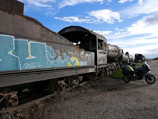 The train graveyard near Uyuni, Bolivia. Finally, it was New Year's Eve, and the day we'd been waiting for: our venture into the salt flats. We had heard that just the week prior, the Salar (salt flats) was as dry as a bone, but that recent rains had turned some areas into the mirror-like effect we had been hoping for. So we washed our bikes with diesel grease for a protectant (because we knew that salt was bad for our bikes, we just didn't realize how bad), and then headed out.
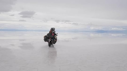
After a brief stop at the Dakar Rally sign, we were soon in the vast nothingness of the salt. It's almost dizzying to see just white and sky around you, and it was hard to follow the GPS that wanted to take us down certain “roads". So we finally decided to just pick a point on the horizon, and head that way.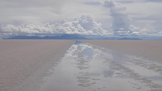 One of the “roads" of the Salar, visible by recent rains. Things started out hard and dry, but as we headed deeper into the flats, we noticed a layer of slush forming on the surface. Even though some parts looked mushy, we were pleased to find that salt is sharp, and our tires could easily grip onto it. And then all of a sudden we were in the mirror, and it surrounded us like infinity. It was like we were transported into the clouds and even beyond, into a glassy version of outer space.
 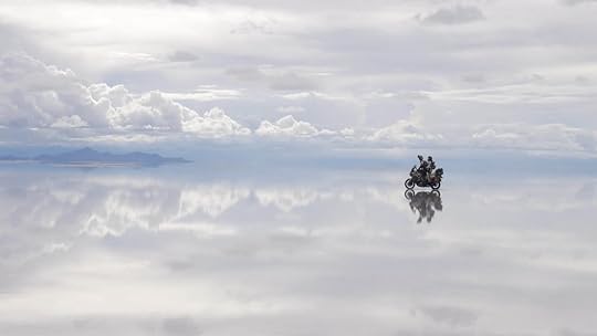 It was hard to tell where the land began and the sky ended, and it felt like we were floating in oblivion, skating through a dream of ice and clouds, or simply soaring through endlessness. It was a truly magical experience that I wish I could recommend to all. Unfortunately, we are currently not sure if this all turned out to be worth it.
 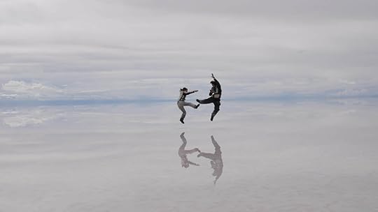 We spent a long time out there in the mirrored abyss, jumping, skipping, doing cartwheels, driving in circles, and all the while snapping pictures like we never wanted the dream to end.
If I had ever stepped into the looking glass and ended up in Wonderland, then this was it.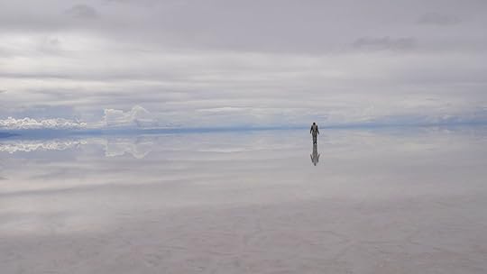
 But, as with all dreams, this too had to come to an end. We knew the salt water could not be good for our bikes, and we could see it already crystalizing over the engine. In fact, as we rode further through the mirror, Brendon pulled us over to tell us that our exhaust pipe had completely crystalized over in salt. And sure enough, it had. We had to pick it apart with pliers, and then realized that the exhaust pipe was even coated with salt on the inside.
 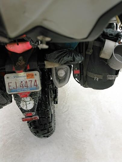 Our exhaust pipe was not exactly functioning at this moment. Though we had originally wanted to camp on one of the “islands" in the Salar, we realized that more importantly we needed to get our bikes out of the salt and washed. And it needed to be done soon.
So we headed to the closest dry land, first having to ride our bikes through deep puddles of salt water where buses and Land Rovers had dug trenches with their tires. It almost makes me cringe to write this, but I was knee-deep in the saltiest water imaginable pushing Tim out of the salt slush. This is pure motorcycle death.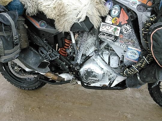 No, this is not snow. Much worse than snow. Thankfully, we did find a carwash next to a lovely salt hotel (yes, it's all made out of salt), and spent New Year's Eve lighting off fireworks over wine and a delicious dinner we cooked up. Everything seemed perfect.
  Some of the salt furniture at the salt hotel. Pretty cool, but I'm not sure I'd want to live there forever. The next day the bikes started up fine, and we were looking forward to heading farther south into Bolivia on a road called the Lagunas Route, passing colorful lakes of flamingoes and geological activity. But our dreams were dashed pretty quickly once our bike started stalling out while we were riding. We would start it again, go for a bit, and then stall out once more. At times it wouldn't start at all.
 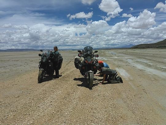 Once again, we got ourselves into the middle of nowhere. Tim and Brendon worked on it for hours, and all the while we kept getting text messages from friends on motorcycles who had also gone out on the Salar, and now their bikes were not starting either! This all began to seem like a terrible way to start off the New Year.
And then finally the bike was just dead. The Haks' bike was fine, thankfully, but we were on the side of the road, 90 miles (140 km) away from Uyuni, wondering what in the world we were going to do. So we camped there on the highest ground we could find, and tried to sleep through a night of windstorms, rain, and hail.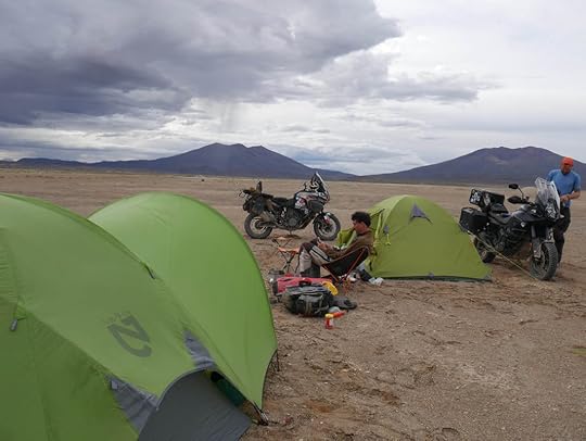 What do you do when you can't go any farther? Well, just set up camp right there. The Haks never once left our side, and we are incredibly thankful for their patience, help, motorcycle guidance, and just plain-old moral support. I guess that's what real friends are for, and I will forever be indebted to them. Plus, they always know how to bring out a smile from even the most desperate of situations.
In the morning the weather had cleared, and we stopped a motorcyclist on the road who said he had a friend with a flat-bed truck. Not excited to be towed for hours down a dirt road by a 4x4 with a rope, we figured the flat-bed would be best, no matter the price. It ended up being $145 to be driven all the way back to Uyuni where we knew there were amenities and fellow broken-down friends with their bikes.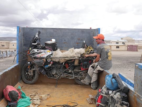 When worse comes to worse, a giant truck will usually do the trick. And so here we are, waiting for a homemade gasket to dry after Tim took the whole bike apart, cleaned every nook and cranny with dielectric grease, and cleaned the airbox, filters, and fuel pump. Now we just have to put it all back together again (we being Tim, and Tim being mostly Brendon Hak), and hope for the best when turning the key.
Even if it does work, will it work for long, or will there need to be more cleaning and modifications done down the road? It's all just speculation at this point, but as always, we'll keep you posted.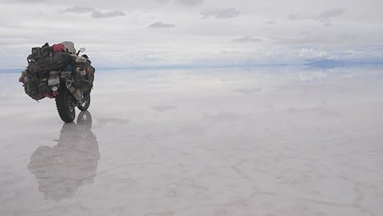 Was it worth it? It's hard to say. But it sure was pretty. So the moral of the story is not to go out on the Salar de Uyuni in the wet season with a motorcycle, or any rustable machine I suppose, unless you are truly aware of the risks involved. Out of all our friends here at the moment, three out of four bikes did not start after driving out there. One of them is functioning again, but the other two are still in the works. The pictures we took and the experience we had of riding through the void was breathless and enchanting, but the Salar can be just as ruthless as it is beautiful.
For our most up-to-minute posts and updates, follow us on Facebook and Instagram.
 Yes, it looks awesome: the mirror effect of the largest salt flats in the world during the wet season. But don't let the surreal image of us riding through the Salar de Uyuni in Bolivia fool you, because it has rendered our motorcycle immobile.
The amazing photographers who took this shot are our friends Kira and Brendon Hak, the fellow KTM-riding duo called the Adventure Haks. We met up with them for Christmas in Sucre, Bolivia, and then headed south together a few days before this epic failure-of-a-ride.
 From left to right: me, Tim, Kira, and Brendon jumping for joy. Salar de Uyuni, Bolivia. Before we got to the salt flats, we made a brief stop in Potosí, a high-altitude historic city with a very rich silver mine next to it. In fact, the mine was so lucrative in the time of the Spanish (and still produces plenty of ore), that mining towns in Mexico, Wisconsin, Missouri, and Nevada have been named after Potosí in the hopes of producing similar wealth.
Though most tourists who visit Potosí take a tour of the mine, I had a stomach bug and chose not to go. But I'm not sure how much I would've liked seeing the conditions of the workers there, since I've heard it's somewhat horrific. Luckily, the colonial center of Potosí itself turned out to be very quaint, and it was nice to walk around the pedestrian-only streets at night lit by old lamps. It almost reminded me of Paris. Ok, maybe that's a stretch, but it was nice.
 The historic streets of Potosí, Bolivia. After Potosí, we headed straight to Uyuni, the town that is the jumping-off point for the salt flats. We camped the night at an old train yard full of rusting engines and train cars half-buried in the sand. At first I thought this place would be boring, but it turned into a unique and fascinating experience as we cooked our dinner atop one of the cars, watched the sun set over the vast desert, and then slept beside the silence of the long-retired trains. It was like we were in the Bolivian version of the Wild West.
  The train graveyard near Uyuni, Bolivia. Finally, it was New Year's Eve, and the day we'd been waiting for: our venture into the salt flats. We had heard that just the week prior, the Salar (salt flats) was as dry as a bone, but that recent rains had turned some areas into the mirror-like effect we had been hoping for. So we washed our bikes with diesel grease for a protectant (because we knew that salt was bad for our bikes, we just didn't realize how bad), and then headed out.
After a brief stop at the Dakar Rally sign, we were soon in the vast nothingness of the salt. It's almost dizzying to see just white and sky around you, and it was hard to follow the GPS that wanted to take us down certain “roads". So we finally decided to just pick a point on the horizon, and head that way.
 One of the “roads" of the Salar, visible by recent rains. Things started out hard and dry, but as we headed deeper into the flats, we noticed a layer of slush forming on the surface. Even though some parts looked mushy, we were pleased to find that salt is sharp, and our tires could easily grip onto it. And then all of a sudden we were in the mirror, and it surrounded us like infinity. It was like we were transported into the clouds and even beyond, into a glassy version of outer space.
  It was hard to tell where the land began and the sky ended, and it felt like we were floating in oblivion, skating through a dream of ice and clouds, or simply soaring through endlessness. It was a truly magical experience that I wish I could recommend to all. Unfortunately, we are currently not sure if this all turned out to be worth it.
  We spent a long time out there in the mirrored abyss, jumping, skipping, doing cartwheels, driving in circles, and all the while snapping pictures like we never wanted the dream to end.
 If I had ever stepped into the looking glass and ended up in Wonderland, then this was it.

 But, as with all dreams, this too had to come to an end. We knew the salt water could not be good for our bikes, and we could see it already crystalizing over the engine. In fact, as we rode further through the mirror, Brendon pulled us over to tell us that our exhaust pipe had completely crystalized over in salt. And sure enough, it had. We had to pick it apart with pliers, and then realized that the exhaust pipe was even coated with salt on the inside.
  Our exhaust pipe was not exactly functioning at this moment. Though we had originally wanted to camp on one of the “islands" in the Salar, we realized that more importantly we needed to get our bikes out of the salt and washed. And it needed to be done soon.
So we headed to the closest dry land, first having to ride our bikes through deep puddles of salt water where buses and Land Rovers had dug trenches with their tires. It almost makes me cringe to write this, but I was knee-deep in the saltiest water imaginable pushing Tim out of the salt slush. This is pure motorcycle death.
 No, this is not snow. Much worse than snow. Thankfully, we did find a carwash next to a lovely salt hotel (yes, it's all made out of salt), and spent New Year's Eve lighting off fireworks over wine and a delicious dinner we cooked up. Everything seemed perfect.
  Some of the salt furniture at the salt hotel. Pretty cool, but I'm not sure I'd want to live there forever. The next day the bikes started up fine, and we were looking forward to heading farther south into Bolivia on a road called the Lagunas Route, passing colorful lakes of flamingoes and geological activity. But our dreams were dashed pretty quickly once our bike started stalling out while we were riding. We would start it again, go for a bit, and then stall out once more. At times it wouldn't start at all.
  Once again, we got ourselves into the middle of nowhere. Tim and Brendon worked on it for hours, and all the while we kept getting text messages from friends on motorcycles who had also gone out on the Salar, and now their bikes were not starting either! This all began to seem like a terrible way to start off the New Year.
And then finally the bike was just dead. The Haks' bike was fine, thankfully, but we were on the side of the road, 90 miles (140 km) away from Uyuni, wondering what in the world we were going to do. So we camped there on the highest ground we could find, and tried to sleep through a night of windstorms, rain, and hail.
 What do you do when you can't go any farther? Well, just set up camp right there. The Haks never once left our side, and we are incredibly thankful for their patience, help, motorcycle guidance, and just plain-old moral support. I guess that's what real friends are for, and I will forever be indebted to them. Plus, they always know how to bring out a smile from even the most desperate of situations.
In the morning the weather had cleared, and we stopped a motorcyclist on the road who said he had a friend with a flat-bed truck. Not excited to be towed for hours down a dirt road by a 4x4 with a rope, we figured the flat-bed would be best, no matter the price. It ended up being $145 to be driven all the way back to Uyuni where we knew there were amenities and fellow broken-down friends with their bikes.
 When worse comes to worse, a giant truck will usually do the trick. And so here we are, waiting for a homemade gasket to dry after Tim took the whole bike apart, cleaned every nook and cranny with dielectric grease, and cleaned the airbox, filters, and fuel pump. Now we just have to put it all back together again (we being Tim, and Tim being mostly Brendon Hak), and hope for the best when turning the key.
Even if it does work, will it work for long, or will there need to be more cleaning and modifications done down the road? It's all just speculation at this point, but as always, we'll keep you posted.
 Was it worth it? It's hard to say. But it sure was pretty. So the moral of the story is not to go out on the Salar de Uyuni in the wet season with a motorcycle, or any rustable machine I suppose, unless you are truly aware of the risks involved. Out of all our friends here at the moment, three out of four bikes did not start after driving out there. One of them is functioning again, but the other two are still in the works. The pictures we took and the experience we had of riding through the void was breathless and enchanting, but the Salar can be just as ruthless as it is beautiful.
For our most up-to-minute posts and updates, follow us on Facebook and Instagram.


December 25, 2018
Dec. 25, 2018 - I'll be in Sucre for Christmas, if only in my dreams...
By Marisa  We entered Bolivia a little more than a week ago, excited for this new country of dynamic culture, mountains, and jungle. And to celebrate the holidays, we wanted to be in the white-washed colonial city of Sucre to meet fellow motorcycle travelers and friends for Christmas. That gave us nine days to get there from the Peruvian border and see all the fantastic sites in between. So we were a little rushed, but it didn't seem to be an impossible task. At least in the beginning.
Our first night in Bolivia was spent at Copacabana, the border town with Peru on the shores of Lake Titicaca. It's a favorite spot for backpackers and is maybe one of the nicer border towns in the world. It had crisp views of the blue lake along with little vegetarian and tiki-type restaurants dotting its main strip, but Tim and I felt it to be overpriced for what we knew Bolivia to cost. So we stayed briefly, and then immediately headed inland.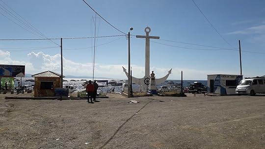 The wharf of Copacabana, Bolivia. To get anywhere inland from Copacabana, you have to first drive along a lovely paved road that hugs the inlets and curves of Lake Titicaca (I think the Bolivian side is the more picturesque side of the lake, sorry Peru). And then you are forced to put your vehicle on a rickety ferry that crosses Lake Titicaca's Tiquina Strait.
Made of warped wooden boards and not much else, this “ferry" took about a half hour and cost us only 5 Bolivianos a person ($0.72) but you get what you pay for. It's not a very far journey, and I think it'd just be easier to build a bridge, but it was a great introduction to the reckless and haphazard adventure that Bolivia was going to be. We even passed another ferry along the way with a guy in it who was literally bucketing out his flooded ferry one bucket-full at a time. I was thankful that we stayed afloat the whole ride. Me trying to keep the bike upright on the ferry across Tiquina Strait, Bolivia. Our first stop after Copacabana was La Paz, the Bolivian seat of government and the highest capital in the world (elevation is at 12,000 ft./3,650 meters). Though we didn't explore too much, we immediately felt that it was a fun city with lots of culture and views everywhere. And the best part was that because of the surrounding hills, there are cable cars running all over the city called teleféricos, allowing people to sour above the traffic below while taking in its cloud-touching vistas.
 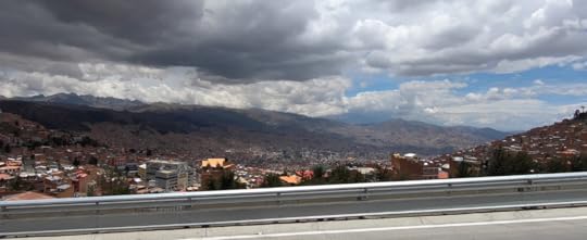 La Paz, Bolivia From La Paz we decided to ride along the infamous route northeast called Death Road, which my mother wasn't too happy about. Ruta de la Muerte, a.k.a. Yungas Road, used to have a horrific death rate due to its narrow cliffside two-way traffic, plus it was the only way for anyone to get to the town of Coroico. It was so bad, that by 2006 one estimate said 200-300 travelers were killed a year on it. But after putting in some improvements such as guard rails, and constructing a new, less-deadly road to Coroico, only one person or so dies every few years on it now.
So off we went to tackle the Death Road, but on the way, our horn went out (for the millionth time, it keeps doing that despite all of Tim's “fixes"). And as a semi-truck came barreling around the turn toward us, missing us by just a foot, Tim said to me, “Wouldn't it be horrible if we died on the road right before Death Road?"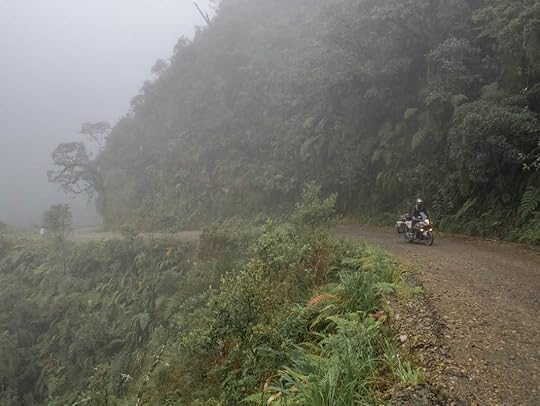 The misty cliffside beauty of Death Road (Yungas Road), Bolivia. Thankfully we didn't die on either road, and to be honest, I think calling it Death Road is a misnomer these days. It's actually a very well-maintained gravel road with a gradual descent (you have to pay to go on it, 25Bobs a person, so I'm glad to see the money goes to something). And considering the only real traffic are downhill cyclists, it's not that dangerous anymore. It descends from La Paz's high altiplano elevation down into the tropical jungles of mist and waterfalls, which makes it a gorgeous ride. In fact, I think the road should be called Scenic Jungle Road, and then nobody would get the wrong impression of what it's like.
  The near-death road after Death Road. Ironically, the real adventure did not begin for us until after Death Road. From Coroico we thought we'd head southeast to Cochabamba and finally to Sucre from the most direct way possible. Even though Google had us going back to La Paz and then taking the main highway, we thought, “Hey, there's this other road that goes straight there. Why not take that?"
Well, I now know the answer to that. This little squiggly dirt road that goes along Bolivia's northern foothills near the Amazon might be a great ride during the dry season, but in December during the rainy season, it becomes a muddy slosh pit. Talk about Death Roads, this Route 25 was one of the worst we've been on. This road was just sludge and soup. Amidst all the puddles and soggy streets, camping was not going to be a fun option. So we tried to stay the nights in any cheap hotel we could find, and ended up laying in moldy beds and listening to the thunder and downpour, all the while worrying about how we were ever going to make it through the mud the next day. I began to doubt we would ever get to Sucre for Christmas.
And then on our way to the village of Licoma, Tim suddenly pulled over and yelled, “The front tire's flat!" Sure enough, it was completely flat and we were riding on the rim. But what's strange was that after much inspection, we could not find the puncture wound. And what's worse, we definitely could not pump it up again with our little travel pump.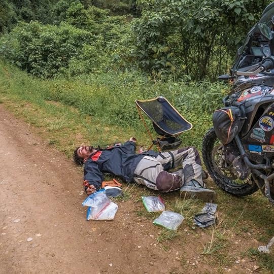 Tim on the side of the road almost giving up on life. We knew this moment would come eventually: a time when the bike would become so immobile, we'd have to either separate, or abandon the bike. Luckily, Licoma was just 20 minutes away, so I decided to hitch a ride with some friendly passerbys, and take the tire to a gomería in Licoma.
For once, things worked out better than I had expected, and everything went to plan. I got dropped off at a tire shop, the guys there pumped it back up and came to the conclusion that nothing was wrong with it. Maybe it went flat because a small rock had gotten between the rim and tire, maybe the pressure was too low, who knows.
I was able to pay the tire man's neighbor for a ride back up into the mountains where Tim was waiting with the immobile bike. We got the tire back on, said farewell to our new friends, and made our way to Licoma relieved and ready for a good night's rest.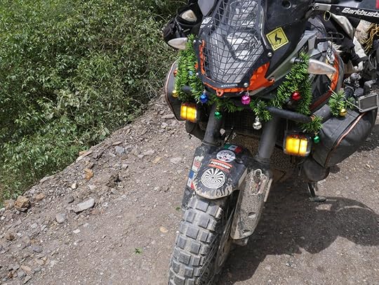 We finally got our Christmas decor up on our home / bike. Of course it stormed worse than ever that night, and all I could think about laying in that moldy bed of the hotel (it was really just someone's house with an unused room of mildew) was how I wanted pavement. Glorious, wonderful pavement. And Christmas in Sucre with friends and non-moldy beds.
As predicted, the morning after was muddy mayhem, and it became a slip-n-slide down the mountain. I have to say that Tim did such a great job keeping us upright, he shall forever be known in my book as the Mud Master.
And there was hope on the horizon. We decided to turn off of Route 25 as quickly as we could, and went through a stunning valley around the town of Quime before coming to pavement. And from there on out it was smooth sailing until the city of Cochabamba, where we met with our Bolivian friend, German.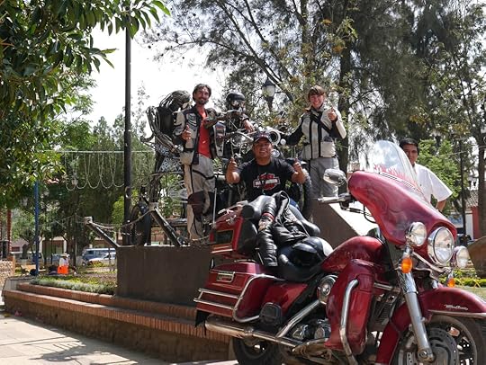 Tim, German, and me on a statue that German actually built out of motorcycle parts with his friends. German gave us a warm welcome to Cochabamba, a delightful city with the tallest Christ statue in the world (yup, it's taller than the one in Rio). And we enjoyed seeing the oldest church of Bolivia, built in 1521.
From Cochabamba we spent two days riding lovely roads to the city of Sucre: they were paved and wound through the rocky countryside of spring green scrubland. There were two problems with this road: the trash, and the amount of women and children begging along the sides. It broke my heart to see them waving and shaking their hands and hats at every car that passed, and I was shocked to see so much destitute poverty around every turn. There were hundreds of them in the cold, in the rain, and in tattered clothes. I know that Bolivia is making advancements, but for many people, it has leaps and bounds to go. Some of the many children begging at the side of the highway. At last we arrived in Sucre, and just like my dreams, we had a glorious Christmas spent with the Haks, Twoifbyland (another motorcycle couple), our Norwegian friend Single Piston Vikings, and Rick, a motorcycle adventurer from California. For a couple of travelers far from home and with no family around, we're feeling pretty fortunate this year to be surrounded by such great people, scenery, and food.
We wish you all a happy holidays and a Happy New Year, and I hope it will be just like in your dreams.
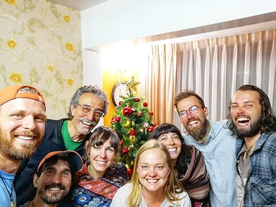 It's a very happy holidays with Brendon, Tim, Rick, me, Kira, Diana, Nathan, and Odd (a.k.a. Single Piston Viking). Check out our latest pics, maps, and videos (I just finished two on Peru) on facebook, instagram, and youtube.
 We entered Bolivia a little more than a week ago, excited for this new country of dynamic culture, mountains, and jungle. And to celebrate the holidays, we wanted to be in the white-washed colonial city of Sucre to meet fellow motorcycle travelers and friends for Christmas. That gave us nine days to get there from the Peruvian border and see all the fantastic sites in between. So we were a little rushed, but it didn't seem to be an impossible task. At least in the beginning.
Our first night in Bolivia was spent at Copacabana, the border town with Peru on the shores of Lake Titicaca. It's a favorite spot for backpackers and is maybe one of the nicer border towns in the world. It had crisp views of the blue lake along with little vegetarian and tiki-type restaurants dotting its main strip, but Tim and I felt it to be overpriced for what we knew Bolivia to cost. So we stayed briefly, and then immediately headed inland.
 The wharf of Copacabana, Bolivia. To get anywhere inland from Copacabana, you have to first drive along a lovely paved road that hugs the inlets and curves of Lake Titicaca (I think the Bolivian side is the more picturesque side of the lake, sorry Peru). And then you are forced to put your vehicle on a rickety ferry that crosses Lake Titicaca's Tiquina Strait.
Made of warped wooden boards and not much else, this “ferry" took about a half hour and cost us only 5 Bolivianos a person ($0.72) but you get what you pay for. It's not a very far journey, and I think it'd just be easier to build a bridge, but it was a great introduction to the reckless and haphazard adventure that Bolivia was going to be. We even passed another ferry along the way with a guy in it who was literally bucketing out his flooded ferry one bucket-full at a time. I was thankful that we stayed afloat the whole ride.
 Me trying to keep the bike upright on the ferry across Tiquina Strait, Bolivia. Our first stop after Copacabana was La Paz, the Bolivian seat of government and the highest capital in the world (elevation is at 12,000 ft./3,650 meters). Though we didn't explore too much, we immediately felt that it was a fun city with lots of culture and views everywhere. And the best part was that because of the surrounding hills, there are cable cars running all over the city called teleféricos, allowing people to sour above the traffic below while taking in its cloud-touching vistas.
  La Paz, Bolivia From La Paz we decided to ride along the infamous route northeast called Death Road, which my mother wasn't too happy about. Ruta de la Muerte, a.k.a. Yungas Road, used to have a horrific death rate due to its narrow cliffside two-way traffic, plus it was the only way for anyone to get to the town of Coroico. It was so bad, that by 2006 one estimate said 200-300 travelers were killed a year on it. But after putting in some improvements such as guard rails, and constructing a new, less-deadly road to Coroico, only one person or so dies every few years on it now.
So off we went to tackle the Death Road, but on the way, our horn went out (for the millionth time, it keeps doing that despite all of Tim's “fixes"). And as a semi-truck came barreling around the turn toward us, missing us by just a foot, Tim said to me, “Wouldn't it be horrible if we died on the road right before Death Road?"
 The misty cliffside beauty of Death Road (Yungas Road), Bolivia. Thankfully we didn't die on either road, and to be honest, I think calling it Death Road is a misnomer these days. It's actually a very well-maintained gravel road with a gradual descent (you have to pay to go on it, 25Bobs a person, so I'm glad to see the money goes to something). And considering the only real traffic are downhill cyclists, it's not that dangerous anymore. It descends from La Paz's high altiplano elevation down into the tropical jungles of mist and waterfalls, which makes it a gorgeous ride. In fact, I think the road should be called Scenic Jungle Road, and then nobody would get the wrong impression of what it's like.
  The near-death road after Death Road. Ironically, the real adventure did not begin for us until after Death Road. From Coroico we thought we'd head southeast to Cochabamba and finally to Sucre from the most direct way possible. Even though Google had us going back to La Paz and then taking the main highway, we thought, “Hey, there's this other road that goes straight there. Why not take that?"
Well, I now know the answer to that. This little squiggly dirt road that goes along Bolivia's northern foothills near the Amazon might be a great ride during the dry season, but in December during the rainy season, it becomes a muddy slosh pit. Talk about Death Roads, this Route 25 was one of the worst we've been on.
 This road was just sludge and soup. Amidst all the puddles and soggy streets, camping was not going to be a fun option. So we tried to stay the nights in any cheap hotel we could find, and ended up laying in moldy beds and listening to the thunder and downpour, all the while worrying about how we were ever going to make it through the mud the next day. I began to doubt we would ever get to Sucre for Christmas.
And then on our way to the village of Licoma, Tim suddenly pulled over and yelled, “The front tire's flat!" Sure enough, it was completely flat and we were riding on the rim. But what's strange was that after much inspection, we could not find the puncture wound. And what's worse, we definitely could not pump it up again with our little travel pump.
 Tim on the side of the road almost giving up on life. We knew this moment would come eventually: a time when the bike would become so immobile, we'd have to either separate, or abandon the bike. Luckily, Licoma was just 20 minutes away, so I decided to hitch a ride with some friendly passerbys, and take the tire to a gomería in Licoma.
 For once, things worked out better than I had expected, and everything went to plan. I got dropped off at a tire shop, the guys there pumped it back up and came to the conclusion that nothing was wrong with it. Maybe it went flat because a small rock had gotten between the rim and tire, maybe the pressure was too low, who knows.
I was able to pay the tire man's neighbor for a ride back up into the mountains where Tim was waiting with the immobile bike. We got the tire back on, said farewell to our new friends, and made our way to Licoma relieved and ready for a good night's rest.
 We finally got our Christmas decor up on our home / bike. Of course it stormed worse than ever that night, and all I could think about laying in that moldy bed of the hotel (it was really just someone's house with an unused room of mildew) was how I wanted pavement. Glorious, wonderful pavement. And Christmas in Sucre with friends and non-moldy beds.
 As predicted, the morning after was muddy mayhem, and it became a slip-n-slide down the mountain. I have to say that Tim did such a great job keeping us upright, he shall forever be known in my book as the Mud Master.
And there was hope on the horizon. We decided to turn off of Route 25 as quickly as we could, and went through a stunning valley around the town of Quime before coming to pavement. And from there on out it was smooth sailing until the city of Cochabamba, where we met with our Bolivian friend, German.
 Tim, German, and me on a statue that German actually built out of motorcycle parts with his friends. German gave us a warm welcome to Cochabamba, a delightful city with the tallest Christ statue in the world (yup, it's taller than the one in Rio). And we enjoyed seeing the oldest church of Bolivia, built in 1521.
From Cochabamba we spent two days riding lovely roads to the city of Sucre: they were paved and wound through the rocky countryside of spring green scrubland. There were two problems with this road: the trash, and the amount of women and children begging along the sides. It broke my heart to see them waving and shaking their hands and hats at every car that passed, and I was shocked to see so much destitute poverty around every turn. There were hundreds of them in the cold, in the rain, and in tattered clothes. I know that Bolivia is making advancements, but for many people, it has leaps and bounds to go.
 Some of the many children begging at the side of the highway. At last we arrived in Sucre, and just like my dreams, we had a glorious Christmas spent with the Haks, Twoifbyland (another motorcycle couple), our Norwegian friend Single Piston Vikings, and Rick, a motorcycle adventurer from California. For a couple of travelers far from home and with no family around, we're feeling pretty fortunate this year to be surrounded by such great people, scenery, and food.
We wish you all a happy holidays and a Happy New Year, and I hope it will be just like in your dreams.
 It's a very happy holidays with Brendon, Tim, Rick, me, Kira, Diana, Nathan, and Odd (a.k.a. Single Piston Viking). Check out our latest pics, maps, and videos (I just finished two on Peru) on facebook, instagram, and youtube.
December 16, 2018
Over a Year on the Road - Our Gear Revisited
By Tim Notier After having been on the road for over a year, it is time to look back at our favorite items, and some that didn't make the cut.
The following is a list of the things we brought with us and why. We have not received any discounts or free merchandise for promotional purposes. We purchased these items with our own money, and due to that fact, better-quality and more expensive items may exist out there. These are simply our honest, unfiltered opinions on what we decided to bring on our trip.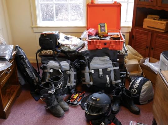 Universal Bike Enhancements No matter what bike you have, these are great improvements whatever lays ahead. The links to the items are highlighted in Green.
We have AirHawk cushions (B+) for both seats as I'm in a never-ending quest to make my ass more comfortable. At first I had to slightly customize the AirHawk cover to allow me to stuff a scarf in the front to better support my nether area that needed support... In Guatemala (because a dog ate my AirHawk), I purchased a newer model that has a space cut out for that area. Barkbuster hand-guards (A+). They haven't snapped off yet after countless of drops, and a couple of power slides. A great investment to keep your levers safe. PDM power distribution module (A+). I upgraded our electrical system with outlets all around the bike to plug in our heated gear (that we have since sent back home), charge our phones and GPS, etc. Great device, simple to install.
Auxbeam 4" auxiliary lights (A+) - A cheap ($20) set from Amazon, have not failed me yet over 7 months through rain and hail. I personally do not see a need to spend hundreds of dollars on Aux lights. With the Mounting Kit, and an On/Off Toggle, the whole set up was under $40 bucks. Double Take Collapsable mirrors (A+) When the bike goes down, the mirrors just fold in on themselves as they mount to RAM mounts. This has been a great investment. Slime Motorcycle air compressor (A+) and Plug Kit for flat tires (tubeless). This combo has gotten us out of trouble in Colombia and Ecuador. Rotopax 1 Gallon Fuel Container (A+). This has come in handy countless of times. From just having the extra security of another 40 miles, to easily filling up our MSR fuel bottles that we use for our stove. Piece of mind, and ours conveniently attaches to the inside of our left pannier rack. Navigation is key while riding, and keeping our phone (so much better than a dedicated GPS) locked in place is essential. After a bit of trial and error with other products, we bought the Perfect Squeeze (A+), and it has kept our phone sturdily in place over potholes, river crossings, and every Latin American speed bump throughout our journey. To avoid snatch-and-grab would-be thieves while we walk around markets, or leave the bike unattended, we have two Big Panther carabiner locks (A+)with a metal bungie. We use them to secure our helmets, boots, and jackets to the bike. I also put a Grip Lock (A+) on the break lever so no one can push the motorcycle from where I left it. Both of these cheap deterrents help prevent people from snagging our stuff. 
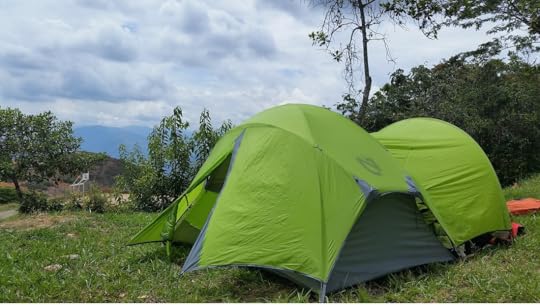
 Cooking and Camping Our Nemo Losi 2P (A+) tent with the addition of a separate Garage has provided us countless nights of protection from the elements and comfort in a combination with two Nemo Cosmo insulated 25L air pads.
Cooking on the road is also important. The MSR Whisperlight (A+) stove has been unstoppable and seems to be the go-to product for long distance travel. Paired with the MSR liquid fuel bottle, it can burn any fuel, and is pretty much hassle-free with the right maintenance. We do also carry an extra fuel pump, just in case the original acts up. Water sources abroad are not always the cleanest, so to filter the muck, toxic minerals, and E-coli out, we use a Survivor Filter (A). Make sure you bring extra filters with you, after a year of use, the filters need to be changed. But from cooking to making the essence of life, coffee, it has served us very well and kept us healthy. For extended camping, we just fill up our 6 liter MSR Dromedary bag (A+) to have plenty of water on hand.
Enlightened Equipment Accomplice quilt. (A+++) Definitely keeps us warm on cold nights. It packs down small and is extremely light due to the down feathers. This was not a cheap purchase, but was an important one since keeping Marisa warm is a top priority. She often states she loves this quilt more than me.On cold nights we put a Reflective Blanket under our sleeping pads. This reflects our body heat back up, containing it in the tent. I also put six drawstring attachments on it and it doubles as a bike cover. So cheap and so useful.
 Life's Little Extras Our G4Free (A+) chairs have been some of our favorite bonus items we have. From sitting down at campsites, on beaches, or even hours-long roadblocks, we have never regretted bringing these with us. They've needed some minor repairs over the past year, but nothing some duct tape can't fix.
Alpinestar Toucon (A+) motorcycle boots. Great protection, and can still hike around in them for short periods of time. We climbed some Mayan ruins in them, I don't suggest that, way too hot. Great all-around boots!
Mountain Hardwear down jacket. (A+) This is another part of our gear that Marisa may love more than me. It keeps us warm on the coldest of days, and doubles as a pillow at night.
A lot of people see our Hip Bags (A+) in photos and ask, "Where did we get those from?" We bought them cheap on Amazon, and there are plenty to choose from. They are great as a purse around Marisa's shoulder, and then strapped to her leg while on the road. I keep my smokes, stickers, and other loose items inside that are constantly needed to be within arm's reach.
Everyone needs a belt anyway, and a great place to stash some emergency cash is in a Money Belt (A+). It has an interior zipper to stash some extra cash. Rok Straps (A+). These aren't breaking news to anyone, but just awesome ways to secure loose ends to the bike such as extra water and food for long trips.
Eno Double Hammock (A+).. We used this all across the States and throughout Central America. We ended up sending it home once we reached Peru because of the cold weather, but man was it great while it lasted.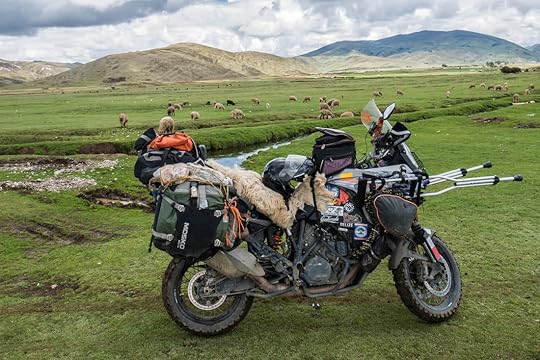
 Electronic Gizmos Phones... so expensive, even more so when waterproof. But for our GPS-dedicated device, we needed one. The Kyocera Duraforce (A+) is the Adventurer's phone, and it has been unbreakable. For less than a hundred bucks, and the addition of Google offline maps, OSM+, iOverlander, and Mapps.me, this is in my opinion the best navigation set-up there is. Waterproof, dust-proof, shock-proof, life-proof. And if stolen, you are only out ~$90.
I charge everything through the tank-bag using a surface SAE Connector I hook directly to my battery, via the PDM. I then route it through my tank-bag via separate Entry Cable Adapter, and then finally convert it to two USB Ports. This set-up lets me charge my phones, Senas, and anything else via USB.
We recently had someone bring us Magnetic Charging Chords and I wish I had them sooner. They take away the wear and tear of constantly plugging in and disconnecting your gadgets. I would definitely check these out, they are cheap and very convenient. Communication on the road is key. And even more so, music. We have the ever so popular Sena Bluetooth Headsets (A+). We love them! Hours on the road have dramatically changed for the better when listening to anything from Guns and Roses to Jack Johnson. We can communicate with each other and also listen to our own music separately. In Marisa's case, it is one big epic movie soundtrack as she meanders around the world.
To charge all the nicknacks when we are wild camping multiple nights in a row, we bought an EasyAcc Portable Charger(A+). It has four USB outlets, and we can charge both of our phones, and both or our Senas at the same time. Great investment. For emergencies only, we have a Rugged Geek Portable Jump Starter (A+). We thankfully have never needed to use this on the trip, but it did successfully jump the bike back to life in the cold midwestern winters.For "action" videos, we splurged and bought a GoPro Hero6 (A+). I know, it's expensive, but man is it worth it. It takes amazing footage and is much more reliable than the cheaper $100 range action cameras, two of which we went through before purchasing the GoPro. Plus, it has amazing stabilization and slow-motion.To save all of the pics and vids, we wanted a solid-state external hard drive. We had purchased the standard disk drives, and they failed us. You definitely do not want that happening and loosing all of your glorious footage!!! We bought a MyDigital SSD (A+) drive, and it has served us flawlessly. For a smaller, more portable thumb-drive, we each have a Samsung 128 gig flash drive (A+). It is perfect for saving documents and other easier access items quickly, and is unbelievably small.
As a middleweight camera, not a DSLR but not a standard point and shoot, the Panasonic Lumix G7 4k mirrorless camera (A+) has been an amazing piece of hardware that has captured all of the great images that we have taken along the way. I love this camera.
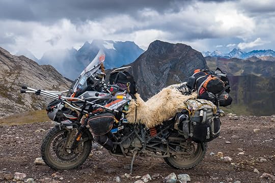
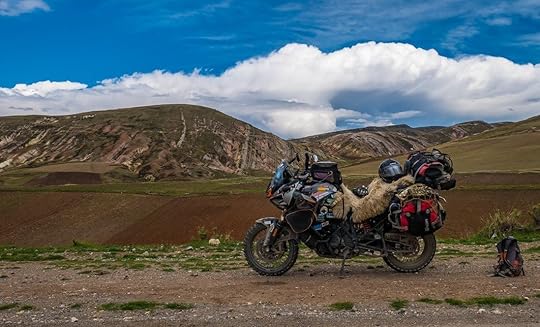 Storage Right, left, and top soft luggage cases by Mosko Moto (A+) I love these bags! When the bike falls, they act like airbags and are able to survive the fall relatively unharmed. We have had to duct tape some fraying straps, but that's because we put these bags through absolute hell. And they truly are waterproof. We switched to these after our hard cases broke from a fall in the States.
The Pelican Hard Case (A-) was left at home, but did make for a nice set-up for shorter trips. This is a large, robust case that had served us well prior to the trip.
KTM Tank Bag. (B-) We obviously love KTM, and this matches the bike, but after 3 years of use the zipper broke. I fixed it with my amazing seamstress abilities and it is still in use!
 KTM 1190 Specific Rumbux crash bars and skid plate (A+). I love this set up, and admire the abuse it can take.
Powercell pod air intakes (A+), a critical upgrade. They work amazingly, and the KTM Powershop in Bogotá, Colombia, said they had never seen an 1190 with such a clean airbox as ours! We highly recommend these.
Puig Tall Windshield (A-) The tall windshield makes me think I may decapitate myself if I fall forward while riding off-road. Hopefully it will be a nice clean cut under the chin of my helmet, severing my head without pain or discomfort. But, it is nice on the highways. I like the Puig much better compared to the Genuine KTM 1190 Adventure Tall Windscreen (C).
KTM heated grips (C) If its 65 degrees, and you want it to be 67 degrees, they work awesome... for any real cold weather, they don't really do all that much, even when cranked on high. Personal Gear - Tim KTM/Shuberth modular helmet. (A) This is a recent purchase in Costa Rica because my old Fulmer modular helmet was old, and it may be a half a size too big. My new helmet fits well, though I had to make some padding adjustments since I was not used to such a tight fit. It's a great helmet but can get a little hot.
Spidi H2Out motorcycle jacket (C) It does its job taking the brunt of the dirt, dust, grime, and rain. But the original waterproof liner was not 100%, and the thermal layer attached awkwardly. It does have nice basic shoulder and elbow protection, but we did scrap the thermal and waterproof layers for a down jacket and rain jacket with a hood that could be worn separately from the touring jacket.
Sedici motorcycle pants (C) Same as above... the waterproof zip-in liner was a joke. It had a wide "V" where the material separated at the crotch, right in the spot where most of the water funnels while riding through a rain storm. We have since purchased heavy duty rain pants. Ascend rain jacket and pants. (F) At first I thought this was a great replacements for the not-so-funtional waterproof sections of the touring jacket and pants. Then Marisa started complaining about getting wet and exchanged hers for a cheap plastic version in Colombia. Then here in Ecuador, we got into such a horrible storm, that I was cold and wet for hours afterwards, and have since ditched my Ascend rain gear. I've now purchased a local plastic set-up that I hope will be better.
Every type of glove that was ever made I have bought, none of them are waterproof. I may have a problem with buying gloves. Personal Gear - Marisa Schuberth modular helmet (A-) Marisa says it can get hot, the vents do not provide a difference in airflow. Besides that, she loves it. It blocks a great amount of the outside noise, and is comfortable.Spidi motorcycle jacket (C) Marisa's jacket also came with useless liners.
Joe Rocket motorcycle pants (C) Didn't come with any waterproof liner, but is great for its protective padding. And with the addition of rain pants underneath, serves well in all types of weather. There is the added frustration that it's nearly impossible to find pants the fit women properly, and these do not. Plus, the front buttons never stay snapped.
Ascend rain jacket (F) She says it was not waterproof. So she ended up buying cheap plastic cyclist jacket and pants in Colombia, and though they are hideous, they work great. She wears the rain pants under her motorcycle pants, but puts the jacket over her touring jacket and says that breaks the wind better.
Mountain Hardwear down jacket (A+) Packs down small, is light, and most importantly, is warm. Only problem is it's hard to wash.BMW Allround waterproof boots (A+) Marisa was not really a fan of her old boots (BILT), so she purchased a pair of very expensive, but very comfortable boots that she has been able to hike in and wear daily in cold and wet weather. I of course have to plug my book as well: Maiden Voyage. Within it I express some of the miseries we experienced before we had the above items.
I hope that you may have found some of this information useful. Please let us know what your must-have gear is, and any additional input on the above items.
The following is a list of the things we brought with us and why. We have not received any discounts or free merchandise for promotional purposes. We purchased these items with our own money, and due to that fact, better-quality and more expensive items may exist out there. These are simply our honest, unfiltered opinions on what we decided to bring on our trip.
 Universal Bike Enhancements No matter what bike you have, these are great improvements whatever lays ahead. The links to the items are highlighted in Green.
We have AirHawk cushions (B+) for both seats as I'm in a never-ending quest to make my ass more comfortable. At first I had to slightly customize the AirHawk cover to allow me to stuff a scarf in the front to better support my nether area that needed support... In Guatemala (because a dog ate my AirHawk), I purchased a newer model that has a space cut out for that area. Barkbuster hand-guards (A+). They haven't snapped off yet after countless of drops, and a couple of power slides. A great investment to keep your levers safe. PDM power distribution module (A+). I upgraded our electrical system with outlets all around the bike to plug in our heated gear (that we have since sent back home), charge our phones and GPS, etc. Great device, simple to install.
Auxbeam 4" auxiliary lights (A+) - A cheap ($20) set from Amazon, have not failed me yet over 7 months through rain and hail. I personally do not see a need to spend hundreds of dollars on Aux lights. With the Mounting Kit, and an On/Off Toggle, the whole set up was under $40 bucks. Double Take Collapsable mirrors (A+) When the bike goes down, the mirrors just fold in on themselves as they mount to RAM mounts. This has been a great investment. Slime Motorcycle air compressor (A+) and Plug Kit for flat tires (tubeless). This combo has gotten us out of trouble in Colombia and Ecuador. Rotopax 1 Gallon Fuel Container (A+). This has come in handy countless of times. From just having the extra security of another 40 miles, to easily filling up our MSR fuel bottles that we use for our stove. Piece of mind, and ours conveniently attaches to the inside of our left pannier rack. Navigation is key while riding, and keeping our phone (so much better than a dedicated GPS) locked in place is essential. After a bit of trial and error with other products, we bought the Perfect Squeeze (A+), and it has kept our phone sturdily in place over potholes, river crossings, and every Latin American speed bump throughout our journey. To avoid snatch-and-grab would-be thieves while we walk around markets, or leave the bike unattended, we have two Big Panther carabiner locks (A+)with a metal bungie. We use them to secure our helmets, boots, and jackets to the bike. I also put a Grip Lock (A+) on the break lever so no one can push the motorcycle from where I left it. Both of these cheap deterrents help prevent people from snagging our stuff.

 Cooking and Camping Our Nemo Losi 2P (A+) tent with the addition of a separate Garage has provided us countless nights of protection from the elements and comfort in a combination with two Nemo Cosmo insulated 25L air pads.
 Cooking on the road is also important. The MSR Whisperlight (A+) stove has been unstoppable and seems to be the go-to product for long distance travel. Paired with the MSR liquid fuel bottle, it can burn any fuel, and is pretty much hassle-free with the right maintenance. We do also carry an extra fuel pump, just in case the original acts up. Water sources abroad are not always the cleanest, so to filter the muck, toxic minerals, and E-coli out, we use a Survivor Filter (A). Make sure you bring extra filters with you, after a year of use, the filters need to be changed. But from cooking to making the essence of life, coffee, it has served us very well and kept us healthy. For extended camping, we just fill up our 6 liter MSR Dromedary bag (A+) to have plenty of water on hand.
Enlightened Equipment Accomplice quilt. (A+++) Definitely keeps us warm on cold nights. It packs down small and is extremely light due to the down feathers. This was not a cheap purchase, but was an important one since keeping Marisa warm is a top priority. She often states she loves this quilt more than me.On cold nights we put a Reflective Blanket under our sleeping pads. This reflects our body heat back up, containing it in the tent. I also put six drawstring attachments on it and it doubles as a bike cover. So cheap and so useful.

 Life's Little Extras Our G4Free (A+) chairs have been some of our favorite bonus items we have. From sitting down at campsites, on beaches, or even hours-long roadblocks, we have never regretted bringing these with us. They've needed some minor repairs over the past year, but nothing some duct tape can't fix.
Alpinestar Toucon (A+) motorcycle boots. Great protection, and can still hike around in them for short periods of time. We climbed some Mayan ruins in them, I don't suggest that, way too hot. Great all-around boots!
Mountain Hardwear down jacket. (A+) This is another part of our gear that Marisa may love more than me. It keeps us warm on the coldest of days, and doubles as a pillow at night.
A lot of people see our Hip Bags (A+) in photos and ask, "Where did we get those from?" We bought them cheap on Amazon, and there are plenty to choose from. They are great as a purse around Marisa's shoulder, and then strapped to her leg while on the road. I keep my smokes, stickers, and other loose items inside that are constantly needed to be within arm's reach.
Everyone needs a belt anyway, and a great place to stash some emergency cash is in a Money Belt (A+). It has an interior zipper to stash some extra cash. Rok Straps (A+). These aren't breaking news to anyone, but just awesome ways to secure loose ends to the bike such as extra water and food for long trips.
Eno Double Hammock (A+).. We used this all across the States and throughout Central America. We ended up sending it home once we reached Peru because of the cold weather, but man was it great while it lasted.

 Electronic Gizmos Phones... so expensive, even more so when waterproof. But for our GPS-dedicated device, we needed one. The Kyocera Duraforce (A+) is the Adventurer's phone, and it has been unbreakable. For less than a hundred bucks, and the addition of Google offline maps, OSM+, iOverlander, and Mapps.me, this is in my opinion the best navigation set-up there is. Waterproof, dust-proof, shock-proof, life-proof. And if stolen, you are only out ~$90.
I charge everything through the tank-bag using a surface SAE Connector I hook directly to my battery, via the PDM. I then route it through my tank-bag via separate Entry Cable Adapter, and then finally convert it to two USB Ports. This set-up lets me charge my phones, Senas, and anything else via USB.
We recently had someone bring us Magnetic Charging Chords and I wish I had them sooner. They take away the wear and tear of constantly plugging in and disconnecting your gadgets. I would definitely check these out, they are cheap and very convenient. Communication on the road is key. And even more so, music. We have the ever so popular Sena Bluetooth Headsets (A+). We love them! Hours on the road have dramatically changed for the better when listening to anything from Guns and Roses to Jack Johnson. We can communicate with each other and also listen to our own music separately. In Marisa's case, it is one big epic movie soundtrack as she meanders around the world.
To charge all the nicknacks when we are wild camping multiple nights in a row, we bought an EasyAcc Portable Charger(A+). It has four USB outlets, and we can charge both of our phones, and both or our Senas at the same time. Great investment. For emergencies only, we have a Rugged Geek Portable Jump Starter (A+). We thankfully have never needed to use this on the trip, but it did successfully jump the bike back to life in the cold midwestern winters.For "action" videos, we splurged and bought a GoPro Hero6 (A+). I know, it's expensive, but man is it worth it. It takes amazing footage and is much more reliable than the cheaper $100 range action cameras, two of which we went through before purchasing the GoPro. Plus, it has amazing stabilization and slow-motion.To save all of the pics and vids, we wanted a solid-state external hard drive. We had purchased the standard disk drives, and they failed us. You definitely do not want that happening and loosing all of your glorious footage!!! We bought a MyDigital SSD (A+) drive, and it has served us flawlessly. For a smaller, more portable thumb-drive, we each have a Samsung 128 gig flash drive (A+). It is perfect for saving documents and other easier access items quickly, and is unbelievably small.
As a middleweight camera, not a DSLR but not a standard point and shoot, the Panasonic Lumix G7 4k mirrorless camera (A+) has been an amazing piece of hardware that has captured all of the great images that we have taken along the way. I love this camera.

 Storage Right, left, and top soft luggage cases by Mosko Moto (A+) I love these bags! When the bike falls, they act like airbags and are able to survive the fall relatively unharmed. We have had to duct tape some fraying straps, but that's because we put these bags through absolute hell. And they truly are waterproof. We switched to these after our hard cases broke from a fall in the States.
The Pelican Hard Case (A-) was left at home, but did make for a nice set-up for shorter trips. This is a large, robust case that had served us well prior to the trip.
KTM Tank Bag. (B-) We obviously love KTM, and this matches the bike, but after 3 years of use the zipper broke. I fixed it with my amazing seamstress abilities and it is still in use!

 KTM 1190 Specific Rumbux crash bars and skid plate (A+). I love this set up, and admire the abuse it can take.
Powercell pod air intakes (A+), a critical upgrade. They work amazingly, and the KTM Powershop in Bogotá, Colombia, said they had never seen an 1190 with such a clean airbox as ours! We highly recommend these.
Puig Tall Windshield (A-) The tall windshield makes me think I may decapitate myself if I fall forward while riding off-road. Hopefully it will be a nice clean cut under the chin of my helmet, severing my head without pain or discomfort. But, it is nice on the highways. I like the Puig much better compared to the Genuine KTM 1190 Adventure Tall Windscreen (C).
KTM heated grips (C) If its 65 degrees, and you want it to be 67 degrees, they work awesome... for any real cold weather, they don't really do all that much, even when cranked on high.
 Personal Gear - Tim KTM/Shuberth modular helmet. (A) This is a recent purchase in Costa Rica because my old Fulmer modular helmet was old, and it may be a half a size too big. My new helmet fits well, though I had to make some padding adjustments since I was not used to such a tight fit. It's a great helmet but can get a little hot.
Spidi H2Out motorcycle jacket (C) It does its job taking the brunt of the dirt, dust, grime, and rain. But the original waterproof liner was not 100%, and the thermal layer attached awkwardly. It does have nice basic shoulder and elbow protection, but we did scrap the thermal and waterproof layers for a down jacket and rain jacket with a hood that could be worn separately from the touring jacket.
Sedici motorcycle pants (C) Same as above... the waterproof zip-in liner was a joke. It had a wide "V" where the material separated at the crotch, right in the spot where most of the water funnels while riding through a rain storm. We have since purchased heavy duty rain pants. Ascend rain jacket and pants. (F) At first I thought this was a great replacements for the not-so-funtional waterproof sections of the touring jacket and pants. Then Marisa started complaining about getting wet and exchanged hers for a cheap plastic version in Colombia. Then here in Ecuador, we got into such a horrible storm, that I was cold and wet for hours afterwards, and have since ditched my Ascend rain gear. I've now purchased a local plastic set-up that I hope will be better.
Every type of glove that was ever made I have bought, none of them are waterproof. I may have a problem with buying gloves.
 Personal Gear - Marisa Schuberth modular helmet (A-) Marisa says it can get hot, the vents do not provide a difference in airflow. Besides that, she loves it. It blocks a great amount of the outside noise, and is comfortable.Spidi motorcycle jacket (C) Marisa's jacket also came with useless liners.
Joe Rocket motorcycle pants (C) Didn't come with any waterproof liner, but is great for its protective padding. And with the addition of rain pants underneath, serves well in all types of weather. There is the added frustration that it's nearly impossible to find pants the fit women properly, and these do not. Plus, the front buttons never stay snapped.
Ascend rain jacket (F) She says it was not waterproof. So she ended up buying cheap plastic cyclist jacket and pants in Colombia, and though they are hideous, they work great. She wears the rain pants under her motorcycle pants, but puts the jacket over her touring jacket and says that breaks the wind better.
Mountain Hardwear down jacket (A+) Packs down small, is light, and most importantly, is warm. Only problem is it's hard to wash.BMW Allround waterproof boots (A+) Marisa was not really a fan of her old boots (BILT), so she purchased a pair of very expensive, but very comfortable boots that she has been able to hike in and wear daily in cold and wet weather.
 I of course have to plug my book as well: Maiden Voyage. Within it I express some of the miseries we experienced before we had the above items.
I hope that you may have found some of this information useful. Please let us know what your must-have gear is, and any additional input on the above items.
December 14, 2018
Dec. 14, 2018 - Rainbow Mountains and Floating Islands
By Marisa 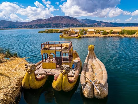 After exploring the world of the Inca around Cusco and Machu Picchu, we knew that our time in Peru was coming to a close. But before we headed into Bolivia (arrived today!), there were a couple of things left in Peru that we wanted to see and get done.
 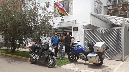 Cezar, Tim, Nicolai, and their bikes at the Bolivian Consulate, Cusco, Peru. First and foremost, and definitely not fun at all, we needed to get our Bolivian visa from the consulate in Cusco. This extremely expensive visa ($160 + $10 processing fee per person!) is only required for Americans, as it seems we do the same to Bolivians, so it's a reciprocal charge.
Technically, the whole visa process can be done at the border, but we wanted to just get it out of the way ahead of time. So after more than an hour at the Bolivian Consulate of filling out an online form, printing proof of a booked hotel, writing up an itinerary, getting passport pictures, and paying $340 in US dollars cash (there's more that I won't get into), we finally got our gorgeous and hard-earned visas. And best of all, we met a couple of awesome motorcyclist Romanians there too, Cezar and Nicolai.
To be fair, what we had to go through is nothing compared to what Bolivians and people of many other nationalities have to do to get into the US, if they can get in at all. So I really should not complain.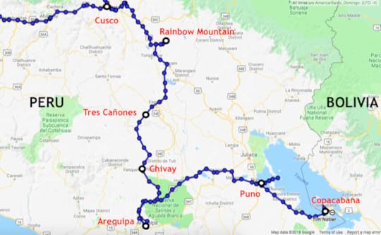 With our visas in our passports, we were ready to leave Cusco, and headed south toward the city of Arequipa where a new back tire was awaiting us. But just a day's ride from Cusco was the Instagram-worthy tourist spot called Rainbow Mountain, or locally known as La Montaña de los Siete Colores or Vinicunca. It does look beautiful in all the pictures, so we thought we'd give it a go.
 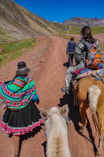 Taking horses up to Rainbow Mountain, Peru. We stayed the night in a small village near the mountain called Pitumarca where sheep and alpacas were herded through the streets and the women dressed traditionally in wide skirts, tasseled hats, and long braids. From there we left in the morning and enjoyed the gorgeous ride to the mountain trail base. After paying our ten Soles entrance fee (~$3), we headed up the mountain on horseback for 50 Soles (~$15) a person since I wasn't too excited to do the steep hike at high altitude (it starts at 14,000 ft/4,300 meters, ends at 17,060 ft/5,200 meters).
 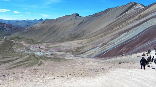 The side we came up on: nobody there.
 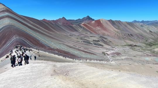 The other side: a great migration of tourists. Though we were practically the only people on the trail, once we got to the ridge of Rainbow Mountain, there were tons of tourists who had come up the other side, all taking buses from Cusco. Despite the amount of people, the views were stunning with blue skies, beige stones, green fields, and red earth striped with yellow and turquoise minerals. We could even clearly see the snowy peak of the sacred Ausangate mountain.
 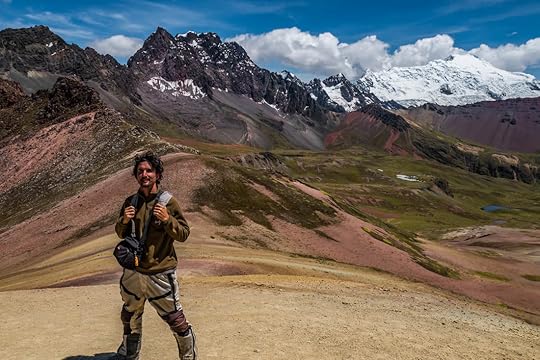 Tim and Ausangate Mountain in the background, Peru.
 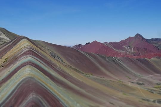 Original image.
 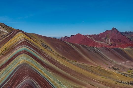 Photoshopped image. Above I've put both the photoshopped picture of Rainbow Mountain and the untouched one for you to compare. Yes, unfiltered doesn't look as awesome, but in all honesty, pictures don't do it justice because it's such an incredible feeling to stand there and admire such superb natural beauty in person. Maybe we were just lightheaded from the climb, but the view impressed me, and I'm so glad we went.
 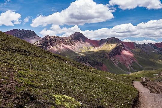 The trail back from Rainbow Mountain, Peru. Further on our way to Arequipa, we passed by a beautiful spot quite by accident called Tres Cañones, or Three Canyons. It was on a dirt road with a few parts that were somewhat washed out, but the ride was definitely worth it, not just for the Three Canyons view, but the amazing ruins nearby (Mauk'allacta) and strange rock formations following it. I'm sure in the dry season this road would be just fine, but it was so much fun to ride, I would recommend it at any time of year for those who enjoy going off-road.
 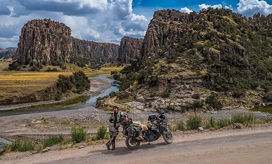 Tres Cañones, Peru.
 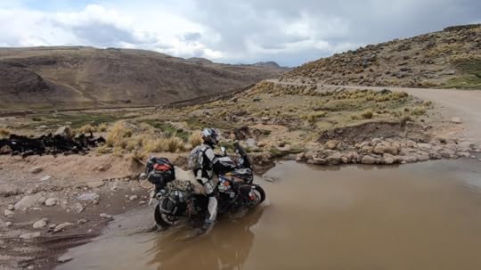 This was not the worst of the "puddles". Yeah our feet got a little wet. Our last stop before Arequipa was Chivay, the tourist gateway to Colca Canyon. Unfortunately, even though there is a road going along this extremely deep canyon, you have to pay 70 Soles a person to access it. Tim and I weren't going to hike in anyway because of my foot and we had a date to catch with our new tire in Arequipa (our old one had a slow annoying leak). So we sadly skipped the canyon and went on to Arequipa.
The road from high-altitude Chivay to warm and sunny Arequipa was twisty and paved, but not as spectacular as I'd hoped. Desert and trash was the view throughout, and we had to dodge tons of trucks making their way to this concrete-producing city outside of Chivay: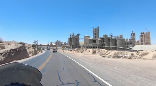 Looks like something made by jawas on Tatooine. Star Wars fans, you know what I mean. At last we arrived in Arequipa. It's Peru's second-largest city after Lima, but thankfully it did not compare to the grimy urban mayhem that is Lima. Instead, Arequipa has a nice colonial center with lovely stone buildings made from the white volcanic rock of the nearby Misti Volcano. It was also where we met the fine people of Peru Moto Tours who helped us get our brand new tire (MotoZ Tractionaire, best rear tire in our opinion) and new brakes.
 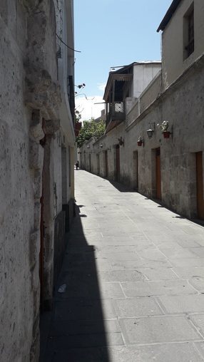 The quaint streets of Arequipa.
 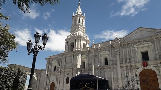 Basilica Cathedral of Arequipa, Peru.
 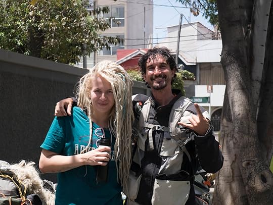 Tim and Eglé (pronounced Egg-lay) We also had the fortune of meeting up with a traveling motorcyclist who we'd been following for a long time: Eglé, and had a great time in Arequipa having beers and even splurging on some Starbucks coffee with her.
From Arequipa, we headed toward Bolivia on the main road to Puno, which was definitely nothing to rave about. It was nicely paved (until a gravel shortcut we took to skip Juliaca), but boring. Best part about it was that there were vicuñas everywhere, the llama's endangered wild cousin.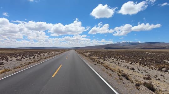 Road to nowhere? Nope. Road to Puno, Peru. Finally, we came to our last stop in Peru and a place with one of the weirdest geographic names ever: Lake Titicaca. We even heard a local joke that since the lake is split between countries, Peru has the titi side and Bolivia has the caca side (though they say the opposite in Bolivia of course). But seventh-grade humor aside, it was originally pronounced Titi-haha, and it's been a dream of mine to see this high-altitude blue gem of a lake with its unique floating islands.
Made of the totora reed and its roots, these islands were first constructed as a way for the Aymará-speaking people to escape the invading Incas, and have been a tradition in the region ever since. They even make their houses and boats out of this buoyant material.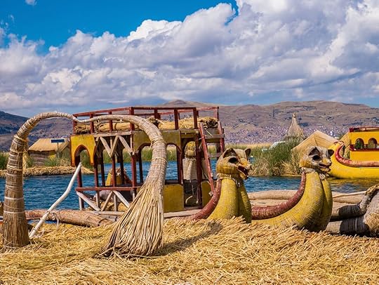 One of the many floating islands and boats around Uros, Lake Titicaca, Peru. I'll admit, the tour we went on to see these islands was the most touristy thing we've done yet. Authentic would not be a word I could use to describe this, but as these are islands and I don't have a boat, it was the only way I could see to get out there.
And the extra hour and a half ride it took to visit the non-floating island of Taquile was not worth it in my mind (and that was on the fast boat). Taquile is just a regular island, but I did enjoy getting a glimpse of the local culture of Quechua-speaking people that live there. And I understand that the money spent does go to the preservation of these endangered communities. But if I had to do it again, I would try to stay overnight on a floating island to get a more authentic experience.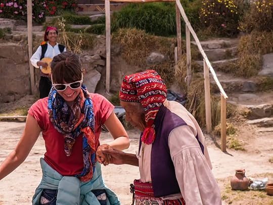 Me dancing with a local man of Taquile Island who is allegedly 105 years old. That was yesterday, and today we are still on the shores of Lake Titicaca, but this time we are in Copacabana on the Bolivian side. Because we'd gotten our visas prior, crossing the border wasn't too bad, and now we're catching up on some computer work before heading into the interior of Bolivia, our 12th country!
We'll keep you posted. And if you want the latest photos, videos, and updates, don't forget to follow us on Facebook and Instagram.
Until next time...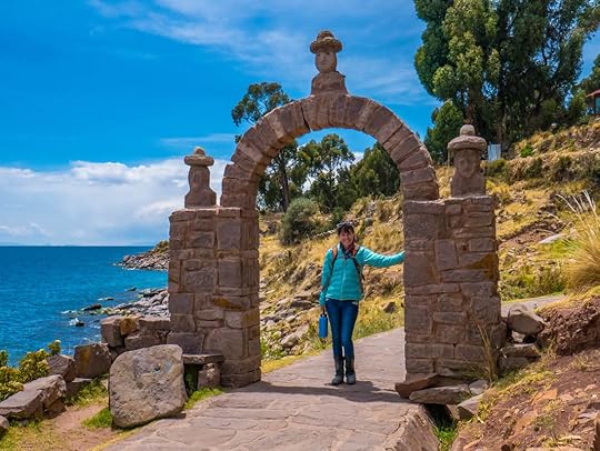 Me on Taquile Island. The blues here are unbelievable.
 After exploring the world of the Inca around Cusco and Machu Picchu, we knew that our time in Peru was coming to a close. But before we headed into Bolivia (arrived today!), there were a couple of things left in Peru that we wanted to see and get done.
  Cezar, Tim, Nicolai, and their bikes at the Bolivian Consulate, Cusco, Peru. First and foremost, and definitely not fun at all, we needed to get our Bolivian visa from the consulate in Cusco. This extremely expensive visa ($160 + $10 processing fee per person!) is only required for Americans, as it seems we do the same to Bolivians, so it's a reciprocal charge.
Technically, the whole visa process can be done at the border, but we wanted to just get it out of the way ahead of time. So after more than an hour at the Bolivian Consulate of filling out an online form, printing proof of a booked hotel, writing up an itinerary, getting passport pictures, and paying $340 in US dollars cash (there's more that I won't get into), we finally got our gorgeous and hard-earned visas. And best of all, we met a couple of awesome motorcyclist Romanians there too, Cezar and Nicolai.
To be fair, what we had to go through is nothing compared to what Bolivians and people of many other nationalities have to do to get into the US, if they can get in at all. So I really should not complain.
 With our visas in our passports, we were ready to leave Cusco, and headed south toward the city of Arequipa where a new back tire was awaiting us. But just a day's ride from Cusco was the Instagram-worthy tourist spot called Rainbow Mountain, or locally known as La Montaña de los Siete Colores or Vinicunca. It does look beautiful in all the pictures, so we thought we'd give it a go.
  Taking horses up to Rainbow Mountain, Peru. We stayed the night in a small village near the mountain called Pitumarca where sheep and alpacas were herded through the streets and the women dressed traditionally in wide skirts, tasseled hats, and long braids. From there we left in the morning and enjoyed the gorgeous ride to the mountain trail base. After paying our ten Soles entrance fee (~$3), we headed up the mountain on horseback for 50 Soles (~$15) a person since I wasn't too excited to do the steep hike at high altitude (it starts at 14,000 ft/4,300 meters, ends at 17,060 ft/5,200 meters).
  The side we came up on: nobody there.
  The other side: a great migration of tourists. Though we were practically the only people on the trail, once we got to the ridge of Rainbow Mountain, there were tons of tourists who had come up the other side, all taking buses from Cusco. Despite the amount of people, the views were stunning with blue skies, beige stones, green fields, and red earth striped with yellow and turquoise minerals. We could even clearly see the snowy peak of the sacred Ausangate mountain.
  Tim and Ausangate Mountain in the background, Peru.
  Original image.
  Photoshopped image. Above I've put both the photoshopped picture of Rainbow Mountain and the untouched one for you to compare. Yes, unfiltered doesn't look as awesome, but in all honesty, pictures don't do it justice because it's such an incredible feeling to stand there and admire such superb natural beauty in person. Maybe we were just lightheaded from the climb, but the view impressed me, and I'm so glad we went.
  The trail back from Rainbow Mountain, Peru. Further on our way to Arequipa, we passed by a beautiful spot quite by accident called Tres Cañones, or Three Canyons. It was on a dirt road with a few parts that were somewhat washed out, but the ride was definitely worth it, not just for the Three Canyons view, but the amazing ruins nearby (Mauk'allacta) and strange rock formations following it. I'm sure in the dry season this road would be just fine, but it was so much fun to ride, I would recommend it at any time of year for those who enjoy going off-road.
  Tres Cañones, Peru.
  This was not the worst of the "puddles". Yeah our feet got a little wet. Our last stop before Arequipa was Chivay, the tourist gateway to Colca Canyon. Unfortunately, even though there is a road going along this extremely deep canyon, you have to pay 70 Soles a person to access it. Tim and I weren't going to hike in anyway because of my foot and we had a date to catch with our new tire in Arequipa (our old one had a slow annoying leak). So we sadly skipped the canyon and went on to Arequipa.
The road from high-altitude Chivay to warm and sunny Arequipa was twisty and paved, but not as spectacular as I'd hoped. Desert and trash was the view throughout, and we had to dodge tons of trucks making their way to this concrete-producing city outside of Chivay:
 Looks like something made by jawas on Tatooine. Star Wars fans, you know what I mean. At last we arrived in Arequipa. It's Peru's second-largest city after Lima, but thankfully it did not compare to the grimy urban mayhem that is Lima. Instead, Arequipa has a nice colonial center with lovely stone buildings made from the white volcanic rock of the nearby Misti Volcano. It was also where we met the fine people of Peru Moto Tours who helped us get our brand new tire (MotoZ Tractionaire, best rear tire in our opinion) and new brakes.
  The quaint streets of Arequipa.
  Basilica Cathedral of Arequipa, Peru.
  Tim and Eglé (pronounced Egg-lay) We also had the fortune of meeting up with a traveling motorcyclist who we'd been following for a long time: Eglé, and had a great time in Arequipa having beers and even splurging on some Starbucks coffee with her.
From Arequipa, we headed toward Bolivia on the main road to Puno, which was definitely nothing to rave about. It was nicely paved (until a gravel shortcut we took to skip Juliaca), but boring. Best part about it was that there were vicuñas everywhere, the llama's endangered wild cousin.
 Road to nowhere? Nope. Road to Puno, Peru. Finally, we came to our last stop in Peru and a place with one of the weirdest geographic names ever: Lake Titicaca. We even heard a local joke that since the lake is split between countries, Peru has the titi side and Bolivia has the caca side (though they say the opposite in Bolivia of course). But seventh-grade humor aside, it was originally pronounced Titi-haha, and it's been a dream of mine to see this high-altitude blue gem of a lake with its unique floating islands.
Made of the totora reed and its roots, these islands were first constructed as a way for the Aymará-speaking people to escape the invading Incas, and have been a tradition in the region ever since. They even make their houses and boats out of this buoyant material.
 One of the many floating islands and boats around Uros, Lake Titicaca, Peru. I'll admit, the tour we went on to see these islands was the most touristy thing we've done yet. Authentic would not be a word I could use to describe this, but as these are islands and I don't have a boat, it was the only way I could see to get out there.
And the extra hour and a half ride it took to visit the non-floating island of Taquile was not worth it in my mind (and that was on the fast boat). Taquile is just a regular island, but I did enjoy getting a glimpse of the local culture of Quechua-speaking people that live there. And I understand that the money spent does go to the preservation of these endangered communities. But if I had to do it again, I would try to stay overnight on a floating island to get a more authentic experience.
 Me dancing with a local man of Taquile Island who is allegedly 105 years old. That was yesterday, and today we are still on the shores of Lake Titicaca, but this time we are in Copacabana on the Bolivian side. Because we'd gotten our visas prior, crossing the border wasn't too bad, and now we're catching up on some computer work before heading into the interior of Bolivia, our 12th country!
We'll keep you posted. And if you want the latest photos, videos, and updates, don't forget to follow us on Facebook and Instagram.
Until next time...
 Me on Taquile Island. The blues here are unbelievable.
December 10, 2018
Making a List, and Checking it Twice
By Tim Notier Here is a brief Christmas idea list for those motorcycle enthusiasts in your life. These are some of our favorite items which have served us well on our round-the-world trip and we highly recommend. We are not sponsored by any of the products below, and bought each item ourselves with our hard-earned money. These are simply our fair, honest opinions after putting them through hell for a year and four months.
Stocking Stuffers Some great items that wont break the bank. We love them all, and some may call them "luxury" items... but we are glad to have them. The links to Amazon are highlighted in Green. Our G4Free chairs have been some of our favorite bonus items we have. From sitting down at campsites, on beaches, or even hours-long roadblocks, we have never regretted bringing these with us.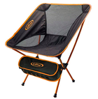 Navigation is key while riding, and keeping our phone (so much better than a dedicated GPS) locked in place is essential. After a bit of trial and error with other products, we bought the Perfect Squeeze, and it has kept our phone sturdily in place over potholes, river crossings, and every Latin American speed bump throughout our journey.
 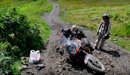 Phones... so expensive, even more so when waterproof. But, for our GPS-dedicated device, we needed one. The Kyocera Duraforce has been unbreakable. For less than a hundred bucks, and the addition of Google offline maps, OSM+, iOverlander, and Mapps.me, this is in my opinion the best navigation set-up there is. Waterproof, dust-proof, shock-proof, life-proof. And if stolen, you are only out ~$90.
Communication on the road is key. And even more so, music. We have the ever so popular Sena Bluetooth Headsets. We love them! Hours on the road have dramatically changed for the better when listening to anything from Guns and Roses to Jack Johnson. We can communicate with each other and also listen to our own music separately. In Marisa's case, it is one big epic movie soundtrack as she meanders around the world.
To charge all the nicknacks when we are wild camping multiple nights in a row, we bought an EasyAcc Portable Charger. It has four USB outlets, and we can charge both of our phones, and both or our Senas at the same time. Great investment. For emergencies only, we have a Rugged Geek Portable Jump Starter. We thankfully have never needed to use this on the trip, but it did successfully jump the bike back to life in the cold midwestern winters.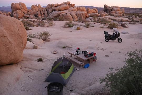 Cooking on the road is also important. The MSR Whisperlight stove has been unstoppable and seems to be the go-to product for long distance travel. Paired with the MSR liquid fuel bottle, it can burn any fuel, and is pretty much hassle-free with the right maintenance. We do also carry an extra fuel pump, just in case the original acts up.
Water sources abroad are not always the cleanest, so to filter the muck, toxic minerals, and E-coli out, we use a Survivor Filter. Make sure you bring extra filters with you, after a year of use the filters need to be changed. But from cooking to making the essence of life, coffee, it has served us very well and kept us healthy. For extended camping, we just fill up our 6 liter MSR Dromedary bag to have plenty of water on hand. To avoid snatch-and-grab would-be thieves while we walk around markets, or leave the bike unattended, we have two Big Panther carabiner locks with a metal bungie. We use them to secure our helmets, boots, and jackets to the bike. I also put a Grip Lock on the break lever so no one can push the motorcycle from where I left it. Both of these cheap deterrents help prevent people from snagging our stuff. A lot of people see our Hip Bags in photos and ask, "Where did we get those from?" We bought them cheap on Amazon, and there are plenty to choose from. They are great as a purse around Marisa's shoulder, and then strapped to her leg while on the road. I keep my smokes, stickers, and other loose items inside that are constantly needed to be within arms reach. The "They have been really good" List As a middleweight camera, not a DSLR but not a standard point and shoot, the Panasonic Lumix G7 4k mirrorless camera has been an amazing piece of hardware that has captured all of the great images that we have taken along the way. I love this camera.
  For "action" videos, we splurged and bought a GoPro Hero6 (I know, it's expensive, but man is it worth it). It takes amazing footage and is much more reliable than the cheaper $100 range action cameras, two of which we went through before purchasing the GoPro. Plus, it has amazing stabilization and slow-motion.To save all of the pics and vids, we wanted a solid-state external hard drive. We had purchased the standard disk drives, and they failed us. You definitely do not want that happening and loosing all of your glorious footage!!! We bought a MyDigital SSD drive, and it has served us flawlessly. For a smaller, more portable thumb-drive, we each have a Samsung 128 gig flash drive. It is perfect for saving documents and other easier access items quickly, and is unbelievably small. To upload all the images, and create our movies from all of our footage, we also wanted a SSD computer. Splurge #2... we bought a Macbook Air. With the bonus of iMovie, I am very happy with all of its capabilities, and knowing that it can bounce around and still function like the day we got it. Communication and tracking is both important to us as well as to our families, so we bought a Garmin inReach Explorer. With our data plan, we've been able to track our journey every turn of the wheel. We can also text (SMS) from anywhere in the world. And if something horrible were to happen, there is also an SOS button that will send the troops directly to our location. I think it's the best out there. I personally can vouch for each and every one of these items. Some things on this trip have fallen apart or have not served us well, but not these things. They are travel-tried and true, and I'm sure that it would make any adventure motorcyclist grin from ear to ear to unwrap one of these gifts.
Merry Christmas and Happy Holidays to everyone. Please let us know your experiences with the gear you use in your travels, and if you have any additional input on the items above.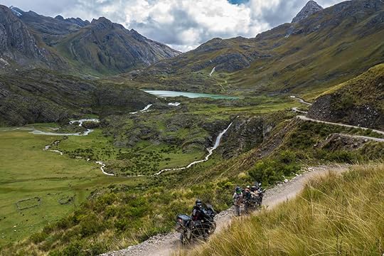
Stocking Stuffers Some great items that wont break the bank. We love them all, and some may call them "luxury" items... but we are glad to have them. The links to Amazon are highlighted in Green. Our G4Free chairs have been some of our favorite bonus items we have. From sitting down at campsites, on beaches, or even hours-long roadblocks, we have never regretted bringing these with us.
Navigation is key while riding, and keeping our phone (so much better than a dedicated GPS) locked in place is essential. After a bit of trial and error with other products, we bought the Perfect Squeeze, and it has kept our phone sturdily in place over potholes, river crossings, and every Latin American speed bump throughout our journey.  Phones... so expensive, even more so when waterproof. But, for our GPS-dedicated device, we needed one. The Kyocera Duraforce has been unbreakable. For less than a hundred bucks, and the addition of Google offline maps, OSM+, iOverlander, and Mapps.me, this is in my opinion the best navigation set-up there is. Waterproof, dust-proof, shock-proof, life-proof. And if stolen, you are only out ~$90.
Communication on the road is key. And even more so, music. We have the ever so popular Sena Bluetooth Headsets. We love them! Hours on the road have dramatically changed for the better when listening to anything from Guns and Roses to Jack Johnson. We can communicate with each other and also listen to our own music separately. In Marisa's case, it is one big epic movie soundtrack as she meanders around the world.
To charge all the nicknacks when we are wild camping multiple nights in a row, we bought an EasyAcc Portable Charger. It has four USB outlets, and we can charge both of our phones, and both or our Senas at the same time. Great investment. For emergencies only, we have a Rugged Geek Portable Jump Starter. We thankfully have never needed to use this on the trip, but it did successfully jump the bike back to life in the cold midwestern winters.
 Cooking on the road is also important. The MSR Whisperlight stove has been unstoppable and seems to be the go-to product for long distance travel. Paired with the MSR liquid fuel bottle, it can burn any fuel, and is pretty much hassle-free with the right maintenance. We do also carry an extra fuel pump, just in case the original acts up.
 Water sources abroad are not always the cleanest, so to filter the muck, toxic minerals, and E-coli out, we use a Survivor Filter. Make sure you bring extra filters with you, after a year of use the filters need to be changed. But from cooking to making the essence of life, coffee, it has served us very well and kept us healthy. For extended camping, we just fill up our 6 liter MSR Dromedary bag to have plenty of water on hand. To avoid snatch-and-grab would-be thieves while we walk around markets, or leave the bike unattended, we have two Big Panther carabiner locks with a metal bungie. We use them to secure our helmets, boots, and jackets to the bike. I also put a Grip Lock on the break lever so no one can push the motorcycle from where I left it. Both of these cheap deterrents help prevent people from snagging our stuff. A lot of people see our Hip Bags in photos and ask, "Where did we get those from?" We bought them cheap on Amazon, and there are plenty to choose from. They are great as a purse around Marisa's shoulder, and then strapped to her leg while on the road. I keep my smokes, stickers, and other loose items inside that are constantly needed to be within arms reach.
 The "They have been really good" List As a middleweight camera, not a DSLR but not a standard point and shoot, the Panasonic Lumix G7 4k mirrorless camera has been an amazing piece of hardware that has captured all of the great images that we have taken along the way. I love this camera. For "action" videos, we splurged and bought a GoPro Hero6 (I know, it's expensive, but man is it worth it). It takes amazing footage and is much more reliable than the cheaper $100 range action cameras, two of which we went through before purchasing the GoPro. Plus, it has amazing stabilization and slow-motion.To save all of the pics and vids, we wanted a solid-state external hard drive. We had purchased the standard disk drives, and they failed us. You definitely do not want that happening and loosing all of your glorious footage!!! We bought a MyDigital SSD drive, and it has served us flawlessly. For a smaller, more portable thumb-drive, we each have a Samsung 128 gig flash drive. It is perfect for saving documents and other easier access items quickly, and is unbelievably small. To upload all the images, and create our movies from all of our footage, we also wanted a SSD computer. Splurge #2... we bought a Macbook Air. With the bonus of iMovie, I am very happy with all of its capabilities, and knowing that it can bounce around and still function like the day we got it. Communication and tracking is both important to us as well as to our families, so we bought a Garmin inReach Explorer. With our data plan, we've been able to track our journey every turn of the wheel. We can also text (SMS) from anywhere in the world. And if something horrible were to happen, there is also an SOS button that will send the troops directly to our location. I think it's the best out there. I personally can vouch for each and every one of these items. Some things on this trip have fallen apart or have not served us well, but not these things. They are travel-tried and true, and I'm sure that it would make any adventure motorcyclist grin from ear to ear to unwrap one of these gifts.
Merry Christmas and Happy Holidays to everyone. Please let us know your experiences with the gear you use in your travels, and if you have any additional input on the items above.

December 3, 2018
Machu Picchu for Overlanders
By Marisa 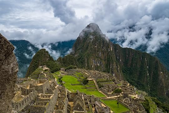 One of the seven wonders of the world and rightfully so, the lost Incan city of Machu Picchu is on many people's bucket list. But as picturesque, breathtaking, and mysterious as it is, in recent years it has become a tourist hot-spot, and an expensive one. And I'm not just talking about the ticket price. The Peruvian government knows that they can get more than twice the ticket cost out of every visitor because Machu Picchu is inaccessible by road, which forces everyone to take overpriced train rides there (from Ollantaytambo it's $45 per person one way, from Cusco it's $75 one way!).
For many people this is fine, as they have been saving up all year to spend a weekend in Peru seeing the sights, and the train is certainly the quickest and most comfortable way of getting to Machu Picchu. But for long-term travelers trying to keep to a budget, getting there can be such a headache and a dent in the wallet, that many are now missing it simply for the cost involved. And that is a real shame.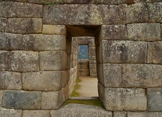 I'm not sure why the Inca liked trapezoid shapes so much, but it definitely looks cool. There are no group of travelers who find this more frustrating than overlanders: people who travel from country to country via their own vehicle. We are used to driving up to places, finding a parking spot, and calling it home for the day. We wake up to gorgeous sunrises over empty tourist sites as everyone else is sleeping back at their hotels, and we can get to places that no bus or train could ever go.
Unfortunately, this is not possible for Machu Picchu. In order to visit the site, we have to give up our vehicle, which is our home on wheels and is not something we do lightly. But the good news is that if you have a few days on your hands and are up for a hike, then there is a way to cut out the cost of the train rides.
This is what Tim and I did, along with our fellow motorcycle friend Aditya. We didn't invent this route and there are plenty of others who take it every day, but it's a complicated process, so I wanted to lay out in detail how we managed. Hopefully this can help and inspire anyone else who wants to visit one of the most difficult to get to, but rewarding wonders of the world. Step 1: Drive to Santa Teresa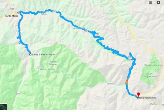 Santa Teresa is the closest town to Machu Picchu that you can get to by road (Aguas Calientes, a.k.a. Machu Picchu Pueblo, is at the base of the site's mountain but has no road going to it). To get to Santa Teresa from Cusco, we decided to stop by all the Incan sites along the way before the grand finale of Machu Picchu (if you're interested, a detailed blog about our own paved version of the “Inca Trail" is here).
The last real tourist outpost before Santa Teresa is Ollantaytambo, which is a lovely traditional Incan village with a set of ruins nearby, and also has a nice market. And since we knew things were going to get more expensive the closer we got to Machu Picchu, we bought three days' worth of food and supplies there before leaving.
From Ollantaytambo the road was paved and fast, going up into fairly high altitudes with snow-capped mountains on either side. That high up, the weather turned cold and rainy on us, but soon we dropped thousands of feet in elevation until we were in the heat of the humid Amazonian region. There was a lot of putting on, and taking off, rain gear and layers that day.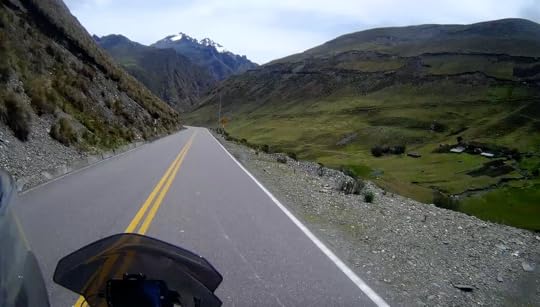 Just one of the many snow-tipped mountains of Abra de Málaga region, Peru. We hit the town of Santa Maria and turned our tires to Santa Teresa, where the asphalt became dirt. It's not that the dirt road was bad, it's that once it started winding narrowly along the sheer cliff edges with colectivo buses and local cars driving like madmen on the wrong side of the road (as usual), it felt a bit dangerous. We even saw a smashed car being towed up the cliff that had crashed way down in the valley. I'm not sure anyone who had been in that car could have made it out alive.
But if you do survive this road, then you'll easily get from Ollantaytambo to Santa Teresa in the same day.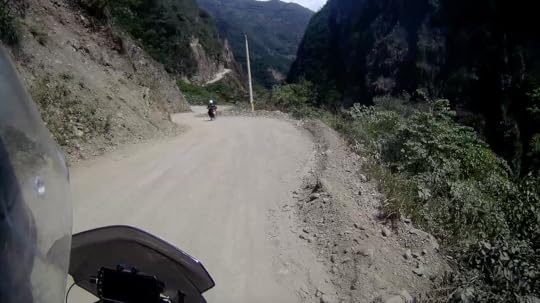 The cliffside road between Santa Maria and Santa Teresa, Peru. Santa Teresa has been recently built up for tourists doing this same trainride-skipping route, and we rightly assumed that things there would be a little pricey. So we stayed at a recommended hotel where we knew there was secure motorcycle parking (Hospedaje Miel) and were easily able to talk the owner down to 20 Soles a person per night (~$6) and no charge for parking. Not too bad at all. Step 2: Get to Hydroelectrica Unfortunately, this is where we said goodbye to our bikes, and took a colectivo car to a train station called Hidroelectrica for 5 Soles a person (~$1.50). That is the going rate, and to make things even easier, the hotel owner called up a colectivo to come and pick us up, but you can find them waiting around the town square as well.
Colectivos are usually white taxis and vans that take people to places as a public service. But this means they may not leave until they fill up, and it can become a game of patience to see who will break first: either they'll leave without being full, or you'll pay for the empty seats. As motorcycle overlanders, we were not used to this game, and I found it frustrating, but we did our best to be patient.
Our driver to Hidroelectrica was fine (I don't even want to talk about the driver back, he was a nightmare), but to save yourself the hassle, you can drive to Hidroelectrica yourself if you want. And if you have a car or RV-type setup that locks and is secure, you'll probably want to. But Hidroelectrica is a bustling parking lot with people coming in and out all day, and we did not feel comfortable leaving our bikes there. Step 3: Walk the Tracks to Aguas Calientes As mentioned before, Machu Picchu and its nearby town of Aguas Calientes is only accessible by train. So since we decided we were not going to purchase expensive train tickets, that meant we had to walk the tracks instead.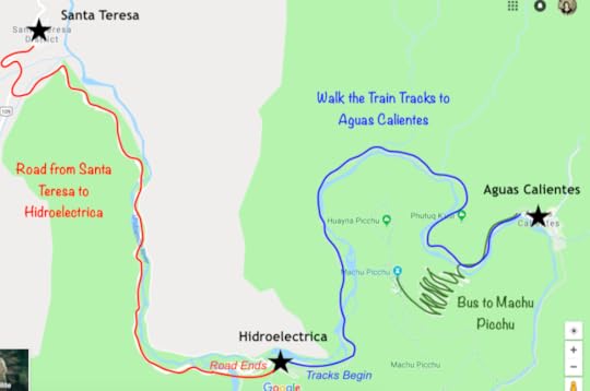 We reserved a day for this hike and I'm glad we did because it took us 4 hours to get from Hidroelectrica to Aguas Calientes (this included lots of rest stops, picture ops, and a lunch break). The tracks sloped slightly upwards the whole time, so getting there was a bit worse and coming back only took us 3 hours.
 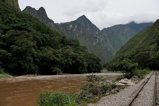 The beautiful scenery around the Urubamba River, Peru. Because of the gradual incline, it's not a difficult hike, but the loose railroad rocks get wearisome on the soles and ankles. Plus, it's definitely hot jungle out there. I got bit by mosquitoes and sand flies along the way, so dress appropriately and pack some bug spray.
Amazingly, there are tons of other people hiking along the tracks as well (they either take buses to Santa Maria and then transfer to Hidroelectrica, or they get bused in to Hidroelectrica directly from their hostel). And there are even stores built beside the tracks, campgrounds, and restaurants selling burgers, cold beers, and ice cream! Some of what they're selling isn't all that expensive, so even though we packed everything we'd need, it's good to know we were never too far from affordable provisions.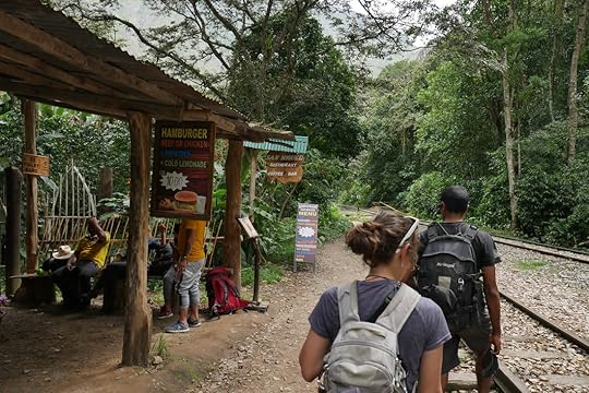 One of the many stores along the tracks. About every hour or so, the expensive train going to and from Santa Teresa would pass, which was a great opportunity to get some Peruvian Soles coins smashed on the tracks as souvenirs.
The last bit of the hike turned away from the tracks and headed up to Aguas Calientes, and was the steepest part of the trek. Once in town, we walked along the thoroughfare until we found a cheap hostel for the night. No reservation was needed, but we came in the low season (Dec-Feb).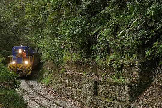 The train coming from Santa Teresa to Aguas Calientes. Step 4: Buy Your Tickets In the high season (June-Sep), it might be preferable to purchase your Machu Picchu tickets way ahead of time in Cusco or even online. There are also a couple of paid trails that you can buy with your ticket (Huayna Picchu Mountain and Machu Picchu Mountain), and these should be gotten early because they sell out quick. But because we were in the off season, we had no problems getting tickets the day before, and even those hikes which are normally sold out months in advance were available.
The Machu Picchu ticket office in Aguas Calientes is open until 10 PM, and the cost was 152 Soles a person (~$45) without the extra hikes. Be warned, they were only taking cash in Soles when we went, and we had to each present our passport when purchasing the tickets.
Finally, we headed over to the bus ticket office.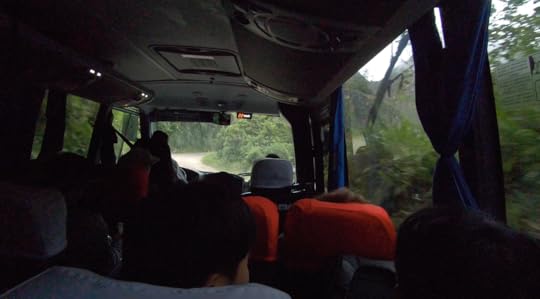 The bus ride up to Machu Picchu. To take the bus up to Machu Picchu or not to take the bus, that is the question!
So there are buses that leave Aguas Calientes and bring you up to Machu Picchu or back down every 10 minutes all day long, starting at 5:30 AM. It takes about 25 minutes and costs $12 each way (you must buy these tickets the day before and only from Aguas Calientes at this office, closes at 9:00 PM). But there is also a trail that runs straight up the side of the mountain, and many people swear by the unforgettable experience of actually hiking up to Machu Picchu.
Because I had recently hurt my foot in a fall, I knew I was taking the bus, at least for the ride up. But Tim and Aditya weren't sure which would get to Machu Picchu first, the hikers or the bus? Being at Machu Picchu for sunrise and before it got full of tour groups was extremely important to us. And even though the hike supposedly took an hour or more, hikers were allowed to start the climb a half hour earlier than the buses. And while they said the first bus would leave at 5:30, would we get on the first bus? And even if we did, would it really leave on time? After all, this is Peru.
So what to do? Step 5: Get up the Mountain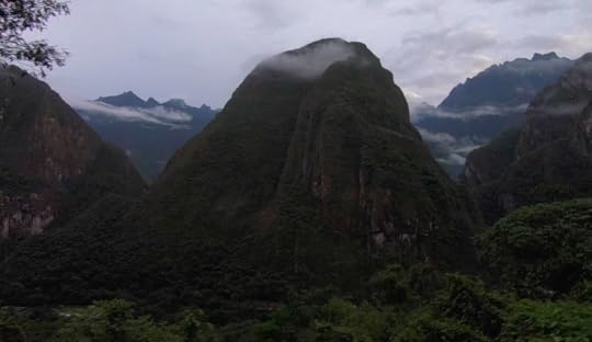 View from the window of the bus going up to Machu Picchu. In the end, we decided to stick together and all take the bus up, but to save on costs, we'd walk back down. So after buying our tickets the night prior, we woke up at 4:00 AM, got into the bus line by 4:30 which had already started forming (it's first come, first serve), and were able to get onto the third bus out. And most amazingly, it actually left at 5:28 (most punctual thing in Peru!), and we were at Machu Picchu by the time the gates opened at 6:00.
We ended up being very happy with this decision to take the bus up as we saw plenty of hikers along the road staring at us with forlorn expressions. Maybe they were simply catching their breath from the grueling hike, or maybe they just hated watching busloads of tourists beating them up there. But I'm pretty sure not a single hiker could have gotten up the mountain before the buses.
That being said, if hiking up to Machu Picchu is your dream, then don't let me talk you out of it. Not only is it cheaper, but I'm sure it is much more rewarding and impactful to arrive via your own two feet. Some people say it was what made their time at Machu Picchu particularly special. Step 6: Enjoy!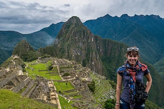 Me fulfilling my dream of standing in front of the might and beauty of Machu Picchu, Peru. At the main gate, we checked in some baggage for 5 Soles (~$1.50), and showed our passports and tickets to get in (don't forget your passport!). This is also the only place with bathrooms in the park, and it costs 2 Soles (~$0.60). The women's line was of course super long, and I felt bad for them because they were all missing getting pictures of Machu Picchu at sunrise because they had to pee.
Big duffle bags or backpacker packs are not allowed into the park, and many people were forced to check them in. But day backpacks seemed to be fine. And food, walking poles, and selfie sticks are technically not allowed either, but if it's hidden in your bag, you should have no problem.
Once inside the gates, we were confronted with the postcard view of Machu Picchu that everyone loves. Thankfully, the Inca built terraces that are perfect selfie-taking platforms where everyone can all spread out and take pictures of the same view (well planned, Inca!). We climbed up to the House of the Guardian and the Funerary Rock to get some elevation for our shots, and it was as perfect as I could have ever hoped.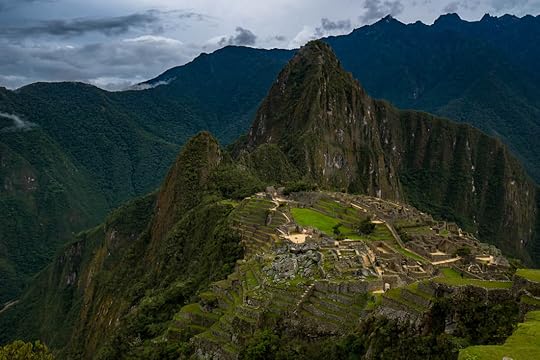
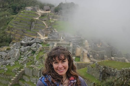 It's real early in the morning, but I'm super happy to be at Machu Picchu. After a few minutes, tendrils of mist and clouds started tickling the mountaintop of Huayna Picchu, and tumbling down the sides while the further mountains crowned the whole scene. It was mysterious, it was majestic, and most of all, I had the feeling that I had walked into another world, or stepped back in time. It was indescribable.
 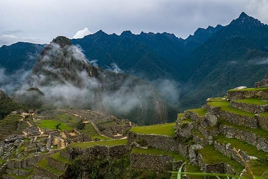 Walking around Machu Picchu is actually a one-way circuit, and going backwards is forbidden. So plan your route ahead of time and where you need to be when, because it's hard to get back if you've missed something.
There are two paid hikes that you have to buy with your ticket if you want to do them: Huayna Picchu and Machu Picchu Mountain, and then there are two free ones: Inca Bridge and Sun Gate. Huayna Picchu is the steep peak you see behind the ruins in every picture, and it's the most difficult hike in the park, usually taking many hours to complete. Machu Picchu Mountain is behind where everyone takes pictures, and it's not as strenuous, but offers fantastic views of the ruins below. I've heard the extra cost of these treks is 24 Soles each (~$7.50).
For both of these you can choose when buying your tickets between going at 7:00 or 10:00. People have said good and bad things about both timings, but many people claim that it's too foggy at 7:00 AM to see anything on top of those peaks, so 10:00 may be better. Needless to say, because of my foot, we did not do either of these hikes.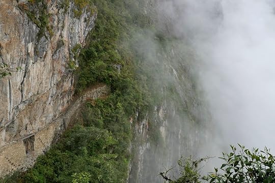 The Inca Bridge of wooden planks across a narrow stone path to Machu Picchu. But we did go down the Inca Bridge Trail to what was a wooden drawbridge of sorts that the Inca could raise to make it difficult for anyone to invade (the actual bridge is closed off because it's dangerous, but you can see it from the path). The hike was lovely, and it was one of my favorite parts of Machu Picchu because there was almost no one there, the fog was rolling around us in clumps and gaps, and it was peaceful and silent, except for bird calls. The Inca Bridge walk was easy and magical, and it only took a half hour for us to complete.
Afterwards, we made our way down through the ruins of Machu Picchu along with the rest of the tourists, which was starting to become more like a moving herd of people.
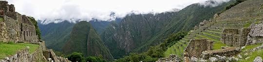
 The one-way track around the ruins of Machu Picchu. If you can imagine that the route through Machu Picchu is shaped like an oval, then you are starting on the left side and you come back on the right. And they say to take your time through the left side because it is the ceremonial and temple side, whereas the right has only residential buildings. So that is precisely what we did.
  Intihuatana: The Sundial Stone. The backside of it was chipped in 2000 from a crane accident while filming a beer commercial. Saddest story ever. By the time we got to the residential side, we knew there wasn't much left to do, so we sat in a grassy house and ate a packed lunch while soaking in the fact that we were relaxing in the old house of some long gone Machu Picchu resident. Amazing.
One of the last things on the route was the Temple of the Condor with a large condor sculpture on the ground (I needed to use my imagination a bit), and then we were out of the park. We made sure we didn't forget to have our passports stamped with the Machu Picchu stamp right as we exited. In the low season, it was easy for us to find an empty building to have a picnic in with no one else around. As we were leaving at 10:00, we noticed hoards of people coming in who had all probably taken the train from Cusco. Good thing we didn't do that! It seemed like midday was going to be a busy, jam-packed time at Machu Picchu.
In total, we spent about four hours in the park and felt very satisfied with our time there. Those who do Huayna Picchu hikes and other trails might spend all day there. Step 7: Reverse it all back to Santa Teresa We had completed our tour of Machu Picchu, but our day was far from over. This is because we were a little stressed for time, and had decided to hike down the mountain and then immediately back along the tracks to Hidroelectrica. So we got our bags out of the luggage check, and headed to the trail that zig-zagged down the mountain.
The hike down was fine, though some of those stone steps are huge and I just could not imagine having to climb up it. Bravo to anyone who does!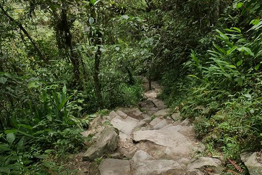 The trail down Machu Picchu. Personally, I was happy we hadn't taken it up. At the bottom of the mountain, if you turn left down the road there is the Machu Picchu Museum which you can go to for 22 Soles (~$6.50). It's small, but is supposed to be a hidden gem that no one knows about. Next to it is a botanical garden which is allegedly free when presenting your Machu Picchu ticket. Unfortunately, we were so rushed, we missed out on both these things.
If I had to do it all again, and did not have the time crunch, I would reserve a day for hiking the railroad tracks in, a day for Machu Picchu, and then another full day for walking the tracks back to Hidroelectrica. For Tim and Aditya, doing the park and the train tracks in one day was fine, but for me and my recovering foot, I was in a bit of pain by the end of it all. Plus, my legs felt like iron the next day. So it's all up to your personal preference, and being back with our bikes in Santa Teresa that night was definitely doable. But I would have preferred a more relaxed time-frame where I could've enjoyed the scenery a bit better.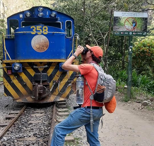 Don't be like this unobservant tourist. So is it worth it? For me, it definitely was. But everyone has their own experience, and if it was the high season and the weather was either hot and miserable or rainy and miserable, then I may have come to a different conclusion. But by hiking in along the tracks and not spending money on the train, even if the experience ended up being less-than-perfect, at least I'd know that I didn't break the bank doing it.
Safe journeys to all, and I hope if that you ever enter the magical world of Machu Picchu, you find it as gloriously mysterious and enticing as I did.
One of the seven wonders of the world and rightfully so, the lost Incan city of Machu Picchu is on many people's bucket list. But as picturesque, breathtaking, and mysterious as it is, in recent years it has become a tourist hot-spot, and an expensive one. And I'm not just talking about the ticket price. The Peruvian government knows that they can get more than twice the ticket cost out of every visitor because Machu Picchu is inaccessible by road, which forces everyone to take overpriced train rides there (from Ollantaytambo it's $45 per person one way, from Cusco it's $75 one way!).For many people this is fine, as they have been saving up all year to spend a weekend in Peru seeing the sights, and the train is certainly the quickest and most comfortable way of getting to Machu Picchu. But for long-term travelers trying to keep to a budget, getting there can be such a headache and a dent in the wallet, that many are now missing it simply for the cost involved. And that is a real shame.
 I'm not sure why the Inca liked trapezoid shapes so much, but it definitely looks cool. There are no group of travelers who find this more frustrating than overlanders: people who travel from country to country via their own vehicle. We are used to driving up to places, finding a parking spot, and calling it home for the day. We wake up to gorgeous sunrises over empty tourist sites as everyone else is sleeping back at their hotels, and we can get to places that no bus or train could ever go.
Unfortunately, this is not possible for Machu Picchu. In order to visit the site, we have to give up our vehicle, which is our home on wheels and is not something we do lightly. But the good news is that if you have a few days on your hands and are up for a hike, then there is a way to cut out the cost of the train rides.
This is what Tim and I did, along with our fellow motorcycle friend Aditya. We didn't invent this route and there are plenty of others who take it every day, but it's a complicated process, so I wanted to lay out in detail how we managed. Hopefully this can help and inspire anyone else who wants to visit one of the most difficult to get to, but rewarding wonders of the world. Step 1: Drive to Santa Teresa
 Santa Teresa is the closest town to Machu Picchu that you can get to by road (Aguas Calientes, a.k.a. Machu Picchu Pueblo, is at the base of the site's mountain but has no road going to it). To get to Santa Teresa from Cusco, we decided to stop by all the Incan sites along the way before the grand finale of Machu Picchu (if you're interested, a detailed blog about our own paved version of the “Inca Trail" is here).
The last real tourist outpost before Santa Teresa is Ollantaytambo, which is a lovely traditional Incan village with a set of ruins nearby, and also has a nice market. And since we knew things were going to get more expensive the closer we got to Machu Picchu, we bought three days' worth of food and supplies there before leaving.
From Ollantaytambo the road was paved and fast, going up into fairly high altitudes with snow-capped mountains on either side. That high up, the weather turned cold and rainy on us, but soon we dropped thousands of feet in elevation until we were in the heat of the humid Amazonian region. There was a lot of putting on, and taking off, rain gear and layers that day.
 Just one of the many snow-tipped mountains of Abra de Málaga region, Peru. We hit the town of Santa Maria and turned our tires to Santa Teresa, where the asphalt became dirt. It's not that the dirt road was bad, it's that once it started winding narrowly along the sheer cliff edges with colectivo buses and local cars driving like madmen on the wrong side of the road (as usual), it felt a bit dangerous. We even saw a smashed car being towed up the cliff that had crashed way down in the valley. I'm not sure anyone who had been in that car could have made it out alive.
But if you do survive this road, then you'll easily get from Ollantaytambo to Santa Teresa in the same day.
 The cliffside road between Santa Maria and Santa Teresa, Peru. Santa Teresa has been recently built up for tourists doing this same trainride-skipping route, and we rightly assumed that things there would be a little pricey. So we stayed at a recommended hotel where we knew there was secure motorcycle parking (Hospedaje Miel) and were easily able to talk the owner down to 20 Soles a person per night (~$6) and no charge for parking. Not too bad at all. Step 2: Get to Hydroelectrica Unfortunately, this is where we said goodbye to our bikes, and took a colectivo car to a train station called Hidroelectrica for 5 Soles a person (~$1.50). That is the going rate, and to make things even easier, the hotel owner called up a colectivo to come and pick us up, but you can find them waiting around the town square as well.
Colectivos are usually white taxis and vans that take people to places as a public service. But this means they may not leave until they fill up, and it can become a game of patience to see who will break first: either they'll leave without being full, or you'll pay for the empty seats. As motorcycle overlanders, we were not used to this game, and I found it frustrating, but we did our best to be patient.
Our driver to Hidroelectrica was fine (I don't even want to talk about the driver back, he was a nightmare), but to save yourself the hassle, you can drive to Hidroelectrica yourself if you want. And if you have a car or RV-type setup that locks and is secure, you'll probably want to. But Hidroelectrica is a bustling parking lot with people coming in and out all day, and we did not feel comfortable leaving our bikes there. Step 3: Walk the Tracks to Aguas Calientes As mentioned before, Machu Picchu and its nearby town of Aguas Calientes is only accessible by train. So since we decided we were not going to purchase expensive train tickets, that meant we had to walk the tracks instead.
 We reserved a day for this hike and I'm glad we did because it took us 4 hours to get from Hidroelectrica to Aguas Calientes (this included lots of rest stops, picture ops, and a lunch break). The tracks sloped slightly upwards the whole time, so getting there was a bit worse and coming back only took us 3 hours.
  The beautiful scenery around the Urubamba River, Peru. Because of the gradual incline, it's not a difficult hike, but the loose railroad rocks get wearisome on the soles and ankles. Plus, it's definitely hot jungle out there. I got bit by mosquitoes and sand flies along the way, so dress appropriately and pack some bug spray.
Amazingly, there are tons of other people hiking along the tracks as well (they either take buses to Santa Maria and then transfer to Hidroelectrica, or they get bused in to Hidroelectrica directly from their hostel). And there are even stores built beside the tracks, campgrounds, and restaurants selling burgers, cold beers, and ice cream! Some of what they're selling isn't all that expensive, so even though we packed everything we'd need, it's good to know we were never too far from affordable provisions.
 One of the many stores along the tracks. About every hour or so, the expensive train going to and from Santa Teresa would pass, which was a great opportunity to get some Peruvian Soles coins smashed on the tracks as souvenirs.
The last bit of the hike turned away from the tracks and headed up to Aguas Calientes, and was the steepest part of the trek. Once in town, we walked along the thoroughfare until we found a cheap hostel for the night. No reservation was needed, but we came in the low season (Dec-Feb).
 The train coming from Santa Teresa to Aguas Calientes. Step 4: Buy Your Tickets In the high season (June-Sep), it might be preferable to purchase your Machu Picchu tickets way ahead of time in Cusco or even online. There are also a couple of paid trails that you can buy with your ticket (Huayna Picchu Mountain and Machu Picchu Mountain), and these should be gotten early because they sell out quick. But because we were in the off season, we had no problems getting tickets the day before, and even those hikes which are normally sold out months in advance were available.
The Machu Picchu ticket office in Aguas Calientes is open until 10 PM, and the cost was 152 Soles a person (~$45) without the extra hikes. Be warned, they were only taking cash in Soles when we went, and we had to each present our passport when purchasing the tickets.
Finally, we headed over to the bus ticket office.
 The bus ride up to Machu Picchu. To take the bus up to Machu Picchu or not to take the bus, that is the question!
So there are buses that leave Aguas Calientes and bring you up to Machu Picchu or back down every 10 minutes all day long, starting at 5:30 AM. It takes about 25 minutes and costs $12 each way (you must buy these tickets the day before and only from Aguas Calientes at this office, closes at 9:00 PM). But there is also a trail that runs straight up the side of the mountain, and many people swear by the unforgettable experience of actually hiking up to Machu Picchu.
Because I had recently hurt my foot in a fall, I knew I was taking the bus, at least for the ride up. But Tim and Aditya weren't sure which would get to Machu Picchu first, the hikers or the bus? Being at Machu Picchu for sunrise and before it got full of tour groups was extremely important to us. And even though the hike supposedly took an hour or more, hikers were allowed to start the climb a half hour earlier than the buses. And while they said the first bus would leave at 5:30, would we get on the first bus? And even if we did, would it really leave on time? After all, this is Peru.
So what to do? Step 5: Get up the Mountain
 View from the window of the bus going up to Machu Picchu. In the end, we decided to stick together and all take the bus up, but to save on costs, we'd walk back down. So after buying our tickets the night prior, we woke up at 4:00 AM, got into the bus line by 4:30 which had already started forming (it's first come, first serve), and were able to get onto the third bus out. And most amazingly, it actually left at 5:28 (most punctual thing in Peru!), and we were at Machu Picchu by the time the gates opened at 6:00.
We ended up being very happy with this decision to take the bus up as we saw plenty of hikers along the road staring at us with forlorn expressions. Maybe they were simply catching their breath from the grueling hike, or maybe they just hated watching busloads of tourists beating them up there. But I'm pretty sure not a single hiker could have gotten up the mountain before the buses.
That being said, if hiking up to Machu Picchu is your dream, then don't let me talk you out of it. Not only is it cheaper, but I'm sure it is much more rewarding and impactful to arrive via your own two feet. Some people say it was what made their time at Machu Picchu particularly special. Step 6: Enjoy!
 Me fulfilling my dream of standing in front of the might and beauty of Machu Picchu, Peru. At the main gate, we checked in some baggage for 5 Soles (~$1.50), and showed our passports and tickets to get in (don't forget your passport!). This is also the only place with bathrooms in the park, and it costs 2 Soles (~$0.60). The women's line was of course super long, and I felt bad for them because they were all missing getting pictures of Machu Picchu at sunrise because they had to pee.
Big duffle bags or backpacker packs are not allowed into the park, and many people were forced to check them in. But day backpacks seemed to be fine. And food, walking poles, and selfie sticks are technically not allowed either, but if it's hidden in your bag, you should have no problem.
Once inside the gates, we were confronted with the postcard view of Machu Picchu that everyone loves. Thankfully, the Inca built terraces that are perfect selfie-taking platforms where everyone can all spread out and take pictures of the same view (well planned, Inca!). We climbed up to the House of the Guardian and the Funerary Rock to get some elevation for our shots, and it was as perfect as I could have ever hoped.

 It's real early in the morning, but I'm super happy to be at Machu Picchu. After a few minutes, tendrils of mist and clouds started tickling the mountaintop of Huayna Picchu, and tumbling down the sides while the further mountains crowned the whole scene. It was mysterious, it was majestic, and most of all, I had the feeling that I had walked into another world, or stepped back in time. It was indescribable.
  Walking around Machu Picchu is actually a one-way circuit, and going backwards is forbidden. So plan your route ahead of time and where you need to be when, because it's hard to get back if you've missed something.
There are two paid hikes that you have to buy with your ticket if you want to do them: Huayna Picchu and Machu Picchu Mountain, and then there are two free ones: Inca Bridge and Sun Gate. Huayna Picchu is the steep peak you see behind the ruins in every picture, and it's the most difficult hike in the park, usually taking many hours to complete. Machu Picchu Mountain is behind where everyone takes pictures, and it's not as strenuous, but offers fantastic views of the ruins below. I've heard the extra cost of these treks is 24 Soles each (~$7.50).
For both of these you can choose when buying your tickets between going at 7:00 or 10:00. People have said good and bad things about both timings, but many people claim that it's too foggy at 7:00 AM to see anything on top of those peaks, so 10:00 may be better. Needless to say, because of my foot, we did not do either of these hikes.
 The Inca Bridge of wooden planks across a narrow stone path to Machu Picchu. But we did go down the Inca Bridge Trail to what was a wooden drawbridge of sorts that the Inca could raise to make it difficult for anyone to invade (the actual bridge is closed off because it's dangerous, but you can see it from the path). The hike was lovely, and it was one of my favorite parts of Machu Picchu because there was almost no one there, the fog was rolling around us in clumps and gaps, and it was peaceful and silent, except for bird calls. The Inca Bridge walk was easy and magical, and it only took a half hour for us to complete.
Afterwards, we made our way down through the ruins of Machu Picchu along with the rest of the tourists, which was starting to become more like a moving herd of people.

 The one-way track around the ruins of Machu Picchu. If you can imagine that the route through Machu Picchu is shaped like an oval, then you are starting on the left side and you come back on the right. And they say to take your time through the left side because it is the ceremonial and temple side, whereas the right has only residential buildings. So that is precisely what we did.
  Intihuatana: The Sundial Stone. The backside of it was chipped in 2000 from a crane accident while filming a beer commercial. Saddest story ever. By the time we got to the residential side, we knew there wasn't much left to do, so we sat in a grassy house and ate a packed lunch while soaking in the fact that we were relaxing in the old house of some long gone Machu Picchu resident. Amazing.
One of the last things on the route was the Temple of the Condor with a large condor sculpture on the ground (I needed to use my imagination a bit), and then we were out of the park. We made sure we didn't forget to have our passports stamped with the Machu Picchu stamp right as we exited.
 In the low season, it was easy for us to find an empty building to have a picnic in with no one else around. As we were leaving at 10:00, we noticed hoards of people coming in who had all probably taken the train from Cusco. Good thing we didn't do that! It seemed like midday was going to be a busy, jam-packed time at Machu Picchu.
In total, we spent about four hours in the park and felt very satisfied with our time there. Those who do Huayna Picchu hikes and other trails might spend all day there.
 Step 7: Reverse it all back to Santa Teresa We had completed our tour of Machu Picchu, but our day was far from over. This is because we were a little stressed for time, and had decided to hike down the mountain and then immediately back along the tracks to Hidroelectrica. So we got our bags out of the luggage check, and headed to the trail that zig-zagged down the mountain.
The hike down was fine, though some of those stone steps are huge and I just could not imagine having to climb up it. Bravo to anyone who does!
 The trail down Machu Picchu. Personally, I was happy we hadn't taken it up. At the bottom of the mountain, if you turn left down the road there is the Machu Picchu Museum which you can go to for 22 Soles (~$6.50). It's small, but is supposed to be a hidden gem that no one knows about. Next to it is a botanical garden which is allegedly free when presenting your Machu Picchu ticket. Unfortunately, we were so rushed, we missed out on both these things.
If I had to do it all again, and did not have the time crunch, I would reserve a day for hiking the railroad tracks in, a day for Machu Picchu, and then another full day for walking the tracks back to Hidroelectrica. For Tim and Aditya, doing the park and the train tracks in one day was fine, but for me and my recovering foot, I was in a bit of pain by the end of it all. Plus, my legs felt like iron the next day. So it's all up to your personal preference, and being back with our bikes in Santa Teresa that night was definitely doable. But I would have preferred a more relaxed time-frame where I could've enjoyed the scenery a bit better.
 Don't be like this unobservant tourist. So is it worth it? For me, it definitely was. But everyone has their own experience, and if it was the high season and the weather was either hot and miserable or rainy and miserable, then I may have come to a different conclusion. But by hiking in along the tracks and not spending money on the train, even if the experience ended up being less-than-perfect, at least I'd know that I didn't break the bank doing it.
Safe journeys to all, and I hope if that you ever enter the magical world of Machu Picchu, you find it as gloriously mysterious and enticing as I did.
December 2, 2018
Dec. 2, 2018 - Inca-redible
By Marisa 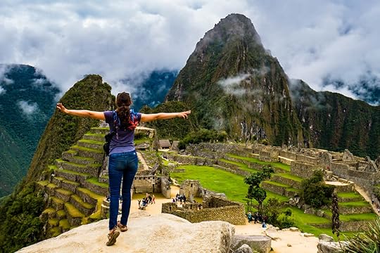 In the 15th century, it was the largest empire in the world, and it still captures the hearts and minds of people today. Though the Inca Empire didn't last long, it made its mark on South America by reshaping the landscape and creating structures that are still marveled at by people from around the globe.
Getting up-close and personal to Peru's Incan past has been a dream of mine since I was a child. And now that Tim and I finally found ourselves in Cusco, the old Incan capital, I could just feel the excitement mounting inside me. I wanted to see and experience it all.
And so we made a plan. Our Paved "Inca Trail" Machu Picchu is of course Peru's big ticket tourist attraction, and probably the most famous Incan settlement on earth. But Tim and I decided that we were going to see Peru's other Incan sites first and save Machu Picchu for last. This turned out to be great, as it felt like everything we were seeing was leading up to the finale of this spectacular lost city of the Inca. The route became our own sort of Inca Trail, but one we could do on our motorcycle.
So if you are interested in coming to Peru and have the time and means to do this, and if you also have the burning desire to see South American ruins as I do, then I would highly recommend taking this route.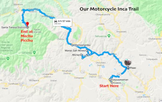 Above is a map of the gradual progression of ruins that we visited, starting in Cusco and ending in Machu Picchu. I would recommend at least six days for this, and that would give you enough time to absorb every site without being rushed or ruined-out.
We'd heard that in order to do all the sites on this route in the most cost-effective way, we first needed to buy a full boleto turistico (tourist ticket) from the COSITUC office in the historic center of Cusco (-13.518063, -71.978563). It cost us 130 Soles (~$39) per person, was valid for 10 days, and allowed us to get into all the major Incan sites around Cusco and some museums, but it did not cover Machu Picchu. That is a separate ticket, and if you are going in the high season (June-Sep) you may want to consider buying your Machu Picchu ticket in Cusco as well, as they sometimes sell out weeks in advance. Otherwise, you can buy it when you get to Machu Picchu Pueblo (Aguas Calientes), like we did.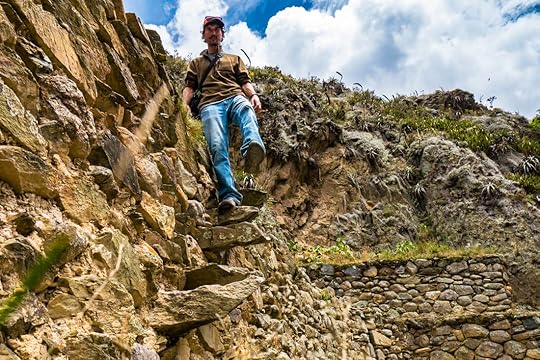 Tim going down some Incan steps that would not be up to modern safety standards. The boleto turistico is kind of expensive (at least when you are on a budget), and there are ways to see many great ruins without it. So if you want see some Incan sites while spending a little less cash, then read on, because I'll label which need the boleto, and also give you some tips on what you can see for next to nothing, or for free. Cusco We started off in the old Incan capital city, which is like a living ruin in and of itself. It's a touristy place, for sure, but well worth every moment spent meandering its quaint streets lined in Incan stonework and Spanish churches. You could spend a fortune here, but if you look hard enough, you can also find some great deals. And in all honesty, no matter what your budget is, Cusco seems to be a magical place for pretty much everyone.
 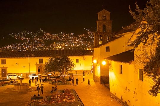 Cusco at night from the San Blas Mirador. As far as Incan construction goes, the crown jewel of the city is Qoricancha, the Incan ceremonial center that was later turned into a church by the Spanish conquerors. Though a lot of Incan work was lost, today there is still much of the original pre-hispanic walls left, and for only 15 Soles a person (~$4.20), it's definitely worth a peek inside.
 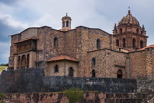 The Incan walls of Qoricancha, now under a Colonial Spanish church. Cusco, Peru. The boleto turistico does not give you access to Qoricancha, but it does allow you to go into the Qoricancha Museum which is located under the park by the main road in front. The ticket also includes three other museums in Cusco: the Museum of Popular Art, Regional History, and Contemporary Art, as well as access to the Pachacutiq Monument, two traditional villages near to Cusco (Tipón and Pikillacta), and a daily dance performance at the Native Music and Dance Center. We did not see these things, but our friends said they loved the dance performance. Sexy Woman and her Friends Saqsaywaman - included on the boleto Often called by foreigners “Sexy Woman," Saqsaywamán (SAAK-sai-wa-MAN) is actually an Incan fortress built on the hill overlooking Cusco. They say Cusco was designed to be in the shape of a puma, the sacred animal of the earth to the Inca, and Saqsaywamán was its head.
 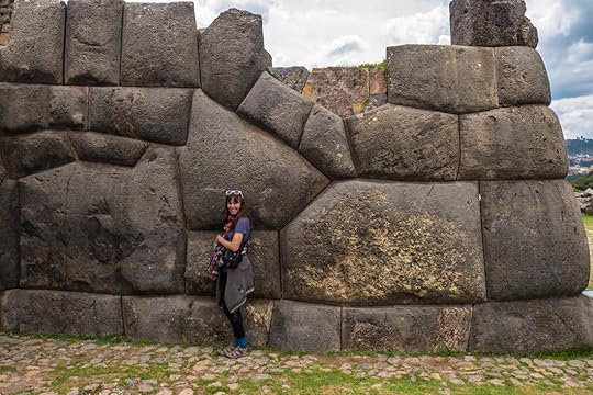 Me and the massive Incan stones of Saqsaywamán, Peru. Saqsaywamán is an expansive complex of impressive stonework with some of the largest boulders used for Incan walls in existence. You can even see the looming structures of Saqsaywamán from Cusco, and from the ruins you can get an incredible view of the city.
 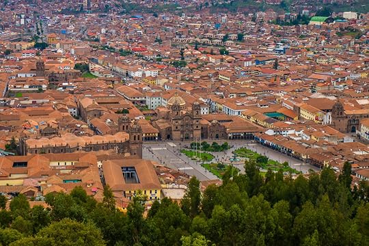 A view of Cusco from the nearby mountain ruins of Saqsaywamán. If you like walking uphill at high altitude (11,200 ft, 3,400 m), then you can hike up there for free from Cusco. But if you don't, then you can hire a cab like we did or take a bus. If you have your own vehicle, then take that, because the area surrounding Saqsaywamán is filled with other ruins which are pretty far apart for walking, but doable in one day by vehicle. We were definitely kicking ourselves for not bringing the bike when we went. Qenqo - included on the boleto A bit up the road from Saqsaywamán is Qenqo (KEN-ko), a temple carved out of a giant rock monolith, making it quite unique looking. And it has a bit of a sinister past as it was the site of human sacrifices.
  Apparently, the corpse of a baby sacrificed during Incan times was found here. Qenqo, Peru. Temple of the Moon - free Near Qenqo, there is a place called Templo de la Luna, which is an outcropping of rock with a trail that goes up it, and the area was supposedly dedicated to the mother Killa, or moon. If you're looking for free ruins, this is a great one, and you can even make a day trip by hiking around and exploring the other smaller free sites nearby.
  Some of the carvings around Temple of the Moon, near Qenqo, Peru. Puca Pucara - included on the boleto From there, it's either an hour walk up the road or a short bus ride to Puca Pucara (catch the blue and white Huerto bus for one Sol, which is $0.30). Puca Pucara (PU-ka pu-KA-ra) is a picturesque mountaintop fortress meaning red fort because of the red granite stones used. It is said that this outpost was built to protect Cusco from invading tribes coming from the Amazon region.
  The red fort of Puca Pucara, Peru. Tambomachay - included on the boleto
 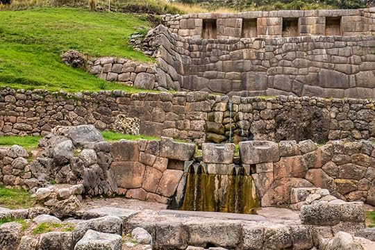 The Incan baths of Tambomachay, Peru. And finally, just a five minute walk from Puca Pucara is Tambomachay (TAM-bo-ma-CHAI), the last of the major Incan ruins near Saqsaywamán. It's also known as the “Bath of the Inca" because it has gorgeous fountains of trickling water, and may have served as a spa for the Incan elite.
You can do all these sites in a day as long as you have a vehicle, hire a cab, or take busses. Either that or you're a hiking athlete who's already climbed Everest twice. The Sacred Valley From Cusco to Machu Picchu, there is a nice paved road (mostly) that connects every major Incan ruin in a relatively straight line, starting with Pisac. Tim and I went out of order because we really wanted to meet up with our friends at Moray, which was super fun. But without that variable, I would go in order with Pisac first.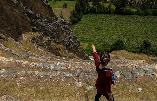 Me pointing at more ruins in the distance at Pisac, Sacred Valley, Peru. Pisac - included on the boleto There is a cute cobble-stoned village of Pisac (PEE-saak) at the base of the mountains that is famous for its traditional morning market, and then there are the nearby cliffside ruins of Pisac high up on the peaks. These are some of the most impressive ruins you'll ever see, and because they're perched at the top of rugged mountains, they offer spectacular views of the surrounding countryside.
 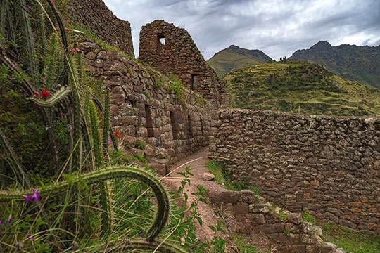 The mountaintop ruins of Pisac, Sacred Valley, Peru. The Inca sure loved stacking rocks in high-up places. The site is surprisingly large as I found that after every turn in the cliffs, it just kept going. There are baths, fountains, geometric terraces, altars, and a temple to the sun god, Inti. It has a bit of everything you could ever want out of Incan ruins, and if you are adventurous, there are even trails to go off to distant cliffside ruins that you can see from the main ones, and you would definitely be the only people there. Moray - included on the boleto These terraced concentric circles look like they were made by aliens, and I'm sure there are people out there who believe that. Moray (MO-rai) is a lot more impressive in person than in photos, because as you stand on the edge of these terraces, you can really appreciate the immensity and perfection of them.
 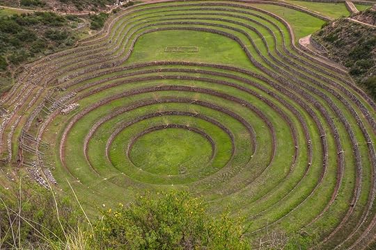 The bizarre and beautiful Incan terraces of Moray, Peru. Some say they were used for agricultural experimentation, but the truth is, nobody knows for sure why they were built. Maybe the Inca just wanted outsiders to see them and stand in awe at their magnificence.
The hike around the terraces shouldn't take more than 45 minutes, and if you don't like hiking, this is one of the few places that doesn't require lots of walking since you can park almost up to the edge and still get the full effect. The road here is dirt and goes through the cute village of Maras, a perfect place to stop for lunch. Maras Salinas - not included on the boleto, costs 10 Soles No more than a half hour away from Moray and past the town of Maras are the salt pools of Salinas, which is Spanish for saltworks. Originally, Tim and I had no intention of seeing a bunch of salt, but as our friends were camped there, we decided to go (camping overnight is free with entry). And I am so happy we did.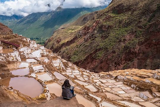 The Incan-made salt pools of Maras Salinas, Peru. The terraced evaporation pools were used by the Incas to collect salt from the salty stream that they ingeniously channeled onto each platform. It's strangely beautiful when the sun hits the shallow water, and the amount of work that went into converting this mountainside into their salt collection station is incredible.
The boleto turistico does not cover this site, but it costs only ten Soles to get in (~$3). And best of all, the bathrooms are stocked with toilet paper and paper towels, whoa! Ollantaytambo - included on the boleto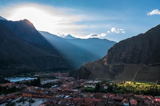 The traditional Incan village of Ollantaytambo at sunset, Sacred Valley, Peru. Ollantaytambo (o-YAN-tai-TAM-bo) is not to be missed whether you have the boleto turistico or not, as it is one of my favorite places in all of Peru, and maybe even all of South America. It is both an Incan town and Incan ruins, and the village itself (no charge to visit) is the best representation of Incan city planning that exists today. In a perfectly grid-like design of narrow pedestrian-only streets, and buildings built onto Incan stonework, Ollantaytambo has channels of bubbling water along every road that not only give the town its plumbing, but also an atmospheric sound that follows you everywhere.
 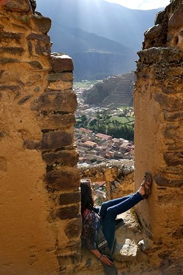 There is something incredibly peaceful and perfect about Ollantaytambo, Peru. Ollantaytambo is touristy, but I can forgive it for that because I don't blame anyone for wanting to go there, and then wanting to stay forever. And what's more, the village is flanked on either end by granite peaks jutting into the air with Incan ruins along their sides.
 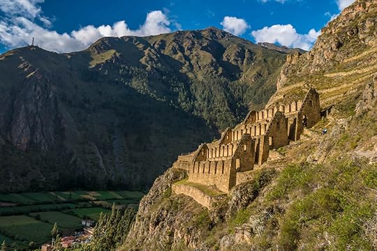 The steeply perched granaries of Pinkuylluna.
 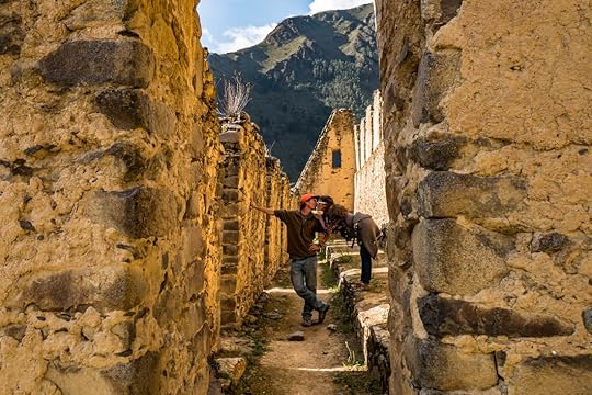 Tim and I catching a kiss in Pinkuylluna, at Oyantaytambo, Peru. (It was totally staged) One of these sites, the old Incan granaries called Pinkuylluna (PIN-kui-YU-na), is free to go to and offers fantastic views. The hike up is a bit strenuous, but once you're there, you will be thankful you made it to what are perhaps the most spectacular grain warehouses in the world.
 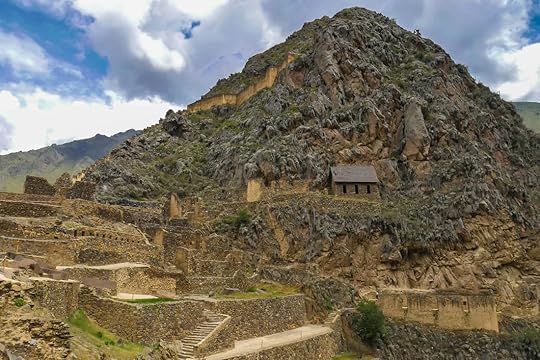 The Incan ruins of Ollantaytambo which overlook the village of Ollantaytambo, Sacred Valley, Peru. And then across town there are the main ruins of Ollantaytambo (boleto turistico required), complete with a fortress, temples, terraces, and baths. Climbing up into the fortress and seeing the Temple of the Sun with its calendar to judge the solstices was amazing enough. But my personal favorite part were the baths and buildings below the fort where channels of flowing river water made for heavenly fountains in every house. I could just see the Incan Emperor Pachacutiq admiring this masterpiece of his with complete pride.
  Ollantaytambo is an Incan paradise of running water, gardens, mountains, and impressive stone structures. Machu Picchu Finally, the literal pinnacle of all Incan ruins: Machu Picchu. It's not cheap to go there (the ticket alone is 152 Soles, ~$45), but it's one of those things you really must do when visiting Peru. I was actually quite worried about going because I'd heard that it had gotten so touristy, that it wasn't worth it. But Tim and I, and our motorcyclist friend Aditya who came with us (a.k.a. Mak), really lucked out.
Maybe it was because we went in the low season (Dec-Feb), or maybe it was because the weather was perfectly misty and mysterious. But my visit to Machu Picchu was everything I'd ever wanted and more. The misty glory of Machu Picchu, Peru. Because you can't actually get to Machu Picchu by road, it's one of the most complicated sites to visit, in my opinion. So I'm going to write a whole blog on how we did it with the motorcycle, and how we cut the costs of buying an expensive train ride (the cheapest of which is $45 per person from Ollantaytambo, one way, yikes!).
So stay tuned, and I hope I have inspired somebody out there to experience these incredible Incan sites for themselves. A Final Note One of the greatest things about visiting these Incan ruins was that we came to realize that even though the Inca Empire may be gone, the Inca people and their culture are still here. By riding along our paved version of the “Inca Trail", we came face to face with the Incan descendants who built these monuments, we heard them speak their soft and majestic language of Quechua, and we were dazzled by the colors of their textiles and the smells of their cooking. Even the rhythms of these people is not just in the traditional pan-pipe music you hear playing in the tourist shops, but in the modern music that popular Peruvian artists are still making.
So unlike Machu Picchu, the Incan way of life is not gone, it's not ruined, and it's not lost. It's here, it's alive, and in the land of the Inca, it's all around us.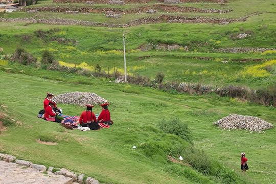
 In the 15th century, it was the largest empire in the world, and it still captures the hearts and minds of people today. Though the Inca Empire didn't last long, it made its mark on South America by reshaping the landscape and creating structures that are still marveled at by people from around the globe.
Getting up-close and personal to Peru's Incan past has been a dream of mine since I was a child. And now that Tim and I finally found ourselves in Cusco, the old Incan capital, I could just feel the excitement mounting inside me. I wanted to see and experience it all.
And so we made a plan. Our Paved "Inca Trail" Machu Picchu is of course Peru's big ticket tourist attraction, and probably the most famous Incan settlement on earth. But Tim and I decided that we were going to see Peru's other Incan sites first and save Machu Picchu for last. This turned out to be great, as it felt like everything we were seeing was leading up to the finale of this spectacular lost city of the Inca. The route became our own sort of Inca Trail, but one we could do on our motorcycle.
So if you are interested in coming to Peru and have the time and means to do this, and if you also have the burning desire to see South American ruins as I do, then I would highly recommend taking this route.
 Above is a map of the gradual progression of ruins that we visited, starting in Cusco and ending in Machu Picchu. I would recommend at least six days for this, and that would give you enough time to absorb every site without being rushed or ruined-out.
We'd heard that in order to do all the sites on this route in the most cost-effective way, we first needed to buy a full boleto turistico (tourist ticket) from the COSITUC office in the historic center of Cusco (-13.518063, -71.978563). It cost us 130 Soles (~$39) per person, was valid for 10 days, and allowed us to get into all the major Incan sites around Cusco and some museums, but it did not cover Machu Picchu. That is a separate ticket, and if you are going in the high season (June-Sep) you may want to consider buying your Machu Picchu ticket in Cusco as well, as they sometimes sell out weeks in advance. Otherwise, you can buy it when you get to Machu Picchu Pueblo (Aguas Calientes), like we did.
 Tim going down some Incan steps that would not be up to modern safety standards. The boleto turistico is kind of expensive (at least when you are on a budget), and there are ways to see many great ruins without it. So if you want see some Incan sites while spending a little less cash, then read on, because I'll label which need the boleto, and also give you some tips on what you can see for next to nothing, or for free. Cusco We started off in the old Incan capital city, which is like a living ruin in and of itself. It's a touristy place, for sure, but well worth every moment spent meandering its quaint streets lined in Incan stonework and Spanish churches. You could spend a fortune here, but if you look hard enough, you can also find some great deals. And in all honesty, no matter what your budget is, Cusco seems to be a magical place for pretty much everyone.
  Cusco at night from the San Blas Mirador. As far as Incan construction goes, the crown jewel of the city is Qoricancha, the Incan ceremonial center that was later turned into a church by the Spanish conquerors. Though a lot of Incan work was lost, today there is still much of the original pre-hispanic walls left, and for only 15 Soles a person (~$4.20), it's definitely worth a peek inside.
  The Incan walls of Qoricancha, now under a Colonial Spanish church. Cusco, Peru. The boleto turistico does not give you access to Qoricancha, but it does allow you to go into the Qoricancha Museum which is located under the park by the main road in front. The ticket also includes three other museums in Cusco: the Museum of Popular Art, Regional History, and Contemporary Art, as well as access to the Pachacutiq Monument, two traditional villages near to Cusco (Tipón and Pikillacta), and a daily dance performance at the Native Music and Dance Center. We did not see these things, but our friends said they loved the dance performance. Sexy Woman and her Friends Saqsaywaman - included on the boleto Often called by foreigners “Sexy Woman," Saqsaywamán (SAAK-sai-wa-MAN) is actually an Incan fortress built on the hill overlooking Cusco. They say Cusco was designed to be in the shape of a puma, the sacred animal of the earth to the Inca, and Saqsaywamán was its head.
  Me and the massive Incan stones of Saqsaywamán, Peru. Saqsaywamán is an expansive complex of impressive stonework with some of the largest boulders used for Incan walls in existence. You can even see the looming structures of Saqsaywamán from Cusco, and from the ruins you can get an incredible view of the city.
  A view of Cusco from the nearby mountain ruins of Saqsaywamán. If you like walking uphill at high altitude (11,200 ft, 3,400 m), then you can hike up there for free from Cusco. But if you don't, then you can hire a cab like we did or take a bus. If you have your own vehicle, then take that, because the area surrounding Saqsaywamán is filled with other ruins which are pretty far apart for walking, but doable in one day by vehicle. We were definitely kicking ourselves for not bringing the bike when we went. Qenqo - included on the boleto A bit up the road from Saqsaywamán is Qenqo (KEN-ko), a temple carved out of a giant rock monolith, making it quite unique looking. And it has a bit of a sinister past as it was the site of human sacrifices.
  Apparently, the corpse of a baby sacrificed during Incan times was found here. Qenqo, Peru. Temple of the Moon - free Near Qenqo, there is a place called Templo de la Luna, which is an outcropping of rock with a trail that goes up it, and the area was supposedly dedicated to the mother Killa, or moon. If you're looking for free ruins, this is a great one, and you can even make a day trip by hiking around and exploring the other smaller free sites nearby.
  Some of the carvings around Temple of the Moon, near Qenqo, Peru. Puca Pucara - included on the boleto From there, it's either an hour walk up the road or a short bus ride to Puca Pucara (catch the blue and white Huerto bus for one Sol, which is $0.30). Puca Pucara (PU-ka pu-KA-ra) is a picturesque mountaintop fortress meaning red fort because of the red granite stones used. It is said that this outpost was built to protect Cusco from invading tribes coming from the Amazon region.
  The red fort of Puca Pucara, Peru. Tambomachay - included on the boleto
  The Incan baths of Tambomachay, Peru. And finally, just a five minute walk from Puca Pucara is Tambomachay (TAM-bo-ma-CHAI), the last of the major Incan ruins near Saqsaywamán. It's also known as the “Bath of the Inca" because it has gorgeous fountains of trickling water, and may have served as a spa for the Incan elite.
You can do all these sites in a day as long as you have a vehicle, hire a cab, or take busses. Either that or you're a hiking athlete who's already climbed Everest twice. The Sacred Valley From Cusco to Machu Picchu, there is a nice paved road (mostly) that connects every major Incan ruin in a relatively straight line, starting with Pisac. Tim and I went out of order because we really wanted to meet up with our friends at Moray, which was super fun. But without that variable, I would go in order with Pisac first.
 Me pointing at more ruins in the distance at Pisac, Sacred Valley, Peru. Pisac - included on the boleto There is a cute cobble-stoned village of Pisac (PEE-saak) at the base of the mountains that is famous for its traditional morning market, and then there are the nearby cliffside ruins of Pisac high up on the peaks. These are some of the most impressive ruins you'll ever see, and because they're perched at the top of rugged mountains, they offer spectacular views of the surrounding countryside.
  The mountaintop ruins of Pisac, Sacred Valley, Peru. The Inca sure loved stacking rocks in high-up places. The site is surprisingly large as I found that after every turn in the cliffs, it just kept going. There are baths, fountains, geometric terraces, altars, and a temple to the sun god, Inti. It has a bit of everything you could ever want out of Incan ruins, and if you are adventurous, there are even trails to go off to distant cliffside ruins that you can see from the main ones, and you would definitely be the only people there. Moray - included on the boleto These terraced concentric circles look like they were made by aliens, and I'm sure there are people out there who believe that. Moray (MO-rai) is a lot more impressive in person than in photos, because as you stand on the edge of these terraces, you can really appreciate the immensity and perfection of them.
  The bizarre and beautiful Incan terraces of Moray, Peru. Some say they were used for agricultural experimentation, but the truth is, nobody knows for sure why they were built. Maybe the Inca just wanted outsiders to see them and stand in awe at their magnificence.
The hike around the terraces shouldn't take more than 45 minutes, and if you don't like hiking, this is one of the few places that doesn't require lots of walking since you can park almost up to the edge and still get the full effect. The road here is dirt and goes through the cute village of Maras, a perfect place to stop for lunch. Maras Salinas - not included on the boleto, costs 10 Soles No more than a half hour away from Moray and past the town of Maras are the salt pools of Salinas, which is Spanish for saltworks. Originally, Tim and I had no intention of seeing a bunch of salt, but as our friends were camped there, we decided to go (camping overnight is free with entry). And I am so happy we did.
 The Incan-made salt pools of Maras Salinas, Peru. The terraced evaporation pools were used by the Incas to collect salt from the salty stream that they ingeniously channeled onto each platform. It's strangely beautiful when the sun hits the shallow water, and the amount of work that went into converting this mountainside into their salt collection station is incredible.
The boleto turistico does not cover this site, but it costs only ten Soles to get in (~$3). And best of all, the bathrooms are stocked with toilet paper and paper towels, whoa! Ollantaytambo - included on the boleto
 The traditional Incan village of Ollantaytambo at sunset, Sacred Valley, Peru. Ollantaytambo (o-YAN-tai-TAM-bo) is not to be missed whether you have the boleto turistico or not, as it is one of my favorite places in all of Peru, and maybe even all of South America. It is both an Incan town and Incan ruins, and the village itself (no charge to visit) is the best representation of Incan city planning that exists today. In a perfectly grid-like design of narrow pedestrian-only streets, and buildings built onto Incan stonework, Ollantaytambo has channels of bubbling water along every road that not only give the town its plumbing, but also an atmospheric sound that follows you everywhere.
  There is something incredibly peaceful and perfect about Ollantaytambo, Peru. Ollantaytambo is touristy, but I can forgive it for that because I don't blame anyone for wanting to go there, and then wanting to stay forever. And what's more, the village is flanked on either end by granite peaks jutting into the air with Incan ruins along their sides.
  The steeply perched granaries of Pinkuylluna.
  Tim and I catching a kiss in Pinkuylluna, at Oyantaytambo, Peru. (It was totally staged) One of these sites, the old Incan granaries called Pinkuylluna (PIN-kui-YU-na), is free to go to and offers fantastic views. The hike up is a bit strenuous, but once you're there, you will be thankful you made it to what are perhaps the most spectacular grain warehouses in the world.
  The Incan ruins of Ollantaytambo which overlook the village of Ollantaytambo, Sacred Valley, Peru. And then across town there are the main ruins of Ollantaytambo (boleto turistico required), complete with a fortress, temples, terraces, and baths. Climbing up into the fortress and seeing the Temple of the Sun with its calendar to judge the solstices was amazing enough. But my personal favorite part were the baths and buildings below the fort where channels of flowing river water made for heavenly fountains in every house. I could just see the Incan Emperor Pachacutiq admiring this masterpiece of his with complete pride.
  Ollantaytambo is an Incan paradise of running water, gardens, mountains, and impressive stone structures. Machu Picchu Finally, the literal pinnacle of all Incan ruins: Machu Picchu. It's not cheap to go there (the ticket alone is 152 Soles, ~$45), but it's one of those things you really must do when visiting Peru. I was actually quite worried about going because I'd heard that it had gotten so touristy, that it wasn't worth it. But Tim and I, and our motorcyclist friend Aditya who came with us (a.k.a. Mak), really lucked out.
Maybe it was because we went in the low season (Dec-Feb), or maybe it was because the weather was perfectly misty and mysterious. But my visit to Machu Picchu was everything I'd ever wanted and more.
 The misty glory of Machu Picchu, Peru. Because you can't actually get to Machu Picchu by road, it's one of the most complicated sites to visit, in my opinion. So I'm going to write a whole blog on how we did it with the motorcycle, and how we cut the costs of buying an expensive train ride (the cheapest of which is $45 per person from Ollantaytambo, one way, yikes!).
So stay tuned, and I hope I have inspired somebody out there to experience these incredible Incan sites for themselves. A Final Note One of the greatest things about visiting these Incan ruins was that we came to realize that even though the Inca Empire may be gone, the Inca people and their culture are still here. By riding along our paved version of the “Inca Trail", we came face to face with the Incan descendants who built these monuments, we heard them speak their soft and majestic language of Quechua, and we were dazzled by the colors of their textiles and the smells of their cooking. Even the rhythms of these people is not just in the traditional pan-pipe music you hear playing in the tourist shops, but in the modern music that popular Peruvian artists are still making.
So unlike Machu Picchu, the Incan way of life is not gone, it's not ruined, and it's not lost. It's here, it's alive, and in the land of the Inca, it's all around us.

November 22, 2018
Nov. 22, 2018 - The Road to Cusco
By Marisa Happy Thanksgiving to all of you out there who celebrate it! Even though it's another year where we're unable to eat turkey with family, at least we are in the beautiful and historic city of Cusco, the old capital of the Incas. 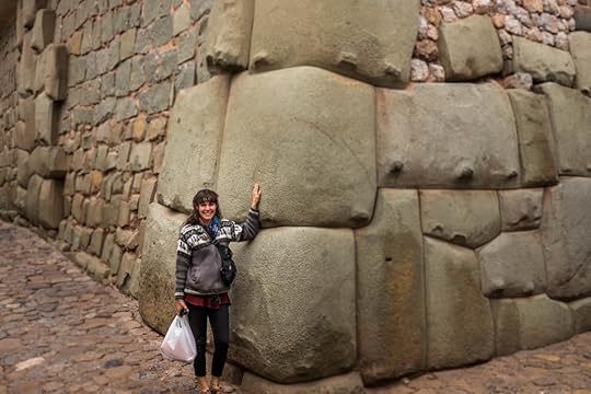 Me standing next to some of the incredible stonework of the Incas, Cusco, Peru. Cusco itself is an incredible destination, but the journey here from Lima wasn't half-bad either. Like usual, we didn't take the normal route or main highway, and instead opted to journey through an area of cascading waterfalls, snowy peaks, and wind-carved canyons. It's a national park with a name I can never remember nor pronounce: Reserva Paisajistica Nor Yauyos-Cochas, and if you are ever in the area, I highly recommend this gorgeous ride.
 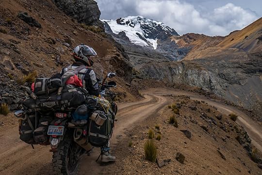 Tim, the bike, and the mountains of Reserva Paisajistica Nor Yauyos-Cochas, Peru.
 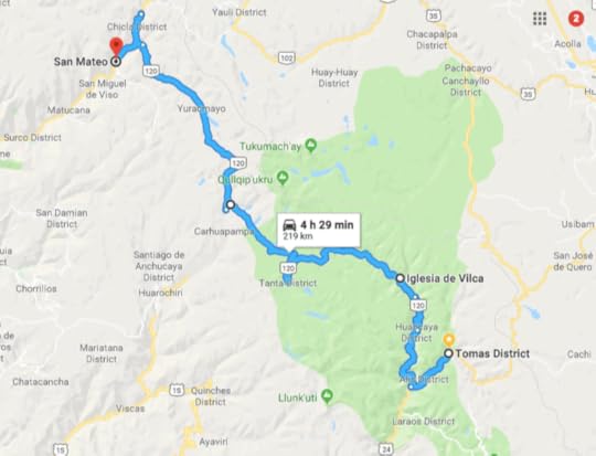 The road between San Mateo and Vilca rose in altitude and wound between mountains that were covered in snow at their peaks. Herds of llamas and alpacas watched us pass with their long-legged babies keeping close to their sides. It was unpaved, but definitely a doable road with only a few steep rocky switchbacks that brought out the wobbles and even tipped us once, breaking our windshield (we got a new one in Huancayo).
When we arrived in Vilca, we were greeted with cascades of turquoise water flowing between the green hillsides, and it was so stunning, I thought, “Why is Vilca, Peru not a major tourist destination?" Maybe the remoteness of its location keeps it hidden, but Vilca wasn't even the star of the show as the waterfalls just got bigger and more impressive as we made our way toward Tomas District.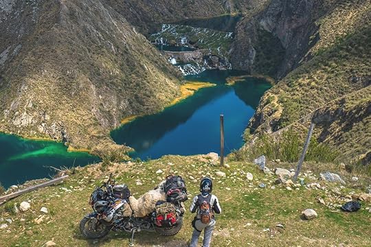 Cascadas de Carhuayno, Peru After less than a day of riding, I felt like I had left the snowy alpine world of grazing llamas and entered a tropical realm of crystal waters. The river just kept toppling over rocky ledges until it led us into the enveloping walls of a narrow canyon striped in many layers of different rocks. It's called Uchco Canyon, not a very well known place, but I think it should be on anyone's Peru ride list. And if you were to go north instead of south like we did, you would be heading opposite to the river and facing each and every gorgeous waterfall and tumble of the river.
 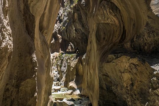 Tim riding through Uchco Canyon near Tomas District, Peru.
 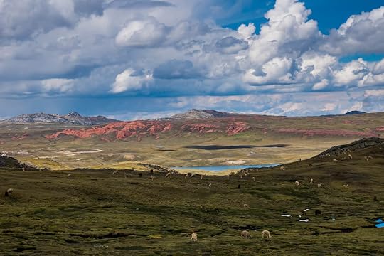 Striking red mountains between Tomas District and Huancayo, Peru. We eventually reached the city of Huancayo where we got a new front tire, windshield, and witnessed a cultural parade of traditional costumes and dancing.
 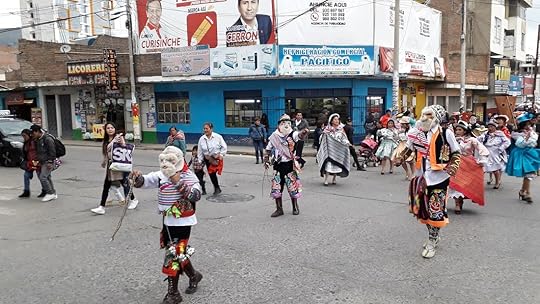 A parade in Huancayo, Peru. The plan after Huancayo was simply to get to Cusco. Like usual, we didn't want to go the main road, so we took a parallel route and ended up waiting at road blocks until night, almost got run off a cliff by angry drivers in the rain, and then the next day dropped our bike in a river crossing. All ended up well, but I don't think that road was worth it, and would advise people to just take the highway and find your off-road adventures elsewhere in Peru, of which there are plenty.
 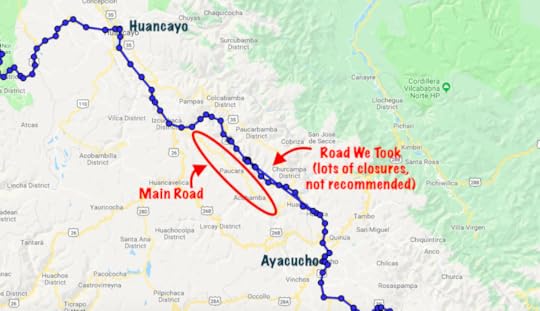 The main road is called 3S, the road we took is called 3S, and the road north of it is also 3S. Go figure. The main highway turned out to be paved, fast, and a real breeze. We even met up with a fellow motorcycle traveler from the States, Will Buckner, and had a blast zipping through the countryside with him before we had to part ways.
At long last, we arrived in Cusco, the historic capital of the Incan Empire. It has been a dream of mine to see this city since childhood, when I'd first heard stories of the famed Incan stonework and winding streets between gloriously-decorated Spanish churches. And now that I'm here, I will say that Cusco does not disappoint.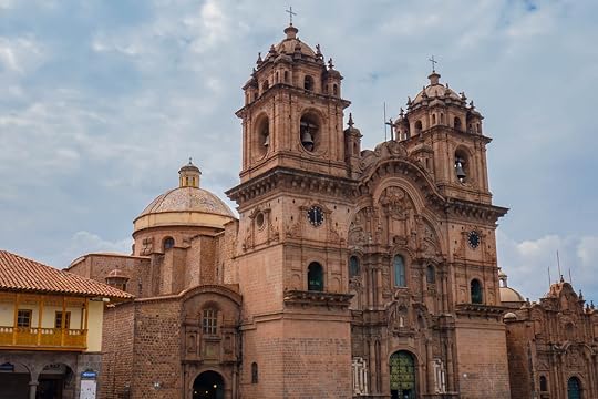 Iglesia de la Compañia de Jesús, Plaza de Armas, Cusco, Peru.
 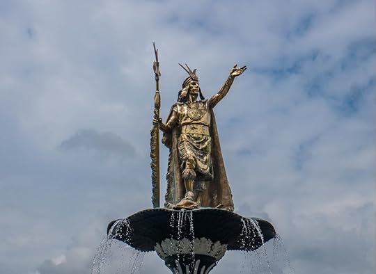 Fountain of the Incan leader Pachacuti who is believed to have built Machu Picchu. Plaza de Armas, Cusco, Peru. But to go along with all of Cusco's grandeur and spectacular sights are a whole lot of tourists. I feel that Tim and I have been in such remote areas of Peru, places where we feel as if we are the first foreigners to ever step foot there, that this cosmopolitan concoction of people from around the world speaking in all sorts of languages, wearing backpacks and with blond hair, it's a real culture shock for us.
And because of all the tourism, Cusco is expensive compared to the rest of Peru, as a meal can cost twice or three times the price here. But sometimes it's worth it, as I'm not going to complain about the sushi bars and French bakeries that we have stumbled across. The old Incan walls with a Spanish church built on top, Qoricancha, Cusco, Peru.
 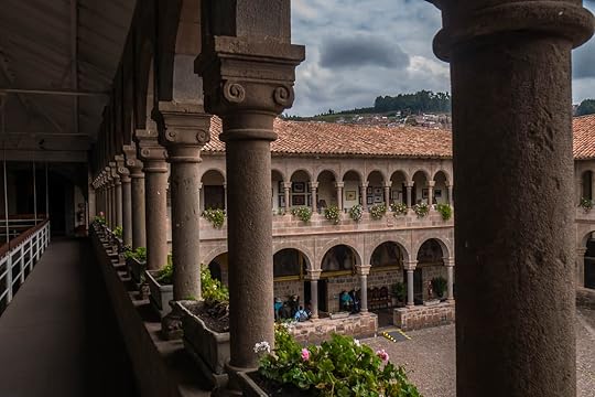 Spanish courtyard of Qoricancha, Cusco, Peru. We still have a few things we want to see here before we head into the Sacred Valley and finally get to Machu Picchu, but I'm already feeling the excitement of being in the land where the Inca reigned, as their presence is still felt, not just in the stones, but in the faces of the people, the colors of their clothing, and the smells of incense wafting through the air and meats cooking over the stove. It's a heady vibe to be here, where civilizations and empires have come and gone, and we are certainly enjoying every second of it.
Until next time.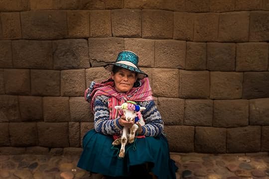 A local woman of Cusco sitting against an old Incan wall.
 Me standing next to some of the incredible stonework of the Incas, Cusco, Peru. Cusco itself is an incredible destination, but the journey here from Lima wasn't half-bad either. Like usual, we didn't take the normal route or main highway, and instead opted to journey through an area of cascading waterfalls, snowy peaks, and wind-carved canyons. It's a national park with a name I can never remember nor pronounce: Reserva Paisajistica Nor Yauyos-Cochas, and if you are ever in the area, I highly recommend this gorgeous ride.
  Tim, the bike, and the mountains of Reserva Paisajistica Nor Yauyos-Cochas, Peru.
  The road between San Mateo and Vilca rose in altitude and wound between mountains that were covered in snow at their peaks. Herds of llamas and alpacas watched us pass with their long-legged babies keeping close to their sides. It was unpaved, but definitely a doable road with only a few steep rocky switchbacks that brought out the wobbles and even tipped us once, breaking our windshield (we got a new one in Huancayo).
When we arrived in Vilca, we were greeted with cascades of turquoise water flowing between the green hillsides, and it was so stunning, I thought, “Why is Vilca, Peru not a major tourist destination?" Maybe the remoteness of its location keeps it hidden, but Vilca wasn't even the star of the show as the waterfalls just got bigger and more impressive as we made our way toward Tomas District.
 Cascadas de Carhuayno, Peru After less than a day of riding, I felt like I had left the snowy alpine world of grazing llamas and entered a tropical realm of crystal waters. The river just kept toppling over rocky ledges until it led us into the enveloping walls of a narrow canyon striped in many layers of different rocks. It's called Uchco Canyon, not a very well known place, but I think it should be on anyone's Peru ride list. And if you were to go north instead of south like we did, you would be heading opposite to the river and facing each and every gorgeous waterfall and tumble of the river.
  Tim riding through Uchco Canyon near Tomas District, Peru.
  Striking red mountains between Tomas District and Huancayo, Peru. We eventually reached the city of Huancayo where we got a new front tire, windshield, and witnessed a cultural parade of traditional costumes and dancing.
  A parade in Huancayo, Peru. The plan after Huancayo was simply to get to Cusco. Like usual, we didn't want to go the main road, so we took a parallel route and ended up waiting at road blocks until night, almost got run off a cliff by angry drivers in the rain, and then the next day dropped our bike in a river crossing. All ended up well, but I don't think that road was worth it, and would advise people to just take the highway and find your off-road adventures elsewhere in Peru, of which there are plenty.
  The main road is called 3S, the road we took is called 3S, and the road north of it is also 3S. Go figure. The main highway turned out to be paved, fast, and a real breeze. We even met up with a fellow motorcycle traveler from the States, Will Buckner, and had a blast zipping through the countryside with him before we had to part ways.
At long last, we arrived in Cusco, the historic capital of the Incan Empire. It has been a dream of mine to see this city since childhood, when I'd first heard stories of the famed Incan stonework and winding streets between gloriously-decorated Spanish churches. And now that I'm here, I will say that Cusco does not disappoint.
 Iglesia de la Compañia de Jesús, Plaza de Armas, Cusco, Peru.
  Fountain of the Incan leader Pachacuti who is believed to have built Machu Picchu. Plaza de Armas, Cusco, Peru. But to go along with all of Cusco's grandeur and spectacular sights are a whole lot of tourists. I feel that Tim and I have been in such remote areas of Peru, places where we feel as if we are the first foreigners to ever step foot there, that this cosmopolitan concoction of people from around the world speaking in all sorts of languages, wearing backpacks and with blond hair, it's a real culture shock for us.
And because of all the tourism, Cusco is expensive compared to the rest of Peru, as a meal can cost twice or three times the price here. But sometimes it's worth it, as I'm not going to complain about the sushi bars and French bakeries that we have stumbled across.
 The old Incan walls with a Spanish church built on top, Qoricancha, Cusco, Peru.
  Spanish courtyard of Qoricancha, Cusco, Peru. We still have a few things we want to see here before we head into the Sacred Valley and finally get to Machu Picchu, but I'm already feeling the excitement of being in the land where the Inca reigned, as their presence is still felt, not just in the stones, but in the faces of the people, the colors of their clothing, and the smells of incense wafting through the air and meats cooking over the stove. It's a heady vibe to be here, where civilizations and empires have come and gone, and we are certainly enjoying every second of it.
Until next time.
 A local woman of Cusco sitting against an old Incan wall.
November 8, 2018
Enchanting Ecuador
By Marisa Ecuador is one of the smaller countries of South America, but even so, a whole lot of biodiversity and culture is packed into its borders. You can pretty much come to Ecuador and fulfill your South American dream, no matter what it is: from meeting Andean peoples in ponchos and bowler hats, to swimming with pink dolphins of the Amazonian rivers, to exploring Colonial Spanish cities perfectly painted and preserved, and you can even see whales, dolphins, or the Blue-Footed Boobies of Ecuador's coast made famous by the Galapagos. In Ecuador, there's a little bit of something for everyone here. 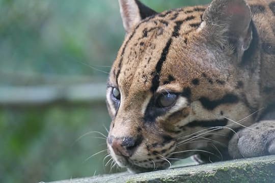 Named after its geographical position of being directly on the equator, Ecuador has a consistent climate all year round with no real seasons per se, but temperatures completely depend on altitude. Since the mountains of the Andes can get quite high, you can experience snow on the equator, and then a few hours later, be at the beach.
Ecuador is also an easy country to travel in. Not only are the distances between attractions short by South American standards, but it's a well-developed country with modern infrastructure and good roads. To make matters even easier, Ecuador uses the US dollar as its official currency.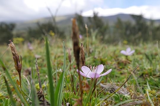 For someone who is interested in going to South America, but perhaps has never traveled there before, Ecuador is the perfect introduction to a huge continent that can be at times daunting and difficult to navigate.
The following is a list of some of our favorite experiences in Ecuador, followed by a few challenges we faced while traveling there. Quito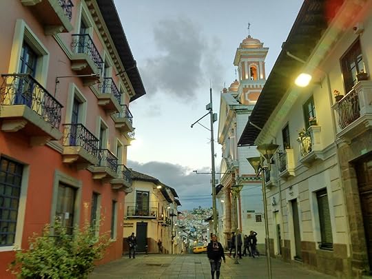 A lovely street in the old town of Quito, Ecuador. Usually, Tim and I avoid capital cities in Latin America because they are crowded and polluted with not much to offer as far as the types of things we like to see. But Quito is an exception to this rule. Situated across many steep hilltops and blessed with sunny days following chilly nights, Quito is not just Ecuador's capital, it's also the largest Spanish Colonial city in the Americas, and a gorgeously preserved Colonial city as well. You can spend days wandering through its web-like roads, peering into ornately-decorated churches, and sitting at cafes on cobble-stoned streets. Mindo and Cloud Forests
 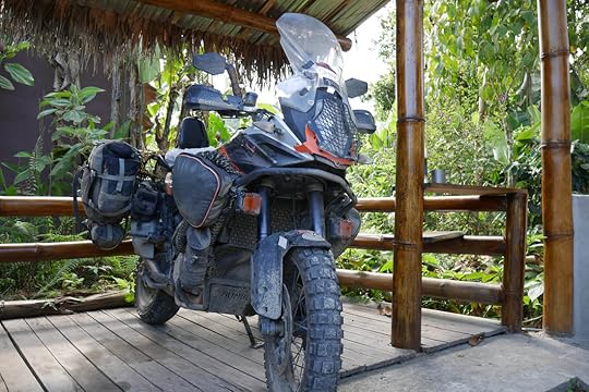 The bike in its wild element at our campground in Mindo, Ecuador. If you like the biodiversity and the lush greenery of the rainforest, but you don't want to feel like you're melting away in the heat and humidity as you hike through the jungle, then perhaps the cloud forest is perfect for you. Cloud forests are generally at a higher altitude with a temperate climate and are obviously known for their fog, but also for their abundance of flora and fauna. In Ecuador, Mindo is the usual jumping-off point to experience cloud forests first-hand, and the surrounding area is filled with waterfalls, butterfly sanctuaries, and hummingbird parks.
 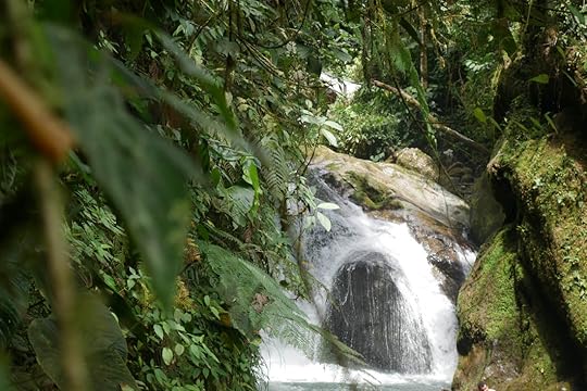 One of the many waterfalls at Nambillo, Mindo, Ecuador. Whales and the Coast When it comes to sunny tropical beaches, Ecuador cannot compare to the beaches of Colombia or most Central American countries. This is because of the consistent cloud cover that seems to hang over Ecuador's coastline, and the temperature of its Pacific waters might be considered chilly to some, though beautiful beaches and occasional perfect days do exist. But what Ecuador does have is a whole lot of marine life, and during Humpback Whale breeding season, there's no better place to be.
 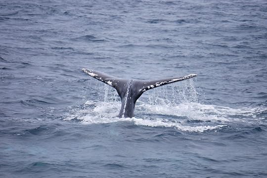 A Humpback Whale diving near Puerto Lopez, Ecuador. From Puerto Lopez, it's a cheap boat ride ($20 per person) to see the whales waving their fins, tail slapping, and breaching into the air. June to September is the best time to go, and you can also combine this experience with a ride to Isla de la Plata, a tour that's considered to be Ecuador's “Poor Man's Galapagos". Here you will most likely see some of the species that the Galapagos Islands are famous for, such as the Magnificent Frigatebird with its red throat on the males, or the Blue-Footed Boobie.
 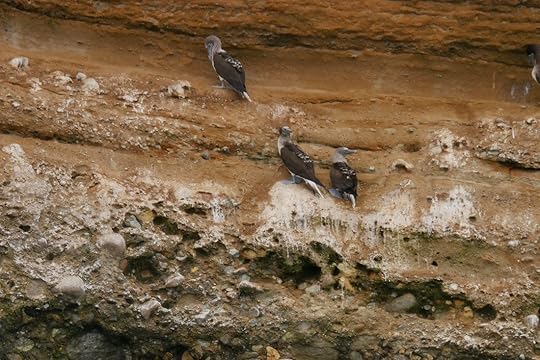 The oh-so-popular Blue-Footed Boobies. I think people just like saying their name. Of course, the Galapagos Islands themselves are Ecuador's number one tourist attraction, but because of their distance and cost (and the fact that they're islands we can't get to on a motorcycle), Tim and I decided that they should be reserved for a trip in and of itself. Quilotoa Crater and Cotopaxi Volcano
 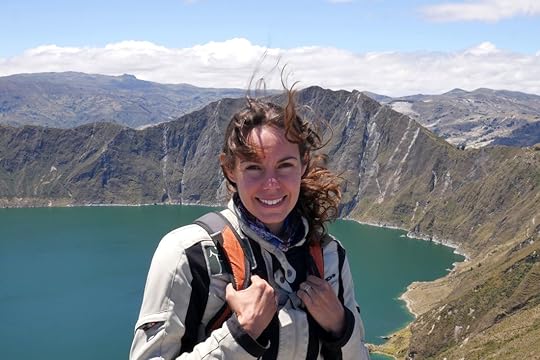 Me in front of Quilotoa Crater, Ecuador. Quilotoa Crater is a picturesque dormant volcanic crater that is now filled with a bright teal-colored lake. It's located high up in the Andes mountains at 12,800 ft. (3,900 meters), and is easily accessible as the parking lot nearly comes right up to the rim. There are hiking trails and camping spots all around, but what we enjoyed most was riding around the area and experiencing the local Andean cultures who mix their Spanish with indigenous languages and sell incredible wool and alpaca ponchos and crafts.
 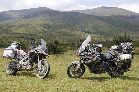 Our bike, the KTM 1190 on the right, and our friends Craig and Michelle's bike on the left, BMW F800. Cotopaxi is Ecuador's Mt. Fuji: a snow-covered, perfectly conical volcano with a national park around it. Unfortunately, national parks in Ecuador don't allow motorcycles in (more on that later), but we were able to hitch along with some local guides to get into the park and snap some pics. Ecuador also hosts a bunch of other high-altitude national parks, many of which we didn't get a chance to visit, though they sound well worth the effort from talking to other travelers.
 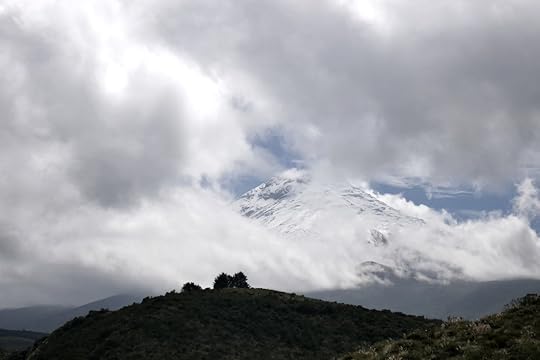 Can you pick out the snow-capped volcano of Cotopaxi from the clouds? Amazonia
 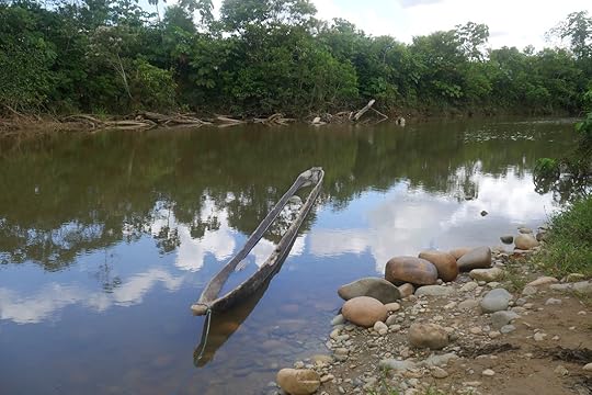 An old dug-out canoe we found on the backroads between Misahuallí and El Coca, Ecuador. Going to the Amazon is the highlight for many visitors to South America, and Ecuador is a great place to get into the thick of the jungle, meet some indigenous peoples, and see some unique wildlife. Unfortunately, joining a tour is an expensive investment, from several hundred dollars per person to thousands of dollars, and we discovered that not much of that money goes directly to the local communities.
Also, the Amazon region in South America is best navigated by river, not by motorcycle. To get the full Amazon experience, many people hop on boats, whether dug-out canoes to jungle lodges, or passenger ferries to far off places like Iquitos, Peru or Manaus, Brazil. So Tim and I decided that we would most likely do an extensive Amazon journey at a later date when we find the right tour and don't have a motorcycle with us to worry about. View over the Napo River in Misahuallí, Ecuador. Luckily, we were still able to get a good feel for the Amazon rainforest by traveling by bike from Misahaullí to EL Coca and then to Tena. We stayed in cabins along the Napo River in Misahuallí, learned about indigenous people at the MACCO museum, got up-close and personal to lots of animals at the Coca Zoo, and then swam in waterfalls at Tena where butterflies fluttered around us. It was pretty perfect. Challenges we faced in Ecuador Theft Ecuador is no stranger to tourism, and people have learned that tourists are wealthy targets. Tim got his phone stolen outside of Quito, along with our friend at the same time, someone tried to unzip the pockets of a third friend to get her phone, and another traveling couple we know got their camera stolen at a festival in Quito. We've seen small children put on a show for us while their parents came up behind to snatch our wallet (did not work thankfully), so pickpocketing is a full-time job for some people in Ecuador. We had not seen anything like this level of petty robbery previously on our trip, so all travelers to Ecuador, keep your belongings close! No Motorcycles Allowed in National Parks Obviously this only affects those of us traveling by motorcycle, but it was a point of frustration for us because all other vehicles are let into the national parks, areas which boast lots of scenic roads that we really wanted to see. Just not motorcycles. I've heard that the reason for this is the noise that motorcycles produce scare the wildlife, which is a fair point, but our bike and the type of bikes mostly found in Ecuador (around 250 cc's) are quiet, and they are not your typical American rumbling Harleys. Also, as in all of Latin America, people have no problem blaring music at all sorts of decibels from every car and storefront. Noise is a part of daily life out here, so I'm not sure why the Ecuadorian park service has a thing against motorcycles only. Expense Compared to its neighbors, Ecuador is an expensive country. It's not just expensive for tourists, but imports (such as motorcycles and parts) cost twice as much as in the States. Because Ecuador uses US dollars, it's easy to compare. So even though Ecuadorian salaries are lower than US salaries, vehicles and many goods cost twice as much as we would pay, which makes it hard for an Ecuadorian person to get out of poverty, and hard for us to fix our bike when things go wrong. Tourism Having just come out of stigmatized Colombia, we entered Ecuador and couldn't believe how many tourists there were. Obviously we are also tourists, so it's a hypocritical thing to not like them, but the amount of tourists swarming around a single waterfall in Baños, or all pressed up against each other in the thermal pools is a bit alarming, and definitely took away from the charm of the place.
 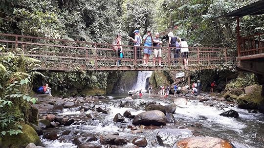 Try getting a shot of this waterfall without people in it. Nambillo, Mindo, Ecuador. In Conclusion
  An Incan temple converted into a Spanish church, San Agustín Hacienda, Ecuador. Despite having a bunch of motorcycle trouble in Ecuador, and therefore having to stay about a month longer than we'd expected, we enjoyed our time in Ecuador to the fullest. It's so easy to make loops around the country, each time coming back to the amenities, beauty, and convenience of Quito situated at its heart. So I would say that all around, Ecuador is a gorgeous and enjoyable country to travel in.
For its size, there are a remarkable amount of different sights and experiences to be had in Ecuador. When it comes to South American nature and culture, you can get a good taste of whatever it is you're searching for, even Incan ruins which can be found as far north as Quito. Ecuador also has an abundance of different climates, and you can pick and choose your temperature and ecosystem according to your altitude. So if you want to experience South America in a reliable and user-friendly way, Ecuador is the country to come to.
 Named after its geographical position of being directly on the equator, Ecuador has a consistent climate all year round with no real seasons per se, but temperatures completely depend on altitude. Since the mountains of the Andes can get quite high, you can experience snow on the equator, and then a few hours later, be at the beach.
Ecuador is also an easy country to travel in. Not only are the distances between attractions short by South American standards, but it's a well-developed country with modern infrastructure and good roads. To make matters even easier, Ecuador uses the US dollar as its official currency.
 For someone who is interested in going to South America, but perhaps has never traveled there before, Ecuador is the perfect introduction to a huge continent that can be at times daunting and difficult to navigate.
The following is a list of some of our favorite experiences in Ecuador, followed by a few challenges we faced while traveling there. Quito
 A lovely street in the old town of Quito, Ecuador. Usually, Tim and I avoid capital cities in Latin America because they are crowded and polluted with not much to offer as far as the types of things we like to see. But Quito is an exception to this rule. Situated across many steep hilltops and blessed with sunny days following chilly nights, Quito is not just Ecuador's capital, it's also the largest Spanish Colonial city in the Americas, and a gorgeously preserved Colonial city as well. You can spend days wandering through its web-like roads, peering into ornately-decorated churches, and sitting at cafes on cobble-stoned streets. Mindo and Cloud Forests
  The bike in its wild element at our campground in Mindo, Ecuador. If you like the biodiversity and the lush greenery of the rainforest, but you don't want to feel like you're melting away in the heat and humidity as you hike through the jungle, then perhaps the cloud forest is perfect for you. Cloud forests are generally at a higher altitude with a temperate climate and are obviously known for their fog, but also for their abundance of flora and fauna. In Ecuador, Mindo is the usual jumping-off point to experience cloud forests first-hand, and the surrounding area is filled with waterfalls, butterfly sanctuaries, and hummingbird parks.
  One of the many waterfalls at Nambillo, Mindo, Ecuador. Whales and the Coast When it comes to sunny tropical beaches, Ecuador cannot compare to the beaches of Colombia or most Central American countries. This is because of the consistent cloud cover that seems to hang over Ecuador's coastline, and the temperature of its Pacific waters might be considered chilly to some, though beautiful beaches and occasional perfect days do exist. But what Ecuador does have is a whole lot of marine life, and during Humpback Whale breeding season, there's no better place to be.
  A Humpback Whale diving near Puerto Lopez, Ecuador. From Puerto Lopez, it's a cheap boat ride ($20 per person) to see the whales waving their fins, tail slapping, and breaching into the air. June to September is the best time to go, and you can also combine this experience with a ride to Isla de la Plata, a tour that's considered to be Ecuador's “Poor Man's Galapagos". Here you will most likely see some of the species that the Galapagos Islands are famous for, such as the Magnificent Frigatebird with its red throat on the males, or the Blue-Footed Boobie.
  The oh-so-popular Blue-Footed Boobies. I think people just like saying their name. Of course, the Galapagos Islands themselves are Ecuador's number one tourist attraction, but because of their distance and cost (and the fact that they're islands we can't get to on a motorcycle), Tim and I decided that they should be reserved for a trip in and of itself. Quilotoa Crater and Cotopaxi Volcano
  Me in front of Quilotoa Crater, Ecuador. Quilotoa Crater is a picturesque dormant volcanic crater that is now filled with a bright teal-colored lake. It's located high up in the Andes mountains at 12,800 ft. (3,900 meters), and is easily accessible as the parking lot nearly comes right up to the rim. There are hiking trails and camping spots all around, but what we enjoyed most was riding around the area and experiencing the local Andean cultures who mix their Spanish with indigenous languages and sell incredible wool and alpaca ponchos and crafts.
  Our bike, the KTM 1190 on the right, and our friends Craig and Michelle's bike on the left, BMW F800. Cotopaxi is Ecuador's Mt. Fuji: a snow-covered, perfectly conical volcano with a national park around it. Unfortunately, national parks in Ecuador don't allow motorcycles in (more on that later), but we were able to hitch along with some local guides to get into the park and snap some pics. Ecuador also hosts a bunch of other high-altitude national parks, many of which we didn't get a chance to visit, though they sound well worth the effort from talking to other travelers.
  Can you pick out the snow-capped volcano of Cotopaxi from the clouds? Amazonia
  An old dug-out canoe we found on the backroads between Misahuallí and El Coca, Ecuador. Going to the Amazon is the highlight for many visitors to South America, and Ecuador is a great place to get into the thick of the jungle, meet some indigenous peoples, and see some unique wildlife. Unfortunately, joining a tour is an expensive investment, from several hundred dollars per person to thousands of dollars, and we discovered that not much of that money goes directly to the local communities.
 Also, the Amazon region in South America is best navigated by river, not by motorcycle. To get the full Amazon experience, many people hop on boats, whether dug-out canoes to jungle lodges, or passenger ferries to far off places like Iquitos, Peru or Manaus, Brazil. So Tim and I decided that we would most likely do an extensive Amazon journey at a later date when we find the right tour and don't have a motorcycle with us to worry about.
 View over the Napo River in Misahuallí, Ecuador. Luckily, we were still able to get a good feel for the Amazon rainforest by traveling by bike from Misahaullí to EL Coca and then to Tena. We stayed in cabins along the Napo River in Misahuallí, learned about indigenous people at the MACCO museum, got up-close and personal to lots of animals at the Coca Zoo, and then swam in waterfalls at Tena where butterflies fluttered around us. It was pretty perfect. Challenges we faced in Ecuador Theft Ecuador is no stranger to tourism, and people have learned that tourists are wealthy targets. Tim got his phone stolen outside of Quito, along with our friend at the same time, someone tried to unzip the pockets of a third friend to get her phone, and another traveling couple we know got their camera stolen at a festival in Quito. We've seen small children put on a show for us while their parents came up behind to snatch our wallet (did not work thankfully), so pickpocketing is a full-time job for some people in Ecuador. We had not seen anything like this level of petty robbery previously on our trip, so all travelers to Ecuador, keep your belongings close! No Motorcycles Allowed in National Parks Obviously this only affects those of us traveling by motorcycle, but it was a point of frustration for us because all other vehicles are let into the national parks, areas which boast lots of scenic roads that we really wanted to see. Just not motorcycles. I've heard that the reason for this is the noise that motorcycles produce scare the wildlife, which is a fair point, but our bike and the type of bikes mostly found in Ecuador (around 250 cc's) are quiet, and they are not your typical American rumbling Harleys. Also, as in all of Latin America, people have no problem blaring music at all sorts of decibels from every car and storefront. Noise is a part of daily life out here, so I'm not sure why the Ecuadorian park service has a thing against motorcycles only. Expense Compared to its neighbors, Ecuador is an expensive country. It's not just expensive for tourists, but imports (such as motorcycles and parts) cost twice as much as in the States. Because Ecuador uses US dollars, it's easy to compare. So even though Ecuadorian salaries are lower than US salaries, vehicles and many goods cost twice as much as we would pay, which makes it hard for an Ecuadorian person to get out of poverty, and hard for us to fix our bike when things go wrong. Tourism Having just come out of stigmatized Colombia, we entered Ecuador and couldn't believe how many tourists there were. Obviously we are also tourists, so it's a hypocritical thing to not like them, but the amount of tourists swarming around a single waterfall in Baños, or all pressed up against each other in the thermal pools is a bit alarming, and definitely took away from the charm of the place.
  Try getting a shot of this waterfall without people in it. Nambillo, Mindo, Ecuador. In Conclusion
  An Incan temple converted into a Spanish church, San Agustín Hacienda, Ecuador. Despite having a bunch of motorcycle trouble in Ecuador, and therefore having to stay about a month longer than we'd expected, we enjoyed our time in Ecuador to the fullest. It's so easy to make loops around the country, each time coming back to the amenities, beauty, and convenience of Quito situated at its heart. So I would say that all around, Ecuador is a gorgeous and enjoyable country to travel in.
For its size, there are a remarkable amount of different sights and experiences to be had in Ecuador. When it comes to South American nature and culture, you can get a good taste of whatever it is you're searching for, even Incan ruins which can be found as far north as Quito. Ecuador also has an abundance of different climates, and you can pick and choose your temperature and ecosystem according to your altitude. So if you want to experience South America in a reliable and user-friendly way, Ecuador is the country to come to.

November 7, 2018
Nov. 7, 2018 - The White Heart of Peru
By Marisa  When it comes to Peru, the Inca steal the show. Machu Picchu, Cusco, and the Inca Trail are all things that usually come to mind when thinking of Peru. I certainly never pictured glacier-capped mountains and strikingly-blue alpine lakes tucked amidst them. But I do now.
Only the local Peruvians who have been farming these high-altitude slopes for centuries, overlanders like ourselves, and the most adventurous of travelers ever delve into this region. It's called the Cordillera Blanca (meaning white mountain range), and has some of the highest mountain passes in the world.
I now believe that anyone who comes to Peru just to go to Cusco and Machu Picchu is only seeing the face of Peru, the one in all the postcards and brochures. But they will be missing out on the heart of Peru, the one where it's only you and the llamas standing between stone ruins of long lost civilizations, and where red-cheeked babies peek out from the colorful swaddles on local women's backs. It's where white-washed peaks blend into the clouds and turquoise lakes dot the landscape. One of the many glacial lakes outside of Huayhuash National Park.
 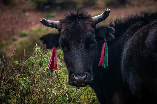 A calf decorated in the traditional Peruvian fashion: with color, beauty, and practicality (knowing which cows are yours). It's a region that felt like we were transported back a thousand years, to a time in Peru before the Spanish and before modernization, a place where I truly felt like Hiram Bingham discovering Machu Picchu for the first time, as if no foreigner had ever stepped foot there before. It's a land hidden in mist and snow and terrible roads that keep it separated from the rest of the world, isolated and proud. When it comes to Peruvian majesty, the Cordillera Blanca is truly the tip of the crown.
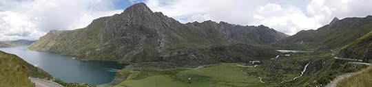
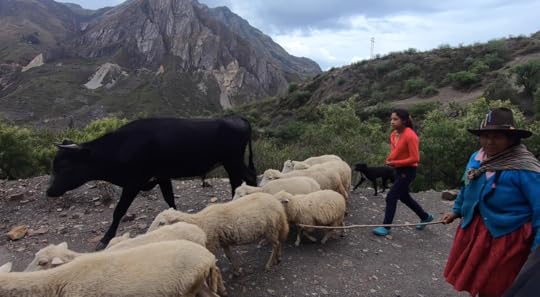 Our adventures into the Cordillera Blanca started in Huaraz, the largest city of the region, where as you may remember, I was recuperating as my foot healed from an earlier spill. But after a couple weeks in Huaraz, the pain had subsided and I was hobbling around pretty well on crutches. And so with the two crutches strapped onto the front of the bike, we decided we were ready to continue with our journey, and luckily, we weren't going to tackle this isolated region alone. We were going to do it all with two fellow KTM riders: the Adventure Haks.
 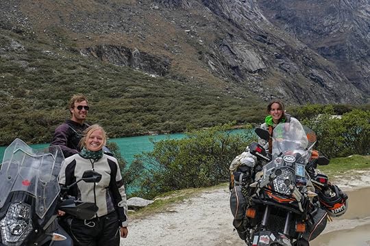 Brendon and Kira Hak with their KTM 1290, and me on our KTM 1190. We had been online stalking Brendon and Kira Hak for quite some time because they were a couple just like us riding south through the Americas on a KTM. We have a few slight differences: they're from Canada and we're from the US, and they have the newer model bike, the 1290 Super Adventure, whereas we have the 1190 Adventure. But we had a lot more in common than differences, and I just knew that we were going to hit it off great with them. They also have an incredible blog and stunning photos, oh and they can cook up gourmet feasts while camping, what's not to like?
So after months of near misses, we finally were able to meet up, and the four of us made our first stop at the stunningly-blue lake of Laguna Paron. Situated between snowy peaks, this lake was a perfect introduction to the regal beauty of the Cordillera Blanca.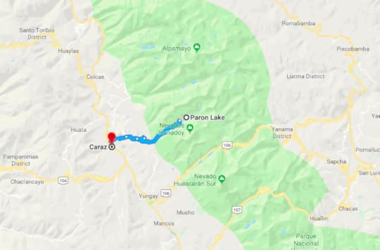
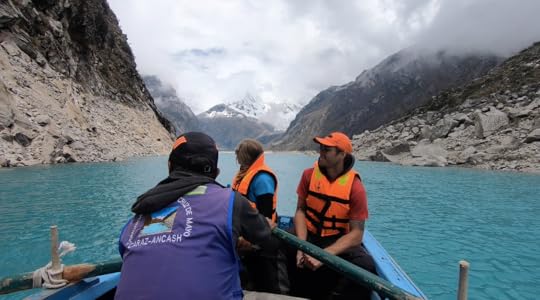 Kira and Brendon admiring the views of Laguna Paron, Perú. Next, we knew we had to really get a taste for these mountains, and that meant going into Huascarán. As you can see in the following map, the green area is Huascarán National Park, named after its highest peak and the 16th century Incan Emperor, Huáscar. This park encompasses the majority of what is known as the Cordillera Blanca, and there are four passes, three of which we took. The first two are shown here: the northern pass which is not paved and more rugged, and the southern pass which is paved, pristine, and well-traveled.
 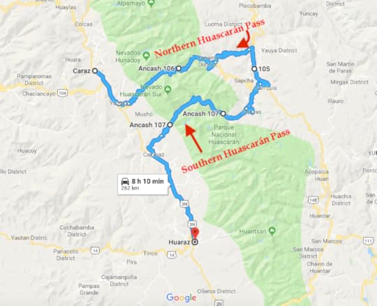 Though Google seems to think the entirely of this loop can be done in 8 hours and 10 minutes, in reality it took us five days, and each white circle is where we camped. But it was five glorious days of wild camping, telling stories around the campfire, and unforgettable views.
Both passes are stunning and literally breath-taking since the northern road reaches an altitude of nearly 15,000 ft. (4,500 meters) and the southern road reaches over 15,000 ft. We kept our coca leaf tea handy for the mornings to help combat the inevitable headaches and stomach cramps that came from altitude sickness, as it took a few days before we acclimated.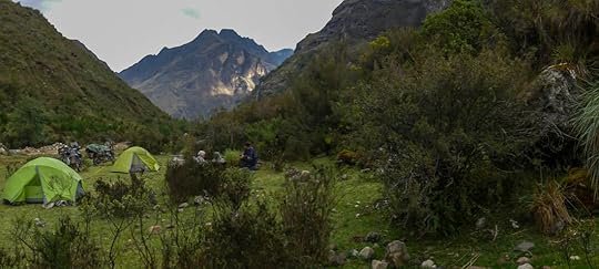 A pretty sweet spot to camp.
 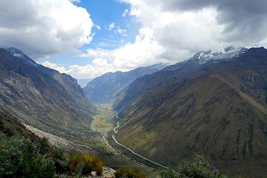 Perhaps the most perfect valley in the universe. Once completing the passes, we took a break in the city of Huaraz to shower and get some more supplies. But soon we were off again, this time doing the most southern pass in the park, the last pass in Huascarán. It's not a very well-trodden route, but it turned out to be one of the most enjoyable and picturesque rides we've ever been on. Not only were there snow-capped mountains, but herds of sheep scrambled their way through pond-dotted bogs and marshlands that reflected all the blues of the sky. And then over the pass things became drier with windswept plains, thatched huts for shepherds, ancient petroglyphs on the cliff walls, and some of the strangest looking trees we've ever seen.
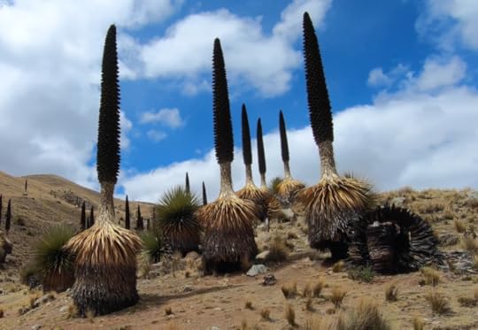 Puya trees, a.k.a. Queen of the Andes. And they are huge.
 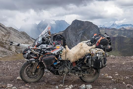 As if we didn't get enough stares on our bike already, we added crutches to the front to complete the look.
 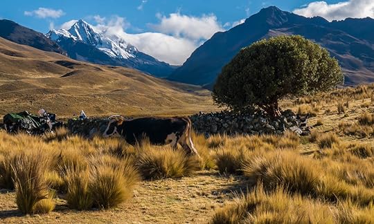 We were greeted with clear skies and cows in the morning at this campsite.
  The grassy plateau around Huánuco Pampa, Perú. Once reaching the eastern side of the pass, we camped in a grassy field filled with every type of grazing animal you could name, including alpaca. It was an ideal spot to stay the night since it was situated right next to an Incan ruin called Huánuco Pampa. Though I'd never heard of it before, this immense city of 47 acres (19 hectares) and over 4,000 buildings was an important Incan metropolis of commerce situated on the Pre-Hispanic highway between Cusco and Quito.
 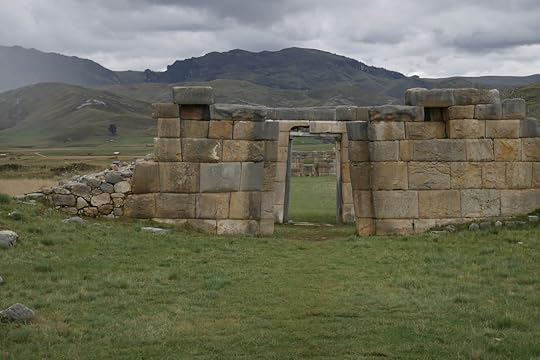 Two of many perfectly-aligned doorways leading out of the city of Huánuco Pampa, Perú.
 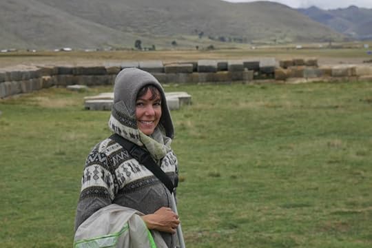 Me in my alpaca sweater in Huánuco Pampa, and I'm now down to only one crutch! I was deeply impressed with this city for the size of its structures, the fabulous stonework of mortar-less walls perfectly slanted upwards to withstand any earthquake, and the carvings of monkeys or lizards on the doorways. But even more than that, it was the feeling of the place, because we were truly alone in a deserted city that had once thrived, now left abandoned. It was an eerie and also exciting feeling, and I felt, once again, like I was the first explorer to ever set foot there.
Having come to the end of Huascarán National Park, and on the Amazon side of the mountains, we knew we'd have to cross the Andes one more time to get back on the western side. And what better place to do so than at the next National Park: Huayhuash (pronounced “Why wash?", a question which Tim frequently ponders).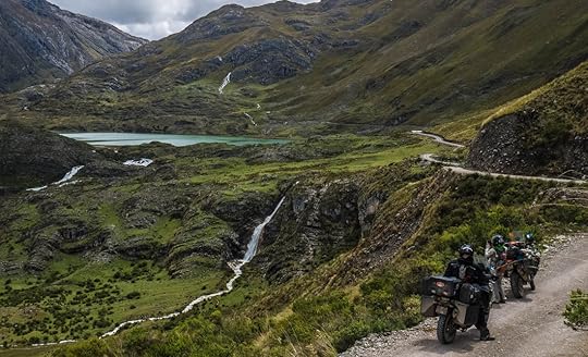 The unreal mountains and valleys near Huayhuash National Park. Though there are no roads which go straight through the park, we were able to make our way alongside it, all within view of its stunning peaks. Plus, we were greeted with more crystal lakes and green valleys that looked like they should have been out of The Land Before Time.
Sounds like pure bliss, right? Well, not all of our adventures went as planned. Three out of four of us came down with some sort of unpleasant stomach sickness (lucky you Brendon for avoiding it with your spicy food), and Tim and I dropped the bike, ummm, I'm not even going to tell you how many times. Amazingly, and much to our chagrin, the Haks did not even drop their bike once.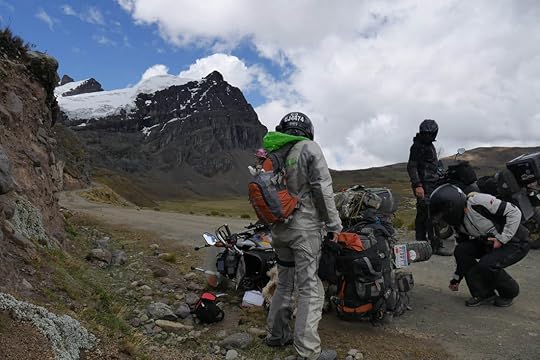 Not our finest moment. And then there was that one day where we got ourselves into a spot that I thought we may never get out of. The first half of the day went fine, I would even call it glorious. We had mostly clear skies, stunning vistas, and a successful crossing of the highest pass we have been on to date: 16,375 ft. (4,991 meters)! By this point, we were very well-acclimated and didn't even noticed the lack of oxygen.
The strange part is that the second half of the day after the town of Rapaz was supposed to be a breeze because we were to take something labeled as a “major road". Major roads in Peru, we have learned, can be something of a bewildering misnomer, but this one takes the cake for misnomers, because it was practically impassable.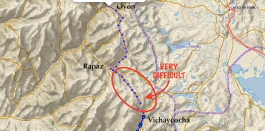
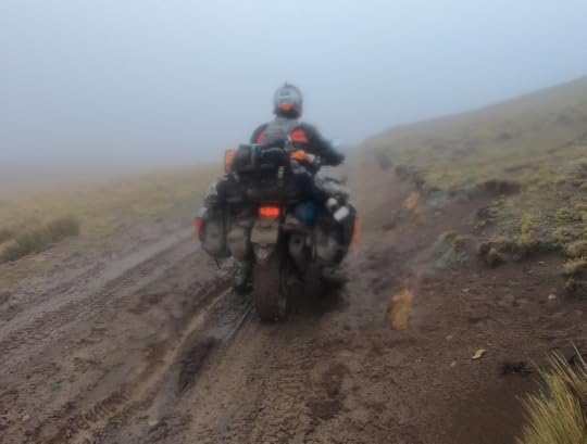 An unpleasant road, to say the least. As the afternoon fog set in, we started going up and up, starting at 12,000 ft. mind you. And because we were unable to see much, and we had just finished a huge pass, I kept thinking after an hour of ascending switchbacks, “How is it possible that we're still going up? Will this ever end?"
As you can imagine, the weather did not improve as we hit over 14,000 ft. and the fog turned into a rain that seemed to have formed at the beginning of time and had never stopped. Everything was just sludge, and we saw no one else on the road, which should have been a warning sign. Well, except there was that one man who had hiked up to get his pregnant cow. Oh, and the guy in the Hummer out for a muddy joy ride who nearly hit the Haks and then actually hit us (he was a jerk, is there a rule about that and Hummers?).
But even the Hummer guy warned us not to go any farther, giving us the tell-tale sign of death as he signaled with his finger to cut his throat. Unfortunately, we did not have enough gas to go back for hours down the sloshy mud pit of a road that we had come from. So onwards we went.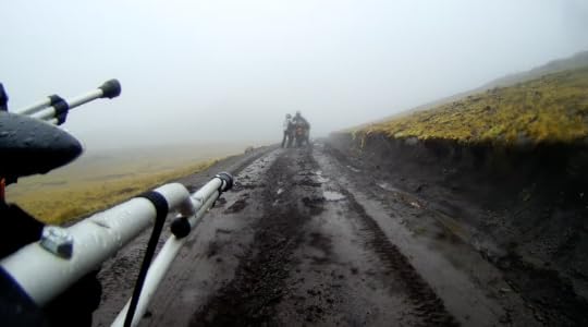 It's no fun to pull 500+ lb. bikes out of mud like this. The Hummer guy was right. Things got so nasty, Kira and I were pushing the bikes through the soupy mess as the boys did their best to make the tires grip onto anything and keep the bike upright. But it was slow going, hard breathing at that altitude, and night was coming on fast. So we figured we would continue pushing on (literally) until it was too dark to do so or we were too exhausted, and then we'd have to make camp and try again in the morning.
Luckily, we did not have to camp there, and eventually passed the worst of the muck. We were even greeted with a lovely herd of llamas that glared at us like they had never seen people on motorcycles before. Who knows, maybe they hadn't.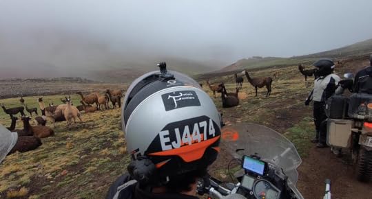 For the llamas, this wet, cold, and high-altitude terrain is no problem. The next sign of civilization came like a Christmas village of orange lights softly burning through the night fog, and we were ecstatic to find a hotel/restaurant as one of the first buildings. It had no running water, which made for a particularly disgusting toilet, but we weren't complaining. It was a roof over our heads and we were just glad to be out of that mud.
We all agreed that it was time to take a little break from our adventuring and do some laundry, buy some supplies, and get bike repairs/bike washing done. So we all headed to Lima, Peru's capital, and are here now getting rested and caught up with our blogs (sorry for the wait, rural Peru is not known for its internet).
The Adventure Haks have certainly lived up to their name, and it's sad that we may be parting ways now (though not forever, we will definitely be meeting up again along the road). But it's been some of the most memorable sights and experiences from the past two weeks, and I would highly recommend to anyone interested in coming to Peru to rent a vehicle (get full insurance, you'll need it) and come to the white heart of the Cordillera Blanca where you will see a side of this country that is majestic, breath-taking, and truly authentic. And you will have an adventure that you'll remember for the rest of your life. We certainly did.
What's next? The famous Incan ruins around Cusco, and of course, Machu Picchu... we'll keep you posted.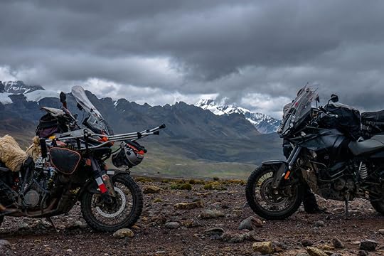
 When it comes to Peru, the Inca steal the show. Machu Picchu, Cusco, and the Inca Trail are all things that usually come to mind when thinking of Peru. I certainly never pictured glacier-capped mountains and strikingly-blue alpine lakes tucked amidst them. But I do now.
Only the local Peruvians who have been farming these high-altitude slopes for centuries, overlanders like ourselves, and the most adventurous of travelers ever delve into this region. It's called the Cordillera Blanca (meaning white mountain range), and has some of the highest mountain passes in the world.
I now believe that anyone who comes to Peru just to go to Cusco and Machu Picchu is only seeing the face of Peru, the one in all the postcards and brochures. But they will be missing out on the heart of Peru, the one where it's only you and the llamas standing between stone ruins of long lost civilizations, and where red-cheeked babies peek out from the colorful swaddles on local women's backs. It's where white-washed peaks blend into the clouds and turquoise lakes dot the landscape.
 One of the many glacial lakes outside of Huayhuash National Park.
  A calf decorated in the traditional Peruvian fashion: with color, beauty, and practicality (knowing which cows are yours). It's a region that felt like we were transported back a thousand years, to a time in Peru before the Spanish and before modernization, a place where I truly felt like Hiram Bingham discovering Machu Picchu for the first time, as if no foreigner had ever stepped foot there before. It's a land hidden in mist and snow and terrible roads that keep it separated from the rest of the world, isolated and proud. When it comes to Peruvian majesty, the Cordillera Blanca is truly the tip of the crown.
 Our adventures into the Cordillera Blanca started in Huaraz, the largest city of the region, where as you may remember, I was recuperating as my foot healed from an earlier spill. But after a couple weeks in Huaraz, the pain had subsided and I was hobbling around pretty well on crutches. And so with the two crutches strapped onto the front of the bike, we decided we were ready to continue with our journey, and luckily, we weren't going to tackle this isolated region alone. We were going to do it all with two fellow KTM riders: the Adventure Haks.
  Brendon and Kira Hak with their KTM 1290, and me on our KTM 1190. We had been online stalking Brendon and Kira Hak for quite some time because they were a couple just like us riding south through the Americas on a KTM. We have a few slight differences: they're from Canada and we're from the US, and they have the newer model bike, the 1290 Super Adventure, whereas we have the 1190 Adventure. But we had a lot more in common than differences, and I just knew that we were going to hit it off great with them. They also have an incredible blog and stunning photos, oh and they can cook up gourmet feasts while camping, what's not to like?
So after months of near misses, we finally were able to meet up, and the four of us made our first stop at the stunningly-blue lake of Laguna Paron. Situated between snowy peaks, this lake was a perfect introduction to the regal beauty of the Cordillera Blanca.

 Kira and Brendon admiring the views of Laguna Paron, Perú. Next, we knew we had to really get a taste for these mountains, and that meant going into Huascarán. As you can see in the following map, the green area is Huascarán National Park, named after its highest peak and the 16th century Incan Emperor, Huáscar. This park encompasses the majority of what is known as the Cordillera Blanca, and there are four passes, three of which we took. The first two are shown here: the northern pass which is not paved and more rugged, and the southern pass which is paved, pristine, and well-traveled.
  Though Google seems to think the entirely of this loop can be done in 8 hours and 10 minutes, in reality it took us five days, and each white circle is where we camped. But it was five glorious days of wild camping, telling stories around the campfire, and unforgettable views.
Both passes are stunning and literally breath-taking since the northern road reaches an altitude of nearly 15,000 ft. (4,500 meters) and the southern road reaches over 15,000 ft. We kept our coca leaf tea handy for the mornings to help combat the inevitable headaches and stomach cramps that came from altitude sickness, as it took a few days before we acclimated.
 A pretty sweet spot to camp.
  Perhaps the most perfect valley in the universe. Once completing the passes, we took a break in the city of Huaraz to shower and get some more supplies. But soon we were off again, this time doing the most southern pass in the park, the last pass in Huascarán. It's not a very well-trodden route, but it turned out to be one of the most enjoyable and picturesque rides we've ever been on. Not only were there snow-capped mountains, but herds of sheep scrambled their way through pond-dotted bogs and marshlands that reflected all the blues of the sky. And then over the pass things became drier with windswept plains, thatched huts for shepherds, ancient petroglyphs on the cliff walls, and some of the strangest looking trees we've ever seen.
 Puya trees, a.k.a. Queen of the Andes. And they are huge.
  As if we didn't get enough stares on our bike already, we added crutches to the front to complete the look.
  We were greeted with clear skies and cows in the morning at this campsite.
  The grassy plateau around Huánuco Pampa, Perú. Once reaching the eastern side of the pass, we camped in a grassy field filled with every type of grazing animal you could name, including alpaca. It was an ideal spot to stay the night since it was situated right next to an Incan ruin called Huánuco Pampa. Though I'd never heard of it before, this immense city of 47 acres (19 hectares) and over 4,000 buildings was an important Incan metropolis of commerce situated on the Pre-Hispanic highway between Cusco and Quito.
  Two of many perfectly-aligned doorways leading out of the city of Huánuco Pampa, Perú.
  Me in my alpaca sweater in Huánuco Pampa, and I'm now down to only one crutch! I was deeply impressed with this city for the size of its structures, the fabulous stonework of mortar-less walls perfectly slanted upwards to withstand any earthquake, and the carvings of monkeys or lizards on the doorways. But even more than that, it was the feeling of the place, because we were truly alone in a deserted city that had once thrived, now left abandoned. It was an eerie and also exciting feeling, and I felt, once again, like I was the first explorer to ever set foot there.
Having come to the end of Huascarán National Park, and on the Amazon side of the mountains, we knew we'd have to cross the Andes one more time to get back on the western side. And what better place to do so than at the next National Park: Huayhuash (pronounced “Why wash?", a question which Tim frequently ponders).
 The unreal mountains and valleys near Huayhuash National Park. Though there are no roads which go straight through the park, we were able to make our way alongside it, all within view of its stunning peaks. Plus, we were greeted with more crystal lakes and green valleys that looked like they should have been out of The Land Before Time.
Sounds like pure bliss, right? Well, not all of our adventures went as planned. Three out of four of us came down with some sort of unpleasant stomach sickness (lucky you Brendon for avoiding it with your spicy food), and Tim and I dropped the bike, ummm, I'm not even going to tell you how many times. Amazingly, and much to our chagrin, the Haks did not even drop their bike once.
 Not our finest moment. And then there was that one day where we got ourselves into a spot that I thought we may never get out of. The first half of the day went fine, I would even call it glorious. We had mostly clear skies, stunning vistas, and a successful crossing of the highest pass we have been on to date: 16,375 ft. (4,991 meters)! By this point, we were very well-acclimated and didn't even noticed the lack of oxygen.
The strange part is that the second half of the day after the town of Rapaz was supposed to be a breeze because we were to take something labeled as a “major road". Major roads in Peru, we have learned, can be something of a bewildering misnomer, but this one takes the cake for misnomers, because it was practically impassable.

 An unpleasant road, to say the least. As the afternoon fog set in, we started going up and up, starting at 12,000 ft. mind you. And because we were unable to see much, and we had just finished a huge pass, I kept thinking after an hour of ascending switchbacks, “How is it possible that we're still going up? Will this ever end?"
As you can imagine, the weather did not improve as we hit over 14,000 ft. and the fog turned into a rain that seemed to have formed at the beginning of time and had never stopped. Everything was just sludge, and we saw no one else on the road, which should have been a warning sign. Well, except there was that one man who had hiked up to get his pregnant cow. Oh, and the guy in the Hummer out for a muddy joy ride who nearly hit the Haks and then actually hit us (he was a jerk, is there a rule about that and Hummers?).
But even the Hummer guy warned us not to go any farther, giving us the tell-tale sign of death as he signaled with his finger to cut his throat. Unfortunately, we did not have enough gas to go back for hours down the sloshy mud pit of a road that we had come from. So onwards we went.
 It's no fun to pull 500+ lb. bikes out of mud like this. The Hummer guy was right. Things got so nasty, Kira and I were pushing the bikes through the soupy mess as the boys did their best to make the tires grip onto anything and keep the bike upright. But it was slow going, hard breathing at that altitude, and night was coming on fast. So we figured we would continue pushing on (literally) until it was too dark to do so or we were too exhausted, and then we'd have to make camp and try again in the morning.
Luckily, we did not have to camp there, and eventually passed the worst of the muck. We were even greeted with a lovely herd of llamas that glared at us like they had never seen people on motorcycles before. Who knows, maybe they hadn't.
 For the llamas, this wet, cold, and high-altitude terrain is no problem. The next sign of civilization came like a Christmas village of orange lights softly burning through the night fog, and we were ecstatic to find a hotel/restaurant as one of the first buildings. It had no running water, which made for a particularly disgusting toilet, but we weren't complaining. It was a roof over our heads and we were just glad to be out of that mud.
We all agreed that it was time to take a little break from our adventuring and do some laundry, buy some supplies, and get bike repairs/bike washing done. So we all headed to Lima, Peru's capital, and are here now getting rested and caught up with our blogs (sorry for the wait, rural Peru is not known for its internet).
The Adventure Haks have certainly lived up to their name, and it's sad that we may be parting ways now (though not forever, we will definitely be meeting up again along the road). But it's been some of the most memorable sights and experiences from the past two weeks, and I would highly recommend to anyone interested in coming to Peru to rent a vehicle (get full insurance, you'll need it) and come to the white heart of the Cordillera Blanca where you will see a side of this country that is majestic, breath-taking, and truly authentic. And you will have an adventure that you'll remember for the rest of your life. We certainly did.
What's next? The famous Incan ruins around Cusco, and of course, Machu Picchu... we'll keep you posted.