Tim Notier's Blog, page 10
July 18, 2019
Sweet Home Chicago: Shipping the Bike, Giving Presentations, and Getting Married
By Marisa 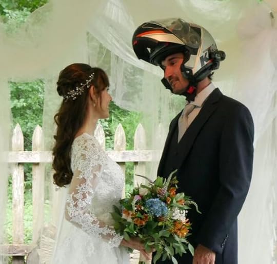 I haven't written a post in a while, but that's because we're back home in Chicago for a break before heading off to Africa, and life here has been pretty normal.
The regular American grind used to be our daily reality: waking up to the sound of the alarm, getting the coffee machine brewing before our eyes were properly opened, running from an air-conditioned building to an air-conditioned car, then coming home to turn on Wheel of Fortune or some other brain mush show until falling asleep. It's not a terrible existence, in fact, there's something very comforting and lovely about it. It's predictable, controlled, and best of all, here in Chicago, our friends and family are always close by, and weekends are spent visiting one another with good food and laughter.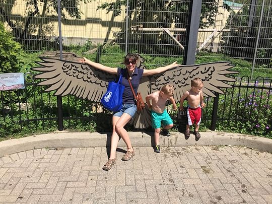 On a recent visit to the zoo with my best friend and her two adorable kids, I spotted this life-sized Andean Condor cutout, the largest flying bird in the world. It felt special to tell the kids I had seen a wild one in Peru! But after 20 months of riding throughout North and South America on the back of a motorcycle, I got used to the unexpected. I got used to eating whatever we could find at roadside markets, to always be drenched in sweat under my motorcycle jacket, and to be constantly fighting off stomach bugs and rubbing out aching bones.
And though that really sounds awful, I can tell you, it's worth it. When I wake up in the morning to the sound of exotic birds and a distant waterfall, I think to myself, “Where am I? Oh yeah. I'm living out my dreams." And I wouldn't trade it for the world. It's that feeling you get when you open your eyes and wonder what that day will bring, not knowing where you'll go, what you'll see, and who you'll meet. There's nothing like it.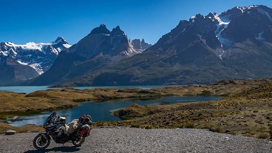 Torres del Paine, Chile It's a great life, but by the time we got to Buenos Aires, we were ready for a break from the road, and to see our friends and family. But most importantly, the bike was ready for a break too, as it needed some new gaskets, coolant, an oil change, new brakes, tires, wheel bearings... yeah, it was time.
So we took the advice of fellow travelers, and used Dakar Motos to fly our bike back to Chicago from Argentina. It cost us nearly $1800, but having the bike arrive the day after we did was phenomenal. Javier and Sandra helped us out with all the customs paperwork, and told us what we could keep on the bike (our panniers, helmets, boots, empty gas canisters, some camping gear, we even got to keep our sheep skin!). Then with the windshield off and mirrors in, they shrink-wrapped it all up on a palette and sent it away.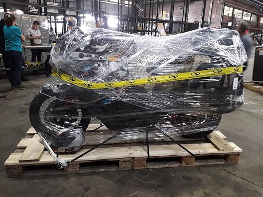 So this is how motorcycles fly... with a lot of cellophane. When we arrived back home, everything seemed to slip right into place as if we'd never left. Since we have no official residence anymore, we've been staying with family for the past few months, which has been wonderful. But I must admit that I had a tiny bit of culture shock coming back to the States. It wasn't a lot of culture shock, since Chile and Argentina are both very “Western" and modernized (and expensive), not too different from what we're used to. But I found myself ordering food at restaurants in Spanish by accident, or saying, “Disculpe," whenever I bumped into someone.
 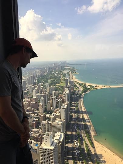 Tim gazing down at the city from the 96th floor of the Hancock Tower, a.k.a. top of the Cock. And then we went to Costco, which if you don't know what that is, it's a huge store, like Walmart, but bigger and where everything is sold in bulk. And I must have looked like a cave man walking around (ok, cave woman) who had just been unfrozen and plopped into the modern world. The place was massive, and most of all... excessive. I felt lost and dazed, because after having lived a minimalist lifestyle of two rolls of toilet paper is too much to carry, I suddenly found myself in 21st Century America, where the TVs are as big as walls, muffins are the size of my face, and now there's not just milk, but there's also almond milk and coconut milk and rice milk and flax milk and hemp milk... what is hemp milk?
 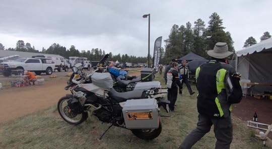 We were in the book booth at Overland Expo West with other motorcycle adventurers... doesn't get better! But the perfect remedy for feeling like an out-of-place nomadic cave woman was going to the Overland Expo West in Flagstaff, Arizona, where we met tons of like-minded travelers and aspiring overlanders. Unfortunately, the bike was still under the knife, so we had to take a car there. But as it started to snow out there, I was secretly thankful to have a vehicle with... can you believe it, windows!
 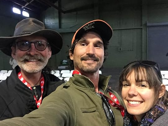 Us and Sam Manicom... a legend! We spent 3 days camping at the Expo, gave our first major presentation in the States, and were part of two round-table events. We met up with old friends (Greg and Jess, who saved us in Guatemala from a bad situation, and now have an awesome charitable dog-collar company, Ruff on the Road), and I even got introduced to some of my adventure motorcycle idols, Ted Simon, Sam Manicom, and Simon and Lisa Thomas.
 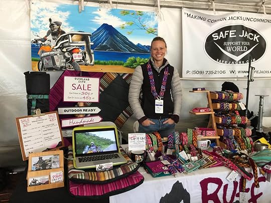 This was Greg and Jess's amazingly-colorful booth for their company, Ruff on the Road. We also got to visit our friends Dana and Bill from Utah along the way, and then came back through Arkansas to see other long-time friends who first helped Tim get his off-road skills. The expo couldn't have gone better, and I only wish we would be around to attend Overland Expo East this fall in Virginia. But we'll hopefully be in Southern Africa by then.
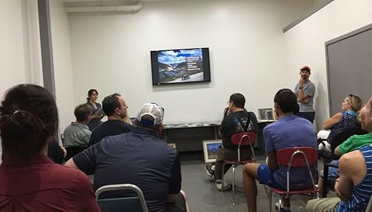
 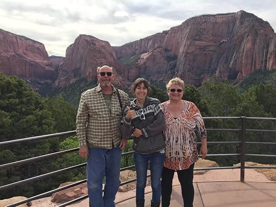 Bill, me (Marisa), and Dana in front of the gorgeous Kolob Mountains of Utah. Having once been absolutely terrified of public speaking, we've given three presentations this summer (about to be four) at a local library, a motorcycle dealership, etc. and I think we're over our fear now. As Tim once said to me the night before we were to present at the Expo, “Who knows? Maybe I'll die in my sleep and won't have to present." Talk about morbid. So we've come a long way, and I foresee us giving lots more presentations as we traverse the globe.
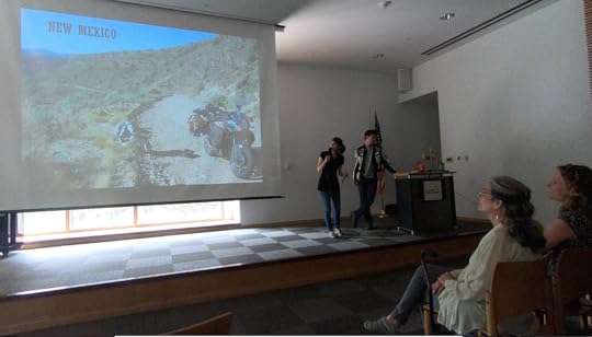
 But somehow I'd thought that at least after the Expo, we could rest, sit around and drink tea, and get to watch a bunch of Netflix. But then we decided to get married, and relaxing went out the window.
We planned the event to be in a friend's backyard, and we wanted it to be low-key, intimate, and stress-free. Well, we got the first two. But unless you elope to Las Vegas or a courthouse, I think there always has to be a little stress involved in planning a wedding.
I bought my dress tailored to my measurements from Amazon, (yes, that's a real thing - take that, hemp milk! I'm still with the modern times!). But of course, something went wrong with the online order, so that was a stress (once things were fixed, the dress turned out perfect, by the way). This was the first reveal of the dress to Tim. Then the tent company canceled on us, and the catering fell through, and the weather was supposed to be 93 degrees (34C) with high humidity and thunderstorms... ok, the point is that everything worked out and the day of the wedding was so perfect, it made all the stress worth it (and the weather was lovely). It was certainly the best day of our lives, and what made it great was not just each other, but the effort, love, and support of our good friends and family who made it all possible. We even had some friends that we've met in our travels come from afar, including Craig and Michelle who we traveled with in Ecuador!
 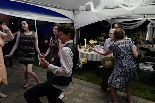 A little air-guitar never hurt anybody... And the best part is that I'm married to the man of my dreams. I know everybody says that, but I'm serious. It had always been my dream to be whisked away on the back of a motorcycle and brought to see every beautiful corner of this world. Well, of course it didn't include helmet hair and sweaty boots and riding through hailstorms, but it's still a dream come true. And I couldn't have picked a funnier, smarter, and more loving man to do it with. And most of all, he has a good heart. Ok, I got really cheesy there for a second. But when am I supposed to be cheesy if not when I get married?
  Now that the wedding's over, we can set our sights on Africa. We plan on going to South Africa, stopping in Namibia, then riding along the eastern side of the continent up to Egypt. But there's a lot of paperwork (Carnet de Passage), bike repairs, and other preparations that need to get done before we can buy any tickets.
But maybe our next post will be from across the sea! So stay tuned... Subscribe to our Blog Be a part of the journey and help push us forward by checking out our Books and Photos for sale: Books and Photos for sale
 I haven't written a post in a while, but that's because we're back home in Chicago for a break before heading off to Africa, and life here has been pretty normal.
 The regular American grind used to be our daily reality: waking up to the sound of the alarm, getting the coffee machine brewing before our eyes were properly opened, running from an air-conditioned building to an air-conditioned car, then coming home to turn on Wheel of Fortune or some other brain mush show until falling asleep. It's not a terrible existence, in fact, there's something very comforting and lovely about it. It's predictable, controlled, and best of all, here in Chicago, our friends and family are always close by, and weekends are spent visiting one another with good food and laughter.
 On a recent visit to the zoo with my best friend and her two adorable kids, I spotted this life-sized Andean Condor cutout, the largest flying bird in the world. It felt special to tell the kids I had seen a wild one in Peru! But after 20 months of riding throughout North and South America on the back of a motorcycle, I got used to the unexpected. I got used to eating whatever we could find at roadside markets, to always be drenched in sweat under my motorcycle jacket, and to be constantly fighting off stomach bugs and rubbing out aching bones.
And though that really sounds awful, I can tell you, it's worth it. When I wake up in the morning to the sound of exotic birds and a distant waterfall, I think to myself, “Where am I? Oh yeah. I'm living out my dreams." And I wouldn't trade it for the world. It's that feeling you get when you open your eyes and wonder what that day will bring, not knowing where you'll go, what you'll see, and who you'll meet. There's nothing like it.
 Torres del Paine, Chile It's a great life, but by the time we got to Buenos Aires, we were ready for a break from the road, and to see our friends and family. But most importantly, the bike was ready for a break too, as it needed some new gaskets, coolant, an oil change, new brakes, tires, wheel bearings... yeah, it was time.
So we took the advice of fellow travelers, and used Dakar Motos to fly our bike back to Chicago from Argentina. It cost us nearly $1800, but having the bike arrive the day after we did was phenomenal. Javier and Sandra helped us out with all the customs paperwork, and told us what we could keep on the bike (our panniers, helmets, boots, empty gas canisters, some camping gear, we even got to keep our sheep skin!). Then with the windshield off and mirrors in, they shrink-wrapped it all up on a palette and sent it away.
 So this is how motorcycles fly... with a lot of cellophane. When we arrived back home, everything seemed to slip right into place as if we'd never left. Since we have no official residence anymore, we've been staying with family for the past few months, which has been wonderful. But I must admit that I had a tiny bit of culture shock coming back to the States. It wasn't a lot of culture shock, since Chile and Argentina are both very “Western" and modernized (and expensive), not too different from what we're used to. But I found myself ordering food at restaurants in Spanish by accident, or saying, “Disculpe," whenever I bumped into someone.
  Tim gazing down at the city from the 96th floor of the Hancock Tower, a.k.a. top of the Cock. And then we went to Costco, which if you don't know what that is, it's a huge store, like Walmart, but bigger and where everything is sold in bulk. And I must have looked like a cave man walking around (ok, cave woman) who had just been unfrozen and plopped into the modern world. The place was massive, and most of all... excessive. I felt lost and dazed, because after having lived a minimalist lifestyle of two rolls of toilet paper is too much to carry, I suddenly found myself in 21st Century America, where the TVs are as big as walls, muffins are the size of my face, and now there's not just milk, but there's also almond milk and coconut milk and rice milk and flax milk and hemp milk... what is hemp milk?
  We were in the book booth at Overland Expo West with other motorcycle adventurers... doesn't get better! But the perfect remedy for feeling like an out-of-place nomadic cave woman was going to the Overland Expo West in Flagstaff, Arizona, where we met tons of like-minded travelers and aspiring overlanders. Unfortunately, the bike was still under the knife, so we had to take a car there. But as it started to snow out there, I was secretly thankful to have a vehicle with... can you believe it, windows!
  Us and Sam Manicom... a legend! We spent 3 days camping at the Expo, gave our first major presentation in the States, and were part of two round-table events. We met up with old friends (Greg and Jess, who saved us in Guatemala from a bad situation, and now have an awesome charitable dog-collar company, Ruff on the Road), and I even got introduced to some of my adventure motorcycle idols, Ted Simon, Sam Manicom, and Simon and Lisa Thomas.
  This was Greg and Jess's amazingly-colorful booth for their company, Ruff on the Road. We also got to visit our friends Dana and Bill from Utah along the way, and then came back through Arkansas to see other long-time friends who first helped Tim get his off-road skills. The expo couldn't have gone better, and I only wish we would be around to attend Overland Expo East this fall in Virginia. But we'll hopefully be in Southern Africa by then.
  Bill, me (Marisa), and Dana in front of the gorgeous Kolob Mountains of Utah. Having once been absolutely terrified of public speaking, we've given three presentations this summer (about to be four) at a local library, a motorcycle dealership, etc. and I think we're over our fear now. As Tim once said to me the night before we were to present at the Expo, “Who knows? Maybe I'll die in my sleep and won't have to present." Talk about morbid. So we've come a long way, and I foresee us giving lots more presentations as we traverse the globe.
 But somehow I'd thought that at least after the Expo, we could rest, sit around and drink tea, and get to watch a bunch of Netflix. But then we decided to get married, and relaxing went out the window.
We planned the event to be in a friend's backyard, and we wanted it to be low-key, intimate, and stress-free. Well, we got the first two. But unless you elope to Las Vegas or a courthouse, I think there always has to be a little stress involved in planning a wedding.
I bought my dress tailored to my measurements from Amazon, (yes, that's a real thing - take that, hemp milk! I'm still with the modern times!). But of course, something went wrong with the online order, so that was a stress (once things were fixed, the dress turned out perfect, by the way).
 This was the first reveal of the dress to Tim. Then the tent company canceled on us, and the catering fell through, and the weather was supposed to be 93 degrees (34C) with high humidity and thunderstorms... ok, the point is that everything worked out and the day of the wedding was so perfect, it made all the stress worth it (and the weather was lovely). It was certainly the best day of our lives, and what made it great was not just each other, but the effort, love, and support of our good friends and family who made it all possible. We even had some friends that we've met in our travels come from afar, including Craig and Michelle who we traveled with in Ecuador!
  A little air-guitar never hurt anybody... And the best part is that I'm married to the man of my dreams. I know everybody says that, but I'm serious. It had always been my dream to be whisked away on the back of a motorcycle and brought to see every beautiful corner of this world. Well, of course it didn't include helmet hair and sweaty boots and riding through hailstorms, but it's still a dream come true. And I couldn't have picked a funnier, smarter, and more loving man to do it with. And most of all, he has a good heart. Ok, I got really cheesy there for a second. But when am I supposed to be cheesy if not when I get married?
  Now that the wedding's over, we can set our sights on Africa. We plan on going to South Africa, stopping in Namibia, then riding along the eastern side of the continent up to Egypt. But there's a lot of paperwork (Carnet de Passage), bike repairs, and other preparations that need to get done before we can buy any tickets.
But maybe our next post will be from across the sea! So stay tuned... Subscribe to our Blog Be a part of the journey and help push us forward by checking out our Books and Photos for sale: Books and Photos for sale


July 14, 2019
Picture Perfect with the Right Frame of Mind
 Marisa and I are excited to offer professional-grade prints of our most memorable snap-shots of the trip so far. Our first round of prints are all from our ventures in South America. From epic landscapes, to unbelievable roads that we found ourselves on, these prints should be able to jump-start some travel inspiration as you plan your own motorcycle adventure.
We would love to have a piece of our memories and most inspiring moments gracing the walls of offices and living rooms across the country. At three different sizes; 8" x 12", 12" x 16", and 13" x 19", we hope to fit a piece of our travels into your hallways, man-caves, she-sheds, and living-rooms.
Fresh off the printer, we're putting them on sale in three sizes with three flat rates that include Free Shipping within the United States:
8" x 12": $30
12" x 16": $35
13" x 19": $40
Please take a look below at the available prints, and click on the ones you like to get details on the backstory, location, and how to order.
If you would prefer a different size, or shipping to Canada, just shoot us an email at NotiersFrontiers@outlook.com and we will make it happen!
 Splash Mountain, Peru (Photo Credit: Kira Hak)
 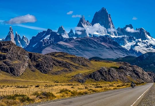 The Mighty Chalten
 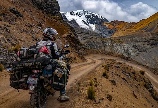 Overloaded Traveler, Peru
 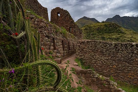 Incan Ruins of Pisac, Peru
  Winding Road, Peru
 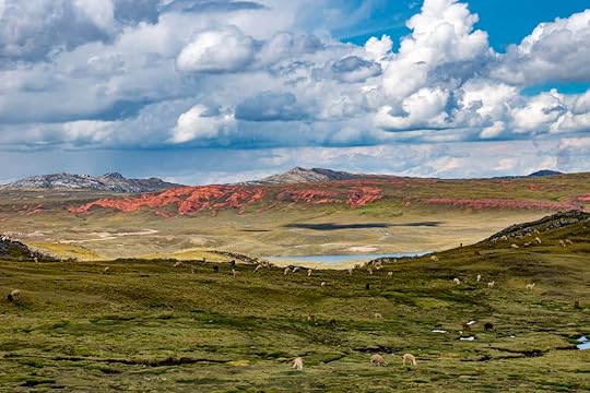 Alpamarca Landscape, Peru
 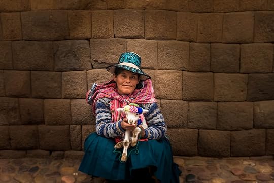 Quechua Woman
 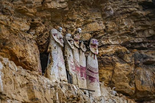 Sarcophagus of Karajia, Northern Peru
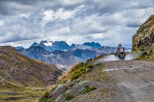
 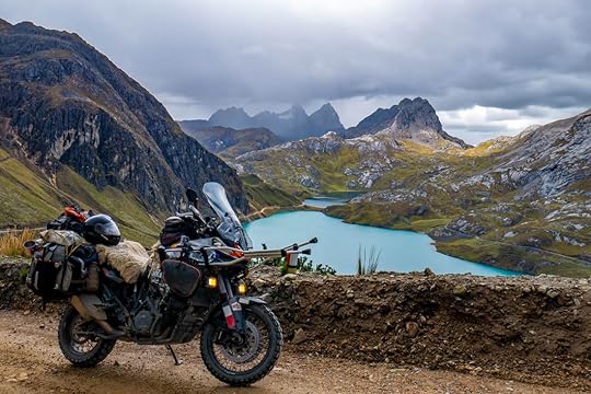 Peruvian Pass, Peru
 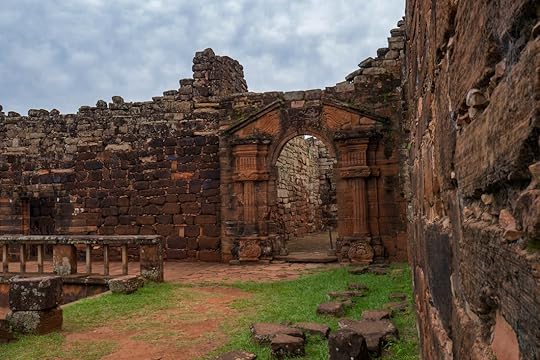 Amazonian Archway
 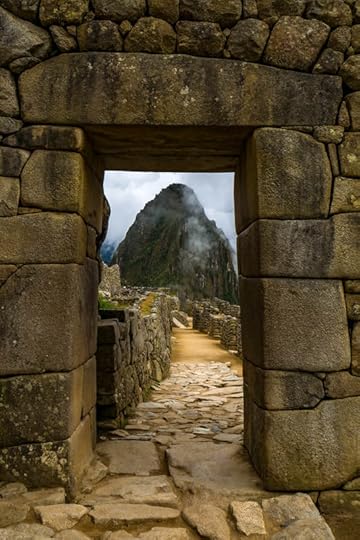 Doorway to Machu Picchu We truly hope you get to enjoy these pictures as much as we enjoyed the moments and places they represent.
From both of us here at Notier's Frontiers, and to all of our friends around the world, keep exploring and thank you for the support!!
Tim and Marisa Notier
We'll keep you posted as we soon head off to Africa!
April 24, 2019
Gear Review - After 2 Years of Abuse
By: Tim Notier 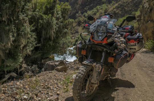 Two years on the road are now in the books (and soon to be in physical books). From Chicago to Ushuaia, and back up to Iguazu Falls, the questions are: what worked and what did not? The following is a list of the things we carred with us and why. We have not received any discounts or free merchandise for promotional purposes, nor are we paid by or affiliated with any company. We purchased these items with our own money, and due to that fact, better-quality and more expensive items may exist out there. These are simply our honest, unfiltered opinions on what we decided to bring on our trip. Categories:Universal Bike EnhancementsCooking and CampingLife's Little ExtrasElectronic GizmosStorageKTM 1190 SpecificPersonal Gear - TimPersonal Gear - Marisa
 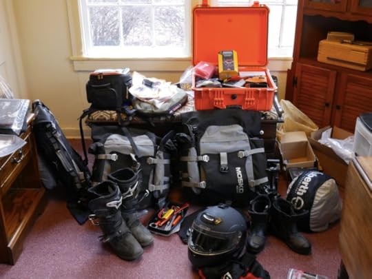 Universal Bike Enhancements These are some great items that wont break the bank. We love them all, and some people may call them “luxury" items... but we are glad to have them. The links to Amazon are highlighted in green. We have AirHawk cushions (B+) for both seats as I'm in a never-ending quest to make my ass more comfortable. At first, I had to slightly customize the AirHawk cover to allow me to stuff a scarf in the front to better support my nether regions that needed support, but(t) overall, a great product.
Barkbuster hand-guards (A+) They haven't snapped off yet after countless drops, and a couple of power slides. A great investment to keep your levers safe.
PDM power distribution module (A+) I upgraded our electrical system with outlets all around the bike to plug in our heated gear (that we ended up sending back home), charge our phones and GPS, etc. Great device, simple to install.
Auxbeam 4" auxiliary lights (A+) A cheap ($20) set from Amazon, have not failed me yet over 2 years of rain and hail. I personally do not see a need to spend hundreds of dollars on Aux lights. With the Mounting Kit, and an On/Off Toggle the whole set up was under $40 bucks. Double Take Collapsable mirrors (A+) When the bike goes down, the mirrors just fold in on themselves as they mount to RAM mounts. This has been a great investment. Slime Motorcycle air compressor (A+) and Plug Kit for flat tires (tubeless). This combo has gotten us out of trouble in Colombia, Ecuador, Peru, Bolivia, and Argentina. South America's awesome back roads have little sharp surprises! Rotopax 1 Gallon Fuel Container (A+) This has come in handy countless of times, from just having the extra security of another 40 miles, to easily filling up our MSR fuel bottles that we use for our stove. We were so thankful to have this in Bolivia because gas was a nightmare to obtain in some areas, but in most cases, there was no conflict if we parked away from the gas station and filled up a gallon at a time. Navigation is key while riding, and keeping our phone (so much better than a dedicated GPS) locked in place is essential. After a bit of trial and error with other products, we bought the Perfect Squeeze (A+), and it has kept our phone sturdily in place over potholes, river crossings, and every Latin American speed bump throughout our journey. To avoid snatch-and-grab would-be thieves while we walk around markets, or leave the bike unattended, we have two Big Panther carabiner locks (A+) with a metal bungie. We use them to secure our helmets, boots, and jackets to the bike. I also put a Grip Lock (A+) on the break lever so no one can push the motorcycle from where I left it. Both of these cheap deterrents help prevent people from snagging our stuff. 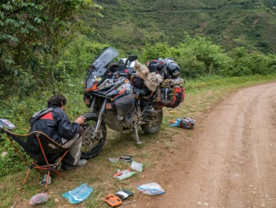 Cooking and Camping Our Nemo Losi 2P (A+) tent with the addition of a separate Garage has provided us with countless nights of comfort and protection from the elements used in combination with two Nemo Cosmo insulated 25L air pads.
Cooking on the road is also important. The MSR Whisperlight (A+) stove has been unstoppable and seems to be the go-to product for long distance travel. Paired with the MSR liquid fuel bottle, it can burn any fuel, and is pretty much hassle-free with the right maintenance. We do also carry an extra fuel pump, just in case the original acts up. Water sources abroad are not always the cleanest, so to filter the muck, toxic minerals, and E-coli out, we use a Survivor Filter (A). Make sure you bring extra filters with you, after a year of use the filters need to be changed. But from cooking to making the essence of life - coffee - it has served us very well and kept us healthy. For extended camping, we just fill up our 6 liter MSR Dromedary bag (A+) to have plenty of water on hand.
Our Enlightened Equipment Quilt (A+++) Definitely keeps us warm on cold nights. It packs down small and is extremely light due to the down feathers. This was not a cheap purchase, but was an important one since keeping Marisa warm is a top priority. She often states she loves this quilt more than me. On cold nights we put a Reflective Blanket under our sleeping pads. This reflects our body heat back up, containing it in the tent. I also put six drawstring attachments on it and it doubles as a bike cover.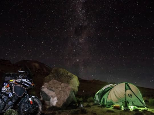 Life's Little Extras Our G4Free (A+) chairs have been some of our favorite bonus items we have. From sitting down at campsites, on beaches, or even hours-long roadblocks, we have never regretted bringing these with us. The did need some repairs over the 2 years, but nothing a bit of duct tape and superglue couldn't fix. A lot of people see our Hip Bags (A+) in photos and ask, “Where did you get those from?" We bought them cheap on Amazon, and there are plenty to choose from. They are great as a purse around Marisa's shoulder, and then strapped to her leg while on the road. I keep my smokes, stickers, and other loose items inside that are constantly needed to be within arm's reach. Everyone needs a belt anyway, and a great place to stash some emergency cash is in a Money Belt (A+). It has an interior zipper to stash some extra cash. Rok Straps (A+) These aren't breaking news to anyone, but just awesome ways to secure loose ends to the bike. Eno Double Hammock (A+) We used this all across the States and through Central America. We ended up sending it home once we reached Peru because of the cold weather, but man was it great while the weather permitted lazy days of laying around in a hammock.
 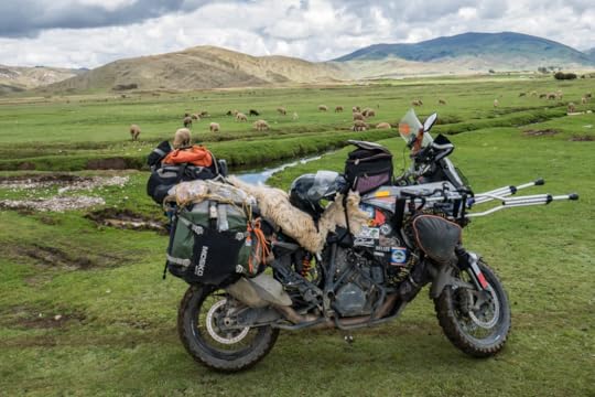 Electronic Gizmos Phones... so expensive, even more so when waterproof. But, for our GPS-dedicated device, we needed one. The Kyocera Duraforce (A+) is the adventurer's phone, and it has been unbreakable. For less than a hundred bucks, and the addition of Google offline maps, OSM+, iOverlander, and Maps.me, this is in my opinion the best navigation set-up there is. Waterproof, dust-proof, shock-proof, life-proof. And if stolen, you are only out ~$90. I charge everything through the tank-bag using a surface SAE Connector I hook directly to my battery, via the PDM. I then route it through my tank-bag via a separate Entry Cable Adapter, and then finally convert it to two USB Ports. This set-up lets me charge my phones, Senas, and anything else via USB. Magnetic Charging Cords come in real handy. They take away the wear and tear of constantly plugging in and disconnecting your gadgets. And if you keep your phone or GPS plugged in while riding, the bumps of the road can ruin the port. Please check these out, they are cheap and very convenient. Communication on the road is key. And even more so, music! We have the ever-so-popular Sena Bluetooth Headsets (A+). We love them! Hours on the road have dramatically changed for the better when listening to anything from Guns & Roses to Jack Johnson. We can communicate with each other and also listen to our own music separately. In Marisa's case, it is one big epic movie soundtrack as she meanders around the world.
To charge all the nicknacks when we are wild camping multiple nights in a row, we bought an EasyAcc Portable Charger(A+). It has four USB outlets, and we can charge both of our phones, and both of our Senas at the same time. Great investment. For emergencies only, we have a Rugged Geek Portable Jump Starter (A+). We thankfully have never needed to use this on the trip, but it did successfully jump the bike back to life in the cold midwestern winters.For “action" videos, we splurged and bought a GoPro Hero6 (A+). I know, it's expensive, but it was worth it. It takes amazing footage and is much more reliable than the cheaper $100 range action cameras, two of which we went through before purchasing the GoPro. Plus, it has amazing stabilization and slow-motion. And the footage it takes is so good, some of our most popular pictures are actually screenshots from a GoPro video!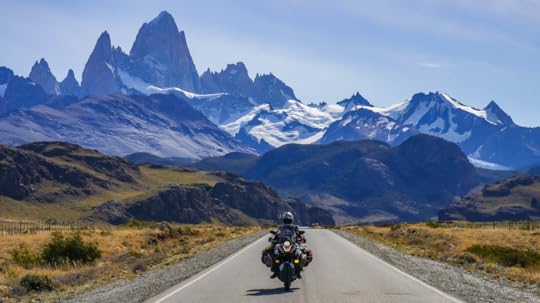 To save all of the pics and vids, we wanted a solid-state external hard drive. We had purchased the standard disk drives, and they failed us. You definitely do not want that happening and loosing all of your glorious footage! We bought a MyDigital SSD (A+) drive, and it has served us flawlessly. For a smaller, more portable thumb-drive, we each have a Samsung 128 gig flash drive (A+). It is perfect for saving documents and other easier access items quickly, and is unbelievably small.
As a middleweight camera, not a DSLR, but not a standard point-and-shoot, the Panasonic Lumix G7 4k mirrorless camera (A+) has been an amazing piece of hardware that has captured all of the great images that we have taken along the way. I love this camera. Storage Our right, left, and top soft luggage cases are by Mosko Moto (A+), and I love these bags! When the bike falls, they act like airbags and are able to survive the fall relatively unharmed. We have had to duct tape some fraying straps, but that's because we put these bags through absolute hell.
The Pelican Hard Case (A-) was left at home, but did make for a nice set-up for shorter trips. This is a large, robust case that had served us well prior to the trip.
KTM Tank Bag (B-) We obviously love KTM, and this matches the bike, but after 3 years of use, the zipper broke. I fixed it with my amazing seamstress abilities and it is still in use! KTM 1190 Specific Powercell pod air intakes (A+) Critical upgrade. They work amazingly, and the KTM Powershop in Bogotá, Colombia, said they had never seen an 1190 with such a clean airbox as ours! We highly recommend these.
Puig Tall Windshield (A-) The tall windshield makes me think I may decapitate myself if I fall forward while riding off-road. Hopefully it will be a nice clean cut under the chin of my helmet, severing my head without pain or discomfort. But it is nice on the highways. I like the Puig much better compared to the Genuine KTM 1190 Adventure Tall Windscreen (C). KTM heated grips (C) If its 65 degrees, and you want it to be 67 degrees, they work awesome... for any real cold weather, they don't really do all that much, even when cranked on high. Personal Gear - Tim KTM/Shuberth modular helmet (A) This is a recent purchase in Costa Rica because my old Fulmer modular helmet was old, and it might have been seven sizes too big. My new helmet fits well, though I had to make some padding adjustments since I was not used to such a tight fit. It's a great helmet but can get a little hot.
Spidi H2Out motorcycle jacket (C) It does its job taking the brunt of the dirt, dust, grime, and rain. But the original waterproof liner was not 100%, and the thermal layer attached awkwardly. It does have nice basic shoulder and elbow protection, but we scrapped the thermal and waterproof layers for a down jacket and rain jacket with a hood that could be worn separately from the touring jacket.
Sedici motorcycle pants (C) Same as above... the waterproof zip-in liner was a joke. It had a wide “V" where the material separated at the crotch, right in the spot where most of the water funnels while riding through a rain storm. We have since purchased heavy-duty rain pants. Alpinestar Toucan (A+) motorcycle boots. Great protection, and can still hike around in them for short periods of time. We climbed some Mayan ruins in them, I don't suggest that, way too hot. Great all-around boots!
Mountain Hardwear (A+) down jacket. This is another part of our gear that Marisa may love more than me. It keeps us warm on the coldest of days, and doubles as a pillow at night.
Ascend rain jacket and pants (F) At first I thought this was a great replacements for the not-so-funtional waterproof sections of the touring jacket and pants. Then Marisa started complaining about getting wet, then actually got pneumonia, and exchanged hers for a cheap plastic version in Colombia which works much better. Then in Ecuador, we got into such a horrible storm, that I was cold and wet for hours afterwards, and have since ditched my Ascend rain gear. I've now purchased a local plastic jacket that is so far working better.
Every type of glove that was ever made I have bought, none of them are waterproof. I may have a problem with buying gloves. Personal Gear - Marisa Schuberth modular helmet (A-) Marisa says it can get hot, and the vents do not provide a difference in airflow. Besides that, she loves it. It blocks a great amount of the outside noise, and is comfortable. It's black, and when it's in the sun for a long time, Marisa swears it shrinks on her. Then again, we've been in some extremely hot places.Spidi motorcycle jacket (C) Marisa's jacket also came with useless liners. Joe Rocket motorcycle pants (C) Didn't come with any waterproof liner, but is great for its protective padding. And with the addition of rain pants underneath, serves well in all types of weather. There is the added frustration that it's nearly impossible to find pants the fit women properly, and these do not. Plus, the front buttons never stay snapped. Marisa is currently looking for something that fits her better.
  Ascend rain jacket (F) Despite being a rain jacket, it was not waterproof. So she ended up buying a set of cheap plastic cyclist jacket and pants in Colombia, and though they are hideous, they work great. She wears the rain pants under her motorcycle pants, but puts the jacket over her touring jacket and says that breaks the wind better.
Mountain Hardwear down jacket (A+) Packs down small, is light, and most importantly, is warm. Only problem is it's hard to wash.BMW Allround waterproof boots (A+) Marisa was not really a fan of her old boots (BILT), so she purchased a pair of very expensive, but very comfortable boots that she has been able to hike in (a little bit) and wear daily in cold and wet weather. I of course have to plug my book Maiden Voyage: within its chapters are even more insights to our original gear. You can read about how we were woefully unprepared for our trip around the Rocky Mountains. None of the gear we had first purchased made it onto the current trip/s we are undertaking.
Bonus News! Marisa and I are getting married on June 22nd, 2019. While we are back in the States, we need to replenish some of the wearable items we have used and abused for the last two years. Some of these items are listed on our Wedding Registry. If you would like to supply the pair of shoes that I will walk in for the next two years, or the pots we will cook in daily, or provide filtered water for every cup of coffee, we would be forever grateful!
We will be updating this list and giving our feedback on these products throughout our journey. Any recommendations on what has worked for you, please leave your comments on our blog page, facebook page, or drop us a line.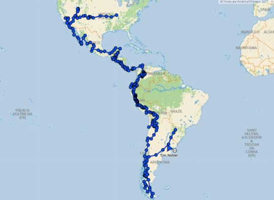 The Americas portion of our trip. Next up: Africa.
 Two years on the road are now in the books (and soon to be in physical books). From Chicago to Ushuaia, and back up to Iguazu Falls, the questions are: what worked and what did not? The following is a list of the things we carred with us and why. We have not received any discounts or free merchandise for promotional purposes, nor are we paid by or affiliated with any company. We purchased these items with our own money, and due to that fact, better-quality and more expensive items may exist out there. These are simply our honest, unfiltered opinions on what we decided to bring on our trip. Categories:Universal Bike EnhancementsCooking and CampingLife's Little ExtrasElectronic GizmosStorageKTM 1190 SpecificPersonal Gear - TimPersonal Gear - Marisa
  Universal Bike Enhancements These are some great items that wont break the bank. We love them all, and some people may call them “luxury" items... but we are glad to have them. The links to Amazon are highlighted in green. We have AirHawk cushions (B+) for both seats as I'm in a never-ending quest to make my ass more comfortable. At first, I had to slightly customize the AirHawk cover to allow me to stuff a scarf in the front to better support my nether regions that needed support, but(t) overall, a great product.
Barkbuster hand-guards (A+) They haven't snapped off yet after countless drops, and a couple of power slides. A great investment to keep your levers safe.
PDM power distribution module (A+) I upgraded our electrical system with outlets all around the bike to plug in our heated gear (that we ended up sending back home), charge our phones and GPS, etc. Great device, simple to install.
Auxbeam 4" auxiliary lights (A+) A cheap ($20) set from Amazon, have not failed me yet over 2 years of rain and hail. I personally do not see a need to spend hundreds of dollars on Aux lights. With the Mounting Kit, and an On/Off Toggle the whole set up was under $40 bucks. Double Take Collapsable mirrors (A+) When the bike goes down, the mirrors just fold in on themselves as they mount to RAM mounts. This has been a great investment. Slime Motorcycle air compressor (A+) and Plug Kit for flat tires (tubeless). This combo has gotten us out of trouble in Colombia, Ecuador, Peru, Bolivia, and Argentina. South America's awesome back roads have little sharp surprises! Rotopax 1 Gallon Fuel Container (A+) This has come in handy countless of times, from just having the extra security of another 40 miles, to easily filling up our MSR fuel bottles that we use for our stove. We were so thankful to have this in Bolivia because gas was a nightmare to obtain in some areas, but in most cases, there was no conflict if we parked away from the gas station and filled up a gallon at a time. Navigation is key while riding, and keeping our phone (so much better than a dedicated GPS) locked in place is essential. After a bit of trial and error with other products, we bought the Perfect Squeeze (A+), and it has kept our phone sturdily in place over potholes, river crossings, and every Latin American speed bump throughout our journey. To avoid snatch-and-grab would-be thieves while we walk around markets, or leave the bike unattended, we have two Big Panther carabiner locks (A+) with a metal bungie. We use them to secure our helmets, boots, and jackets to the bike. I also put a Grip Lock (A+) on the break lever so no one can push the motorcycle from where I left it. Both of these cheap deterrents help prevent people from snagging our stuff.
 Cooking and Camping Our Nemo Losi 2P (A+) tent with the addition of a separate Garage has provided us with countless nights of comfort and protection from the elements used in combination with two Nemo Cosmo insulated 25L air pads.
 Cooking on the road is also important. The MSR Whisperlight (A+) stove has been unstoppable and seems to be the go-to product for long distance travel. Paired with the MSR liquid fuel bottle, it can burn any fuel, and is pretty much hassle-free with the right maintenance. We do also carry an extra fuel pump, just in case the original acts up. Water sources abroad are not always the cleanest, so to filter the muck, toxic minerals, and E-coli out, we use a Survivor Filter (A). Make sure you bring extra filters with you, after a year of use the filters need to be changed. But from cooking to making the essence of life - coffee - it has served us very well and kept us healthy. For extended camping, we just fill up our 6 liter MSR Dromedary bag (A+) to have plenty of water on hand.
Our Enlightened Equipment Quilt (A+++) Definitely keeps us warm on cold nights. It packs down small and is extremely light due to the down feathers. This was not a cheap purchase, but was an important one since keeping Marisa warm is a top priority. She often states she loves this quilt more than me. On cold nights we put a Reflective Blanket under our sleeping pads. This reflects our body heat back up, containing it in the tent. I also put six drawstring attachments on it and it doubles as a bike cover.
 Life's Little Extras Our G4Free (A+) chairs have been some of our favorite bonus items we have. From sitting down at campsites, on beaches, or even hours-long roadblocks, we have never regretted bringing these with us. The did need some repairs over the 2 years, but nothing a bit of duct tape and superglue couldn't fix. A lot of people see our Hip Bags (A+) in photos and ask, “Where did you get those from?" We bought them cheap on Amazon, and there are plenty to choose from. They are great as a purse around Marisa's shoulder, and then strapped to her leg while on the road. I keep my smokes, stickers, and other loose items inside that are constantly needed to be within arm's reach. Everyone needs a belt anyway, and a great place to stash some emergency cash is in a Money Belt (A+). It has an interior zipper to stash some extra cash. Rok Straps (A+) These aren't breaking news to anyone, but just awesome ways to secure loose ends to the bike. Eno Double Hammock (A+) We used this all across the States and through Central America. We ended up sending it home once we reached Peru because of the cold weather, but man was it great while the weather permitted lazy days of laying around in a hammock.
  Electronic Gizmos Phones... so expensive, even more so when waterproof. But, for our GPS-dedicated device, we needed one. The Kyocera Duraforce (A+) is the adventurer's phone, and it has been unbreakable. For less than a hundred bucks, and the addition of Google offline maps, OSM+, iOverlander, and Maps.me, this is in my opinion the best navigation set-up there is. Waterproof, dust-proof, shock-proof, life-proof. And if stolen, you are only out ~$90. I charge everything through the tank-bag using a surface SAE Connector I hook directly to my battery, via the PDM. I then route it through my tank-bag via a separate Entry Cable Adapter, and then finally convert it to two USB Ports. This set-up lets me charge my phones, Senas, and anything else via USB. Magnetic Charging Cords come in real handy. They take away the wear and tear of constantly plugging in and disconnecting your gadgets. And if you keep your phone or GPS plugged in while riding, the bumps of the road can ruin the port. Please check these out, they are cheap and very convenient. Communication on the road is key. And even more so, music! We have the ever-so-popular Sena Bluetooth Headsets (A+). We love them! Hours on the road have dramatically changed for the better when listening to anything from Guns & Roses to Jack Johnson. We can communicate with each other and also listen to our own music separately. In Marisa's case, it is one big epic movie soundtrack as she meanders around the world.
To charge all the nicknacks when we are wild camping multiple nights in a row, we bought an EasyAcc Portable Charger(A+). It has four USB outlets, and we can charge both of our phones, and both of our Senas at the same time. Great investment. For emergencies only, we have a Rugged Geek Portable Jump Starter (A+). We thankfully have never needed to use this on the trip, but it did successfully jump the bike back to life in the cold midwestern winters.For “action" videos, we splurged and bought a GoPro Hero6 (A+). I know, it's expensive, but it was worth it. It takes amazing footage and is much more reliable than the cheaper $100 range action cameras, two of which we went through before purchasing the GoPro. Plus, it has amazing stabilization and slow-motion. And the footage it takes is so good, some of our most popular pictures are actually screenshots from a GoPro video!
 To save all of the pics and vids, we wanted a solid-state external hard drive. We had purchased the standard disk drives, and they failed us. You definitely do not want that happening and loosing all of your glorious footage! We bought a MyDigital SSD (A+) drive, and it has served us flawlessly. For a smaller, more portable thumb-drive, we each have a Samsung 128 gig flash drive (A+). It is perfect for saving documents and other easier access items quickly, and is unbelievably small.
As a middleweight camera, not a DSLR, but not a standard point-and-shoot, the Panasonic Lumix G7 4k mirrorless camera (A+) has been an amazing piece of hardware that has captured all of the great images that we have taken along the way. I love this camera. Storage Our right, left, and top soft luggage cases are by Mosko Moto (A+), and I love these bags! When the bike falls, they act like airbags and are able to survive the fall relatively unharmed. We have had to duct tape some fraying straps, but that's because we put these bags through absolute hell.
The Pelican Hard Case (A-) was left at home, but did make for a nice set-up for shorter trips. This is a large, robust case that had served us well prior to the trip.
KTM Tank Bag (B-) We obviously love KTM, and this matches the bike, but after 3 years of use, the zipper broke. I fixed it with my amazing seamstress abilities and it is still in use!
 KTM 1190 Specific Powercell pod air intakes (A+) Critical upgrade. They work amazingly, and the KTM Powershop in Bogotá, Colombia, said they had never seen an 1190 with such a clean airbox as ours! We highly recommend these.
Puig Tall Windshield (A-) The tall windshield makes me think I may decapitate myself if I fall forward while riding off-road. Hopefully it will be a nice clean cut under the chin of my helmet, severing my head without pain or discomfort. But it is nice on the highways. I like the Puig much better compared to the Genuine KTM 1190 Adventure Tall Windscreen (C). KTM heated grips (C) If its 65 degrees, and you want it to be 67 degrees, they work awesome... for any real cold weather, they don't really do all that much, even when cranked on high.
 Personal Gear - Tim KTM/Shuberth modular helmet (A) This is a recent purchase in Costa Rica because my old Fulmer modular helmet was old, and it might have been seven sizes too big. My new helmet fits well, though I had to make some padding adjustments since I was not used to such a tight fit. It's a great helmet but can get a little hot.
Spidi H2Out motorcycle jacket (C) It does its job taking the brunt of the dirt, dust, grime, and rain. But the original waterproof liner was not 100%, and the thermal layer attached awkwardly. It does have nice basic shoulder and elbow protection, but we scrapped the thermal and waterproof layers for a down jacket and rain jacket with a hood that could be worn separately from the touring jacket.
Sedici motorcycle pants (C) Same as above... the waterproof zip-in liner was a joke. It had a wide “V" where the material separated at the crotch, right in the spot where most of the water funnels while riding through a rain storm. We have since purchased heavy-duty rain pants. Alpinestar Toucan (A+) motorcycle boots. Great protection, and can still hike around in them for short periods of time. We climbed some Mayan ruins in them, I don't suggest that, way too hot. Great all-around boots!
Mountain Hardwear (A+) down jacket. This is another part of our gear that Marisa may love more than me. It keeps us warm on the coldest of days, and doubles as a pillow at night.
Ascend rain jacket and pants (F) At first I thought this was a great replacements for the not-so-funtional waterproof sections of the touring jacket and pants. Then Marisa started complaining about getting wet, then actually got pneumonia, and exchanged hers for a cheap plastic version in Colombia which works much better. Then in Ecuador, we got into such a horrible storm, that I was cold and wet for hours afterwards, and have since ditched my Ascend rain gear. I've now purchased a local plastic jacket that is so far working better.
Every type of glove that was ever made I have bought, none of them are waterproof. I may have a problem with buying gloves.
 Personal Gear - Marisa Schuberth modular helmet (A-) Marisa says it can get hot, and the vents do not provide a difference in airflow. Besides that, she loves it. It blocks a great amount of the outside noise, and is comfortable. It's black, and when it's in the sun for a long time, Marisa swears it shrinks on her. Then again, we've been in some extremely hot places.Spidi motorcycle jacket (C) Marisa's jacket also came with useless liners. Joe Rocket motorcycle pants (C) Didn't come with any waterproof liner, but is great for its protective padding. And with the addition of rain pants underneath, serves well in all types of weather. There is the added frustration that it's nearly impossible to find pants the fit women properly, and these do not. Plus, the front buttons never stay snapped. Marisa is currently looking for something that fits her better.
  Ascend rain jacket (F) Despite being a rain jacket, it was not waterproof. So she ended up buying a set of cheap plastic cyclist jacket and pants in Colombia, and though they are hideous, they work great. She wears the rain pants under her motorcycle pants, but puts the jacket over her touring jacket and says that breaks the wind better.
Mountain Hardwear down jacket (A+) Packs down small, is light, and most importantly, is warm. Only problem is it's hard to wash.BMW Allround waterproof boots (A+) Marisa was not really a fan of her old boots (BILT), so she purchased a pair of very expensive, but very comfortable boots that she has been able to hike in (a little bit) and wear daily in cold and wet weather. I of course have to plug my book Maiden Voyage: within its chapters are even more insights to our original gear. You can read about how we were woefully unprepared for our trip around the Rocky Mountains. None of the gear we had first purchased made it onto the current trip/s we are undertaking.
Bonus News! Marisa and I are getting married on June 22nd, 2019. While we are back in the States, we need to replenish some of the wearable items we have used and abused for the last two years. Some of these items are listed on our Wedding Registry. If you would like to supply the pair of shoes that I will walk in for the next two years, or the pots we will cook in daily, or provide filtered water for every cup of coffee, we would be forever grateful!
We will be updating this list and giving our feedback on these products throughout our journey. Any recommendations on what has worked for you, please leave your comments on our blog page, facebook page, or drop us a line.
 The Americas portion of our trip. Next up: Africa.
April 7, 2019
Apr. 7, 2019 - Argentina: Lakes, Rivers, and Waterfalls
By Marisa 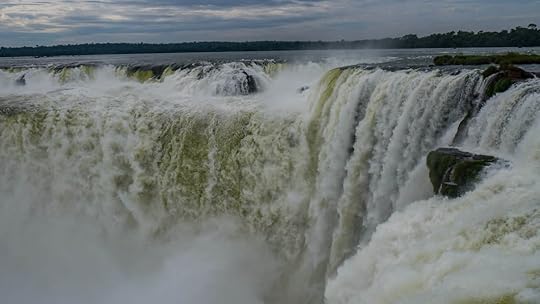 As I write this sitting on my dorm bunkbed in Buenos Aires, I'm coming to the gut-stabbing realization that this is the end. Well, at least it's the end of South America for us.
Because in a few days we fly ourselves and our bike back home to Chicago for a few months' rest before we then head on to Africa. But as I reflect on all that we've seen and done not just in the past two years of travel, but also in the past two weeks here in Argentina, I know that at least we ended our Great Americas Journey with a bang. Or a splash I guess I should say.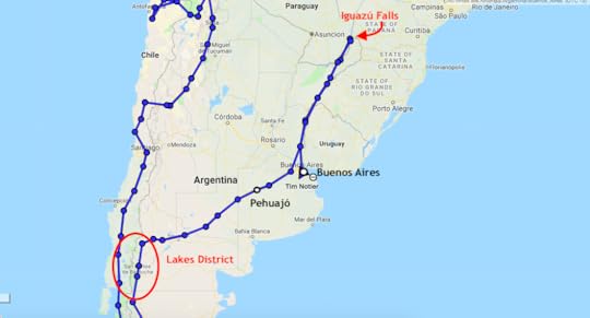 Our journey north from the Lakes District, to Iguazú, and then back down to Buenos Aires. We were coming into central Argentina from the southern reaches of Patagonia, and we arrived in a mountainous, alpine area known as Argentina's Lake District. Our first stop was to set up camp in Los Alerces National Park (350 Pesos per person, ~$8), named after the ancient cypress trees that grow there. Often compared to the sequoias in the US, some alerce trees are more than 3,600 years old and are some of the oldest living organisms on earth!
The place feels like an untamed and crisp wilderness, like you could be lost somewhere in the Colorado Rockies. We took a gorgeous winding dirt road through the park that ran along mountainsides with views of glittering blue lakes below us. And that night we found a camp spot with a view out our tent window of fish jumping out of the crystal clear water of a glacial lake. Pretty hard to beat.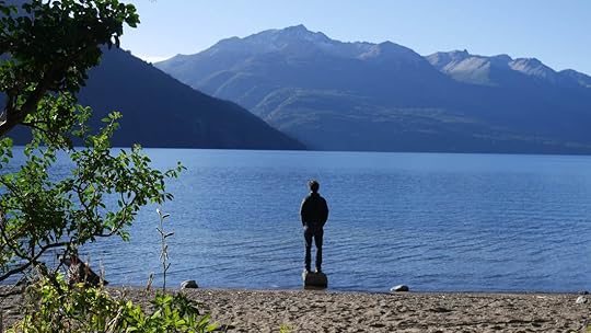 Camping beside Lago Rivadavia in Los Alerces National Park, Argentina. After Los Alerces NP, we headed deeper into the Lakes District which is famous for its Swiss-looking towns such as El Bolsón, La Angostura, San Martín de los Andes, and the region's urban and tourist center, San Carlos de Bariloche. These towns felt clean, friendly, wealthy, and quaint with their wooden and stucco houses of high-pitched roofs boasting shuttered windows and flower boxes. And if that's not great enough, the town centers were lined in sweet-smelling German bakeries and chocolate shops.
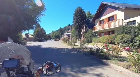 San Martín de los Andes, Argentina. These places definitely have an old-world European feel, and though the chocolate is divine, one should keep in mind that this is still modern Argentina, and that these structures and cities are all very new compared to the original ski towns of the Alps. And for all their charm, sometimes it can feel like a movie set version of the real thing.
 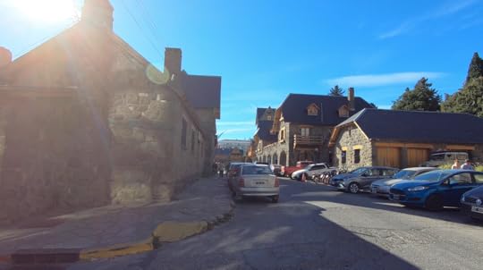 The old town of Bariloche, Argentina. We spent our last few days in the Lakes District taking random scenic dirt roads through the mountains, and wild camping next to pristine rivers. It was idyllic (except for a punctured tire, but Tim's a pro at fixing them now), and I would highly recommend these roads to anyone willing to get off the beaten-path (Rte 65 and 63 between Bariloche and San Martín, and Rte 23 north of San Martín).
 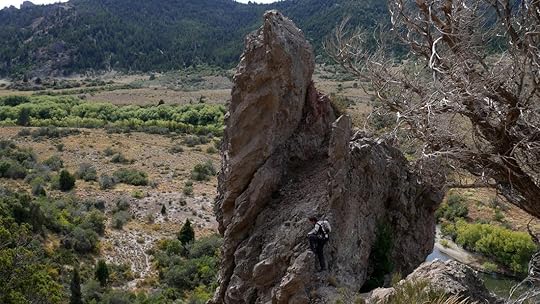 This incredible boulder looks like fire frozen in rock formation. Our last night camping started off fine, but by morning it was so icy, we decided that summer had definitely abandoned us in this part of the world, and that it might be time to stay in a warm hotel instead.
 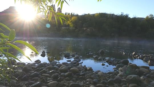 Morning mist off the river Aluminé on Rte 23. With the Lakes District now behind us, our plan was to get to Buenos Aires on the other side of the continent as quickly as we could, which turned out to be a four day ride. There's really not much to see or do in the windy pampas grasslands that is the entirety of middle Argentina. Just wave to the gauchos on horseback herding their cattle as you pass.
It's a little like the Midwest, where we're from, except instead of corn fields as far as you can see, it's just grass. Barbed wire fences and grass. And maybe a grazing animal or two. And wind. There's something austere and comforting about it all, for sure, especially since it reminds me of home. But it's also terribly boring.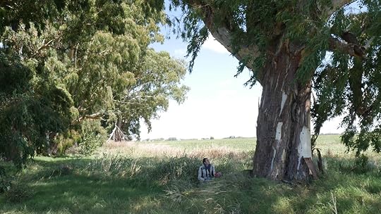 A lovely picnic spot in the countryside. The closer we got to Buenos Aires, the more like the Midwest it became: rolling corn, soy, and wheat fields surrounding the occasional giant metal grain cooperative. And then we came to maybe the friendliest town in Argentina: Pehuajó (peh-wa-HO).
There's not anything particularly special about Pehuajó, except that I felt like I had entered a “Leave it to Beaver" episode and found myself in 1950's Perfectville, USA. Because as Tim was putting more oil in the bike (we still have a leak) and cleaning out the air filter right in downtown Pehuajó, people started gathering around. Sure, he and the bike are definitely attention-grabbing, but you would have thought everyone's long-lost cousin had showed up. So many people were coming up to him and talking, giving him their number for if he needed any help, inviting us to join their motorcycle club, we even got invited to someone's 80th birthday party!
There were children playing on the street, people riding by on bicycles with little bells, the owner of the hotel greeted every person who walked by with a smile and by name. There was even a woman on a bike with her baby swaddled into the front basket (probably not the safest thing, but hey, it's 1950's America, nobody cared!). The opthamologist across the street kept coming by to make sure we didn't need any of the tools he had, the woman next door gave me a map of the region, it was so much friendliness, that this tiny town with not much there will forever stay in my heart and memories.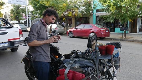 This picture was taken exactly thirty seconds before the entire Mr. Rogers' Neighborhood showed up to inspect us. From Pehuajó, we had a choice to make: go straight to Buenos Aires, or first go to these incredible waterfalls we'd heard about called Iguazú (ee-gwa-SU). The obvious choice would be to see the waterfalls if they're supposed to be so great, but the problem is that it's a long journey to get there. Like if it's your dream in life to visit Paraguay, then they would maybe make sense to see (poor Paraguay, I doubt that's anyone's dream), but otherwise you have to go days out of your way to see these waterfalls. Our bike had an oil leak along with some other issues that needed attention, so there were plenty of reasons to get to Buenos Aires to fly home as soon as possible.
On the other hand, even though most people might have never heard of Iguazú Falls, it's one of the largest and most spectacular waterfalls in the world, and is more than twice the height and width of Niagara. It has been a bucket list item of mine for years, and so despite it not making sense when considering finances and time, I told Tim that it would mean a lot to me if we went.
Tim had very little interest in the falls, but out of a favor for me, we headed north to Iguazú.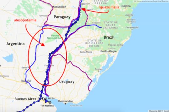 It was a four day unpleasant journey through a humid and rainy landscape called Mesopotamia, an homage to the fact that like the Fertile Crescent, it's also wedged between two major rivers: the Uruguay and the Paraná. Full of timber and yerba mate farms, the flat views of never-ending green stretches can be interesting at first, but it didn't take more than a half hour before I started to wonder if any waterfall could ever make this worth it.
After a few days on the road, we started to see signs for something called La Alemana (the German Woman), and not just one sign, but an incessant amount of signs. Have you ever driven through South Dakota and seen all the signs for Wall Drug? There's nothing else to look at and you just can't tune out the obnoxious billboards, until you find yourself actually anticipating whatever this proclaimed amazing business is.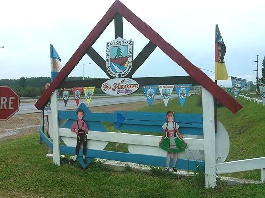 It is here that the eye rolling and head shaking begins. Well, like we expected, La Alemana is a kitsch German-themed store that sells hamburgers, pickles, sausages, and cheeses, complete with a fake windmill and waterwheel. But I found myself actually surprised by the quality of the products. They're supposedly all made by 24 local German-ancestry families, and I really enjoyed my jar of chicken escabeche, which is like a vinegar preserve with meat and veggies, mmmm! They even had wild game versions made with ñandú (ostrich-like local birds), viscacha (chinchillas), pheasants, llama, and all sorts of animals I had no idea what they were.
  And it only gets worse inside. After La Alemana, we were sure we weren't going to see anything of even the slightest interest until the falls. But when we arrived in the town of San Ignacio, we checked into our hotel and the owner asked us if we knew how to get ruins. “Ruins?" I asked. She said, “Oh. You didn't come here to see the ruins?" It turns out we were only a few blocks away, and as we are avid Indiana Jones wannabes, we knew we had to check it out.
 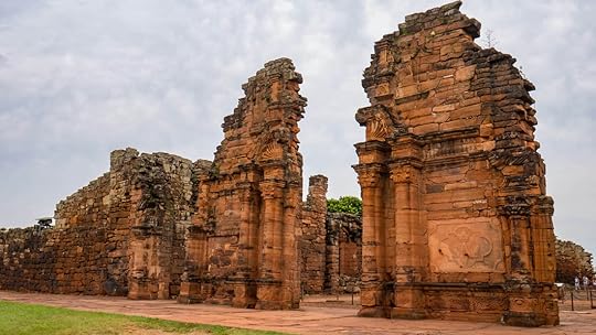 This was just the doorway into the main Jesuit church. The original structure was about twice as high with two massive bell towers on either side. On the way there, I kept thinking, “What sort of South American civilization made huge stone ruins in this part of the Amazon jungle?" And then once we got there I realized that even though these ruins were old for American standards (from 1632), they were not indigenous. The San Ignacio Miní mission was built by Spanish Jesuits (costs 270 Pesos a person, ~$6.15), and despite not being quite as mysterious as Incan and Mayan temples, they were still very impressive and had their own sort of mystique to them.
 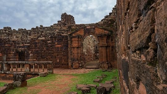 San Ignacio Miní ruins in San Ignacio, Argentina. The red stones carved into ancient Greek and Roman designs contrasted against the rich and savage jungle green, the detailed carvings of mermaids and griffons above the doorways, and the sheer size of the structures really made me feel like we had stumbled upon a hidden treasure. And the trees! The massive trunks supporting a web of vines... one tree had been completely consumed by an invading cactus, another tree had a different tree growing right through the middle of it.
 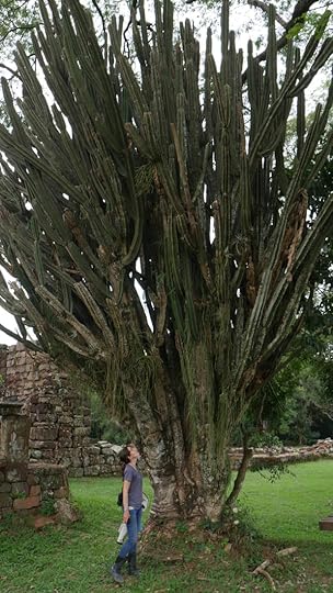 This is not a cactus tree. This is a tree that's being eaten alive by hundreds of individual cactuses. And the best part for us were the areas where the jungle had taken over, like this was the lost city of Angkor Wat. It was oppressively hot with the clouds holding all the moisture to the ground like they wanted to suffocate us, but that all sort of added to the adventure of the place, like we were two sweaty explorers who had found El Dorado.
 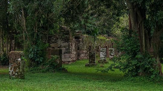 I'm both surprised and glad more people haven't discovered these hidden ruins of San Ignacio Miní, Argentina. The next day we pulled our bike into Puerto Iguazú (the Argentinian town closest to the falls), we found a hotel, and hoped that the weather would hold for our next day's trip into the National Park. But I was nervous, not just about the weather, but I was afraid that this was all going to be a disappointment. I knew that no matter what, I would be grateful for Tim bringing me there, but I worried that I'd regret having convinced him to take so much time and money just to see a waterfall. That he would sigh and say to me afterwards, “Ok, so we did that. Can we go home now?".
Part of the problem is that we wouldn't be going to the Brazilian side of the falls. Although the entirety of Iguazú Falls is technically in Argentina, Brazil has a fantastic lookout point (poor Paraguay, again... so close, but they somehow missed out on all the action). But it would cost us even more time and money to enter Brazil, and we had decided against it. So whatever Argentina had to offer, that was going to be what we got.
We woke up on the day of truth to see rain-filled clouds above us. Great. I started to get the sense that this was going to be a disaster. This is what Iguazú Falls looks like on Google. It seems almost like a volcano, which sort of makes sense since it was actually created by an ancient volcanic explosion. The other crazy part is, what you see here is just one section of the falls, and the rest is completely covered by that huge constant plume of mist. The park cost us 700 Pesos a person (~$17.50), plus 70 for parking (~$1.60), and once we got inside, we had to get tickets (free) for a train that would take us to the main attraction: La Garganta del Diablo, or Devil's Throat.
The train was crowded and slow, but as we started hiking along a congested metal walkway over the river, feeling squished and herded along like I was stuck in line at a Disney World ride, I noticed a thick mist forming over the river in the distance. And then as we got closer, there was this constant roar. And before we knew it, we were standing on a platform actually built over the largest part of the waterfall! It was loud, wet, and intense, like we were inseparable from the water, a part of the action, feeling like we were about to tumble over!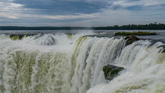 La Garganta del Diablo, or Devil's Throat, Iguazú Falls, Argentina. It was a thrilling experience, but as far as views go, you couldn't see much besides the rushing water beneath you because everything else was shrouded in the mist it created.
So we left the Devil's Throat, now with smiles on our wet faces, got back on the packed and sweaty train, and made our way to a trail that was said to be the best: the Lower Circuit. In Spanish, this trail is called El Paseo Inferior, which, as opposed to the Paseo Superior, did not sound like it was going to be better. But sure enough, once we trekked through the dark and humid rainforest, we arrived at an opening with a view that just erased any doubts I may have had.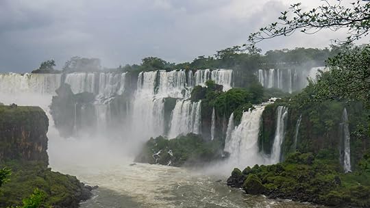
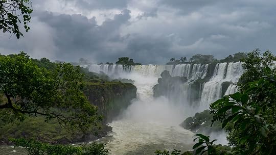 After a good ten minutes of awed silence and picture taking, Tim turned to me and said, “Now this is worth it. This is amazing!"
And I could have cried. Except that he wouldn't have noticed from all the rain on my face. Yes, it was raining, but I realized that it didn't matter. After all, we were in the rainforest and we had come to see water, lots of it. But also the ferocity of the clouds seemed to fit right in.
Those deep tones of the grumbling sky against the angry water hurtling itself over the edge and punching its way down against the rocks, that whole battle scene was in perfect contrast with the ballet dance of the bridal veils of singular streaming falls on either side, like delicate silk threads becoming lost in the wispy forest foliage. If I had to describe a place like heaven with all its strength and beauty wrapped into one, it would be simply this image of Iguazú Falls, and the feeling I felt as I stood there marveling at its grandeur.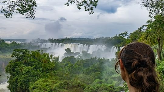
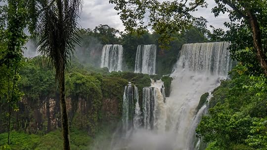 We hiked both the Lower and Upper Circuit trails that go beside, over, and even under countless waterfalls. And there wasn't just the view of the main falls, but there were falls all around us, behind us, plunging below the walkways, each and every one would have been an attraction in and of itself if it were anywhere else.
I have to say that this National Park really puts your money to hard work. Most of the trails are metal walkways built over rivers and wetlands, and they have done a fantastic job. As you walk the miles of grated boardwalks, you will see huge fish and stoic egret beneath you, and you'll really appreciate how it was no easy feat to create these trails. There are bathrooms, benches, garbages, recycling bins, food stores, handicapped-accessible ramps to nearly everything, and best of all, friendly employees standing around guiding people and giving directions. For being a water-laden site in the middle of thick Amazonian jungle, they've really made it easy and comfortable to get to. Even the slow train is ok, I suppose.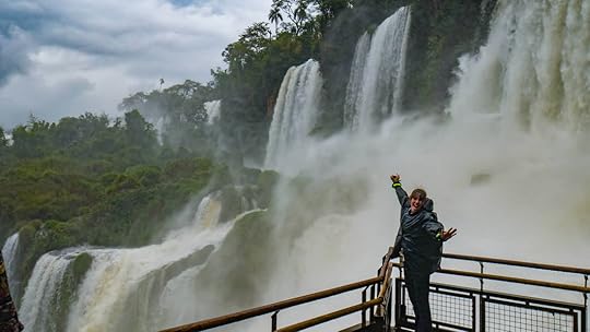 Me near San Martín falls. If you go, bring a raincoat even if it's sunny. Ponchos there cost nearly $15. So, was it worth it? Yes! And I hope that the name Iguazú becomes a household name for one of the world's great natural wonders.
We rode back east to Buenos Aires (stopping at La Alemana again for more German chicken-in-a-jar), and yesterday we had a marvelous time exploring this dynamic city of culture, arts, food, music, and dance. Buenos Aires is a beautiful city with a posh atmosphere that somehow feels relaxed at the same time. I mean, steaks and wine and tango and museums and nightlife, this historic city is always vibrant, always having a good time, and always awake (probably due to all the mate drinking).
But now it's time for us to go back home.
Don't worry, the trip is not over! First we'll ride our bike out to Flagstaff, Arizona to give a presentation at the Overland Expo West on May 17-19 (we hope to see you there!). And we'll also be getting married in June! Whoa, that's a big one. And then, off to Africa!
So lots of exciting stuff to come, stay tuned and we'll keep you updated here, on facebook, and instagram.
 As I write this sitting on my dorm bunkbed in Buenos Aires, I'm coming to the gut-stabbing realization that this is the end. Well, at least it's the end of South America for us.
Because in a few days we fly ourselves and our bike back home to Chicago for a few months' rest before we then head on to Africa. But as I reflect on all that we've seen and done not just in the past two years of travel, but also in the past two weeks here in Argentina, I know that at least we ended our Great Americas Journey with a bang. Or a splash I guess I should say.
 Our journey north from the Lakes District, to Iguazú, and then back down to Buenos Aires. We were coming into central Argentina from the southern reaches of Patagonia, and we arrived in a mountainous, alpine area known as Argentina's Lake District. Our first stop was to set up camp in Los Alerces National Park (350 Pesos per person, ~$8), named after the ancient cypress trees that grow there. Often compared to the sequoias in the US, some alerce trees are more than 3,600 years old and are some of the oldest living organisms on earth!
The place feels like an untamed and crisp wilderness, like you could be lost somewhere in the Colorado Rockies. We took a gorgeous winding dirt road through the park that ran along mountainsides with views of glittering blue lakes below us. And that night we found a camp spot with a view out our tent window of fish jumping out of the crystal clear water of a glacial lake. Pretty hard to beat.
 Camping beside Lago Rivadavia in Los Alerces National Park, Argentina. After Los Alerces NP, we headed deeper into the Lakes District which is famous for its Swiss-looking towns such as El Bolsón, La Angostura, San Martín de los Andes, and the region's urban and tourist center, San Carlos de Bariloche. These towns felt clean, friendly, wealthy, and quaint with their wooden and stucco houses of high-pitched roofs boasting shuttered windows and flower boxes. And if that's not great enough, the town centers were lined in sweet-smelling German bakeries and chocolate shops.
 San Martín de los Andes, Argentina. These places definitely have an old-world European feel, and though the chocolate is divine, one should keep in mind that this is still modern Argentina, and that these structures and cities are all very new compared to the original ski towns of the Alps. And for all their charm, sometimes it can feel like a movie set version of the real thing.
  The old town of Bariloche, Argentina. We spent our last few days in the Lakes District taking random scenic dirt roads through the mountains, and wild camping next to pristine rivers. It was idyllic (except for a punctured tire, but Tim's a pro at fixing them now), and I would highly recommend these roads to anyone willing to get off the beaten-path (Rte 65 and 63 between Bariloche and San Martín, and Rte 23 north of San Martín).
  This incredible boulder looks like fire frozen in rock formation. Our last night camping started off fine, but by morning it was so icy, we decided that summer had definitely abandoned us in this part of the world, and that it might be time to stay in a warm hotel instead.
  Morning mist off the river Aluminé on Rte 23. With the Lakes District now behind us, our plan was to get to Buenos Aires on the other side of the continent as quickly as we could, which turned out to be a four day ride. There's really not much to see or do in the windy pampas grasslands that is the entirety of middle Argentina. Just wave to the gauchos on horseback herding their cattle as you pass.
It's a little like the Midwest, where we're from, except instead of corn fields as far as you can see, it's just grass. Barbed wire fences and grass. And maybe a grazing animal or two. And wind. There's something austere and comforting about it all, for sure, especially since it reminds me of home. But it's also terribly boring.
 A lovely picnic spot in the countryside. The closer we got to Buenos Aires, the more like the Midwest it became: rolling corn, soy, and wheat fields surrounding the occasional giant metal grain cooperative. And then we came to maybe the friendliest town in Argentina: Pehuajó (peh-wa-HO).
There's not anything particularly special about Pehuajó, except that I felt like I had entered a “Leave it to Beaver" episode and found myself in 1950's Perfectville, USA. Because as Tim was putting more oil in the bike (we still have a leak) and cleaning out the air filter right in downtown Pehuajó, people started gathering around. Sure, he and the bike are definitely attention-grabbing, but you would have thought everyone's long-lost cousin had showed up. So many people were coming up to him and talking, giving him their number for if he needed any help, inviting us to join their motorcycle club, we even got invited to someone's 80th birthday party!
There were children playing on the street, people riding by on bicycles with little bells, the owner of the hotel greeted every person who walked by with a smile and by name. There was even a woman on a bike with her baby swaddled into the front basket (probably not the safest thing, but hey, it's 1950's America, nobody cared!). The opthamologist across the street kept coming by to make sure we didn't need any of the tools he had, the woman next door gave me a map of the region, it was so much friendliness, that this tiny town with not much there will forever stay in my heart and memories.
 This picture was taken exactly thirty seconds before the entire Mr. Rogers' Neighborhood showed up to inspect us. From Pehuajó, we had a choice to make: go straight to Buenos Aires, or first go to these incredible waterfalls we'd heard about called Iguazú (ee-gwa-SU). The obvious choice would be to see the waterfalls if they're supposed to be so great, but the problem is that it's a long journey to get there. Like if it's your dream in life to visit Paraguay, then they would maybe make sense to see (poor Paraguay, I doubt that's anyone's dream), but otherwise you have to go days out of your way to see these waterfalls. Our bike had an oil leak along with some other issues that needed attention, so there were plenty of reasons to get to Buenos Aires to fly home as soon as possible.
On the other hand, even though most people might have never heard of Iguazú Falls, it's one of the largest and most spectacular waterfalls in the world, and is more than twice the height and width of Niagara. It has been a bucket list item of mine for years, and so despite it not making sense when considering finances and time, I told Tim that it would mean a lot to me if we went.
Tim had very little interest in the falls, but out of a favor for me, we headed north to Iguazú.
 It was a four day unpleasant journey through a humid and rainy landscape called Mesopotamia, an homage to the fact that like the Fertile Crescent, it's also wedged between two major rivers: the Uruguay and the Paraná. Full of timber and yerba mate farms, the flat views of never-ending green stretches can be interesting at first, but it didn't take more than a half hour before I started to wonder if any waterfall could ever make this worth it.
After a few days on the road, we started to see signs for something called La Alemana (the German Woman), and not just one sign, but an incessant amount of signs. Have you ever driven through South Dakota and seen all the signs for Wall Drug? There's nothing else to look at and you just can't tune out the obnoxious billboards, until you find yourself actually anticipating whatever this proclaimed amazing business is.
 It is here that the eye rolling and head shaking begins. Well, like we expected, La Alemana is a kitsch German-themed store that sells hamburgers, pickles, sausages, and cheeses, complete with a fake windmill and waterwheel. But I found myself actually surprised by the quality of the products. They're supposedly all made by 24 local German-ancestry families, and I really enjoyed my jar of chicken escabeche, which is like a vinegar preserve with meat and veggies, mmmm! They even had wild game versions made with ñandú (ostrich-like local birds), viscacha (chinchillas), pheasants, llama, and all sorts of animals I had no idea what they were.
  And it only gets worse inside. After La Alemana, we were sure we weren't going to see anything of even the slightest interest until the falls. But when we arrived in the town of San Ignacio, we checked into our hotel and the owner asked us if we knew how to get ruins. “Ruins?" I asked. She said, “Oh. You didn't come here to see the ruins?" It turns out we were only a few blocks away, and as we are avid Indiana Jones wannabes, we knew we had to check it out.
  This was just the doorway into the main Jesuit church. The original structure was about twice as high with two massive bell towers on either side. On the way there, I kept thinking, “What sort of South American civilization made huge stone ruins in this part of the Amazon jungle?" And then once we got there I realized that even though these ruins were old for American standards (from 1632), they were not indigenous. The San Ignacio Miní mission was built by Spanish Jesuits (costs 270 Pesos a person, ~$6.15), and despite not being quite as mysterious as Incan and Mayan temples, they were still very impressive and had their own sort of mystique to them.
  San Ignacio Miní ruins in San Ignacio, Argentina. The red stones carved into ancient Greek and Roman designs contrasted against the rich and savage jungle green, the detailed carvings of mermaids and griffons above the doorways, and the sheer size of the structures really made me feel like we had stumbled upon a hidden treasure. And the trees! The massive trunks supporting a web of vines... one tree had been completely consumed by an invading cactus, another tree had a different tree growing right through the middle of it.
  This is not a cactus tree. This is a tree that's being eaten alive by hundreds of individual cactuses. And the best part for us were the areas where the jungle had taken over, like this was the lost city of Angkor Wat. It was oppressively hot with the clouds holding all the moisture to the ground like they wanted to suffocate us, but that all sort of added to the adventure of the place, like we were two sweaty explorers who had found El Dorado.
  I'm both surprised and glad more people haven't discovered these hidden ruins of San Ignacio Miní, Argentina. The next day we pulled our bike into Puerto Iguazú (the Argentinian town closest to the falls), we found a hotel, and hoped that the weather would hold for our next day's trip into the National Park. But I was nervous, not just about the weather, but I was afraid that this was all going to be a disappointment. I knew that no matter what, I would be grateful for Tim bringing me there, but I worried that I'd regret having convinced him to take so much time and money just to see a waterfall. That he would sigh and say to me afterwards, “Ok, so we did that. Can we go home now?".
Part of the problem is that we wouldn't be going to the Brazilian side of the falls. Although the entirety of Iguazú Falls is technically in Argentina, Brazil has a fantastic lookout point (poor Paraguay, again... so close, but they somehow missed out on all the action). But it would cost us even more time and money to enter Brazil, and we had decided against it. So whatever Argentina had to offer, that was going to be what we got.
We woke up on the day of truth to see rain-filled clouds above us. Great. I started to get the sense that this was going to be a disaster.
 This is what Iguazú Falls looks like on Google. It seems almost like a volcano, which sort of makes sense since it was actually created by an ancient volcanic explosion. The other crazy part is, what you see here is just one section of the falls, and the rest is completely covered by that huge constant plume of mist. The park cost us 700 Pesos a person (~$17.50), plus 70 for parking (~$1.60), and once we got inside, we had to get tickets (free) for a train that would take us to the main attraction: La Garganta del Diablo, or Devil's Throat.
The train was crowded and slow, but as we started hiking along a congested metal walkway over the river, feeling squished and herded along like I was stuck in line at a Disney World ride, I noticed a thick mist forming over the river in the distance. And then as we got closer, there was this constant roar. And before we knew it, we were standing on a platform actually built over the largest part of the waterfall! It was loud, wet, and intense, like we were inseparable from the water, a part of the action, feeling like we were about to tumble over!
 La Garganta del Diablo, or Devil's Throat, Iguazú Falls, Argentina. It was a thrilling experience, but as far as views go, you couldn't see much besides the rushing water beneath you because everything else was shrouded in the mist it created.
So we left the Devil's Throat, now with smiles on our wet faces, got back on the packed and sweaty train, and made our way to a trail that was said to be the best: the Lower Circuit. In Spanish, this trail is called El Paseo Inferior, which, as opposed to the Paseo Superior, did not sound like it was going to be better. But sure enough, once we trekked through the dark and humid rainforest, we arrived at an opening with a view that just erased any doubts I may have had.

 After a good ten minutes of awed silence and picture taking, Tim turned to me and said, “Now this is worth it. This is amazing!"
And I could have cried. Except that he wouldn't have noticed from all the rain on my face. Yes, it was raining, but I realized that it didn't matter. After all, we were in the rainforest and we had come to see water, lots of it. But also the ferocity of the clouds seemed to fit right in.
Those deep tones of the grumbling sky against the angry water hurtling itself over the edge and punching its way down against the rocks, that whole battle scene was in perfect contrast with the ballet dance of the bridal veils of singular streaming falls on either side, like delicate silk threads becoming lost in the wispy forest foliage. If I had to describe a place like heaven with all its strength and beauty wrapped into one, it would be simply this image of Iguazú Falls, and the feeling I felt as I stood there marveling at its grandeur.

 We hiked both the Lower and Upper Circuit trails that go beside, over, and even under countless waterfalls. And there wasn't just the view of the main falls, but there were falls all around us, behind us, plunging below the walkways, each and every one would have been an attraction in and of itself if it were anywhere else.
I have to say that this National Park really puts your money to hard work. Most of the trails are metal walkways built over rivers and wetlands, and they have done a fantastic job. As you walk the miles of grated boardwalks, you will see huge fish and stoic egret beneath you, and you'll really appreciate how it was no easy feat to create these trails. There are bathrooms, benches, garbages, recycling bins, food stores, handicapped-accessible ramps to nearly everything, and best of all, friendly employees standing around guiding people and giving directions. For being a water-laden site in the middle of thick Amazonian jungle, they've really made it easy and comfortable to get to. Even the slow train is ok, I suppose.
 Me near San Martín falls. If you go, bring a raincoat even if it's sunny. Ponchos there cost nearly $15. So, was it worth it? Yes! And I hope that the name Iguazú becomes a household name for one of the world's great natural wonders.
We rode back east to Buenos Aires (stopping at La Alemana again for more German chicken-in-a-jar), and yesterday we had a marvelous time exploring this dynamic city of culture, arts, food, music, and dance. Buenos Aires is a beautiful city with a posh atmosphere that somehow feels relaxed at the same time. I mean, steaks and wine and tango and museums and nightlife, this historic city is always vibrant, always having a good time, and always awake (probably due to all the mate drinking).
But now it's time for us to go back home.
Don't worry, the trip is not over! First we'll ride our bike out to Flagstaff, Arizona to give a presentation at the Overland Expo West on May 17-19 (we hope to see you there!). And we'll also be getting married in June! Whoa, that's a big one. And then, off to Africa!
So lots of exciting stuff to come, stay tuned and we'll keep you updated here, on facebook, and instagram.
March 19, 2019
Mar. 19, 2019 - Perfect Patagonia: Mountains and Glaciers (and Wind)
By Marisa 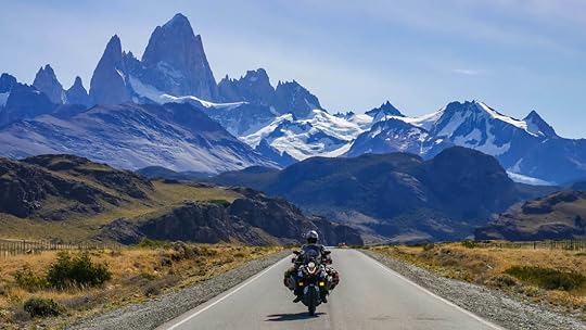 Traveling is not always easy. It's not like the eternal vacation we all had in our minds when planning things out, and sometimes it can beat us down.
After having a slew of bike issues in the flat and windy far reaches of Patagonia, we were just about ready to give up and go home. Tim and I weren't exactly enjoying ourselves anymore, because if you could see our faces from inside our helmets as we strained against the relentless wind, you would've noticed that we were grimacing and probably swearing with every bad word we could think of.
Intense winds are awful, but our motorcycle falling apart brought us to a whole new level of frustration. The worst was the day after I wrote my last blog, March 3rd. We'd just spent $1,000 on bike repairs, got new tires, a new chain, an oil change, and we were thrilled to be back on the road again... until we got to Puerto Natales, Chile, and noticed oil dripping out of every spot on the engine that it could find. It was a disaster, and we felt defeated. Our bike was crying oil, and we felt just as sad. Being in the middle of nowhere, Tim made a last-ditch attempt at fixing the worst leak with some silicon, waited a day for it to dry, and then as we set off with fingers crossed, miraculously it worked! The major leak was fixed, and the smaller ones were something that we could live with. We were thrilled that we could now continue on our adventure, and lucky for us, our next stop was the picturesque Chilean National Park of Torres del Paine.
 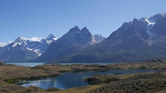 Torres del Paine National Park, Chile.
 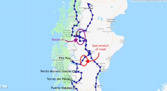 Our route coming back north through Patagonia. Torres means “towers" in Spanish, and Paine (PIE-neh, like apple pie) is a local Tehuelche word which means “blue". So these mountains are the Blue Towers, and it's a fitting description, especially since when we were there, it was all blue skies reflecting in the glacial lakes at the base of the snow-capped peaks of the torres.
The park is not cheap to enter (21,000 Chilean Pesos per person for a day-pass, ~$31.50), and it's an extremely popular destination, especially with hikers who pack the place throughout the summer. But for us, it was worth every penny because the traveling gods had finally decided to give us a break from our string of misfortunes by entreating us with a glorious day. For the entire week prior it had just been clouds and rain up there, but as we wound our way along the dirt road that snakes through the park, we were greeted with beaming sunshine, breathtaking views, and believe it or not, barely any wind.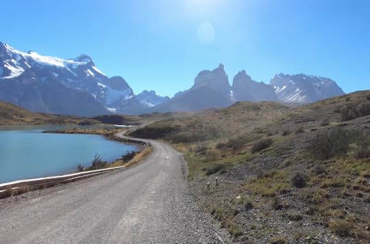 The road through Torres del Paine National Park, Chile. At one point we pulled over to snap some shots, and as the road cleared, we found ourselves to be alone. The breeze quieted, the ducks in the pond were quacking, and Tim and I turned to each other and practically both said at the same time, “Now this is more like it!"
Just then, I heard thunder. Roaring, crumbling, crescendoing thunder. I looked back at the mountain peaks with only crystal blue sky behind them, and as I started to wonder where the storm was coming from, it hit me. An avalanche.
Actually the avalanche didn't hit me, the snow was way off in the distance, which I'm thankful for. But Tim and I took that moment to appreciate the sheer immensity and force of mother nature. And we were simply happy to be experiencing life to the fullest once again.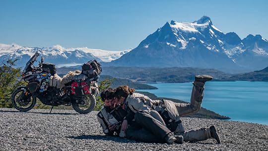 Me trying to convince Tim to get off his phone! No, actually he was using his phone to trigger the camera remotely. After Torres del Paine, our excitement for traveling had been restored. And before we knew it, we were at a place that I will forever cherish: the glacier of Perito Moreno in Argentina.
Now there are tons of glaciers in this world, and for someone who doesn't like the ice and cold, visiting glaciers is not high up on my list of things to do. But Perito Moreno is special because of its position.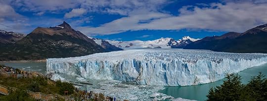 Perito Moreno Glacier, Argentina. The glacier is slowly spilling into a lake, and directly across from this cracking edge of enormous ice is a hill which makes for a perfect viewing platform. To get to the glacier, you have to pay 700 Argentinian Pesos per person ($17.50), but it's a small price to pay to see a natural wonder so impressive, I would absolutely say it's like the Patagonian version of the Grand Canyon.
 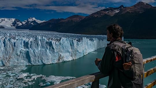 Like the Grand Canyon, what you really come for is the awe-inspiring view, and it is out of this world. As you stand there, marveling at the 230 foot high wall of ice (70 meters), you can hear cracking as pieces crash into the water below, and it sounds as loud as explosions. It's like watching a slow-motion battle of epic proportions between ice and water as the lake eternally consumes the never-ending charge of the flowing glacier.
And like the Grand Canyon, you feel time in all its vastness, as you realize that you are just a mere blip in the age of this earth. You are nothing compared to the amount of time it took for this glacier to form way up there in the mountain. And then slowly flow down to the lake. And then finally crumble into it. Just like the Colorado River took millions of years to create the Grand Canyon, you feel small, insignificant, and at the same time, so appreciative to be able to witness it all.
Perito Moreno Glacier is located just 45 minutes away from the cute town of El Calafate, it has handicapped accessible lookouts, miles of boardwalk trails, and for the extremely adventurous, is next to Los Glaciares National Park which is free and full of hikes to many other glaciers. I would highly recommend coming here for anyone.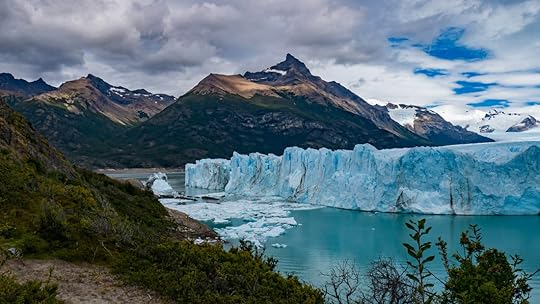 Pictures cannot do justice to the sheer size and raw beauty of Perito Moreno Glacier, Argentina. Our Patagonian tour of bliss was not yet over. The next stop was a mountain peak that is famous throughout the world: Fitz Roy. Also known as Cerro Chaltén, this jagged vertical rock is a rock climber's dream come true. Since we are not climbers, or even really big into hiking, Tim and I appreciated the mountain from afar. But the road coming to it was worth the trip in itself and turned out to be one of the most enjoyable rides of my life.
 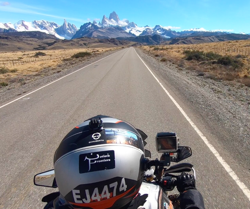 The glorious road leading to El Chaltén, Argentina. Once again we lucked out with the weather, and we couldn't have been more excited to watch those peaks grow bigger and bigger, like they were giant granite crystals shooting into the sky. It took us way longer than normal to get to the nearby village of El Chaltén, simply because we kept stopping for pictures. Again, Tim and I would tell each other, “This makes everything worth it."
 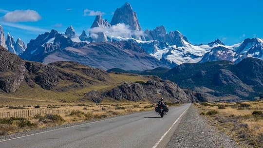 The breathtaking mountain of Fitz Roy, El Chaltén, Argentina. After El Chaltén, we took Route 40, which is the major artery that runs the span of Argentina north to south. And although most of it is paved, there are a few rough sections, and we hit one of them, a 45 mile stretch (72 km). We had been warned about this bit, because when it rains, this section between Chaltén and Gobernador Gregores notoriously becomes a slosh pit of mud. So we had to time things right, but luck was with us once again, and we got through it.
 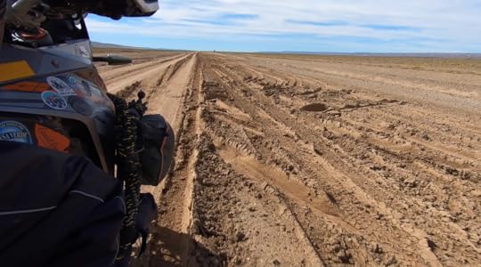 So this was Rte 40 two days after it rained. We didn't want to imagine what it was like wet.
 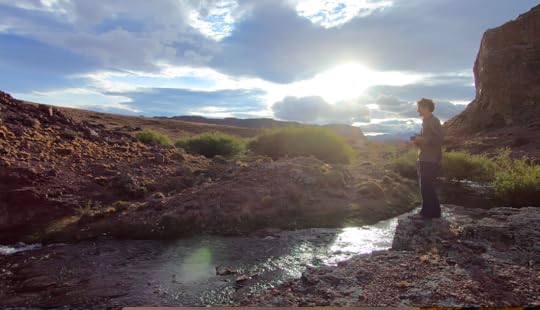 The river beside our perfect camp spot along Rte 41, near Roballos pass. Our time in Patagonia was coming to an end as we journeyed north, but not without one last hurrah. We took a little dirt road that weaves close to the Chilean border called Route 41, a road that many people had recommended to us. And somewhere along it we found a perfect camp spot between the cliffs and beside a bubbling stream.
 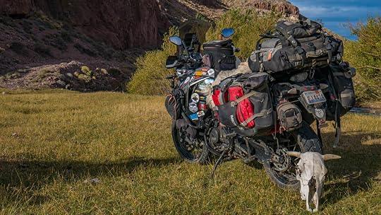 Complete with a cow skull, this was real gaucho country. And then out of nowhere we heard the sound of a motorcycle. But not just any motorcycle, our motorcycle! Even though we thought we'd camped out of sight from the road, it turned out that a fellow KTM 1190 rider had seen us, and came zipping down the field to greet us shouting, “Notier's Frontiers!".
 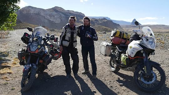 Tim, Roberto, and their two KTM 1190's. This was Roberto from Italy, also known as The Biker Chef, and we had been internet friends for a while. So it was thrilling to get to meet him and spend the night camping together (plus it's pretty awesome he's an Italian chef!).
Okay, so technically his bike is the R version, and we have the S, but whatever, same bike basically, and for me it was an incredible experience not just because of the gorgeous locale and Roberto's great sense of humor, but also because he brought fishing gear. So we spent the afternoon catching trout in the river, and Roberto showed us his culinary skills as he gutted them and grilled them on the fire. And this was seriously the most delicious fish I've ever had. What a night!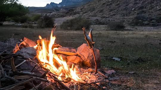 Don't get jealous. Only two are pictured here, but we had four fresh fish to go along with dinner that night. Unfortunately, our paths had to split the next day, and it has been nothing but wind and more miserable wind ever since. But as we make our way north to the last and final leg of our Great Americas Journey (I know, it's sad, we'll be leaving South America soon), at least we have incredible memories of Patagonia to look back on.
 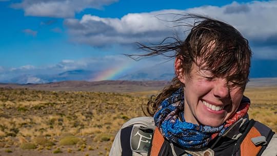 A nice rainbow, but the brutal wind makes it hard to take pictures.
 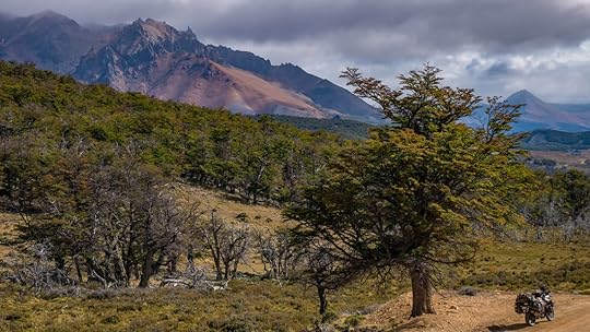 The northern part of Route 41, Argentina. Our final route to end our South American adventures will include the Lake District of Argentina, and at long last, Buenos Aires. But don't worry, our world traveling isn't over yet, not by a long-shot. Because our next continent to explore is Africa.
As always, we'll keep you posted here. You can subscribe to our blog, and follow us on facebook and instagram. Also, check out Tim's book about our humble beginnings and how this whole thing got started.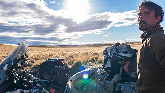 This is quite possibly my favorite picture from us camping in the pampas of Argentina.
 Traveling is not always easy. It's not like the eternal vacation we all had in our minds when planning things out, and sometimes it can beat us down.
After having a slew of bike issues in the flat and windy far reaches of Patagonia, we were just about ready to give up and go home. Tim and I weren't exactly enjoying ourselves anymore, because if you could see our faces from inside our helmets as we strained against the relentless wind, you would've noticed that we were grimacing and probably swearing with every bad word we could think of.
Intense winds are awful, but our motorcycle falling apart brought us to a whole new level of frustration. The worst was the day after I wrote my last blog, March 3rd. We'd just spent $1,000 on bike repairs, got new tires, a new chain, an oil change, and we were thrilled to be back on the road again... until we got to Puerto Natales, Chile, and noticed oil dripping out of every spot on the engine that it could find. It was a disaster, and we felt defeated.
 Our bike was crying oil, and we felt just as sad. Being in the middle of nowhere, Tim made a last-ditch attempt at fixing the worst leak with some silicon, waited a day for it to dry, and then as we set off with fingers crossed, miraculously it worked! The major leak was fixed, and the smaller ones were something that we could live with. We were thrilled that we could now continue on our adventure, and lucky for us, our next stop was the picturesque Chilean National Park of Torres del Paine.
  Torres del Paine National Park, Chile.
  Our route coming back north through Patagonia. Torres means “towers" in Spanish, and Paine (PIE-neh, like apple pie) is a local Tehuelche word which means “blue". So these mountains are the Blue Towers, and it's a fitting description, especially since when we were there, it was all blue skies reflecting in the glacial lakes at the base of the snow-capped peaks of the torres.
The park is not cheap to enter (21,000 Chilean Pesos per person for a day-pass, ~$31.50), and it's an extremely popular destination, especially with hikers who pack the place throughout the summer. But for us, it was worth every penny because the traveling gods had finally decided to give us a break from our string of misfortunes by entreating us with a glorious day. For the entire week prior it had just been clouds and rain up there, but as we wound our way along the dirt road that snakes through the park, we were greeted with beaming sunshine, breathtaking views, and believe it or not, barely any wind.
 The road through Torres del Paine National Park, Chile. At one point we pulled over to snap some shots, and as the road cleared, we found ourselves to be alone. The breeze quieted, the ducks in the pond were quacking, and Tim and I turned to each other and practically both said at the same time, “Now this is more like it!"
Just then, I heard thunder. Roaring, crumbling, crescendoing thunder. I looked back at the mountain peaks with only crystal blue sky behind them, and as I started to wonder where the storm was coming from, it hit me. An avalanche.
Actually the avalanche didn't hit me, the snow was way off in the distance, which I'm thankful for. But Tim and I took that moment to appreciate the sheer immensity and force of mother nature. And we were simply happy to be experiencing life to the fullest once again.
 Me trying to convince Tim to get off his phone! No, actually he was using his phone to trigger the camera remotely. After Torres del Paine, our excitement for traveling had been restored. And before we knew it, we were at a place that I will forever cherish: the glacier of Perito Moreno in Argentina.
Now there are tons of glaciers in this world, and for someone who doesn't like the ice and cold, visiting glaciers is not high up on my list of things to do. But Perito Moreno is special because of its position.
 Perito Moreno Glacier, Argentina. The glacier is slowly spilling into a lake, and directly across from this cracking edge of enormous ice is a hill which makes for a perfect viewing platform. To get to the glacier, you have to pay 700 Argentinian Pesos per person ($17.50), but it's a small price to pay to see a natural wonder so impressive, I would absolutely say it's like the Patagonian version of the Grand Canyon.
  Like the Grand Canyon, what you really come for is the awe-inspiring view, and it is out of this world. As you stand there, marveling at the 230 foot high wall of ice (70 meters), you can hear cracking as pieces crash into the water below, and it sounds as loud as explosions. It's like watching a slow-motion battle of epic proportions between ice and water as the lake eternally consumes the never-ending charge of the flowing glacier.
And like the Grand Canyon, you feel time in all its vastness, as you realize that you are just a mere blip in the age of this earth. You are nothing compared to the amount of time it took for this glacier to form way up there in the mountain. And then slowly flow down to the lake. And then finally crumble into it. Just like the Colorado River took millions of years to create the Grand Canyon, you feel small, insignificant, and at the same time, so appreciative to be able to witness it all.
Perito Moreno Glacier is located just 45 minutes away from the cute town of El Calafate, it has handicapped accessible lookouts, miles of boardwalk trails, and for the extremely adventurous, is next to Los Glaciares National Park which is free and full of hikes to many other glaciers. I would highly recommend coming here for anyone.
 Pictures cannot do justice to the sheer size and raw beauty of Perito Moreno Glacier, Argentina. Our Patagonian tour of bliss was not yet over. The next stop was a mountain peak that is famous throughout the world: Fitz Roy. Also known as Cerro Chaltén, this jagged vertical rock is a rock climber's dream come true. Since we are not climbers, or even really big into hiking, Tim and I appreciated the mountain from afar. But the road coming to it was worth the trip in itself and turned out to be one of the most enjoyable rides of my life.
  The glorious road leading to El Chaltén, Argentina. Once again we lucked out with the weather, and we couldn't have been more excited to watch those peaks grow bigger and bigger, like they were giant granite crystals shooting into the sky. It took us way longer than normal to get to the nearby village of El Chaltén, simply because we kept stopping for pictures. Again, Tim and I would tell each other, “This makes everything worth it."
  The breathtaking mountain of Fitz Roy, El Chaltén, Argentina. After El Chaltén, we took Route 40, which is the major artery that runs the span of Argentina north to south. And although most of it is paved, there are a few rough sections, and we hit one of them, a 45 mile stretch (72 km). We had been warned about this bit, because when it rains, this section between Chaltén and Gobernador Gregores notoriously becomes a slosh pit of mud. So we had to time things right, but luck was with us once again, and we got through it.
  So this was Rte 40 two days after it rained. We didn't want to imagine what it was like wet.
  The river beside our perfect camp spot along Rte 41, near Roballos pass. Our time in Patagonia was coming to an end as we journeyed north, but not without one last hurrah. We took a little dirt road that weaves close to the Chilean border called Route 41, a road that many people had recommended to us. And somewhere along it we found a perfect camp spot between the cliffs and beside a bubbling stream.
  Complete with a cow skull, this was real gaucho country. And then out of nowhere we heard the sound of a motorcycle. But not just any motorcycle, our motorcycle! Even though we thought we'd camped out of sight from the road, it turned out that a fellow KTM 1190 rider had seen us, and came zipping down the field to greet us shouting, “Notier's Frontiers!".
  Tim, Roberto, and their two KTM 1190's. This was Roberto from Italy, also known as The Biker Chef, and we had been internet friends for a while. So it was thrilling to get to meet him and spend the night camping together (plus it's pretty awesome he's an Italian chef!).
Okay, so technically his bike is the R version, and we have the S, but whatever, same bike basically, and for me it was an incredible experience not just because of the gorgeous locale and Roberto's great sense of humor, but also because he brought fishing gear. So we spent the afternoon catching trout in the river, and Roberto showed us his culinary skills as he gutted them and grilled them on the fire. And this was seriously the most delicious fish I've ever had. What a night!
 Don't get jealous. Only two are pictured here, but we had four fresh fish to go along with dinner that night. Unfortunately, our paths had to split the next day, and it has been nothing but wind and more miserable wind ever since. But as we make our way north to the last and final leg of our Great Americas Journey (I know, it's sad, we'll be leaving South America soon), at least we have incredible memories of Patagonia to look back on.
  A nice rainbow, but the brutal wind makes it hard to take pictures.
  The northern part of Route 41, Argentina. Our final route to end our South American adventures will include the Lake District of Argentina, and at long last, Buenos Aires. But don't worry, our world traveling isn't over yet, not by a long-shot. Because our next continent to explore is Africa.
As always, we'll keep you posted here. You can subscribe to our blog, and follow us on facebook and instagram. Also, check out Tim's book about our humble beginnings and how this whole thing got started.
 This is quite possibly my favorite picture from us camping in the pampas of Argentina.
March 2, 2019
Mar. 2, 2019 - Stuck at the End of the World
By Marisa 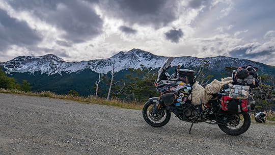 We've made it to the end of the world: the most southern point that you can get to by road on the planet, which is quite an accomplishment, but it has not been without its obstacles. We've had one bike problem after the next, so much so that we are now stuck in Punta Arenas, Chile until we can get the proper parts flown in to this section of the world.
More than a month ago in northern Chile, the engine started overheating on crisp and cold days. So we took it in to the KTM workshop in Santiago where they fixed the water pump, changed out the coolant, and figured our bike issues were behind us.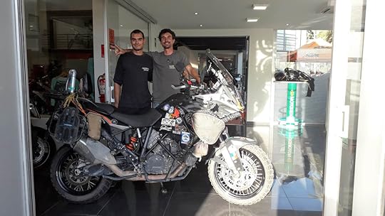 Tim with our amazing mechanic, “Piña", at KTM, Santiago, Chile. But not far down the road, on the Austral Highway into Chile's Patagonia, we realized that the bike was low on oil. This was strange since “consuming" oil was not something that this bike had ever done. So we went out of our way to get the right type of oil in Coyhaique, filled her up, and hoped that all was good once again.
We continued our way south, trying to get to the beautiful mountains and glaciers of Chaltén and Torres del Paine National Park, but before we could reach them, Tim noticed that there were strange bubbles forming on the front tire. Though the tire was not yet ready to be changed, because of the bizarre bubbles, we knew the wise choice would be to change it as soon as possible. And unfortunately for us, the only place to do so was Punta Arenas, Chile, meaning we would have to bypass Chaltén and Torres del Paine. But no problem, we thought. We'll just hit up those destinations on the way back north. This is one of the many bubbles that started forming along the side of the tire's knobs.
  We changed our "bubble" tire for this new one, we being Tim of course. After putting on the new (and expensive) front tire from Punta Arenas, we headed into the frightfully-strong wind toward Ushuaia, which is truly the end of the earth, or at least the end of the road in South America. In order to get there, you have to cross the Strait of Magellan, and due to high winds the day we got there, the ferry wasn't running. We waited a good five hours with the hope that things would calm, but no such luck.
Yet something great did happen because of that delay: we met a fellow motorcycle traveler from Australia named Luke (under the instagram handle lukegetslost), and so at least we had company to share in the misery of being stuck without a ferry. He was wonderful for a good laugh, always positive, and it turned out he worked in the same industry as Tim (as a hand model. No, just kidding. The reality of their jobs is too boring to explain here).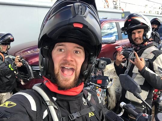 Luke, from @Lukegetslost, who actually does not get lost in real life. We were able to get rooms in a nearby hotel for the night, and were thrilled to see that the next morning was calm and clear. The ferry only took 20 minutes (we went on the small ferry at the Bahia Azul crossing for 4,900 Pesos/~$7.40).
Once onto the island of Tierra del Fuego, we rode through the intense wind on an angle to a bay where a colony of King Penguins live year round. King Penguins are the world's second largest penguins, and they're the ones with the reddish-orange chests (Emperor Penguins are the largest. Monarchy-wise it kind of makes sense, right?). For me, this was a huge draw for coming to such a windy, cold, and distant place: to see penguins! The Chilean government has taken great measures to make the bay a penguin sanctuary, now called Parque Pingüino Rey. It cost us 12,000 Pesos a person (~$18) to enter the park, and after a quick presentation in the museum, we were off to see the penguins. Interestingly enough, I learned that King Penguins do not live in Antarctica, but only on the surrounding islands, such as Tierra del Fuego. Emperor penguins are the kings of Antarctica, I mean, er, emperors of Antarctica, since they live nowhere else. Ah, this is getting confusing.
We were told to stay quiet, and to even turn off the beeping of our cameras. They said it's because this is a breeding colony and they're a fragile species, as studies from certain islands have shown a 90% decline in their population in recent years! The King Penguins of Tierra del Fuego, Chile. You can even see some of their chicks. Even though we were kept at a distance and behind a wooden bird blind, it was amazing to hear the squawking chatter that the penguins made, completely oblivious to us. Fluffy grey babies huddled next to their mother (or father!), and the odor of fish that they exuded was so strong, we could smell them from even where we stood. It was a once-in-a-lifetime experience, and was certainly the highlight for me in coming to Tierra del Fuego.
 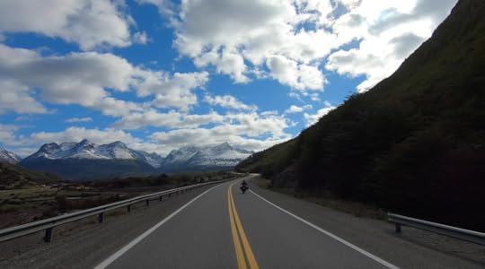 The gorgeous ride to Garibaldi Pass, Tierra del Fuego, Argentina. After the penguins, we all headed off through the wind into Argentina (there are lots of borders to cross in Patagonia), and we finally found ourselves gliding through the snow-sprinkled mountain pass of Garibaldi on our way to Ushuaia. It had just snowed the day before, and yes, it is cold in Tierra del Fuego, oh yeah, and windy, did I mention that? But that drive was simply stunning as we were surrounded by jagged peaks with deep green pine forests dusted in snow. Since leaving the Austral Highway, this was the first time that we'd seen beautiful mountains. It had been many days of riding through nothing but dry grasslands with guanacos (llama-like animals) and sparse trees bent over as they strained against the wind.
But Garibaldi pass felt like a whole other world as we made our way along the paved road that hugged the mountainsides with vistas of lakes and valleys all around.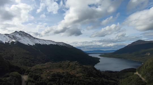 The views of Lake Fagnano on Garibaldi Pass to Ushuaia, Argentina. Unfortunately, our sense of bliss was to very quickly come to an end as Tim pulled over after smelling something burning. It turned out that it wasn't something burning, it was worse. The chain guard had broken off and now the chain was literally eating into the swingarm body of the bike!
 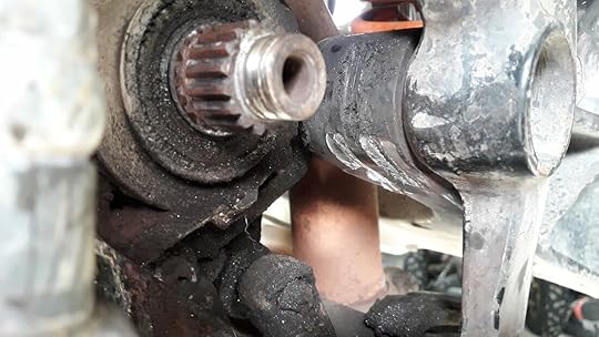 The area where the chain ate into the chassis of the bike.
 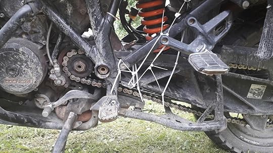 Zip-ties, plastic bags, and duct tape. I'm pretty sure that's all you need for survival. Tim did his very best McGyver impression to get us to Ushuaia by zip-tying the chain guard in place, but by the time we arrived there, the zip-ties had been burnt away and now formed a blackened pile of incinerated plastic.
“Well, it seems bad, but it's not like it's the end of the world for us," I told Tim. “We have tons of zip-ties. We'll just keep zip-tying it until we can get somewhere that can order us a new guard."
“It is the end of the world!" Tim said as he pointed at Ushuaia all around us. I guess in that sense, he was right.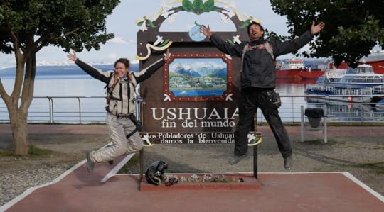 We made it to Ushuaia, as far south as we can go! And despite all the bike issues, in this moment, we are thrilled. So it's true, we had arrived at our southern-most destination. But like the heavy grey clouds looming above us in this cold summer weather near Antarctica, we did not feel like celebrating.
But celebrate we did, as we met up with lots of other motorcycle travelers, who all managed to cheer us up tremendously. Yet the problem for us was that this motorcycle had become our entire life over the past year and a half of travel, and to watch it fall apart again and again was heartbreaking. It was emotionally draining. Each time we'd just try to put on that smile and say, “When we get this fixed, everything will be alright." But after over 50,000 miles of extremely tough riding (80,000 kilometers), we knew it would never be like it was when it was brand new.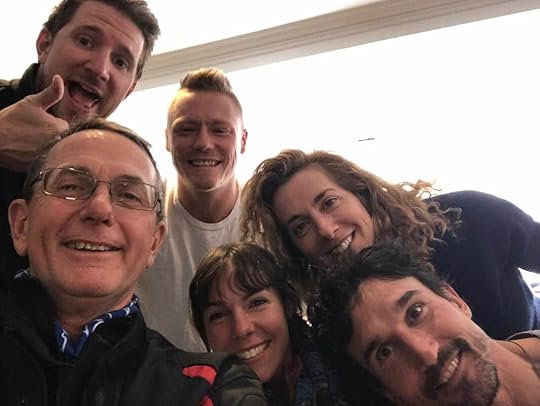 From left to right: Luke, Gordon, Chris, Me, Michie, and Tim. It was a battle between the Aussies and the Americans. We waited three days in Ushuaia for the weather to become nice enough to leave, and then headed back the way we came to Punta Arenas, Chile where we could get the parts we needed at KTM. We said goodbye to Luke and the rest of our new-found friends, and brought the bike into the shop. The new chain, sprockets, and chain guard were going to arrive in just two days, and because we wanted to leave feeling confident in our bike once again, we decided to get an oil change and a new back tire as well, just to be sure that we wouldn't need to have any maintenance done on the bike anytime soon.
That was wishful thinking.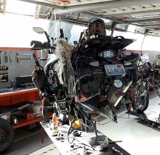 Our bike stripped of a tire and some innards. It has seen better times. With everything done and installed, we picked up the bike yesterday and went down the block to an ATM only to find a gushing oil leak had sprung from somewhere in the engine. The mechanics at KTM pointed out where it was coming from, and were able to get a new gasket for it within the day. Phew, we thought. At last we had solved all our problems and could finally be on our way.
That night we decided to check out a presentation by Ana Grechishkina (Ihaveadreamtravel.info), a solo female motorcycle traveler from Ukraine who has been traveling the world for the past 5 years and happened to be in the same town as us. Plus, she has a KTM 1190 too! We of course had to go, but on the way there, noticed that the back brakes were now pulsating on and off, as if they were affected by the ABS. Good thing we were at an event filled with motorcycle experts who all gathered around the bike, each making their own diagnosis, until someone noticed that the ABS sensor plate was bent and activating the ABS whenever the brakes were being applied. Back to KTM we'd have to go in the morning.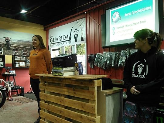 Ana Grechishkina (left) presented at La Guarida motorcycle and coffee shop in Punta Arenas, Chile. Ana's presentation was a real hit, and an inspiration for us, especially since we're going to be presenting at the Overland Expo in Arizona this May! Ana is now striving to hold the record for traveling the most miles around the world on a motorcycle as a solo woman. We are certainly honored to have met her, and truly hope she never stops following her dreams.
That was last night, and this morning we brought the bike back to the shop, only to find that our tire pressure on the new rear tire leaked down to 15 PSI overnight. Not good. So after fixing the ABS plate, we checked the tire, and found the leak on one of the spokes in the rim. The problems just never end! We were all packed to go, helmets on, gloves on, and then realized that we are going nowhere.
There are ways to quick-fix this spoke leak, but we decided to properly resolve it with the right OEM part. We just so desperately want a working bike that we don't have to worry about, and we're tired of things being “fixed" with zip-ties and duct tape. We want to be confident in our motorcycle once again so that we can do what we love: explore the world.
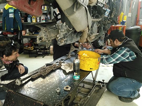 Coolant leaks, oil leaks, tire leaks, we've seen it all in the past few weeks. And so here we are, stuck at the end of the world, waiting for the part to come in five days. It's cold, rainy, and expensive in Punta Arenas, but it could definitely be worse. We need to just stay positive and thankful that we have our health, we have each other, and tons of incredible memories so far to look back on. I just keep reminding myself to think of baby penguins, and it always puts a smile on my face.
Fingers crossed, no new leaks will spring out of nowhere! Please send us your good luck vibes!
We'll keep you informed, and for our most up-to-the-minute news, check us out on facebook or instagram, and check out Tim's book Maiden Voyage on Amazon to see how it all started.
 We've made it to the end of the world: the most southern point that you can get to by road on the planet, which is quite an accomplishment, but it has not been without its obstacles. We've had one bike problem after the next, so much so that we are now stuck in Punta Arenas, Chile until we can get the proper parts flown in to this section of the world.
More than a month ago in northern Chile, the engine started overheating on crisp and cold days. So we took it in to the KTM workshop in Santiago where they fixed the water pump, changed out the coolant, and figured our bike issues were behind us.
 Tim with our amazing mechanic, “Piña", at KTM, Santiago, Chile. But not far down the road, on the Austral Highway into Chile's Patagonia, we realized that the bike was low on oil. This was strange since “consuming" oil was not something that this bike had ever done. So we went out of our way to get the right type of oil in Coyhaique, filled her up, and hoped that all was good once again.
We continued our way south, trying to get to the beautiful mountains and glaciers of Chaltén and Torres del Paine National Park, but before we could reach them, Tim noticed that there were strange bubbles forming on the front tire. Though the tire was not yet ready to be changed, because of the bizarre bubbles, we knew the wise choice would be to change it as soon as possible. And unfortunately for us, the only place to do so was Punta Arenas, Chile, meaning we would have to bypass Chaltén and Torres del Paine. But no problem, we thought. We'll just hit up those destinations on the way back north.
 This is one of the many bubbles that started forming along the side of the tire's knobs.
  We changed our "bubble" tire for this new one, we being Tim of course. After putting on the new (and expensive) front tire from Punta Arenas, we headed into the frightfully-strong wind toward Ushuaia, which is truly the end of the earth, or at least the end of the road in South America. In order to get there, you have to cross the Strait of Magellan, and due to high winds the day we got there, the ferry wasn't running. We waited a good five hours with the hope that things would calm, but no such luck.
Yet something great did happen because of that delay: we met a fellow motorcycle traveler from Australia named Luke (under the instagram handle lukegetslost), and so at least we had company to share in the misery of being stuck without a ferry. He was wonderful for a good laugh, always positive, and it turned out he worked in the same industry as Tim (as a hand model. No, just kidding. The reality of their jobs is too boring to explain here).
 Luke, from @Lukegetslost, who actually does not get lost in real life. We were able to get rooms in a nearby hotel for the night, and were thrilled to see that the next morning was calm and clear. The ferry only took 20 minutes (we went on the small ferry at the Bahia Azul crossing for 4,900 Pesos/~$7.40).
Once onto the island of Tierra del Fuego, we rode through the intense wind on an angle to a bay where a colony of King Penguins live year round. King Penguins are the world's second largest penguins, and they're the ones with the reddish-orange chests (Emperor Penguins are the largest. Monarchy-wise it kind of makes sense, right?). For me, this was a huge draw for coming to such a windy, cold, and distant place: to see penguins!
 The Chilean government has taken great measures to make the bay a penguin sanctuary, now called Parque Pingüino Rey. It cost us 12,000 Pesos a person (~$18) to enter the park, and after a quick presentation in the museum, we were off to see the penguins. Interestingly enough, I learned that King Penguins do not live in Antarctica, but only on the surrounding islands, such as Tierra del Fuego. Emperor penguins are the kings of Antarctica, I mean, er, emperors of Antarctica, since they live nowhere else. Ah, this is getting confusing.
We were told to stay quiet, and to even turn off the beeping of our cameras. They said it's because this is a breeding colony and they're a fragile species, as studies from certain islands have shown a 90% decline in their population in recent years!
 The King Penguins of Tierra del Fuego, Chile. You can even see some of their chicks. Even though we were kept at a distance and behind a wooden bird blind, it was amazing to hear the squawking chatter that the penguins made, completely oblivious to us. Fluffy grey babies huddled next to their mother (or father!), and the odor of fish that they exuded was so strong, we could smell them from even where we stood. It was a once-in-a-lifetime experience, and was certainly the highlight for me in coming to Tierra del Fuego.
  The gorgeous ride to Garibaldi Pass, Tierra del Fuego, Argentina. After the penguins, we all headed off through the wind into Argentina (there are lots of borders to cross in Patagonia), and we finally found ourselves gliding through the snow-sprinkled mountain pass of Garibaldi on our way to Ushuaia. It had just snowed the day before, and yes, it is cold in Tierra del Fuego, oh yeah, and windy, did I mention that? But that drive was simply stunning as we were surrounded by jagged peaks with deep green pine forests dusted in snow. Since leaving the Austral Highway, this was the first time that we'd seen beautiful mountains. It had been many days of riding through nothing but dry grasslands with guanacos (llama-like animals) and sparse trees bent over as they strained against the wind.
But Garibaldi pass felt like a whole other world as we made our way along the paved road that hugged the mountainsides with vistas of lakes and valleys all around.
 The views of Lake Fagnano on Garibaldi Pass to Ushuaia, Argentina. Unfortunately, our sense of bliss was to very quickly come to an end as Tim pulled over after smelling something burning. It turned out that it wasn't something burning, it was worse. The chain guard had broken off and now the chain was literally eating into the swingarm body of the bike!
  The area where the chain ate into the chassis of the bike.
  Zip-ties, plastic bags, and duct tape. I'm pretty sure that's all you need for survival. Tim did his very best McGyver impression to get us to Ushuaia by zip-tying the chain guard in place, but by the time we arrived there, the zip-ties had been burnt away and now formed a blackened pile of incinerated plastic.
“Well, it seems bad, but it's not like it's the end of the world for us," I told Tim. “We have tons of zip-ties. We'll just keep zip-tying it until we can get somewhere that can order us a new guard."
“It is the end of the world!" Tim said as he pointed at Ushuaia all around us. I guess in that sense, he was right.
 We made it to Ushuaia, as far south as we can go! And despite all the bike issues, in this moment, we are thrilled. So it's true, we had arrived at our southern-most destination. But like the heavy grey clouds looming above us in this cold summer weather near Antarctica, we did not feel like celebrating.
But celebrate we did, as we met up with lots of other motorcycle travelers, who all managed to cheer us up tremendously. Yet the problem for us was that this motorcycle had become our entire life over the past year and a half of travel, and to watch it fall apart again and again was heartbreaking. It was emotionally draining. Each time we'd just try to put on that smile and say, “When we get this fixed, everything will be alright." But after over 50,000 miles of extremely tough riding (80,000 kilometers), we knew it would never be like it was when it was brand new.
 From left to right: Luke, Gordon, Chris, Me, Michie, and Tim. It was a battle between the Aussies and the Americans. We waited three days in Ushuaia for the weather to become nice enough to leave, and then headed back the way we came to Punta Arenas, Chile where we could get the parts we needed at KTM. We said goodbye to Luke and the rest of our new-found friends, and brought the bike into the shop. The new chain, sprockets, and chain guard were going to arrive in just two days, and because we wanted to leave feeling confident in our bike once again, we decided to get an oil change and a new back tire as well, just to be sure that we wouldn't need to have any maintenance done on the bike anytime soon.
That was wishful thinking.
 Our bike stripped of a tire and some innards. It has seen better times. With everything done and installed, we picked up the bike yesterday and went down the block to an ATM only to find a gushing oil leak had sprung from somewhere in the engine. The mechanics at KTM pointed out where it was coming from, and were able to get a new gasket for it within the day. Phew, we thought. At last we had solved all our problems and could finally be on our way.
That night we decided to check out a presentation by Ana Grechishkina (Ihaveadreamtravel.info), a solo female motorcycle traveler from Ukraine who has been traveling the world for the past 5 years and happened to be in the same town as us. Plus, she has a KTM 1190 too! We of course had to go, but on the way there, noticed that the back brakes were now pulsating on and off, as if they were affected by the ABS. Good thing we were at an event filled with motorcycle experts who all gathered around the bike, each making their own diagnosis, until someone noticed that the ABS sensor plate was bent and activating the ABS whenever the brakes were being applied. Back to KTM we'd have to go in the morning.
 Ana Grechishkina (left) presented at La Guarida motorcycle and coffee shop in Punta Arenas, Chile. Ana's presentation was a real hit, and an inspiration for us, especially since we're going to be presenting at the Overland Expo in Arizona this May! Ana is now striving to hold the record for traveling the most miles around the world on a motorcycle as a solo woman. We are certainly honored to have met her, and truly hope she never stops following her dreams.
That was last night, and this morning we brought the bike back to the shop, only to find that our tire pressure on the new rear tire leaked down to 15 PSI overnight. Not good. So after fixing the ABS plate, we checked the tire, and found the leak on one of the spokes in the rim. The problems just never end! We were all packed to go, helmets on, gloves on, and then realized that we are going nowhere.
There are ways to quick-fix this spoke leak, but we decided to properly resolve it with the right OEM part. We just so desperately want a working bike that we don't have to worry about, and we're tired of things being “fixed" with zip-ties and duct tape. We want to be confident in our motorcycle once again so that we can do what we love: explore the world.
 Coolant leaks, oil leaks, tire leaks, we've seen it all in the past few weeks. And so here we are, stuck at the end of the world, waiting for the part to come in five days. It's cold, rainy, and expensive in Punta Arenas, but it could definitely be worse. We need to just stay positive and thankful that we have our health, we have each other, and tons of incredible memories so far to look back on. I just keep reminding myself to think of baby penguins, and it always puts a smile on my face.
Fingers crossed, no new leaks will spring out of nowhere! Please send us your good luck vibes!
We'll keep you informed, and for our most up-to-the-minute news, check us out on facebook or instagram, and check out Tim's book Maiden Voyage on Amazon to see how it all started.
February 16, 2019
Feb. 16, 2019 - The Austral Highway: Chile's Patagonia
By Marisa 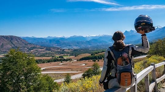 Riding along Chile's Austral Highway wasn't just my dream, it's been a dream of the Chilean people to connect the remote villages of western Patagonia since the 1950's. Completed in 2003, the highway is now called Route 7, or the Carretera Austral (meaning the southern highway), and it passes through mountains of snow, lakes of fresh glacial water, and it goes from temperate rainforests to desert bluffs in 770 miles (1,240 km) of weaving and winding paved bliss.
Of course, we had to go.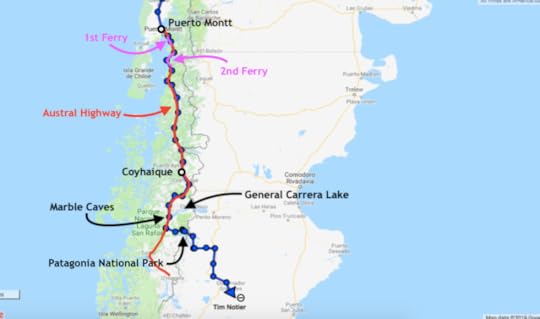 Getting to the Austral Highway from Santiago was the boring part. We took the straight-shot fast-paced super highway of Route 5 all the way down to Puerto Montt, and I think I took no pictures. Certainly there are more scenic ways to go, but as we were pressed for time (we wanted to be in southern Patagonia before summer ended), we decided to just go open throttle and get to the Austral as fast as we could.
Luckily, we had amazing company: Jerry and Jet, an American/Filipino couple who met in Thailand and decided to pack up their belongings and travel South America via motorcycle together. They bought a KLR in Colombia, and have been on the road ever since.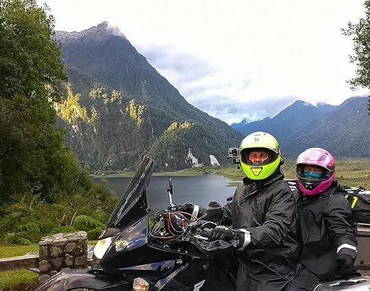 Jerry and Jet at the beginning of the Austral Highway. With the same end goal of Patagonia in mind, we all zipped along Route 5 together, finally reaching the beginning of the Austral at Puerto Montt. But because southern Chile looks like a modern art splatter of islands and misshapen land forms, there's almost more water out there than land, and our introduction to the Austral Highway actually took the form of two ferry-crossings.
The first ferry between Caleta La Arena and Caleta Puelche was only a half-hour ride (7,200 Pesos/~$11), but the second one between Hornopirén and Caleta Gonzalo (8,400 Pesos for motorcycle + 5,600 Pesos for passenger pillion/~$21) took us four and a half hours. It was a long, wet journey, as this region is the rainiest part of Chile, so much so, that's it's considered to be a temperate rainforest. But all that rain made the surrounding mountains as emerald, lush, and mysterious as the forests of Oregon.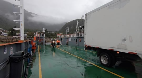 Jerry pulling onto the first ferry. By the time we disembarked and got our tires back on firm land, the sun was setting, and as if to greet us, it momentarily showed its face from behind the clouds to shimmer gold over the waters of Lago Río Negro and Lago Río Blanco. We stopped for a moment at an overlook to snap this picture of the Jurassic landscape of giant ferns and huge firs that now surrounded us. I breathed in the crisp, yet richly humid air, and knew that now we were truly on the Austral Highway.
 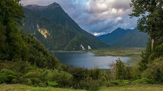 This was exactly what we came to Patagonia for. After spending the night in a cute cabin in the woods complete with a wood-burning stove to stave off the cold, the four of us set off the next day into the frigid rain. As we wound our way through the forest and hills, the rain tapered off, and by afternoon the sun was shining, though the verdant rainforest was gone. It had turned into drier stands of pine between outcroppings of granite, reminding me of the Black Hills of South Dakota.
Unfortunately, this is where we split ways with Jerry and Jet since they didn't have camping gear, and we wanted to camp, especially now that the sun was out. But we're hoping that our paths will cross once again.
For the rest of our time on the Austral we camped, and thankfully, it was blue skies and sunshine throughout.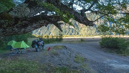 Despite the annoying horseflies, this was a pretty sweet camp spot. Douglas Tompkins is a famous name out here in Chilean Patagonia, as he was not only the founder of The North Face and Esprit outdoor equipment and clothing companies, but he purchased huge swaths of land in Chile which he later donated to the government to become national parks. All of us who take the Austral Highway and enjoy these wild and rugged mountains and lakes, free from trash and pollution, are absolutely indebted to this man's generosity. I can only imagine that the temptation was huge to exploit the land for oil, minerals, or development. And yet he decided to preserve it as it is, so that here in Patagonia you will find some of the most unspoiled and untamed stretches of wilderness on earth.
 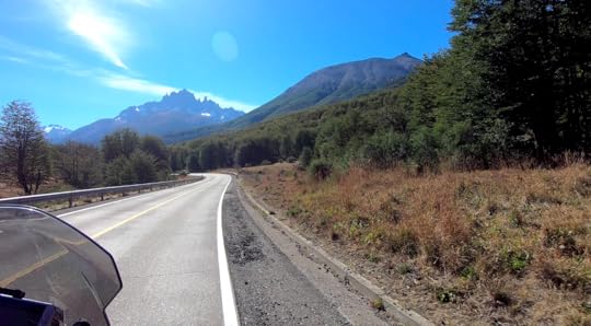 Cerro Castillo looming in the distance, meaning Castle Mountain. It does look like sleeping beauty may be up there. Patagonia is also the least-populated area of Chile, so when we realized that we were mysteriously running low on oil, Tim was worried we wouldn't be able to find any. Luckily, the region's largest town, Coyhaique (koy-AI-kay), was not far. So we headed there and spent an afternoon talking with Willford, the amazingly-knowledgable frontman for MotoRentAdventure Patagonia tours. He told us where to get our oil, and then gave us the run-down of the local roads, which places to fill up on gas, and where to avoid. He seriously knew every road in southern Chile and Argentina, and was not only a wealth of information, but very nice too. If you are ever in the area and need help, or are looking to rent a motorcycle for your own Patagonian adventure, I can personally say I would recommend going here.
With new oil in the beast, we were off again, this time to a place I had heard about years prior: the marble caves of General Carrera Lake. And though I'd seen pictures before, when we turned the corner in the road and were greeted with the sight of the lake, my breath got stuck somewhere in my chest and Tim and I immediately pulled over to take in the views. Because I doubt there is any body of water on earth more blue and stunning than this lake.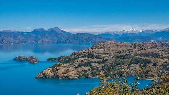 This is not some colorizing photoshop trick. This is actually what it looked like. From Puerto Rio Tranquilo, we hitched ourselves a boat ride to the marble caves for only 10,000 Pesos a person (~$15), and this tour may have been the highlight of my time along the Austral Highway. Though one would think the marble of these caves would be smooth, they actually had a naturally-formed chiseled texture, eaten away by the lake water, the wind, and rain.
 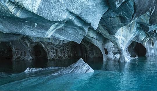 Here you can see the pocked texture of the marble. But the colors were what really took me by surprise, not just of the marbled whites, purples, greens, and blacks streaking the bizarre “cake frosting" shapes of the stone, but the blending between that and the iridescently-blue waters, it almost looked tropical. And yet, white-capped mountains ringed the borders of the lake. It was surreal.
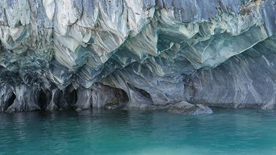
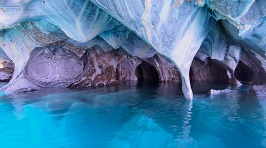
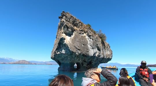 This is called La Capilla de Mármol, or the Marble Chapel. According to our guide, the lake's blue color is due to tiny refracting particles brought in by glacial runoff. And it turns out that General Carrera is not the only water in the region with this incredible color. Nearby Lago Bertrand, also stunningly-blue, is where we spent the night camped next to the Cochrane River, which was a turquoise color that was out-of-this-world. It looked like it was made of Kool-aid, but thankfully it wasn't, and we were told it had some of the purest water on earth. So of course we had to fill up our bottles with it, which was not something I felt comfortable doing, but sure enough, it was the best tasting water I've ever had.
 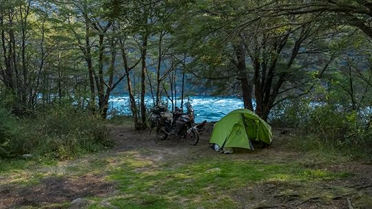 Yup. Candyland River. And Río Cochrane was no peaceful bubbling stream. This river was a white-water rafter's dream, and it was so intense, it created its own wake. We spent the afternoon sitting along the shores waving to groups of rafters as they screamed their way by us like they were on a Disney World ride.
 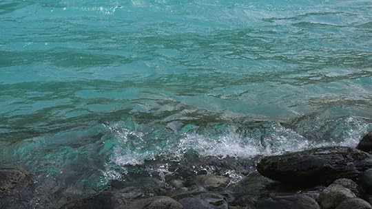 The river water of Río Cochrane almost glows from within. Unfortunately, there was a massive forest fire engulfing the area while we were there, making the skies hazy and the air difficult to breath. Several locals told us not to make any fires since supposedly it was a camper who had accidentally started it, but of course, we already knew not to have bonfires since there were signs everywhere of alto riesgo (high risk). Yet as we covered our faces that night from the smoke, we hoped things would be better the next day.
By morning, the smoke had mostly cleared, and we were excited and also sad since this was going to be end of our Austral journey. Actually, we weren't going to complete Route 7, since the highway goes all the way down to the town of O'Higgins, but dead-ends there. So in order to continue our way south, we took the gravel road through Patagonia National Park and into Argentina. 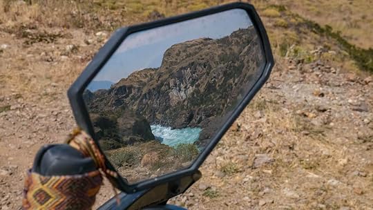 These were the views at the start of Patagonia National Park. It was here that the forests waned into the rocky grasslands that the eastern side of the Andes is known for. But within the park, mountains still surrounded us, some with bits of snow on top, and we found a perfectly placid stream to camp beside. It was idyllic, all except for the fresh puma tracks we found in the river mud. Yeah, there are definitely pumas out there. Luckily we didn't get eaten by any, so that's good.
 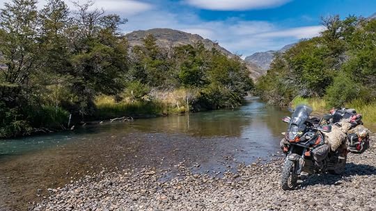 The river at this “puma" campsite was much calmer than our last.
 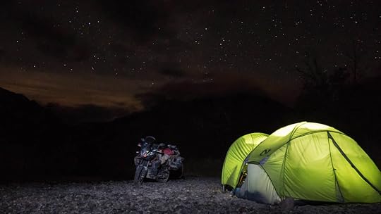 Of course, the stars out there were incredible. We crossed into Argentina at the Roballos border the next day, and while watching the reddened mountains fade in our rear-view mirror, we have since been in the windy plains of desolate towns and straight roads. We hit Route 40, and rode through the grasslands at a neck-bracing slant, all the while passing grazing guanacos (wild llama ancestors) and rheas (giant ostrich-like birds, called ñandú in Spanish).
 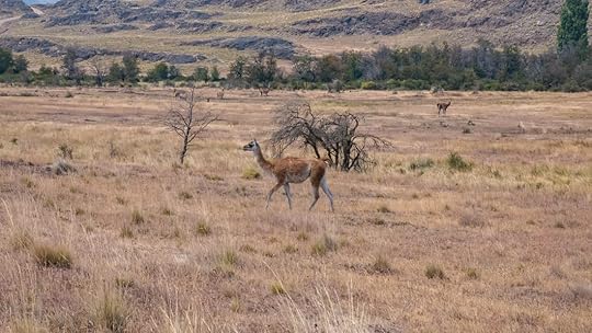 A guanaco. It reminds me of a small camel without a hump. Our destination now is the town of Ushuaia at the very tip of South America: the end of the world. It's the most southern point on earth that you can get to by road, and we're hoping to see some glaciers, and if we're lucky, even a penguin.
We'll keep you updated on facebook, instagram, and of course here on our blog. Until next time...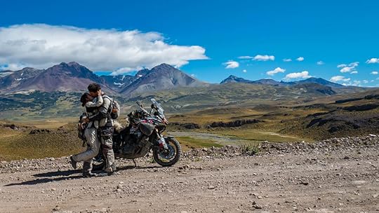 Snagging a quick Valentine's Day kiss near the Roballos border crossing.
 Riding along Chile's Austral Highway wasn't just my dream, it's been a dream of the Chilean people to connect the remote villages of western Patagonia since the 1950's. Completed in 2003, the highway is now called Route 7, or the Carretera Austral (meaning the southern highway), and it passes through mountains of snow, lakes of fresh glacial water, and it goes from temperate rainforests to desert bluffs in 770 miles (1,240 km) of weaving and winding paved bliss.
Of course, we had to go.
 Getting to the Austral Highway from Santiago was the boring part. We took the straight-shot fast-paced super highway of Route 5 all the way down to Puerto Montt, and I think I took no pictures. Certainly there are more scenic ways to go, but as we were pressed for time (we wanted to be in southern Patagonia before summer ended), we decided to just go open throttle and get to the Austral as fast as we could.
Luckily, we had amazing company: Jerry and Jet, an American/Filipino couple who met in Thailand and decided to pack up their belongings and travel South America via motorcycle together. They bought a KLR in Colombia, and have been on the road ever since.
 Jerry and Jet at the beginning of the Austral Highway. With the same end goal of Patagonia in mind, we all zipped along Route 5 together, finally reaching the beginning of the Austral at Puerto Montt. But because southern Chile looks like a modern art splatter of islands and misshapen land forms, there's almost more water out there than land, and our introduction to the Austral Highway actually took the form of two ferry-crossings.
The first ferry between Caleta La Arena and Caleta Puelche was only a half-hour ride (7,200 Pesos/~$11), but the second one between Hornopirén and Caleta Gonzalo (8,400 Pesos for motorcycle + 5,600 Pesos for passenger pillion/~$21) took us four and a half hours. It was a long, wet journey, as this region is the rainiest part of Chile, so much so, that's it's considered to be a temperate rainforest. But all that rain made the surrounding mountains as emerald, lush, and mysterious as the forests of Oregon.
 Jerry pulling onto the first ferry. By the time we disembarked and got our tires back on firm land, the sun was setting, and as if to greet us, it momentarily showed its face from behind the clouds to shimmer gold over the waters of Lago Río Negro and Lago Río Blanco. We stopped for a moment at an overlook to snap this picture of the Jurassic landscape of giant ferns and huge firs that now surrounded us. I breathed in the crisp, yet richly humid air, and knew that now we were truly on the Austral Highway.
  This was exactly what we came to Patagonia for. After spending the night in a cute cabin in the woods complete with a wood-burning stove to stave off the cold, the four of us set off the next day into the frigid rain. As we wound our way through the forest and hills, the rain tapered off, and by afternoon the sun was shining, though the verdant rainforest was gone. It had turned into drier stands of pine between outcroppings of granite, reminding me of the Black Hills of South Dakota.
Unfortunately, this is where we split ways with Jerry and Jet since they didn't have camping gear, and we wanted to camp, especially now that the sun was out. But we're hoping that our paths will cross once again.
For the rest of our time on the Austral we camped, and thankfully, it was blue skies and sunshine throughout.
 Despite the annoying horseflies, this was a pretty sweet camp spot. Douglas Tompkins is a famous name out here in Chilean Patagonia, as he was not only the founder of The North Face and Esprit outdoor equipment and clothing companies, but he purchased huge swaths of land in Chile which he later donated to the government to become national parks. All of us who take the Austral Highway and enjoy these wild and rugged mountains and lakes, free from trash and pollution, are absolutely indebted to this man's generosity. I can only imagine that the temptation was huge to exploit the land for oil, minerals, or development. And yet he decided to preserve it as it is, so that here in Patagonia you will find some of the most unspoiled and untamed stretches of wilderness on earth.
  Cerro Castillo looming in the distance, meaning Castle Mountain. It does look like sleeping beauty may be up there. Patagonia is also the least-populated area of Chile, so when we realized that we were mysteriously running low on oil, Tim was worried we wouldn't be able to find any. Luckily, the region's largest town, Coyhaique (koy-AI-kay), was not far. So we headed there and spent an afternoon talking with Willford, the amazingly-knowledgable frontman for MotoRentAdventure Patagonia tours. He told us where to get our oil, and then gave us the run-down of the local roads, which places to fill up on gas, and where to avoid. He seriously knew every road in southern Chile and Argentina, and was not only a wealth of information, but very nice too. If you are ever in the area and need help, or are looking to rent a motorcycle for your own Patagonian adventure, I can personally say I would recommend going here.
With new oil in the beast, we were off again, this time to a place I had heard about years prior: the marble caves of General Carrera Lake. And though I'd seen pictures before, when we turned the corner in the road and were greeted with the sight of the lake, my breath got stuck somewhere in my chest and Tim and I immediately pulled over to take in the views. Because I doubt there is any body of water on earth more blue and stunning than this lake.
 This is not some colorizing photoshop trick. This is actually what it looked like. From Puerto Rio Tranquilo, we hitched ourselves a boat ride to the marble caves for only 10,000 Pesos a person (~$15), and this tour may have been the highlight of my time along the Austral Highway. Though one would think the marble of these caves would be smooth, they actually had a naturally-formed chiseled texture, eaten away by the lake water, the wind, and rain.
  Here you can see the pocked texture of the marble. But the colors were what really took me by surprise, not just of the marbled whites, purples, greens, and blacks streaking the bizarre “cake frosting" shapes of the stone, but the blending between that and the iridescently-blue waters, it almost looked tropical. And yet, white-capped mountains ringed the borders of the lake. It was surreal.

 This is called La Capilla de Mármol, or the Marble Chapel. According to our guide, the lake's blue color is due to tiny refracting particles brought in by glacial runoff. And it turns out that General Carrera is not the only water in the region with this incredible color. Nearby Lago Bertrand, also stunningly-blue, is where we spent the night camped next to the Cochrane River, which was a turquoise color that was out-of-this-world. It looked like it was made of Kool-aid, but thankfully it wasn't, and we were told it had some of the purest water on earth. So of course we had to fill up our bottles with it, which was not something I felt comfortable doing, but sure enough, it was the best tasting water I've ever had.
  Yup. Candyland River. And Río Cochrane was no peaceful bubbling stream. This river was a white-water rafter's dream, and it was so intense, it created its own wake. We spent the afternoon sitting along the shores waving to groups of rafters as they screamed their way by us like they were on a Disney World ride.
  The river water of Río Cochrane almost glows from within. Unfortunately, there was a massive forest fire engulfing the area while we were there, making the skies hazy and the air difficult to breath. Several locals told us not to make any fires since supposedly it was a camper who had accidentally started it, but of course, we already knew not to have bonfires since there were signs everywhere of alto riesgo (high risk). Yet as we covered our faces that night from the smoke, we hoped things would be better the next day.
By morning, the smoke had mostly cleared, and we were excited and also sad since this was going to be end of our Austral journey. Actually, we weren't going to complete Route 7, since the highway goes all the way down to the town of O'Higgins, but dead-ends there. So in order to continue our way south, we took the gravel road through Patagonia National Park and into Argentina.
 These were the views at the start of Patagonia National Park. It was here that the forests waned into the rocky grasslands that the eastern side of the Andes is known for. But within the park, mountains still surrounded us, some with bits of snow on top, and we found a perfectly placid stream to camp beside. It was idyllic, all except for the fresh puma tracks we found in the river mud. Yeah, there are definitely pumas out there. Luckily we didn't get eaten by any, so that's good.
  The river at this “puma" campsite was much calmer than our last.
  Of course, the stars out there were incredible. We crossed into Argentina at the Roballos border the next day, and while watching the reddened mountains fade in our rear-view mirror, we have since been in the windy plains of desolate towns and straight roads. We hit Route 40, and rode through the grasslands at a neck-bracing slant, all the while passing grazing guanacos (wild llama ancestors) and rheas (giant ostrich-like birds, called ñandú in Spanish).
  A guanaco. It reminds me of a small camel without a hump. Our destination now is the town of Ushuaia at the very tip of South America: the end of the world. It's the most southern point on earth that you can get to by road, and we're hoping to see some glaciers, and if we're lucky, even a penguin.
We'll keep you updated on facebook, instagram, and of course here on our blog. Until next time...
 Snagging a quick Valentine's Day kiss near the Roballos border crossing.
February 2, 2019
Feb. 2, 2019 - The Road to Santiago
By Marisa 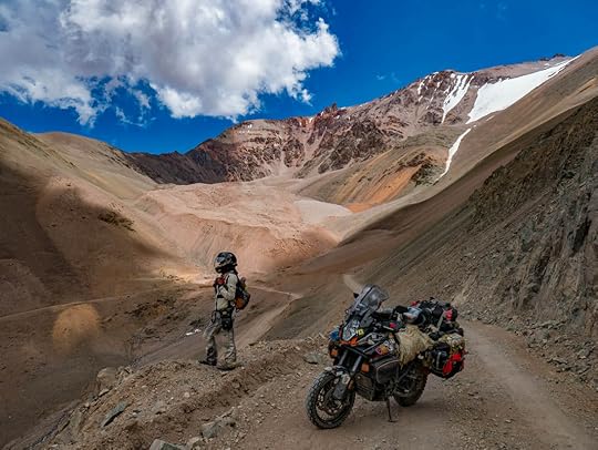 We were in northern Argentina, spending our days poolside in the shade of peach trees and vineyards, when we realized that it had to come to an end. Because if we were ever going to get to Patagonia's glaciers before the roads became impassable with snow, we would need to exchange this warm-weather grape-eating lifestyle for one of down jackets and wooly hats. And it had to be soon, before we'd miss our window of opportunity to get to the Antarctic regions of South America while it's still summer there.
 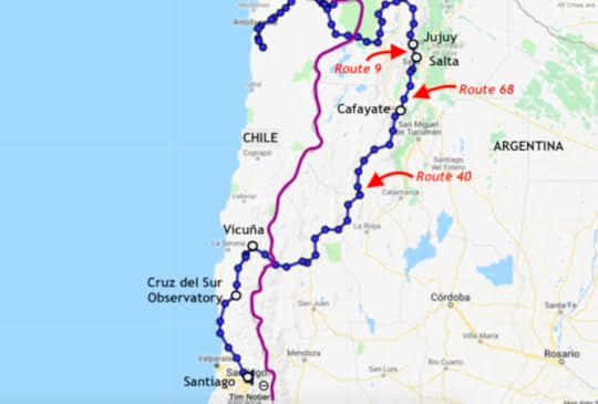 Our route from Jujuy in northern Argentina down to Chile's capital, Santiago. So we made a plan to head south, south, and more south, maybe stopping along the way in Chile's capital, Santiago, maybe not if we felt rushed. But that was all before the problems with the bike started (yes, that's right, more problems, but nothing as serious as the ones after the salt flats).
We left Jujuy, Argentina, and headed into the thick of the lush green Amazonian highlands to get to the region's largest city, Salta. And by a pure wonderful accident, we took a road that is now one of my favorites of all time: Route 9. They had signs at the beginning warning us that this was going to be “sinuoso", which meant it had lots of curves, but I think that's an understatement. It was narrow, perfectly-paved, and a twisting roller-coaster ride that wound along the fertile mountainsides like we were gliding through Jurassic Park. The scenery reminded me of the wild and overgrown Death Road in Bolivia, but on speed since it was paved and fast. There were so many vines hanging over the way, we even got hit by them. As the road danced through the rich farmlands and cut into the steamy rainforest, it was hot, it was thrilling, and it was not for those who get car-sick! Despite being sweaty and sweltering in our jackets, Tim and I were all smiles throughout. This picture does not do justice to Rte 9 between Jujuy and Salta. It was a ride of a lifetime. Salta turned out to be a lovely colonial white-washed city that feels as tropical, humid, friendly, and laid-back as a Caribbean island. It's also where we had our first real Argentinian steak: and slab of perfectly-spiced meat that was so good, even just writing about it makes my mouth water.
From there, we headed towards what we'd heard was a beautiful mountain pass into Chile, a border crossing called Agua Negra, but of course we took the scenic way to get there. Route 68 from Salta to Cafayate was another of Argentina's pristinely-paved roads, but this time it brought us through a red canyon of colorful spires and cliffs that was not too unlike what you'd find in Arizona, or Canyonlands National Park, Utah. Wiley Coyote or James Earp would have been right at home in this cactus-filled desert of reds, pinks, and oranges. We even camped in the middle of it along the tiny river that created these awe-inspiring stone-scapes over thousands of years. It was just us, the parrots, a fox, and the sparse spiky plants out there in the wilds of Argentina. The unbelievably beautiful campsite we found along Rte 68, Argentina. We reached Cafayate the next morning to find that they had somehow transformed this rugged desert landscape into a Tuscan haven of spring-green vineyards with huge plantation-like winery hotels leading into the cute and quaint center of town. From what I heard, Cafayate is home to a population of Germans who emigrated after WWII (as in many placed in Argentina). But here they not only make world-class wines, but also brew some of the best beers in South America.
  A curious bird-of-prey made our acquaintance in Salica, Argentina. We hit the causeway of Argentina's Route 40 and went south toward the mountain pass to Chile, flying as fast as we could through the sweltering heat, sliding through one canyon after the next. I could have seriously cooked an egg on my helmet if it weren't so round. It's a black helmet, and I'm not sure why Schuberth thought it the best color for wearing on your head as you make your way around the world in the scorching sun. But that's the way it is, and no amount of venting could prevent my brain from cooking in my skull. I couldn't even speak Spanish properly by the end of the day.
At last we arrived at the pass over the Andes mountains that would take us into Chile, and we were excited for some cool breezes and possibly some snow. I would have gladly jumped into snow at that moment, and considering I hate the cold, that's a huge statement.
This is also where our bike problems started. The Argentinian side of the Agua Negro border crossing with Chile. We'd get on the bike, ready to go, Tim would press the ignition switch, and then nothing would happen. The engine wouldn't turn, the lights wouldn't come on... nothing. Usually by the second try things would be back to normal, but it was disconcerting.
Then as we were winding our way up the pass's switchbacks which were dirt and a little corrugated, the bike started overheating. It's done this a lot ever since Peru, and we've changed the coolant, but this time the coolant was literally boiling inside the engine. You could hear the bubbles raging and coolant was spewing out the overflow hose like it was throwing up. And it wasn't even that hot out, certainly nothing like what we had just been through in the lower regions of Argentina. Again, disconcerting, especially since we wanted to head out into the wilderness of Patagonia next where if something went wrong, we'd really be stranded.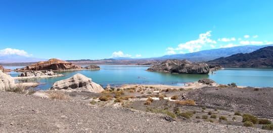 Las Islas Griegas, at the start of the Agua Negra pass. The pass was lovely, with its stones and hills carved by the wind, and it had two tropically-colored turquoise lakes, one called Las Islas Griegas (The Greek Islands), and the other simply called La Laguna (The Lagoon, easy to remember I suppose). And there was snow on the pass, which I did not jump into, because a cloud of worry had begun to loom over us about the bike. So we decided to go to the KTM dealership in Santiago as soon as we could. After all, it was going to be the last outpost with professionals who could look at it before Patagonia.
 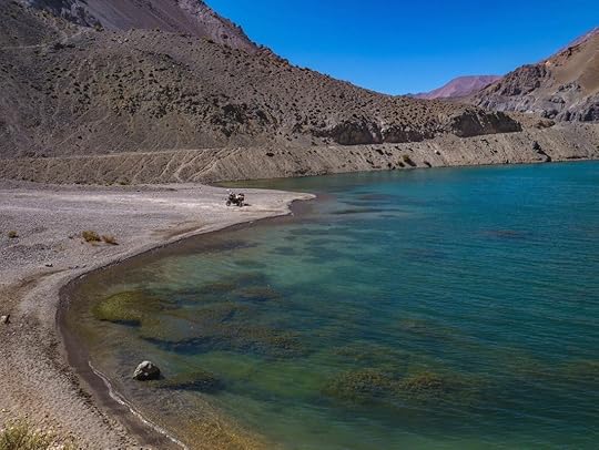 La Laguna, or The Lagoon, Chile. The cloud of stress became thicker as we went through Chilean customs. I knew from the last time that I wasn't allowed to bring any fruit over, so I'd eaten all my fresh Argentinian peaches before getting there. But as they strip searched our luggage like we were criminals, they found an onion, garlic, our tomatoes, and some chicken which I was saving for dinner that night, and took it all. I know that tomatoes are technically fruits, but the onion! We'd planned on camping that night near the pass, and I had bought the chicken and tomatoes as a surprise for Tim, something better than the usual pasta with watery powder cheese sauce. I now know it's illegal to bring any perishable foods over, not just fruits, and I was in the wrong, but at that moment, I was really upset. So to all overlanders: beware of crossing into Chile! I think it's all a ploy to force you into buying their overpriced not-so-delicious Chilean food.
So we arrived in Chile, the sun was setting, and we were without anything for dinner. After a hard day of riding, this was not how we wanted to end up. Ah, all the luscious grapes we ate in Argentina... and then in Chile we found ourselves in a food desert. So we rode all the way to Vicuña, a cute tourist town in the Elqui valley famous for producing pisco brandy and Chilean wines. We spent nearly $20 on four empanadas, and found a hotel to stay at since camping in the area was nearly the same price.
Everything in Chile is expensive, and you usually get very little for your money (I promised Tim I would not complain again about the sandwich I bought yesterday, but here goes: plain white bread and boiled gristly chicken with mayo globbed on top which cost $8!). But this boutique hotel turned out to be an oasis (Hotel Aldea del Elqui). Breakfast (included) was a huge buffet of croissants, fruits, cheeses, breads, and scrambled eggs. There was a pool, jacuzzi, gardens with fountains, and the place wasn't breaking the bank. So we decided to rest there for a day to recuperate and make a plan of how to get to Santiago. We love cats, and this hotel in Vicuña had three huge, fluffy ones. The Elqui Valley is also the world's first designated International Dark Sky Sanctuary, meaning visibility of the stars is high due to lack of moisture and light pollution. Plus, it was almost the new moon, and since Tim and I love the cosmos, we knew we couldn't leave the region without a tour of an observatory.
 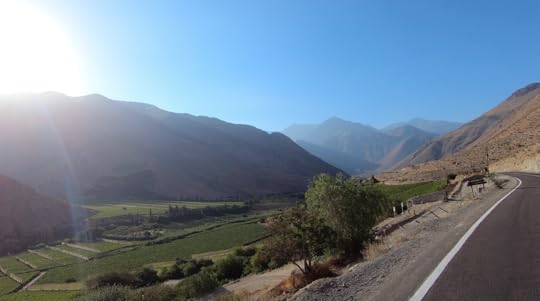 The Elqui Valley, Chile. So we took the dirt road through the cactus-covered hills to Combarbalá, and got tickets to the Cruz del Sur Observatory that night, which was actually built in the shape of the southern cross. The bike was still not always starting the first time, but we never had problems the second time, so our confidence was high that we could get to Santiago no problem.
That night the skies were twinkling and magical. I learned three ways to find polar south using the Southern Cross, how the ancients used the stars as a calendar, and I can now point out Taurus, Gemini, Leo, Cancer, the False Cross, Subaru a.k.a. Pleiades (yes, the Japanese car company, and their logo is the constellation), two other galaxies outside of the Milky Way, and we got to look through the big telescope at nebulas and the brightest star in the sky, Sirius A. It was an experience of a lifetime. If you like the night sky, and even if you've never really seen a constellation in your life, if you come to Chile, this is a must do. There are tons of observatories in the Elqui region, but even just a night of staring at the stars without a guide is impressive enough to make you feel breathtakingly insignificant compared to the vastness of the universe.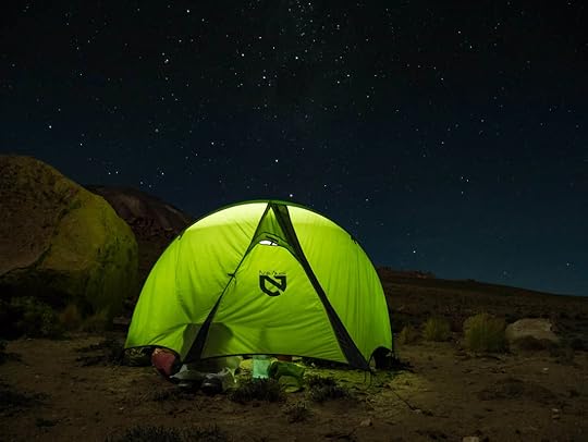 This picture wasn't taken at the observatory, but it shows how our nights have been recently.
 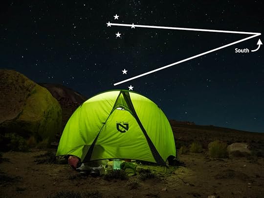 Above, I've demonstrated one way to find polar south using the Southern Cross. Yesterday we took Chile's massive coastal highway down to Santiago, and through the mist and wind, we watched the waves of the Pacific crash onto the sharp and jagged coast.
Now we're in the sparkling metropolitan city of Santiago, full of glass high rises, LA-like criss-crossing highways, and even some snowy mountain peaks in the distance. The bike is at KTM, and I'm feeling very confident that our starting and overheating problems will be resolved quickly (knock on wood), especially considering Tim showed the guys a bolt he'd found and didn't know where it came from, and the mechanic knew right away from where it had fallen. He passed the test!
Once the bike is as good as new (ok, that may not happen, but good enough to get us through Patagonia), we'll go into the real southern reaches of Chile, and take the Austral highway down into the land of glaciers, mountains, and ice.
As always, you can see our latest pictures and stories on facebook and instagram.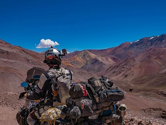
 We were in northern Argentina, spending our days poolside in the shade of peach trees and vineyards, when we realized that it had to come to an end. Because if we were ever going to get to Patagonia's glaciers before the roads became impassable with snow, we would need to exchange this warm-weather grape-eating lifestyle for one of down jackets and wooly hats. And it had to be soon, before we'd miss our window of opportunity to get to the Antarctic regions of South America while it's still summer there.
  Our route from Jujuy in northern Argentina down to Chile's capital, Santiago. So we made a plan to head south, south, and more south, maybe stopping along the way in Chile's capital, Santiago, maybe not if we felt rushed. But that was all before the problems with the bike started (yes, that's right, more problems, but nothing as serious as the ones after the salt flats).
We left Jujuy, Argentina, and headed into the thick of the lush green Amazonian highlands to get to the region's largest city, Salta. And by a pure wonderful accident, we took a road that is now one of my favorites of all time: Route 9. They had signs at the beginning warning us that this was going to be “sinuoso", which meant it had lots of curves, but I think that's an understatement. It was narrow, perfectly-paved, and a twisting roller-coaster ride that wound along the fertile mountainsides like we were gliding through Jurassic Park. The scenery reminded me of the wild and overgrown Death Road in Bolivia, but on speed since it was paved and fast. There were so many vines hanging over the way, we even got hit by them. As the road danced through the rich farmlands and cut into the steamy rainforest, it was hot, it was thrilling, and it was not for those who get car-sick! Despite being sweaty and sweltering in our jackets, Tim and I were all smiles throughout.
 This picture does not do justice to Rte 9 between Jujuy and Salta. It was a ride of a lifetime. Salta turned out to be a lovely colonial white-washed city that feels as tropical, humid, friendly, and laid-back as a Caribbean island. It's also where we had our first real Argentinian steak: and slab of perfectly-spiced meat that was so good, even just writing about it makes my mouth water.
From there, we headed towards what we'd heard was a beautiful mountain pass into Chile, a border crossing called Agua Negra, but of course we took the scenic way to get there. Route 68 from Salta to Cafayate was another of Argentina's pristinely-paved roads, but this time it brought us through a red canyon of colorful spires and cliffs that was not too unlike what you'd find in Arizona, or Canyonlands National Park, Utah. Wiley Coyote or James Earp would have been right at home in this cactus-filled desert of reds, pinks, and oranges. We even camped in the middle of it along the tiny river that created these awe-inspiring stone-scapes over thousands of years. It was just us, the parrots, a fox, and the sparse spiky plants out there in the wilds of Argentina.
 The unbelievably beautiful campsite we found along Rte 68, Argentina. We reached Cafayate the next morning to find that they had somehow transformed this rugged desert landscape into a Tuscan haven of spring-green vineyards with huge plantation-like winery hotels leading into the cute and quaint center of town. From what I heard, Cafayate is home to a population of Germans who emigrated after WWII (as in many placed in Argentina). But here they not only make world-class wines, but also brew some of the best beers in South America.
  A curious bird-of-prey made our acquaintance in Salica, Argentina. We hit the causeway of Argentina's Route 40 and went south toward the mountain pass to Chile, flying as fast as we could through the sweltering heat, sliding through one canyon after the next. I could have seriously cooked an egg on my helmet if it weren't so round. It's a black helmet, and I'm not sure why Schuberth thought it the best color for wearing on your head as you make your way around the world in the scorching sun. But that's the way it is, and no amount of venting could prevent my brain from cooking in my skull. I couldn't even speak Spanish properly by the end of the day.
At last we arrived at the pass over the Andes mountains that would take us into Chile, and we were excited for some cool breezes and possibly some snow. I would have gladly jumped into snow at that moment, and considering I hate the cold, that's a huge statement.
This is also where our bike problems started.
 The Argentinian side of the Agua Negro border crossing with Chile. We'd get on the bike, ready to go, Tim would press the ignition switch, and then nothing would happen. The engine wouldn't turn, the lights wouldn't come on... nothing. Usually by the second try things would be back to normal, but it was disconcerting.
 Then as we were winding our way up the pass's switchbacks which were dirt and a little corrugated, the bike started overheating. It's done this a lot ever since Peru, and we've changed the coolant, but this time the coolant was literally boiling inside the engine. You could hear the bubbles raging and coolant was spewing out the overflow hose like it was throwing up. And it wasn't even that hot out, certainly nothing like what we had just been through in the lower regions of Argentina. Again, disconcerting, especially since we wanted to head out into the wilderness of Patagonia next where if something went wrong, we'd really be stranded.
 Las Islas Griegas, at the start of the Agua Negra pass. The pass was lovely, with its stones and hills carved by the wind, and it had two tropically-colored turquoise lakes, one called Las Islas Griegas (The Greek Islands), and the other simply called La Laguna (The Lagoon, easy to remember I suppose). And there was snow on the pass, which I did not jump into, because a cloud of worry had begun to loom over us about the bike. So we decided to go to the KTM dealership in Santiago as soon as we could. After all, it was going to be the last outpost with professionals who could look at it before Patagonia.
  La Laguna, or The Lagoon, Chile. The cloud of stress became thicker as we went through Chilean customs. I knew from the last time that I wasn't allowed to bring any fruit over, so I'd eaten all my fresh Argentinian peaches before getting there. But as they strip searched our luggage like we were criminals, they found an onion, garlic, our tomatoes, and some chicken which I was saving for dinner that night, and took it all. I know that tomatoes are technically fruits, but the onion! We'd planned on camping that night near the pass, and I had bought the chicken and tomatoes as a surprise for Tim, something better than the usual pasta with watery powder cheese sauce. I now know it's illegal to bring any perishable foods over, not just fruits, and I was in the wrong, but at that moment, I was really upset. So to all overlanders: beware of crossing into Chile! I think it's all a ploy to force you into buying their overpriced not-so-delicious Chilean food.
So we arrived in Chile, the sun was setting, and we were without anything for dinner. After a hard day of riding, this was not how we wanted to end up.
 Ah, all the luscious grapes we ate in Argentina... and then in Chile we found ourselves in a food desert. So we rode all the way to Vicuña, a cute tourist town in the Elqui valley famous for producing pisco brandy and Chilean wines. We spent nearly $20 on four empanadas, and found a hotel to stay at since camping in the area was nearly the same price.
 Everything in Chile is expensive, and you usually get very little for your money (I promised Tim I would not complain again about the sandwich I bought yesterday, but here goes: plain white bread and boiled gristly chicken with mayo globbed on top which cost $8!). But this boutique hotel turned out to be an oasis (Hotel Aldea del Elqui). Breakfast (included) was a huge buffet of croissants, fruits, cheeses, breads, and scrambled eggs. There was a pool, jacuzzi, gardens with fountains, and the place wasn't breaking the bank. So we decided to rest there for a day to recuperate and make a plan of how to get to Santiago.
 We love cats, and this hotel in Vicuña had three huge, fluffy ones. The Elqui Valley is also the world's first designated International Dark Sky Sanctuary, meaning visibility of the stars is high due to lack of moisture and light pollution. Plus, it was almost the new moon, and since Tim and I love the cosmos, we knew we couldn't leave the region without a tour of an observatory.
  The Elqui Valley, Chile. So we took the dirt road through the cactus-covered hills to Combarbalá, and got tickets to the Cruz del Sur Observatory that night, which was actually built in the shape of the southern cross. The bike was still not always starting the first time, but we never had problems the second time, so our confidence was high that we could get to Santiago no problem.
That night the skies were twinkling and magical. I learned three ways to find polar south using the Southern Cross, how the ancients used the stars as a calendar, and I can now point out Taurus, Gemini, Leo, Cancer, the False Cross, Subaru a.k.a. Pleiades (yes, the Japanese car company, and their logo is the constellation), two other galaxies outside of the Milky Way, and we got to look through the big telescope at nebulas and the brightest star in the sky, Sirius A. It was an experience of a lifetime. If you like the night sky, and even if you've never really seen a constellation in your life, if you come to Chile, this is a must do. There are tons of observatories in the Elqui region, but even just a night of staring at the stars without a guide is impressive enough to make you feel breathtakingly insignificant compared to the vastness of the universe.
 This picture wasn't taken at the observatory, but it shows how our nights have been recently.
  Above, I've demonstrated one way to find polar south using the Southern Cross. Yesterday we took Chile's massive coastal highway down to Santiago, and through the mist and wind, we watched the waves of the Pacific crash onto the sharp and jagged coast.
Now we're in the sparkling metropolitan city of Santiago, full of glass high rises, LA-like criss-crossing highways, and even some snowy mountain peaks in the distance. The bike is at KTM, and I'm feeling very confident that our starting and overheating problems will be resolved quickly (knock on wood), especially considering Tim showed the guys a bolt he'd found and didn't know where it came from, and the mechanic knew right away from where it had fallen. He passed the test!
Once the bike is as good as new (ok, that may not happen, but good enough to get us through Patagonia), we'll go into the real southern reaches of Chile, and take the Austral highway down into the land of glaciers, mountains, and ice.
As always, you can see our latest pictures and stories on facebook and instagram.

January 24, 2019
Jan. 24, 2019 - Solar Older, Lunar Sooner
By Marisa 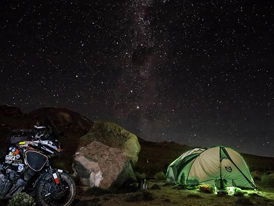 After four months of roughing it in Peru and Bolivia, Tim and I arrived at the Chilean customs office dirty, tired, beaten down by the cold wind, and on our last drop of gas and food. But once crossing into Chile, we coasted down 6,000 feet in elevation on perfect pavement (no need for gas!), and we could feel the sun warming our Bolivian-chilled bones as we entered Chile's Atacama desert. In less than an hour, we found ourselves awe-struck in the town of San Pedro de Atacama, as foreigners walked around in shorts and sun dresses, and the place was as modern and expensive as anything we'd seen since the States.
Nearby Calama was just like home (though not in the best way) with its own Walmart, fast food chains, and strip malls. There were pharmacies with cash registers, and gas stations that took credit cards and even had handicapped parking spots labeled on the asphalt. Of course, all this luxury came at a high price, as the cheapest room we could find in San Pedro was $30 a night (the same as paying for camping), instead of the normal $10. We were in culture shock plus sticker shock.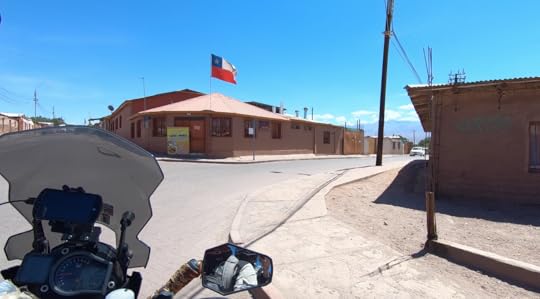 Don't be fooled by San Pedro's adobe-walled Santa Fe look. It's a modern town underneath those mud bricks. We stayed in ultra-expensive San Pedro de Atacama far too long, but were waiting for our friends, the Adventure Haks, to get parts for their motorcycle which needed new front wheel bearings. We also decided to do some repairs and an oil change on our bike, since after riding through the corrosive salt flats of Bolivia, we wanted to be sure that everything was in tip-top shape before continuing on.
After a little more than a week, we were ready to leave San Pedro and explore more of what the region had to offer. And because we'd been told that northern Argentina's landscape was like Utah and Arizona, filled with canyons and bluffs, we knew we couldn't pass that up. Unfortunately, this meant that we were going to part ways with the Haks, as they were headed south instead of staying in the north.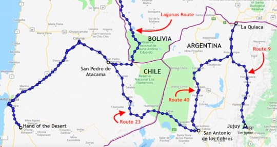 Though northern Argentina was our destination, our first stop was in the opposite direction in Chile: La Mano del Desierto (the Hand of the Desert). This iconic piece of outdoor art is something that many motorcycle travelers in South America try to see, and I have to say, it was larger than I'd expected, and it makes you feel insignificant, as if you're in the land of the giants.
 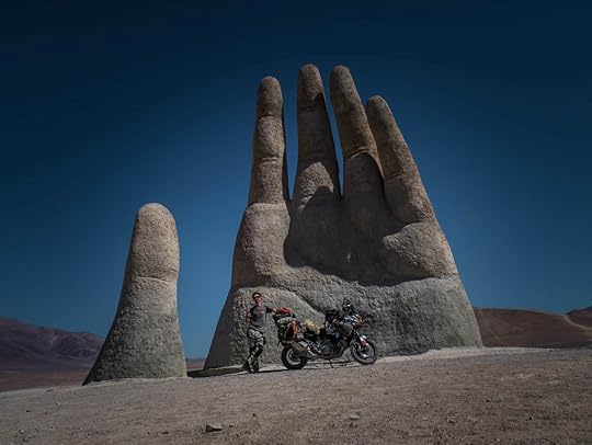 La Mano del Desierto, or Hand of the Desert, Chile. We camped just down the hill from the Hand, and that night we woke up to take some starry pictures, and for the first time saw the Southern Cross. At this latitude and time of year, you have to wait until late into the night to see this incredibly-bright southern hemisphere constellation, and since we are very much interested in the cosmos, it was a thrill for us to finally see it. The Southern Cross was a clear sign that we had come quite far from our home of Chicago.
 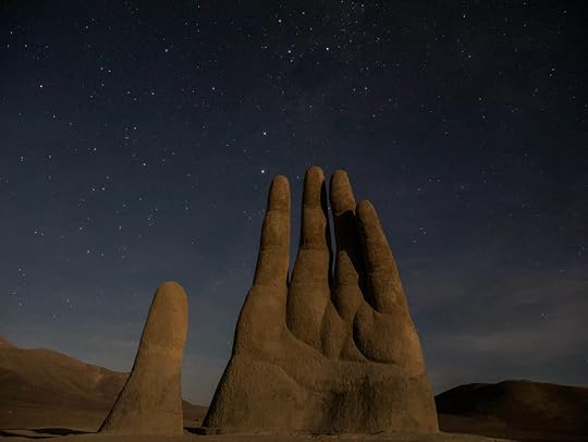 You can see the Southern Cross like a kite coming off from the Hand's pointer finger. Back across the desert we went, first stopping by the beautiful coastal city of Antofagasta for lunch, and then through the barren wasteland of the desert that is northern Chile. It's called the Atacama, and is the highest and driest desert in the world, well, driest second only to Antartica, but I'm not sure that counts as a typical desert in my book. But the Atacama is a vast Martian expanse of rocks and not much else.
 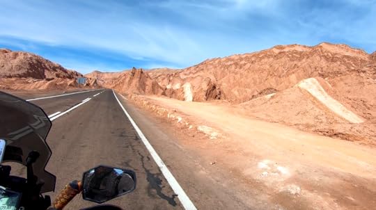 The strange rock formations of Valle de la Luna, Atacama, Chile. After the Atacama, crossing into Argentina was next, and we had two borders to choose from: Route 27, the easier way, or Route 23, the out-of-the-way more scenic one. And of course we choose the road less taken, which turned out to have similar scenery to the incredibly-difficult Lagunas Route in Bolivia, but was paved and therefore much easier. Again we passed mineral-rich mountains surrounding salt flats and colorful lagoons. It was high-altitude cold desert that felt surreal and otherworldly, but it was gorgeous.
 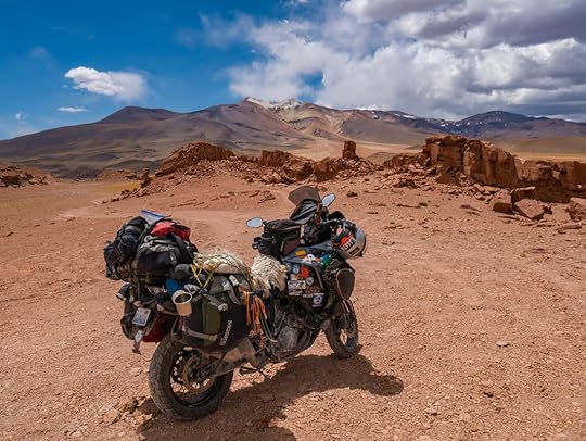 A perfect picture spot, Route 23, Chile.
 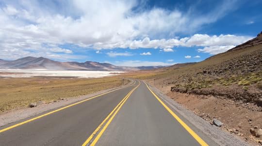 Chile certainly has some nice roads. As we crossed the border, we'd heard from some friends that there were free places to stay on the Argentinian side. So we asked the customs official about it, and sure enough, he told us to come on over to the bunkhouse. We had the whole building to ourselves: kitchen, hot showers, wifi, and tons of tiny beds without sheets to choose from (can't complain about free). I was liking Argentina already.
  The free bunkhouse at the Argentinian border. The next day we passed through more incredible desert scenery to the wild-west town of San Antonio de los Cobres, a mud-brick village of rocky cliffs, horses, and train bridges, making me feel like I had gotten lost in a cowboy movie. And from there we took the famous Route 40 of Argentina north, bumping along its corrugated washboard, and swiveling through its sandy patches, until we found what I considered to be the perfect camp spot.
There was a gushing stream of fresh water that made a green, grassy path through the otherwise dry landscape of giant red boulders and towering cliffs standing sentry on either side of the valley. Rose quartz crystals dotted the ground, and the sound of the warm water trickling over the smooth stones made the landscape idyllic. And what's more, the water was so warm, I swear it may have been heated by geothermal activity. Pictures just cannot do justice to the peaceful atmosphere of this place.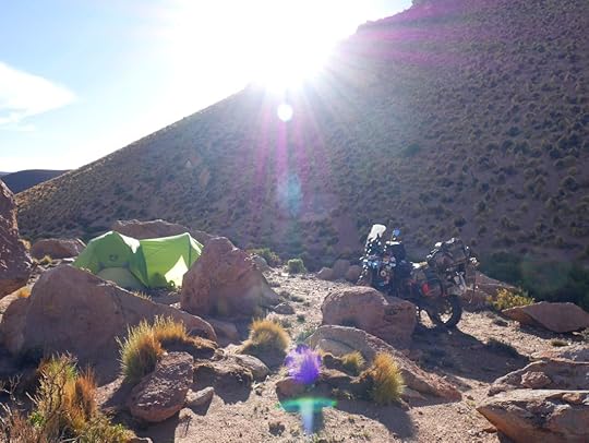 Our perfect wild camp find. The sun set red and gold over the hills as the full moon rose on the opposite side of the sky. And then just when I thought things couldn't get any more ideal, we woke up at 1:00 AM to take some night shots, and noticed that the moon was no longer full, but a crescent. And that's when we remembered that it must have been the night of the full lunar eclipse. If we hadn't have known this, or had lived hundreds of years ago, we probably would've been freaking out.
  The super blood wolf moon of Jan. 20, 2019. The sliver of the moon became smaller and smaller, until finally the whole of it was covered in the earth's shadow, and turned a deep red color. For Tim and I, this was a dream come true and a fitting turn of events since we left to start our journey a year and a half ago on the day of the full solar eclipse in the States. And now this full lunar eclipse symbolized another great moment marked, as if the skies were whispering a welcome to us for reaching the other end of the globe and the other side of our trip in the Americas.
  This was a pretty special moment for us. We left our perfect campsite the next morning all smiles, and headed north on Route 40, crossing east on the sandy and scenic 74 where we saw a baby armadillo and giant wild ostrich-like birds called rheas. Finally, we hit the pavement of Route 9. After a brief stopover at La Quiaca, the border town with Bolivia, we jetting back down on the massive and pristine highway that is Route 9, all the way down to Jujuy, where we are now. The scenery along the road was absolutely stunning, as it changed from rolling fields of horses and llamas, to stark red and yellow striped canyons with giant saguaro cacti, and finally morphed into the lush Amazonian jungle area that we are in now. This happened all within a matter of a few hours, and since it was completely paved with gas stations along the way, I would recommend this road to anyone in any type of vehicle.
 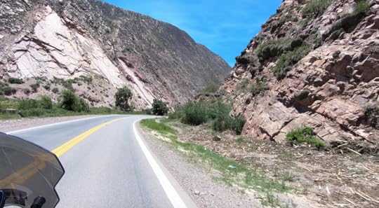 Route 9 between Humahuaca and Jujuy, Argentina. And so our journey through northern Chile and Argentina has come to an end, and from here on out things are going to get colder and windier the more south we go. So we're trying to soak up the South American summer warmth while we can by staying next to a pool here at our campground. We'll keep you posted on our next set of adventures, and you can check out our latest updates and photos on facebook and instagram.
 After four months of roughing it in Peru and Bolivia, Tim and I arrived at the Chilean customs office dirty, tired, beaten down by the cold wind, and on our last drop of gas and food. But once crossing into Chile, we coasted down 6,000 feet in elevation on perfect pavement (no need for gas!), and we could feel the sun warming our Bolivian-chilled bones as we entered Chile's Atacama desert. In less than an hour, we found ourselves awe-struck in the town of San Pedro de Atacama, as foreigners walked around in shorts and sun dresses, and the place was as modern and expensive as anything we'd seen since the States.
Nearby Calama was just like home (though not in the best way) with its own Walmart, fast food chains, and strip malls. There were pharmacies with cash registers, and gas stations that took credit cards and even had handicapped parking spots labeled on the asphalt. Of course, all this luxury came at a high price, as the cheapest room we could find in San Pedro was $30 a night (the same as paying for camping), instead of the normal $10. We were in culture shock plus sticker shock.
 Don't be fooled by San Pedro's adobe-walled Santa Fe look. It's a modern town underneath those mud bricks. We stayed in ultra-expensive San Pedro de Atacama far too long, but were waiting for our friends, the Adventure Haks, to get parts for their motorcycle which needed new front wheel bearings. We also decided to do some repairs and an oil change on our bike, since after riding through the corrosive salt flats of Bolivia, we wanted to be sure that everything was in tip-top shape before continuing on.
After a little more than a week, we were ready to leave San Pedro and explore more of what the region had to offer. And because we'd been told that northern Argentina's landscape was like Utah and Arizona, filled with canyons and bluffs, we knew we couldn't pass that up. Unfortunately, this meant that we were going to part ways with the Haks, as they were headed south instead of staying in the north.
 Though northern Argentina was our destination, our first stop was in the opposite direction in Chile: La Mano del Desierto (the Hand of the Desert). This iconic piece of outdoor art is something that many motorcycle travelers in South America try to see, and I have to say, it was larger than I'd expected, and it makes you feel insignificant, as if you're in the land of the giants.
  La Mano del Desierto, or Hand of the Desert, Chile. We camped just down the hill from the Hand, and that night we woke up to take some starry pictures, and for the first time saw the Southern Cross. At this latitude and time of year, you have to wait until late into the night to see this incredibly-bright southern hemisphere constellation, and since we are very much interested in the cosmos, it was a thrill for us to finally see it. The Southern Cross was a clear sign that we had come quite far from our home of Chicago.
  You can see the Southern Cross like a kite coming off from the Hand's pointer finger. Back across the desert we went, first stopping by the beautiful coastal city of Antofagasta for lunch, and then through the barren wasteland of the desert that is northern Chile. It's called the Atacama, and is the highest and driest desert in the world, well, driest second only to Antartica, but I'm not sure that counts as a typical desert in my book. But the Atacama is a vast Martian expanse of rocks and not much else.
  The strange rock formations of Valle de la Luna, Atacama, Chile. After the Atacama, crossing into Argentina was next, and we had two borders to choose from: Route 27, the easier way, or Route 23, the out-of-the-way more scenic one. And of course we choose the road less taken, which turned out to have similar scenery to the incredibly-difficult Lagunas Route in Bolivia, but was paved and therefore much easier. Again we passed mineral-rich mountains surrounding salt flats and colorful lagoons. It was high-altitude cold desert that felt surreal and otherworldly, but it was gorgeous.
  A perfect picture spot, Route 23, Chile.
  Chile certainly has some nice roads. As we crossed the border, we'd heard from some friends that there were free places to stay on the Argentinian side. So we asked the customs official about it, and sure enough, he told us to come on over to the bunkhouse. We had the whole building to ourselves: kitchen, hot showers, wifi, and tons of tiny beds without sheets to choose from (can't complain about free). I was liking Argentina already.
  The free bunkhouse at the Argentinian border. The next day we passed through more incredible desert scenery to the wild-west town of San Antonio de los Cobres, a mud-brick village of rocky cliffs, horses, and train bridges, making me feel like I had gotten lost in a cowboy movie. And from there we took the famous Route 40 of Argentina north, bumping along its corrugated washboard, and swiveling through its sandy patches, until we found what I considered to be the perfect camp spot.
There was a gushing stream of fresh water that made a green, grassy path through the otherwise dry landscape of giant red boulders and towering cliffs standing sentry on either side of the valley. Rose quartz crystals dotted the ground, and the sound of the warm water trickling over the smooth stones made the landscape idyllic. And what's more, the water was so warm, I swear it may have been heated by geothermal activity. Pictures just cannot do justice to the peaceful atmosphere of this place.
 Our perfect wild camp find. The sun set red and gold over the hills as the full moon rose on the opposite side of the sky. And then just when I thought things couldn't get any more ideal, we woke up at 1:00 AM to take some night shots, and noticed that the moon was no longer full, but a crescent. And that's when we remembered that it must have been the night of the full lunar eclipse. If we hadn't have known this, or had lived hundreds of years ago, we probably would've been freaking out.
  The super blood wolf moon of Jan. 20, 2019. The sliver of the moon became smaller and smaller, until finally the whole of it was covered in the earth's shadow, and turned a deep red color. For Tim and I, this was a dream come true and a fitting turn of events since we left to start our journey a year and a half ago on the day of the full solar eclipse in the States. And now this full lunar eclipse symbolized another great moment marked, as if the skies were whispering a welcome to us for reaching the other end of the globe and the other side of our trip in the Americas.
  This was a pretty special moment for us. We left our perfect campsite the next morning all smiles, and headed north on Route 40, crossing east on the sandy and scenic 74 where we saw a baby armadillo and giant wild ostrich-like birds called rheas. Finally, we hit the pavement of Route 9. After a brief stopover at La Quiaca, the border town with Bolivia, we jetting back down on the massive and pristine highway that is Route 9, all the way down to Jujuy, where we are now. The scenery along the road was absolutely stunning, as it changed from rolling fields of horses and llamas, to stark red and yellow striped canyons with giant saguaro cacti, and finally morphed into the lush Amazonian jungle area that we are in now. This happened all within a matter of a few hours, and since it was completely paved with gas stations along the way, I would recommend this road to anyone in any type of vehicle.
  Route 9 between Humahuaca and Jujuy, Argentina. And so our journey through northern Chile and Argentina has come to an end, and from here on out things are going to get colder and windier the more south we go. So we're trying to soak up the South American summer warmth while we can by staying next to a pool here at our campground. We'll keep you posted on our next set of adventures, and you can check out our latest updates and photos on facebook and instagram.
January 10, 2019
Jan 10, 2019 - The Lagunas Route
By Marisa 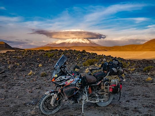 With the bike not starting from our ride through Bolivia's salt flats, we were in a bit of a predicament. Our dear and wonderful friends who'd stayed by our sides throughout it all, Brendon and Kira Hak, were on the verge of overextending their visa in Bolivia, and needed to go. Unlike us, their bike was fully functional, and their plan was to take a difficult, but gorgeous route south and out of Bolivia: the Lagunas Route.
But as Tim and I found ourselves immobile in the town of Uyuni, we knew that if we didn't get our bike running before they had to leave, we would not want to do such a challenging road by ourselves with a questionable motorcycle. Our plans and dreams of riding the Lagunas Route were now falling apart.
So the pressure was on for Tim to fix the bike, and he needed to do it by 11:00 AM the next day, which was checkout time for the Haks and the latest possible moment before they had to leave.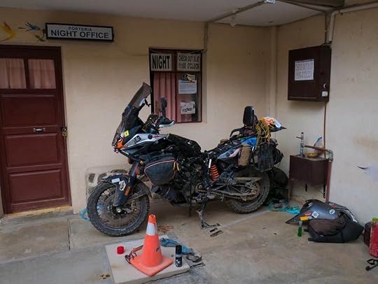 The bike in all its pieces while we tried to fix it in Uyuni, Bolivia. Tim had not properly slept for days, just thinking about the bike and what could be wrong with it. We knew that riding it out into the wet salt flats was a big risk (though we got some incredible pictures out there), but I'm not sure we realized quite how detrimental it would be for our motorcycle.
Salt is not just corrosive to metals, but electricity also speeds up its corrosive powers, making it erode anything electrical as well. With a big bike like ours, most of its functions are run through the motorcycle's CPU, and that means that nearly everything, from the tire pressure gauge to the suspension, are electronically controlled. Though we washed the bike again and again, salt could've gotten anywhere, and eaten away at any electrical component.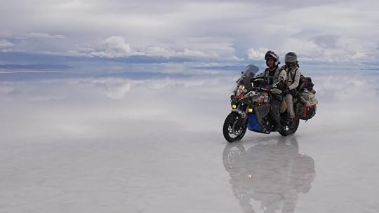 It was definitely magical riding out there. But was it worth it? Considering the bike is both our transport and home, and we nearly destroyed it, I don't think so. Thankfully, Brendon helped Tim out every waking moment he could, and they narrowed the problem back down to the kickstand, which was their original suspicion. Yup, even the kickstand has an electronic sensor that doesn't allow the bike to run or go into first gear when the kickstand's down. Though the faulty kickstand's symptoms seemed more similar to a fuel issue, it was the wiring harness to this tiny sensor that the salt had destroyed: the culprit of all our woes.
So only two hours before the Haks were supposed to leave, Tim and I were running around town, trying to find a tiny electrical resistor to bypass the kickstand sensor. And after wandering around for an hour and a half, we had just a half hour left when we finally found it! Tim ran back to the hotel where the bike was, he and Brendon installed it, and it worked! We were stressed, exhausted, but ecstatic.
With truly no time to spare, at least we had a functioning bike once again, and could finally go with the Haks on the Lagunas Route! We packed up, got gas, wolfed down some food, and with big smiles, we headed out to conquer one of the worst roads in Bolivia.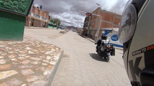 We were thrilled to be on the bike again and headed out of Uyuni, despite the dark clouds in the distance. The Lagunas Route is known to be a difficult road, especially for large motorcycles or drivers of any vehicle without 4WD. It's usually only taken by local Jeeps and off-road vehicles looking to bring tourists on a sight-seeing journey through southern Bolivia and into northern Chile. There are a couple of isolated hotels situated along the way that have sprung up due to the tourism, but there are no gas stations, towns, restaurants, or any other type of amenities. It's rugged, cold, beautiful, and the very essence of the word adventure.
 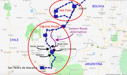 Every blue box is where we camped or stayed the night. The Lagunas Route isn't actually one road either, but there are several ways to go. The eastern side is said to be easier, but only because it has less deep sand. But the western side is known to be more picturesque and the way the tour groups go. So regardless of the poor road conditions, with the Haks and a working bike, we now felt invincible. So we knew that west was the way we wanted to take.
 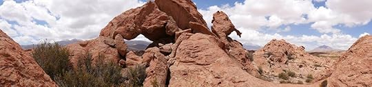 Valle de las Rocas at the start of the Lagunas Route. We began by camping near the last real outpost, a town called Culpina K, where we stocked up with several days' worth of food, water, and as much gasoline as we could possibly carry. The next day was easy going until we turned off the main gravel road, and headed south into the real Lagunas Route.
 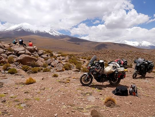 Our first picnic spot of the day. Not a bad view either. The road started ascending, and turned into a rutted and gutted channel filled with large rocks. It was definitely a high-clearance vehicle road, but Tim did an expert job of getting us safely up and into the high-elevation altiplano where we found ourselves in a flattened plain surrounded by snow-capped mountains.
 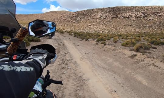 This was our welcome to the Lagunas Route. From there we rode along what would become the norm for the next few days: sandy washboard. It's not difficult riding, but the bumpy corrugation was very uncomfortable, plus it's terrible for the bike. But all we cared about at this point was that we were running, staying upright, and on the Lagunas Route with our friends.
And then we saw our first laguna: a clear shallow body of water filled with flamingoes. And this is part of the reason why people come out here on these horrible roads, to see the threatened Chilean flamingoes in all their soft-pink glory. When these massive birds “graze" for plankton with their bills upside-down in the water, they make this pleasant clucking and chirping sound to each other. And when they fly with neck and spindly legs outstretched, flapping those pink and black wings, they look more elegant than I ever thought a flamingo could. It was very special to see such wild and precious animals right in front of me.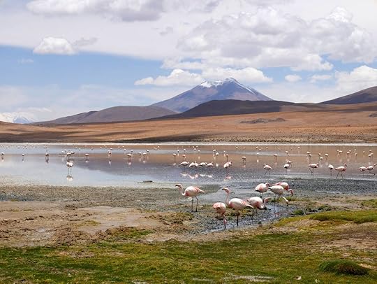 Our first encounter with Chilean flamingoes. We camped next to a hidden lagoon of flamingoes with no one else around in what I considered to be extremely barren and hostile terrain. The sun and wind up at that altitude was intense (14,000 ft / 4,250 meters), and we found our faces and lips were immediately chaffed. Even my fingers around my nails got so dry, some started bleeding. Surrounding us were massive mountains and volcanic rocks encasing the lagoons of strange sulfury colors, so the only signs of life were dry tufts of grass, and then these gorgeous tropical-looking pink birds. The flamingoes just seemed so strangely at peace within their lunar world, and so out of place.
What's more, we'd read that every night, the water that the flamingoes stand in freezes over (it's very cold up there, and this time of year is summer!). And then in the morning they're stuck until it thaws and they can move around again. For me, it felt like a very bizarre new planet up there in the far-flung reaches of Bolivia.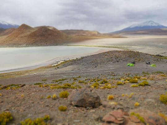 Our remote and wonderful campsite at a hidden pond near Laguna Honda.
 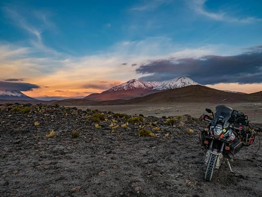 An incredibly beautiful, yet windy sunset from our campsite. Day two was going to be the hardest day, but also with the most sights to see. We started off in the morning only to be jostled about as we made our way down the washboard road for hours, and had to take frequent picnic stops to rest our rattled bones and brains. The whole time, there were tour-group Jeeps speeding around us, avoiding the terrible roads by cutting through the flat areas and making new roads of their own. It was weird being out in the middle of nowhere, and at the same time surrounded by so many people from around the world.
After successfully navigating through another bout of ruts and rocks in a narrow ravine, we bumped our way along windswept valleys of sand between colorful mountains. The terrain became more and more desert-like the further south we went, and we passed lagoon after lagoon, which were like pockets of pink and blue life amidst the reds and grays of the rocky wilds.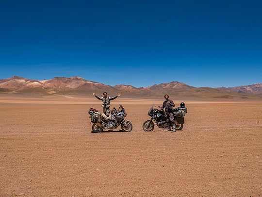 It's a little bit like Mad Max out there, don't you think? Mad Max with flamingoes. What a random combo. For lunch we stopped near a red outcropping where a few of Bolivia's rodent chinchillas came out for a photoshoot. They're locally called viscachas, and though they resemble fat fluffy rabbits, they have long fuzzy squirrel-like tails, and hilariously lazy eyes with droopy eyelids.
 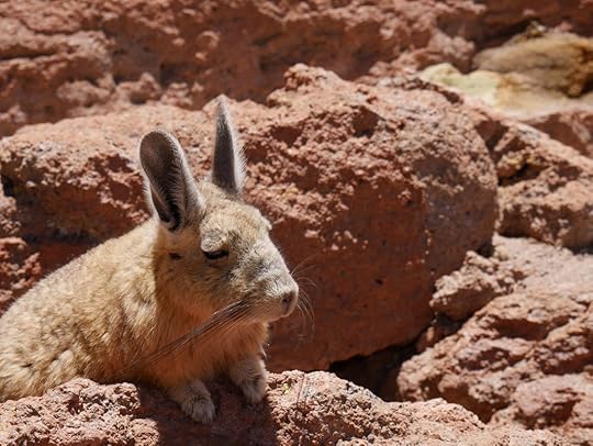 Maybe this chinchilla has eaten too many coca leaves. One of the main photo stops of the Lagunas Route is the Rock Tree, or Árbol de Piedra. It's just a rock that's in an interesting shape, but it's surprisingly big, and also surrounded by other strange stones carved into pocked and rounded shapes by the intense wind.
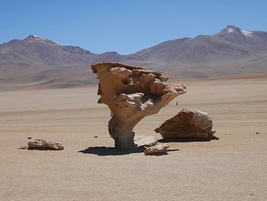 Árbol de Piedra, or Rock Tree. It's actually much bigger than it looks in the picture. Unfortunately, this is where Brendon started noticing a strange crunching noise coming from his front tire. After a bit of inspection, the diagnosis was not looking good, as it seemed there was something majorly wrong, though nobody could be sure of what without taking everything apart. And we had a long way to go before reaching our campsite that night near Laguna Colorada.
 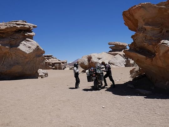 A starkly beautiful place, but not the best spot to find that something's wrong with your motorcycle. So we slowly made our way onwards and hit the worst stretch of sand of the whole trip. This was deep sand, and it was visibly impossible to distinguish from the not-so-deep-and-horrible sand. You just came upon it, the tires would want to slip out from underneath, and then you'd do your best to stay upright. It was slow wobbly going, and Tim and I fell a few times (ok, five times). The Haks of course did not fall at all, though they almost did, and they are superhero off-road pros. I would not recommend this stretch of road to anybody on a large and heavy motorcycle.
 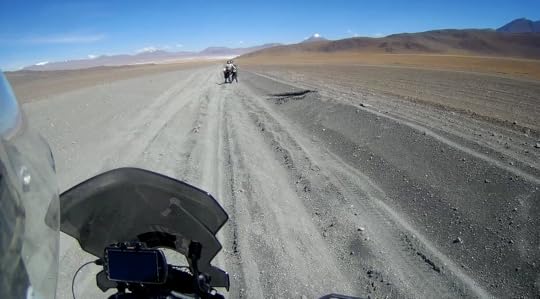 This sand was no fun to go through. By the time we got to the national park checkpoint at Laguna Colorada (where we had to pay 150 Bolivianos per person to enter: ~$22), we were simply beat and tired. Once getting our tickets, we passed the ambers, blues, and whites of Laguna Colorada and the hot-spring pools next to it where people were soaking and enjoying the volcanic warmth, but we were in no mood to stop needlessly. The Haks' bike was sounding worse and worse, and we knew we needed to get to camp before we could rest and see what was wrong.
That night we camped in an isolated canyon near Laguna Colorada, and though the temperatures were icy cold at night, this camp spot was like a paradise for me. I love reddened deserts of sand, silence, and stars, and I found the canyon to be glittered at night in some of the most impressive star-scapes I've ever seen.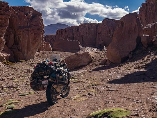 One of my favorite camp spots of Bolivia.
 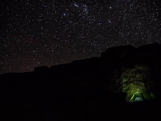 The stars here were unbelievable. The third day was to be our last day on the Lagunas Route, and the day we'd cross into Chile. But we had some major challenges ahead of us. We were running low on gas and food, but what's more, after taking the front assembly apart on Brendon's bike, he discovered that the bearings had become shredded apart like a bomb had blown up inside. We'd heard from a mechanic back at the salt flats that this is a common problem with bikes that go into the salt, as it eats away at the grease in the bearings until the balls become dry and macerated like shrapnel.
But as we were in the middle of nowhere, and this was the last day on the Haks' visa for Bolivia, there was nothing else to do but just keep going. At a very slow pace, of course. And without front brakes.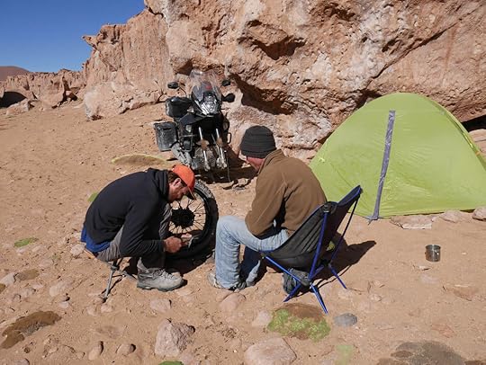 Things were not looking good for the Haks' bike. Even using the back brakes didn't seem to be a good idea for the Haks, but luckily, the road was flat that day. And so we limped ourselves along to the Sol de la Mañana Geysers, just off the main path, and it was an extraordinary sight to see the wafts of sulfur steam drifting out of mud pits and caverns in the colorful earth. It seemed to be a suitable end to this bizarre and magnificent world of southern Bolivia.
 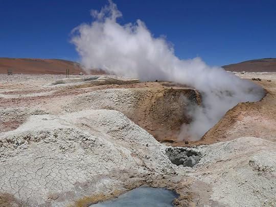 The Sol de la Mañana Geysers. Actually this is a fumarole with constant steam instead of spewing hot water. We crawled past Laguna Blanca and the impressive conical volcano of Lincancabur, and finally found ourselves at the Chilean border, where I saw something strange in the distance. Could it be pavement? And white and yellow lines, and a speed limit sign, and little reflector thingies? I hadn't seen such safety standards in so long, I couldn't be sure, but as the bike's tires mounted the smooth surface of the asphalt, I breathed in a sigh of comfort. No more Lagunas Route. It had been incredible, but at that moment, I was glad for no more rocks and ruts and jostling around.
 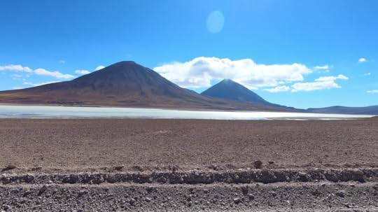 Laguna Blanca and the peaks of nearby volcanoes whose lava created this entire plain full of igneous rocks. But the comfort didn't last long, because this border with Chile may have been the windiest border I've ever been to. It was brutal up there, and the wind cut straight to the bone through my layers of jackets. But as we entered Chile's customs office, we found ourselves in a room with computers, leather chairs, cameras on the ceiling, and even a heater! I couldn't believe the modernity around me. And as the officer handed me a pen to fill out a form, I found my hand was too cold to write anything, and I just stared at his crisply-ironed uniform as Bruno Mars played in the background, and I thought, “Have I died and gone back to America?"
Kira and I looked at each other, both faces red from sunburn and with flaky skin, and I noticed that bits of moisture around our watery eyes and running noses had dried into white crusts. We looked like we had just been through the pits of hell, and certainly did not belong in this clean room of new things. And I said through lips so chapped they hurt to move, “After four months of being in Peru and Bolivia, if this is what Chile's like, I don't know if I can handle all this niceness." The customs office exiting Bolivia.
 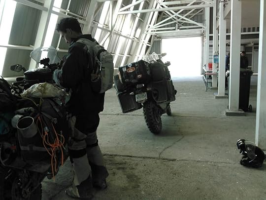 The customs office entering Chile. And I don't think we were ready at all for the first-world challenge that is Chile. Rules and laws and paperwork and such. Because as they searched our belongings and found some sparklers that we had leftover from New Years, it started to sink in that I am not in Bolivia anymore. Bolivia is a country where you can chew coca leaves all day long and buy dynamite and set it off wherever you want. But apparently Chile is a whole other world.
And as they threatened to handcuff Brendon for trying to smuggle pyrotechnics over the border, I realized that we had done something illegal, and that this was bad. Thankfully, the police officer did not seem excited to arrest Brendon, and as we all pleaded that we had no idea about the laws and were just lowly miserable travelers with no gas and broken-down bikes and salt still seeped into our clothes with nothing else to eat but day-old rice, they tore up the sparklers and said, “We'll pretend these never existed." Thank God! Ah, we made it to Chile! Though not without a few bumps in the road (pun intended). It was 47 kilometers (30 miles) to the next gas station in San Pedro de Atacama, and Tim and I were on empty. We were below empty actually, at the flashing lights point. And we were more than worried that even after all we'd been through, we might not ever get there.
But as we left the custom's office and rounded a turn in the road, the sun broke out from the clouds to reveal an illuminated valley below us where San Pedro de Atacama was. And as if the light and warmth were guiding the way, we coasted down the perfect pavement, not even hitting the gas, picking up speed with the dive. The engine could've even been off. And after countless ear pops and 6,700 feet of descent in elevation (2,000 meters), we arrived in San Pedro elated that we had somehow made it through the Lagunas Route.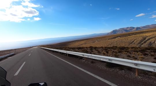 The glorious ride (more like glide) down to San Pedro de Atacama, Chile. So here we are in San Pedro de Atacama in Chile, an incredibly expensive town compared to what we're used to in Peru and Bolivia (our hotel costs us $44 a night!). But it's a beautiful, fun, sunny place full of energy, adobe walls, tourists from around the world, and even some amenities for our bikes. And there are addresses here, and mail! Which means that Brendon and Tim are currently waiting for parts to arrive from Santiago, because we've decided that whatever the Haks need to do to their bike due to the salt, we should probably do the same. And so as we wait, we're relaxing here with fellow motorcycle friends that we've made along our journey, recuperating until our next adventure.
And what's next? We're not sure, maybe the desert canyons of northern Argentina? But whatever it is, we'll keep the stories, pictures, and videos coming.
For our latest updates and images, check us out on facebook and instagram.
 With the bike not starting from our ride through Bolivia's salt flats, we were in a bit of a predicament. Our dear and wonderful friends who'd stayed by our sides throughout it all, Brendon and Kira Hak, were on the verge of overextending their visa in Bolivia, and needed to go. Unlike us, their bike was fully functional, and their plan was to take a difficult, but gorgeous route south and out of Bolivia: the Lagunas Route.
 But as Tim and I found ourselves immobile in the town of Uyuni, we knew that if we didn't get our bike running before they had to leave, we would not want to do such a challenging road by ourselves with a questionable motorcycle. Our plans and dreams of riding the Lagunas Route were now falling apart.
So the pressure was on for Tim to fix the bike, and he needed to do it by 11:00 AM the next day, which was checkout time for the Haks and the latest possible moment before they had to leave.
 The bike in all its pieces while we tried to fix it in Uyuni, Bolivia. Tim had not properly slept for days, just thinking about the bike and what could be wrong with it. We knew that riding it out into the wet salt flats was a big risk (though we got some incredible pictures out there), but I'm not sure we realized quite how detrimental it would be for our motorcycle.
Salt is not just corrosive to metals, but electricity also speeds up its corrosive powers, making it erode anything electrical as well. With a big bike like ours, most of its functions are run through the motorcycle's CPU, and that means that nearly everything, from the tire pressure gauge to the suspension, are electronically controlled. Though we washed the bike again and again, salt could've gotten anywhere, and eaten away at any electrical component.
 It was definitely magical riding out there. But was it worth it? Considering the bike is both our transport and home, and we nearly destroyed it, I don't think so. Thankfully, Brendon helped Tim out every waking moment he could, and they narrowed the problem back down to the kickstand, which was their original suspicion. Yup, even the kickstand has an electronic sensor that doesn't allow the bike to run or go into first gear when the kickstand's down. Though the faulty kickstand's symptoms seemed more similar to a fuel issue, it was the wiring harness to this tiny sensor that the salt had destroyed: the culprit of all our woes.
So only two hours before the Haks were supposed to leave, Tim and I were running around town, trying to find a tiny electrical resistor to bypass the kickstand sensor. And after wandering around for an hour and a half, we had just a half hour left when we finally found it! Tim ran back to the hotel where the bike was, he and Brendon installed it, and it worked! We were stressed, exhausted, but ecstatic.
With truly no time to spare, at least we had a functioning bike once again, and could finally go with the Haks on the Lagunas Route! We packed up, got gas, wolfed down some food, and with big smiles, we headed out to conquer one of the worst roads in Bolivia.
 We were thrilled to be on the bike again and headed out of Uyuni, despite the dark clouds in the distance. The Lagunas Route is known to be a difficult road, especially for large motorcycles or drivers of any vehicle without 4WD. It's usually only taken by local Jeeps and off-road vehicles looking to bring tourists on a sight-seeing journey through southern Bolivia and into northern Chile. There are a couple of isolated hotels situated along the way that have sprung up due to the tourism, but there are no gas stations, towns, restaurants, or any other type of amenities. It's rugged, cold, beautiful, and the very essence of the word adventure.
  Every blue box is where we camped or stayed the night. The Lagunas Route isn't actually one road either, but there are several ways to go. The eastern side is said to be easier, but only because it has less deep sand. But the western side is known to be more picturesque and the way the tour groups go. So regardless of the poor road conditions, with the Haks and a working bike, we now felt invincible. So we knew that west was the way we wanted to take.
  Valle de las Rocas at the start of the Lagunas Route. We began by camping near the last real outpost, a town called Culpina K, where we stocked up with several days' worth of food, water, and as much gasoline as we could possibly carry. The next day was easy going until we turned off the main gravel road, and headed south into the real Lagunas Route.
  Our first picnic spot of the day. Not a bad view either. The road started ascending, and turned into a rutted and gutted channel filled with large rocks. It was definitely a high-clearance vehicle road, but Tim did an expert job of getting us safely up and into the high-elevation altiplano where we found ourselves in a flattened plain surrounded by snow-capped mountains.
  This was our welcome to the Lagunas Route. From there we rode along what would become the norm for the next few days: sandy washboard. It's not difficult riding, but the bumpy corrugation was very uncomfortable, plus it's terrible for the bike. But all we cared about at this point was that we were running, staying upright, and on the Lagunas Route with our friends.
And then we saw our first laguna: a clear shallow body of water filled with flamingoes. And this is part of the reason why people come out here on these horrible roads, to see the threatened Chilean flamingoes in all their soft-pink glory. When these massive birds “graze" for plankton with their bills upside-down in the water, they make this pleasant clucking and chirping sound to each other. And when they fly with neck and spindly legs outstretched, flapping those pink and black wings, they look more elegant than I ever thought a flamingo could. It was very special to see such wild and precious animals right in front of me.
 Our first encounter with Chilean flamingoes. We camped next to a hidden lagoon of flamingoes with no one else around in what I considered to be extremely barren and hostile terrain. The sun and wind up at that altitude was intense (14,000 ft / 4,250 meters), and we found our faces and lips were immediately chaffed. Even my fingers around my nails got so dry, some started bleeding. Surrounding us were massive mountains and volcanic rocks encasing the lagoons of strange sulfury colors, so the only signs of life were dry tufts of grass, and then these gorgeous tropical-looking pink birds. The flamingoes just seemed so strangely at peace within their lunar world, and so out of place.
What's more, we'd read that every night, the water that the flamingoes stand in freezes over (it's very cold up there, and this time of year is summer!). And then in the morning they're stuck until it thaws and they can move around again. For me, it felt like a very bizarre new planet up there in the far-flung reaches of Bolivia.
 Our remote and wonderful campsite at a hidden pond near Laguna Honda.
  An incredibly beautiful, yet windy sunset from our campsite. Day two was going to be the hardest day, but also with the most sights to see. We started off in the morning only to be jostled about as we made our way down the washboard road for hours, and had to take frequent picnic stops to rest our rattled bones and brains. The whole time, there were tour-group Jeeps speeding around us, avoiding the terrible roads by cutting through the flat areas and making new roads of their own. It was weird being out in the middle of nowhere, and at the same time surrounded by so many people from around the world.
After successfully navigating through another bout of ruts and rocks in a narrow ravine, we bumped our way along windswept valleys of sand between colorful mountains. The terrain became more and more desert-like the further south we went, and we passed lagoon after lagoon, which were like pockets of pink and blue life amidst the reds and grays of the rocky wilds.
 It's a little bit like Mad Max out there, don't you think? Mad Max with flamingoes. What a random combo. For lunch we stopped near a red outcropping where a few of Bolivia's rodent chinchillas came out for a photoshoot. They're locally called viscachas, and though they resemble fat fluffy rabbits, they have long fuzzy squirrel-like tails, and hilariously lazy eyes with droopy eyelids.
  Maybe this chinchilla has eaten too many coca leaves. One of the main photo stops of the Lagunas Route is the Rock Tree, or Árbol de Piedra. It's just a rock that's in an interesting shape, but it's surprisingly big, and also surrounded by other strange stones carved into pocked and rounded shapes by the intense wind.
 Árbol de Piedra, or Rock Tree. It's actually much bigger than it looks in the picture. Unfortunately, this is where Brendon started noticing a strange crunching noise coming from his front tire. After a bit of inspection, the diagnosis was not looking good, as it seemed there was something majorly wrong, though nobody could be sure of what without taking everything apart. And we had a long way to go before reaching our campsite that night near Laguna Colorada.
  A starkly beautiful place, but not the best spot to find that something's wrong with your motorcycle. So we slowly made our way onwards and hit the worst stretch of sand of the whole trip. This was deep sand, and it was visibly impossible to distinguish from the not-so-deep-and-horrible sand. You just came upon it, the tires would want to slip out from underneath, and then you'd do your best to stay upright. It was slow wobbly going, and Tim and I fell a few times (ok, five times). The Haks of course did not fall at all, though they almost did, and they are superhero off-road pros. I would not recommend this stretch of road to anybody on a large and heavy motorcycle.
  This sand was no fun to go through. By the time we got to the national park checkpoint at Laguna Colorada (where we had to pay 150 Bolivianos per person to enter: ~$22), we were simply beat and tired. Once getting our tickets, we passed the ambers, blues, and whites of Laguna Colorada and the hot-spring pools next to it where people were soaking and enjoying the volcanic warmth, but we were in no mood to stop needlessly. The Haks' bike was sounding worse and worse, and we knew we needed to get to camp before we could rest and see what was wrong.
That night we camped in an isolated canyon near Laguna Colorada, and though the temperatures were icy cold at night, this camp spot was like a paradise for me. I love reddened deserts of sand, silence, and stars, and I found the canyon to be glittered at night in some of the most impressive star-scapes I've ever seen.
 One of my favorite camp spots of Bolivia.
  The stars here were unbelievable. The third day was to be our last day on the Lagunas Route, and the day we'd cross into Chile. But we had some major challenges ahead of us. We were running low on gas and food, but what's more, after taking the front assembly apart on Brendon's bike, he discovered that the bearings had become shredded apart like a bomb had blown up inside. We'd heard from a mechanic back at the salt flats that this is a common problem with bikes that go into the salt, as it eats away at the grease in the bearings until the balls become dry and macerated like shrapnel.
But as we were in the middle of nowhere, and this was the last day on the Haks' visa for Bolivia, there was nothing else to do but just keep going. At a very slow pace, of course. And without front brakes.
 Things were not looking good for the Haks' bike. Even using the back brakes didn't seem to be a good idea for the Haks, but luckily, the road was flat that day. And so we limped ourselves along to the Sol de la Mañana Geysers, just off the main path, and it was an extraordinary sight to see the wafts of sulfur steam drifting out of mud pits and caverns in the colorful earth. It seemed to be a suitable end to this bizarre and magnificent world of southern Bolivia.
  The Sol de la Mañana Geysers. Actually this is a fumarole with constant steam instead of spewing hot water. We crawled past Laguna Blanca and the impressive conical volcano of Lincancabur, and finally found ourselves at the Chilean border, where I saw something strange in the distance. Could it be pavement? And white and yellow lines, and a speed limit sign, and little reflector thingies? I hadn't seen such safety standards in so long, I couldn't be sure, but as the bike's tires mounted the smooth surface of the asphalt, I breathed in a sigh of comfort. No more Lagunas Route. It had been incredible, but at that moment, I was glad for no more rocks and ruts and jostling around.
  Laguna Blanca and the peaks of nearby volcanoes whose lava created this entire plain full of igneous rocks. But the comfort didn't last long, because this border with Chile may have been the windiest border I've ever been to. It was brutal up there, and the wind cut straight to the bone through my layers of jackets. But as we entered Chile's customs office, we found ourselves in a room with computers, leather chairs, cameras on the ceiling, and even a heater! I couldn't believe the modernity around me. And as the officer handed me a pen to fill out a form, I found my hand was too cold to write anything, and I just stared at his crisply-ironed uniform as Bruno Mars played in the background, and I thought, “Have I died and gone back to America?"
Kira and I looked at each other, both faces red from sunburn and with flaky skin, and I noticed that bits of moisture around our watery eyes and running noses had dried into white crusts. We looked like we had just been through the pits of hell, and certainly did not belong in this clean room of new things. And I said through lips so chapped they hurt to move, “After four months of being in Peru and Bolivia, if this is what Chile's like, I don't know if I can handle all this niceness."
 The customs office exiting Bolivia.
  The customs office entering Chile. And I don't think we were ready at all for the first-world challenge that is Chile. Rules and laws and paperwork and such. Because as they searched our belongings and found some sparklers that we had leftover from New Years, it started to sink in that I am not in Bolivia anymore. Bolivia is a country where you can chew coca leaves all day long and buy dynamite and set it off wherever you want. But apparently Chile is a whole other world.
And as they threatened to handcuff Brendon for trying to smuggle pyrotechnics over the border, I realized that we had done something illegal, and that this was bad. Thankfully, the police officer did not seem excited to arrest Brendon, and as we all pleaded that we had no idea about the laws and were just lowly miserable travelers with no gas and broken-down bikes and salt still seeped into our clothes with nothing else to eat but day-old rice, they tore up the sparklers and said, “We'll pretend these never existed." Thank God!
 Ah, we made it to Chile! Though not without a few bumps in the road (pun intended). It was 47 kilometers (30 miles) to the next gas station in San Pedro de Atacama, and Tim and I were on empty. We were below empty actually, at the flashing lights point. And we were more than worried that even after all we'd been through, we might not ever get there.
But as we left the custom's office and rounded a turn in the road, the sun broke out from the clouds to reveal an illuminated valley below us where San Pedro de Atacama was. And as if the light and warmth were guiding the way, we coasted down the perfect pavement, not even hitting the gas, picking up speed with the dive. The engine could've even been off. And after countless ear pops and 6,700 feet of descent in elevation (2,000 meters), we arrived in San Pedro elated that we had somehow made it through the Lagunas Route.
 The glorious ride (more like glide) down to San Pedro de Atacama, Chile. So here we are in San Pedro de Atacama in Chile, an incredibly expensive town compared to what we're used to in Peru and Bolivia (our hotel costs us $44 a night!). But it's a beautiful, fun, sunny place full of energy, adobe walls, tourists from around the world, and even some amenities for our bikes. And there are addresses here, and mail! Which means that Brendon and Tim are currently waiting for parts to arrive from Santiago, because we've decided that whatever the Haks need to do to their bike due to the salt, we should probably do the same. And so as we wait, we're relaxing here with fellow motorcycle friends that we've made along our journey, recuperating until our next adventure.
And what's next? We're not sure, maybe the desert canyons of northern Argentina? But whatever it is, we'll keep the stories, pictures, and videos coming.
For our latest updates and images, check us out on facebook and instagram.