Daniel Royse's Blog, page 2
September 12, 2019
China: Top Things to See and Do in Chengdu
Chengdu, located in the Sichuan province of western China is famous for so many things…most notably their rolling hills at the base of the Tibetan Plateau, their spicy cuisine and they hot Chengdu women! ��The Sichuan province is one of China’s most popular tourist destination for all these reasons and more.
Even as the capital city, Chengdu has a lot to offer despite being a large overcrowded Chinese city. ��Here are some of the more interesting things to see and do in the city of Chengdu if you have a few days to kill there.
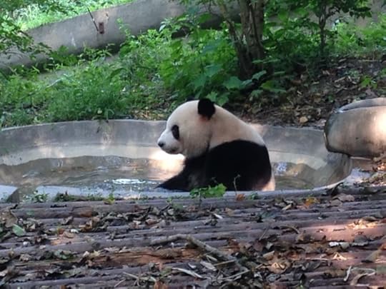
Giant Panda Breeding Research Base:
If you know one thing about Chengdu then its that they have Pandas! ��Despite that many Chinese people find this to be a boring waste of time, foreigners love it. ��Even if you are marginally interested, its worth a trip…hell, your in Chengdu right? ��It is however important to note that it does feel a bit like a zoo and you will need to get there early if you want to see the pandas (especially in summer), as they avoid the heat during midday.
People’s Park:
People’s Park in central Chengdu is a great place to take a walk, grab a tea or just generally kill some time.�� Its packed with koi ponds and traditional Chinese architecture as well as numerous paths for walking.
Wenshu Temple:
One of Chengdu’s best examples of Chinese Buddhism, this temple is located near the city center and is an easy excursion without having to travel too far.�� Its free to get into the complex and the surrounding streets are packed full of vendors selling all sorts of tourist trinkets.
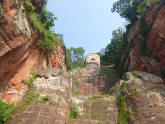
Leshan (World’s Largest Buddha):
This giant stone Buddha has earned the title of Worlds Largest Buddha Statue, and yes it is quite large.�� It sits at the shore of the Minjiang River and has a series of stairs so you can view it from multiple angles.�� Beware this is a popular place equipped with ticket takers, ice cream stands and annoying crowds.


September 5, 2019
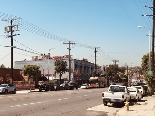
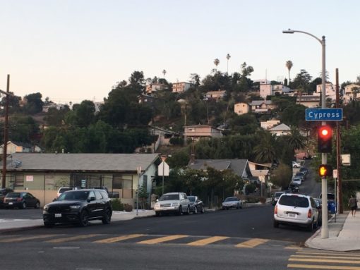
Los Angeles: Guide to Cypress Park
As more and more people start moving to Cypress Park in search of affordable housing near downtown, it seems that its time to write up a brief guide to the area. Recently the neighborhood has become more popular with people in their 20s and mid 30s as it sits close to downtown Los Angeles and all the bars and restaurants of Highland Park, so lets go over what you can expect from living here…if you so choose.
Food:
If you like Mexican or El Salvadorian food, you’ve come to the right place! In fact, you’d be hard pressed to find more authentic Mexican food anywhere else in the city. If you’re looking for something outside of that category, you’ll need to make the drive up to Highland Park or across the river to Echo Park.
Nightlife:
Admittedly Cypress Park is not a nightlife destination. In fact, the only bar in Cypress Park worth mentioning is Footsies on Figueroa. Although its a great little dive bar, if you’re looking for more action Highland Park is a quick Uber up the street and downtown LA is about 5 minutes away.
Transit:
Cypress Park shines when it comes to transit options! The 5 Freeway sits to the west of it and the 110 sits to the east. The Metro Gold line has the Lincoln Heights/Cypress Park station on Ave 26 and the LA River bike path starts/ends at the Cypress Park round-about.
Nature:
You might be shocked to know that despite its urban setting, Cypress Park has access to nature…easily! Mt Washington is a quick 10 minute walk up the hill to a number of hidden hiking trails, Elysian Park is just across the LA River, and Ernst Debs Park is on the other side of the 110 Freeway.
Location:
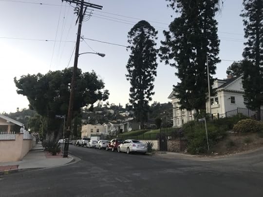
As you probably know, Cypress Park has a great central location in Los Angeles. It sits on the southern tip of the NELA (North East Los Angeles) district and just north of Chinatown and Downtown. In addition, Cypress Park is only 5 minutes away from Highland Park and 15 minutes away from Silverlake/Echo Park.
Crime:
Cypress Park is slightly infamous for its crime…or at least it was a few years ago. These days, the crime issues are mostly gone. Periodic incidents do occur but if you look at the LA crime map, you’ll notice that Cypress Park is far safer than areas like Echo Park, Hollywood, and even Santa Monica. I can confirm that, although the neighborhood is still pretty gritty, it’s safe overall and has tons of character.
July 10, 2019
Travel For Work: Most Annoying Business Terms
 Ive been working the “business world” for over 10 years now.�� So I feel its only fitting that I vent a bit and compile my Official list of the Most Annoying Business Terms.�� These are the phrases and sayings that I hear so often that it makes me cringe and question my life choices.�� If you’ve been in the white-collar world for a while now, you’re sure to have heard them.�� If you’re just starting out, this should prepare you for whats to come.�� Beware!
Circle Back:��
Let’s start out simple.�� This one is so common that I almost forgot that it’s really business slang for “Follow Up”.�� In fact, it doesn’t really even annoy me that badly.
Definition:�� Follow Up
Used in a Sentence:�� “Let’s circle back with that in the morning.”
The Ask:��
If you would have asked me six years ago, I would have said that this one would never catch on.�� How wrong I would have been!�� I first noticed it in the consulting world.�� Now I hear it everywhere.
Definition:�� The Request
Used in a Sentence:�� “Ive got to admit, I’m lost…what’s the ask here?”
Bio-Break:
Yup, that’s right…Bio-Break.�� Its a fancy, non-offensive way to say “take a shit”
Definition:�� Use the Rest Room
Used in a Sentence:�� “Let’s take five minutes for a quick Bio-Break.”
Swirl:
Swirl is kind of a good one.�� This is what happens when issues go round and round and never get resolved.
Definition:�� When issues go back and forth amongst a group without any resolution
Used in a Sentence:�� “I’d like to just reach out to our vendor and get a straight answer so we can avoid all this swirl.”
Out of Pocket:
Not sure where this one came from, but it’s just a more annoying way of saying “Out of the Office”.
Definition:�� Out of the Office
Used in a Sentence:�� “I’ll be out of pocket most of next week, so maybe we can circle back on Friday.”
To Be Continued…
I’ll be updating this as a way to vent as I discover more insane phrases at work.�� Don’t you worry about that!
June 18, 2019
Los Angeles, CA: Crazy Quirky Facts About Cypress Park
 After moving to Cypress Park a little over two years ago, I realized that most Angelenos dont really know anything about it.�� Despite its central location, most people just lump the neighborhood into the greater North East Los Angeles (NELA) district centered around Highland Park.�� However, as more outsiders begin to move in and more houses start to flip, there has become an increased interest in the area.
To that note, I thought it was only fitting to briefly write up some of the strange and quirky things that Ive been noticing during my time here.
1. Chickens Roam Freely in Some Backyards:
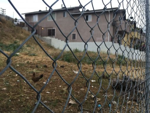 Despite being next to downtown you can still spot some homes that have a farm-like vibe to them.�� Look closely enough and you’ll see chickens and roasters running around some of the backyards in the area.�� Try not to rent a place right next door to one of these homes, or you may have an early morning wake up call every day.
If you’re worried about the noise….don’t be. ��This is not a very common sight.
2. Cypress Park is a Very Film Friendly Location:
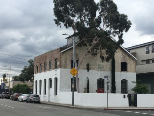 One thing I didnt necessarily expect to see was all the filming that goes on here.�� Its not over the top, but still fairly consistent.�� Most of the filming that Ive seen has taken place in the area where Fig and San Fernando meet.�� Footsies Bar and the Huron Substation are two popular locations.
Some of the popular movies, shows and music videos that have been filmed here are:
Footsies Bar:�� Bad Santa (Film)
Footsies Bar:�� Barry (Series)
Footsies Bar:�� Live Your Life by T.I. and Rihanna (Music Video)
Huron Substation:�� Bright by Echosmith (Music Video)
Huron Substation:�� NCIS New Orleans (Series)
Huron Substation:�� The Kids Are Alright (Series)
Unknown Location:�� The Fast and The Furious (Film)
Unknown Location:�� Catwoman (Film)
Unknown Location:�� Date Night (Film)
Unknown Location:�� Heros (Series)
Jeffries Ave:�� I Got The Hook Up 2 (Film)
3. Cypress Park is Filled with Small Road-Side (semi legal) Taco Stands:
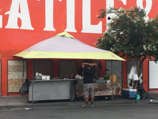 You might expect this from an area like Cypress Park, but I had to mention it because I absolutely love these little places.�� Cypress Park is packed with great Mexican and El Salvadorian restaurants, many of which are little more than a cart with plastic chairs.�� Some are actually permanent restaurants that are simply a tent, chairs and a grill.�� In the evenings the smell of grilled carne asada can be noticed anywhere, and the food tends to be great!
4. Old school Ice-Cream Trucks still Drive the Streets:
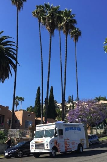 This is probably the most noticable strange and quirky thing about Cypress Park, so I had to save it for last.�� On any given day, you’ll see various old-school ice cream trucks driving up and down the streets.�� They sell all kinds of cold sugary treats and are typically no more than just a van with ice cream stickers all over it.�� Be sure to drive slowly as kids are often running close by.
May 9, 2019
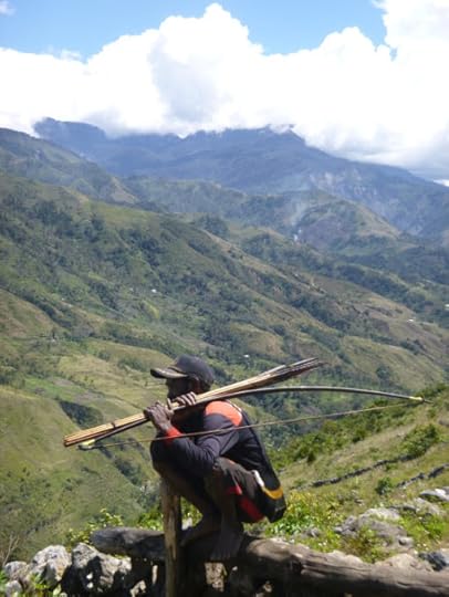
Indonesia: Independent Trekking in Papua���s Central Highlands
 Until 1930 the central highlands of Papua were believed to be completely uninhabited.����But when two Australian gold prospectors made an expedition into the western central highlands, those assumptions were shattered forever.����What they found were numerous tribes speaking hundreds of different languages and who lived in such isolation that they had no concept of the outside world.����Since that time the Papuan people have been thrust into modernity, sometimes not so willingly.����But with an endless terrain of dense mountainous jungle, many people believe that remote tribes still live isolated and virtually uncontacted by the rest of the world.����It was stories like this that sparked my interest and compelled me to dig deeper into visiting this remote mountain range.
Finding reliable information on Papua was challenging at best.����I spent months pouring over blogs, forums and articles trying to piece together a complete picture of where I wanted to go.����It seemed that few people trekked independently in the area, and even fewer wrote about it.�� In the end, I settled on a plan to trek the Baliem Valley of the central highlands in Papua, Indonesia.
All treks in the central highlands start with a flight to Wamena, the main hub of the region.�� This small mountain town is the last place to stock up on basic amenities and Western style comforts, but aside from that there���s not much to keep your interest.
 Although I made the trip alone, at my guesthouse in Wamena I met a small group of travelers who were also interested in trekking the Baliem Valley.�� Together, we hitchhiked to the trailhead at the village of Kurima, and from there we began our trek east into the central highland mountain range.
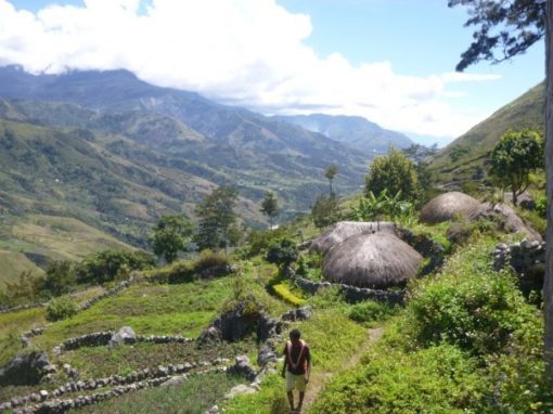
Over the next few days we hiked across the dense jungle clad mountains, doing our best to navigate the muddy and barely discernible trails.�� Periodically we would ask for directions from local farmers or kids who noticed us passing by.�� And from time to time, we would even have an entourage of children leading us between villages.
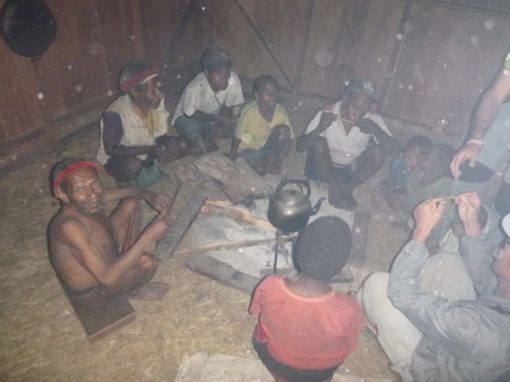
Along the way we stayed in local huts, typically maintained for passing travelers and tourists.�� They are generally very basic and consist of only an empty room with no running water and limited electricity. ��Each evening when we arrived in a new village, we���d sit around the fire eating sweet potatoes, sharing photos and sometimes playing a little music.
Our trek got us as far as the village of Ugem, at which point we decided to start circling back on the opposite side of the river valley.�� On the return trip, we passed through more villages where we met other foreigners on guided tours.�� In the end getting away from the guided treks allowed us to visit villages and meet people who lived a different version of reality than what we were accustomed to, and I think that���s what we were all hoping to find.
 Trekking Regions:
The central highlands are composed of a mountain range that stretches from west to east across the interior of the island of New Guinea.����As a general rule, trekking routes exist where roads do not.����Here���s a breakdown of the major trekking regions.
Lani Country:����Located west of Wamena and connected by road, the Lani people are generally considered to be less traditional yet friendlier.����By public bus you can get to the first town in Lani country (Kimbim) in about two hours.����Another 12 hours or so will get you to Tiom or Karubaga where the trailheads begin.
Dani Country (Baliem Valley):����It���s no surprise that the Baliem Valley is the most popular trekking destination in the central highlands.����With Wamena sitting at its center, it���s the easiest area to reach.����But with paved roads going north and west out of Wamena, trekking options are usually limited to the eastern areas where mountains have prevented road construction.����Trailheads here start at Hitigima or Kurima, about 45 minutes from Wamena.
Yali Country:����If you keep going east from Baliem Valley you���ll eventually hit Yali Country.����It���s the most traditional area of the highlands and also the hardest to reach.����Most travelers run out of time before making it this far.����The trailhead is the same as for Baliem Valley and takes about 4/6 days to reach the first Yali settlement (Angguruk).����To reach the end of Yali Country (Kosarek) it takes a total of about two weeks from Wamena.
Mek Country:����Further east still, yet not necessarily more traditional, is the Mek region.����This area sits up against the border with Papua New Guinea.����Few travelers make it here, although there has been significant missionary involvement over past few decades making it less traditional despite is remote location.
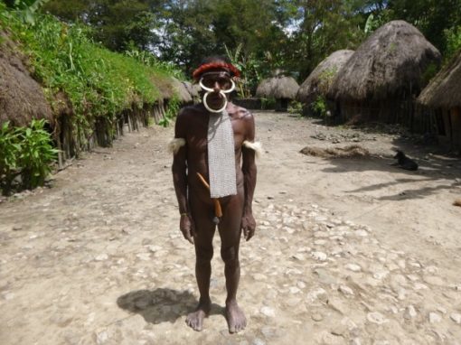
Culture of the Papuan Central Highlands:
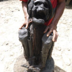
Although Papua is still one of the more untouched places left on earth, things are changing quickly.�� Traditional Papuan clothing in the central highlands usually consists of a Penis Gourd for men and a simple grass skirt for women. ��But these days most people choose to wear Western style clothing with a common accessory being an outdated flip phone.
Airstrips have long been a fixture across the Papuan landscape ever since Christian missionaries descended upon the island. As a result, change has come to the island faster than might normally be expected. ��In addition, roads are beginning to crisscross the area more and more, driven mostly by mineral exploration. ��However mountainous areas, which tend to keep road construction at bay, have helped limit outside influence and keep the local culture more intact in some highland areas.
The typical central highlands diet, which hasn���t changed all that much over the years, is based around the almighty sweet potato.�� In the highlands it seems to be the only thing eaten, aside from the rare occurrence when a pig is slaughtered. ��Although villages that see tourists will occasionally have ramen noodles packages available for sale.
Most Papuans living in remote villages will still use local building materials for their homes.�� This can be seen in the form of small huts that dot the mountainous landscape.�� We were even lucky enough to see the men of one village working together to build a hut for one of the elderly widows in their village.�� These homes usually consist of a wooden frame, a grass roof, a raised sleeping area and a fire pit in the center.
 Surat Jalan (Travel Permit):
As if traveling in Papua wasn���t complicated enough, the government has decided to add an additional layer of red tape for you to cut through.����Its called a ���Surat Jalan���, and you���ll need to obtain one upon your arrival in Papua.����It���s essentially a travel permit that outlines the areas that you plan to visit. ��Remember that many Papuans are not thrilled by the fact that they are governed by Indonesia, and as a result civil unrest means there are many areas are off-limits to foreign travelers.
The best place to get your Surat Jalan is at the Polresta (police station) in Jayapura or Wamena.����The process takes about an hour but you���ll need to make sure you have your passport, visa and a passport-sized headshot available. Just be sure to list out every province and village that you plan to visit, even places that you ���might��� visit.����It���s better to overshoot your list rather than come up short, since it costs you nothing to do so.
That being said, after I got my Surat Jalan I put it in my bag and forgot about it for the rest of the trip.����I didn���t check in at local police stations and no one asked for my papers.����In reality it seems more of a formality than anything else, but I had it in case I needed it. ��The last thing you want is to get told to turn back for not having the correct paperwork.
Getting There:
All roads to Papua start in Jakarta and eventually make their way to the island���s capital of Jayapura.����Flights from Jakarta to Jayapura take anywhere from 6 to 11 hours.����Garuda, Batik and Lion Air all offer flights starting at around $500 USD.
From Jayapura you���ll need to take a scenic 1-hour flight to the town of Wamena.����It���s from this jumping off point that all treks begin.����Flights from Jayapura to Wamena are offered by Wings, Nam and Trigana Air, but be prepared for some long delays if weather doesn���t cooperate.
Telephones:
To call the numbers below from the U.S., dial 011 (the international dialing code), +62
(Country code for Indonesia), 9 (the area code) and the local number.
 Getting Around:
Wamena is small enough to traverse on foot or by local taxi.����For overland travel between villages, taxis and public transit are available however transit it can be slow and inconsistent.����Taxis won���t always be available in villages outside Wamena so it���s important to book one for the entire day but hitchhiking is also a common and safe way to get around in a pinch.����Major towns in Papua are likely not connected by road, making air and water travel the only option for cross-country travel.
Where to stay:
Hotel Nayak; Wamena Kota, Wamena, Papua 99511, Indonesia; +62 969 31067. As the most popular budget guesthouse, this place offers clean and simple rooms in the center of town.
Baliem Valley Resort; Desa Sekan, Kecamatan Siepkosi, Jayawijaya, Pugima, Wamena, Papua, 80034, Indonesia. +62 812-4802-3489. For a rustic, upscale experience try this eco-resort about an hour east of Wamena.
Rainbow Hotel; Jl. Irian, Wamena Kota, Wamena, Papua 99511, Indonesia; +62 812-4813-7568. If a rainbow themed hotel serving food is what you���ve been after, look no further.
Where to eat:
Nasi Kuning Ternate; JI. Trikora, Wamena Kota, Wamena, Papua 99511, Indonesia; +62 852-5428-4029.�� This small and slightly dingy restaurant just across from the Wamena airstrip serves up quality Indonesian food.
Rumah Makan Fakhira; Jl. Jenderal Sudirman, Hurekama, Wamena, Papua 99511, Indonesia; +62 813-4482-5154.�� For slightly more options this place is just down the road.�� Deserts and juices are also available.
Pilamo Caf�� & Bakery; Jl. Safri Darwin No.2, Wamena Kota, Wamena, Papua 99511, Indonesia; +62 969 31162.�� This place is worth a visit for pastries and sweets���.things you wont get for quite some time if you���re heading into the mountains.
May 5, 2019
Los Angeles: Best Neighborhoods for Young People
 Remember when Hollywood was cool?�� Or how about when Venice was still ghetto?�� Were you around when Downtown was unheard of or when Silverlake was the underground hangout for the ���cool��� kids?�� The point is that LA is changing���.and always has been.�� Any LA native can tell you how surprising it is that these once ���too dangerous��� or ���too far��� neighborhoods have become the preferred hangouts for the cities young and hip.�� So if you���re new to LA or just thinking about making the move out west, let me shed some light on this confusing mesh of cities and districts that make up the central LA area.
Silverlake/Echo Park:
No list of hip and cool areas would be complete without at least mentioning LA���s mainstay hipster enclave of Silverlake and Echo Park.�� Although these areas have been gentrified for a while now, they are still the go-to neighborhoods for things like organic kombucha, craft beer and ironic fashion.�� However their high prices have pushed most young people into other areas.
Highland Park:
The holy grail of hip-ness, Highland Park is LA���s ���coolest��� neighborhood.�� It���s a predominantly Latino area that sites along the Arroyo Seco, between Mt Washington and Eagle Rock.�� For the longest time it was considered pretty sketchy, but these days it seems to be ���the place��� that people are requesting to relocate to from out of state.�� Highland Park is packed with trendy restaurants, bars, theaters and even an historic bowling alley.�� All this lives amongst a thriving Mexican scene so great food is easy to find.
 Cypress/Glassell Park:
Most likely the ���next big thing��� in real estate development, Cypress Park and Glassell Park are now finally starting to benefit from their prime location after years of neglect.�� Once an area of gang violence and crime, Cypress Park and Glassell Park are now considered two of the trendiest areas in Los Angeles.�� The two adjacent neighborhoods have become popular in recent years due to their easy access to Mt Washington, the LA River bike path and the bars and restaurants of Highland Park.�� Being connected by three freeways and a few metro stops doesn���t hurt either.
Frog Town:
Also known as Elysian Valley, this small isolated strip of land was nick-named ���Frog Town��� in the 1930���s due to the abundance of frogs that would make their way out of the LA River and into the neighborhood.�� These days, the frogs are gone but Frogtown is on the rise as breweries, coffee shops and bars pop up.�� The revitalization of the LA River has helped spur business development along the river bike path as well.
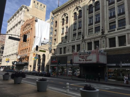 Downtown LA:
Once a prime example of urban decay, many parts of downtown have taken a turn for the better.�� Where there were once abandoned streets, drugs and homelessness there are now cool bars and restaurants, converted warehouses and hip districts like Japan Town, Arts District and the Historic Core.�� What makes this part of town so interesting is that it is right in the middle of being cleaned up, so it still has a lot of the grittiness that people are drawn to without that ���stabby��� feeling that makes you feel like you shouldn���t be there���think Manhattan 20 years ago.
Boyle Heights:
Just east of downtown sits the residential neighborhood of Boyle Heights.�� It���s always been a primarily Latino area, until recently the art gallery scene has made its way into the community���.not always welcomed, I might add.�� The area was a natural expansion of the downtown Arts District, as it sits just across the LA River. ��These days you���ll find a combination of art galleries and Mexican shops and restaurants living ���sometimes��� harmoniously together.
February 10, 2019
Guide to Griffith Park
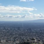 Griffith Park, that giant swath of green at the eastern edge of the Hollywood Hills, is one of the largest urban parks in North America and despite being rather wild and rugged, is surprisingly close to Los Angeles proper.�� It’s (apparently) sometimes referred to as the Central Park of Los Angeles, but whereas New York’s Central Park is orderly, planned and easy to navigate, Griffith Park is anything but.
For me personally, Griffith Park has always been an easy place to access but a hard place to understand.�� It has mountains, canyons, flat lands, golf courses, museums, a zoo and of course the famous Observatory.�� For all these reasons Ive spent some time exploring the area and have broken down the park into artificial “sections” to make it easier to understand.
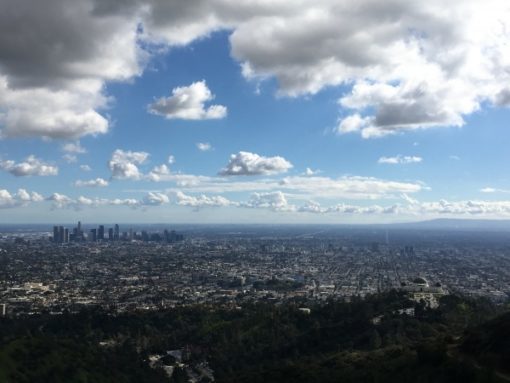 The Observatory (And Surrounding Trails):
Probably the most popular thing to see in the park is the Observatory.�� There are two roads that lead up to it, one being Fern Dell Dr and the other being Vermont Canyon Rd.�� In theory you can drive all the way up so no hiking is required, although parking is limited and traffic can get really bad on weekends.�� It’s not uncommon to have to park on the road leading up to the Observatory and then walk up.�� For this reason, you should be slightly fit.�� Another option would be to park at the bottom, near the entrance and hike your way to the top.�� There are numerous routes that you can take.�� Just bring lots of water and try not to do it on a really hot day.
The Observatory offers great view of Los Angeles proper, from downtown to the beach.�� It also has a free space-related museum with restrooms.�� And of course, this is where that famous scene from “Rebel Without a Cause” was filmed.
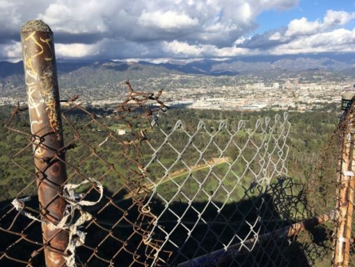
The Hollywood Sign:
Nothing says LA like the Hollywood sign and we’ve got it here on the western edge of Griffith Park.�� You can’t get directly onto the sign, but you can follow a fairly strenuous hike up to it and see the sign from behind.�� Just south of here is the Hollywood Reservoir, although not technically in the park it still makes for a decent walk around its perimeter.
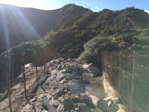
 Bronson Canyon:
This section has an easy hike that leads up to the Bronson Caves.�� It’s not the most spectacular section of the park, but it is famous for being the location of the original “BatCave” from the 1960’s Batman TV Series and well as about a million other movies and shows throughout the years.
The Flats:
This area refers to the flat lands on the eastern side of the park.�� It mostly consists of golf courses, picnic areas and parking lots.
The Merry-Go-Round Hikes:
The area at the south-east corner of the park is sometimes just referred to as “Merry-Go-Round”.�� Yes, there’s an actual Merry-Go-Round there but more importantly its where a lot of the trails into the hills start.�� From here to the “Old Zoo” area, you’ll find the trailheads to many of the routes to Mount Hollywood, Bee Rock, Hollywood Sign and the Observatory.�� There’s also a lot of parking here with minimal crowds.
The LA Zoo:
Yup, the LA Zoo is located within the boundaries of Griffith Park.�� And actually the “Old Zoo” is just south of it (mentioned above).�� The “Old Zoo” has been decommissioned and turned into picnic facilities, whereas the current zoo is situated at the north-east corner of the park.�� Next door you’ll find the Autry Museum of the American West.
 Cemetery:
On the north-west side of the park near Burbank, you’ll find a mortuary and cemetery.�� There’s not much reason to venture here but since it occupies a large area, I thought I would mention it.
Summary:
Griffith Park is scattered with roads but only a few are actually open to the public, the rest are fire roads.�� These fire roads, along with the endless labyrinth of trails, are all open to hiking.�� So you have a lot of options, but it will take more than a few visits to hit all the hiking options available.
January 22, 2019
Guide to Elysian Park
 What’s that big green splotch surrounding Dodger Stadium?….its none other than the often overlooked Elysian Park. Despite being overshadowed by its massive neighbor to the north (Griffith Park), Elysian Park is still packed with things to see and do. Its home to Dodger Stadium and just a few minutes from Downtown LA, Hollywood, and Silverlake/Echo Park, but with all its hills, roads and side trails it can be hard to fully understand. So, in an attempt to make sense of it all Ive broken the park down by “section”. Here’s the low down.
Dodger Stadium:
This is obviously the most notable and distinguishing feature of the park…and perhaps the only reason you’ve ever ventured here. For those unfamiliar with the park, Dodger Stadium takes up the large southern section of the park and can be access ed by a handful of roads leading to its surrounding parking lots.
 The Reservoir:
On the map it looks like it could be a lovely lake situated in the middle of the park. Eh, not so much. In reality its a dried up reservoir….at least at the time of writing. Nothing more to see or say about it.
The 5 Freeway Hike:
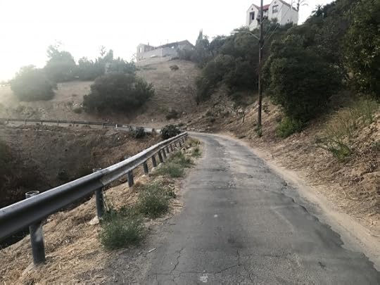
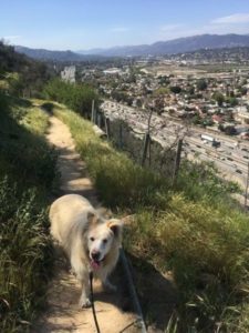
Im not sure what its technically called, but here Ill refer to it as “The 5 Freeway Hike”. Its a pretty cool (and easy) hike that takes you along the ridge of the park high above the 5 Freeway. It starts at the southern tip of the park and runs to the northern edge…the whole time running high above the freeway and offering some cool views of Cypress Park and Mount Washington below. Its also a popular spot for teenagers to drink beer and get high so trash and graffiti is not uncommon.
The Flat Lands:
There are two sections of flat lands in the park. Both offer your standard features of bbq pits, picnic tables and shelters. This is the domain of families, kids, dogs, frisbees and carne asada grilling on the bbq. Parking is abundant and the sketchiness found in other parts of the park is mostly non-existent.
Stadium Way
Park Row Dr
Elysian Field:
This section includes baseball diamond, shelters, bbq pits and is a popular place for families and small gatherings.
Angels Point:
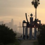
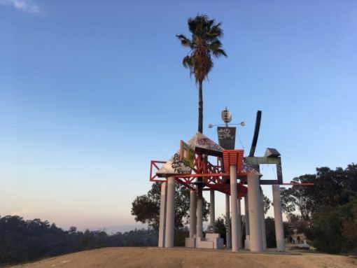
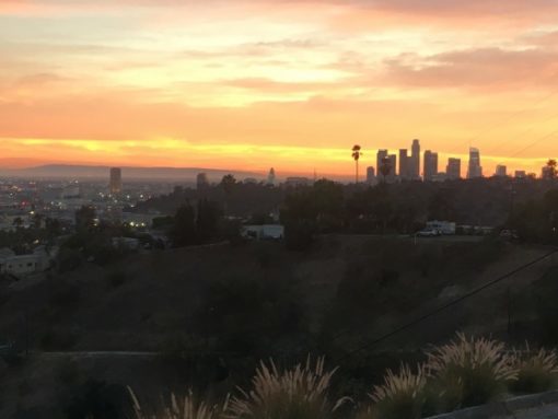
Probably the most common destination in the hilly areas of the park, this picturesque overlook has great views of downtown Los Angeles, some short hiking trails and a small bbq area. The main overlook area has a cool artsy viewing platform. Its also a popular spot for photographers.
 Buena Vista Overlook:
Easily the creepiest section of the park, Buena Vista Overlook is a hill that shoots out across the 110 freeway. Its an interesting place to say the least and known as a spot where gay men go to hook up in the surrounding trees. I can confirm that the times Ive been there Ive always seen cars parked with single men in them…just sitting. Its also not uncommon to see piles of beer cans, trash and used condoms in various places amongst the trees. You’ve been warned.
December 31, 2018
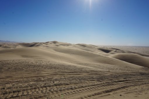
Guide to the Imperial Sand Dune Recreational Area [Algodones Dunes]
 Have you ever been driving out of San Diego or LA and noticed those massive sand dunes just off the freeway? Maybe you thought to yourself…”how could I have lived here for so long and never knew about this?”. Or maybe you grew up near them and know everything I’m about to tell you. Either way, here’s the breakdown of the Imperial Sand Dune Recreational Area, also known as the Algodones Dunes.
Imperial Sand Dune Recreational Area vs Algodones Dunes?
The term “Algodones Dunes” refers to the entire geographical feature of the dune system, whereas the term “Imperial Sand Dune Recreational Area” refers to the administrative body that governs it. The terms are used interchangeably to describe the same area. The term “Glamis Dunes” is an informal term used because the major town in the area is Glamis.
 What is the Imperial Sand Dune Recreational Area (Algodones Dunes)?
Its the largest sand dune field in California, stretching approximately 45 miles by 6 miles. It runs southeast from Hwy 10 all the way south to the boarder with Mexico. The dune system was created when the Colorado River would periodically flood or change its course, leaving silt deposits that built up over time.
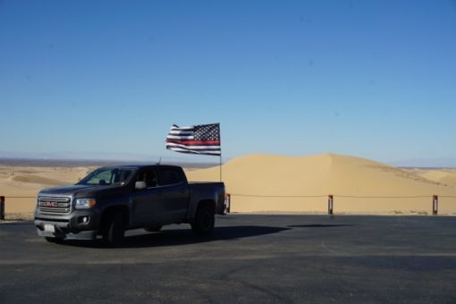
How To Get to the Imperial Sand Dunes:
There are two main routes into the dunes. The most common is Hwy 78 that runs through the town of Glamis. The other is Hwy 8 that runs through Yuma.
From Hwy 78, you can pull off near Glamis (AKA Vendor Row) or on Gecko Road. Both areas have camping and some basic amenities (Firewood, food, fuel, ATV Rentals).
From Hwy 8, you can pull off at Gordon Wells or Buttercup. Each one allows camping and has basic amenities.
Imperial Sand Dunes Cahuilla Ranger Station:
Here you can purchase your required permit. It’s $50 onsite or $35 online for a week…or $150 for the season. The ranger station can give you a map and more detailed info about what to see and do in the area.
Address: Gecko Rd, Brawley, CA 92227
Phone: (760) 337-4400
 Orientation:
The Imperial Sand Dunes/Algodones Dunes are broken up into three sections.
NORTHERN SECTION:
The northern most section, known as Mammoth Wash is a more isolated area that does allow OHV riding.
MIDDLE SECTION:
This is the “North Algodones Dunes Wilderness” area. It was established in 1994 and is closed to all motorized vehicles. But it is quiet and is open to hiking, horseback riding and sandboarding.
SOUTHERN SECTION:
This is everything south of Hwy 78. It’s a heavily used area and can get very busy on holiday weekends. This is the playground of quads, bikes and side-by-sides. This is where you’ll find the campgrounds, ranger station and, on some weekends, 250,000 other people.
Where to Camp?
OFF HWY 78:
Camping is free anywhere in the dunes along Hwy 78, however you will need a valid permit to avoid getting a fine. Camping is first come, first served so if you show up to a spot next to other people, just be sure to ASK FIRST before setting up shop. Most people are pretty nice, but if you just start setting up next to someone you may end up in a fight.
Gecko Road: Gecko Road is a six mile paved road that allows free first come, first serve camping along a series of “pads”, or paved areas. There are toilets along the road in various places. Its operated by BLM and they do not accept reservations.
Glamis/Vendor Row: This area also allows free camping, although it is smaller and busier. The nice thing about this area is that it is just off of Hwy 78, so less driving and easier to get out on busy holiday weekends. It also has public toilets and does not take reservations.
OFF HWY 8:
Gordon Wells: Gordon Wells has a nice and helpful campground on the south end of the dunes on a paved road. These are paid spots.
Buttercup: Buttercup also has a paid camping location just off of Hwy 8 with public toilets.
Where to go OHV Riding:
The only area in the dunes where you cannot ride an OHV (ATV, Quad, Dirtbike, Motocross) is in the “North Algodones Dunes Wilderness”. This is the green section on Google Maps. So the north section of Mammoth Wash and everything south of Hwy 78 is all fair game.
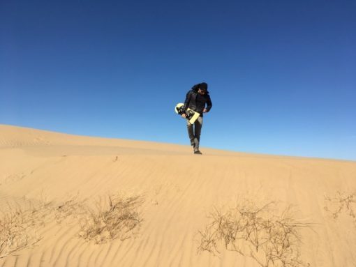
 Where to go Sandboarding:
If you’ve got a quad and a board, then you’re golden! Pick the biggest dune, watch for other riders and go for it.
If you just have a board, sandboarding gets a bit trickier. The first problem is parking. If you don’t have an OHV, then you are stuck to areas near roads, or to hiking in…and these are not going to be your large dunes. Most of the largest dunes are in the OHV areas, so you’ll have no way to reach them. One exception is the Osbourne Overlook, but you will be battling OHV riders.
If you’re looking for a place to park and go sandboarding without the threat of a quad slamming into the back of you, here are a few options.
Glamis/Vendor Row:
You can park here and walk across Hwy 78 into the North Algodones Dunes Wilderness. Here you’ll have access to medium sized dunes and no OHV riders.
Ted Klpf Road:
You can also take the Ted Klpf Road north along the eastern side of the North Algodones Dunes Wilderness. It’s a gravel road but has periodic pull off areas where you can park and hike in. Keep in mind that some of the sand at these pull off areas can be deep, so a 4 wheel drive is wise.
Things to See and Do:
Osbourne Overlook:
This is essentially a drive up view point where you can get an amazing view of the dunes looking south. You can also camp here for free, but spaces are very limited.
OHV Riding:
As stated above, you can ride anything from quads, dirtbikes, side-by-sides. It’s an ATV paradise.
Sandboarding:
As stated above, you can sandboard here….anywhere in fact. The trick is just reaching the right area.
Hiking and Horseback Riding:
This is done in the North Algodones Dunes Wilderness. You’ll probably have it mostly to yourself.
October 16, 2018
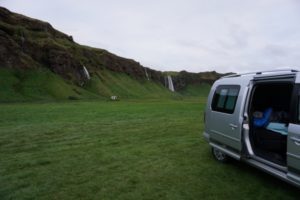
Five Campervan Essentials for an Amazing Icelandic Road Trip
 So you’ve seen your friends amazing photos of Iceland all over your Instagram feed and decided you just have to see it for yourself. Does that sound about right? Well, you won’t be disappointed! At least not with the countries natural beauty. The prices that you end up paying for things like lodging, tours and mediocre food will surely make you sad inside. But not to worry, there’s a sure-fire way to have a great time in Iceland while saving some cash. Yes, you can get yourself a Campvan!
How Does Campervaning Work in Iceland?
Let’s get a few things cleared up first. You will not be the only person with this idea. In fact, the Campervan situation is a pretty common way to travel around Iceland. So much so, that you can just rent one like you would any rental car and be on your way. In addition, there are tons of campsite scattered all around the country and they don’t book up and do not need reservations. I’ll say that again….they DO NOT need to be reserved in advance. Lastly, you don’t need to be a camping expert to survive in a Campervan for a week. Its pretty simple and the rental company will show you how everything works before you leave with the vehicle.
 What is Included in a Campervan?
Any Campervan you get will have the basics included. These are things like a mattress to sleep on, a cooler, a grill, storage, and utensils. But this article is more about those not-so-standard things that your going to want to have in your Campervan. The idea is to help you choose a rental company that can offer these things, so you’re not stuck in an uncomfortable situation. And let the record show, that we don’t endorse any particular rental company…nor do we give a shit who you choose.
The Five Campervan Essentials:
Stand-Alone Heater:
Perhaps you weren’t aware, but Iceland is a cold place…even in summer. So those nights sleeping in the back of a van can be quite uncomfortable if you don’t have some heat. Luckily many Campervan rentals come with stand-alone heaters that you can run at night off of a second battery that charges during the day while you drive. Its the perfect plan!
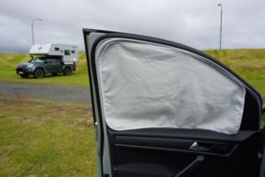
Window Covers:
If you’re traveling to Iceland in the winter, then this won’t matter. But if you are like most people and your there in the summer, you’ll probably want window covers to block out that pesky sun that never seems to set. In addition, these give you some privacy while your sleeping and changing cloths in the back of the van. Ours worked by using small magnets in the covers that could be attached to the metal frame of the van.
Mobile WiFi Device:
Yes, you can get a Campervan with a WiFi hotspot so you wont have to look up from your phone…maybe ever!
Sleeping Bags:
Camping in a cold environment without sleeping bags is never a good plan. And they can be life savers if your heater doesnt last the night…like ours did. The sleeping bags saved us.
Refillable Water Jug:
The tap water in Iceland is excellent! If you’re buying bottled water here, there’s something very wrong with you. Despite that bottled water is worse for you than tap and costs a lot more (especially in Iceland), buying bottled water creates an enormous trash problem for a tiny island country like this. So please don’t be ridiculous.
 Anyway, that’s it. I’m sure you’ve read a ton of articles like this one, but hopefully this can help in your search for the perfect Icelandic experience. Its an amazing place with tons to see and do.