Sam Benson's Blog, page 3
July 17, 2012
Following Footsteps into Oahu's History
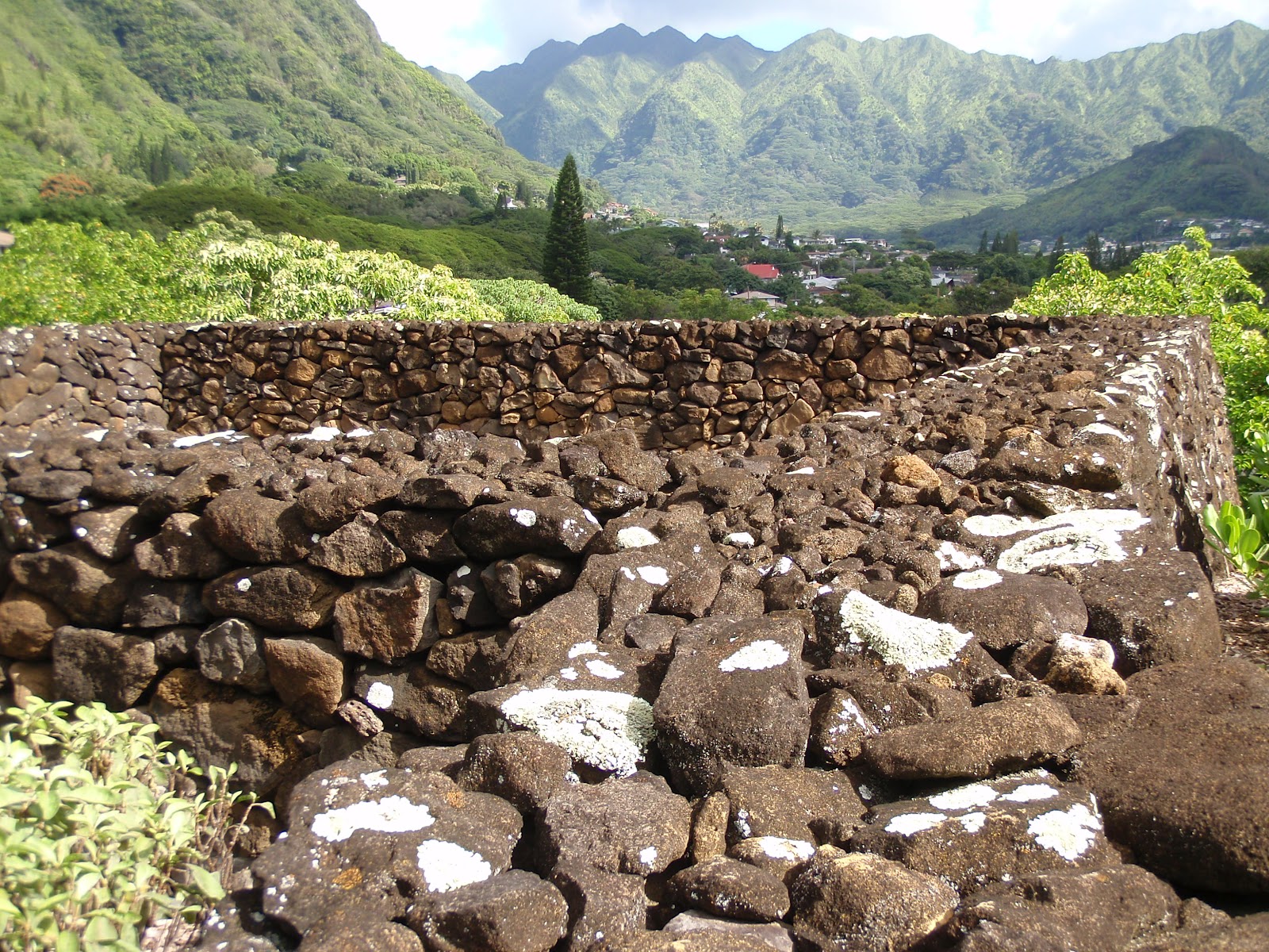
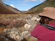
Want to dig deeper into Hawaiian culture and history during your island vacation? There's no better place to start on than Oahu, home to ancient temples and battlegrounds, WWII historical sites, and the wild scenery of the Windward Coast and North Shore.
Over at LonelyPlanet.com, you can check out my list of five of the most worthwhile day hikes across Oahu, from the easy ascent of Diamond Head near Waikiki to the Maunawaili Trail that snakes below the jagged pali (cliffs). Visit WWII pillboxes or a Hawaiian temple of traditional medicine and healing, all within a surprisingly short drive of Honolulu and Waikiki.
Here's a bonus for blog readers like you! What I didn't have room to include in my Lonely Planet article are da best locals' places to chow down after your hike:
1. Diamond Head - Back in Waikiki, drop by Waiola Shave Ice for icy treats or 1950s-era Leonard's Bakery for malasadas (Portuguese-style doughnuts).
2. Maunawili Trail Network - Drive from any trailhead to Sweet Home Waimanalo market-fresh cafe, pouring veggie smoothies and mint lemonade.
3. Lanikai Pillboxes - Line up at Lanikai Juice for tropical fruit smoothies, often made with produce from organic farms, and heaping fruit bowls.
4. Kaena Point State Park - Backtrack to Haleiwa for sweet Matsumoto Shave Ice from a roadside shack.
5. Keaiwa Heiau State Recreation Area - Gorge on an island plate lunch or poke rice bowl with spicy eggplant fries on the side at chef Elmer's Poke Stop.
Got another favorite hike on Oahu? Let us know where it is by leaving a comment below!
Related links:
Big Island Trekking: From Coast to Volcanic Peaks
Hawaii: Go Green, Live Local & Save Money
Hidden Hiking Trails in West Maui
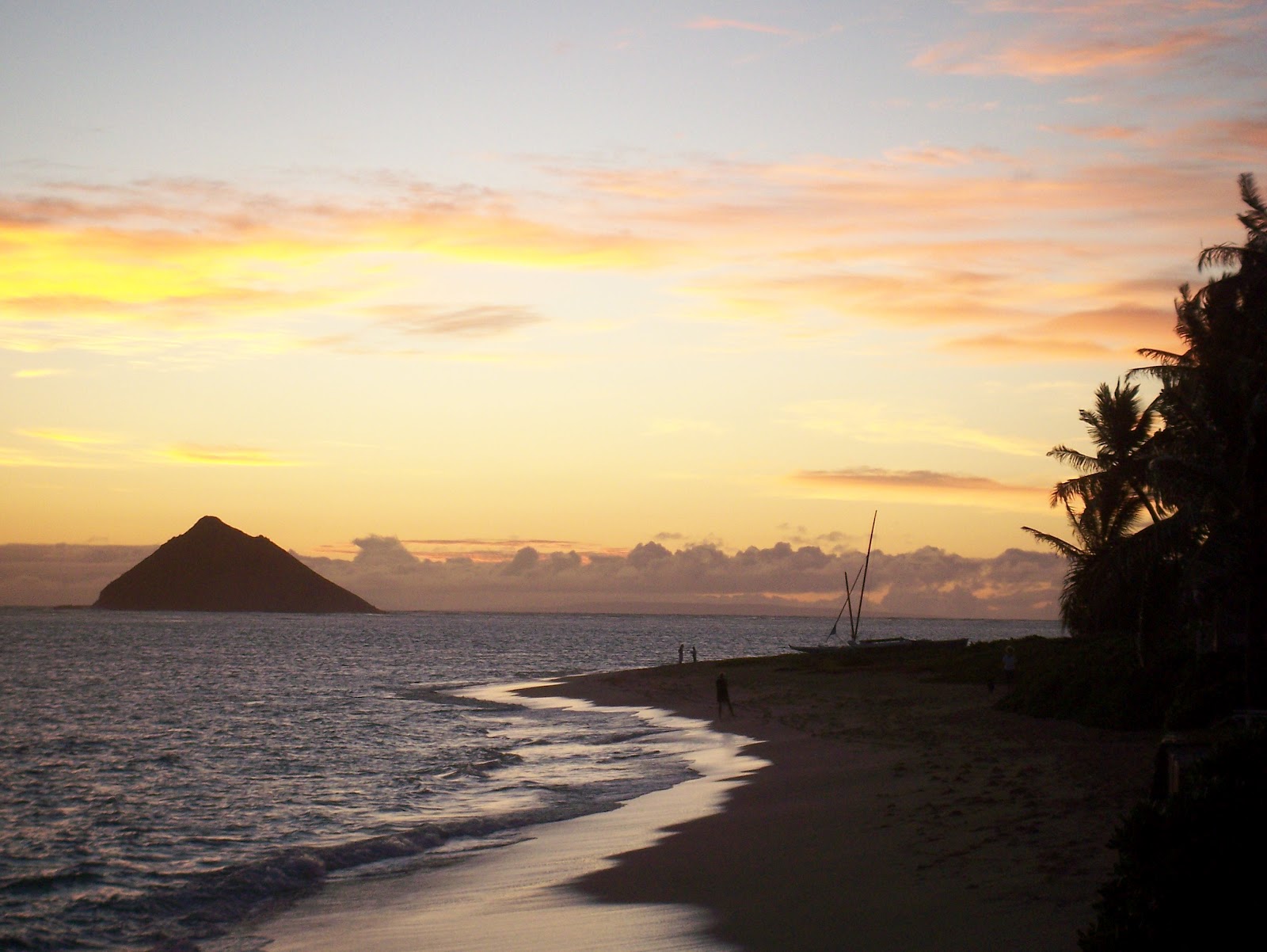
Photo credit: Sara Benson & Michael Connolly Jr.


July 10, 2012
Hiking Yosemite's Half Dome [Photo Essay]
Often reading about a hiking trail doesn't give you enough information. Honestly, how difficult is it to hike up Half Dome inside Yosemite National Park? Take a look at our trek and decide for yourself.
 View of Half Dome from Clouds Rest peak in Yosemite National Park
Heading up to Clouds Rest from the Sunrise Lakes Trailhead off Tioga Road, you get panoramic views of this glacially polished granite dome. Its rear profile resembles a hawk perched above Yosemite Valley.
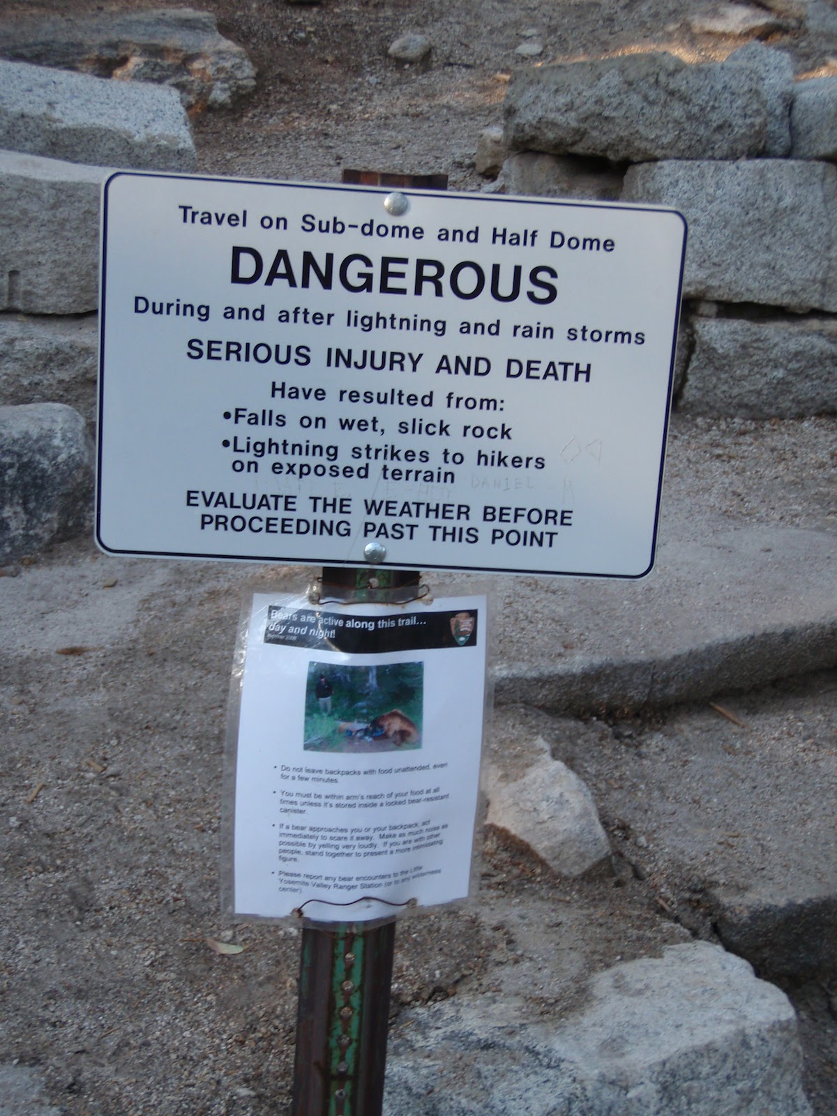
 Lightning strikes, falling from the cables and other risks
Warning signs at the base of Half Dome are ignored by hikers too intent on making it to the summit despite inclement weather. Fatalities from lightning strikes or slipping off the cables have happened.
 Half Dome cables, which are put up seasonally each summer
To safely ascend the cables bolted into the rock, leather gloves and climbing shoes or hiking boots with good traction help. So does upper body strength, as you'll be pulling yourself up to the top of the cables, not pushing off the rock with your legs.
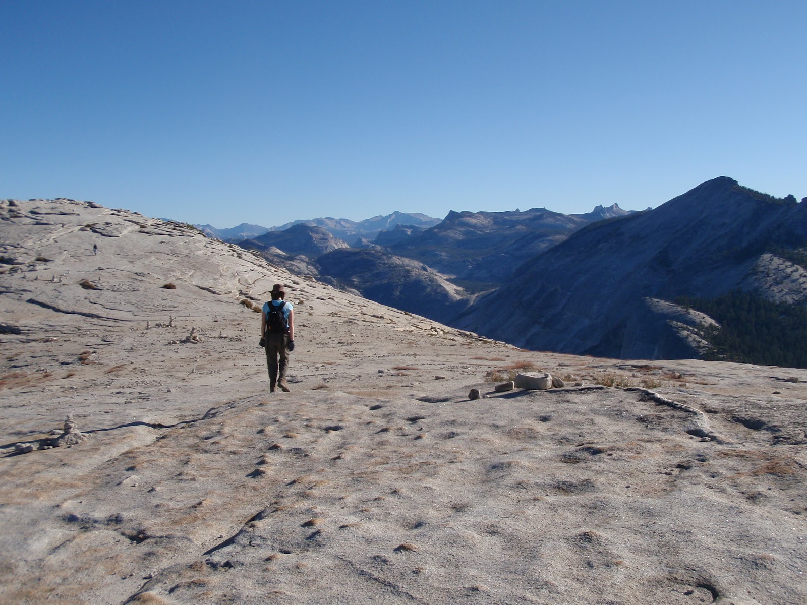
 Walking on the top of Half Dome on a summer weekday before 10 a.m.
Is it worth the effort of getting up early enough to beat the crowds to the top? Yes. Fewer people on the cables before 9 a.m. makes it quicker, easier and safer for you to ascend and descend the cables. You'll need to get a hiking permit in advance.
 View of Yosemite Valley from the summit of Half Dome
At the summit, stop to catch your breath, let your cramped arm muscles loosen, and gaze down at evergreen trees and meadows beside the Merced River, which meanders through Yosemite Valley.
 Safely back down the cables, thanks to climbing rope and clips
We finished our 20-mile overnight hike in Yosemite Valley, descending from Half Dome and over the wooden bridge above Nevada Fall. Take the John Muir Trail if you're already knock-kneed, or drop down the steeper Mist Trail beside Vernal Fall.
Have you climbed Yosemite's Half Dome? Was it worth it? Would you do it again? Have any other tips for novices? Leave us a comment below!
Related links:
Catching the Firefall in Yosemite Valley
Winter's Last Lucky Call in Yosemite
Yosemite's Half Dome Through the Back Door
Photos: Yosemite National Park (Michael Connolly Jr. & Sara Benson)
 View of Half Dome from Clouds Rest peak in Yosemite National Park
Heading up to Clouds Rest from the Sunrise Lakes Trailhead off Tioga Road, you get panoramic views of this glacially polished granite dome. Its rear profile resembles a hawk perched above Yosemite Valley.
 Lightning strikes, falling from the cables and other risks
Warning signs at the base of Half Dome are ignored by hikers too intent on making it to the summit despite inclement weather. Fatalities from lightning strikes or slipping off the cables have happened.
 Half Dome cables, which are put up seasonally each summer
To safely ascend the cables bolted into the rock, leather gloves and climbing shoes or hiking boots with good traction help. So does upper body strength, as you'll be pulling yourself up to the top of the cables, not pushing off the rock with your legs.
 Walking on the top of Half Dome on a summer weekday before 10 a.m.
Is it worth the effort of getting up early enough to beat the crowds to the top? Yes. Fewer people on the cables before 9 a.m. makes it quicker, easier and safer for you to ascend and descend the cables. You'll need to get a hiking permit in advance.
 View of Yosemite Valley from the summit of Half Dome
At the summit, stop to catch your breath, let your cramped arm muscles loosen, and gaze down at evergreen trees and meadows beside the Merced River, which meanders through Yosemite Valley.
 Safely back down the cables, thanks to climbing rope and clips
We finished our 20-mile overnight hike in Yosemite Valley, descending from Half Dome and over the wooden bridge above Nevada Fall. Take the John Muir Trail if you're already knock-kneed, or drop down the steeper Mist Trail beside Vernal Fall.
Have you climbed Yosemite's Half Dome? Was it worth it? Would you do it again? Have any other tips for novices? Leave us a comment below!
Related links:
Catching the Firefall in Yosemite Valley
Winter's Last Lucky Call in Yosemite
Yosemite's Half Dome Through the Back Door
Photos: Yosemite National Park (Michael Connolly Jr. & Sara Benson)
July 3, 2012
5 Big Las Vegas Mistakes You Can Avoid
 In 2012, Las Vegas has become one of top two most-searched travel destinations online, behind only Disney. What's everyone trying to find out? Why is this city so hard for first-time visitors and even repeaters to figure out? I'm going to save you a lot of Googling, and even more wasted time and money, and tell you about the five biggest lessons I've learned from a decade of hanging out in Sin City.
1. Let your taxi drive 'long-haul' you through the tunnel. Once you arrive at McCarran Airport and wait in the annoyingly long taxi queue, you're probably not going to pay attention to how your taxi driver gets you to your hotel. But be sure to stay awake and conscious long enough to tell your driver not to take the I-15 connector tunnel if you're staying on or near the Strip. It'll add significantly to your taxi fare and surface streets are faster. (Tip: If you don't want to wait in the airport taxi line, tweet @Hacking Vegas in advance for a stealth pick-up at McCarran.)
2. Not take advantage of valet parking. I'm a diehard self-parker, even on the streets of Los Angeles, where valet parking is treated like a civic duty. But in Las Vegas, valet parking is free at almost every casino hotel and shopping mall. All you need to do is tip when the valet hands you back the car keys (a few bucks is fine, unless they leave your Maserati out front, in which case give 'em a $20). That tip costs less than what you're going to drop in the slot machines, and it saves you having to walk for 15 minutes to and from the self-parking garage. For quick, easy in/out valet parking on the Strip and downtown, I like the Tropicana, Miracle Mile Shops at Planet Hollywood, Bally's, Main Street Station, the Golden Gate and the Golden Nugget's Rush Tower.
 3. Fail to find a deal on your hotel room. There are so many ways to save money on where you stay, whether that's on the Strip, downtown or anywhere else. Most casino hotels announce their deals on Facebook, Google+ and Twitter (the Tropicana is especially savvy with social media offers) and also make promo packages available on their websites. But the best deals are usually reserved for visitors who sign up in advance for email lists (MGM Grand, Bellagio, Wynn & Encore) or register with the casino hotel websites (ex. TI (Treasure Island), Venetian & Palazzo). To get an idea of baseline hotel rates for your travel dates, start your search at Travelworm and compare air/hotel packages on travel booking sites like Expedia. But don't stop your comparison shopping there. Often booking your flights independently and your hotel room directly with the casino nets the biggest savings.
4. Buy full-price tickets for a bad show. When you're on the Strip, you may feel like you have to see a show, as if leaving Vegas without having done so means you'll have missed out. Not true! If you're not a fan of stage shows to begin with, nothing in Vegas is likely to change your mind. If you do want to see a show and you don't have your heart set on Celine Dion or Garth Brooks, head over to the nearest branch of Tix 4 Tonight and get a same-day, steeply discounted ticket for anything that sounds like fun, whether that's Absinthe comedy burlesque, Penn & Teller's magic show or Legends in Concert celebrity impersonators. Even if you don't love the show, at least you won't have spent too much money on it. Bonus tip: If you do want to see Cirque du Soleil, line up before the Tix 4 Tonight booth opens for the day or sign up online for the Cirque Club to buy discount tickets in advance. Also check for promo ticket deals on the Cirque website and the websites of the casinos hotels where the shows are playing.
 5. Pay too much or too little for dinner. Are you excited by the idea of a $10 steak or buffet? Know that you get what you pay for in Vegas, which means bad food for cheapskates (Ellis Island off-Strip is a shining exception to this rule). If you're going to pay for a buffet, pick one of the best, like The Buffet at Wynn, Wicked Spoon at Cosmopolitan or Studio B at the M Resort south of the Strip. It's also worth paying more for top-tier steakhouses, like SW Steakhouse at Wynn, Cut at the Palazzo or N9NE at the Palms. Under-the-radar steakhouse deals include Envy near the city's convention center, Vic & Anthony's at the Golden Nugget, Flame at the El Cortez or the 1950s Golden Steer, where the Rat Pack used to hang out, just west of the Strip. And just because you're splurging, doesn't mean you can't also save yourself money and time. Buy discount dining certificates from Restaurants.com and make free reservations for in-demand restaurants with OpenTable.
 Looking for more expert insider Vegas travel info? Download our Viva Las Vegas, Baby! mobile app or Amazon Kindle ebook. Got your own tips for avoiding tourist traps in Las Vegas? Let us know by leaving a comment below. Thanks!
Related links:
Viva Las Vegas, Baby! mobile app (iTunes / Android)
Viva Las Vegas, Baby! Amazon Kindle ebook
Stacking Up the Strip's Best Burgers
Photo credits: Michael Connolly, Jr. & Sara Benson

June 27, 2012
Good News, Bad News for Endangered California Condors in 2012
 Living near the Big Sur coast and Pinnacles National Monument, I'm lucky enough to have glimpsed California condors soaring in the wild while I hike along windy beaches and rocky cliffs. Given that there were only about two dozen birds left in the world in the 1980s, their species recovery count to over 400 birds counted earlier this year is nothing short of amazing. Captive breeding programs and wild bird banding and tracking studies have kept these ancient ones from flying off into extinction.
Now here's the bad news. Just like in the late 20th-century, lead poisoning is again striking down these majestic hunters, whose future survival is still fragile. The culprit is lead ammunition being used by hunters, whose bullets become embedded in abandoned carcasses that then become food for condors. As discussed in a recent Los Angeles Times article, unless a broader legal ban is instituted on lead ammunition within condor habitats, birds will likely continue to be poisoned, sickened and die.
You can learn more about these scrappy scavengers on the Big Sur coast at Andrew Molera State Park, where the Ventana Wildlife Society staffs the Discovery Center, now open Saturdays and Sundays from Memorial Day through Labor Day. Once the weather cools down, head inland to Pinnacles National Monument, a condor feeding and release site that hosts special bird-watching events, usually in fall, winter and spring (summer is just too hot!).
Can't travel to California? You can follow the condors' dramatic story online with Audubon California and the Ventana Wildlife Society blog and Facebook page, where condor sighting photos are posted. Find out how these birds narrowly came back from the brink of extinction in John Moir's moving and well-researched book, Return of the Condor.
Related links:
10 Steps to a Perfect Day in Big Sur
Marine Life Cameos at Monterey Bay Aquarium
Itty-Bitty Book Review: Shadow of the Bear
Photo credit:
http://www.flickr.com/photos/usfws_pacificsw/ / CC BY 2.0

June 2, 2012
Insta-guide to Kings Canyon National Park
Planning your first trip to Kings Canyon National Park? Or maybe you just want to find how to make the most of your time at the Sierra Nevada's least-visited park? Here's what you need to know, but what the official NPS website won't tell you (or will make you dig through dozens of pages to find!):
Why go? Kings Canyon gives you classic Sierra Nevada mountain scenery without the crowds of Yosemite Valley, plus giant sequoia trees without the traffic jams of Sequoia National Park next door. You can drive down into the canyon itself, one of North America's deepest, and find swimming holes alongside the frothy Kings River, go wildlife watching or lace up your hiking boots and trek to waterfall cascades and alpine lakes.
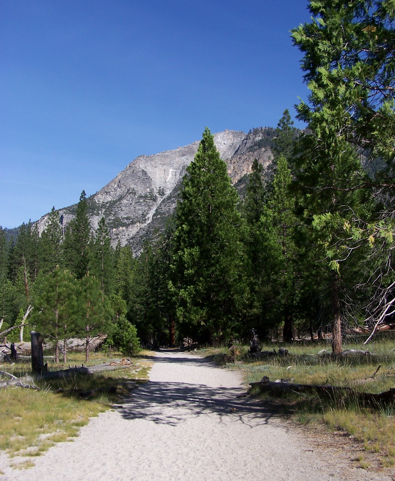
 Access? There's only one way into Kings Canyon National Park and that's via Hwy 180 to the park's Big Stump Entrance outside Grant Grove Village, starting either from Fresno in California's Central Valley or Sequoia National Park via the Generals Hwy. Kings Canyon National Park's two main areas, Grant Grove and Cedar Grove, are geographically separated by the Sequoia National Forest and its Giant Sequoia National Monument. But they're connected by the twisting, narrow Kings Canyon Scenic Byway (Hwy 180), which edges along the face of dizzyingly sheer cliffs for 30 miles down the canyon. This byway is open to Hume Lake year-round, but closed to Cedar Grove by snowfall, usually from mid-November through mid-April.
When to beat the crowds? Like elsewhere in the Sierra Nevada, summer is peak tourist season, especially from July 4th through the Labor Day holiday weekend in early September. Right now, the slower period between Memorial Day and late June is an optimal time to visit, as is September immediately after Labor Day. In winter you can still visit the Grant Grove area of the park to go snowshoeing among the giant sequoia trees.
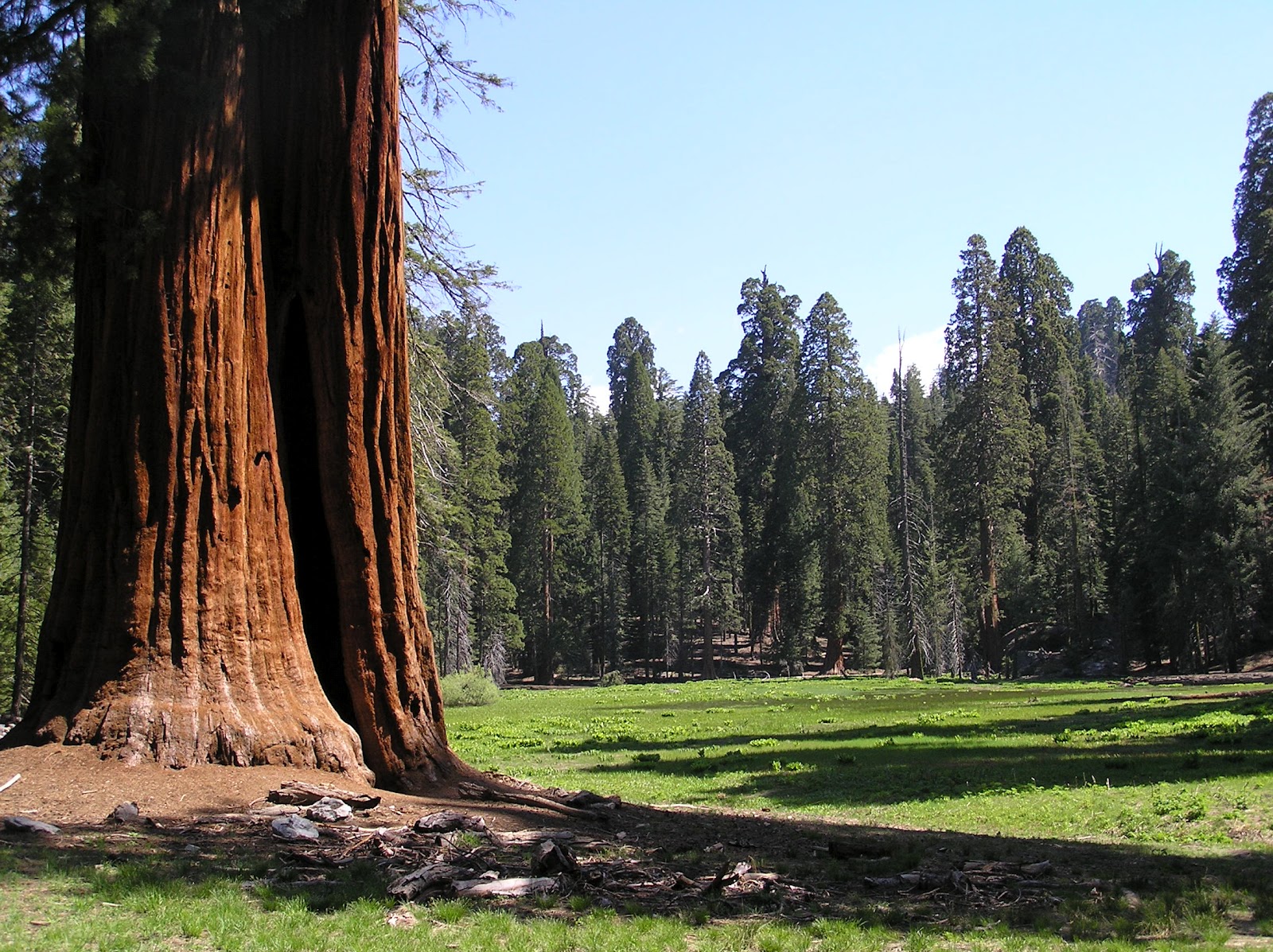 Park highlights honestly worth making time for? Even if you have to wait for a parking space, don't miss seeing Grant Grove, where many of the park's biggest trees live. The nature trail is kid-friendly, and you can walk right through the Fallen Monarch, a giant sequoia stump that once served as a hotel, a bar and a horse stable for US Cavalry who were the Sierra Nevada's first park rangers. Near the end of Hwy 180 past Cedar Grove Village, pull over at Zumwalt Meadow. Across a scenic bridge, a short nature trail loops around the grassy meadows where mule deer graze, black bears forage with their cubs and bird song echoes off canyon walls.
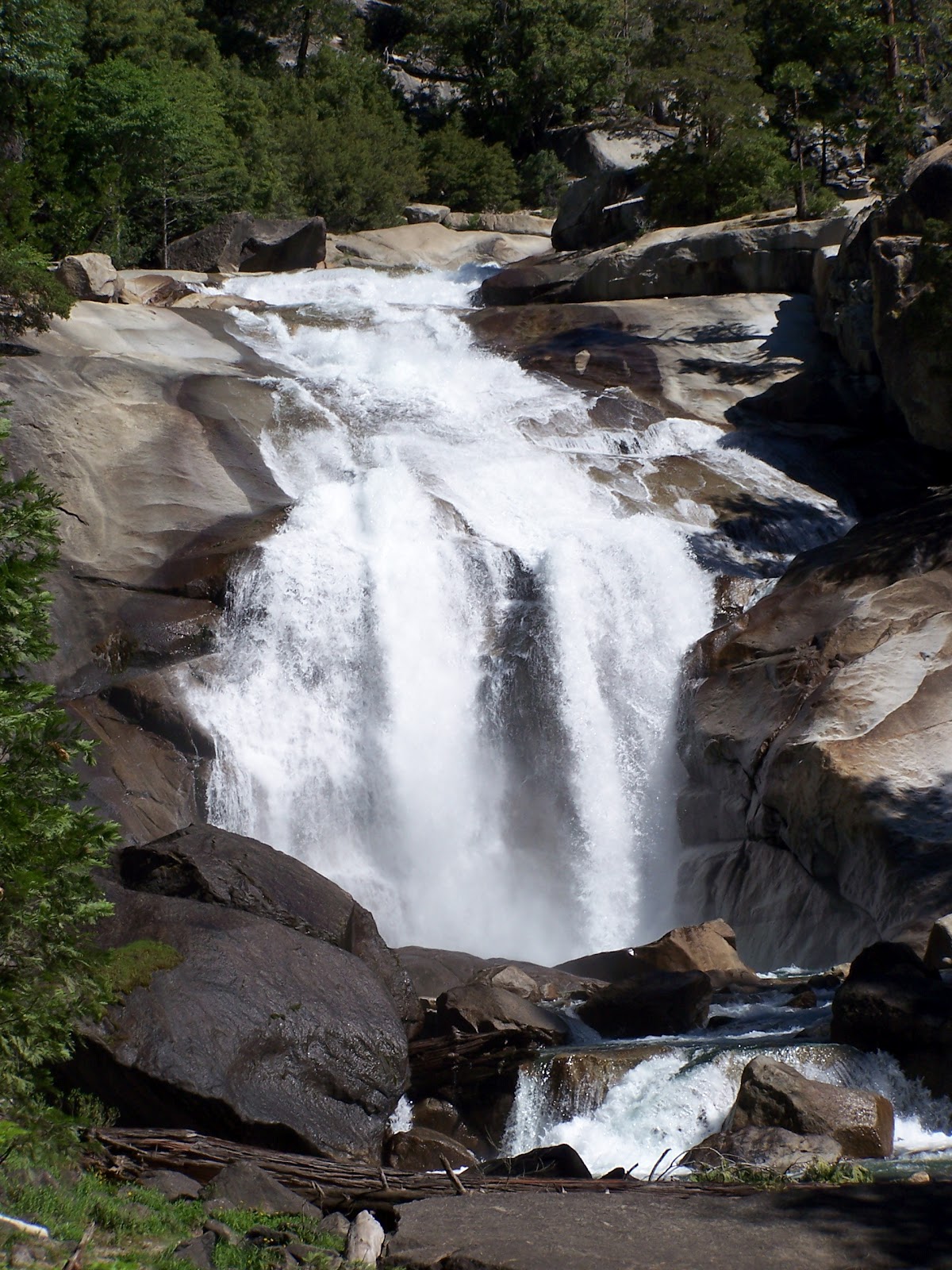 Best day hikes? In addition to the nature trails at Grant Grove and Zumwalt Meadow, the most popular day hike is from Road's End in Cedar Grove to Mist Falls, over 8 miles round-trip but worth every step for the canyon views and waterfall cascading over granite. Extend this hike another 2 miles each way to reach Paradise Valley. A day hike most visitors miss is the peaceful 8-mile Hotel Creek-Lewis Creek Loop, which tops out near the Cedar Grove Overlook and is especially great for birders in the early morning.
Best swimming holes? Cedar Grove has 'em all, but most aren't safe enough to swim in until the Kings River flow slows down later in summer. When in doubt, ask a ranger first before taking a dip. At Road's End, hit the river beach near Muir Rock, where conservationist John Muir once gave inspiring outdoor talks and kids today jump screaming into the river. Or follow the path west from Road's End along the riverside, curving left and south to find the Red Bridge, usually a less crowded swimming hole. Off Hwy 180, Hume Lake is another popular place to swim and paddle around in summer, with USFS recreational areas and beaches by a Christian camp that rents boats.
 Which campgrounds may have last-minute availability? Unlike in Yosemite, Kings Canyon National Park campgrounds are first-come, first-served. Campgrounds in Grant Grove usually fill up before those in Cedar Grove, although on summer holiday weekends, it's not unheard of for all campsites in the park to be taken by early Friday afternoon. Check at the Grant Grove visitor center about campground availability in Cedar Grove before making the drive all the way down canyon.
Affordable alternative base camp outside the park? You can find primitive campgrounds and free dispersed camping in the Sequoia National Forest just outside the park, including near Hume Lake and along Big Meadows Rd off the Generals Hwy between Kings Canyon and Sequoia National Parks.
Any hazards? Drowning is the number-one cause of fatalities in the park, usually in rivers and streams that are flowing too fast and too furiously to be safe to swim in, as well as from fatal slips off boulders by the top of waterfalls. Kings Canyon is also black bear country: all food and scented items (e.g., sunscreen, soap, toiletries, gum, soda, beer, empty coolers and recyclable containers) should be within arm's reach at all times, or else properly stored in a bearproof storage locker and never left visible in your vehicle. When camping, treat the bearproof storage locker at your campsite like a refrigerator: always keep the door closed. For more tips on bear safety, click here.
Have more tips for visiting Kings Canyon National Park or neighboring Sequoia National Park? Let us know by posting a comment below. Thanks!
Related posts:
Insta-guide to Rocky Mountain National Park
Free Online Mini-Guides to Offbeat National Parks
Catching the Firefall in Yosemite Valley
Photo credits: Kings Canyon National Park (Sara J. Benson), Sequoia National Forest (Michael Connolly, Jr.)

April 24, 2012
Freebie Alert! National Parks Week Is Now
 From April 21 through April 29, US national parks are waiving entry fees. That's right: every single national park will be free. So, whether you're dreaming of heading to California's Yosemite or Hawaii's Haleakala, you won't pay a cent. (Of course, some parks are free year-round, like Nevada's epic Great Basin, but that's a story for another blog post.)
Visit this National Park Week site to find out about special events happening at parks across the country. April 28 is National Junior Ranger Day, too. (Kids can earn their badges at almost any national park year-round, or even online at home).
And since the national parks are letting you in for free, why not give back by helping them out with a volunteer project? Even if you missed the public programs on Earth Day (April 21), you can still find an opportunity to help out near you, wherever you live, just by searching the volunteer database.
What's your all-time favorite national park, here in the US or abroad? Inspire us about where we should travel next by leaving a comment below!
Related posts:
Winter's Last Lucky Call in Yosemite Valley
Wild Weather High on Hawaii's Haleakala Volcano
Insta-guide to Rocky Mountain National Park
Photo: Haleakala National Park (Michael Connolly Jr.)

April 4, 2012
Hawaii: Go Green, Live Local & Save Money, Too
 Ever dream of vacationing in Hawaii, only to have your surf-driven fantasies come crashing down on dry land once you find out how much a hotel or condominium and a rental car are going to cost? The budget-saving solution: travel more like local Hawaii residents live, shrink your carbon footprint on the islands, and you can save big bucks, too.
Over on Gogobot, a social travel network that's a real resource for independent DIY travelers, I've been doing a series of columns that tell many of my secrets for green, local and budget travel in Hawaii. Years of living, working and traveling all around the islands has taught me that the most unforgettable trips are often the cheapest.
 Camping, hiking, hanging out at beaches, and learning about Hawaiian culture and history all cost lest than one night squeezed in a tiny beachfront resort hotel room with mai tai cocktails. Plus you'll get better acquainted with a more authentic side of Hawaii, both its traditions and its multicultural, hang-loose contemporary lifestyle.
Check out my guest post with travel tips for Oahu on Gogobot. If you've got your own money-saving, eco-travel ideas to share, leave a comment here or over there. Next up: Maui on April 10. Aloha!
Related posts:
My NPR Interview: Hiking and Ecotourism in Hawaii
Coastal California: The Anti-Hotel Top 10 List
Saving Hawaiian Monk Seals: 4 Ways You Can Help
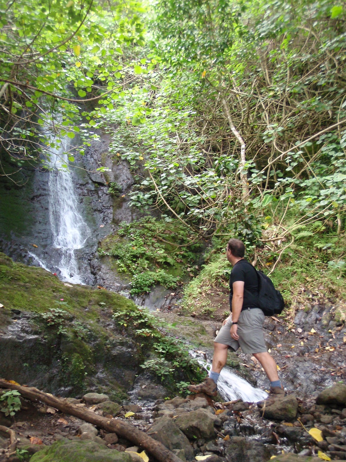
Photos: Lanikai Beach (Michael Connolly Jr.) & Likeke Falls (Sara J. Benson)

March 22, 2012
Winter's Last Lucky Call in Yosemite Valley
 Sometimes travel is all about (un)lucky timing. You can plot your trip out months in advance, reserve your favorite hotel or campground, pack all the gear you'll think you need, and then wham! Nature decides it has other ideas for your trip: how about a massive Sierra Nevada snowstorm in spring?
 This last weekend in Yosemite National Park, so much snow hit that wet clumps falling off spindly pine trees in the valley actually hurt as they thumped my head. Even with AWD and snow tires, driving up into the mountains to Big Oak Flat from Groveland felt like Mission Impossible. Trekking to the bathroom and shower house from my tent cabin at Curry Village was more like a mini hike, post-holing through a heavy blanket of snow.
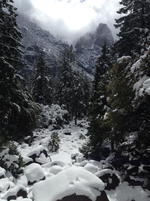 But who cares once the storm clouds floated away, piercingly blue skies were revealed, and the powder dusting on Half Dome looked as ethereal as a fairlyand? Even when grey skies fleetingly returned, snowshoeing across the meadow by the Merced River still felt like a movie set, with us as the pioneer explorers heading for unknown parts. Frazil ice in the stream below Yosemite Falls was a bonus.
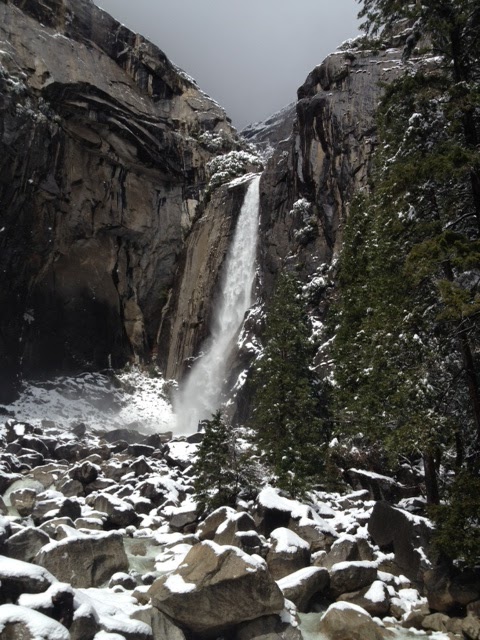 It even snowed along Hwy. 49 in California's Gold Country, which made me imagine mid-19th-century gold miners shivering in their tents by Sutter's Creek, praying they'd make it through another winter on hardtack biscuits and rancid bacon, until they could pan for gold again next spring. Just like a few of them eventually did, I got lucky, too. Adventuring in Yosemite during a snowstorm turned out not be a bad deal at all.
Have you had a memorable trip that got messed up by weather, only to turn out spectacularly? Tell us about it by leaving a comment below!
Related posts:
Skiing & Snowshoeing in Yosemite National Park
Catching the Firefall in Yosemite Valley
Tahoe Trails Without the Crowds, But with Dogs
Photo credits: Yosemite National Park (Sara J. Benson)

March 12, 2012
Coastal California: The Anti-Hotel Top 10 List
 Nothing against motel and hotel chains, which are great in a pinch when you want to save money. But coastal California's most inspiring places to stay are one-of-a-kind. Vintage beach houses, wooden cabins with ocean views, canvas-sided yurts perched on sea cliffs, and safari tents are just a few of the more offbeat (and often eco) lodgings along my stretch of Pacific shoreline.
Cruising from south to north, my top 10 favorite by-the-beach hideaways that I've found so far are:Crystal Cove Beach Cottages, Orange County - Authentically restored 1930s, '40s and '50s seaside bungalows in a state park's historic district. With a beach bar and breezy cafe, you won't need to leave all weekend long. Reservations are tough to get, however.El Capitan Canyon, Santa Barbara County - Creekside cabins and "glamping" tents in a canyon uphill from El Capitan Beach, another state park. They're a great deal in winter, when rates (and temperatures) drop. In summer, the canyon is traffic-free.Jalama Beach Cabins [PDF], Santa Barbara County - Rustic, but newly built wooden cabins with fun bunk beds for the kids and a futon for any friends who decide to come along at the last minute. It's windy here!Treebones Resort, Big Sur - You'll drive a squiggly road uphill from Hwy. 1 to find your canvas-sided yurt waiting with a pedestal sink and cozy quilt-covered bed. It's far from the rest of Big Sur, though, and can be noisy.Asilomar State Park, Monterey Peninsula - In the old-timey seaside resort town of Pacific Grove, this state park conference grounds books uniquely historical rooms in California arts-and-crafts buildings designed by Julia Morgan of Hearst Castle fame. They're thin-walled and the beds aren't comfy, but the common rooms have chatty fireplace nooks.Costanoa Lodge, Pescadero - A short scenic drive north of Santa Cruz, this rustic lodge is all about its tent cabin villages, where you can warm up by outdoor fireplaces in the comfort stations before retiring to your unheated cabin (mercifully, the beds have electric warming pads to keep you toasty).Pigeon Point Lighthouse Hostel & Point Montara Lighthouse Hostel - On that same stretch of Hwy. 1 between Santa Cruz and San Francisco, these two historic lighthouses have been renovated and turned into Hostelling International (HI) youth hostels, although guests of any age can stay. Pigeon Point has an ocean-view hot tub, so it usually books up first. Point Montara is closer to Half Moon Bay, if you're eager for surf and microbrews.Steep Ravine Cabins, Marin County - Near landmark Mt Tamalpais State Park, about 20 miles north of San Francisco, these 1940s ocean-view cabins at the bottom of a dramatic canyon are in high demand, so make your reservations many months in advance.Point Arena Lighthouse, Mendocino County - Stay in historical lightkeeper's homes at the edge of the ocean, guarded by the tallest lighthouse in California that visitors are actually allowed to climb to the top of. Architecturally speaking, the digs are drab, but the rocky point panoramas are fab.
Got another gem of a California coastal lodging spot to share? Let us know by leaving a comment below. We'd especially love to hear about secret spots near San Diego and on the Redwood Coast!
Related posts:
10 Steps to a Perfect Day in Big Sur
Edible Travels: Farmers Market Finds
SoCal Desert Blooms: Poppies, Cacti & More
Photo credit: Pigeon Point (Sara J. Benson)

February 24, 2012
Skiing & Snowshoeing in Yosemite National Park
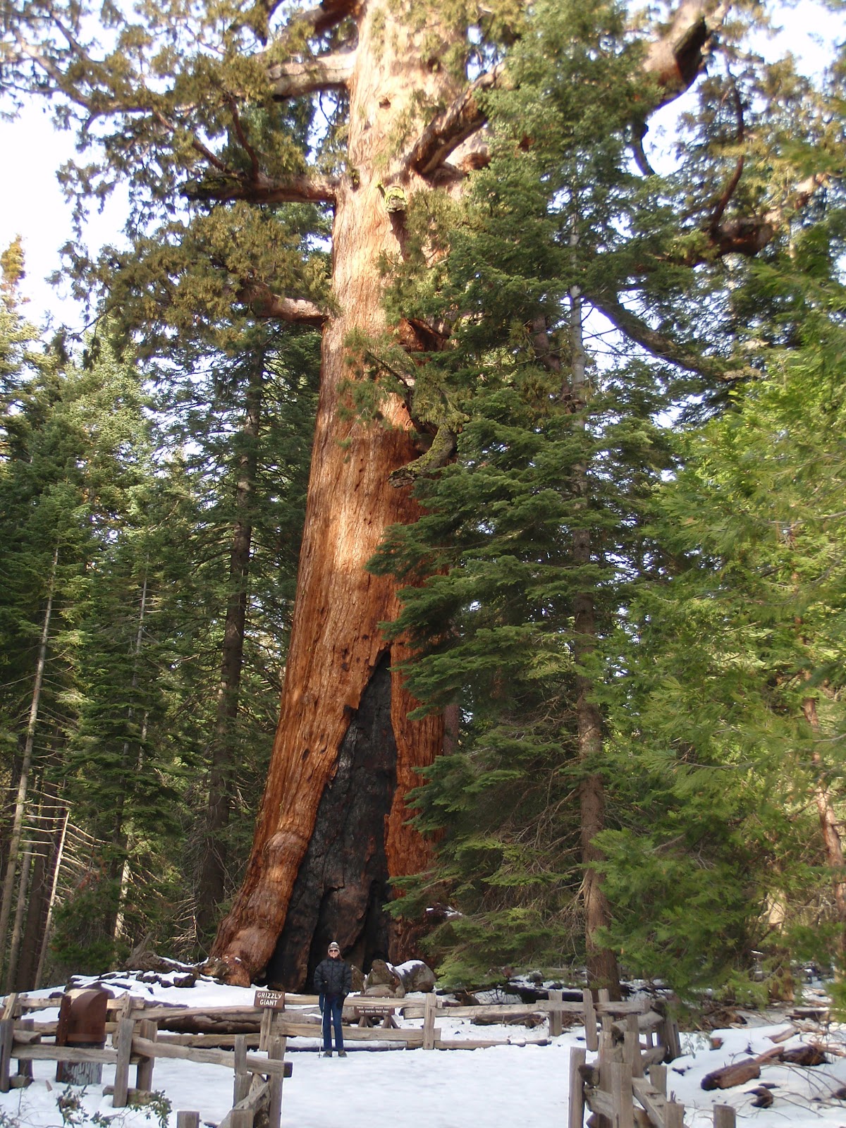
With California experiencing one of the worst droughts in the last century, everyone in the Sierra Nevada keeps asking, "Where's the snow?" Believe it or not, you can still find it in Yosemite National Park, which is where we traipsed around with our skis and snowshoes this week. Bathing in the Zen silence of giant sequoia groves, spotting the tracks of snowshoe hares in fresh powder, and gazing at granite peaks glistening with icy snow all draw us back every year in late February, around the time of Yosemite Valley's famous firefall.

Bare patches of brown grass, mud filled with twigs and dead leaves, and small melting pockets of snow are mostly what you'll find on the valley floor right now this year. But if you head up to Glacier Point Road to Badger Pass, the snow coverage is still 99%. Strap on a pair of XC skis from the nearby rental shop and start gliding down the rolling park road, with its groomed skiing terrain. Snowshoers break off onto the winter trail to Dewey Point, which stretches toward panoramic views of the Yosemite Valley and its waterfalls below.

It's not only Badger Pass that keeps the snow secrets of Yosemite. The Mariposa Grove of giant sequoias, near the park's southern Wawona entrance, is open to hikers (bring YaxTrax for better gription) and snowshoers; we even saw a hardy couple setting off with backpacks for overnight camping in those ancient woods. Up north near Crane Flat and closer to the park's Big Oak Flat entrance station, you can snowshoe and/or hike to the more mellow Merced Grove and Tuolumne Grove of ancient sequoias, the latter with interpretive signs to pique your interest.

Looking for a cabin to cozy up inside after your snow trekking? Our number-one choice is always the Evergreen Lodge, just outside the park's Big Oak Flat entrance station off Hwy. 120. If you're on a budget, try the Yosemite Bug hostel off Hwy. 140, under an hour's drive southwest of the valley.
Got a great tip for visiting Yosemite or any other national park in winter? Let us know by leaving a comment below!
Related posts:
Catching the Firefall in Yosemite Valley
Freeze and Stay Cheap (or Even Free!) in Yosemite
10 Steps to a Perfect Day in Big Sur
Photo credits: Yosemite National Park (Michael Connolly Jr.)