
Kindle Notes & Highlights
Read between
October 26 - November 10, 2025
Watson-Watt’s invention came to be called Radio Detection and Ranging, or radar, and by the beginning of World War II, the coast of England bristled with radar installations.
about 30 percent of mesocyclones generate tornadoes and 95 percent produce severe weather,
You might think a cirrus cloud’s upturned “tail” points in the direction of the prevailing wind, but the opposite is true. As the ice crystals that form the tail begin to fall, they encounter a level where wind speed or direction suddenly changes, and the cloud gets pulled like taffy (or cotton candy) into a long, thin streamer.
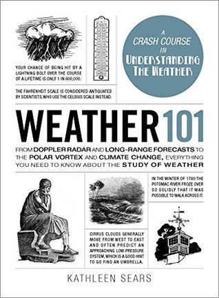
Cirrus clouds generally move from west to east and often predict an approaching low-pressure system, which is a good hint to go find an umbrella.
Because they often form in advance of an approaching cold front or storm, cirrostratus can mean rain in the next twelve to twenty-four hours.
One of the most beautiful cloud types is cirrocumulus, which forms a series of small rounded patches or puffs that often extend across the sky in long rows. Because of their regular, repetitive pattern, cirrocumulus clouds can resemble the scales of a fish, which is why a sky full of cirrocumulus is also called a mackerel sky.
Midlevel cloud types are easy to remember because the most common ones always begin with the prefix alto-. The two main middle cloud types are altocumulus and altostratus.
Altostratus clouds are often confused with cirrostratus, but there’s an easy way to tell them apart: if you look at the ground and don’t see a shadow, it’s probably altostratus. Also, altostratus clouds don’t produce halos. This type of cloud often means you’re in for an extended, steady rain in the near future.
Altocumulus clouds have a distinctive patchy or puffy pattern like cirrocumulus. They’re composed mostly of water rather than ice, though, so they often appear gray instead of white. The individual puffs are also larger than cirrocumulus and sometimes form little cottony “castles” in the sky, meaning it won’t be long before it will probably—guess what—rain!
Low-level clouds, stratus clouds, form below 6,500 feet, and at that height are almost always made of water droplets unless it’s winter. Stratus clouds are arguably the most boring clouds in existence; they usually cover the whole sky in a uniform gray cloak, sometimes completely blotting out the Sun. You won’t generally see much rain falling from stratus clouds, although they can produce some light drizzle or mist. They usually form during stable atmospheric conditions when a large, moist air mass rises slowly to a level where it can condense.
nimbostratus is a dark gray cloud that forms when a front of warm, moist air meets a mass of relatively cool air. When you’re under a nimbostratus layer, you often can’t even see the cloud itself because of the rain and the thick mist formed by evaporation. If the air becomes saturated enough, another layer of ragged, swift clouds called scud can form below the nimbostratus. When you see this type of cloud coming, you might as well settle in with a good book or find an old movie marathon on TV, because it’s probably going to rain or snow for quite a while.
Stratocumulus clouds are similar to altocumulus, but they’re found at lower altitudes and their individual cells are bigger. They don’t produce much rain and often form when cumulus clouds spread out across the sky and begin to merge. Stratocumulus clouds gene...
This highlight has been truncated due to consecutive passage length restrictions.
Cumulus clouds are often thought of as fair-weather clouds, and they usually are—but they can grow into something far more ominous. Cumulus clouds look like big balls of white or light gray cotton drifting across the sky, usually have a flat base, and don’t generate much precipitation in their young, puffy phase. They most often form when the morning Sun heats up the earth’s surface and fills the sky with hundreds of popcornlike clouds floating serenely over your head.
As the day progresses and it gets hotter, cumulus clouds can begin to blossom upward, now resembling a cauliflower more than a cotton ball. Called cumulus congestus, these towering pillars of water vapor are the raw material of the most dangerous cloud of all—the cumulonimbus.
cumulonimbus gets a lot of respect. These are the giant thunderstorm clouds that can produce lightning, hailstorms, and tornadoes. On color weather radar, cumulonimbus cells glow bright red, a warning that their tops have grown high into the atmosphere and severe weather is on its way. Violent updrafts within the storm, which can reach speeds of 100 miles per hour or more, keep it growing ever higher into the troposphere. If the monster cloud has enough energy, it will continue upward u...
This highlight has been truncated due to consecutive passage length restrictions.
Cumulonimbus can also become nurseries for other types of clouds. When a thunderstorm grows all the way up to the troposphere, it’s in cirrus territory. The tops or anvils of cumulonimbus can shear off and become cirrus or cirrostratus clouds, and are often swept hundr...
This highlight has been truncated due to consecutive passage length restrictions.
Nimbostratus is included in the low-level cloud category because thunderstorms always begin near the earth’s surface. But the winner in the lowest-cloud-ever category has to be fog, which is a cloud that forms right at ground level. Actually, fog is nothing more than a stratus cloud you can walk through.
But if more warm air arrives from underneath, it will keep growing until it reaches the saturation point and condenses, making a fluffy little cumulus cloud. When the cloud gets big enough to cast a sizable shadow, it starts to cut off its own heat engine as the ground below it cools. This throws a monkey wrench into the whole convection process, and the cloud begins to show ragged edges as the wind moves it along, causing it to eventually dissipate. But now the ground is free to heat up again, and soon another bubble floats skyward, ready to make yet another cumulus cloud. That’s why you’ll
...more
If air at ground level is warm and moist and upper levels are cold and dry, a process called convective instability can occur, causing a rapid, often violent, cloud growth that can produce severe thunderstorms and tornadoes quicker than you can say, “Run for the basement!”
When warm air rises, it relieves the pressure of the air beneath it and so creates an area of low pressure. But if that same rising air mass cools, then it sinks and presses down on the air below it to create an area of high pressure. Because the atmosphere is always trying to keep itself in balance, and because low-pressure systems are actually partial vacuums, air moves from high-pressure systems to areas of low pressure, producing wind.
Because lows turn counterclockwise and highs clockwise in the Northern Hemisphere, you can look at an isobar map and tell which way the wind is blowing. Wind blows parallel to isobars above the surface, and the closer together the lines are, the faster the wind speed.
So what happens when something comes along to disturb the air’s nice straight course; something like a large mass of cold air moving down from Canada, or a big sticky bubble of hot air floating northward from the Gulf of Mexico? Then we have a meridional flow, so-called because those systems move roughly north or south along meridians, the lines that mark off longitude. A meridional flow indicates that air masses from the north and south are mixing, and that can mean stormy weather as areas of differing temperatures battle it out for air superiority.
Recently scientists have become concerned about the crossing of the equator by the northern jet stream, something, they say, that could bring “unprecedented change” to the world’s weather.
One computer modeling study showed that MCCs (mesoscale convective complexes)—large, circular, long-lived clusters of showers and thunderstorms—develop when rain-cooled air pours down the mountains into a warmer moist air mass on the Great Plains, forcing it to rise and spawn a giant thunderstorm complex.
The first sign that a warm front is approaching is often the appearance of cirrus clouds. Those are followed by lower clouds like altostratus and finally a thick layer of stratus or nimbostratus clouds, which can generate a lot of rain and fairly strong winds.
warm fronts create a gradual change in the weather that can stick around for a day or more, and its rains tend to be less strong but longer lasting than those of a cold front.
So the dew point is the temperature at which the vapor in the air will begin to condense. For instance, if the current temperature is 80°F and a forecaster says the dew point is 70, you know it has to get ten degrees cooler before dew can form.
The Vikings used bronze weather vanes on their ships in the ninth century, and about that time the pope reportedly decreed that every church in Europe should have a rooster on its steeple as a reminder of Luke 22:34, which states that a cock would crow after the disciple Peter had denounced Jesus three times. You’ll still see roosters on weather vanes today.
In 1954 the first pictures of a tropical storm were taken from space using a US Navy Aerobee rocket. The spectacular photos galvanized the meteorological community: for the first time a giant weather system could be seen in its entirety.
On April 1, 1960, the recently formed National Aeronautics and Space Administration (NASA) launched the world’s first weather satellite atop an Air Force Thor-Able rocket.
The most common type of lightning is the cloud-to-cloud type; only about 20 percent of all lightning strikes are directed toward the ground.
The pencil-thin bolt instantly heats the air in this corridor to 54,000°F—hotter than the surface of the Sun—and since heated air expands, a shock wave explodes outward from the lightning channel at the speed of sound, creating a blast of thunder. The bright flash caused by the bolt is expanding outward too, but at the speed of light (186,000 miles per second), a million times faster than the thunder. The flash reaches us almost instantly, while the thunderclap moseys along toward our eardrums at a leisurely 1,125 feet per second or so. If the lightning strike is more than about 15 miles away,
...more
Just because you’re quite a distance from a thunderstorm doesn’t mean you should let your guard down. Cumulonimbus clouds can spawn “positive giants”: lightning strikes that come from the storm’s anvil-shaped head and can blast outward for up to 20 miles.
Other forms of lightning include heat lightning, which is just ordinary lightning seen from a great distance, and sheet lightning, which is lightning striking within a cloud or from one cloud to another. When the actual bolt is obscured by the cloud, it lights up the entire structure, momentarily making it look like a huge white sheet.
Sometimes the positive charge that accumulates on flagpoles, ship masts, and other high points doesn’t provoke a lightning strike, but instead appears as a halo of sparks or a weird glow around the top of the object. That’s called St. Elmo’s fire, named after the patron saint of mariners. The effect is caused by charged plasma called a corona discharge and is similar to the glow given off by a fluorescent light.
Hurricanes also need something to set them spinning, a job handled by the Coriolis force that is created by the earth’s rotation. Because the Coriolis force is zero at the equator, storm systems must migrate at least 5 degrees north of it before they can pick up enough spin to become a hurricane.
Most hurricanes—about two-thirds—form between 10 and 20 degrees north latitude, along a constant feature called the Intertropical Convergence Zone, or ITCZ. This zone marks the area where northeasterly breezes meet southeasterly trade winds, causing the warm, humid tropical air to rise. As the air rises, it naturally condenses into clouds and rain, which often gather into groups of thunderstorms and move along the ITCZ from east to west.
Because they feed on heat, hurricanes need water that is at least 80°F from the surface down to a depth of about 150 feet. The atmosphere above a developing storm must be substantially cooler than the surface, allowing the system to develop towering thunderclouds. The midlevel layers of the atmosphere must be saturated with water vapor, adding to the fuel that powers the storm. As noted earlier, hurricanes can’t form at the equator, so a developing storm has to be at least 500 miles away from zero latitude to get going, and there must be at least some low-level spin in the atmosphere to get it
...more
The gentlest type of whirlwind is the dust devil, caused by the Sun heating up the ground at different rates. Air rising faster in one area than in another nearby causes a weak low-pressure system to form. The air in adjacent areas flows into it, creating a spinning parcel of air that picks up dust, dirt, or leaves in its path.
In Rocky Mount, Dennis had dropped 5 inches of rain, and Floyd deposited another 16.18 inches on top of that. In less than a week many areas of the state received more rainfall than they usually saw all year.
Floods are the number one cause of weather-related deaths in the United States, killing an average of 139 people each year.
Items to stash away include insurance policies, birth certificates, passports, identification cards, irreplaceable photographs and heirlooms, and removable computer media containing backups of your valuable data. Take “before” pictures of your home and any valuable items and store them safely as well.
Now the new science of biometeorology is helping explain how climate can have a very real effect on both physiology and psychology, speeding the development of new treatments for weather-related ills.
Some scientists even think that with enough sustained warming the West Antarctic Ice Sheet could slide into the sea, raising ocean levels up to 20 feet.
on May 2, 1982, The Weather Channel was launched.
With the availability of twenty-four-hour weather TV came the emergence of a new kind of viewer: the weather addict. According to The Weather Channel, people with a deeper interest in climate and weather comprise 41 percent of the American public,
that curiosity isn’t easily satisfied. A Weather Channel press release put it this way: “Seemingly, the more TWC viewers learn, the more they want to know; some of these people look to the all-weather network with the same interest and enthusiasm some television viewers devote to watching movies. According to Jim Alexander, former vice president of research for TWC, ‘A segment of the TWC audience is particularly interested in understanding the mechanisms that influence weather patterns and the meteorological background behind a tornado or hurricane.’ ”
The Weather Channel launched its website, www.weather.com, in April 1995.
Cumulus clouds are among the most common kinds of clouds; they’re puffy with flat bottoms. They often give rise to cumulonimbus clouds, which are much larger and taller and are more likely to bring rain or snow.
If the Sun is shining while there are a lot of water droplets in the sky, the droplets refract, reflect, and disperse the white light of the Sun into its various component colors. The result is a rainbow. In some rare instances, fog rather than rain can produce a rainbow; the water particles in the fog are so small that the rainbow appears white.
