
Sarah Gerdes's Blog, page 10
June 22, 2019
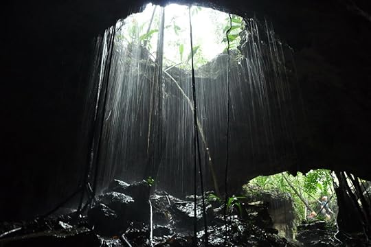
The underground world of Rio Secreto
When we saw Rio Secreto on the National Geographic channel, we were skiing in Idaho, surrounded by snow. The show said Rio Secreto was one of the top 10 places to visit in the world (this was four years ago) and it was the reason why we decided to visit the Yucatan Peninsula in the first place.
Hundreds of cenotes exist in the Yucatan Peninsula, more than one could visit in a lifetime. A cenote is a waterway that’s either partially or wholly covered by rock. The cenotes are fresh water, some stretching hundreds of miles, making their way other waterways and to the ocean. About ten years ago, a farm watched a stretch of his land give way, revealing a secret river underground. Explorers converged, confirming that the area now called Rio Secreto, (secret river), the first and only known cenote that is 100% underground.

As you descend, you will see a few of the openings around the cenotes, so the guide will provide lots of warnings
Since the area is Mayan ancestral land, the government made a deal with the farmers (because the area is so big, multiple farmers are involved); the Mayans continue to own the land but will lease it to the government. After lots of exploration, the area was ultimately opened to the public. I’ve got some great news for you, along with bad. The good news is that it’s an incredible experience to be in the dark for hours, seeing animals, feeling the soft sand and water, and taking beautiful shots. The bad news is that in the last four years, it’s become so commercialized, it feels more like ants underground, stuck in a tunnel with other tour groups coming and going.
Reservations
If you use the concierge at your hotel, you are going to pay a premium of about 30%. That doesn’t necessarily include transportation, so watch out for hidden fees. You can go to the on-line booking center and save the money.
Getting there
Pictures are worth more than my thoughts, so I’ll start with the basics. You arrive at the main entrance, about an hour south of Cancun proper. By cab, rental car or bus, it’s a straight shot, only a single right turn off the freeway. In the last three years, the price has increased from $65 to $95, pretty steep. The first time we thought it a bargain, the second time, not so much. This last visit we were grumpy about it, but still went, because 7 routes are available, and we’d only seen two. A bus will run you about $40 depending on your starting point.

No, not worms, but water hanging at the end of the crystalized rock formed over millions of years
The process
You arrive and wait for those in your group. The area is shaded, and one of the new additions (this year) is a small deli, just in case you are hungry. That said, once you are in your wetsuit (required), you can’t use the bathroom for 2 hours, so relieve yourself first, or you will be in a world of hurt.

Photographers tip: use the flashlight, put it under the water and then you have this effect
You are assigned a tour guide and photographer who gives you
an idea of what is to come. First, everyone loads up in a bus which holds about
7-10 people, and what follows is a 15-20 minute drive on white, dirt roads to the
actual cenote center. Once out, you are show the locker area, where you put on
your bathing suit, or whatever you are going to wear under the wetsuit. Women
and men have separate changing areas, but no inside showers. You are given water
socks, and they require you wear shoes a size too small, because they don’t
want you to slip. The rocks and underground trails are rather slick. That said,
I made the mistake of listening to them once year, and suffered in misery for
two hours. The next two times, I refused to wear smaller water socks, and just
used my normal size.
Next, the group (of between 10-15) is led to an outdoor showering area, which means you stand under an outdoor shower, pull the wooden handle, and get sprayed with seriously cold water. One by one, you walk to the next station, which is the wetsuit area. (do you how hard it is to put on a wetsuit when wet? Nearly impossible. So, if you are uncomfortable pulling up a wetsuit over a sticky, wet body, you will need to get over it.
After this, you select a lifejacket that goes over your wetsuit.
Imagine yourself with the water socks, wetsuit and now lifejacket, but wait,
there’s more. You also don a hard hat with a light, and it has three modes; red,
high and low. The tour guide will identify when to use what, and requires you
listen and do what’s requested, or the tour group can’t move on.
Just before the tour starts, the guide pauses, the photographer stops and takes a picture of the group, who by now, are all sweating, even in the shade. (I took a moment to pet the pitbull lounging under a tree).

On the way to the cenote are all sorts of bizarre plants
Photo taken, we are counseled to pick a walking stick, which we later learned was useful in determining the depth of the water, and if a rock existed (or not). On my third trip, I slipped, fell forward and cut my knee. Darn thing left a scar, because I’m always resting on it and kept ripping it open. Guess I should have used that walking stick!
Almost ready
Depending on the which cenote is chosen for the tour, the walk is between fifteen and twenty minutes. You are in the effort about forty-fifty minutes by now. You have one more stop to make before you descend into the darkness, and that’s the blessing by a shaman priest. This is non-negotiable. As you stand in a semi-circle, the priest moves his smoking device up and down across all the individuals as the man speaks in his native tongue.

The shaman isn’t pictured in this photo, but his stand of ash, which gets on you, is to the right
Now we have another walk to the cenote, and all the while, the group is getting to know one another and the tour guide is dispensing information. Year one, we were spoiled; we had a graduate student of geology from the University of Mexico, who was a vault of information. Hanging bee hives, the trees, stones…you name it. Then we reach the actual entrance and down you go.
Underground ease
Each entrance and exit is different, some with a handrail or two, but most without. It’s pitch black as you are then led beside and in to the waterways, tunnels and lakes. The first time, our girls were six and 10, but they are hardy, adventurous and tough. Two hours in and out of warm water, even with a wetsuit, can be tough for anyone. At the end, my youngest was a little chilled, but fine. I’d definitely say any younger than that wouldn’t be advised.

Everyone at their finest
The time spent underground is nearly fifty minutes—but that reminds me of another rule. No watches or jewelry are allowed, which is mandated to preserve any toxins from getting into the ecosystem. Wedding rings and that’s it. No picture taking/cameras are allowed either, unless you have special permission, which I was granted once, then never asked for again (and I probably got this because I’m an author). Honestly, it’s a lot easier to have their group take the photographs and just enjoy the experience.

Taken just before the lights went out
Cleaning up, eating and returning
Once the tour has finished, we walk back, strip off the jacket, suit and shoes, take a shower, then drive back to the center area. Lunch is included, which is a buffet, open all day long. It’s actually quite nice, and one of the few benefits of the expansion, because it’s cool and well appointed. After that, you pay for the CD of the photography. That’s going to run you another $120. Is it worth it? Yep. Unless you’ve had the photography access, the only way you can get the images is to pay for it.
What I liked most
Seeing the underground world that has existed for millions of years, and the resulting photos. My absolute favorite part of the tour was at the end, when our guide took us out to the middle of the lake, asked us to hold hands, and turn off the lights. At that point, we were quiet for about five minutes in the complete, pitch black. Never, in my life, had I been in total and utter blackness, let alone in the water. It took about a minute for the group to get quiet, but after that, it was complete peace. wow.

My apologies for not recalling the names of these formations–but it looks like an upside down beehive doesn’t it?
What I liked least
The crowds and commercialization have destroyed this place in my opinion. The first two times, they’d limited the tours to one at a time, per cenote. Now, we had four, count them four, different tours going at the same time as ours, so you didn’t get the feeling you were alone, exploring a new universe. It was more like the devil’s version of purgatory. It’s the classic example of destroying something that was perfectly wonderful and unique. Also, the last time, the experience we were hoping to have again (the five minutes of complete quiet in the black), was reduced to about a minute. So. Grumpy. (Management, are you listening??)
Would I go, and can I recommend it to you?
Yes, with the caveat that if you’ve gone before, it’s changed, and for the worse. BUT, if you’ve never gone, I do think it will be quite an experience for you, and your children unlike any other, even with the additional tour groups.

Nope, not eggs, but more great formations created only deep underground
Oh! If you don’t know how to swim, please, please, identify this right up front. On our first adventure, we had three individuals from India, two of whom couldn’t swim, and didn’t say so. The identified themselves as engineers, so they were smart, but didn’t want to be refused entry. The challenge with this is that when it comes time to the lake, you can’t touch the bottom, and must swim. For those who don’t swim, as we found out, it’s an issue. Imagine being an hour deep into the underground, and two people can’t swim. My girls were great, however, and offered to hold their hands and guide them along. The two adults were floating on their backs, and we swam them across. It all worked out, but it was a word to the wise—be honest. They can handle it.
Feature image: taken from the inside of the cenote


June 21, 2019
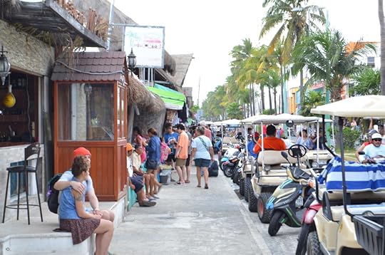
Isla Mujeres: the island that has it all
Isla Mujeres is well-known and visited by the thousands of tourists a year, but it took us three before we decided to go. The primary reason was the split commentary from others we know and trust. “It’s just a tourist trap,” said a couple with teenage children, while the over thirty and single crowd gave it glowing reviews. Yet another demographic, the 60 and over, raved about the exclusivity and near-private beaches available to those fortunate enough to own vacation homes. Still, we weren’t convinced. It took a private excursion on a catamaran, seeing the island from the water to convince us Isla Mujeres was more than bars or private homes.

The first unique experience on Isla Mujeres was going to the tip of Centro on our golf cart. A storm on the horizon was no where to be seen on the other end of the island
First, the catamaran
Before jumping to the island, I’m going to touch on boating. Generally, we avoid boating in Mexico unless it’s fishing because the tour operators oversell, overstuff and overcrowd the boats with bodies. It’s misery. It’s also unsafe, and frustrating. Imagine spending money to go snorkeling off short (because that’s what most offer), only to arrive with to find five other boats, with all the occupants scrambling to get in as fast as possible. Most tours give riders 5-10 minutes in the water, then usher them out and on to the next venture.


Six of us guests had the catamaran to ourselves. It was superbly wonderful. And in case you are wondering, we paid full pop for this tour. It wasn’t sponsored or anything of the kind–which makes it all the better. The average tourist (us) can have the celebrity experience without paying the premium (e.g owning the boat).
We were lucky enough to sit by the owner of Caribbean Dreams at sushi one night at the Villa Del Palmar. We learned he spent a million on his French-made catamaran, and has a limit of 12 people on his boat (compare this to 30-50 for the others). We decided to spend the money and we spent nearly five hours (versus 2) snorkeling, then seeing Isla Mujeres. The experience truly spoiled us forever on the notion of a catamaran. The cost is higher, and justifiably so. From the food, quality of the boat, staff, length of ride and locations, it’s worth the extra $75.


Just compare and contrast the picture on the left; the standard bargain catamaran cruise, and our experience with girls on lush pillows and private snorkeling. Only one serves all-you-can eat and drink (ours). Which one would you take?
Now the Island
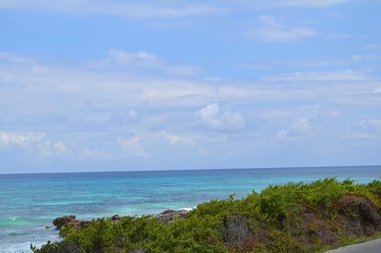
The owner/captain took us around the island, pointing out various sites on the island that’s only 5 miles long and 2,000 feet wide. We were able to see the primary beaches, so crowded the beach wasn’t super visible—but this was balanced with private beaches in front of hotels, which were less so. On the far side of the island, where the shoreline was rocky, visitors zip-lined from high treetops, kayaked in peace in the nooks for paddle boarding. At that point, we realized a lot more existed to this island than what was depicted in the brochures.
We stopped just off the shore for an hour or more, swimming, snorkeling and lounging in the clear, warm water. This gave us the best of the island without having to battle the crowds. The only annoyance were the other chartered boats that came up with booming stereos, killing the vibe. Don’t get me wrong; great music and drunken people have a time and a place, but it wasn’t our groove with kids. Our captain lifted anchor and we moved elsewhere.


A marina with seaside eating is right next to a corridor for yachts and larger boats. The bottom photo is a peninsula home rumored to be formerly (or presently) owned by Rickie Martin. That’s the kind of funny things you get on tours by the locals.
Getting their and around: the ferry and golf carts
Ferry services to Isla Mujeres are available from every port in Cancun. Staying at the Villa Del Palmar, we were fortunate, because the state of Jalisco invested $15M in a state of the art super shuttle ferry here. We walked the 500 meters from the hotel to the marina, paid the $5 per person and had a perfect ride over. The double decker ferry has a kids play area, food service, televisions and air conditioning, pretty much all that’s required.

Big, beautiful and inexpensive from the Isla Blanca ferry terminal
Once on the island, all passengers without cars must hail a cab or walk the 15 minutes in to centro, which is the local name for the city center. Along the way are a myriad of golf cart providers. We mistakenly thought the price would decrease if we walked clear to the end of town, through main street. While this was wrong, (they are all about $60 for an hour), we took a left on a side road, and paid $45 for a new golf cart and were on our way.

The first part of the walk….
The second part, which lasts about a mile–“centro”- or the center of the city
The island itself
Drones are not allowed, which we were bummed to learn as Roger tried to get his airborne. The island has a single airstrip, but it includes military planes, and therefore, the island is considered a no-fly zone. Save yourself the weight and leave the drone at home.

Local art was everywhere–colorful and eye catching. We do all we can to expose our girls to local culture and attitudes, appreciating the differences, talking history and present day.
Zipping up, down and around the main area of the island will take a solid ten minutes, then you head out. The city planners have made the island easy to navigate, because you can essentially ring the land by driving on a single road and it’s a loop. It doesn’t matter which way you head out of town, you are going to end up back in the same place. On your journey, you will encounter itty-bitty communities, lots of stray dogs and open-door homes, replaced with dirt ballparks, small churches and larger homes. This eventually gives way to stretches of beautiful and deserted sandy beaches, private driveways and at the furthest tip of the island, a restaurant and shops. This is the dead end-turnaround.

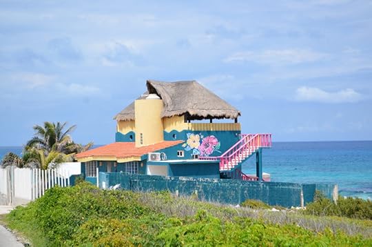
The end of the line–the turnaround with a few restaurants and shops. One of the colorful private homes dotting the shore.
Unless you are driving slowly, you will miss the roadside activities offered, such as the ziplining. We did the first time out, but caught more of them on the return trip. We also slowed to enjoy the cemetery, where I wandered and took pictures, while Rog and the girls bartered for conch shells.


The Isla Mujeres Cemetery….beautiful and unique
The deals
On that note, I can relate the conch shells are legal to transport back to the States. I can also tell you that they are $36 dollars on main street in Isla Mujeres, and $45 or more in Cancun, and we know, because for three years, our girls have been begging for the shell. The roadside stand where Rog and the girls stopped? Five dollars. Yep, count it out. That beautiful, perfect shell now sits on our stands of collectables at home. Our oldest daughter purchased a rough, pearl necklace for seven dollars which was forty-nine in town. Score!
The spa on the beach….
Spa is misleading, but this is what the brochures and tourist companies would have you believe. The only “spas,” per se are the ones attached to the hotels, and I’ve not been, so can’t comment. What I can relate is the experience of two couples we know who did afternoon trips which included getting a massage on a beach. According to one woman, a flight attendant for Lufthansa (who we met on the catamaran trip btw), she thought the 90-minuate beach massage at $50 US was a steal, because that same massage would have been $100-$200 on the mainland. She said she’d go again just for that.


Isla Mujeres offers different eco-climates. Dark storm clouds at one end, centro was right in middle while the sun shone on the least populated end.
We saw a ton of places to eat that looked good, but didn’t stop once, other than to purchase freshly cut fruit, which we did several times. It was so hot, even with the periodic rain shower, we weren’t hungry. Sorry!
What I liked most
The accessibility, freedom to roam, empty beaches and ability to stop roadside and pick up great deals. The Catamaran ride is a must, but that’s outside the island itself.

Stopping at any point on the road is perfectly acceptable. It’s also perfectly lovely
What I liked least
About the island, nothing really. It was lovely, and a fun day trip, which in reality, is more like four or five hours, unless you stop to take advantage of the recreational activities.
Ziplining across the ocean is different from the view over a jungle. In the Cancun area, you can do both
Feature image: taken from the desk of the catamaran
June 20, 2019
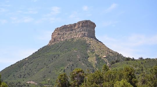
Cliff Dwelling People: The Anasazi
As a child, our ancient history lessons include what was then called the Anasazi Ruins, located in the southern-most part of Colorado. These ancient cliff dwellings, located on a high plateau, some thousand feet above the valley were impossibly glamorous to my then-seven and eight-year-old self. It wasn’t until this last year that I was able to actually see them in person.
This blog wasn’t supposed to come until the fall, when the heat of the area where the ruins are located has ebbed. Then I realized that we went in early July, and while it was hot, it was certainly endurable. Heck, if people can see the Grand Canyon in the middle of August, tourists can make it to the ruins!

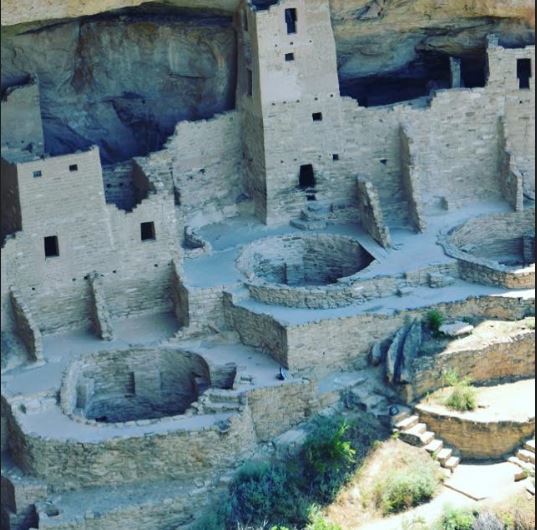
One of 600 cliff dwellings, as seen from the opposite ridge of the Mesa Verde National Park
The backstory
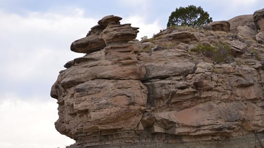
Historians hypothesize the ancient pueblo people, as they are now called, searched for safe areas where water could be collected through the seasons, and used to supply their needs. Scouts are presumed to have found these cliffs, and heaven-only-knows why and who the first settlers scaled up and down the cliffs, then proceeded to car mini-cities from the rock, under the protective stone overhangs. More than 600 cliff dwellings dot the inner linings of the walls. The inhabitants were able to grow and harvest plants, which augmented a presumably meat-based diet.
Drive your car, stop and walk to the edge. Be careful, the park doesn’t believe in stopping selfie photogs from falling off the cliff.
For nearly 700 years, the cliffs were inhabited, and then archeologists believe they were abandoned due to prolonged drought. This made it impossible to grow plants and sustain life of any kind.
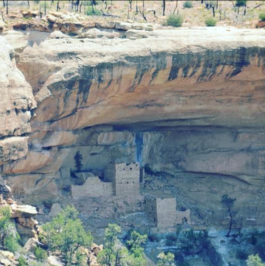
See those blackish/brownish stains on the top ridge? Those are water stains. The Anasazi identified where the water fell, captured it, made mud, then bricks, creating entire communities.
Getting there
It’s an easy route from almost any direction. Most non-US residents are familiar with the ski-resort town of Telluride, Colorado, or its sister city, Ouray, heralded for being “the little Switzerland of the US,” because of its ice climbing in the winter and off-road vehicle terrain in the summer.


Beyond glorious drive to and from Ouray/Telluride down to Cortez
If you are starting from Ouray, tack on another 30 minutes. But from Telluride, it’s less than a two-hour drive through beautiful mountain roads. Keep your camera handy, because you are going to see mountains that look painted with copper and gorgeous rivers.

When arriving at the Mesa Verde National Park, you will see the first of several famous peaks. Up and up you have climbed to reach this point, and you absolutely must stop at any number of the scenic spots.
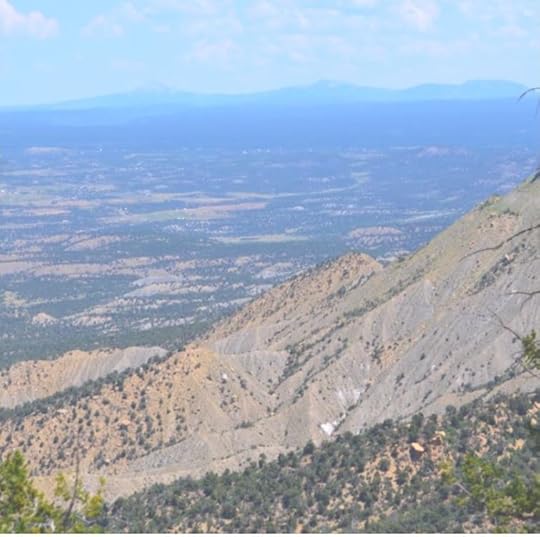
Up, up you drive to get to the high plateau these incredible people found and homesteaded
Believe it or not, the picture-perfect shots are not to be had from the eye-level view. It’s from above, on the opposite ridge, looking down into the specific site. One doesn’t require binoculars to get a great shot, or even a long lens (I had neither). A regular camera will do. The ‘opposite view’ allows one to capture the full majesty of the dwelling.

The tours
We took one tour, and the rest we saw by car. We had no idea
what to expect with a tour, and were mildly disappointed, so I want to pass a
long a few things that aren’t conveyed at the ticket office or on the brochure.
The tour of a dwelling, depending on which one you choose, take quite a while
to get down to the dwelling, (it’s really hot, evening in early July) and then
once you reach the bottom, are strictly limited to the path. The photos I
thought I was going to take were completely impossible. Clearly, one has to be
a professional photographer, with a magazine or have gained a special
authorization to set in, or around inside the dwelling areas. I get it, we don’t
want to disturb/erode the areas, and I’m cool with that. It’s just impossible
to get more than a few (dark) shots of the dwellings when on foot.
Compare that to the drive and view from the ridge. The roads are alongside the cliffs, and multiple stopping/parking areas are available so one can get out, walk the short distance (some are right at the edge, others require less than five minute walk) then look down/across to the dwelling on the other side. This was far and away a better vantage point than the street level, per se.

An example of what a tour group must climb up/down to get to a cliffside dwelling
Don’t miss the center
Most of the time, I am seriously disappointed with park centers, but all four of us agreed the Mesa Verde center ranks in the top five. Perhaps it was the volume of items, or the presentation of original artifacts (and recreations of others) but we enjoyed it immensely. When a center captivates an 8-year old who doesn’t want to leave, but continue reading the small print, you know it’s good.

A restaurant, not located at the center, but in a different area, is open, but we didn’t stop, so I can’t comment on that. Just know you won’t starve if you neglected to bring food or water on the journey.
Entering and existing the Park, you will see famous rock structures like the above
What I liked most
Realizing the life-long dream of seeing the dwellings, walking the area where people lived and shaking my head in wonder at the incredible skill and fortitude of our ancient people.
What I liked least
The lack of public bathrooms and the heat!
This is one of my favorite national parks in the United States thus far, ranking way above Mt. Rushmore in my mind. Both feature carved rock, but whereas one is monuments of presidents’ past, these cliffside dwellings were, and are, a testament to the skills, determination and capabilities of the indigenous people. It’s truly awe inspiring.
Feature Image: taken from the ridge of the canyon
Cliff Dwelling People
As a child, our ancient history lessons include what was then called the Anasazi Ruins, located in the southern-most part of Colorado. These ancient cliff dwellings, located on a high plateau, some thousand feet above the valley were impossibly glamorous to my then-seven and eight-year-old self. It wasn’t until this last year that I was able to actually see them in person.
This blog wasn’t supposed to come until the fall, when the heat of the area where the ruins are located has ebbed. Then I realized that we went in early July, and while it was hot, it was certainly endurable. Heck, if people can see the Grand Canyon in the middle of August, tourists can make it to the ruins!
One of 600 cliff dwellings, as seen from the opposite ridge of the Mesa Verde National Park
The backstory
Historians hypothesize the ancient pueblo people, as they are now called, searched for safe areas where water could be collected through the seasons, and used to supply their needs. Scouts are presumed to have found these cliffs, and heaven-only-knows why and who the first settlers scaled up and down the cliffs, then proceeded to car mini-cities from the rock, under the protective stone overhangs. More than 600 cliff dwellings dot the inner linings of the walls. The inhabitants were able to grow and harvest plants, which augmented a presumably meat-based diet.
Drive your car, stop and walk to the edge. Be careful, the park doesn’t believe in stopping selfie photogs from falling off the cliff.
For nearly 700 years, the cliffs were inhabited, and then archeologists believe they were abandoned due to prolonged drought. This made it impossible to grow plants and sustain life of any kind.
See those blackish/brownish stains on the top ridge? Those are water stains. The Anasazi identified where the water fell, captured it, made mud, then bricks, creating entire communities.
Getting there
It’s an easy route from almost any direction. Most non-US residents are familiar with the ski-resort town of Telluride, Colorado, or its sister city, Ouray, heralded for being “the little Switzerland of the US,” because of its ice climbing in the winter and off-road vehicle terrain in the summer.
Beyond glorious drive to and from Ouray/Telluride down to Cortez
If you are starting from Ouray, tack on another 30 minutes. But from Telluride, it’s less than a two-hour drive through beautiful mountain roads. Keep your camera handy, because you are going to see mountains that look painted with copper and gorgeous rivers.
When arriving at the Mesa Verde National Park, you will see the first of several famous peaks. Up and up you have climbed to reach this point, and you absolutely must stop at any number of the scenic spots.
Up, up you drive to get to the high plateau these incredible people found and homesteaded
Believe it or not, the picture-perfect shots are not to be had from the eye-level view. It’s from above, on the opposite ridge, looking down into the specific site. One doesn’t require binoculars to get a great shot, or even a long lens (I had neither). A regular camera will do. The ‘opposite view’ allows one to capture the full majesty of the dwelling.
The tours
We took one tour, and the rest we saw by car. We had no idea
what to expect with a tour, and were mildly disappointed, so I want to pass a
long a few things that aren’t conveyed at the ticket office or on the brochure.
The tour of a dwelling, depending on which one you choose, take quite a while
to get down to the dwelling, (it’s really hot, evening in early July) and then
once you reach the bottom, are strictly limited to the path. The photos I
thought I was going to take were completely impossible. Clearly, one has to be
a professional photographer, with a magazine or have gained a special
authorization to set in, or around inside the dwelling areas. I get it, we don’t
want to disturb/erode the areas, and I’m cool with that. It’s just impossible
to get more than a few (dark) shots of the dwellings when on foot.
Compare that to the drive and view from the ridge. The roads are alongside the cliffs, and multiple stopping/parking areas are available so one can get out, walk the short distance (some are right at the edge, others require less than five minute walk) then look down/across to the dwelling on the other side. This was far and away a better vantage point than the street level, per se.
An example of what a tour group must climb up/down to get to a cliffside dwelling
Don’t miss the center
Most of the time, I am seriously disappointed with park centers, but all four of us agreed the Mesa Verde center ranks in the top five. Perhaps it was the volume of items, or the presentation of original artifacts (and recreations of others) but we enjoyed it immensely. When a center captivates an 8-year old who doesn’t want to leave, but continue reading the small print, you know it’s good.
A restaurant, not located at the center, but in a different area, is open, but we didn’t stop, so I can’t comment on that. Just know you won’t starve if you neglected to bring food or water on the journey.
Entering and existing the Park, you will see famous rock structures like the above
What I liked most
Realizing the life-long dream of seeing the dwellings, walking the area where people lived and shaking my head in wonder at the incredible skill and fortitude of our ancient people.
What I liked least
The lack of public bathrooms and the heat!
This is one of my favorite national parks in the United States thus far, ranking way above Mt. Rushmore in my mind. Both feature carved rock, but whereas one is monuments of presidents’ past, these cliffside dwellings were, and are, a testament to the skills, determination and capabilities of the indigenous people. It’s truly awe inspiring.
Feature Image: taken from the ridge of the canyon
June 19, 2019
Isla Holbox: the perfect place to disconnect
We discovered this little island by speaking with the staff at the Villa Del Palmar, many who have proved to be well traveled and in possession of great locations for the adventurous visitor. Isla Holbox is not generally known to the American tourists, for in the three years we’ve been visiting the Yucatan, it’s not been brought up once, either at poolside discussions, or travel agencies. It’s always Isla Mujeres, and this is probably because it’s across the bay, large and offers all the standard recreational activities, from rentals to nightlife. Always up for exploring new territory, we piled in the car and got going.

The small marina where you board the ferry to Isla Holbox
Getting there
It’s about three hours by drive, a straight shot in the direction of Chitzen Itza. Nary a police officer in site outside the Cancun city limits, so we followed the locals who booked along at 80 mph. The road is flat, mostly straight with a few turns here and there, but eventually dead-ends at a pier. You will pay about $5 US to park your car, and another $2.50 per adult for the forty-minute ferry ride over. We saw loads of people crammed into mini-taxi buses, mostly young, honeymooners wanting to escape to the romantic, micro island for a few days. I write this with a caveat: those poor passengers were squished in like sardines, and we learned it cost them about $100 US of the three-hour journey. If you’re staying a week and not renting a car, then I suppose it’s reasonable. Just recognize you may want to splurge the extra $20 for a nicer minivan service. If you want to charter a plane, the small airstrip can handle a six-seater Cessna, and that’s about it.
Micro it is
This is perhaps the smallest island I’d ever been on. It reminded me a lot of Rarotonga in terms of vibe, and size. Both are roughly 26 miles long, but the difference ends there. Holbox is only 1.5 km wide, the island has virtually no cars and people walk, or rent mopeds or golf carts. The walk from the ferry the short distance of about 500 yards into central downtown. Most people are in flip flops, because anything more than that is overkill. The beaches are unspoiled and white, and most of all, because it’s facing west, wind doesn’t exist as it does on the eastern-facing Cancun side. Between the soft, white sand and lack of wind, it is simply heaven. It’s also hot.

Tragic tails of boats of the past dot the entry bay to Isla Holbox- enough to make it interesting but not so many that it scares the tourists
The food, hotels and tourist-y things
Unlike Isla Mujeres, which is diverse enough offer every type
of water sports, hotel accommodations, eaters and lots of private homes and
yachts, Isla Holbox pretty much has a couple of each, if that. The hotels are more
like bungalows, but sit beachside. The nicest restaurants are those attached (or
within) the boutique hotels. Quite a few outdoor, casual/beach dining eaters exist,
but one shows up in the bikini, not the cocktail dress. Because cars and even private
golf carts aren’t allowed, and walking is the norm, prepare to wake up and take
a stroll from one side of the island to the other.
That said, locals couldn’t stop telling us about “swimming with the whale sharks” that take place between June and September. As we always go to Mexico around the spring break timeframe, we’ve not experienced that, but certainly have to mention it.

This is it: “Main Street” which you will walk from the ferry to downtown, which is about 200 metres in front of this shot. If you are with a boutique, a golf cart will be waiting. If not, you can hitch a ride (pay, actually) at the marina. Otherwise you are walking.
Family friendly but…
My girls loved the beach, for about three hours. At 9 and 13, they were looking for something…anything to do. If you consider Cancun, where one can rent a jetski, go parasailing, kayaking or anything other pleasure activity one can imagine, it’s not a reality in Isla Holbox. This place is quietly free from loud machines or rentals of any sort. Parked off the beach aren’t party boats, but multi-million-dollar yachts, and once or twice we saw the occupants step in to small watercraft to come ashore.

This was a Saturday. See how empty it is? Aww…the reason you go is because no one else is and it feels like you are all alone…mostly.
What I like best about Isla Holbox
The amazing street art, easy, low-key, local feeling of the area. It’s overwhelmingly populated with native people, leaving folks like us in a small minority. It’s definitely more Sausalito in terms of casual attitude than La Jolla, and we got a lot of practice with our Spanish. The amazingly soft, white sand and crystal clear waters is honestly the best we’ve experienced in the Yucatan thus far.

Those lucky enough to have an off-shore ride to and from the beach.
What I like least
How long it takes to get there. Since we drove, it was 3 hours, as I mentioned, but by boat, going from the tip of the Isla Blanca, where the Villa Del Palmar is located, would have only taken about 30 minutes, because it’s going tip to tip. By driving, we had to go all the way down, then back up the other peninsula. Of course, flying is another level, and we ain’t there yet.

Mainly a fishing community, tourism is increasing, but slowly–for which I’m very grateful
Take away recommendation
For honeymooners or a couple/individual looking to completely and utterly disconnected, Isla Holbox is your destination. Between the pace of the island, the clarity and beauty of the water and beach, Isla Holbox can’t be beat, at least not in the Yucatan Peninsula. For a family, well, I’d say it’s a nice, one-time experience, but we may wait a few years until they are older—or we return by ourselves. The girls recounted the four hours it took to get on the island, then the three hours spent on the beach, and the four to return. We had to agree with them—not the best place for active, mid-range kids, perfect for everyone else!

Perhaps this poor sea creature had suicidal tendencies, but he got there and stayed.
Tip: Be sure to check the ferry schedule, as it stops running to the Mainland early on weekdays
Feature image: on the beach just in front of city-centre
June 15, 2019
A penthouse in Zurich
When we arrived in Zurich, the drive across the bridge, then shoreline conjured visions of romance. How could it not? Glimpsing a couple walking under the trees lining the lake, I rolled down the window, feeling the breeze, watching the sailboarders zip by, wondering…what would it be like to live here, work at a high powered job, go to clubs and find love? ahh….that was the beginning of the Danielle Grant series, the last book which just released.
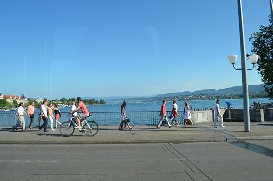
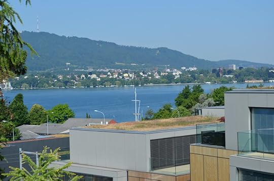
This was the first picture I snapped driving in to Zurich, going across the bridge to the (west) side of the lake where our place was located. Looks like just about every other lakefront strolling area….until you see the magnificent buildings on the left.
One of the elements I love about Zurich is modern convenience with trolleys and cobblestones, the metro quietly zipping through town, yogi’s on bikes navigating between Lambo’s and Ferrari’s. I also loved (and hated) the narrow paths leading up the very steep hillsides. Great for my calves but oh….hard on my fanny. Because they made (and left) such an impression, I use them to my advantage in each book of the series…up and down in the sun and snow.

The narrowed paths between the buildings in Zurich–the coolest little bars and hard to find delis were hidden in these alleys/paths.
Recall the scene where Lars and Danielle break up. right there, on that couch facing the fireplace. Imagine the fern replaced with a Christmas tree and grab a tissue.
There is was. The beginning of the three-book series on
Danielle Grant, an American trader recruited to Switzerland. Of course, Danielle
Grant, the lead character, didn’t come to mind until later, as we explored the
streets of Zurich, noting the incredible number of wealth management and
financial institutions. The owner of the unit is a physician, and while I
initially thought that was interesting, the fast-paced, secretive world of
trading appealed to me. Besides, the physician’s well-built, tattooed, very
handsome but slightly mentally underpowered boyfriend was simply not believable—or
rather, a reader would think it was cliché. The hot doctor (she was hot, and
blond, and brilliant) with an equally hot enforcer-like boyfriend was beyond
the realm of reality. I know you are thinking: but that would be cool?! Well, I
thought it cool as well, but wouldn’t sell, and as I’ve already digressed terribly,
I will tell you I raised this scenario up to my agent, who agreed with my initial
feeling.
“Nope, you’re right,” he said immediately. “It is cliché and
unbelievable.”
“But I actually witnessed this!” I said with frustration. Not
that I was going to run with it anyway, but the notion that real life wasn’t
acceptable was annoying.
“Sad but true,” Peter reaffirmed.
Let’s just have a collective sigh together and move on.
As I dutifully kept my eyes off the boyfriend and paid
attention to the physician, I appreciated everything about the building, unit
and details therein—all of which made their way into Made for Me, book on. When
she slid in the card for the penthouse located on the fifth floor, I was
impressed. The two-bedroom flat with views of the lake from every room was
lovely. All glass and modern, shiny counters and cabinets, metallic tile butting
against French maple—the vision was coming together. The grand piano in the
living, the glass-enclosed dining room with sliding doors, the sauna off the second
bedroom. I wondered to myself—who lived like this, really? I asked the physician.
“I have a much smaller flat downtown closer to my office,” she said. Okay, that answered the question. Not her. She then offered she has five similar units in other cities around the country (Bern, Lucerne, St. Moritz to name a few) and this was her second business. Rog was impressed.

Office on the other side of the glass-enclosed dining room, and the right is a (pretty poor) shot of the master bathroom, built-in sauna on the left side
Not behind in the scenes. In the scenes
Volumes have been written about real life inspirations behind
a character, scene or setting, and I have fun blending fact with fiction, or
rather, improving fact when I want something a little off. Well, I will give
full credit to the unit’s owner who made it really easy for me to catalog every
detail, up to and including the 5-inch solid steel door. It also came with
five, count them five, different locks. So, imagine this: secured building,
private elevator, five-inch steel door with five locks. It’s Switzerland, as I
say in my book, the safest country in the world. Wasn’t this a little bit of
overkill?
“One can never be too secure,” was the physician’s answer. Well then.
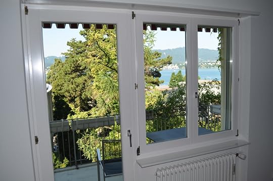
Upper left: one of the two decks opening up with views to Lake Zurich, Upper right, view from the kitchen, over modern office buildings (aka pull the blinds!) the bottom pic is on the waterfront, a ten minute walk from our rental to downtown along the waterfront


Left: Imagine this hallway where Danielle greets Andre in the foyer, and then upper right, in the second bedroom, which she transforms into a second bedroom
A little factoid in the book is the heat of the city. Few, if any, places in the city have air conditioning outside the hotels. The logic is that for the few weeks a year its unbearable, the winds gust off the lake, and up the hillside (or the reverse). In fact, our landlord told us that we were going to be liable if we left the penthouse without drawing in the awnings covering the decks. So we’d close everything up in the morning, arrive in the afternoon, open the windows and it cooled down immediately. The evenings were lovely.
Back to the door….
Guess what kind of door we have in Idaho, on a property in the middle of nowhere, which has a gate, and lots of security. Yep. That five-inch steel door. But lest you think we got crazy and had it especially installed, we didn’t. The house came this way. You see, the previous owner is a Swiss architect who built it for himself, and told us the same thing: “All good homes have doors like this.” Well then, there it is. At least he didn’t put on the five different locks.
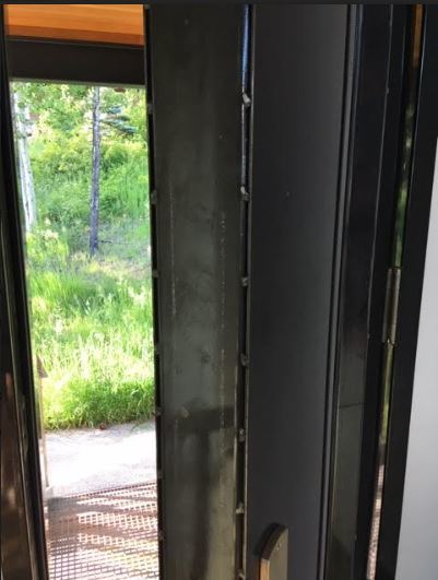
Seriously, you just can’t make this stuff up. Five solid inches of steel in our front door, emulating just about every front door we’ve had in Zurich.
Feature image: A water Polize, who’s big task for the afternoon was saving two geese that were ensnared in a net. The crowd cheered, including us.
June 11, 2019
Cape Kiwanda and Haystack Rock
Ninety minutes south of Portland, Oregon, and about the same distance west of the state capital, Salem, is one of the most picturesque settings on the western coast of the United States. It’s Cape Kiwanda, home of the sand dunes and the “pointy” rock itself–Haystack Rock. The journey has a little of everything: parking on the long, flat beach instead of a concrete lot. Then traipsing up the dune in order to get to the furthest point of the jetty to snap that National Geographic-worthy photo.
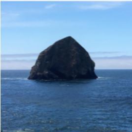
Haystack Rock–and my apologies for the photo- in a moment of complete idiocy, I delted my dropbox for this trip, and the only photos I had were those I’d sent to my phone. So I “resent” them back to myself. Just take the essence of the shot, visualizing how good it was in the original form!

June 5, 2019
An author’s logic
Two questions have been arising that might as well be
addressed in this blog. The first is: why all the travel blogs, and second is:
why do you keep switching back and forth on locations instead of the
chronological order of visits?
If I had any shame whatsoever, I wouldn’t admit that travel
blogging is as much for me as it is for wanna-be tourists. For yearrrrs, after
every trip, I vowed to keep a journey, record—image or written- of where I
went, what I did, ate, liked, hated etc., so if I ever wanted to visit the
destination again, I’d have the details. In other words, my own Sarah version
of Rick Steves. Alas, like my teenage journal writing endeavors, it ended up
being more vision than action. Here I am, a million years later, like Methuselah,
wondering if I need another vision for the Almighty to strike me down to change
my evil ways.
So, it was (yes, this is the actual answer) that in February
of 2019, when we booked this summer’s vacation plans, I was forced to pull out
all the pamphlets, business cards, and what-nots from our last two visits. That
begat the whole “Since I have to write this down anyway, maybe someone will
benefit.” Like unto that was the “oh! This inspired my novel(s), and that might
be interesting for another reader as well.”
Yeah, I know. Long answer to the first question, but now you
know the backstory, and I’m all about backstory.

My scenery & writing area switches with my moods: one moment sitting chair, then couch, table and usually in the mornings, my kitchen counter, half-looking at the neighbors yard above my toaster. More importantly, my back is to the lake, so I’m not distracted. Is it any wonder that gold trader Danielle Grant positions her desk to the hallway and away from Lake Zurich? Who can get a thing done with a great view??
Second question is more simple: I get bored, and so do readers of my IG, Facebook and Blogs. Too much US, then too much Europe, Mexico or wherever. So, my original intention to go alphabetical was quickly discarded, as was the timeline. Now it’s whatever strikes my fancy. I do have one goal, which is to get all my major trips for the last couple of years up, so I can figure out what to replicate, what to add and ignore. Honestly, I’m a little stressed since I leave three weeks from today (time to start dieting), so don’t be surprised if my blogs become a wee-bit shorter, with more visuals than text.
Lichtenstein, where the best things come in small sizes
One afternoon in Zurich we decided to get in the car and just drive towards the Alps. Somewhere along the way was a sign for Lichtenstein, and we had nothing better to do so we hung a left off the A1 and bingo, ended up in another country. Given that we were entering from Zurich, the first town is Vaduz, the capital.

Vaduz castle, in the capital city of Lichtenstein
My previous reference to the country was a place where the excruciatingly
wealthy of the world park their money. Funny thing is that in the US, bastions
of money means huge, ornate buildings, fancy cars and snappy suits. Here, the
environment is so understated you’d have no idea of what lurks behind the
mostly grey, mostly one-story buildings. No flashy cars, just a single
McDonald’s and corner cafes, which are themselves, nothing more than metal
tables and chairs.
Still, we arrived mostly in the company of summer road
bikers, nearly all on BMW touring bikes, their outfits not leather, but mesh,
because as we were told, they “breathe better.”
About a mile or two inside the fourth smallest country in
Europe is the town of Vaduz, pretty much the one and only city. It’s home to
the Prince who lives in a great castle which is off-limits to tours (bummer) a
few parks and lots of great shops for chocolate. As an aside, I know you are
likely sick of my fixation of chocolate by now, but some people have wine,
others coffee, me chocolate. Sorry. At least I can tell you what to purchase on
Amazon, for most of it is in fact, for sale over here.
There are two interesting castles to visit, nonetheless.
Some of which must be done on foot, because the hub is car-free on purpose. The
winy roads rival Lake Cuomo for the width (which is about arms-length wide) and
the goal (we presume) is to get visitors to spend more money on the local
shops.
The Rhine cuts through the country, and nearly every exit
off the A1 offers up a park. And keep in mind that there aren’t that many exits
and then you are out of the country.
Vaduz Castle
Even though it’s not open to the public, take the path and
walk up the 150 meters to take pictures. It’s lovely and really, just standing
by all the wealth in this micro-country makes me feel good at a seriously
temporal level.
Lichtenstein Castle
This is definitely my favorite castle in all of Europe-and it’s likely the smallest. First, it sits on an island of rock that juts up and out, requiring access by bridge. Second, it has a really cool ‘hunting room’ with the original pedestal the hunters would use to stand up and retell their adventures of killing the local boar with one of the original steins that line the upper molding of the room. Third, it has a “mistress” door for the Lord of the manner to sneak out and have a moment with his lady friend. The upper rooms, which are very small and off limits (though we cajoled a peek) are upstairs in the turret-area of the castle. The tour is SO worth it, you must, must, must do it. This castle has a great scene between Danielle (the American expat) and Zurich-born Andre, which is wrote specifically around this destination in the first book of the trilogy, Made for Me.

This is one of the few castles in all of Europe that offer such a glorious, unobstructed perch from which to take photos
Keep an eye out for the funky elements of the area. Rog found a side entrance for the dog, which begat my tongue-i-cheek phrases that when I get my next castle, I’m definitely going to make sure I have that bat-cave door for my four-legged companions.


The nearby armory to ward off the
The day was beautiful, crowds light and completely family-friendly. Easy parking with a bit of a walk in the heat (uphill) but no too bad. Pictures are not allowed inside the castle, as they encourage postcards, so my law-abiding self had to make do with the pics from all the angles possible.


Just a short distance away is the armory. Factoid: during WWII, the Germans tried to bomb the castle but succeeded in damaging only a fraction of the structure; the rest remained completely intact.
Hikers Delight
Two hikes are definitely worth making the effort. The first
is the Prince’s Way Hike and the Eagle’s Way Hike. One thing I seriously love
about Lichtenstein is they offer up a site detailing the location, level of
challenge and more details so you can be fully prepared. (Unlike the States
where it’s more of: you paid the park entry fee, good luck!) Check out this
link for the details for the available hikes.
When we got hungry, literally no restaurants were open
because we arrived (apparently) at an odd hour. The McDonald’s was crammed with
road bikers, but the notion of being in Europe and eating at the sole fast-food
restaurant in the country was a little offensive. So, we kept wandering up and
down the side streets (below the no-car zone) and finally found an open
restaurant. Rog had never had boar before, and I wanted authentic as well, so I
just pointed and ordered, loving the meat, potatoes and schnitzel.
A lake that’s called a swimming pool
Now this was interesting. We were boiling up and thought-
okay, we’ll see what’s around. The Grossabuent
Leisure Centre popped up, and since it is billed as a swimming facility, we
thought pool. Well, we look up the website and laughed, reading that it’s
actually a lake, but billed as a non-chemical swimming area, so it’s named a
Centre. Got all that?
The random monastery/church on the hill. We got lost, found
a church-basilica overlooking the entire town and took a look around. Honestly,
I think some of our best pictures came on that hour side-adventure, and I’m
sorry/embarrassed to say I can’t find the name of the place—one reason why I
MUST start writing these blogs real time during my travel. (and NO, this isn’t the Cathedral of Vaduz,
also known as the Cathedral of St. Florin. This is way smaller.
One of my personal favorite subjects is cemeteries or gravesites. They can be so exquisitely personal and though provoking I am always taking photos- so shame on me. I can’t recall the name of the actual destination but adore the photos! Arg!
Local cathedral
We love churches when the architecture, grounds and vibe is different from what we’ve previously seen. The Cathedral in Vaduz offers that, but then we found another, smaller church that for the life of me, I can’t recall the name. Perhaps one of my readers can help me! The pictures speak for themselves, especially the cemeteries.


I love cemeteries. We learned that this one was/is reserved for only the most stalwart families.
Gutenburg
Castle
in Balzurs
Open to the public after May 1 through October, the tours are by appointment only, and relatively limited, including the gardens and the chapel specifically. It’s also available for weddings upon request. The view from the grounds, however, are awesome and should definitely be seen.
After that, the tour of the country is pretty much over,
well, unless you are there to discuss your gazillion-dollar account with a
financial advisor. Sorry, can’t give you a recommendation on that one.
Feature image: in front of Lichtenstein Castle
June 4, 2019
Day trip from Portland
Portland is a great destination with wonderful sites in and around the city, from the OMSI to the waterfront with the world-famous Rose Festival. You can ride the Aireal Tram (gondola) that lifts you up and over the freeway to take in the famous “City of Roses,” and when hungry, eat at one of my favorites, Papa Hayden’s in the famous Pearl district. If you are just driving through and unable to do any of the above, you must take the exit, find parking and eat. It’s that good—well, actually the cakes and desserts are that good. They made the wedding cake for two one sister, whereas Jerry Franks’s in Salem, an hour south, made the cakes for the other.


Left: the aireal tram (but wasn’t going the day we were in town) and right: view of Portland heading out I-84 east
Hopefully, your trip includes getting out East, because visitors should set aside one really long day to head east out on I-84 for a day. The experience is like a veritable laundry list of sites and destinations you won’t forget. Bring your hiking shoes, camera and a rain jacket, because you are never going to know what you will experience on this journey. And if you simply can’t spare a full day, you can cram a few things in four or five yours.
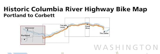
The simple map of the bike trails. A more detailed link below
Getting out of the city
The Columbia Gorge is famous for it’s wind, drawing crazy sailboarding-windsurfers from around the world. Watching the surfers speed along the whitecaps, with sails or parachutes was so romantic I tucked it away for a book, (a three-book series actually). Turns out, Danielle Grant, the American recruited to Zurich to trade keeps up her windsurfing on Lake Zurich, which helped me continue my mental and visual love affair with the sport.
The wind starts about 45 minutes outside the city, as soon
as the Columbia River comes in to view. Prior to that time, however, are some
majorly cool sites that Oregonians take for granted. Well, this one took them
for granted, because we never stopped until I left for college.
Sitting on a majestic bluff that appears to have shot straight up from a volcanic event is an observatory. It’s perched on concrete, on rock, overlooking the Gorge. It’s rather famous, and is called the “crowning glory” of the Columbia River. Hikers, water-sport lovers might disagree, but your inner Einstein will be in vigorous agreement. The hours are 9-6 pm daily, but sometimes it closes depending on extreme weather. Bring your camera and a windbreaker—well, you need that regardless.
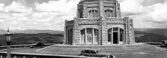

Left: clip from the website from the top, Right: my snap from the turn-off from the bottom of the road
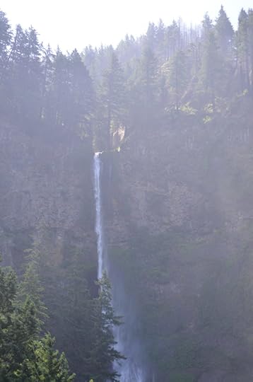
The Falls is a primary tourist destination, but I’m really sorry to say this: it’s pretty darn mundane compared to the so many falls that exist in Switzerland, Austria, Germany….the list goes on. I mean, nothing compares to water gushing from the Alps. Yet, the hike is beautiful, and for Oregon, the Northwest and yes, for much of the United States, Multnomah Falls is something to see. So if you are a European who has really seen some majestic falls, you take go back home and say “yeah, I saw these falls that are super cool to Americans but we have it better.”
That said—and here is the fun part—what very few, if any,
falls in Europe (that we have visited) have is a lodge and the surrounding tourist
areas. No such things as a “Gorge” exists in Europe, next to the Falls, next to
Vista Point, sandwiched in between quaint, hillside towns such as Hood River. All
of these attractions are literally within a 90 minutes (or less) on the major
I-84 freeway. And that, my friends, is something you just can’t get anywhere else.
Several historic, amazing hotels are nearby, including the well-known Columbia Gorge Hotel which is very reminiscent of the old-school Beverly Hills Hotel in terms of 40’s glamour and style (at least the front). It sits right at river’s edge amidst lush, old growth trees. It’s a perfect site for a destination wedding, actually, especially if the couple are lovers of the outdoors. Skamania Lodge is another hotel with quite a reputation. It’s a different vibe, with a golf course, wellness and fitness center (as opposed to the “spa” of the Columbia) and has a full-fledged convention center etc. Yet some visitors want the higher-up view (it’s insane, check out the website photo gallery).
To backtrack a bit on the hotel aspect of Portland, if it
were me traveling to the city (and because I lived in Portland for six years, I
feel well qualified to say this), I’d go for the Heathman Hotel downtown (place of a sister’s
wedding reception) because my mom believes that the Heathman has better food
and cakes that Papa Hayden’s, which I’m happy to argue about. The Heathman is in
a trendy part of downtown but it’s another old-school establishment with high,
vaulted ceilings in the lobby and dining room, old and new meeting in a lovely,
historical space. My personal fav.
Now back to the Gorge. If neither of those hotels are in your budget, you definitely need to stay at the Best Western Plus hotel in Hood River, or nearer the Cascade Locks location. Both hotels are right on an inlet of the river, perfect views, and all the amenities a visitor needs, price+convience = you have more money to do and see everything on your list!

If you recall the devastating fires from the summer of 2018, this area was partially blackened. Thanks to the amazing resilience and rains it’s only half spooky. In the upper shelves of the mountains, the trees resemble black skeletons.
Normally, when one hears the words Locks it refers to a
series of connected waterways, to be rather simplistic. This is somewhat
different. It’s two miles of water create by a massive, ancient landslide. For
history buffs, the Cascade Locks had the first steamboat west of the Mississippi
in 1862, which is on display at the historical museum. After numerous boats fell
apart after hitting the rapids, the US government started the initiative to
create the Locks, and this work began in 1880. For nearly 50 years, the river
was used to transport goods up and down the river, but after the Bonneville Dam
was erected, the area gradually transitioned from a commerce-led township to
tourist destination.
If you’re not into the history, then you are likely being compelled to come here because of the fabulous bike trails, and the “Bridge to the Gods.” Yes, that’s the name. It’s as beautiful from the freeway as it is to ride across from Oregon to the Washington side and back again.

Looking from the Oregon side to Washington, where the land is flat, encouraging the industrial activity to occur on the north side of the Columbia River
First up, I want to say we visited this last weekend (June 1, 2019). It was sunny, it was busy, and the signs in both directions of I-84 said the Parking Lots Full and Closed. Huh. Never seen that before. We ignored it of course, because the Dept of Transportation (DOT) hadn’t put up a physical barrier to the entrance, so we drove right on through. Sure enough, people left, we took a spot and walla! That said, it was about 10 am and already crammed, so if you are going on a weekend, go early or late, because the mid-day is pretty gnarly. (yes, that’s a technical term used by us authors).
Lots of fog in the early morning
As you’ve likely read on numerous sites, the walk is easy, the view great, so what’s not to like?
Hood River, the town
Over the last twenty-years, this town has been like the Phoenix rising. It went from downtrodden ashes of a former timber town to a trendy destination which reminds me of a tiny Telluride. E.g. it has the bike shop on mainstreet with $5,000 starter models, next to a stationary store, meat market, hardware then pizza joint.
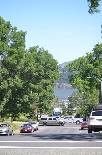
Nearly every street in Hood River has a view to the Columbia
If you look past the bikes, the rest of the prices for everything is Oregon-style. No sales tax and reasonable. The public library and park are also on main, and you’ll get a nice workout starting at one end, going up the hill, turning around at the library then going back down. As you walk down, turn to your left for the views of the Columbia River, and take pics of the homes, which are totally 1920’s-30’s turn lovingly kept up by homeowners. Of all the places to eat, we chose Pietro’s Pizza. You have to understand I grew up with Pietro’s thin crust, which hasn’t changed in 40 years. Hallelujah. It’s on the main street from the high way exit, at the basement of a brewery.


Main street (original clocks and modern condo’s adjacent to a brewery; attributes that make up the trendy town of Hood River
When you cross back over the freeway, it leads to the marina, beach area (it’s actually rock, but that’s what the hardy Hood River residents call beach) and the inlet where the crewing teams row. If you are worried about cold/heat with the crazy winds, the gusts were ferocious, but we were still hot. As one local told us over pizza, “If we didn’t have the breeze it would be unbearable.” We agreed.

The inlet just off the freeway, next to the Hood River Best Western Plus, marina and beach
Not real enticing as far as names go, but the scenery is glorious.
It comprises almost 150 acres and receives only 200,000 visitors a year, mostly
in the summer and fall months.
Hiking the trails is the main reason to come to Starvation
Creek, because it connects major trails. You can use the day park pass and
connect to the Mt. Defiance trail ridge. Going east, you connect the Columbia
River Highway State treail, then Viento State Park. This the map for
bicycle and hiking for easy reference. I snipped the top-view visual for
the map, but the extended map is very intricate so make sure to check that out.
As a side note, many executives come over to the States for summer projects, yet the kids are miserable because they aren’t in school and it can be hard making friends when families take vacation. One activity is the OMSI camps and classes.
Feature Image: View from Vista House L (photo credit their website)


