Paul E. Fallon's Blog, page 47
August 16, 2016
Trip Log – Day 282 – Summerville SC to Charleston SC
 August 13, 2016 – Sunny, 95 degrees
Miles Today: 36
Miles to Date: 14,465
States to Date: 40
Nine months ago I spent a night in the original Sun City, AZ, the first US community exclusively for people over age 55 where, in 1960 an 800 square foot house cost $10,000; air conditioning was optional. People snapped them up as much for the community centers and golf courses as the concrete block cottages. Del Webb, Sun City’s developer, is long dead, but there are over fifty Del Webb communities in twenty states that reflect the evolution of active retirement, an evolution that parallels our national trend toward less community.
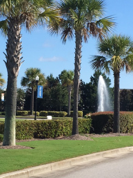
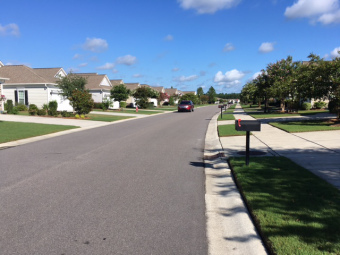
Del Webb Charleston has a community center and swimming pool, organized parties and tennis courts, but no golf courses. Instead it features lagoons – fourteen of them – created by bulldozers shaping the swamp into buildable lots. The focus of development is densely packed individual homes. Garages dominate front yards. My hosts live in a 3-bedroom 2400 square foot house that is as unrelated to its Sun City predecessor as a McMansion is to Levittown.
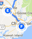
 The ride to Charleston was not pretty. North Charleston is a poor city. Vehicles funnel through the neck of highways and dashed commerce, racing to Charleston’s charming tourist center. I circled The Citadel campus where new plebes were being indoctrinated. Such a loud place. Yelling is an integral component of military education.
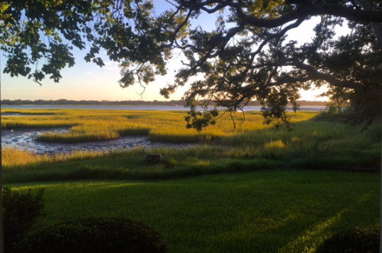
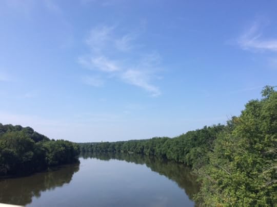
Google maps showed that my host’s home bordered the Ashley River, but the reality was much more impressive. Deb lives in the last of a modest row of townhouses; the sunset views of the marsh from every room are spectacular. I asked whether her house flooded during the massive rains last year; rains that left much of the Del Webb community thirty miles upstream under water. Though barely two feet above high tide, her house had stayed dry. The difference between a natural marsh and a swamp dredged into lagoons.


August 15, 2016
Trip Log – Day 281 – Florence SC to Summerville SC
 August 12, 2016 – Sunny, 95 degrees
Miles Today: 92
Miles to Date: 14,429
States to Date: 40
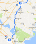
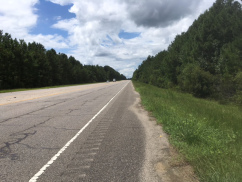 It was impossible to get turned around today – US 52 South for 75 miles, bear right on Alt US 17. I was looking forward to riding through the Francis Marion National Forest, but the tall trees and shady road I imagined was a far cry from the wide highway and mowed shoulders that kept me in full sunshine all day.
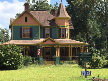
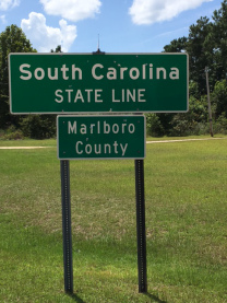
I love when a place shifts expectations, and so far, South Carolina is striking in one omission and one addition. South Carolinians appear to be as flag waving as any other Americans, but I have yet to see even one Confederate flag here. That may be one culture war we’ve left behind.
 What I have seen instead are unexpected signs of recognition. Towns often cite favorite sons on their ‘welcome to’ signs; often sports stars or media celebrities. Along highway 52 I passed four small towns in a row that heralded their connection to more cerebral pursuits: an astronaut, the first African-American female college president, another college president, and a Nobel Prize winner.
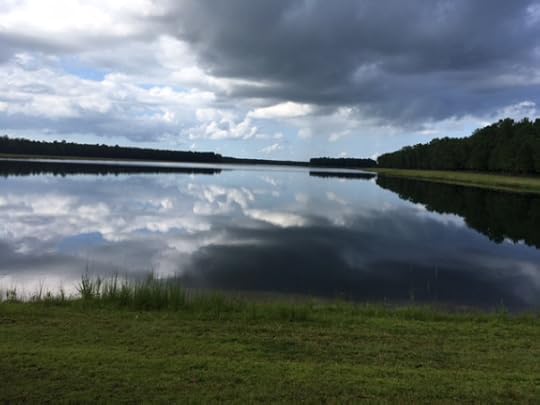
Google Maps for bicycles has a penchant for mapping me on dirt roads. An intriguingly twisty line is not always good as it looks. My hosts for the night live in Del Webb Charleston, an active adult community of serpentine streets, one of multiple developments called Cane Bay that all share one vehicle access, on the far side of my approach. Google offered a route that carved seven miles off the highway. I was skeptical, until it turned out to be the best dirt road of my trip, firm sand reinforced with mesh. It circled the major retention lake of this swamp reshaped into dry land and lagoons. I could have been miles from any human being. Until I came upon a paved bike path that brought me smack into close-packed houses and direct to their street. Sometimes, traveling by bike can be faster than car!


August 14, 2016
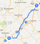
Trip Log – Day 280 – Fayetteville, NC to Florence SC
 August 11, 2016 – Sunny, 95 degrees
Miles Today: 119
Miles to Date: 14,337
States to Date: 40
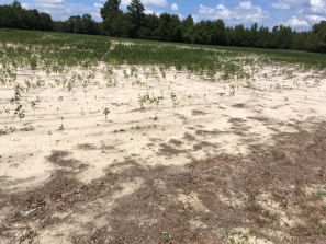
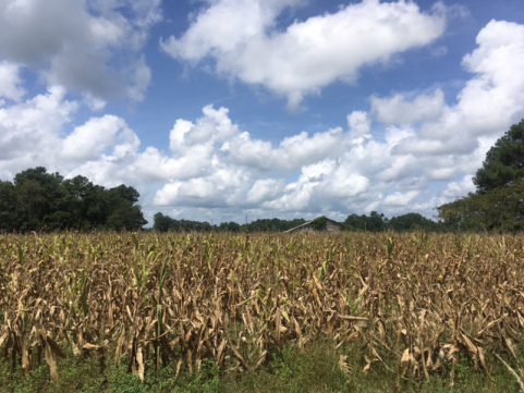
My internal compass went kerflooey today: missed turns; detours; backtracking all over the countryside. Maybe it was the scent of the open fires and pine sap that permeates the sand hills of North Carolina, maybe it was the miles of parched corn begging to be harvested, maybe it was the snap hale storm that bore down on me hard and then stopped within five minutes. What promised to be a long day got completely out of control and turned into the longest single leg of my trip.
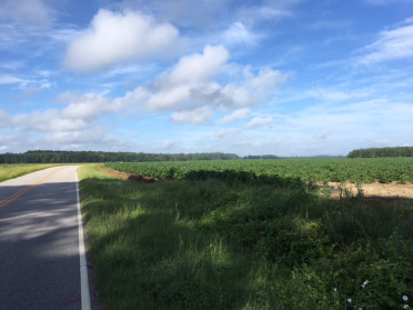 Thankfully, the terrain was flat, the wind benign, and logging 119 miles was not as exhausting as many other days I’ve done. (Loveland Pass holds the record on that). Still, I’m not looking to repeat this century+ again any time soon.
I arrived in Florence just after seven. The miles washed off me in the shower and I was ready for a beer and a great night of front porch talk with a dozen or so locals who would rather live in this former railroad hub with a tight sense of community than any other place on earth.


August 13, 2016
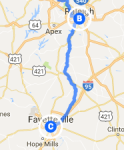
Trip Log – Day 279 – Raleigh NC to Fayetteville, NC
 August 10, 2016 – Partly sunny, 90 degrees
Miles Today: 68
Miles to Date: 14,218
States to Date: 39
A perfect day of bicycle touring. Cotton candy clouds provided dramatic skies all day. A light breeze diminished the high temperature and steamy humidity. The first twenty-five miles out of Raleigh had good shoulders and even a few bike paths. Beyond that, there was so little traffic the lack of shoulder hardly mattered.
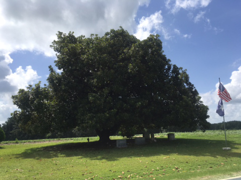
North Carolina has the most beautiful specimen trees I’ve seen. They don’t rival the majesty of California’s Redwoods or Washington’s rain forests, but in many places the woods have been thinned so one or two or three specimens can fill out in grand, symmetrical glory. They are stunning. I particularly liked this one that shelters a small cemetery marked by a flag. It’s all there: ancestors, nature, god, and country.
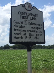
The Battle of Averasboro (March 15 & 16, 1865) took place all along Highway 82. There are dozens of markers as well as several notable structures, a visitor center and cemetery strung along the highway. In classic Confederate spin, the fact that the Rebels pulled their front back three times and eventually retreated is considered a ‘victory’ in slowing the Union advance long enough to decipher Sherman’s intended route of destruction. History may be written by the victors, but the losers come up with more creative interpretations.


August 12, 2016
Trip Log – Day 278 – Durham NC to Raleigh NC
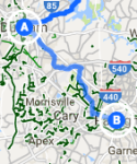 August 9, 2016 – Partly sunny, 85 degrees
Miles Today: 32
Miles to Date: 14,150
States to Date: 39
Our political and economic system is full of policies established with good intent that, over time, become tools that reinforce power and status quo. Consider zoning. Before the industrial revolution, the idea that work, commerce, and living were separate activities didn’t exist. Zoning was a noble idea to reduce urban density, bring light and air to dwellings, and separate people’s homes from noxious industry. Early zoning codes were a key element of the dramatic increase in public health we witnessed a century ago.
However, by the time Charles Erwin Wilson, Eisenhower’s Defense Secretary, announced, “What is good for GM is good for the country,” zoning had become a tool to reinforce economic stratification and promote an automobile-based economy. Compartmentalizing our lives became the norm. Daily transportation, most often by private car, became the link between segregated activities; a link that can consume an hour or more each way from home to office.
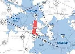
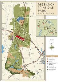
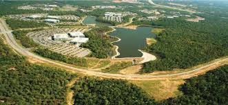
Today I pedaled through Research Triangle Park, perhaps the world’s largest parcel of single use zoning. RTP’s 7,000 acres contain nothing but wide roads connecting over 200 corporate office buildings and parking lots hidden behind trees, trees, and more trees. RTP started in 1959 to create business and research opportunities tied to the area’s three main universities: Duke, UNC, and NC State. It became famous during the 1960’s, when segregating our environment and promoting car travel was king. RTP gained cache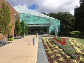 when IBM transferred a large part of their operations there, though if you are true David Sedaris fan, you know his spin on a North Carolina youth with an IBM dad is not all perfection. At ten a.m. on a weekday morning, I encountered little traffic and no sign of the 50,000 people who work here. After driving a minimum of ten miles to their offices, they were snug indoors.
I don’t buy the idea that great ideas take place in a pastoral environment. Innovation comes from constant contact with problems, not in escaping them. The technology start up I visited yesterday is in bustling downtown Durham. Corporations at Research Triangle Park are big guns, long past nimble.
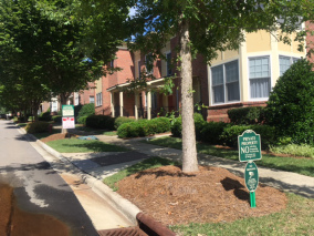 Perhaps the best thing that can be said of sixty years of ultra-low density, monoculture development is that there is plenty of room in RTP for infill. They recently carved out 100 acres, a pittance, to create ‘Center Park’, a new urbanism collection of upscale houses and stores. The first effort at a finer scale of zoning, to create a place rather then simply space. It isn’t much, but it’s a start.


August 11, 2016
Trip Log – Day 277 – Oxford, NC to Durham NC
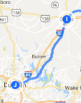 August 8, 2016 – Overcast, 90 degrees
Miles Today: 40
Miles to Date: 14,118
States to Date: 39
A day of anecdotes.
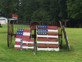
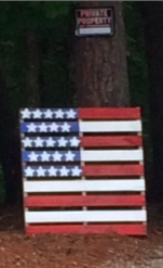
I see flags made from pallets all over rural areas.
The Federal prison at Butner is a campus, of sorts, very different from Duke’s.
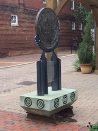
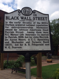
Durham was once the Black Wall Street, a hotbed of African-American entrepreneurs.
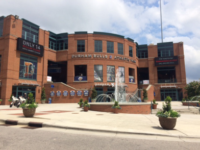
My fraternity brothers who founded 8 Rivers Capital have offices overlooking the Durham Bulls ball field.


August 10, 2016
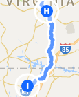
Trip Log – Day 276 – Rice, VA to Oxford, NC
 August 7, 2016 – overcast, 85 degrees
Miles Today: 93
Miles to Date: 14,078
States to Date: 39
Overnight thunderstorms brought cooler air. I left early to get a jump on my long day; it was actually chilly in the long forest shadows. By nine I enjoyed a pleasant juxtaposition of cool breezes in shade, and warm sun when pedaling along exposed fields.
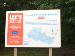 I rode along a portion of Lee’s retreat to Appomattox. The roadside is littered with almost cryptic historical markers. At some point in every depiction of every Civil War altercation are the words ‘the Confederates repulsed the Unionists.’ It takes close reading to decipher that they eventually lost.
Sunday morning 10:00 a.m. in rural Virginia: the most segregated hour of the week. I passed black churches and white churches and empty churches. No integrated churches.
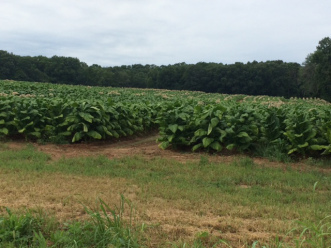
My distance from urbanity continued to expand. The hills leveled out to swales; I travelled miles with nothing on either side of me but trees or tobacco. I detoured to Drake’s Branch to avoid a four-lane stretch of highway with a rumble-strip shoulder. The area has great street names like Genesis Road, Gethsemane Church Road, WPA Road (with electric lines), and Poor House Lane. Back on US 15 from Wylliesburg south is a swell ribbon of fresh pavement all the way to Clarksville.
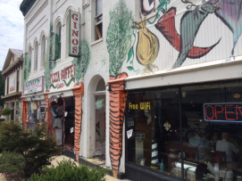 By mid afternoon the heat was rising and the cicadas in the brush alongside the road made such a racket they invaded my headspace. After 68 miles I needed lunch and stillness, so nestled into Gino’s Pizza on Main Street Clarksville. Next time you’re in town, I recommend their steak and cheese sub with all the fixings, served on a roll made from pizza dough. Giant fans churned a breeze in the big empty space. Nascar blasted from the TV.
The line that divides Virginia and North Carolina is arbitrary but ancient. 36 degrees 30 minutes was established by King Charles I in 1665, with absolutely no knowledge of the geography behind it. That latitude eventually influenced the borders of eight states, as far west as Oklahoma.
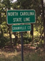 Arbitrary though it may be, the line has sociological significance. As soon as I entered the Tarheel State, the trucks got bigger and louder, their tires bulged, their speed increased. I held my own, wishing that some cycling advocate might turn the grassy area between the highway and the railroad into a bike path. Until a parade of brawny guys in ATV’s came roaring up that strip, popping wheelies on every obstruction. Obviously, I am on the wrong vehicle for this state.


August 9, 2016
Trip Log – Day 275 – Charlottesville VA to Rice, VA
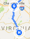 August 6, 2016 – clouds and sun, 90 degrees
Miles Today: 70
Miles to Date: 13,985
States to Date: 38
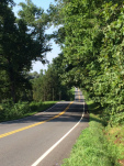 I rolled under the I-64 overpass south of Charlottesville and climbed Virginia Route 20 toward Scottsville and Dillwyn. Over forty miles gradients became shallower, plantations became mere farms, suburban houses became old time bungalows, or mobile homes, or abandoned properties altogether. I was in the country.
If we measured population increase and decay by area, larger tracts of our country are losing population than gaining them. Southern Virginia looks like so many places in the Mid-West and far West; the abandoned homesteads, shuttered gas stations and dwindling towns offset the new, mostly modular houses plopped down on five acres.
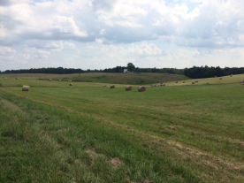 I continued on US 15, which is perhaps the least ‘improved’ US highway in the country: two lanes with little shoulder. But traffic was light and the courteous Virginia drivers treated me well.
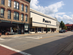
Riding through Farmville on a late summer Saturday reminded me of so many other towns I’d seen on my journey: wide streets with no traffic, underutilized buildings and acres of parking. Heat simmered off so much exposed blacktop. A few souls walked the downtown sidewalk, though few stores were open. I hankered for an ice cream treat, but there wasn’t so much as a convenience store to provide Good Humor.
So I continued on to my hosts, who live deep in the woods about ten miles beyond town. All sorts of bugs I’d never seen landed on my sweaty legs as I pedaled along country roads perfectly scaled to bike travel. I arrived a bit early but Bryan, his wife Joy and their twin sons made me feel at home. They had been giving my question some thought before I arrived. Before I even showered and changed, we launched into tomorrow.


August 8, 2016
Trip Log – Day 274 – Charlottesville VA
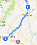 August 5, 2016 – Rain, 75 degrees
Miles Today: 14
Miles to Date: 13,915
States to Date: 38
People are often surprised that I rarely check the weather. If it’s clear when I get up in the morning, I ride. If there’s a major weather event on the horizon, I hear about it. If I stayed put just because the forecast suggested showers, I would still be in Ohio.
Today, however, was different. I woke to steady rain; only the second time on my trip. I checked weather.com and learned that it was not raining in Charlottesville and would not rain all day. Dubious data in the face of actual drops. The rain was real, but not really dangerous. So I pedaled off in my yellow slicker to visit Monticello.
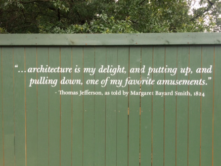
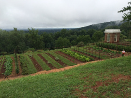 The full paradox of the South is on display in this incredible place constructed over the forty years of Thomas Jefferson’s public life. The man who penned the words, “All men are created equal” owned 600 human beings. That takes a lot of rationalization, which the guides and displays at Monticello weigh with great aplomb. I took the house tour and the slave tour (I’m not a garden tour kind of guy). Each guide was insightful, knowledgeable, and thoughtful.
I imagine the tours were very different thirty years ago. But since the Thomas Jefferson Foundation, which owns Monticello, acknowledged the descendants of Sally Hemming’s six children as part of the Jefferson family in 1998, it cannot shy away from the complex integrations that enabled this segregated society. Jefferson referred to his slaves as ‘servants’ or ‘family’. Every reference to every owned person today is preceded by the word ‘enslaved’.
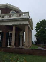
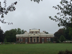
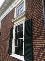
The amazing thing about Monticello is how the ideals of this great Enlightenment man, its magnificent architecture, the ingenious devices, careful planning, and breathtaking site all become secondary to the careful dance of how the masters and slaves coexisted. One tour guide closed with the Emerson quote: “If you put a chain around the neck of a slave, the other end fastens itself around your own.”
Two hundred years later, all that is best and worst about our nation can be distilled from Monticello: incredible resources, noble ideals, inconsistent opportunity, equality, and justice.
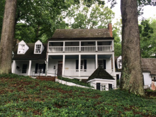 By two the rain had lifted and I rolled downhill to a sumptuous lunch at Michie Tavern, a southern food fest that included the best stewed tomatoes I’ve ever tasted. Sometimes I forget tomatoes are a fruit. I ladled them over fresh biscuits, sweet as any dessert. Bloated with history and sustenance, I returned to town and stayed in a nice alternative-vibe guesthouse.


August 7, 2016
Trip Log – Day 273 – Rixeyville VA to Charlottesville VA
 August 4, 2016 – Overcast, 80 degrees
Miles Today: 55
Miles to Date: 13,901
States to Date: 38
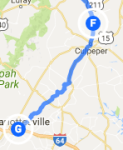
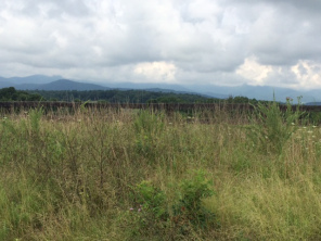 My hosts, Kathy and Robert, served a breakfast of eggs and scrapple, muffins and fresh fruit with yogurt that rivaled the garden fresh vegetables and chicken we enjoyed the night before. I rolled away from their farm well nourished for a ride through more of Virginia’s bike friendly byways. Motorists here are very nice; slowing down in tight spots and pulling up beside me to chat through open windows. Eventually I merged with US 29 South, which was picturesque for a few hours. Ten miles or so outside of Charlottesville, the traffic increased and the shoulder decreased, until construction made it disappear altogether. I was disappointed to find that a huge road project to accommodate the increasing number of cars to the big box chains littering the highway included absolutely no provisions for cyclists: no bike paths, no bike lanes, not even a clear shoulder.
I love the quirky signs I pass in rural areas. It’s comforting to know that God is going to help us in disaster, Jesus has rooms available, and that chili and cheese are yours at 7-11 for the push of a button.
I had a premonition that my warmshowers host for the evening was an iffy thing: a Chinese student arranged for me to stay with her parents. I figured if it panned out, we might have a fascinating cross-cultural exchange. No such luck. Her parents spoke no English. Her younger brother guided me to a solitary place for the night. All fine and safe: just not very interesting.


