
Barbara Edwards's Blog, page 18
April 28, 2014
Sequoia, 2nd day by Barbara Edwards
Leaving Sequoia and King’s Canyon
Leaving camp
I wore my thermal shirt, quilted vest and scarf since it was 44 degrees this morning.
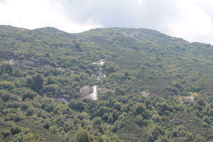
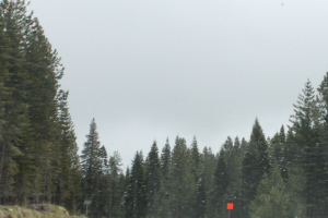
 Driving up and out of Sequoia took us past King’s Canyon, a glacier carved gash in the mountains.

There is a fire burning in King’s Canyon and we are passed by fire trucks.
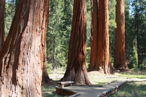
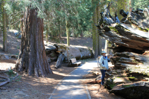
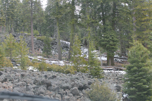
The sequoia forest is just as impressive as yesterday
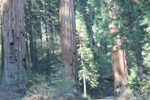
Sequoia Trees
and I take more photos. We climb over 7,000 feet again and it made me feel yucky. I drank more water and waited to descend into Fresno.
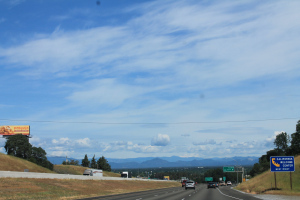
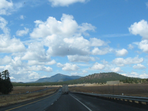
Another place we by-passed. It spreads out flat and brown except for the orange groves and vineyards. Cattle are in the huge fields.
I keep thinking we have to return and stay longer. I know our goal on this trip is Alaska, but I wish I had more time to see and do more. After all, I have friends all over the place from my writing loops.
Got on 41 which was empty and a straight shot into Yosemite. I should rephrase that. It is a fertile land with resorts, fishing areas, farms, vineyards and homes. We pass through Squaw Valley. It’s known for winter sport.
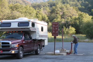
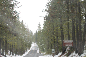
We arrive at Yosemite, with 22 campgrounds only to be told its full.

campground
I whip out my handicap pacared and there are a couple places after all. As we’re getting out reservation done, the ranger mentions its going to snow tomorrow night. People are leaving like flies from bug spray.
Hah. We like the spot we have. Its in the Wanona campground, just inside the entrance and alongside the river. Trees tower overhead. It got all the way up to 70 degrees and I shed my vest. Now I’m going to put it back on. We have the fire going in the firepit, I saw bear skat on the ground when I walked to the latrines. My dog snapped his collar running at another dog and scared the heck out of me. He gave me the most sheepish look when I called and he came right back.
the road ahead
Filed under: Camping, Trip to Alaska Tagged: Alaska, Barbara Edwards,, camping, Sequoia, Yosemite


April 27, 2014
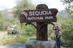
Sequoia National Park by Barbara Edwards
entering the park
Sequoia Ntl Park- first day
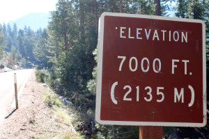
44 degrees this morning. The roads in the park don’t allow for anything over 22 feet long so we made it perfectly.
see the road ahead, that tiny line
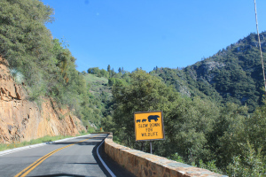
Hairpin turns, steep angles and grades, narrow lanes all are here. Mostly there are tenters in camp last night. The big rigs can’t get any further into the park.
gorgeous view
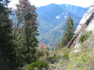
It’s eight am and 45 as we head up the trail to Moro Rock and the best view of Mount Whitney, the highest peak in the lower forty-eight states.
The road is narrow with a deep gorge down to the river. And I mean 400 feet or more down.

in the tree
Hairpin turns challenge my husband’s driving skill, but I trust him totally. He’d be confident with our 35 foot fifth-wheel.
I can’t count the times we stop to take photo after photo. His fancy camera’s battery goes dead and I have to use my old stand-by.
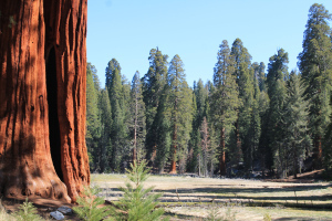
Sequoia grove
It isn’t as clear on landscape, but it loves the Sequoia trees. They look red in the sunlight. So tall I get dizzy looking for the tops.
A fallen giant
I’m so embarrassed that I have run out of descriptive words. A fellow hiker crowed how he felt overwhelmed and I agreed.
Giant meadow
We walked among trees that were thousands of years old. Touched them. I got teary eyed. I want all my family to see what I’ve seen.
Still forty-five when we drive down the mountains. In low gear to save the brakes, with my heart in my mouth. The curves are worse when you can look forward and see over the low abutment. Not everywhere has a guard rail and the drop is right there at the edge of the pavement on a lane ten feet wide.
A tired camper, bearly there
We had lunch at the Waskula Lodge. It was good food and a beautiful setting. Our waitress is working there for the summer until December, using a tiny bungalo for the help that is three minutes walk away. What a place to stay! I recognized Lupines, Daisies, Honeysuckle, and wanted to know the names of several others.
Filed under: Camping, Trip to Alaska Tagged: Alaska Trip, Barbara Edwards,, Sequoia national Park


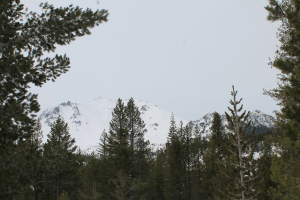
Lassen Volcanic National Park by Barbara Edwards
I hope you forgive me for jumping around. With the internet a strange and unusual unreliable, I’m hopping to today. I’ll jump back I promise.
Lassen Volcanic National Park is forty miles from the campground.
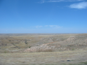
Across the valley floor
Not too far to drive, so here we go.
forest at four thousand feet
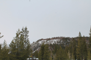
It gets colder as we travel the narrow winding road up over five thousand feet into the snow-clad forest. Aspen, Ponderosa Pine, and Redwoods crowd the road.
Lassen
I’d say over four inches of snow fell last night.
Devastated area
Devastated area
The roads further in the park are closed, but we see the Devastated area.
A horrendous explosion on May 19, 1914 blew the side off the mountain. The damage is clear even a hundred years later.
volcanic rock field
Filed under: Camping, Trip to Alaska Tagged: Barbara Edwards,, Lassen Volcanic National Park, roads closed, snow


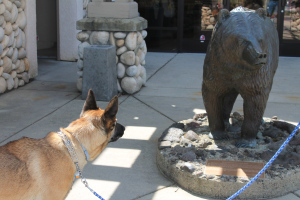
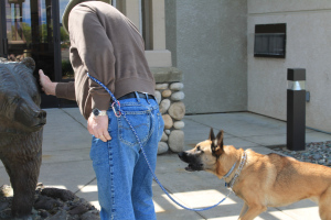
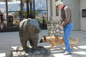
Keeno and the bear by Barbara Edwards
Redding, CA
We went to the visitor’s center in Redding, California to get brochures about the Redwoods, Lassen and anything else close to enjoy.
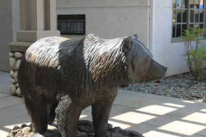
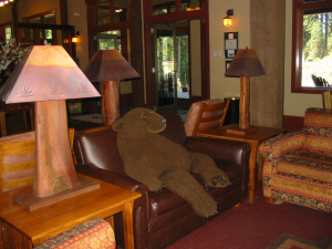
Bear statue
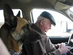
Outside the building is a statue of a California Bear. I wanted a photo so my husband brought over Keeno, our Belgian Malinois to snap it.
Kenno reacted as if the bear was alive.
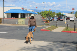
Bill and Keeno
Keeno and the bear
Growling and snapping. See the hair on his nape is raised.
protective Keeno
I had to share with you.
Kenno and Bill
He’s a great dog.
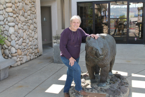
Barbara Edwards and the California Bear
Protective and affectionate.
Please follow, friend or like me. I love to hear from my readers.
Website http://barbaraedwards.net
Facebook https://www.facebook.com/BarbaraEdwards.Author
Twitter https://www.twitter.com/Barb_ed
Amazon Author’s Page http://www.amazon.com/-/e/B003F6ZK1A
GoodReads http://www.goodreads.com/author/show/496095.Barbara_Edwards
Filed under: Camping, Trip to Alaska Tagged: Barbara Edwards,, bear, Bill Edwards, Keeno


April 26, 2014
Got internet today by Barbara Edwards

Actual live cactii growing wild. I imagine it must be painful to brush against. Along with the rattlesnakes that are common out here.
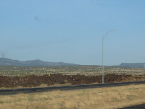
Crossing flatland towards the mountains and the Mohave Desert. There are 205 miles between services and we’ll gas up, get drinks and walk the dog before we start.

 Every few miles we cross a dry wash with names like Rattlesnake, Black Rock. A wash is a gully that drains away the rainwater flowing down from the storms in the
mountains. Its nine o’clock and 81 degrees.
It’s not an empty land. There are lots of brush, clumps of grass and cactus growing in the sandy soil. A haze blurs the distant mountains, but they look blue and purple. Land is for sale. Passing Yucca, established 1883. Fairly big city with planted trees.
Taking a sidetrip to the London Bridge at Lake Havasu. Blooming shrubs crowd the edge of the road. I don’t know what they are, but they are sturdy to flourish here. The mountaintops look like the vertebrae of crouching monsters sprawled side by side.
 The London Bridge is a surprise in this otherwise dry land. The lake is huge and an entire city has grown up around the bridge. Mr. McCullough’s idea was pretty smart after all. At the cost of four million dollars a bustling economy has arrived.

We’re heading across the Mohave Desert and I have a couple photos of the cactus blooming. It’s 88 degrees.
Coming into Barstow is an enormous power plant. Solar panels cover acres alongside the regular generators. Four high tension lines stretch over the mountains to Southern California cities.
Filed under: writing


April 21, 2014
Painted Desert and Petrified Forest by Barbara Edwards
 Historic Painted Desert Inn was remodeled in 1936 by the Conservation Corps. Too much too see, to describe.
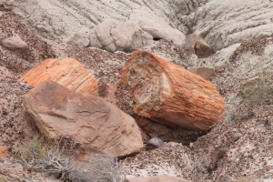
petrified wood
escribe. Incredible.
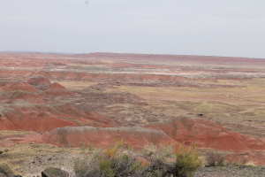
Painted Desert
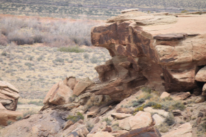
petroglyphs
Filed under: Camping Tagged: Painted Desert, Petrified Forest


April 20, 2014
Meteor Crater and Walnut Canyon by Barbara Edwards

Painted Desert badlands
Painted Desert badlands, then Route 66 stretches across sagebrush acres. 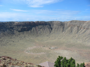 Next morning we stop at Meteor Crater, a national landmark. The deep impact is so impressive, but like everything else this morning its too big to take a good picture. I did try. There are waved of rock across the pastures, left from dirt thrown by the impact. The land around here is my idea of the old West written about by Zane Grey. Brown grass from the winter, sagebrush and low cedar twisted by the wind. Part of the road has signs warning of cattle on the road. Mountains pierce the sky ahead- the Sierra Nevadas. This is high plains country and we’re having the best weather so far on our trip. The sun is bright, puffy clouds float against the robin’s egg blue sky and the land look flat although it gently rolls. Flagstaff ahead, then the California line.
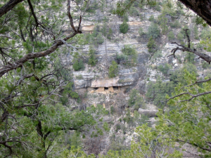
 Walnut Canyon is a beautiful place with views of cliff dwellings, long trails and a variety of plants and animals. Cougar live here, Rain fell over the peaks to the North fo flagstaff. Stopped in Ash Fork for fuel. Place is busy, but not very big. Like many other towns a number of businesses are closed, others are freshly painted and ready for customers. We’re near Seligman and its raining. The sun is shining in the distance.
Filed under: Camping, Trip to Alaska Tagged: Arisona, Barbara Edwards,, Meteor Crater, Walnut Canyon


Another day and I’m losing track by Barbara Edwards
Volcanic rock lines the road
Black, black, black lava flows cover the valley floor before we stopped last night. It looks incredibe. I keep thinking God must have taken a pitcher and poured the lines across the land.
This morning we quickly pass the continental divide at 7,000+ feet.
Oil refineries, a paper mill and small tourist businesses catch my eye. I’m not a big shopper so browsing stores doesn’t get me excited. I told Bill I’m going to look for native gemstone jewelry in Alaska. I already have genuine tourquoise and silver jewelry my Aunt Mary bought in the late 1940s when she visited with her husband.
Living under a cliff
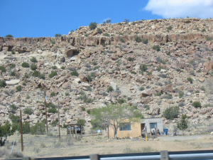
Arizona pops up and the cliffs tower over the welcome station. Red rock boulders, green brush and horses with foals pastured by the road. It’s warmer, in the sixties and overcast. I hope it stays clear until after we visit the pertified forest.
We have 30 days to reach Seattle and every stop is 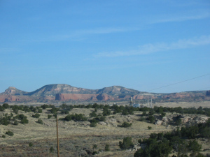 planned, sort-of. We can skip the Grand Canyon since we camped there a couple years ago.
Speed limit has been 75 mph, but we’re cruising between 60-65 since it gives us the best fuel mileage.
There isn’t always internet so my blogs are raggedly timed.
Hope you like them. I am boggled by the endless beauty of our country. I can’t see enough with only one pair of eyes.
Make sure you plan to see all this. It’s all ours.
Please follow, friend or like me. I love to hear from my readers
Website http://barbaraedwards.net
Facebook https://www.facebook.com/BarbaraEdwards.Author
Twitter https://www.twitter.com/Barb_ed
Filed under: Camping, Trip to Alaska Tagged: Alaska Trip, Barbara Edwards,, volcanic rock


April 17, 2014
Another day on our trip by Barbara Edwards
Tried the steak at the Texan Steakhouse in Amarillo last night. What a great place to stop. Stuffed heads hang from the walls, the servers are dressed
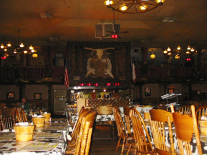
where they eat a 72 ounce steak
like cowboys and girls and the menu is interesting.
The small order of Rocky Mountain oysters (bull testicles) was huge, but delicious. I’m not a big steak eater so I tried buffalo while Bill had the porterhouse. He says it was excellent. I was so full I felt like a stuffed pig when we left.
The campground was right off the highway and we could hear trains and planes during the night. Didn’t keep me awake though.
 Overcast at sunrise, but slowly clearing. Went past a train yard with hundreds of cars waiting to be moved. Windmills are lined along the horizon for miles. Why are they not spinning? I thought we needed them to run for electricity. The wind is blowing, I can feel it push the camper sideways.
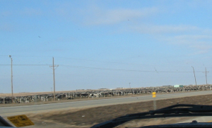
cattle pens
Passed a stockyard with lots of young steers in the pens. Don’t know if they’re being sold for meat or to fatten up for next season.
We’re moving fast so we can stop at several places later.
How did the settlers ever cross this open plain? I’m overwhelmed by the vistas that open around us. I think I can see for a hundred miles in every direction. Brown grass, fences, 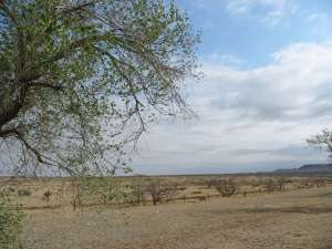 ranch houses and equipment look like miniatures.
The state line into New Mexico reveals a torn, rough landscape. I took lots of pictures because I can’t take it all in. Mesas, gullies cut by water, rough rock crumbling from the wind in red, brown, tan, and white. Wanted to stop at the rest area and take pictures but it is closed. Figures. We’re heading
My Husband and our navigator, Keeno
into Albuquerque and will probably stop since Bill is tired.
I see old-fashioned windmills drawing water for cattle, but few cattle. The land is too vast and they wander far looking for food.
How do the ranchers keep track? It must take hours by truck to travel this land and many use horses.
I noticed there is a local road paralleling the highway for hundreds of miles. Different from up North where the traffic gets on and off the highway.
Drove through rough, rocky hills bordering the highway into the city. Changes so fast back to flat and open it’s amazing.
Trees are leafed out, but short. The city spreads out like a terracotta and turquoise jewel. Larger than I expected.
Lots of manufacturing west of the city, interspersed by dry land. Ranches? I guess. It boggles the mind to think cattle can live here. Or people.
Filed under: Camping, Trip to Alaska Tagged: Barbara Edwards,, New Mexico, Texas


April 16, 2014
Day five- My Alaska Trip
Beautiful morning. Forgot my camera in the camper and can’t take a photo of the gorgeous sunrise or the full moon with Bill’s camera. Point and shot, my foot. I like my old camera.
The red bud tree is the Oklahoma tree. It has purple flowers, go figure.

Red Bud Tree
The area is lovely, green grass, cattle grazing and a newly planted vineyard. There is a huge orchard with a variety of trees. I don’t know but I’m guessing they are nut trees. The owner is planting acres of new trees, and I can see acres more of mature trees.
 Tulsa is a flash off the highway as we whiz by.
I noticed the locals are nice people. Friendly and helpful when I asked for directions. Coming from the way stand-offish New England are, I’m always surprised at how nice people can be to strangers.

Big sky country
Having a little jet lag with the time change. I just went through day-light savings and hated tha change, now we’re leaping across zones and I’m dragging behind. On the radio, enter to win a eight to ten person tornado shelter valued at four thousand dollars. Just what I need.
Driving a portion of Route 66. Do you remember the TV show? How romantic it was. Adventures all over America, handsome men and beautiful women in trouble. Everywhere are the tribal names, Cherokee, Kickapoo, Fox, and others. We travel on a toll road.
Leaving Oklahoma the wind is blowing so hard the truck shakes and my husband must fight the wheel to keep straight. The land is so open. Hard to describe the feeling of looking out towards the horizon. The sea gives me the same view where I think I can see until the earth curves.
Not much changes as we cross into Texas. Sagebrush lines the road and the land spreads in a wide blanket. Cattle dot the fields like tiny miniatures.
Johnson Ranch
The open land enchants me and I take a couple quick pictures before and exit that goes only to the Johnson Ranch. Wow. I’d love to live and ride here.
Filed under: Camping, writing Tagged: Alaska Trip, Barbara Edwards,, Oklahoma, Texas


