Jennifer Jeffries's Blog, page 2
September 20, 2022
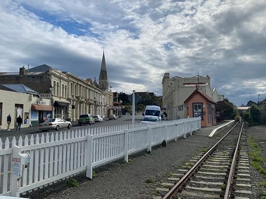
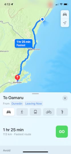
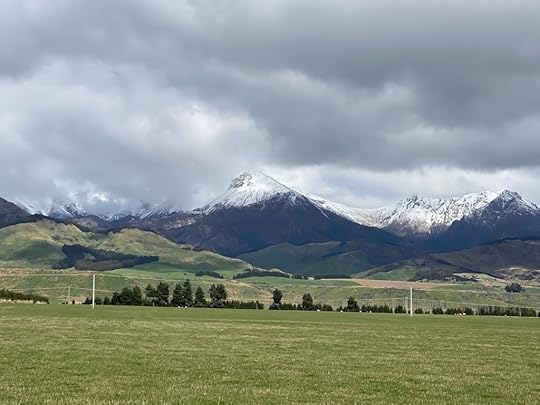
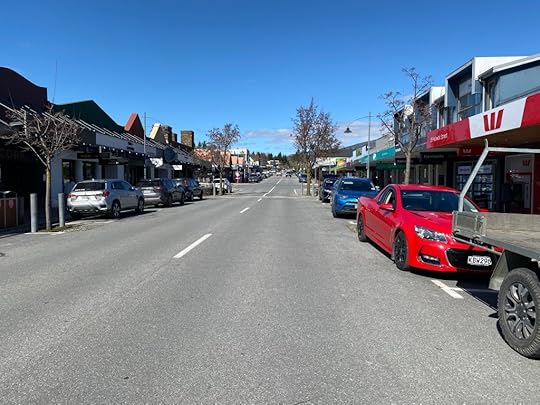
Day 14 – Around Dunedin and then Oamaru
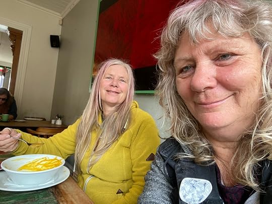
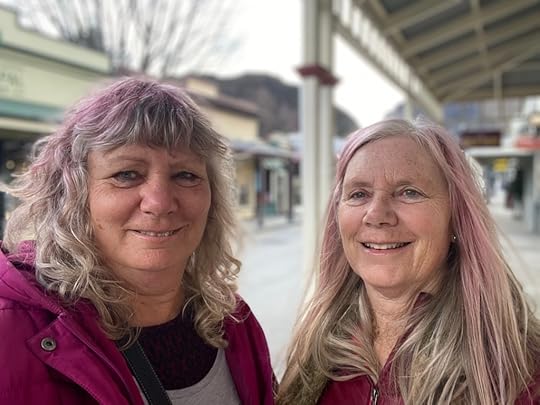
This was the last day with my sis in tow, and she is even now boarding for her flight back to Auckland. I miss the constant banter and the laughter.
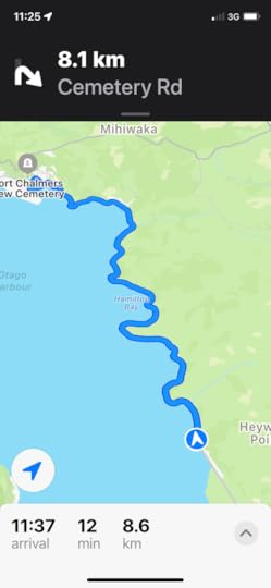
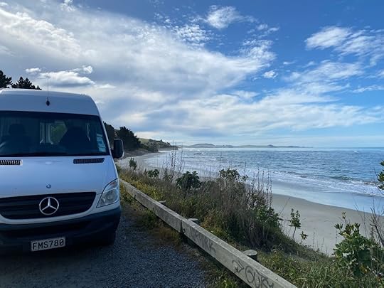
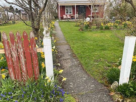
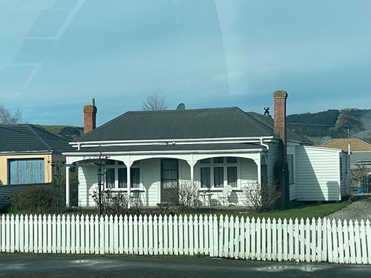
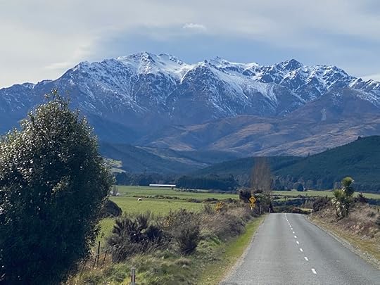
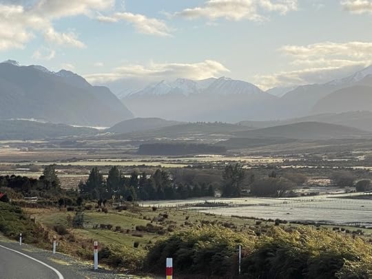
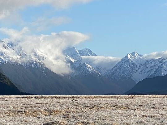
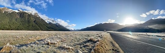
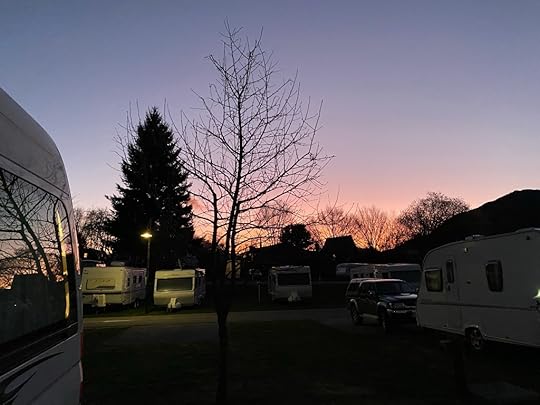
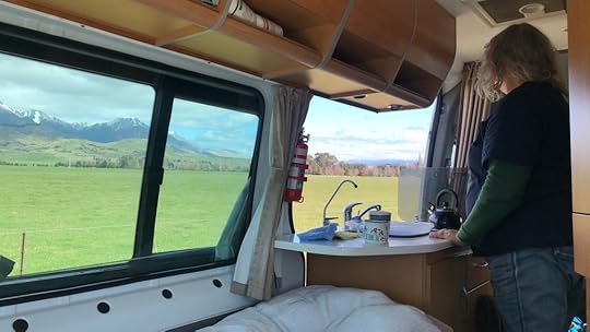
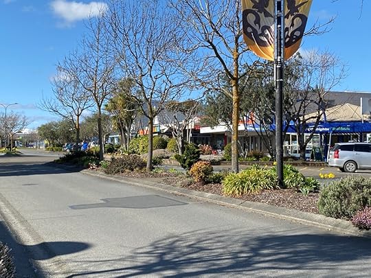
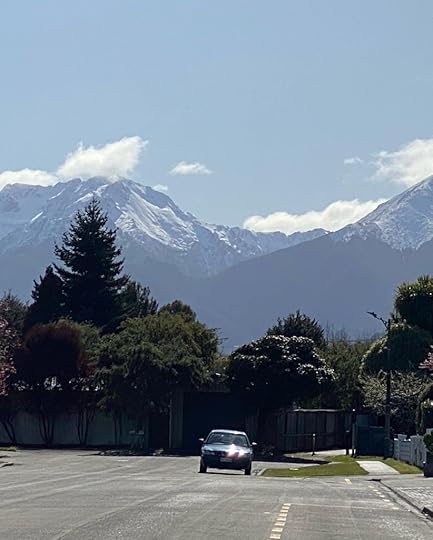
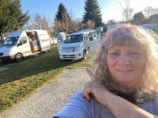
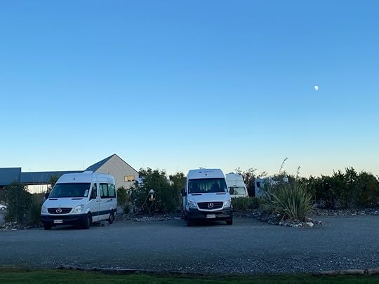
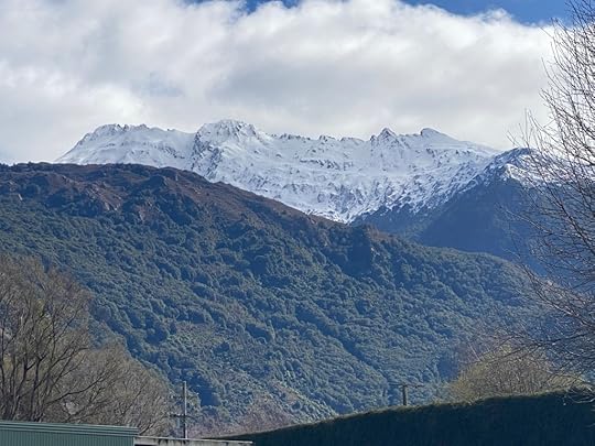
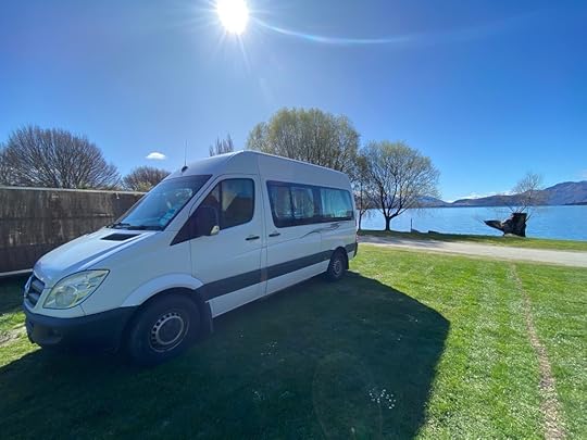
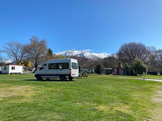
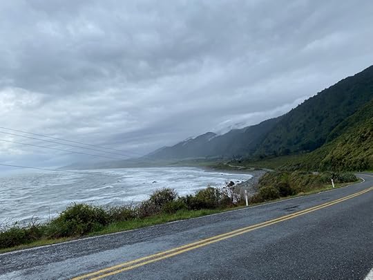
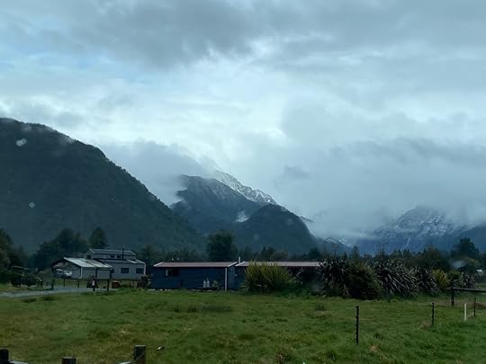
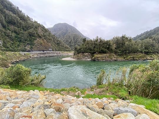
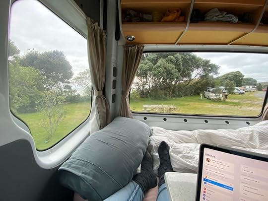
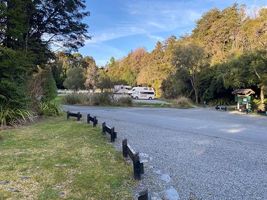
Our stay at the Dunedin Holiday Park was. . .interesting. I’ve become accustomed to a pretty high standard since I have been at mostly Top 10 Holiday Parks, although any that weren’t (Te Anau for instance) were still very good. The Dunedin one was decorated lavishly with bright topical cartoons and brands in the 1960s, and hasn’t been updated since, so things are fading somewhat, and the ablution block was like something out of a prison, with concrete corridor and puddles of water from leaking roof on the floor. Still, let’s not quibble – it was an EXPERIENCE, and we had our camper vans and were close to St Clair beach and the wee restaurants nearby. The morning broke greyish and looking like rain (and according to the weather forecast, it was going to come down by lunchtime.) So I cancelled my scheduled e-bike rental, and we sorted out Helen’s van so that she gave me a few bags to carry home with me, and took her carryon with her. We drove to deliver her camper to the owners who live in McAndrew Bay, halfway along the Portabello Road which hugs the southern edge of the harbour. (And the cycleway that is so promising).
 Holiday Park
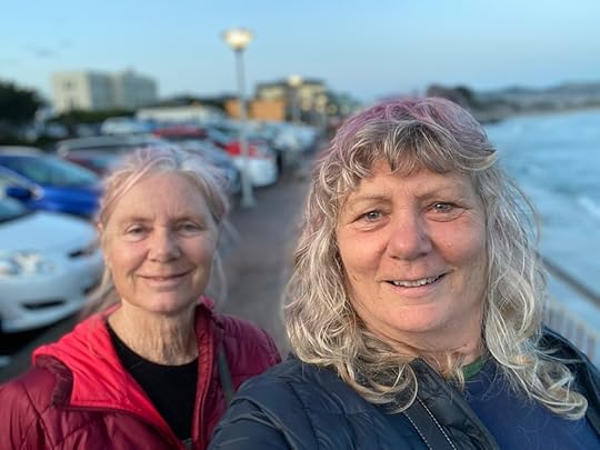
 Helen rides off
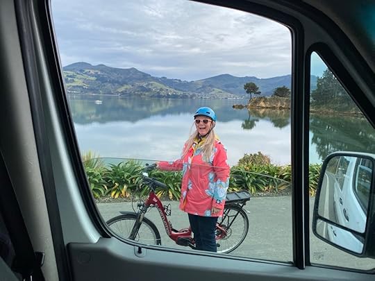
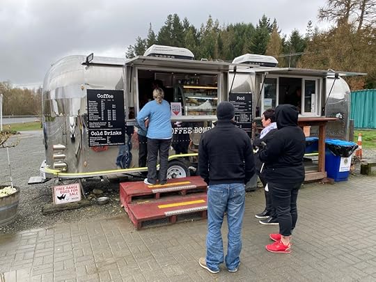
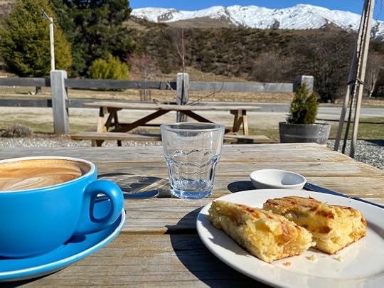
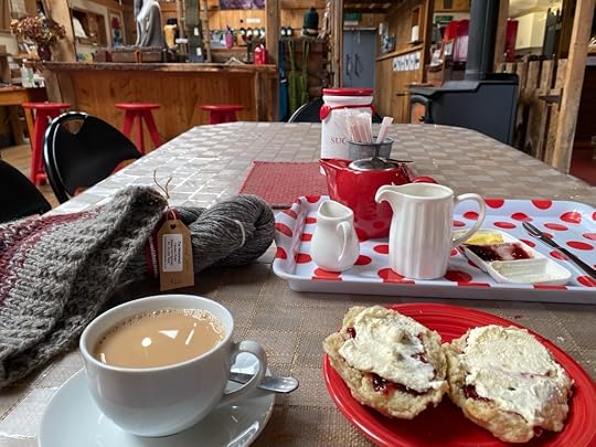
The owners live most of the way up a very steep hill which I forced poor Alfie to climb. I hoped his brakes would hold while I waited for Helen to negotiate the return of her vehicle and the borrowing of their ebike for a short while. They kindly offered to let her have a go along the cycleway, so I drove down to the nearby cafe – The Duck – and ordered a coffee and cheese scone to console myself. Soon Helen arrived to get her helmet out of the van, and head off towards Portabello.
 The Duck
I was so envious! The day had lightened, there was no wind, and the harbour glistened like a mirror. It would have been a task to drive in to the city to pick up the one I had ordered, so I just finished my coffee and decided to follow Helen. I caught up with her kms away – nearly at the end where the road disappears over the hill. Some roadworks forced me to stop at about the place she had arrived at, and we spoke through the window. “Why don’t you ride it back to that other cafe?” She asked. Wow. Sheer delight! And so I did – we swapped. I put the helmet I had brought with me from Auckland on, and rode that bike back. It was such a good feeling! At the Duck we stopped and I ordered another coffee, and Helen had her first. (We returned the bike on the way).
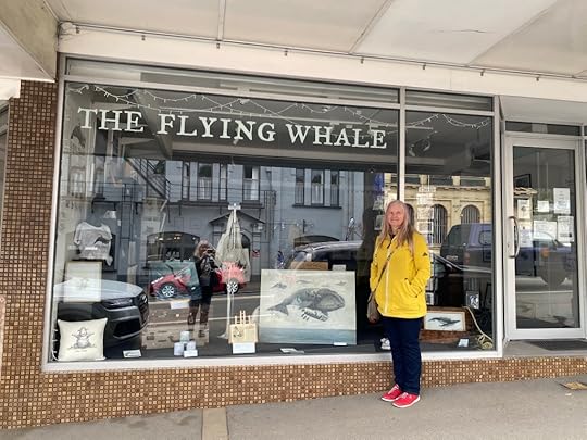
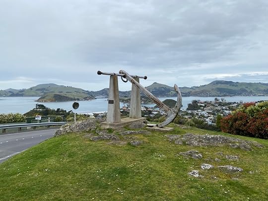
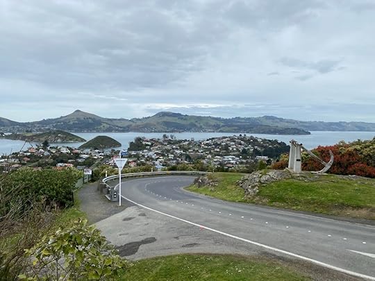
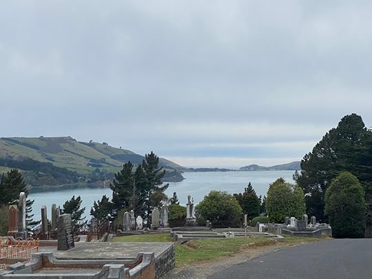
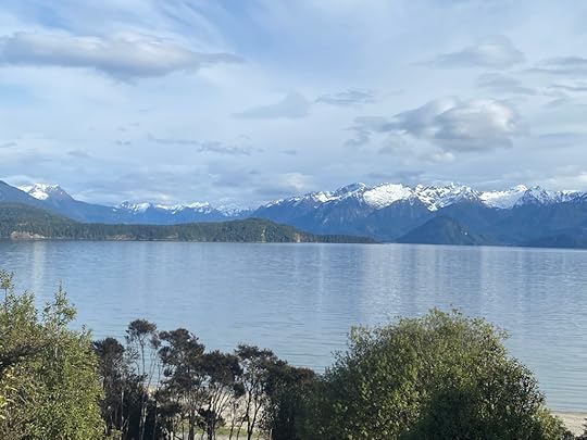
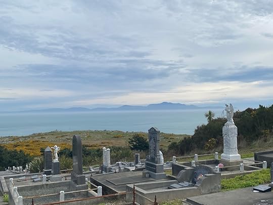
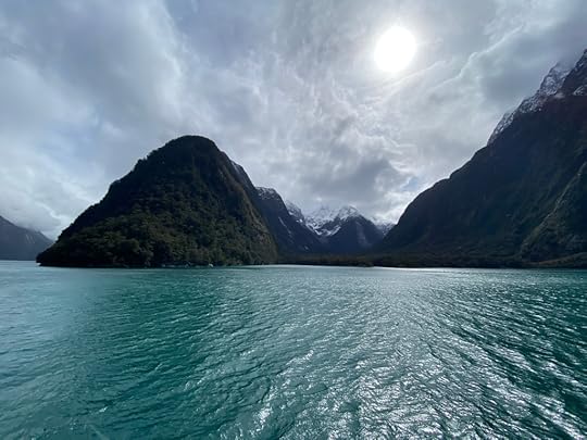
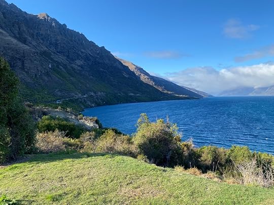
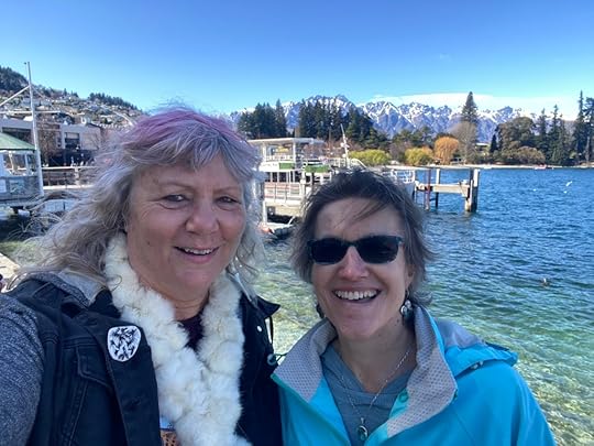
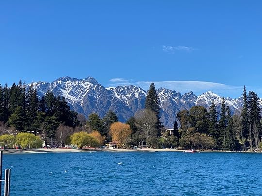
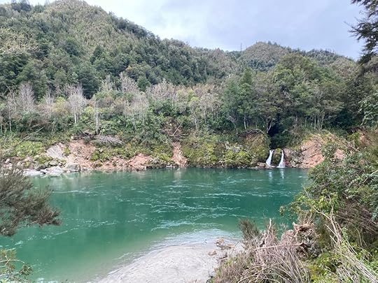
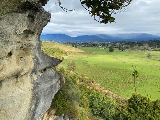
After that it was just a matter of me staying as long as I could before I needed to hit the road again, and Helen enjoying some sights around Dunedin before I dropped her off and she waited until early evening to get the shuttle to the airport. We went out to Port Chalmers, and enjoyed walking the closed shops (Mon and Tues are NOT popular days to find service). We found David Elliot’s shop ‘The Flying Whale’ which I have a print and book from. Unfortunately it was shut for Helen but we took a photo anyway. I drove her out as far along the northern edge of the harbour, past Deborah Bay and the historic hotel there, and out almost as far as Aramoana – but I didn’t want to go into that sad place. (Thirteen people shot dead in Nov 1990). The harbour was lovely in its deep aqua waters, and looked very clear. Out in the sheltered expanse the islands that dot this waterway were like jewels, in their green and bumpy forms, some dotted with brightly coloured houses. I think Dunedin has the prettiest harbour in New Zealand.
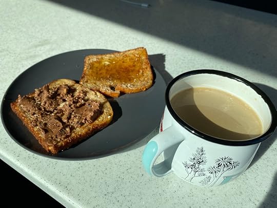
 Salad at Galley Cafe no
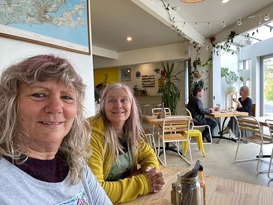
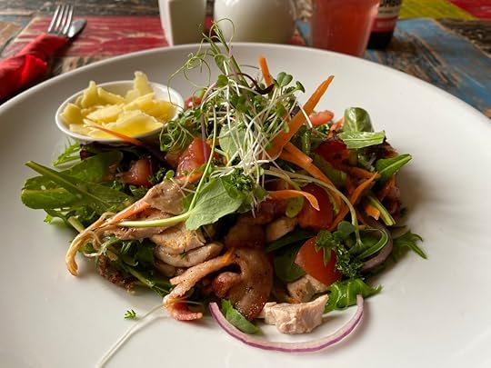
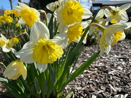
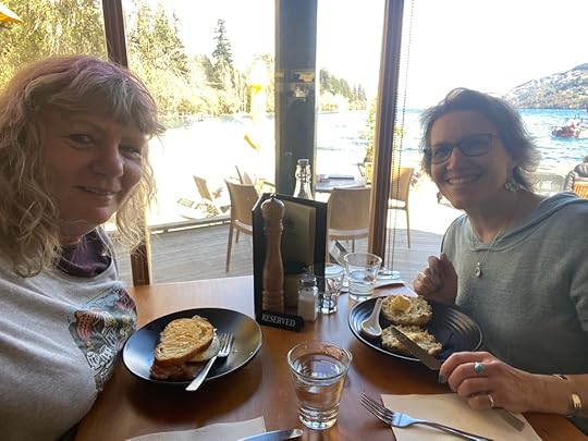
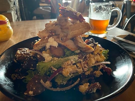
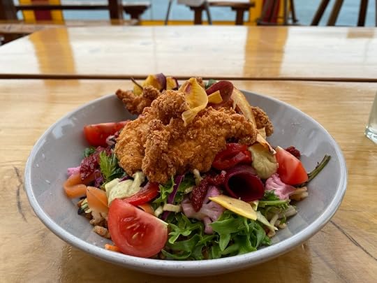
Back at Port Chalmers I parked, and we both headed in to the Galley Cafe, which looked very promising, with an outside patio area in back and an events room beyond that. The garden was flourishing with daffodils and magnolia, and a blackbird was building a nest just within reach of the patrons. I ordered a salad, which was delicious, and much enjoyed after days and days of only finding carb-rich food on offer. Helen had a pumpkin curry soup. Very friendly staff and a lively atmosphere make this a popular eating place.
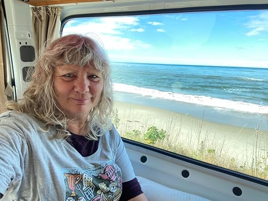
Now I took Helen up the hill on a country road to return to Dunedin – I had to face dropping her off at the Railway Station and heading north. At Iconic Cafe, she unloaded her bag and we hugged, and I left her standing and prepared to read and sip tea for literally hours. She went over to the Railway station and the gallery there, before returning to Iconic. Meanwhile I headed north towards Oamaru, and stopped on the way just after Palmerston on the coast, where there was a picnic place. I felt pretty tired, so I had the luxury of lying down for a short time and sipping my soda water. So far no rain. There was a lot of truck traffic on the road, but the scenery was pleasant and rural and the road not straight.
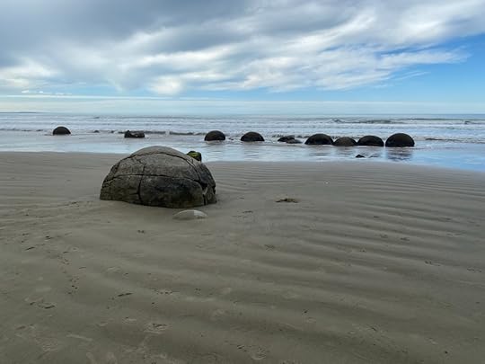
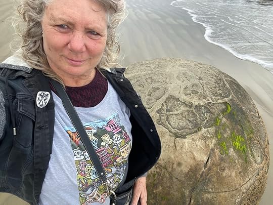
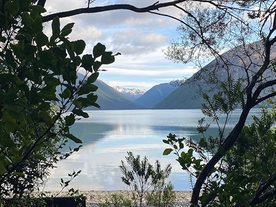
I reached Moeraki not long after getting back on the road, and enjoyed walking the beach to get up and close to the spherical boulders that Moeraki is famous for. These are formed due to the hardening of Paleocene mudstone, which was buried in the cliffs. Over time the waves have eroded the softer stone to reveal the spheres beneath. Very cool.
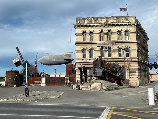 Steampunk hq
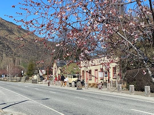
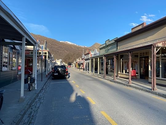
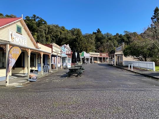
Only half an hour past Moeraki, I reached the outskirts of Oamaru, the Steampunk Capital of the World! (Don’t argue that with me). I attended a Steampunk festival here a number of years ago, with Helen, and we dressed in full regalia and enjoyed ourselves immensely amongst the Victorian buildings and steampunk memorabilia. Check it out.
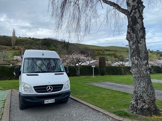
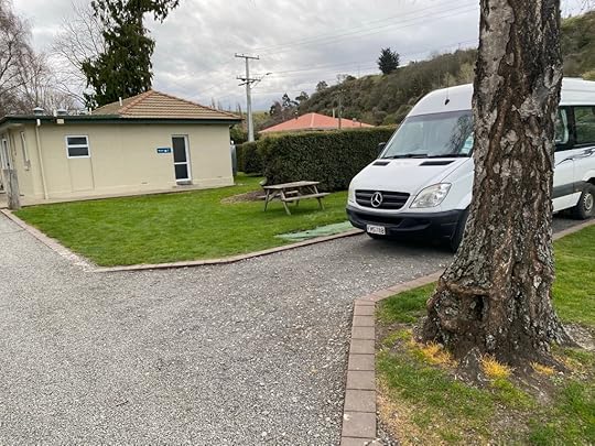
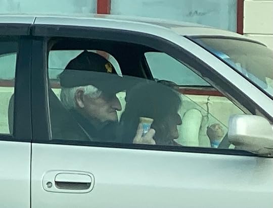
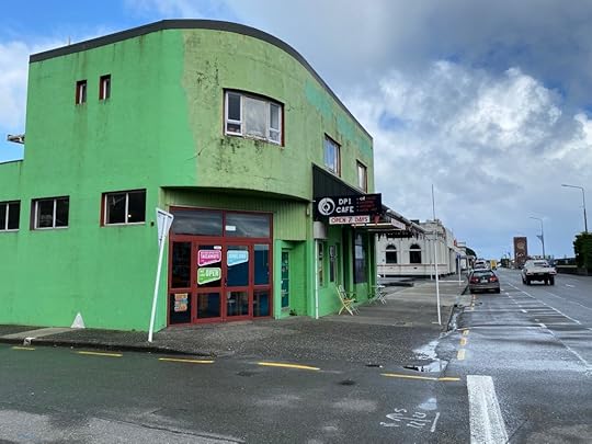
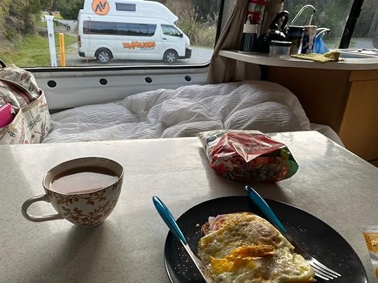
It was 3.30pm and I looked to my side from the driver’s seat, and there parked opposite were an elderly couple licking ice creams outside the dairy they had purchased them in. That was enough for me – I was in there and getting my single cone vanilla and doing the same shortly. Then I drove to the Top 10 Holiday park and booked a powered site for the night. Oh, and a spa! Only after I had, did I get informed that the yellow eyed and blue penguins all are nearby and if I’d booked at the ocean holiday park they would have crept up to sleep under my van at night. Sheesh. I have consoled myself with my spa, and am about to put together a salad from the remains in the fridge. It didn’t help that when I bit down on a gummy supplement it ripped off the front of one of my molars. Still, I think I can make it back home without needing an emergency dentist.
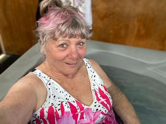
Ho Ho! This is the life for me!


September 19, 2022
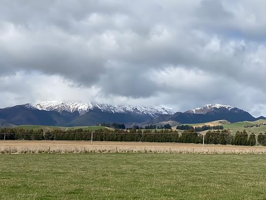
Day 13 – Curio Bay to Dunedin
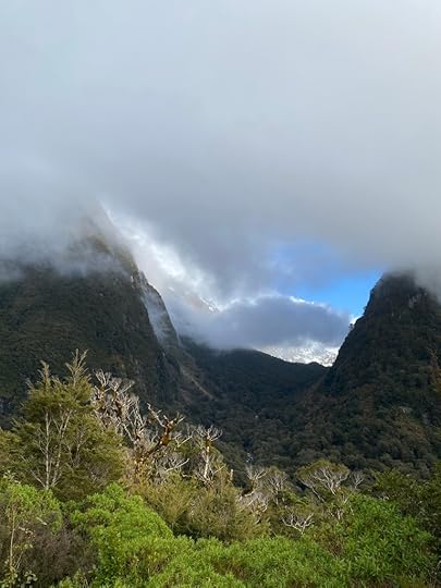
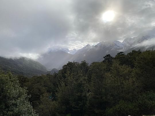
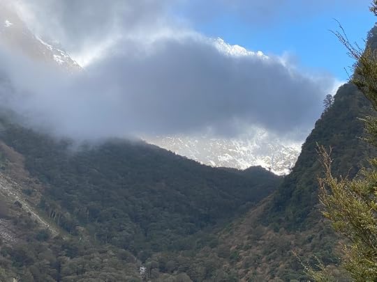
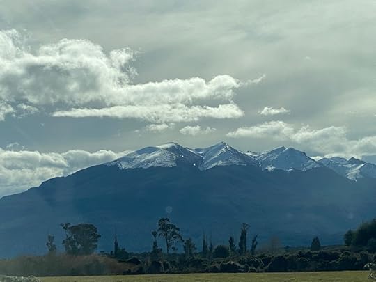
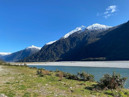
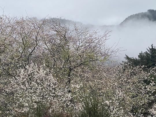
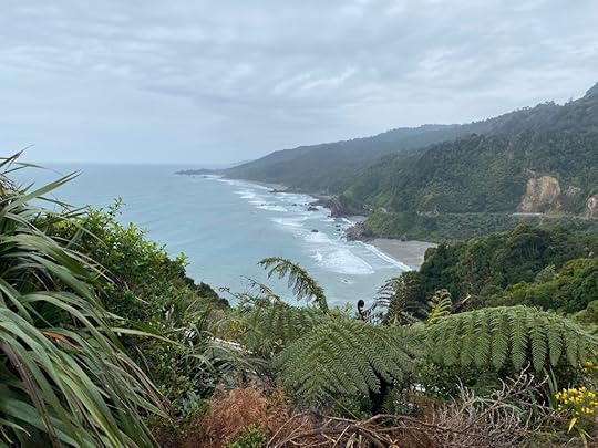
It was lightly showering this morning upon waking – after a windy night – and remained grey with scattered showers most of the day. It did not matter too much. We have had such great weather around Queenstown and Fiordland so getting a grey day for Helen’s final leg of the journey when the mountains were behind us was not bad. The caitlins area is pretty in a foresty rolling hills kind of way.
 Farewell Curio Bay
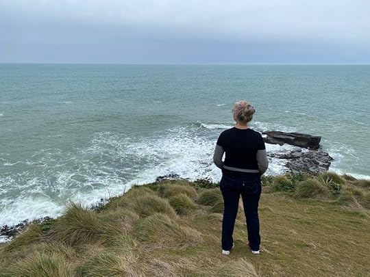
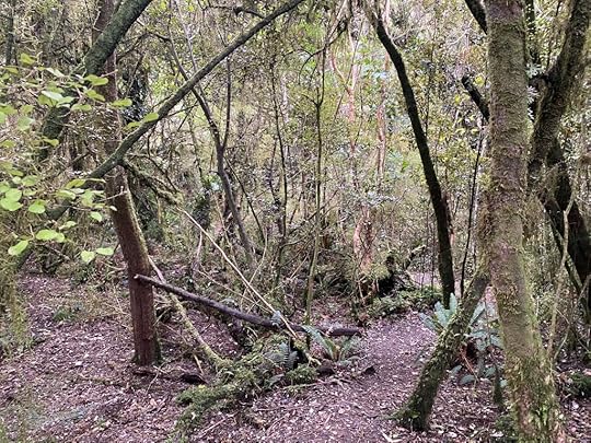
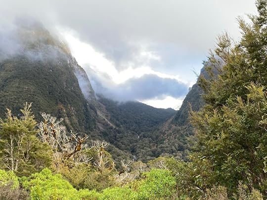
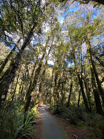
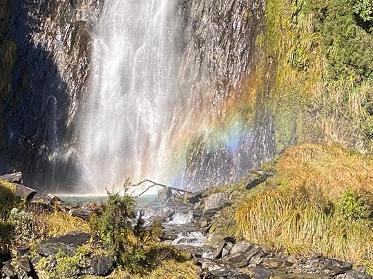
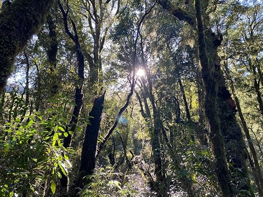
We wound over and around a foresty inland road aware that the coast was not far away. A few times on the trip today we saw signs to waterfalls but upon closer inspection they proved to require 30 to 40 minutes of bushwalking in rain so we did not partake. Instead I took photos of the bush.
 Tolkein would love this
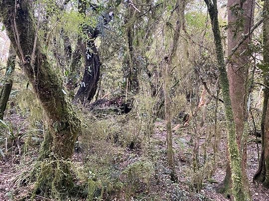
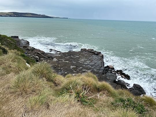
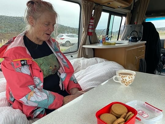
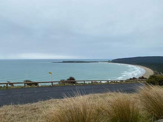
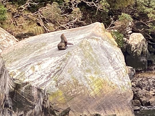
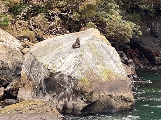
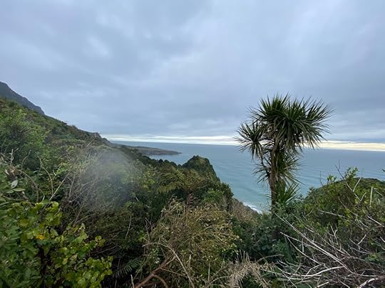
I have grown accustomed to my sister joining me in my larger camper, and we have cackled over the slow encroachment of her from her smaller, less commodious van into sitting on my bed waiting for cups of tea. Hilarious! But yes, I will miss her after she flies back tomorrow. The pic below shows some of the coastline when it came in to view. All the way up this section there are possible seal or penguin sightings. Watch this space.
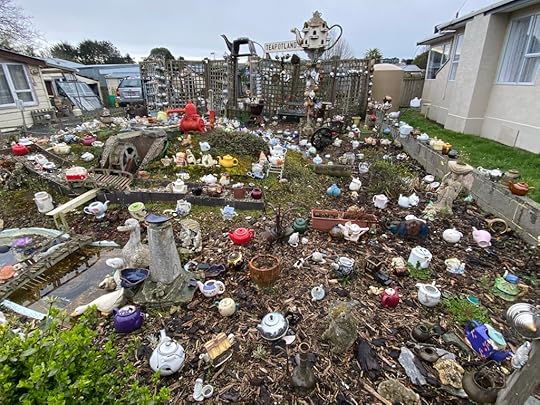
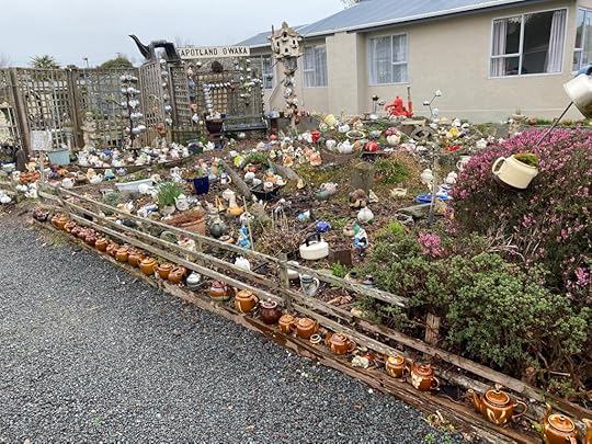
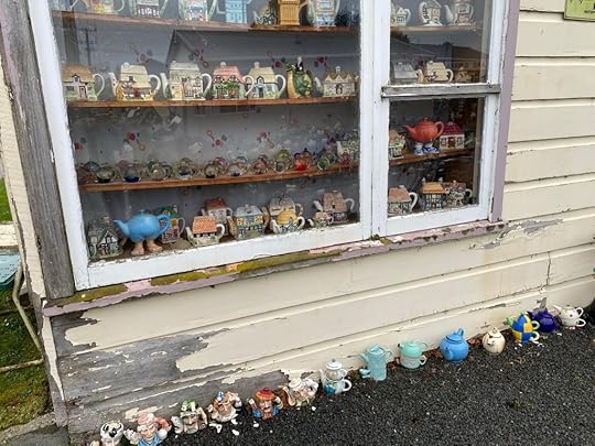
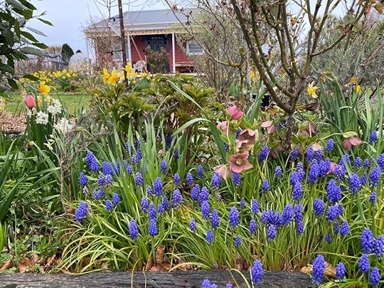
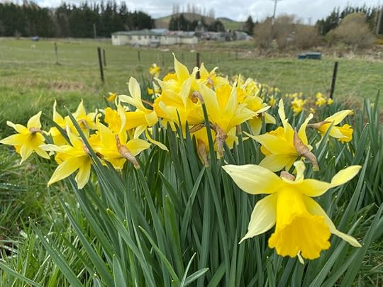
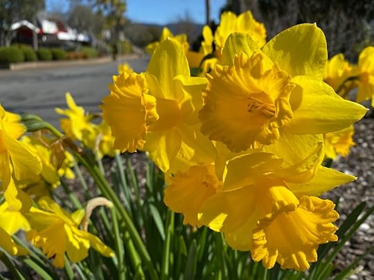
At Owaka we found a Teapot Town – I’ve never seen so many. We had an excellent coffee made for us by a young chap who had a shop serving only coffee (no food). Across the road we attempted to find something appealing but the limited array of cabinet food was unappealing so just gave up. Here too was a house with a garden bursting with daffodils and bluebells.

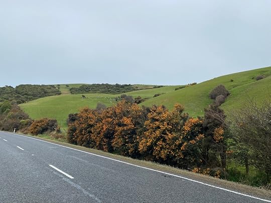
I love the richly coloured bushes that dot the hillsides.
After a long drive – pleasant in its varied landscape and winding around bushy reserves – we began to reach level ground and long stretches. Finally we reached Balclutha and all semblance of country road disappeared and became highway.
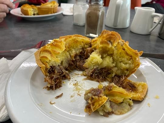 A lamb pie
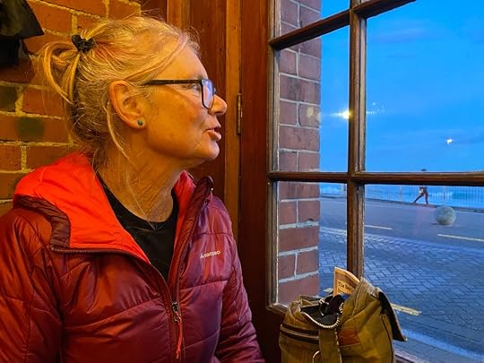
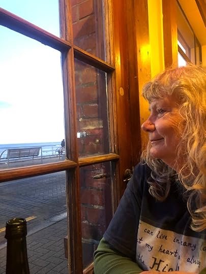
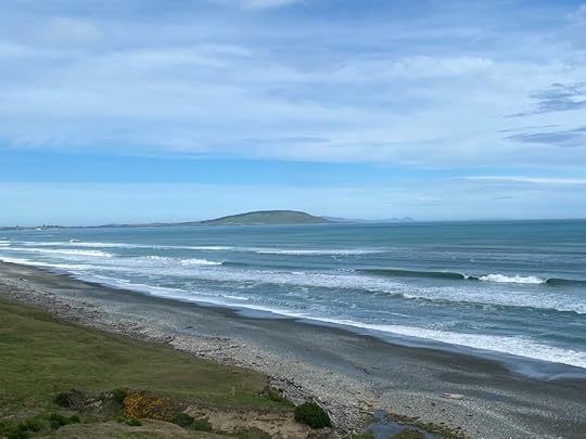
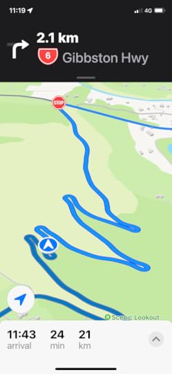
Stopped for a lamb shank pie and braced ourselves for the last push into Dunedin. Nothing much to report but long straights, fast speeds and encroaching suburbs. I had set my Apple Maps for the Dunedin Holiday Park – on the same side as St Clair beach, and at 3.30 we pulled up outside the office. For a mere $35 Helen and I are in two sites near amenities and feeling a little sad to be parting tomorrow. It has been an excellent 6 days in each others company and around our favourite part of NZ.
 St Clair
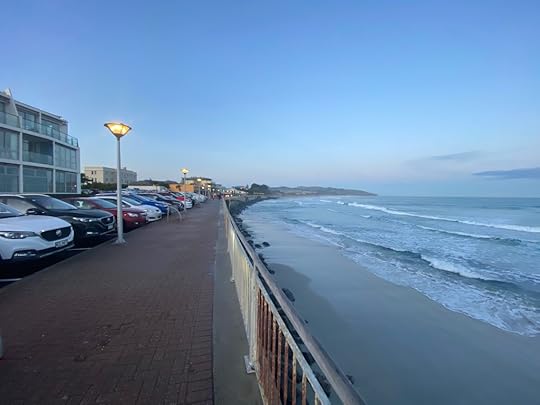
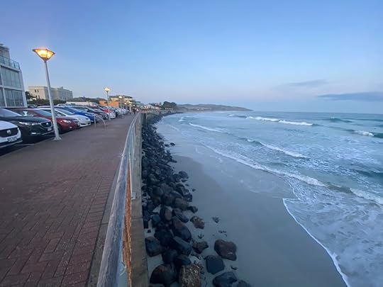
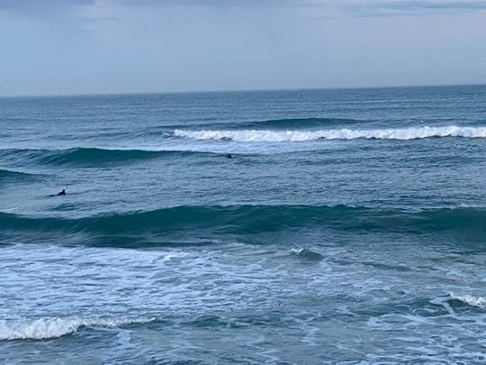

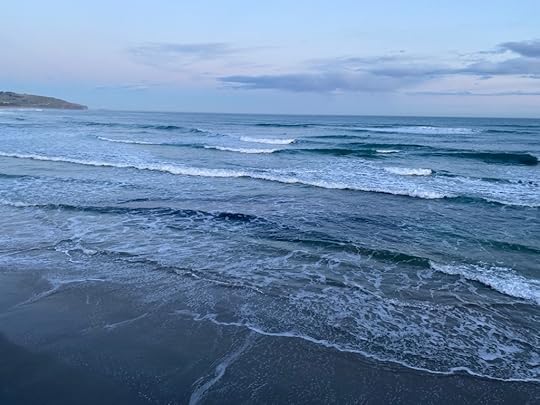
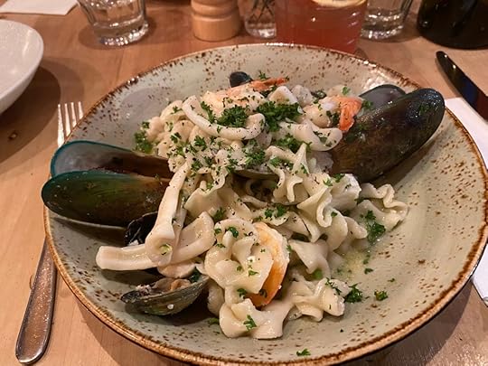
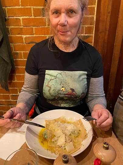
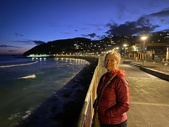
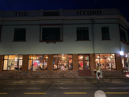
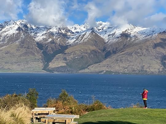
We’ve been down to St Clair for a final meal together – two excellent pasta dishes at The Hydro. The pastel light looked amazing over the ocean and the few surfers braving the waves. Coming out feeling very happy the atmosphere was charming.
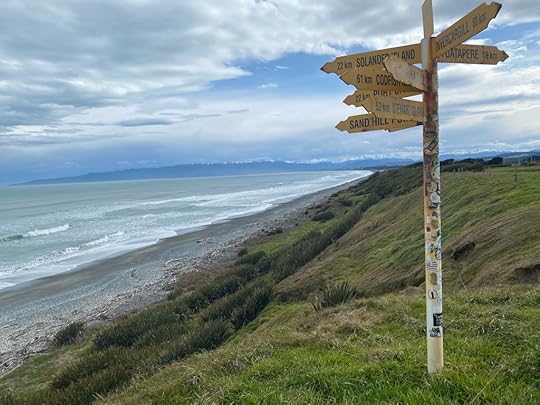
Tomorrow we plan to ride bikes around the harbour cycleway and have lunch before parting ways.
September 18, 2022
Day 12 – Te Anau to Curio Bay
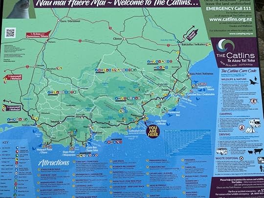
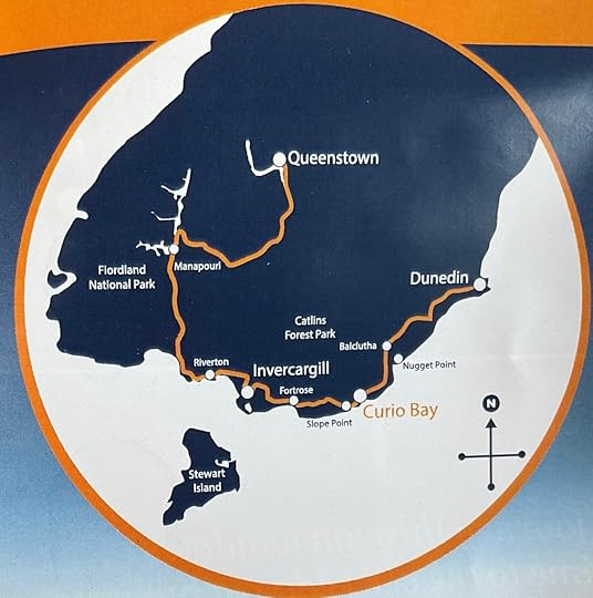
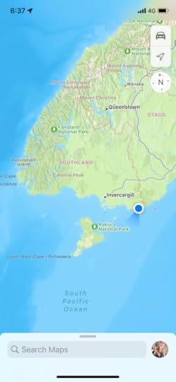
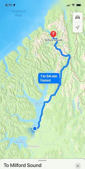
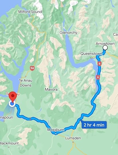
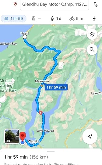
Yesterday I didn’t have it in me to post after a gruelling drive from Te Anau, down through Manapouri, and Tuatapere, to Riverton and Invercargill. We had a bit of lunch there, and decided to go straight down to Bluff to see the bottom of the South Island and the port to Stewart Island. After that it was a drive east along the edge to get to the very bottom right corner and Curio Bay. This map does a good job of showing the route, if you take it from just above Manapouri and finish it at Curio Bay. Today (Day 13) we completed it and arrived at Dunedin.
Yesterday I posted all the pics on Facebook, but I’ll add a few here to keep the blog ‘true’. Manapouri was spectacular. We got out of the vehicles a few times just because the sight of mountains behind the lake was breathtaking. Stopped for a coffee and sausage roll at the wee cafe, and found out where ‘The Bookseller at the End of the World’ lived. See this link: https://www.stuff.co.nz/life-style/128145725/the-bookseller-at-the-end-of-the-world
Ruth Shaw has the cutest little bookstores in Manapouri – a children’s one and a small general one, and Helen had been reading her book on our travels. Jemma, her daughter, manages McLeods Booksellers in Rotorua and recommended it. We knocked boldly on the house door, despite the sign on the shop saying ‘closed’. No one answered but a handy pad and pen sat there, so we wrote a quick note.
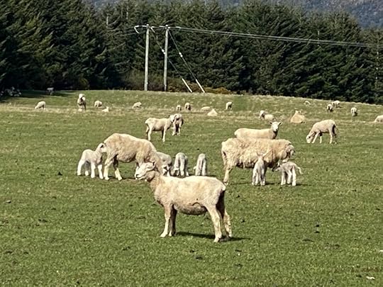
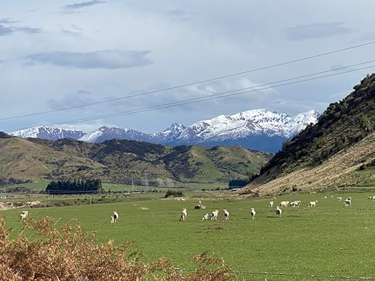
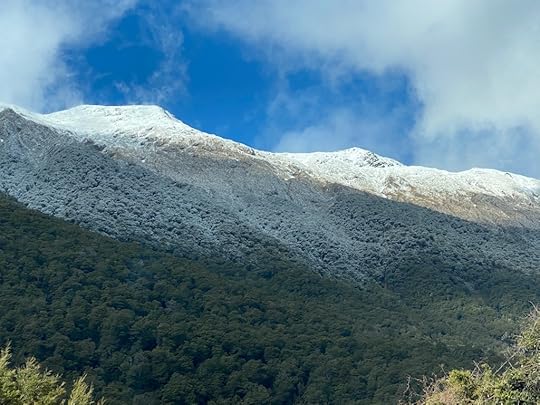
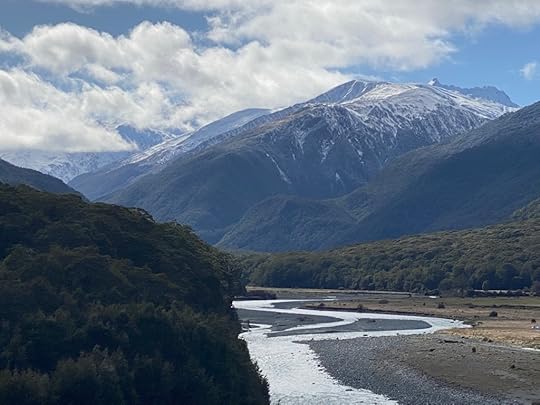
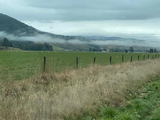
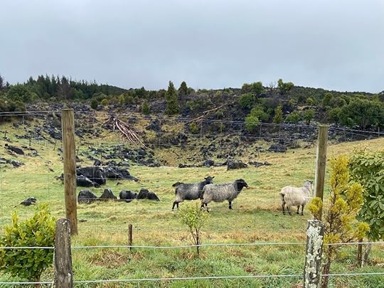
We carried on south, loving the mountains still with us in all their glory, with snow capped peaks and rich colouration on their slopes. Added to that was the reflections and glistening of the lake below. As we continued along toward Tuatapere, we were surrounded by pastoral scenes of young lambs frollicking on green fields all around. At one stage we pulled off to photograph them, and a farmer pulled in and spoke to us. He agreed with us that it was a pretty idyllic spot to live.
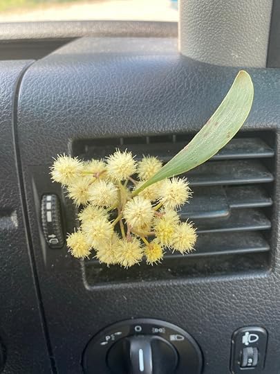
It was with growing sadness we saw the mountains recede behind us, but the line of dark shapes to our right which was Fiordland, stayed with us until we reached the sea. We found a swing bridge which was closed off to traffic at Otautau, and a sharp sweet scent caught our interest – a yellow wattle by the first girder. So lovely to smell. I took a small twig of it back with me. At Tuatapere we stopped for a ‘Deep South’ ice cream – a brand sold in Auckland but it felt very appropriate to have it in its place of manufacture. This little town had broad streets and a few significant concrete/plaster buildings which dated back some time. In a blink we were out and rattling south once more. (Rattling is what best describes life on the road in a camper van).


I was surprised to find that the mountains of Fiordland were still a significant presence when we reached the lowest reaches of land and saw the chilly waters of Foveaux Strait before us. It is about 130km long, and separates the South Island from Stewart Island. And there, before our excited eyes, was the first glimpse either of us had had of that third large island of New Zealand in the flesh, so to speak. For quite some distance we revelled in the wild ocean, the distant island, and Fiordland, all visible together.
Soon, with sinking heart, we put Fiordland into the rear vision mirror and pointed along some straight roads for Riverton, which is a large town that precedes Invercargill. My workmate, Julie, came from here, and recommended it to us. At this point we decided we wanted to push on to past Invercargill to stay the night, because we needed to get to Dunedin by Monday night, so we merely stopped and took pics. Half an hour later we began the drive into the suburbs on the outskirts of Invercargill, which is the largest city in Southland, and one I’ve always wanted to see. We came in on a broad avenue which went on and on, with a picturesque garden entrance on the right hand side, and many blossom trees and flowers on each side. The sun shone down and added a certain summery holiday feeling to the place and we both had a very favourable impression of the city. Closer in, we found the old buildings and town centre, all pretty buzzy for a Sunday afternoon, and parked on one of the main streets and set off to find dinner, or lunch, at 4pm. This felt like Auckland back in 1960s, when you all came in to town for food or drink and the old buildings were still there.

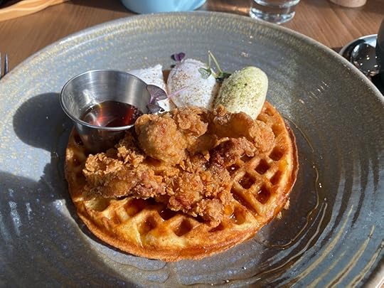
We found a cafe that was popular and filled with a crowd, and sat down to an odd plate of waffles, covered in a couple of poached eggs, two deep fried chicken nibbles, some soft cheese, and maple syrup. I don’t think it quite ticked our boxes, but I ate all mine. The thing I’ve noticed about being on the road, is how difficult it is to find healthy food to eat – hardly any salads, except the coleslaw you can buy in packets at a supermarket. Anyway, it was nice to sit down and stop driving.
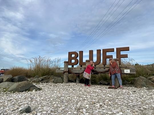
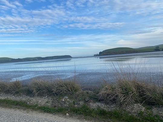
After replenishing ourselves we drove to Bluff, a half an hour away, and enjoyed the view of the bottom most port in NZ. It is the oyster town as well, as evidenced by all the shells underfoot by the large signage at the entrance.

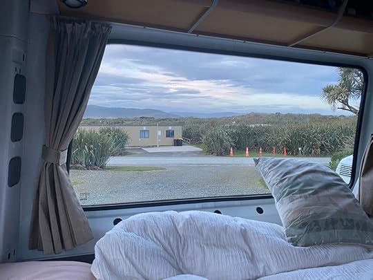
We were both getting pretty tired by now, but determined to get to Curio Bay in time to get settled for the evening. It was dusk, and the road was pretty good in a wandering kind of a way, and long after I thought we would get there, we came upon the metal road over an estuary, and pulled in to a large information centre and office. It was closed of course, being now about 6pm. However, we booked online and called, and received confirmation and given the choice of places to park within a certain range, and soon had backed into a couple of bays near the ablution block.
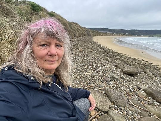
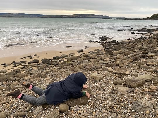
To our mutual delight we discovered this was a visiting point for seals, penguins, and occasional whales. Naturally we spent a bit of time in the dusk staring hard at the rocky beach and hoping to see something move. We were disappointed but still enthusiastic. The next morning Helen was up early and out there with the dawn, but saw nothing. When I took over the ‘shift’, I also spent time staring at the sea hoping for a sleek wet head to appear, but failed to see anything. Sigh. So I had to do something to mark the moment.
 [image error][image error]
I have already started telling you about the next day’s activities so I’ll stop now and begin again soon, with Day 13! I know you’ll be on tenterhooks. . .
September 17, 2022
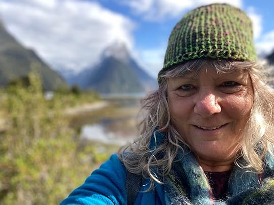
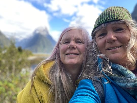
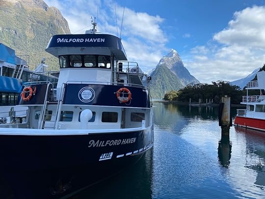
Day 11 – Mitre Peak, Milford Sound
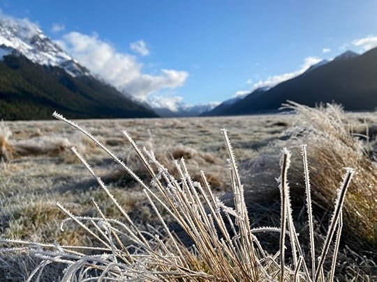
Helen and I really wanted to make a day of this trip, and to that end had an early start on a frosty morning, having been told by the RealNZ guy that it would take 2.5 hours to get there. (Including the walk to the boat at the end). So we were up at dawn, packing our similar packs, wearing similar hats and the same shoes. Layer upon layer of tops through to puffer jackets and raincoat, and gloves, hats, and insect repellant. In the end, apart from the raincoats, we needed it all.

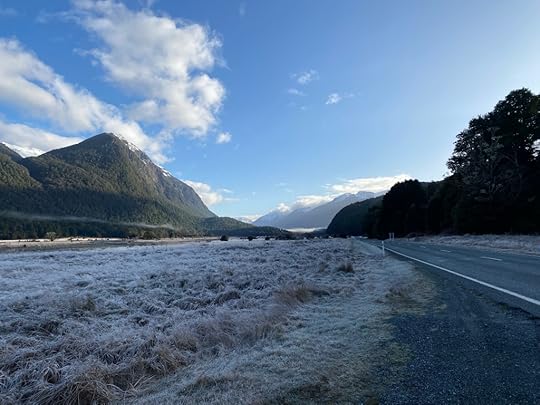
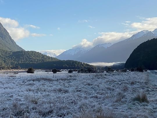
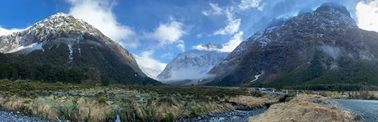
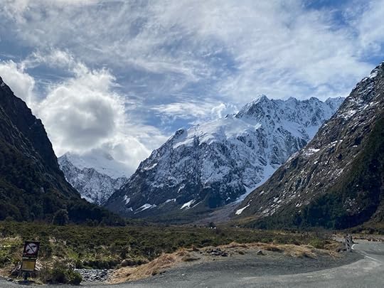
The day just got better and better. From the frost that added a sheen to the fields and verges that we passed, to the gradually closing in mountains on every side, we were captivated. It has been a long time since I enjoyed seeing a proper frost, since Auckland has warmed up over the years. This time we pulled over and took photos of the distance and the fields sparkling in ice and were very glad we had chosen to get up early and make for the 11am sailing. Here’s the distant frost laden fields from the Eglinton Valley area. A number of DOC sites are sign-posted for campers to use, but of course, it was hard to imagine the attraction in the cold light of a frosty morning. (The tent signs I mean).
The road to Milford Sound is not that bad – lots of long straight stretches from Te Anau, and slowly curving sections that hug the river or lake edge. A few single lane bridges, and plenty of pull over spaces to stop and take pics until you get into the mountains, when they were replaced by yellow signs saying “Do not stop – Danger of Avalanche!”


To our mutual joy, about 3/4 hour into our drive, there was a small caravan selling coffee in a leafy glade, and so I screeched belatedly to a halt and backed up. At this point we met an Australian woman, who was with her sister and sister’s husband, heading out to the same boat trip. Back in the van we proceeded with much oohing and aahing at every moment the trees parted to see the increasing layers of sharp snow clad tips of mountains getting closer and overshadowing the road. The weather had been very kind to us. Just a bit overcast at times, but initially it was blue with puffy white clouds obscuring some of the mountain tops. Very beguiling indeed.
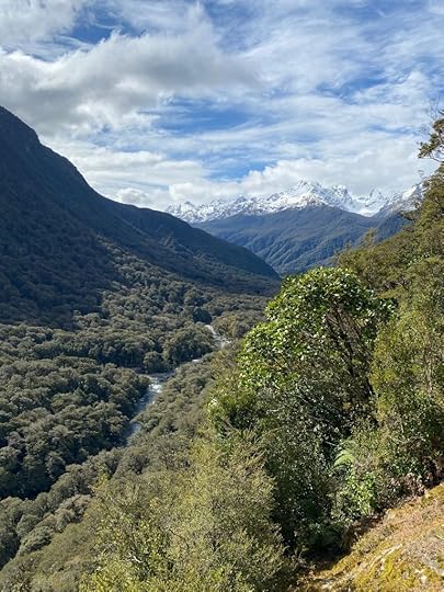
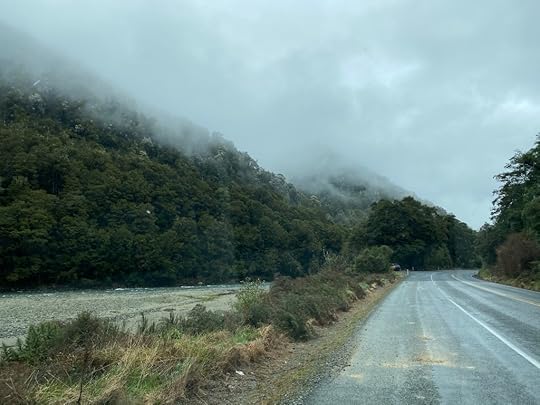
We began to encounter road works from a flood and rain in 2020, when slips had torn away at the tarmac in places. It meant one lane and a traffic light system which slowed us down a bit. We climbed gradually up into the mountains, stopping when we could to take photos. Suddenly in front of us was a small hole in the side of a vast mountainside, which proved to be a tunnel. Who knew!? Heart in our throats, we moved into the single lane tunnel, which ran for 1.4 kms through the mountain in a downward slope with dim lights. My headlights were on, but seemed to have no effect. Hearts racing we watched the gradually increasing light with a sense of relief! Knowing so much solid rock was just above your head was oppressive. Out in the daylight, we entered a world of sharp defined angles and gigantic shapes. Now the road zigzagged down sharply, and our ears popped as we levelled out at the bottom, one eye on the road, and one on the immense walls of mountains, dappled in the lower reaches with moss, and small clinging plants. We had to strain to look up and see where the slopes disappeared into the cloud above.
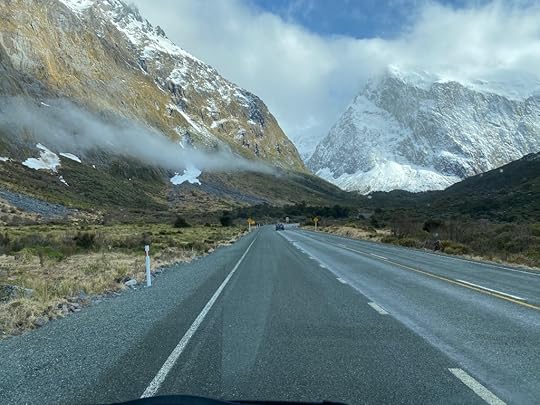
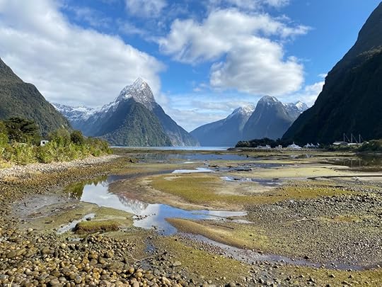
At last we found ourselves approaching signs to Milford Sound, and the sound of helicopters and air traffic. Only two hours to get there at most, so the 2.5 we were told was generous. We drove to the info centre but found the parking there was $25 for five hours, and thinking we needed the exercise anyway, we drove back to the free carpark. Getting out of the van we were both instantly swamped by the infamous midgies (sandfiles) that this place is known for. I got out the repellant and sprayed it liberally on, and then we set off on a pleasant pathway toward the info centre and then the small harbour where the boats are. About 30 minutes walk in all, and past the small aerodrome where helicopters and light planes seemed to continually descend and take off from. We stopped to take more photos from the walk – the most famous spot for many of the Mitre Peak photos I’ve seen.
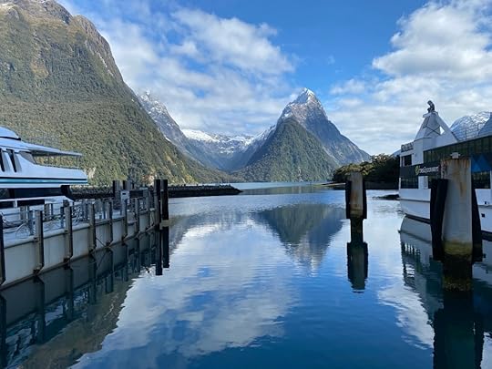

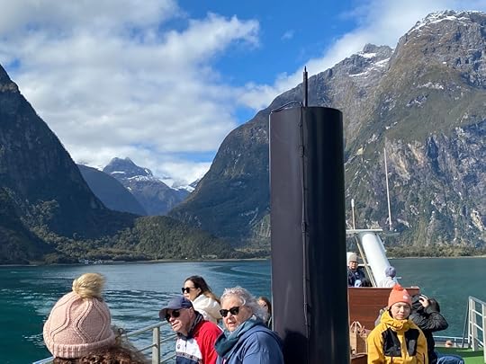
The little departure and arrival centre was bustling, and a few large scenic cruisers were lined up to take passengers. There we saw our Aussie friends from the coffee cart, who would join us on our boat. The weather was not as blue as it had been upon our morning departure, but it was clear enough to see the mountains, some of which were hidden in cloud at the top. It was very cold and before long, because we both sat on the top of the boat to take in the best sights, we had all our warm gear on, including hoods over our hats and gloves on.
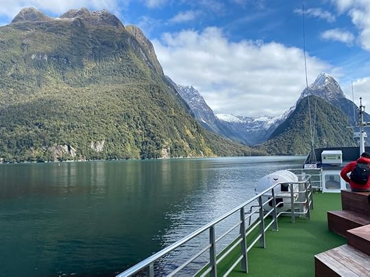
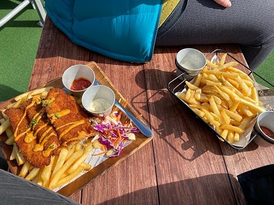
We purchased some lunch from the downstairs deck and waited for the buzzer to go off to go down and get it. My chicken and chips was very warming but needed to be held firmly or it would have been blown away. Helen had chips, but the portions of both were so generous, we could have shared mine. We had a pleasant commentary, a guy who told us some of the history of the place and the remarkable details we would have missed on our own. The boat went up to the wall of rock at one point to allow us to see the moss, lichen and other plants clinging to the sheer rock wall. When we came out into the Tasman Sea, the wind had picked up and the waters were choppy enough that not even my layers were keeping the cold off. Fortunately we didn’t linger there for long before turning to enter the mouth of the Sound again. From out there at sea, it looks like a bay, and you need to come in close to see how it opens out into the Milford Sound as it became known.
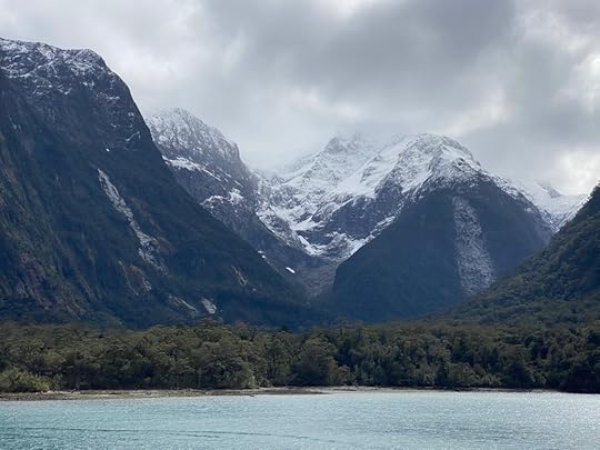
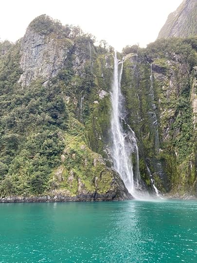
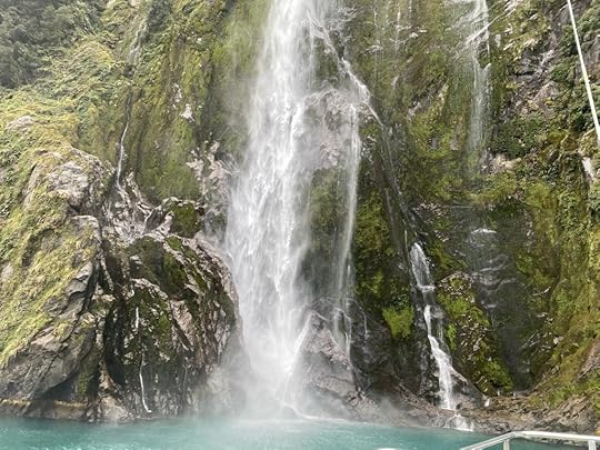
I’m going to let my pictures do the talking for me regarding descriptions. They do not do it justice either, for these mountains were too big to contain in our photos, and their inspiring size and colours were lost a little in a small iphone shot. Imagine rounding a bend in the very deep turquoise waters, and gazing up at the dark stone faces, with multicoloured rock walls, and greens of all colours dotted all over, and seeing a long white fall of water roaring down from extraordinary heights to the sea below.
At one point we had the seal pointed out to us from ‘seal rock’ where they sometimes bask in the sun. This one waved his flipper at just the right moment.
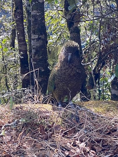
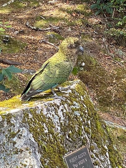
We clicked, we hunched in the lee of the seat we were on, we stared, we gasped. It was all so worth the trip out. Back on land again, we pushed through throngs of people arriving for the afternoon sailings, and also those who had arrived by air. Going back along the path past the aerodrome, we watched a line of small planes waiting to take off, and a helicopter about to rise. We were only too glad to have come by road, and to have the chance to see at close hand the vegetation, the streams, and the BIRDS we had just heard about. Yes, the boat guy told us about the keas who we would likely see up by the tunnel, and so we kept a look out. Great was our elation when two fat kea waddled out and past our van as we waited our turn to go through the tunnel. Such friendly birds, with green plumage and a red flash of feather under the back feathers.
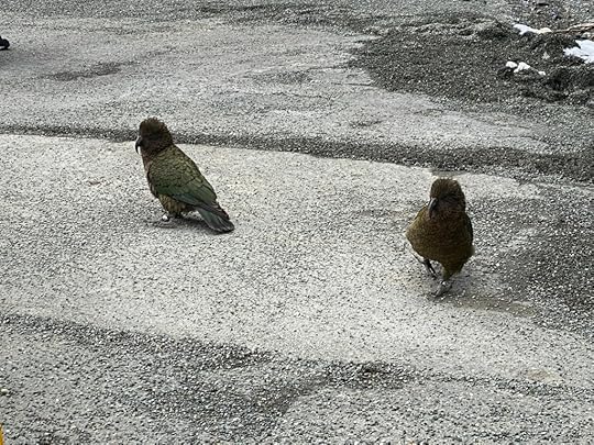
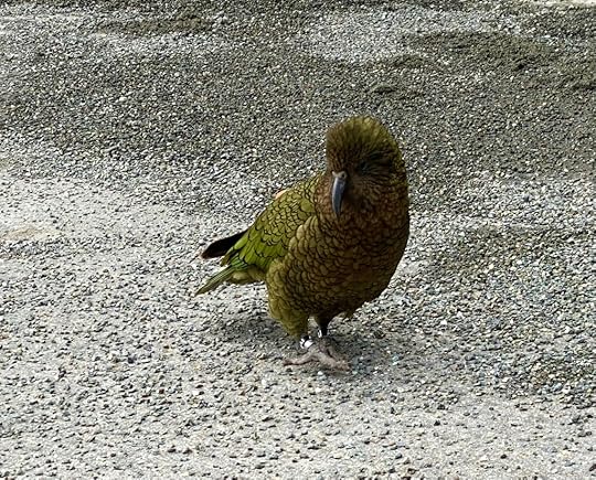
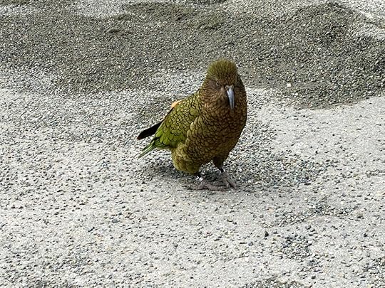
Through the tunnel we went up to the highest part of this road, and then we slowly began the descent. This time a lot more cars were on the road, and we stopped as often as we could having more time to get back than we had in the morning. Not far from the tunnel we stopped to take pics, and hadn’t stepped out of the van when Helen exclaimed, “Oh, hello, look at you! Where did you come from?” She was talking to another kea who had wandered out of the bush by the van door and looked up curiously at us. I got out and took photos, and it posed nicely for the camera. Before long it was the centre of some excitement from the other cars in the area.
The sky lightened as we descended back towards Te Anau, and the mountains looked very different in the afternoon light, with no cloud obscuring their sharp shapes on the horizon. We had a cuppa in the van in a car park out of the slopes, and beside a flowing river. Then soon after, found ourselves on the home stretch for Te Anau. Very happy to get here and relax, and look at our photos, and feel thrilled with how the day had gone. I think they speak for our happiness.
September 16, 2022
Day 10 – Arrowtown to Te Anau
So nice to have company this morning upon pulling aside the curtain in my camper. A person in a smaller vehicle parked beside mine suddenly twitched aside her curtain to look out and grinned foolishly at me. I put the kettle on.
 Arrowtown Holiday Park
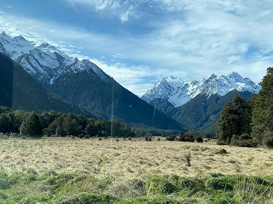
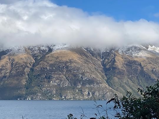
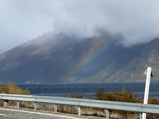
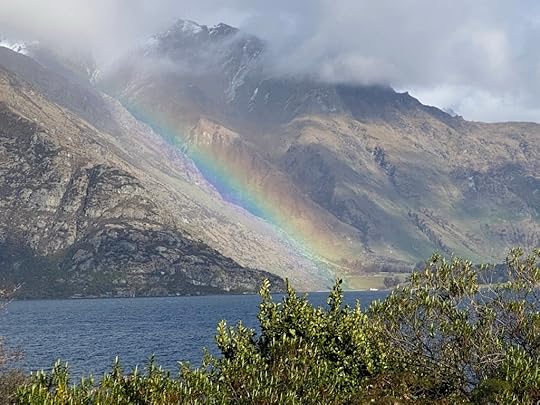
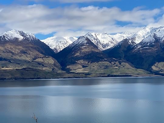
Before very long we formed a convoy heading out of Arrowtown towards Queenstown, and with confidence I allowed Mr Apple to lead me to the nearest petrol station. Silly me. I had apparently ‘arrived’ at the station but all there was was a long hedge and built up cars behind me all trying to get to work in Queenstown. Not a building in sight. So I searched with my own eyes and found the visible sign eventually and pulled in to fill up on diesel. Amazing how much fuel you go through. Then we veered south and hit the road that hugs the lake heading towards Te Anau. We decided that since we wanted to go to Milford Sound, we needed two nights in Te Anau, as it was a full day to drive out to the Sound and back. The drive beside the lake was beautiful, if overcast, but once again, the clouds on the snow-topped peaks only added to the mystery and glory of the mountains all around.
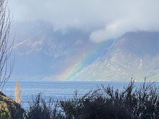
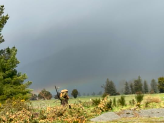
Further south the clouds had built up more, and we chased rainbows on the distant slopes – their loveliness drew us to stop a couple of times to try and capture them.
A small town at the bottom of the lake – Kingston – is the home of the Kingston Flyer, a steam engine that used to operate out of the town. It has apparently started up again, but I could only see a few carriages and a diesel engine. Looked very promising though.
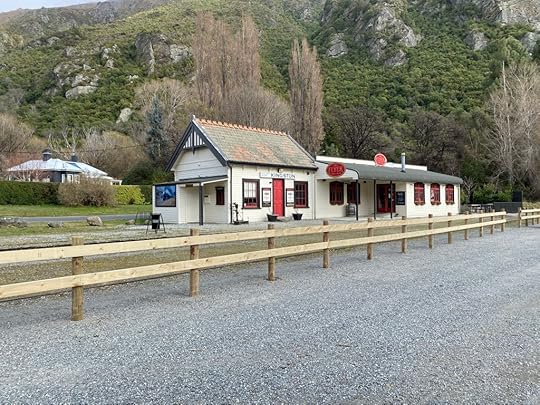 Kingston
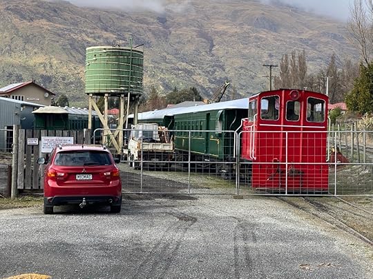
The road lost its curves and became more fast and straight, and before long we were drawing in to the quaint little settlement called Garston (it’s hard not saying that we a southern twang). It held – oh joy – a silver bullet caravan serving hot food and coffee, and we had our first cheese roll in the south from them. We also cruised around an interesting curio and art shop next door which housed the honey stall and tasting. We had a taste of local honey and bought a jar each. My Wild Thyme was delicious.
 Cheese Roll
Further and further south our convoy rolled – on straight highway and creeping ever closer to Te Anau. A very short trip by my standards. We decided to detour slightly and go via Lumsden, which is a moderate sized town that is known to us for its mountain cycle trail. Oh to have had time and my bike with me! We both looked longingly at the map which detailed an extensive circular route around the mountains.
 Lumsden
At Lumsden we took a sharp westward turn and headed straight for Te Anau. . . Only 40 mins or so away. On the way had to stop and gasp and take photos of the encroaching snow-capped peaks all around. Close to Te Anau I stopped and we made a cuppa in the van and sat enjoying the scenery all around and sipping tea.
Down a few more straights, we found ourselves descending gently into the very pretty little town of Te Anau, with daffodils down the centre of the street and blossom trees in full flower. It was delightful to see the wee shops and restaurants and the sleepy placid township in the blazing mid afternoon sun. Lifting our eyes, the lake sparkled in the distance, and beyond and everywhere we turned there were distant and not so distant peaks jutting up with white caps. Gorgeous.
We drove through town to the waterfront, and turned right, and to my delight found the Tasman Holiday Park sign not far along the road. Here we found an English chap sitting behind the reception desk who was very dry in his wit and a bit of bantering took place which is being built on with each encounter. Our vans are parked side by side, and in a lovely setting, and we set out to discover the town by foot. We have eaten a mid-afternoon main meal at the local bar/bistro called Baileze – I had the ribs, and Helen the chicken skewers. The walk back to the reception desk to enquire about booking for the Milford Sound boat the next day, was extended when our friendly host told me to “wear off the ribs I’d eaten and walk down to the corner of town to the Real NZ office”.
We walked the same distance back parallel to the way we had come, and for $89 bought tickets on the boat at Milford Sound. It means we’ll be pressed to drive the distance in the morning to get there in time for the 10.30 clock in, but it will be worth it I’m sure. Now we have had a leisurely time relaxing and reading and will have an early night in prep for the big day out. Still feeling very happy to be here right now. I have a constant presence in my camper with me, as now. It is as familiar as an old sock. A favourite and comfortable sock of course! I had to take out some stitches on her elbow this afternoon – from a bike ride accident nearly 2 weeks ago. The things you find you can do!
September 14, 2022
Day 9 – Wanaka to Arrowtown
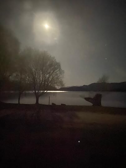
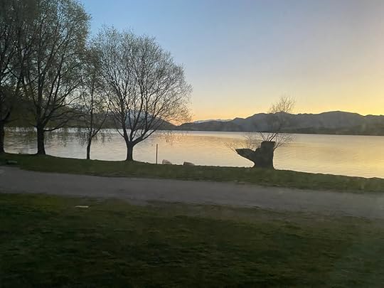

There was a frost on the ground this morning, the first one I have seen in years. . . Auckland doesn’t seem to get them any longer. It was 0 degrees, so not surprising. My little fan heater went all night keeping the chill off. At around 1.30am I opened an eye and looked out the back window and saw the moon on the lake. Such a lovely sight. Slowly the light filled the area and in the morning it was still lovely.
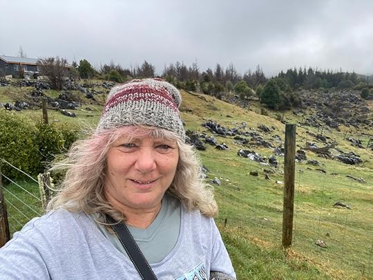
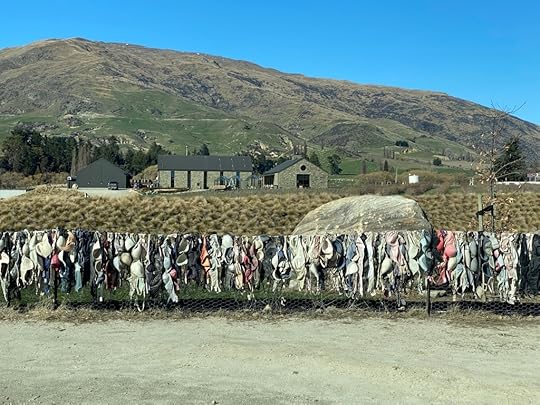 The bra fence at Cardrona
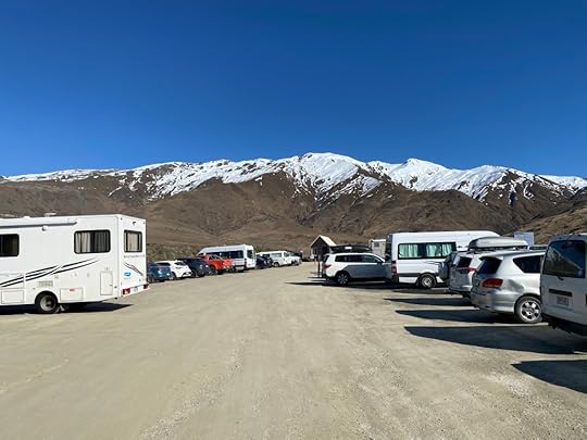 Up the mountain
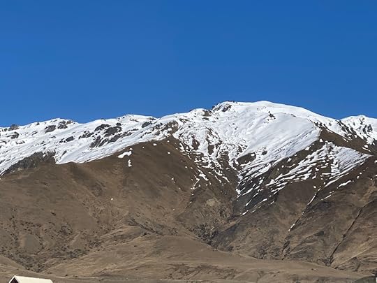
Today was ‘housework’ day – I made good use of the showers and hair washing but had to tramp back over a lot of wet frozen ground to get my $1 for the showers! After that I packed up and unplugged, and then set about the task of emptying various receptacles of liquids stored temporarily onboard. (I don’t think I need embellish). I added fresh water to the reservoir, and then I pointed Alfie’s nose south and took off on the scenic route to Queenstown via Cardrona.
Here’s the thing, Cardrona is a popular ski resort in the vacinity, and the name is familiar to me, and both my brother and my friend Kerrin had told me to take this scenic route and stop on the way there. So when I saw the sign pointing out Cardrona, I turned right and found myself following a dirt (corrugated in many places) road up the mountainside, with many cars behind and in front of me, filled with puffer jacketed people going skiing. It felt odd to be in a camper van doing this too. But my brother had told me to do it. Eventually, and to my relief, I found other campers parked along with cars at the car park further up. People were piling out, grabbing skis, and heading up to the shuttle bus depot. Could my bro have meant me to catch one of those?? I heard back from him, via FB messenger, and a photo showing the old time pub named Cardrona that is a bit of an icon. Apparently REAL town Cardrona was slightly further along the road.
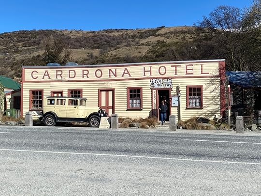
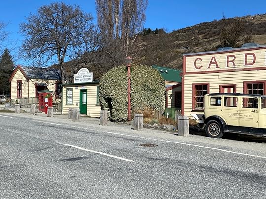
It was lovely. Yes, around a corner and up a hill there was a group of buildings all reminiscent of earlier days, and so I stopped in the store for coffee and a cheese scone, and complimented the serving woman on her place of work. My quip that “THIS is an excellent spot to work – just think, you could come from Auckland like me” fell flat when she admitted “but I DO come from Auckland.” Indeed there seem a LOT of Aucklanders in the Wanaka/Queenstown area. Coming down out of Cardrona there was a glorious vista of mountain and valley leading to a glimpse of Queenstown in the far distance. And then the road wound on down further and further, finally twisting back on itself that I had to take a quick screenshot.
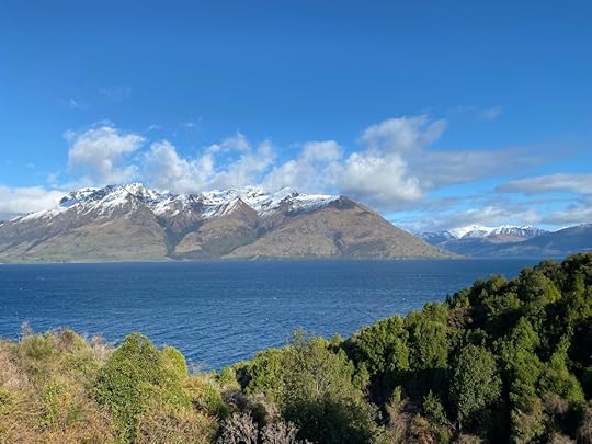
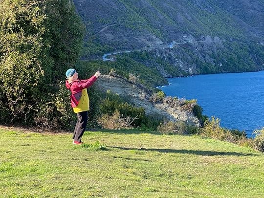
And so I found myself cruising in to the bustling tourist town of Queenstown, all the new housing dotting the slopes around me, the glistening blue waters of Lake Wakatipu stretching out into the distance, and mountains surrounding on all sides – with a cap of snow to add just that bit extra. Such a pretty setting it is. I was here at lunchtime – noon exactly – to meet an old friend. Kerrin used to work with me in Auckland 20 years ago, and since then has moved to Queenstown and works in the centre of town. I parked the van in the carpark on the edge of town, and walked in to meet her at her office. How lucky she is to work and live here, and she is still as pleased about it as she was when she came. We set off down the hill through the main centre, past lots of road works, and plenty of dapper young people lining up for food at hip places all around.

At the waterside we took some photos, saw the tail end of the Earnslaw making its way out to the centre of the lake, and then we wandered around the waterfront to a cafe out by the edge. I ordered a bacon butty, and she a cheese scone, and we enjoyed a catchup in the idyllic setting of mountain and lake surrounding us. She walked back with me to the camper to check it out, and then we parted ways.
 Toad and Ratty
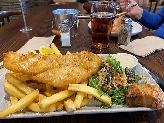
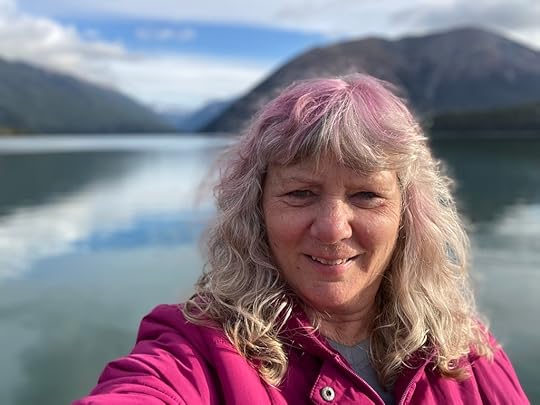
Now I had nothing else to do but drive back up to Arrowtown, which I had passed on the way in, and sort out my spot for the night. Two spots, actually – why? Because my sister, Helen, has opted to join me for next few days, in her own camper!! Yes, she was due to arrive from Dunedin in hers shortly, and so I made it to Arrowtown and found two spots together and soon a smaller compact van arrived with her familiar grinning face. She had come across the central Alexandra area from Dunedin and we would loop down around the bottom through Fiordland and back up the eastern side to Dunedin again.
We have had a pleasant reunion, driven up into Arrowtown to appreciate this remarkable wee town, which is very picturesque in its narrow streets and old shop frontages. It has a history of gold mining at its heart, and just outside town are some shanties that once were where the chinese miners lived and worked. Helen and roamed the shops, and then settled on a hotel – New Orleans – for our early dinner of Blue Cod and chips for me, and Pork Belly for my sis. It was cosy, the fire crackling away, the darkened interior full of conviviality, and the food generous and delicious. We are now back at our campsite, replete, happy, and still dazzled by the snow mountains overshadowing the town.
September 13, 2022
Day 8 – Haast to Wanaka
 Haast
Haast
 Haast
HaastI have more photos than I know what to do with for this day. I got my exercise just getting up and into the van and then dropping back down to take another shot. I must have stopped in every passing bay along the Haast Pass. Fortunately for you, the wifi is so bad where I am, I can’t afford the time to wait for them all to load, so I’ll have to pick the best. I had a comfortable night at Haast, with folks all around me, and an excellent amenity block with free showers. I woke to a clear day and snow on the mountains in the distance. . . naturally I set off early.
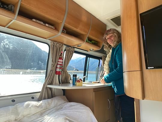
 Toast and coffee for morning tea break in Pass
Almost from the moment that I began driving the Pass, I was thrilled by the mountains with snow tips, all sharply defined against a blue sky. Finally, an hour into the trip I decided to do something I particularly enjoy having a camper van for: making a tea and enjoying the view from the comfort of my own dining space. So I chose the best spot with sweeping views across the river and up the pass to the mountains, and opened my doors, and boiled the kettle. When it had boiled, I put the non-stick saucepan on, and managed to fry/toast two slices of bread, which I slathered with peanut butter and honey. That was the best morning tea set up yet – coffee and toast and THAT view. I had warm water to do the dishes and they were a treat to do.
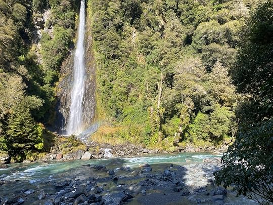
 Thunder Falls
A little further along the road is the DOC campsite called Pleasant Flat, with flush toilets and picturesque setting. Not a soul in sight. I kept driving, and stopping, and clicking, and driving, and turned off at the sign to the Thunder Falls. So glad I did. A short way along the bushwalk you can hear the tinkling of some falls getting louder and louder, and then it opens out on to the delightful sight of a very long drop of white water cascading down into the azure depths of the stream running by below.
 Fantail Falls
Beyond Thunder Falls, another waterfall called Fantail Falls is signposted, so I went to see them too. Less spectacular to my view, but wider and still very pretty.

I kept glancing in my rear vision mirror and seeing the most amazing vista of snow capped peaks against the blue sky – but because I was driving and on a narrow two-lane road it was hard to find ways to stop. I just know the view going North was amazing too. By the time I came out in view of Lake Wanaka, I felt I had seen as much beauty as I could handle, but no – here was blue/green water in a vast expanse, reflecting the huge rising shapes of the mountains all around it, all tipped with snow. They are massive. At least there were signposted bays marked with a camera sign so that you knew there was a view to get out and take.

 Wanaka
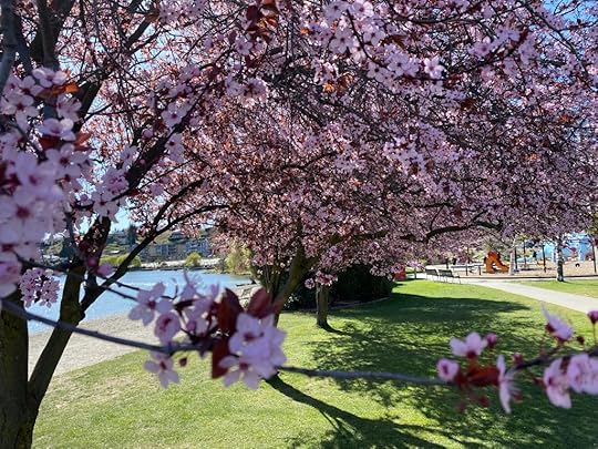 Ah the blossom
 Reubens
I will lift up my eyes to the hills from whence my help comes . . .
Psalms
Finally, after I had reached saturation point with the beauty of it all, I came in to Wanaka at the southern end of the lake, and parked in the park by the lake shore. . . The last one available at that moment. It is busy here – full of affluent tourists or locals who own holiday homes or are staying for the many sporting possibilities. I shuffled across the road to a cafe feeling like a bag lady, and settled in a corner table to eat my ‘Reubens and vegetable chips’ in great content. After a wander around the township, which is upmarket and upbeat, I got back in my trusty Alfie, and set off for 11kms away and the Glendhu Bay Motor Camp where I’m staying for the night. It is on the shores of Lake Wanaka, with a plethora of snow-capped peaks all around it. Everywhere I turn in my camper van, from it’s parked position by the lake, I see a glorious view.

I have enjoyed a relaxed afternoon, resting, reading up on things of interest, and now writing my blog. It is peaceful, calm, and still blue outside. The bar of my delight has been notched up a few levels today.
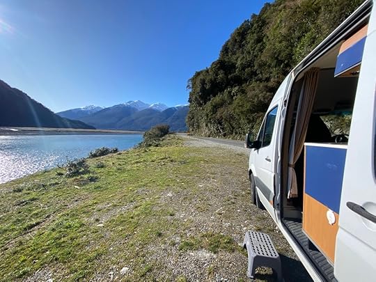
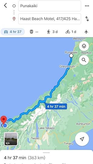
Day 7 – Punakaiki to Haast
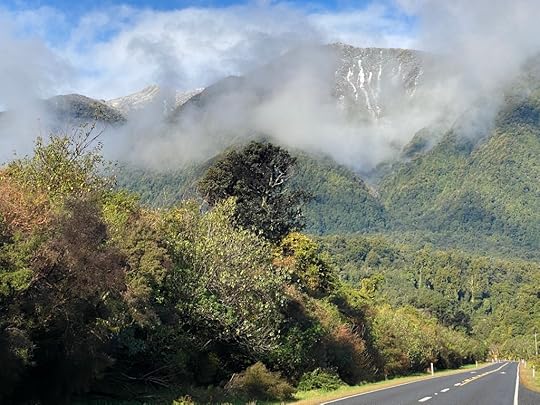
I covered as much distance as I am ever going to want to, today. More than I wanted. I would have stopped sooner had I found a site. Let me start with the impression of the Southern Alps, which were the overpowering presence on this section of my journey.
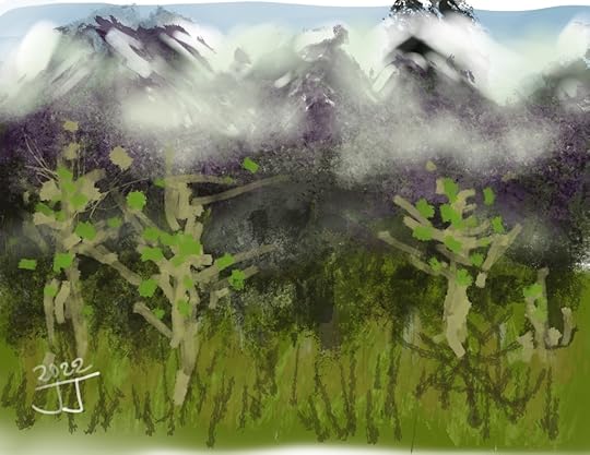 My impression of the Alps
Last night it raged and blew outside my van, and I enjoyed the sensation of being tucked safely away while rain pattered the windows and roof. I had my blow heater on for some of it, and was quite warm, although I read there was snow in the Haast Pass and the weather was pretty thundery in the south where I was going. I had my peppermint tea, got dressed, and unplugged the camper from the power. Went through my checklist and then began driving into the weather.
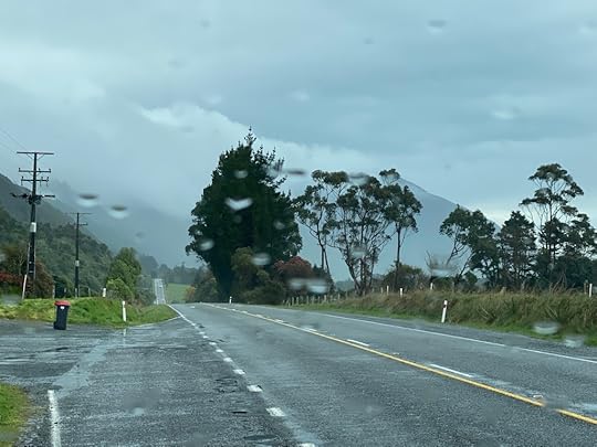 The sharp shape ahead hidden in cloud
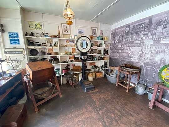
From Punakaiki it is 45 mins to Greymouth, the nearest large town, and I planned to get a coffee there and appreciate something of the mining history of this place. I went through a winding hilly section of road and finally it all levelled out and followed the coastline. The sea was wild and foaming and added to my impressions of the Wild West Coast. I loved the way the clouds lingered in the mountain tops and obscured the view, so that I had just a sense of brooding presence. I kept thinking of the Mystery of the mountains, hidden and being revealed now and then.
When I drove over a long bridge and the grey waters surged beneath me out to the sea, I could make out the clustered buildings and warehouses of a larger town than I expected. I turned left and in to the Town Centre, made up of no tall buildings but sturdy weathered shops and offices built to withstand the exposure to the sea and wind. Parking near the concrete wall that forms a break between town and river, I walked up to take a brisk look at the waters. Behind me were what looked like industrial sheds, but upon closer inspection proved to contain some offices and a modest looking cafe, which I immediately surged towards. It was more than the sum of its parts. Inside were a few old timers yakking, one or two townsfolk who sounded regulars, and a tucked away room which housed the cabinet food and kitchen. Quirky and sixties, and nostalgic. The food was home made and looked appetising, so I asked for a date scone and coffee and both were excellent.
Replete, I drove out of town the long way, and on the way south, still within town limits, I saw a sign pointing off to the left saying ‘Shantytown’ which drew my interest. Here at last was more that might give a sense of the place back in the day. Sure enough, for the princely reduced rate of $28 I was able to roam around the grounds of a reconstructed gold mining and timber town of late 1800s. Some things didn’t work, and some were under reconstruction, but the general impression was pleasant and full of interesting things to poke and and read about. Best of all, although I had missed the train by a short while, I was told to walk up to the Mill and catch it on the way back. Since the pics showed a steam train puffing downhill with timber on its carriages, I not unreasonably thought they might have a steam train going. But no – after wandering the Mill for a while I heard a whistle and rushed out to film the incoming locomotive. It was greatly over-rated. A single carriage on a diesel engine, and a short ride. However, even that was a pleasure. I had a bacon and egg pie and tea at the town cafe before heading out to my camper van.
Now there was a long section of road that followed the coastline further south, an easy fast road with the wild sea on one side and an encroaching presence on the other, with clouds obscuring what that presence was. The rain which had ceased for the duration of my time in Greymouth returned. When I drove through Hokitika and Ross Beach, it was grey and showery, and I didn’t stop. The further south I went the more the dark line ahead of me grew and became almost menacing.

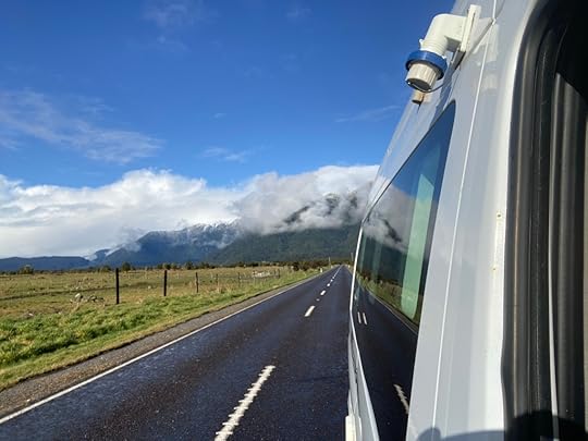
At last I started to climb up the slopes and wind around some tight corners, with glimpses now and then of snow in little patches on the ground and big moments in sharp peaks in the sky. The mountains when they appeared out of the mist, were much bigger than I recall, and I was thrilled. I drove in to Franz Josef glacier township, and don’t remember anything of the look of it from my earlier days. It feels like an alpine resort town, with the shops and restaurants and adventure sports signage. And the blackness of the mountains rearing up around it all disappeared in a thick white fog. I decided to keep going and stop and Fox Glacier instead – it being the one I had not seen in younger days.
By this time I had crossed maybe ten single-lane bridges over deep ravines or fast moving waters – and the water of the one by Franz Josef was a beautiful aqua colour and seemed to be flowing from the glacier itself. I stopped to walk back over the bridge and take photos of the area, gasping as cloud parted and even higher peaks showed, all covered in snow.
Another 40 mins saw me drawing in to Fox Glacier township – a bit smaller, and more exposed, with a range of restaurants all open and a gas station I filled up on diesel with. Asking the petrol station attendant about the Lake Paringa salmon fishing and cafe my brother had told me about, she suggested they might be closed now. I tried calling and there was no answer, so I decided to eat in town here. I had a roast vegetable salad and chicken strips, which was huge, and a local Monteith’s ale. The inside of the bar/restaurant was so dark I only dimly made out shapes sitting at the tables, and silhuettes when I sat down. My eyes hadn’t adjusted by the time I left but at least I could see my food.
By now it was late afternoon, and I planned on another 45 mins driving to get to Lake Paringa and stay somewhere. It was a fast trip because the road was not too windy, and I found it beguiling to look in my rear vision mirror and see the sight of some snow mountains suddenly appearing. I would stop and look back and the clouds had gone over again.
When I got to Lake Paringa, the DOC camp sign pointed into a lonely and empty park area with places to back your van, but no way to book them because I was outside of signal range. The lake was lapping at the shore and the camp was set back from the road so far amongst the bush that it was private. But it was empty. I was disconcerted about the thought of staying there, and so decided not to. And that meant heading off toward Haast Pass and hoping that I would find a holiday park before it got dark.
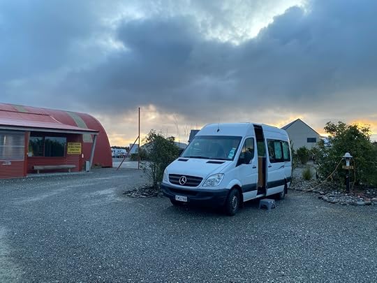
My heart was in my throat thinking I would be travelling in the dark through this pass, when to my great relief and joy, I went over another long single lane bridge to see the holiday park sign pointing to the right. The Haast Beach Holiday Camp. Oh joy!! I am now set up for the night with power, and facilities nearby, and feeling safe and comfortable. Whew. That was the longest day yet.
September 12, 2022
Day 6 – Lake Rotoiti (St Arnaud) to Punakaiki, via Westport
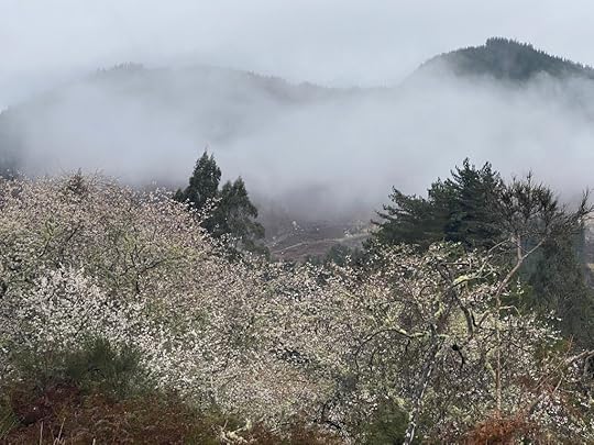
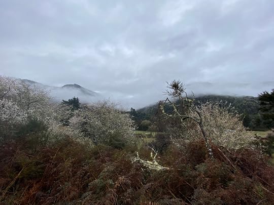
Glad I took the photos yesterday because this morning it was grey and rained on and off, which made for some spectacular misty low cloud over the mountains as I descended towards Murchison. Dappled among the farmland and countryside were blossom trees, pink or white, and when small groves flashed by with the mountains behind, I could only gasp in joy. It is really difficult to take the photos you want, 1) when you are driving and 2) when there are no bays to pull over in to. Take my word for it. The photos I took are not the best I saw.
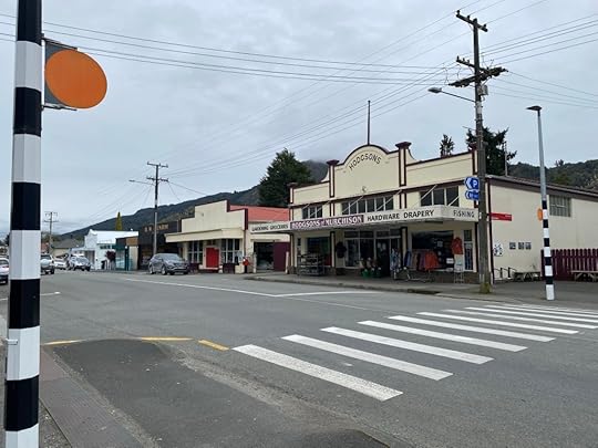
After driving this spectacular Buller gorge for about 45 mins, I came in to Murchison. I absolutely needed the sausage roll and coffee I purchased in the cafe near the end of town.
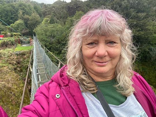
From Murchison we descended even more windy cuttings and followed the beloved Buller River through its twisting concourse towards the coast. Soon after Murchison I encountered a captivating sign entreating me to walk the ‘longest swing bridge in New Zealand’. Why not? At least I would be assured of a decent photo. It was. . . Exhilarating.
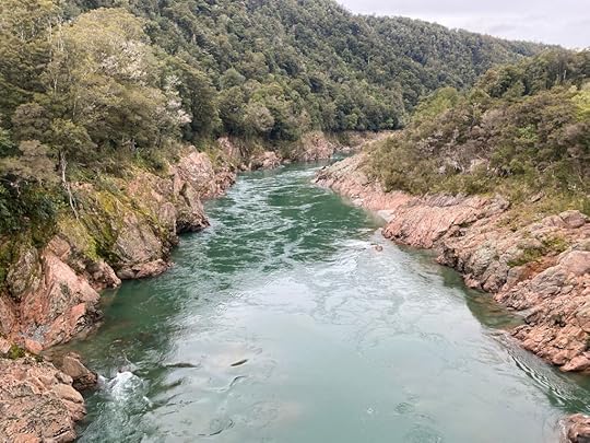
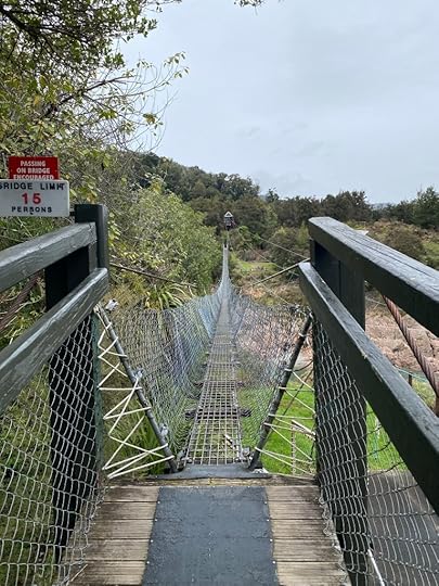
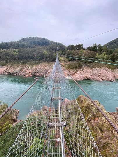
Once there I decided to get some exercise and actually walk the loop track, taking in a gold miner’s hut and some horrifying drops to the deep flowing waters of the Buller. Worth doing. AND I had to pass a small family negotiating the swing bridge towards me when I went back.
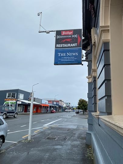
Back in the van, I turned left and carried on towards Westport, an endless twisting section of road following the river and at times going down to one lane around the bends with steep cliff on the left. Only once did I have to back up to allow a car to pass me on such a road. Almost like Scotland! Eventually the road turned either to go south to Punakaiki (Pancake Rocks) or north to Westport, and I wanted to see the latter, so I veered up to the sleepy little town and parked. It was a grey drizzly day, which did not enhance the town’s delights, but it was somehow rustic and endearing. I lunched at a place called the Denniston Dog on a very nice Buddah Bowl of rice, salad and chicken.
I chose this town to fill up with diesel – not being sure when the next spot would be, and so headed out with a full tank. Decided to check out the aptly named Cape Foulwind (although my Apple map commentator insisted on calling it ‘Fall Wynde’). It was in fact so windy, that I declined the walk to the lighthouse and shot a picture of the rocks in the ocean from the van.
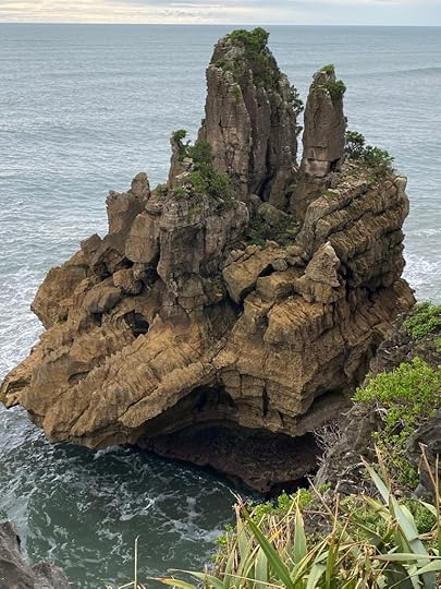
Then I turned south and followed another meandering road up into the hills twisting and turning on tight bends, until finally we found the ocean and followed the coastal path until we reached Punakaiki.
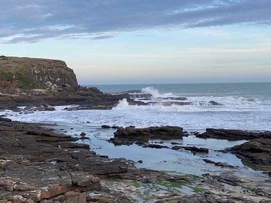
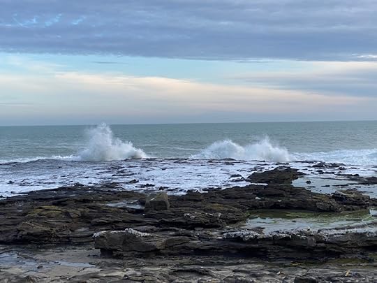
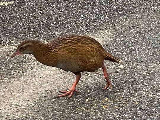
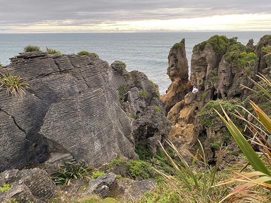
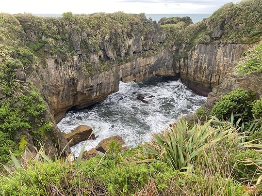
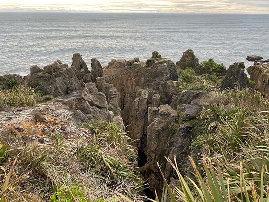
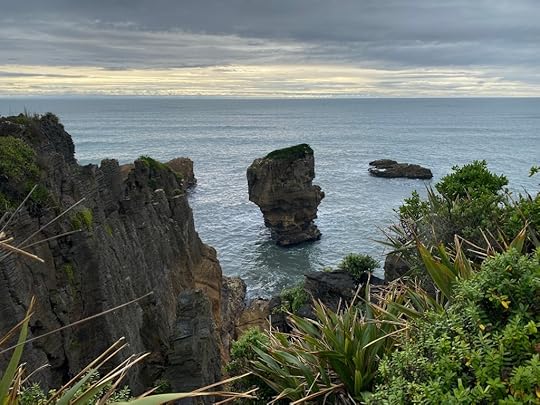
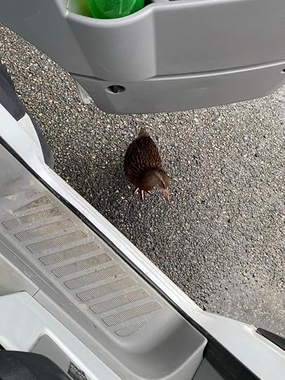
At the visitors centre I met another of the many Weka’s who had darted out in front of my van in the Westport area. They seem prolific in the south. Crossed the road and did the circle track out to the Blow Hole and the Pancake Rocks. A fabulous and unique bit of landscape.
Satisfied with my endeavours today, I turned back for the tiny township and the holiday camp sign I had passed. Sure enough, a friendly woman took $24 from me for a powered site and let me choose which one I wanted. I am now cosy and replete, with the sound of the sea and the rain outside, and the wind gusting against the walls of the camper. The signal is not strong here, but so far I’ve managed to upload some photos to this blog and hope it posts.
September 10, 2022
Day 5 – Pohara beach to Lake Rotoiti, Nelson Lakes
To my dismay, I discovered I would have to return the same way I had come to reach Golden Bay – the hairpin bends (which turned out to be more like 30kms than 45kms. I did not take in to account the valley afterwards). I made the most of the district before I left though. It had rained overnight and the clouds still threatened, but I think I missed the worst of it which was coming down in the east coast and Wellington.
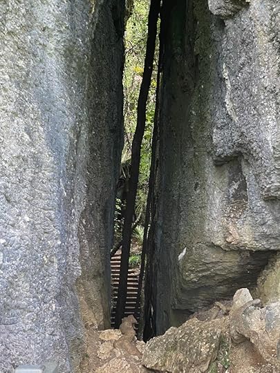
My brother had left me a few tips for places to see, and so, because the camp managers had not arrived, (Office 9 to 5), I went off to fill up on diesel, and then go and visit The Grove. The Grove was one of those unexpected delights, where you turn up at a small parking bay and nothing but a path leads off into the wild. Another vehicle arrived and the couple disappeared up the path, so I waited until they had gone and followed on. Up and up it wound through old tall Nikau palms and great slabs of rock forming walls on either side. Eventually I turned at a sign pointing out a look out, and lo and behold, a narrow corridor between gigantic rock faces lead out on to a viewing platform that took in the whole sweep of valley below. Impressive!
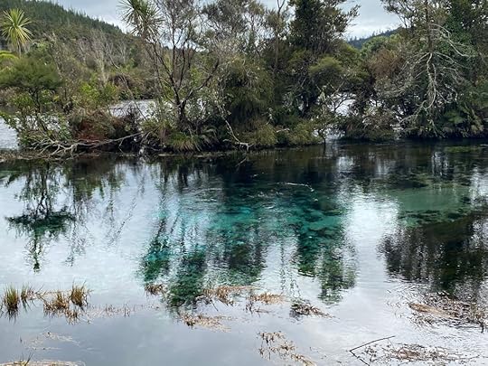
Returning to the holiday park, I found a friendly manager who took my $24 for the overnight stay, and suggested I go and visit the Pupu Springs. As my brother had already mentioned these (Waikoropupu Springs) in his precis, I didn’t need any further pushing. I turned on my trusty Apple Maps, and let the guide lead me. Except once more, the guide failed dismally! I followed it into what looked like (and WAS) private land, over a dirt/rock road, through fields, and pastures and barns, through fences, startling a small cluster of new calves! It thinned and tapered and became a four wheel drive track, and still my huge camper van lumbered on. I could not turn around! The sweet voice on the phone insisted I was doing the right thing, and great was my relief when I rounded a tight bend and found the paved two-lane road that leads to the Springs before me! If the farmer ever reads this: I’m truly sorry.
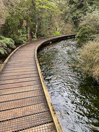
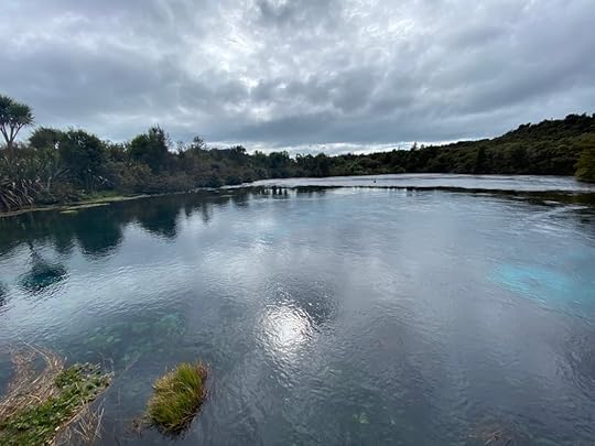
This car park was much bigger, and with a lot of information boards, and I began to get a sense of the mana (spirituality) of this place. It is a loop track of about 1 km, that winds down to follow the river and crosses it in places on a continuous and sinuous boardwalk. It feels very special to be walking over and beside the crystal clear waters as they bubble and gurgle beside you. AND THEN I came out into a wide vista which was the springs themselves. I don’t think any pictures could do justice to them, and at the moment I can’t upload any, you’ll have to believe me when I saw that they were clear and showed sparkling depths with azure and turquoise colours below, and bubbling masses which indicate that there are indeed springs that feed this water way. It was breathtaking. The path continues back and around with glimpses of springs and flowing water, all beautiful and sacred. Back at the carpark and I breathed a sigh of regret to be leaving the place.
Getting into the van, a bird the size of a chicken with orange sharp bill and legs rushed up to me and looked keen to hop in. A weka I believe, and much friendlier than Pukeko.
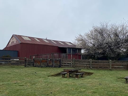
So began my drive back through the golden valley and up into the scissoring road that crosses to Motueka on the Nelson side. At the top there is an extensive cave network, and a cafe and Woolshed run by locals. I stopped and admired the black rocks littering the landscape – our native marble. Inside the rustic tearoom and shop I purchased a woollen hat for further south, and some wool. And had a Devonshire tea to fortify myself. Even the basin the restroom was made of the local marble.
Down through Motueka and then south, to get to Nelson lakes. The plain that is the bay of Nelson gives way to hills and then forestry, winding higher and higher gradually and giving glimpses now and then of the snow tipped peaks of the mountain ranges further south.
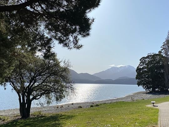
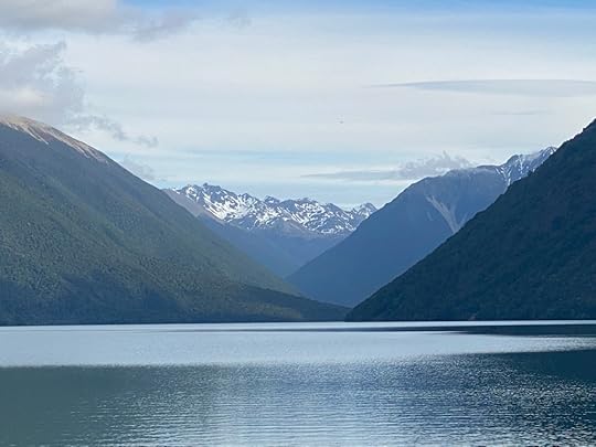
I was here at St Arnaud on the shores of Lake Rotoiti by 2.40pm which was fine by me. Driving through the tiny village which seems like an alpine resort I found the carpark and the lake beyond, which was the perfect setting for the jutting snow capped peaks in the distance. Another breathtaking and familiar view.
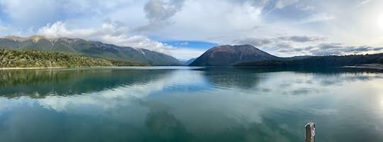
 Lake Rotoiti
The DOC (Department of Conservation) camp ground is just there, beyond the public car park, and so I drive in to the virtually empty grounds and selected a powered site at random. Found out all I had to do was get on line to DOC and book it, which I did. Another cheap night of around $26 for ablution block, kitchen with bbqs, power, water and the SETTING to beat all.
Oh, and the midgies. Yeah, I only had my sliding door on the van open for 15 minutes and hastily slammed it shut. Already the blighters were inside and making their presence felt. Out came my insect repellant and the cheap wee insect repelling lamp I bought, and hopefully I’ve dealt to it. I had a power nap, and then got my boots on and did a loop walk and a wander down by the lake. It was empty of any tourists. Two camper vans are next to me – to my relief – and the toilets not far away, so I’m sitting pretty. The lake is spectacular. I can’t wait to see it in the morning at first light.
So now I’ve made dinner of toast with fried eggs, ham, coleslaw, and a cup of Earl Grey tea. I might put my wee fan heater on, and the lights, and do my dishes. Even they feel like a treat, when the vista in front of me is a suggestion of lake through the trees.
Every day I don’t think it can get any better, and I am wrong. It can!