Rick Page's Blog, page 5
June 1, 2015
Timing the atoll passes
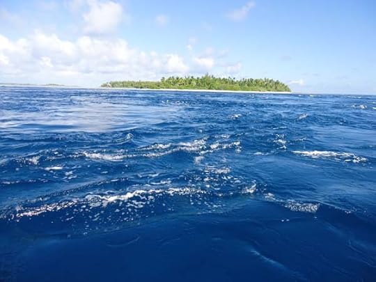
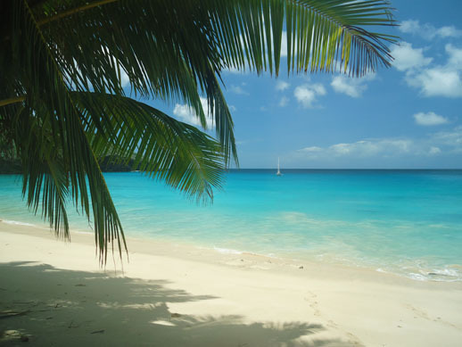
The islands of the Tuamotu group are coral atolls.
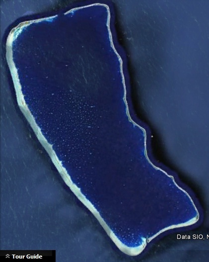
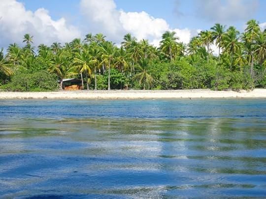
Fakarava
They look like rings of coral with a calm lagoon inside them. Some of this “rings” are complete circles and therefore it is impossible to enter.
Some others have one, two or three openings called passes.
The current in these passes is usually fairly strong, because of the enormous amount of water that exits/enters the lagoon between the low and the hide tide.
In some atolls these current can reach 9 knots, making it pretty much impassable and very dangerous.
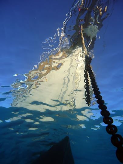
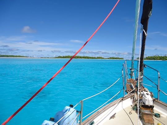
Calypso anchored at Fakarava South Pass
If the water is coming against you, you’d have to push your engine very hard to get any forwarding. But if the current is rushing the same way as you, then it is even worse. Your boat will fly across the pass like down a river and you will have absolutely no steering. The sea will decide where to send you. Maybe it will spit you out in the ocean, but maybe it will throw you on the reef. And you will not be able to do absolutely nothing.
So it is very important to plan your entry at a favourable time, the best time of course being slack water at the change of tides. We have heard tons of terrifying stories from people that ignored this basic rule (overheating engines, boats on the reef, …). And still we keep meeting people that have no idea of the tidal times and seem not to care too much. Ignorance is bliss…
Slack water at Makemo North Pass
I am not writing for those people, but for the sailors that are coming in our wake and take the sea with the due respect. The first step is to accept that perfect timing is more important than your needs and desires. If you arrive two hours to late, you will simply have to heave-to for four hours until the next change of tides or even sail on to another destination. When you accept that, you are half way there. To be all the way there you need to know the time of slack water. We learned that this is not as easy as it sounds.
So far we travelled 14 times in and out of the Tuamotu atolls. Fourteen passes. So you would assume that by now we got them. Well, I have to tell you, I thought so too. Until today.
Let me explain.
Last year, being our first experience, I collected tidal information from many different sources: nautical guides, the internet, different computer software, our chartplotter… I also tried to use the Tidal Guestimator by The Soggy Paws.
About 3kn of incoming current at Makemo
After comparing the reality and the tides from all this sources, I decided to trust the SHOM website. The problem is that they give information only for the main atolls. For the others you have to guess based on the distance from it. But nevertheless, last year we found them spot on. We used the time in Fakarava to enter Kauehi, Fakarava South and Fakarava North. Arrived at the pass one hour early, waited until the pass looked good, entered with almost no current. No problem. Easy peasy.
This season we felt pretty confident. But our feeling was based on last year’s damn good luck. This year we had different experiences. We approached both Raroia and Makemo based on Makemo times (SHOM) and all 4 times were very hairy. The difference was about two hours from official times.
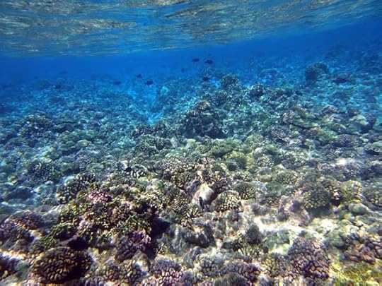
Snorkeling in the passes is always an amazing experience
The scariest exit was in Makemo North where instead of the expected slight incoming tide we found 6 knots of outgoing tide. By the time we realised that, it was too late. Rick tried to turn the boat around to return to the anchorage but there was no way of doing it. We were flying sideways towards the pass. At that point he looked at me and said:
“Well, we don’t have much choice, one way or the other, we are getting out of here.” He pushed on the throttle to get some steerage and Calypso reached her record speed of 10.2 knots. Twenty seconds later, we were out. Speechless, but safe. With many new gray hair.
After an easy overnight sail we arrived to Tahanea. This time I found the tides for this atoll in the charplotter. We approached slowly to check the conditions and found the flattest pass ever. Our chartplotter was spot on! I was happy. The next day (yesterday) I wanted to do a drift snorkel. So we approached the middle pass at what the charplotter gave as low tide, but the current was already coming in at 2-3 knots.
“The official tidal times are about 30 minutes late” was our conclusion.
So today we approached the west pass for a drift snorkel about half an hour before the official low tide, hoping to get the first hour of the incoming tide. WROONG! We were just entering the pass with the dinghy, when we realized that the current is still very strong and outgoing! There was a moment of terror when the outboard gave up and I already saw us drifting all the way to Tahiti. But Rick managed to fix the problem and got us out of there as quickly as possible (it still felt veery long).
We waited and waited but the low tide did not come. Finally we gave up and returned to the boat. We kept observing the nearby middle pass from the boat and noticed slack water at 15.30.
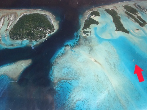
The Makemo Southeast Pass
The confusing things are this:
a) all the official tidal information agreed that low water today is around noon;
b) yesterday the low water was at 11.00 and the difference from one day to the other is usually less than one hour;
c) today we did not have very strong winds or big swell that might have greatly affected the tidal flow.
You may be asking what is the lesson learned. Well, the thing is… I DON’T KNOW.
For now we decided to keep observation of the pass as our main tactic. We will simply patiently wait until the pass looks good.
But in the meantime, if any of you have any suggestions or knowledge that we are missing, please, we are all ears!


March 31, 2015
Coming soon… our new book!
Dear friends,
we have been typing away for a long time and finally our first book is (almost) ready!
It is written for everyone that loves the sea and is thinking about going sailing. Which boat to buy and where, how to learn to sail, the necessary equipment, but above all, how to develop the right attitude in the face of overwhelming marketing.
The title is
GET REAL, GET GONE!
How to become a modern sea gypsy
and sail away forever
The aim of the book is to challenge those who say you need to be rich to go sailing and opens the doors to a great adventure for those on a limited budget.
Subscribe to our mailing list to get an alert when it comes out:
Subscribe to our mailing list
* indicates required
Email Address *
March 22, 2015
Spending the cyclone season in the South Pacific
I am writing a quick note because of the large number of concerned emails we are getting these days regarding Pam, the big cyclone that hit Vanuatu.
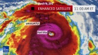
Cyclone Pam, photo by weather.com
We are far away and the cyclone did not affect us at all. The islands of Vanuatu got hit very badly and our thoughts are with them. If anyone wants to help, donations to SeaMercy.org are a good choice. DONATE HERE
The danger of cyclones is the reason that we spent almost 6 months in the Marquesas islands which are NOT in the cyclone zone. After losing two great friends in the Cyclone Odile we decided not to take the risk and did the effort of sailing almost 1000 miles upwind, but it was totally worth it!
This was our tactic:
In november we took advantage of some southerly winds and sailed to Fakarava. This is the easy part.
Fakarava is a wonderful place to wait for a good weather window, but if you have time you can also get to Makemo and/or Raroia and gain some more easting. If you leave yourself enough time, you have a good chance that some SE or NW will come to your help. We left on the back of a big low and had 5 days of NW. We had to dodge a few squalls, but managed to reach Fatu Hiva in one tack. It took us seven days.
Landfall in Fatu Hiva
After that, we had 6 months of lovely easy sailing between islands, enjoying the South Pacific sunshine without worrying about cyclones.
While Tahiti and all the islands west of it had lots of bad weather, we had a total of about 10 days of rain in 6 months. Staying here it was like standing in the sunshine on the top of a high mountain and looking down at the bad weather in the valley.
We had lovely weather, we kept sailing around the islands and made many good friends. We love the Marquesans and it will be hard to leave them.
Christmas Day in Hanamoenoa bay (Tahuata) – Calypso was the only boat there…
New Year’s Party
So if anyone is thinking about where to spend the summer after the sailing season is over, we would highly recommend Fetua Enana – The Islands of the People.
But now is almost April and we are ready to start a new sailing season in the South Pacific. Don’t ask where are we going because, as always, we don’t know!
Fair winds to everyone
Jasna & Rick
February 5, 2015
The Numbers of The Year 2014
Recently I analized our log book and this is what I discovered about last year:
Number of days of sailing: 86
This is more or less 25%, which means that we spent about a quarter of the last year on the water.
Number of nights
Calypso
Jasna
Rick
– at anchor
283
(77%)
280
283
– on passage
50
(14%)
50
50
– in the boatyard
17
(5%)
0*
0*
– on a mooring
15
(4%)
32
32
– in a marina
0
(0%)
0
0
– on land
0
(0%)
3**
0
* In January we hauled out for 17 days. The boatyard did not allowed us to live aboard Calypso, so we moved on Luci which was on a mooring. Thanks again Tim and Meredith!!!
** In March I went to San Diego (to visit some marine stores and get Calypso even lower on her waterline) and stayed with a friend for 3 days, that’s why only Rick has the record of NEVER SLEEPING ON LAND in 2014!
Number of nautical miles: 4696
Longest passage: 32 days (Mex – Poly)
Engine hours: 167 (about one third of that to come back to the Marquesas from Tahiti)
Used diesel: 270 liters – 70 gallons (we left Mexico with 77 gallons)
ISLANDS and ANCHORAGES
Number of islands: 10 (ONLY!?!?)
Number of different anchorages: 22
The majority (13) of this anchorages had no internet access and no shops. So in 2014 we spent 139 days – 38% of the time in places with no shops, banks, internet or post office.
Another interesting statistic is that we spent an average of 14 days in every anchorage. Sounds about right…
January 26, 2015
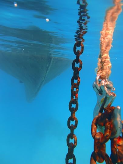
Anchoring in coral
The coral atolls are simply fantastic.
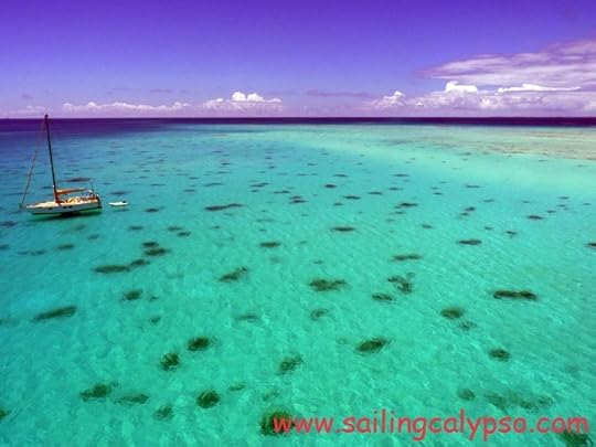
Fakarava in the Tuamotus (French Polynesia)
Nobody can argue with that.
Well, except maybe your anchor chain.
While you will learn to love every fish and every view, your anchor chain will learn to hate every coral head and every wind shift. And on the other side, the coral head will learn to hate your chain very much.
In the Tuamotus is practically impossible to find a clear area where your anchor rode will not touch any coral. Even if you find it, the first wind shift will quickly change the situation.
So, let’s see what you get with anchoring in coral:
1) you will have to listen to the chain grinding on coral all day and all night
2) you can say goodbye to the galvanization on the chain
3) you will ruin most of the live coral around your boat
4) when you want to leave, you may have to spend hours unwrapping the chain from the coral heads
But the main thing is that it is also very dangerous. The chain can get very quickly wrapped and then suddenly you end up having a 1 to 1 scope. This means that in a blow your chain, snubber and anchor roller will be under too much load and may even break.
So, what can you do?
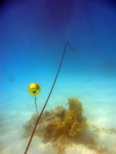
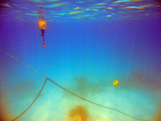
I read somewhere about this technique which I want to share with you. I am still experimenting but it looks really promising. You can use fenders or floats, each one on a separate piece of string. When you let out the chain, you attach this floats to your chain every 15 or 20 ft.
This is how we do it:
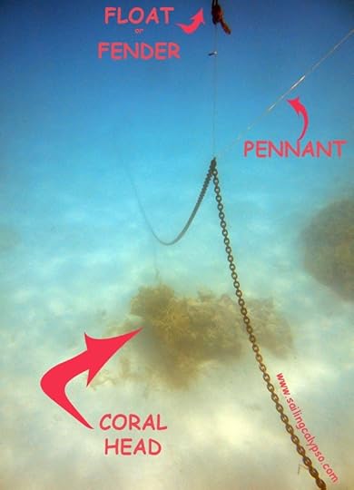
With the pennant I decide how much I want to lift the chain from the seabed. In this example I had the pennant secured to the bowsprit
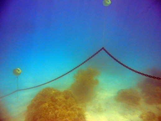
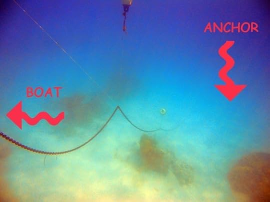
I spent many days in the water trying different ways of doing this. There is many variables – the size of your chain, the depth you are anchoring in, the height of the coral heads, the size of the floats, the lenght of the line between the chain and the floats ecc. So it is not always the same.
If I have to make some changes, it is much easier if I have a pennant that goes from the fender through the chain (see the photo). But I this works only on the last fender, the closest one to the boat.
The one rule I never break is that I never put a float on the first 50 ft of chain, which should always lie flat on the bottom (because of the angle on the anchor). It is not so hard to find a little space with no coral for this.
I also don’t like to tie the lines on the chain. In an emergency I want to be able to retrieve my anchor QUICKLY. I use small carabiners instead.
I know that most people sort out all this floats from the boat. But I always end up going in the water, checking with my mask, making changes and (get this) trying to dive down to the chain with the floats in my hand. It is very difficult and there is many better ways of doing it, but this game keeps me busy for hours on end. I just love pulling myself down on the chain, sitting on the bottom, exchanging a few bubbles with local fish and looking at my boat from down below.
I am half fish and I can’t help it.