Jump to ratings and reviews
Rate this book
Rate this book
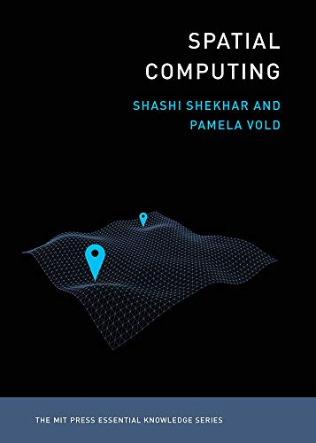
An accessible guide to the ideas and technologies underlying such applications as GPS, Google Maps, Pokémon Go, ride-sharing, driverless cars, and drone surveillance.

Billions of people around the globe use various applications of spatial computing daily—by using a ride-sharing app, GPS, the e911 system, social media check-ins, even Pokémon Go. Scientists and researchers use spatial computing to track diseases, map the bottom of the oceans, chart the behavior of endangered species, and create election maps in real time. Drones and driverless cars use a variety of spatial computing technologies. Spatial computing works by understanding the physical world, knowing and communicating our relation to places in that world, and navigating through those places. It has changed our lives and infrastructures profoundly, marking a significant shift in how we make our way in the world. This volume in the MIT Essential Knowledge series explains the technologies and ideas behind spatial computing.

The book offers accessible descriptions of GPS and location-based services, including the use of Wi-Fi, Bluetooth, and RFID for position determination out of satellite range; remote sensing, which uses satellite and aerial platforms to monitor such varied phenomena as global food production, the effects of climate change, and subsurface natural resources on other planets; geographic information systems (GIS), which store, analyze, and visualize spatial data; spatial databases, which store multiple forms of spatial data; and spatial statistics and spatial data science, used to analyze location-related data.

256 pages, Kindle Edition

Published January 24, 2020

12 people are currently reading
147 people want to read

About the author

Shashi Shekhar

24 books1 follower
Shashi Shekhar is McKnight Distinguished Professor in the Department of Computer Science and Engineering at the University of Minnesota.

Ratings & Reviews

What do you think?
Rate this book
Friends & Following

Create a free account to discover what your friends think of this book!

Community Reviews

5 stars
8 (21%)
4 stars
11 (28%)
3 stars
14 (36%)
2 stars
5 (13%)
1 star
0 (0%)
Displaying 1 - 5 of 5 reviews
Profile Image for Brian Clegg.
Author 164 books3,136 followers
April 24, 2020
A part of the increasingly interesting MIT Press Essential Knowledge series, the topic of this book may at first glance be puzzling - but it's about something many of us use every day - information technology that makes use of spatial information, such as the GPS sat nav system.

One oddity of this series is that it is very inconsistent in the level the books are pitched at. Some are way too technical for the general reader. This one, though, is a straightforward descriptive text with very limited technical detail. There's nothing here that is likely to baffle someone from outside the field and lots of information on where the various technologies have come from (including John Snow's famous map-based identification of the source of a Victorian London cholera outbreak), the basics of how they work and where they are likely to go from here.

If you actually have a need to know this stuff, it's an ideal primer. My only real concern about the book is that I'm not sure I did need to know - it felt a bit too much like doing homework. In their preface, the authors say 'How could a technology used by billions of people around the world not have an accessible guide to describe it to a broad audience?' I think, for me, the answer is 'Because it's not very interesting.' I love using this stuff, but I didn't find reading about it particularly inspiring.

That's not to say that the book won't be useful, whether you've been set an assignment on remote sensing, positioning systems or geographic information systems or you work in a field that makes use of such technology - but as a daily user of GPS, I've already got the basics and I really didn't need to detail.

For those with an interest in the field but limited knowledge, though, it's an excellent, pocket-sized introduction.
Profile Image for Peter Aronson.
397 reviews18 followers
November 13, 2022
Two-and-three-quarters stars. This was kind of mixed. The authors did not keep to a consistent level of detail, and sometimes drilled down into irrelevant bits, like spending half a page explaining what an impedance-mismatch was, when it was only being used as a metaphor in the first place. The chapter on spatial databases read as if someone had somewhat hastily edited a chapter of databases in general to add spatial details. And the history of the fields was generally vague, incomplete and sometimes misleading. And despite having an inherent interest in the subject, I found the book dragged at places as irrelevant information was inserted into an already thin book. And the term "spatial data science" seemed to an egregious addition, as I would called that topic something like "spatial modelling and analysis". And most actual work in that field is done by actual practitioners -- Geographers, Urban Planners, Meteorologists, Biologists, etc. -- not "Data Scientists".

The authors seemed to be splitters rather than lumpers, as the divisions they made between remote sensing, GIS, spatial databases and "spatial data science" don't really exist in practice. Nor are spatial graphs considered something other than a special case of vector data. But I suppose that's a matter of taste.

OK, what did I like about this? They did make an honest attempt to cover the uses of spatial data, and tried to make it relevant to people outside of the fields.

(I recently bought a set of 12 these MIT Press Essential Knowledge guides from Humble Bundle, and decided to read the one that I knew the most about the subject to see how accurate they seemed. I have a BS in Computer and Information Science, and I have an MA in Geography from SUNY Buffalo (which was an early center of research in GIS), and 40 years of experience in the GIS field. So far, I'm not vastly impressed with the line, but I will try others.)
Profile Image for Anadi Vyas.
38 reviews2 followers
May 29, 2024
The name also means something else (AR/VR tech), but this book definitely reminded me of my old Geomatics knowledge. I thoroughly enjoyed it and would have rated it a 5 if it had included more details about technological implementations and algorithms.
Profile Image for cypher.
1,506 reviews
May 17, 2024
great book, i found it very interesting. accessible, concise and educational.

"we are moving towards a future where all software needs to be specially aware" - good quote
Profile Image for Anthony O'Connor.
Author 5 books31 followers
February 25, 2021
Worth a quick read

Not a lot of technical information or insight. Mostly glossy brochure level with lots of digressions into bits of history or mini-explanations of loosely related bits and pieces. But it does cover the main technologies and current applications - just not in any real depth.
Displaying 1 - 5 of 5 reviews

Can't find what you're looking for?

Get help and learn more about the design.