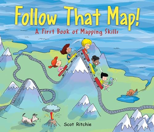
Maps are about far more than getting from a to b. Maps can help children understand and explore both their everyday environment and faraway places. With an appealing search-and-find technique, Follow That Map is an interactive picture book that explains and demonstrates key mapping concepts. Kids will enjoy following Sally and her friends as they search for Max and Ollie, a mischievous dog and cat on the lam from the backyard. Sally and friends take an imaginative trip through the neighborhood, city and country, around the world and beyond. Kids can join in the search for Max and Ollie, who are hiding somewhere in every map. An activity at the end of the book shows children how to make a map of their bedroom.
Surprisingly disappointing. The main problem is not until the very last page is there any actual map in the book. Putting the characters into the "maps" by making the illustrations somewhat map-like probably sounded like a clever idea, but it is just incredibly confusing and not at all effective in what is supposed to be a "First Book" of mapping skills. How is a child supposed to understand symbols and legends when a cartoonish picture of a tree is plopped down on top of a bunch of identically cartoonish pictures of trees? How is a child supposed to understand scale when the line says a centimeter represents a mile but the "map" includes little pictures of buildings and also little pictures of kids, both approximately a centimeter high? I think it would have been much better to include illustrations of places and then separate illustrations of maps of those places.
The framing sequence doesn't work either - our dog and cat ran away! we need maps! what?? - and then in the end the book goes completely off the rails with the page of a "map" of the solar system that is just a bunch of circles in a line and then a text disclaimer that no, the planets are never actually in that position relative to each other and this is just imaginary.
A colorful and creative introduction to learning how to read a map. Although there is a story line, this book is primarily a tool, but one that kids will enjoy as they trace trails with their fingers or search for landmarks.
Ages: 4 - 7
#geography #maps
**Like my reviews? I also have hundreds of detailed reports that I offer too. These reports give a complete break-down of everything in the book, so you'll know just how clean it is or isn't. I also have Clean Guides (downloadable PDFs) which enable you to clean up your book before reading it! Visit my website: The Book Radar.
This fun book begins with a double page spread showing different parts of a map, such as the compass rose, the legend, the scale bar, etc. The story is that five friends use different maps to look for a runaway dog and cat. Each map focuses on a map skill. For example, the first map focuses on the legend, the second on a path, the third on the compass rose, etc. The maps include street maps, topographical maps, map of an amusement park, world map, weather map, etc. The cartoon illustrations are very colorful. Young readers will have fun finding the dog and cat on each of the maps.
This starts promisingly enough. Basic terms like scale, symbols, and landmarks are introduced. The first map is one of the kids' town. Okay. But the illustrations negate the lesson because the kids are in each map, and according to the scale bar, the kids must be at least a mile long... What?! And then a picture of the planets lined up in a row is described as a map? Not really...
I might use the first page, with the introductory terms, for my maps program. But overall, I would not recommend this to beginning map users. It's too confusing.
Using the premise of a group of kids trying to find some missing pets, readers are introduced to parts of a map, how to use them, different types of maps, and get practice using them.
A decent introduction to map skills for kids. Kids will enjoy the fact that they can see where the pets are and the antics they are getting up to in each map. Though there's a fictional element to the story, this is very informative and the purpose of the book is entirely learning map skills so I'm shelving this in nonfiction.
This book provides a good introduction to all types of maps : trail, weather, treasure, topographical, a scale, a guidebook map (at an amusement park), a world map, and a map of outer space. It also teaches map terms like scale, compasses, symbols, landmarks and legends. Bright primary colors and illustrations of children in search of list pets bring the maps and skills to life for readers.
Excellent picture book for teaching & practicing map skills. Could be good with small group instruction & there is a project in the back to challenge students to create their own map. There are good questions throughout to get the students to practice the skills they are learning. This would be good for a classroom library and to recommend to students who really enjoy map skills!
Map reading is an important skill for young children to begin to understand as a foundation for further exploring the subject of geography. This book is a great book for exploring the different types of maps and information that can be learned by a well-designed map. My 4 and 6 year old enjoyed the book.
This is a good introductory book about how maps work and how to read them. Five friends have to find a dog and cat that have gone missing. There are maps along the way to guide them. Will they all be reunited?
This is an interactive book and would be fun to have the child (reader) read with a parent.
As a book that someone would choose to read, I think this book fails. There's a story line, but it feels fake/forced.
This is really more like a set of lessons that are formatted around common characters. In several cases, I don't know that the "story" even motivates the map use it's supposed to.
This was a great book to introduce a child into mapping skills. I really like how it took the time to teach skills like reading a legend etc. It held my 6 year old's interest and the illustrations were colorful and had diverse characters.
This was a good intro to reading maps- specifically reading a legend, using a compass rose, and measuring distance with a scale bar. At the end of the book is an invitation to create a map of your bedroom on grid paper.
An elementary and up guide to maps and how kids can use them in all sorts of ways int here own life. love that many differn't types of maps are presented.
this book is great for a geography lesson. I am using this for a Social Studies lesson about how to read and map and learn the continents and this is a great introduction.
Sally and her friends go on an adventure to find her two missing pets, her dog, Max, and her cat, Ollie. The author creatively uses the chase to explain map symbols, legends, landmarks, routes, a compass rose and scale bar as well as treasure, topographical and weather maps. Children are encouraged to apply their mapping skills by making a map of their room and learn about scale.
What fun this book is! Author and illustrator Scot Ritchie has created a lively adventure featuring five friends – Yulee, Pedro, Nick, Sally and Martin – who go on a round-the-world hunt for Sally’s missing dog, Max, and cat, Ollie. We follow them as they search their neighbourhood, the park, the city, out in the country, off to a secret island, up a mountain, around the world and into outer space. At each stop, we follow their journey on a map, learning about all the features of a map in the process. Each adventure focuses on one feature – legends, roads, directional symbols, the scale bar. The author also includes a topographical map and explains in simple terms how to look at a flat map of the earth. There are directions for creating a map of your bedroom, always a good way to start figuring out how a map works. Ritchie illustrated Eenie Meenie Manitoba and See Saw Saskatchewan and his drawings here have that same sweet and lively quality. He has successfully explained the basic concepts in a child-friendly format, mainly through the pictures. The text is minimal; it is really the pictures that do the teaching. Setting it in the context of a narrative definitely adds to the appeal of the book and keeps the reader turning the pages. And what of Max and Ollie? They appear on every page, out of sight of the children but obvious to the attentive reader; we find them happily dozing under a tree when the fearless five arrive home in time for supper.
Reviewed by Mary Anne Cree in Canadian Children's Book News Spring 2009 VOL.31 NO.2
1. Norma Fleck Award for Canadian Children’s Non-Fiction Nominee 2. First grade through second grade 3. This book teaches how to read a map. It introduces the different parts of a map first all at once, and then explains them more thoroughly one by one, as well as explaining different types of maps such as weather and topographical maps. This accompanies a story of children using a map pretend that they are searching everywhere, even outer space, for their missing cat and dog. The end of the book shows you how to create your own map. 4. This book is a great way to teach children how to read maps, in a way they will find fun and engaging. The small amount of “plot” used as a framing device, with the children going on progressively even more fantastical adventures through their maps and imaginations, helps to keep your interest despite the subject not being the most interesting in the world, even though it is necessary to know. It was a very enjoyable book, from start to finish, with fun illustrations and easy to understand definitions, along with questions for the children to try and answer based on the map in the illustration on each page. 5. Obviously, a unit on map reading could use this book to great effect. An informational text unit could also make use of it. A unit about imagination could possibly use this book, as well. A unit about community could also certainly use this book as a way to teach how to find different parts of a town using a map.
Scot Richie Follow that map!: a first look at mapping skills Kids Can Press 2009 ISBN 978-1-55453274-2 $16.95
"Do you know how to find a hidden treasure? Do you know how far your house is from the candy store? Do you know the way to your favorite ride at the amusement park?" This pleasantly illustrated book introduces students to different types of maps by using topics thay may appeal to them. The narrative follows five multicultural children from page to page as they search for their pets, from different street maps to topographical, treasure and weather maps as the concepts of compass rose, legend, scale bar, gridlines, symbols and landmarks are discussed. There is a solar system map that "lets you imagine what the planets would look like if they were all lined up together", but this is outside the scope of "first mapping skills", and adds a little too much information. A table of contents and index are included, as well as an invitation to extend the story by contructing a map of their bedroom on graph paper. While this book contains solid beginning information on maps, it makes for a difficult read-aloud to children because of the volume of information and intricate illustrations on each page. Either use a document camera to project the pages for thorough examination, or choose Mapping Penny's World (Leedy 2000) instead.
This was an entertaining and informative book introducing map skills to beginners. It was not overly wordy or patronizing. I read it to my seven-year-old tonight and when we finished she asked to read it again. She was able to locate the compass rose and legend on each map as well as use the scale on two of the maps. After reading it one more time on her own she told me which direction each room in our house was from where we were sitting. Success!
This is a great book to use with young kids to introduce mapping skills. It teaches about the legend, compass rose, routes, scales, and includes many maps and pictures within. I really liked using this book to teach kids about how maps are used. I used it in first grade, but it could be used in K or 2 as well.
This book is a great introduction to using maps. My four year old really enjoyed learning how to use map legends and discovering new words on the topographical map. The pictures are colorful and the story about finding Max and Ollie are a great way to keep readers engaged. The final activity of creating your own map is a very appropriate way to end the book.
Great concept and I loved sharing this one-on-one with my son, but it was hard to get behind the story of finding the animals- that didn't really work for me in the context of the book. Seemed like too much of a stretch.
This book would be great for classroom use. It demonstrates many different types of maps, their contents, and uses. There are many things to look for and at. A simple story is intertwined in the teaching of map skills.
Maps are explained in a simple and colorful fashion. Several different types of maps are shown in this quest to find Ollie the cat and Max the dog. It really kept my child interested in the material.