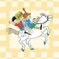
In 51 charmingly illustrated infographic maps, explore every state of the USA from Alabama to Wyoming! Includes an expansive guide to the state flags and US presidents.Discover more than 2,000 facts that celebrate the people, cities, nature and historic events that have helped make America what it is today .Ghost towns, swamp tours, the center of the universe… bacon donuts, brainy berries, salmon jerky… The French Fry King, The Mother of Oregon, The Queen of Blues… be inspired by the inventiveness, beauty, and diversity of the United States in this curious collection of fact-filled maps .On each wonderful map, Each state’s map also contains information about which states it neighbors , its bodies of water and borders as well as where it is situated in the country . Did you know that while Hawaii shares its border with no one, both Missouri and Tennessee border eight other states? Many state parks , battlefields , national forests, and reservations are also included to inspire you to explore the great outdoors.So pack your bags and say later ‘gator… the great States await!The 50 States series of books for young explorers celebrates the USA and the wider world with key facts and fun activities about the people, history and natural environments that make each location within them uniquely wonderful. Beautiful illustrations, maps, and infographics bring the places to colorful life.Also available in this 50 Adventures in the 50 States, 50 Trailblazers of the 50 States, Only in America, Only in California, Only in Texas, We Are the United States, and a wide range of activity books.
Gabrielle Balkan writes for readers of all ages, equally enjoying picture books and readers as chapter books and young adult fiction. Her works include The Dog Rules by Coco LaRue, a Scholastic Book Fairs best-seller that sold 150,000 copies and demanded a follow-up.
One of her first forays into writing nonfiction was “America is hard to See,” a children's audio guide for the the inaugural exhibit at the Whitney Museum of Art's Gansevoort location. The 50 States was Gabrielle's first non-fiction book and was followed by two companion books, two activity sets, one follow-up atlas: 50 Cities.
She's also the author of BOOK OF BONES (an International Literacy Association pick) and it's companion, BOOK OF FLIGHT (coming in Spring 2019).
Before embarking on a career as a full-time writer, Gabrielle was a book buyer for the Scholastic Reading Clubs, a commissioning editor for Scholastic Paperbacks, and the Director of Communications for City and Country School.
Gabrielle was raised across from the State Fair Grounds in Indianapolis, Indiana and lived short stints in Augusta, Georgia and Zurich, Switzerland. After graduating with a degree in English and Elementary Education from Barnard College she decided to see what else the city had to offer, and now lives with her family in Brooklyn.
Everything you want to know about the 50 U.S. states, with stunning art and 2,000 intriguing facts. Should be available in every home and school library!
A fun factoid type book for children to learn about the 50 States and Washington DC. Each gets two pages that includes a cartoon map of the state, historical timeline, fun information, and a few nods to notables in the states. There are also key facts for each state including capital, largest cities, statehood order, state bird, lower, tree etc. This is the kind of fun overview book students would check out of my school library. It isn’t detailed enough to do state reports that one of my elementary school grades requires. I personally was disappointed a little in the information chosen about my own state. But it is hard to summarize a whole state in two pages. Overall, I think kids would enjoy reading and looking through
An ideal book for all school libraries – not just those in the titular 50 States. This gives us a double-page spread for all fifty, with a rough guide to where a select few things are; peppering the maps are tiny box-outs for six famous people per state, and more or less as much trivia as can be fit in, while beyond that we get proper text boxes for a timeline, a discussion of the state, and a databank of major cities, year of inclusion in the list of 50, name meaning, time zone, etc etc.
Some of this is certainly on the trivial-seeming side, but if people felt the need to declare a state neckwear for Arizona then clearly it wasn't exactly trivial to them. And this is certainly not the only gazetteer to focus on the bonkers superlative, such as Idaho having the world's biggest potato chip. But as I say, beyond the rest of the world needing to know this information about all these states, when we see the world's first parking meter, or typewriter, we know we have something of international interest, and that this isn't as jingoistic and inward-looking as you might think. Heck, it's already told you a few things you shouldn't smuggle from New York State to Canada.
I might query the need for this to be in paperback, but it has had a slight update and rejig for that format, apparently, and the 2015 original printing was definitely getting on a bit. That figure is, ultimately, a pretty damn decent review in its own right, mind – the fact this is still in print (and the daddy-o of several similar books) is proof of its many merits. I don't think it would inspire a road trip, or a visit to the great outdoors, as it says it intends, however – it would keep a young me rapt and firmly indoors for all its detail. Four and a half stars.
I have three kids and they all loooove to read. The problem that I sometimes find is that their books lose favor with them quickly, especially as they grow into independent readers. This book is the exception -- you can buy it (maybe even grab one for each kid because they won't want to share) and your children will find something new every time they open the book. The pictures are so beautiful, the facts are interesting, and my kids are learning about US History. It's a win-win.
I'll give an example from my home state of Maine:
- Gorgeous font and photos that kids and adults will enjoy - There is a map showing where the state is in relation to the rest of the country - It gives "moments to remember" which include, aptly, the launch of LL Bean - Key facts give quick facts like the statehood date, the state flower (white pine cone!) and the capital - The map itself, the centerpiece, reads like an infographic which highlights famous Mainers and highlights some of the natural sights of the state, including my personal favorite, Katahdin
Beautiful book that I'm going to buy for all my friends kids when their birthdays roll around.
I’ve been eyeing this book for awhile and jumped at the chance to review it!
As a homeschool mom- this book is everything I could dream it would be. We loved the fun, interesting facts. Aesthetically, it was pleasing to look at (and yes- would look great on a shelf!). My kids are studying American history this year, and I think it would be a great resource to use for research projects or even just learning a couple states a week. I have a daughter that is obsessed with the states right now and is loving learning all the new things that aren’t in every other state book we own. This one is unique and different and would be a great addition to a homeschool shelf (or even a classroom shelf or child’s book shelf- every kid needs access to this book!).
Thanks NetGalley for the chance to review this book. I was provided an electronic copy for review, but all views and opinions are my own.
Thank you to NetGalley and the publisher for providing me with this book in exchange for my review! All opinions are my own.
As someone who is fascinated with history, I enjoyed this children's book, I thought the illustrations were colorful and eye-catching. I would say that this book would probably be best suited for children 7+, -- I think it may be a little advanced for some readers. But the great thing about this book is that it both entertains AND educates children. This book is the perfect book for elementary school teachers and librarians to add to their shelves. I enjoyed reading this book overall :)
"The 50 States" by Gabrielle Balkan is a visually stunning book full of infographic maps of the United States.
I appreciated the inside cover page that explains how to explore the book. Packed full of facts about famous people, state icons, largest cities, places of interest, and more, this book would make the perfect classroom companion for public schools, private schools, and homeschools alike.
I can't get over the graphic design of this book. It's absolutely brilliant! The illustrations are colorful; the fonts are fun, yet readable; and the infographics are well laid-out. Children of all ages will be drawn to this book, and parents and teachers will love reading it to them!
I received an advance copy of this book from NetGalley in exchange for an honest review.
The 50 States is a wonderful educational tool for children. Filled to the brim with historical data, facts about each state, and other tidbits of information, children of all ages will find this book informative. The colorful and vibrancy of the illustrations grab your attention.
I loved the historical facts, state information, and the spotlights on famous and influential people who came from each particular state. The "Moments to Remember" included on each page feature historical events and the dates they occurred. I enjoyed learning different things about each state, but especially my own state of Michigan. This a great tool for educating everyone about the United States.
This has so much packed into it. Probably one of the coolest books I’ve seen on the fifty states and the most facts I’ve seen on the states. I was really excited for my kids to read this. They’re finally learning about the states and this book was so colorful and engaging. The fact’s ranged from fun random facts to some cool historical facts. My favorite was learning the origin of each states name. I would definitely recommend this book to family and friends and anyone with school aged kids. This was awesome!
I voluntarily reviewed this after receiving a copy.
I really like the illustrations that show the major elements and facts about each states in the USA. I like the creativity and the colors - infographics just make my artist heart glad! Even as an adult, I feel tempted to buy a hard copy of this for myself.
A lot of research go into a book like this. I feel confident about the accuracy of the facts as librarians and fact-checkers were used, and for just one country. For a book about the whole world, I think it would have been more difficult.
This is a lovely educational book. Beautifully illustrated and jam packed full of interesting facts and trivia about each State, covering a wide range of things. Each State is given its own two pages in the book. The only thing I would say is we had this as an ebook, to fully appreciate the book I feel it would be better read in physical format especially as each page is so jam packed with information.
This is a great book for young kids to learn about the 50 states and the US capitol. Each state is featured with a blurb about the state and highlights famous people from the state, important events that occurred in state history, fun facts about the state, popular sites, info about various cities throughout the state, and more. The illustrations are cute and engaging. A great companion for children that are learning about US geography and the 50 states.
I loved this book! Not only was it easy to read with my little one but I too enjoyed it. It's the perfect book to cover all 50 states. We loved all the details and facts about each state. I liked that it is in alphabetical order so it was easy to cover all states. There are so many facts that are covered however they are short so it's not overwhelming for children and also people like myself who deal with ADHD.
Thank you NetGalley for providing me with an ARC of this book in exchange for an honest review. This book is so fun, and informative. It was enjoyed thorowly by me and my kids. The only draw back was the format i recieved, could not read it on kindle or any other tablet. Had to read it on laptop which was not convininet at all. But it is a beautiful book and would buy the phisical copy to enjoy.
I was very impressed with the amount of information the author was able to provide on each state. Filled with fun facts on each state individually and in relation to states they border. I see this as a great book for younger readers.
Thanks to the publisher and NetGalley for letting med review this book. This was a fun read about the various states and fun facts. I like that there were several kids’ book recommendations as well.