Byddi Lee's Blog, page 24
September 18, 2015
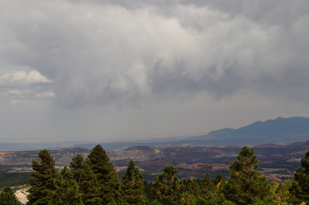
Dem Bones
Day 7 Moab – Vernal/Naples
Mileage 218 miles States – Utah, Colorado, back to Utah
This morning I regretted pre-booking accommodation for the next 5 nights. It left me feeling tied to a schedule, not that we had wavered much from our schedule to date, but I was on the brink of canceling the Yellowstone portion of the trip and just staying amongst the red rocks of Utah.
Alas, the bookings (bar one – ya gotta love www.booking.com) were non-refundable. We had to go... In fact, part of what was putting me off was that the 3 nights (over the weekend, worst luck) in Yellowstone were booked with a place that had terrible reviews. At $175 a night, you’d expect a palace, (well, I would!) but this place does not look inviting. We just weren’t prepared to fork out the $350 a night for the next available option!
So we hit the road again, following the Colorado River. I’ve grown very fond of this river. If it were a person, I’d imagine it as a weathered old western miner/prospector, with a beard, a floppy hat, a battered map in one hand and a quarry pick in the other - a crusty old guy with plenty of stories to tell.
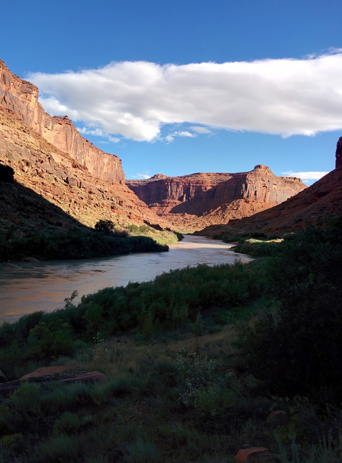
We stopped to take our last picture of the river and stumbled across this charming little campsite.
 Utah has provided the best toilets everywhere we went. Even their long drops smelled nice – no kidding! But this little campsite had the cutest little convenience. A long drop with just a fence around it, enough for privacy but allowing you to stay in the fresh air! We did wonder how it would work on a cold rainy night though.


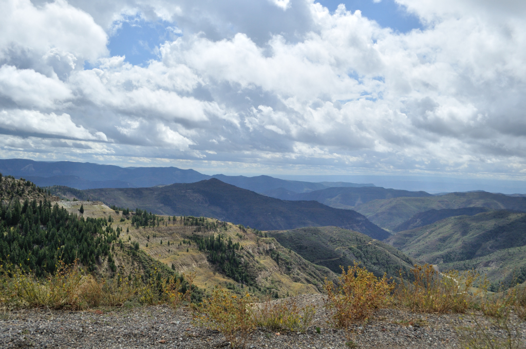
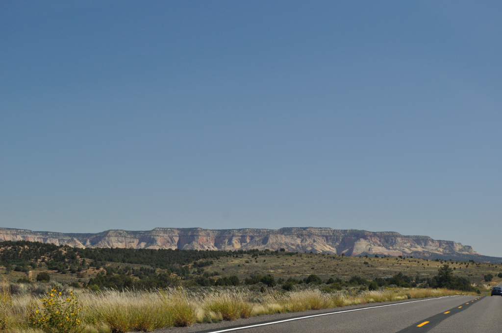
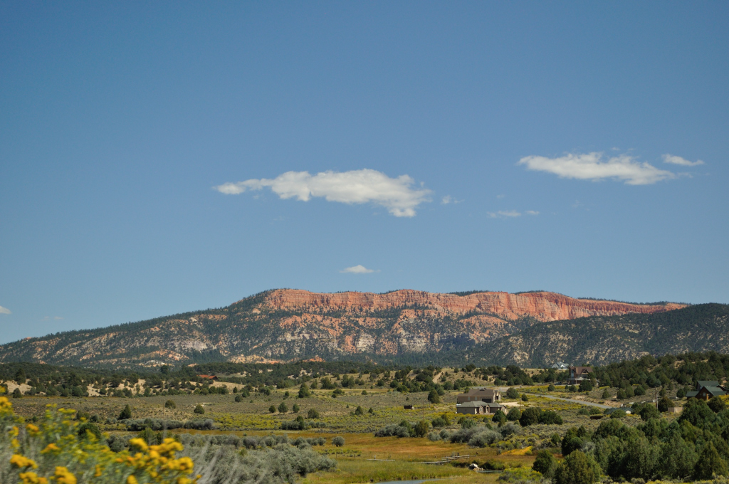
The scenery became much less dramatic as we left the red cliffs behind us. If we’d not been subjected to the splendors of Utah for the last week or so, we’d undoubtedly have oooed and aaahed over this, but now we could only describe it as “kinda nice!”

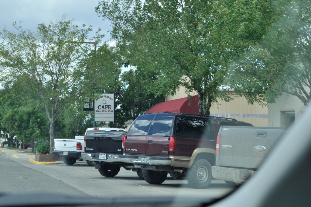
We dipped into Colorado and passed through a town called Rangely where everyone drove a pickup truck! We felt quite self-conscious in our little Prius.

We were surprised to see oil rigs in this area…

…but then realized that it made sense – we were in Dinosaur country after all. They even had a church for them!
 And a town hall…oh look another pickup truck! Maybe the wee dinosaurs ride in the back and the bigger ones use them like roller skates and put one on each foot? How else do they get to church?

But this fella didn’t look too friendly! Perhaps it's because he has no pickup - that digger in the background doesn't look too comfy and the other dinosaurs at church probably laugh at him - poor thing!

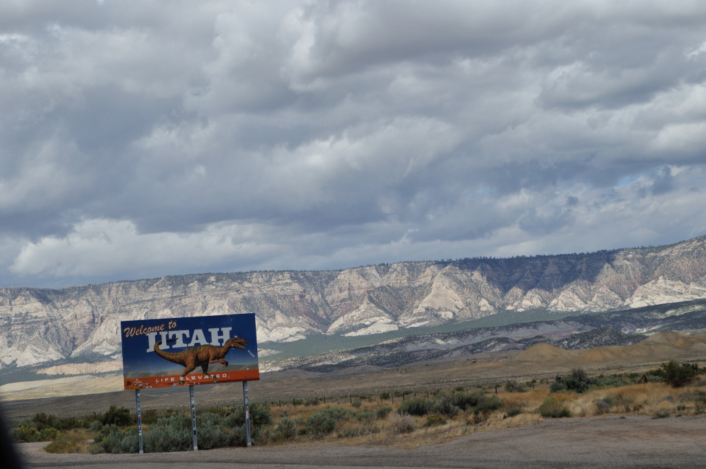
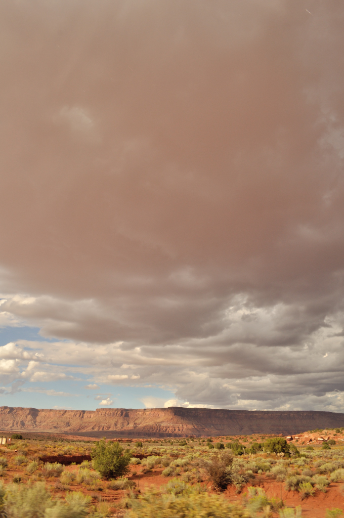
Dinosaurs were evident when we crossed back into Utah too.
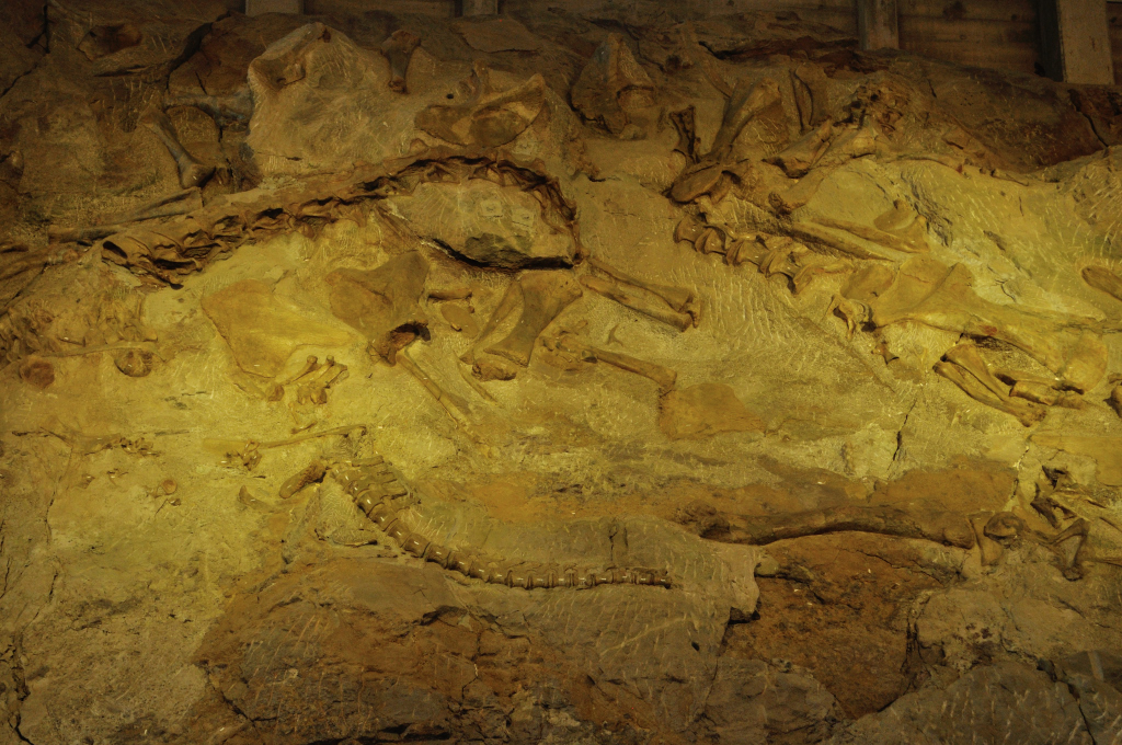
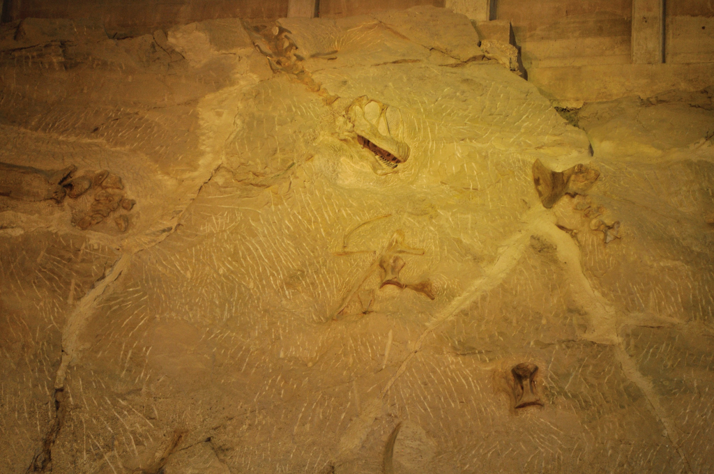
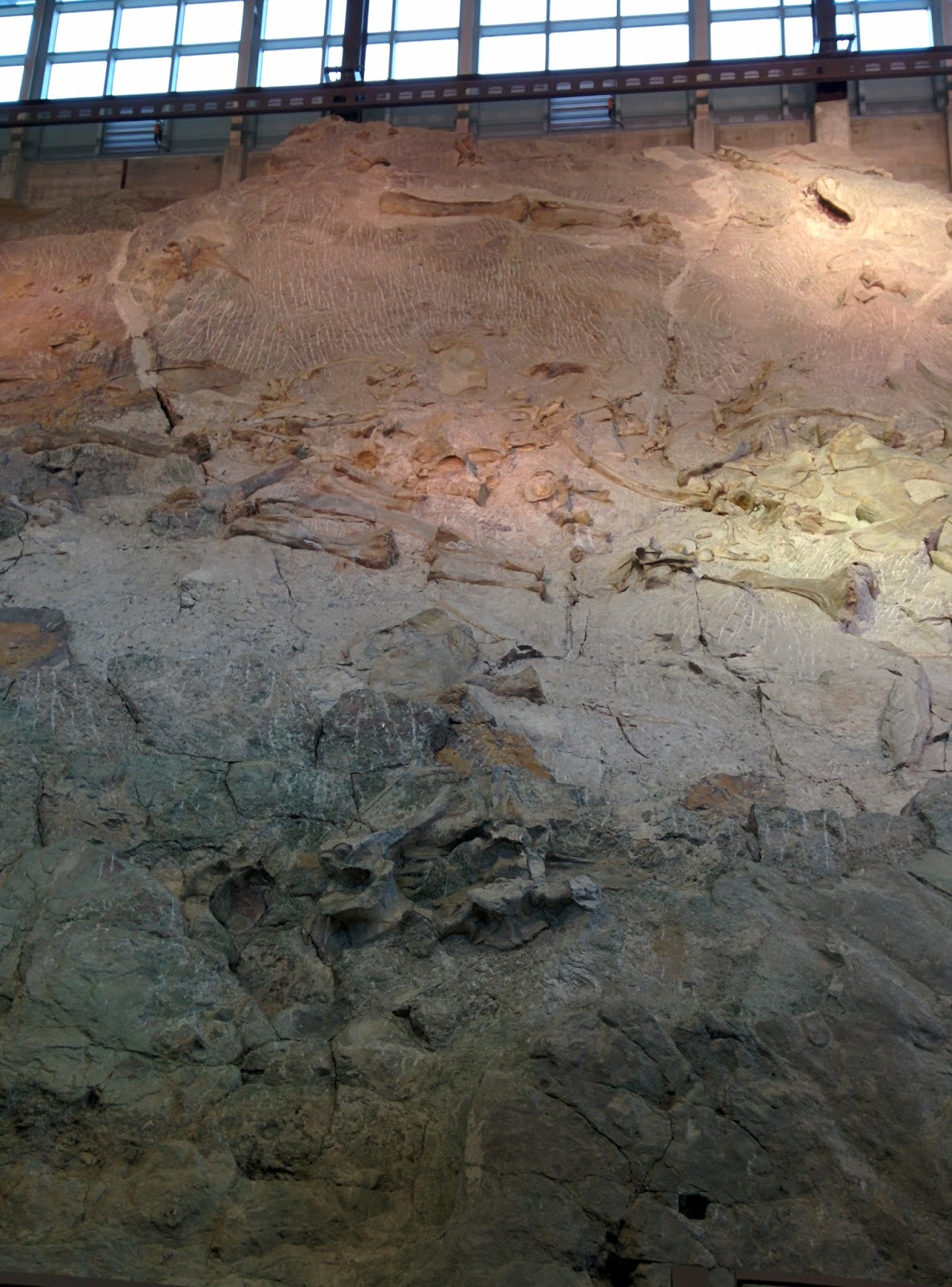
The highlight of the day was Dinosaur National Monument.
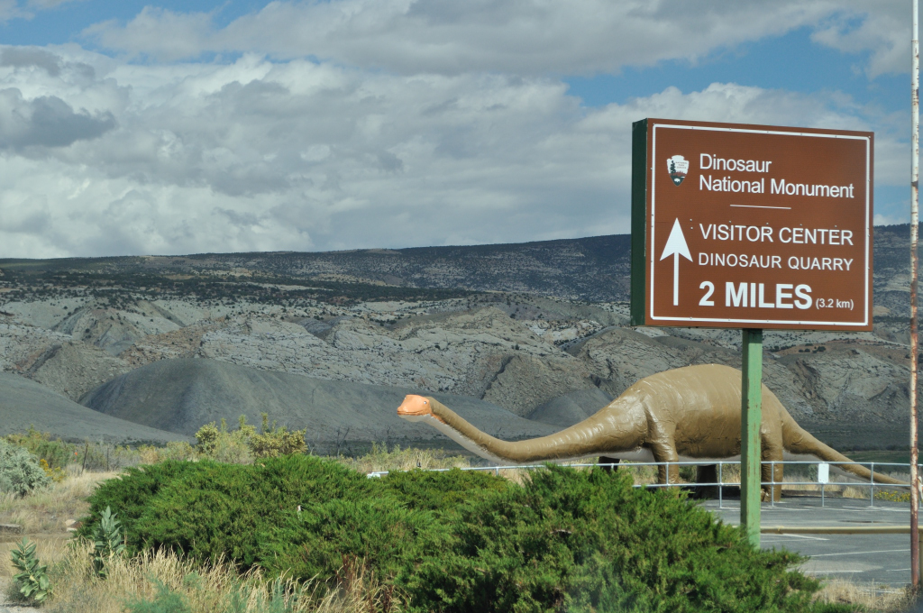
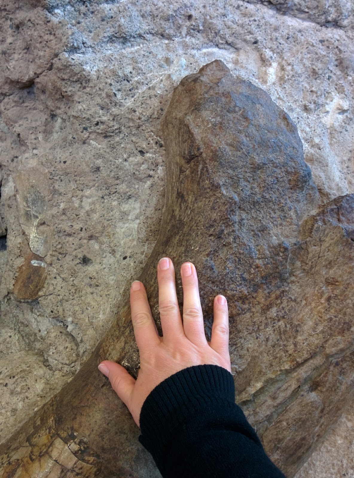
The National Parks and National Monuments have delivered every time and this was no exception. I felt like a 7 year old again as I revisited my fascination with all things dinosaur. I was especially impressed that we could see actual dinosaur bones and not just fossils. We were even permitted to touch them – so exciting!

We got chatting to an English couple, and it turned out that one of them had gone to University of Ulster in Coleraine, on the North Coast of Ireland, the same place as My Husband. The two alumni were thrilled to meet so far away from home. What are the odds? Nearly as low as a whole bunch of dinosaurs all dying in the same place (possibly from dehydration as the climate changed and the river dried out) and having their bones preserved for millions of years. Or possibly 3000 years ago, as I overheard one lady explain to the people with her. That made me chuckle!


That night we stayed in the nearby town of Vernal/Naples.

The hotel here was beautiful – the Microtel Inn and Suites by Wyndham. Such luxury! Got to make the best of it before we get to that place in Yellow Stone the night after next. Maybe there wasn’t much to look at out the window, but I did have the best night’s sleep ever, and you can’t look at scenery when you’re dreaming about dinosaurs and rivers that take human form!
Byddi Lee


September 17, 2015
Canyons and Arches
Day 6 Moab – Canyon Lands and Arches National Parks
Mileage 0 miles States – Utah
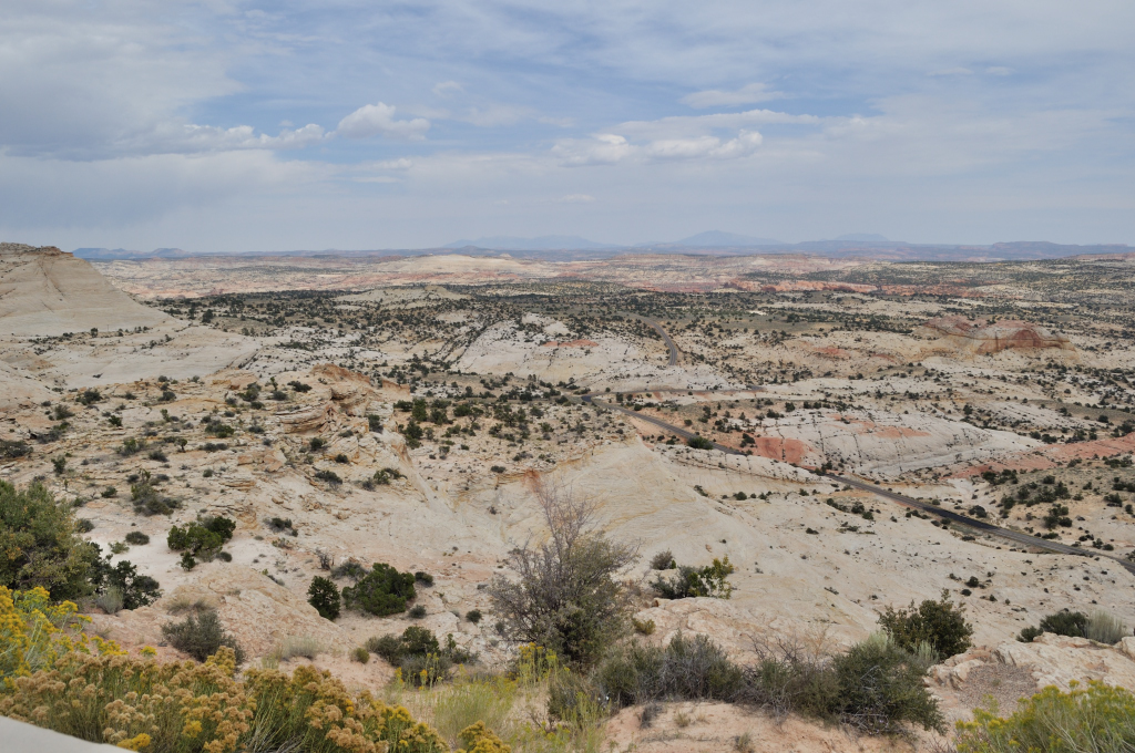
It seems to me that most of Utah is a national park and rightly so. Our eyes have been spoilt by the dramatic scenery for several days now. Moab is right beside two National Parks. You could spend a week here and never hike the same trail twice, not to mention all the water sports and biking on offer here too. We’re coming back…for sure!
We began our day in Canyonland’s Island in the Sky, planning to view the Arches National Park around sunset. The drive through the park is the typical knock-your-socks-off Utah style beauty.
 This rock looks like it will fall any minute!
 We hadn’t planned on a long hike, but the urge to wander struck at Upheaval Dome. Here's the science!
 We hiked to heart-stopping cliff-edges, leaving only as black clouds tumbled in towards us.
  This would not be a good place to be in a lightning storm. I’m not sure if it was a mistake to read Shattered Earth this summer. It’s an account of hikers caught on Half Dome in Yosemite, California, in a lightning storm that killed two people and severely injured a couple more. Perhaps, it’s a good thing I read it. I am subsequently more aware of the dangers of electrical storms.
 Fortunately the skies were clearer on the other side of The Island In The Sky.
 Island In The Sky is at the confluence of the Green River and the Colorado River. Major John Westly Powell explored these rivers in 1869, and as I sat looking over the convolutions of the Colorado River in the canyons below, I tried to image what it must have been like to see this land from the river, turn after turn, looking up at the sheer canyon walls and not knowing what they would find next. I’d be lying if I said that there was no envy mixed in with my admiration for that geologist and explorer.
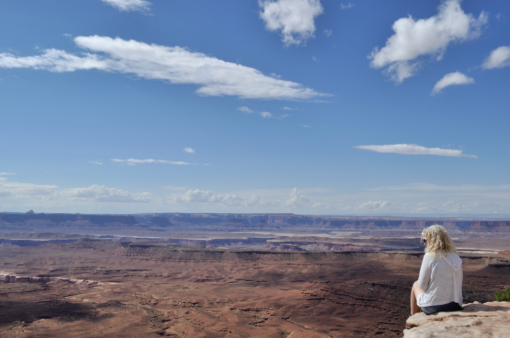 At Grand View Point Overlook, I gazed down at the Colorado River with renewed respect. Yes, I’d seen the Grand Canyon, but it’s actually hard to see the river and connect its actions to the creation of such a phenomenon. From this vantage point, I could see the Colorado River winding and looping in the distance, a testament to perseverance. It carved out these spectacular canyons one speck of dust at a time, its only tools the rocks and sediments it carried, and gravity it’s relentless driving force.
We spent way too much time in Canyonlands and not enough in Arches, but we like to leave something to come back for…did I mention I want to come back? This park has over 2000 Arches. I want to see them all!
At Grand View Point Overlook, I gazed down at the Colorado River with renewed respect. Yes, I’d seen the Grand Canyon, but it’s actually hard to see the river and connect its actions to the creation of such a phenomenon. From this vantage point, I could see the Colorado River winding and looping in the distance, a testament to perseverance. It carved out these spectacular canyons one speck of dust at a time, its only tools the rocks and sediments it carried, and gravity it’s relentless driving force.
We spent way too much time in Canyonlands and not enough in Arches, but we like to leave something to come back for…did I mention I want to come back? This park has over 2000 Arches. I want to see them all!
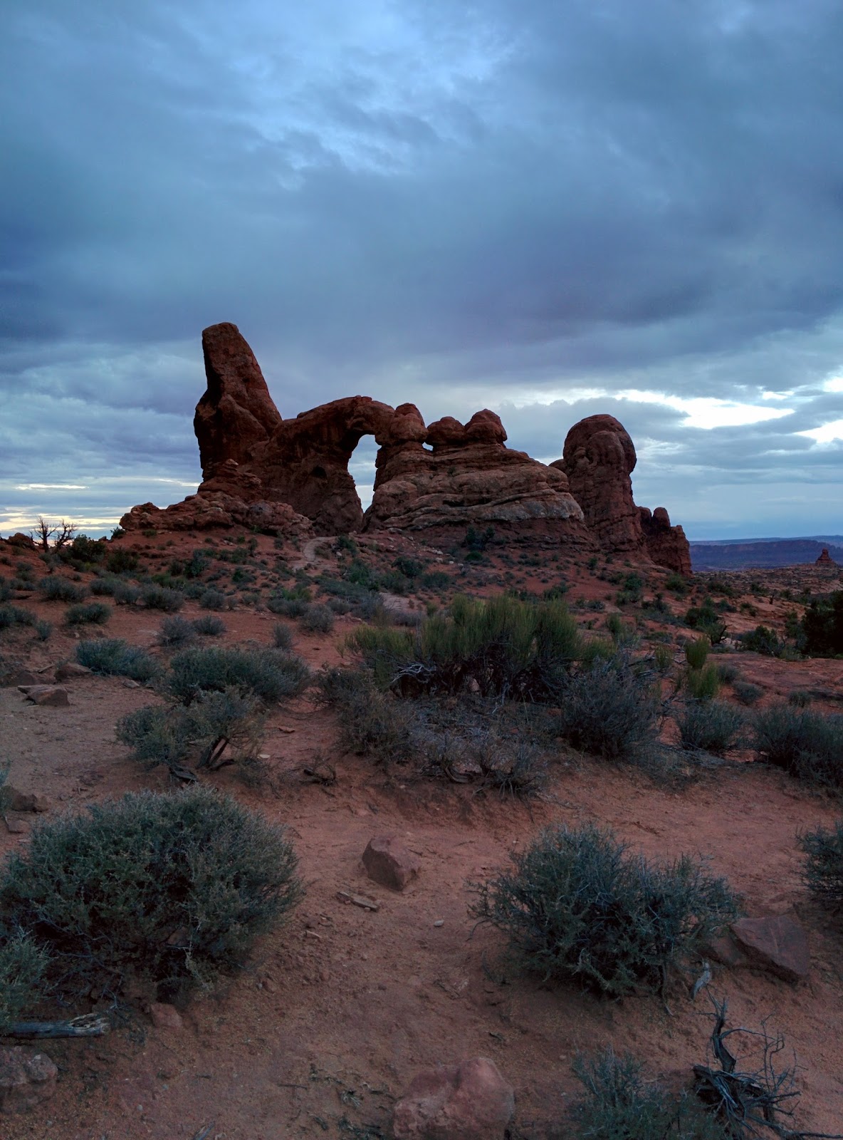
 What time we had in Arches was spent at the Windows area, during sunset. The play of light on the rocks gave us great photo opportunities.
 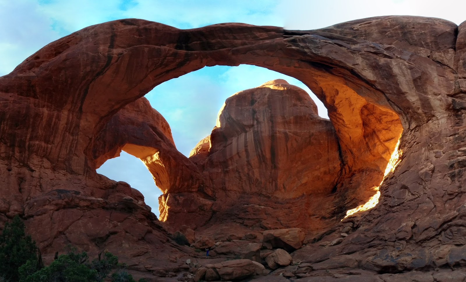 Double Arch
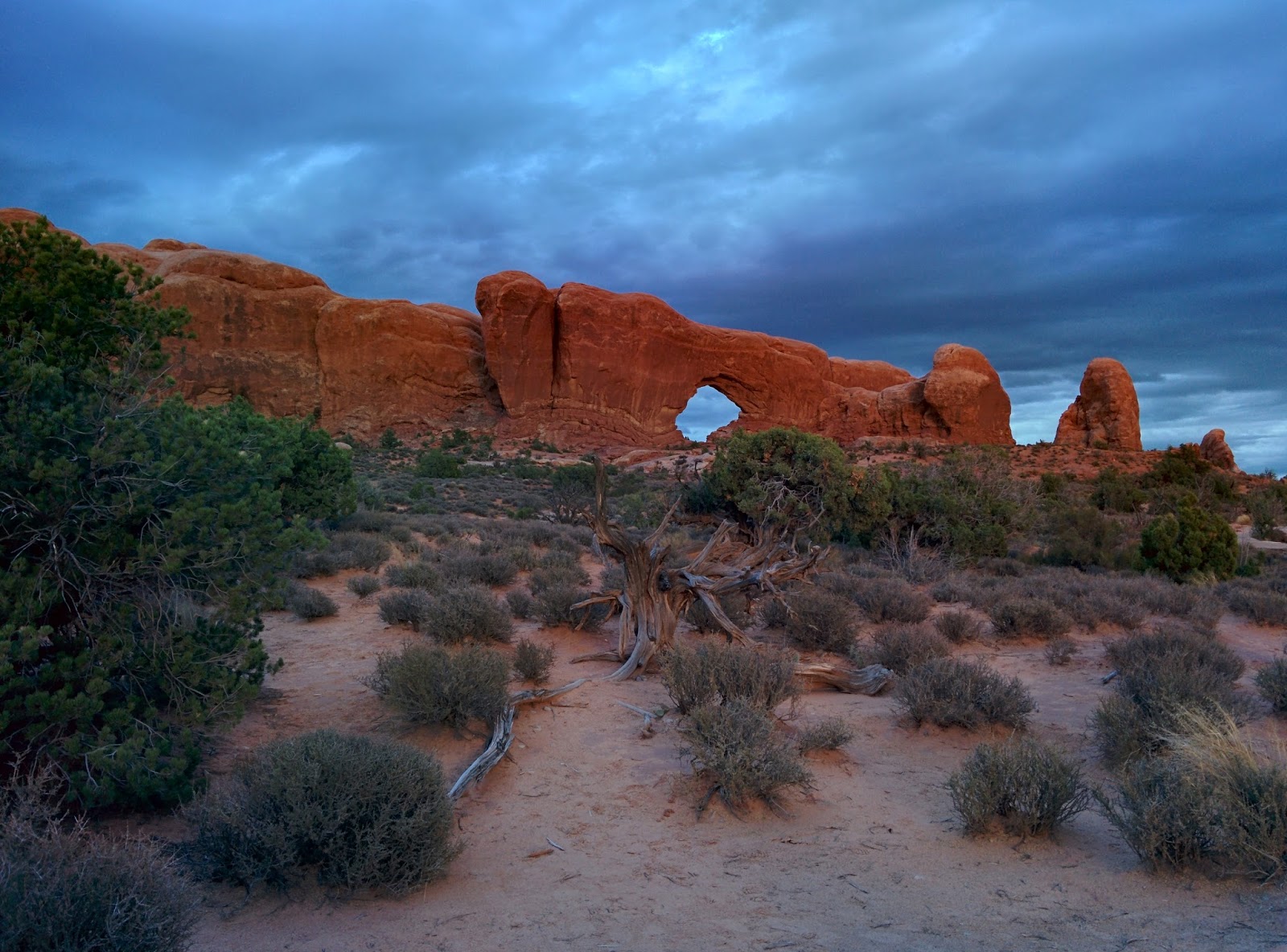
 Smile!
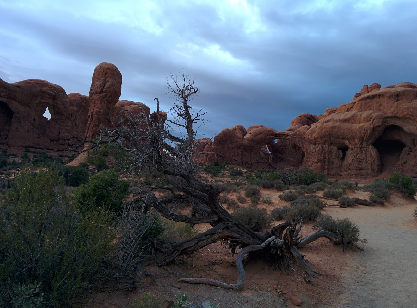
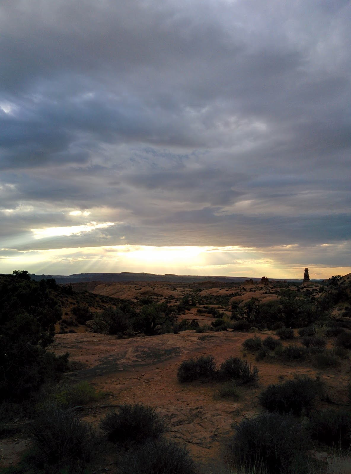
But all too soon we lost the light and the cloud cover obscured the star display. It was time to head back to Moab and feed our bellies having stuffed our eyes full of goodies all day.
It was dark when we arrived back in Moab. We were hungry and tired, but at least we knew we had a roof over our heads, albeit one I’d had to clean myself! We decided to keep it simple and go to the Denny’s beside the hotel for a quick dinner. Plain food, good prices…we could eat gourmet at home. But there was nothing left on the menu other than beef burgers! Everything had sold out. Now, this wasn’t a problem for me, but My Husband hates the taste of beef. So we had to get back into the car and drive into the town center, where we found a nice wee spot that was just the ticket. Not finding something to eat in Denny’s was the last thing we’d expected, but we decided that it was a better drama than the usual nightly drama of finding somewhere to stay.
That evening we took advantage to the free WiFi in our hotel and pre-booked the next 5 nights stay. Good job we did. There was nothing at all in Yellowstone Park and very little in the towns at the gates. What little we did find was eye-wateringly expensive. Eventually, we found something that fit our pockets, if not our sensibilities.
Tomorrow we’d head north and leave this wondrous area. I’d be sad, not feeling quite ready for a change of scene just yet, but I looked forward to the next stage in had become an epic journey.
Byddi Lee

Wilie Coyote Country
Day 5 Hanksville to Moab
Mileage 270 miles, States – Utah
Miles ahead of schedule 81 miles
Hanksville wasn’t much more than a junction and two motels. We hit the road and soon found ourselves traveling through the Glen Canyon, alongside the Colorado River on its way southwest to, what some would consider, its master piece – The Grand Canyon.

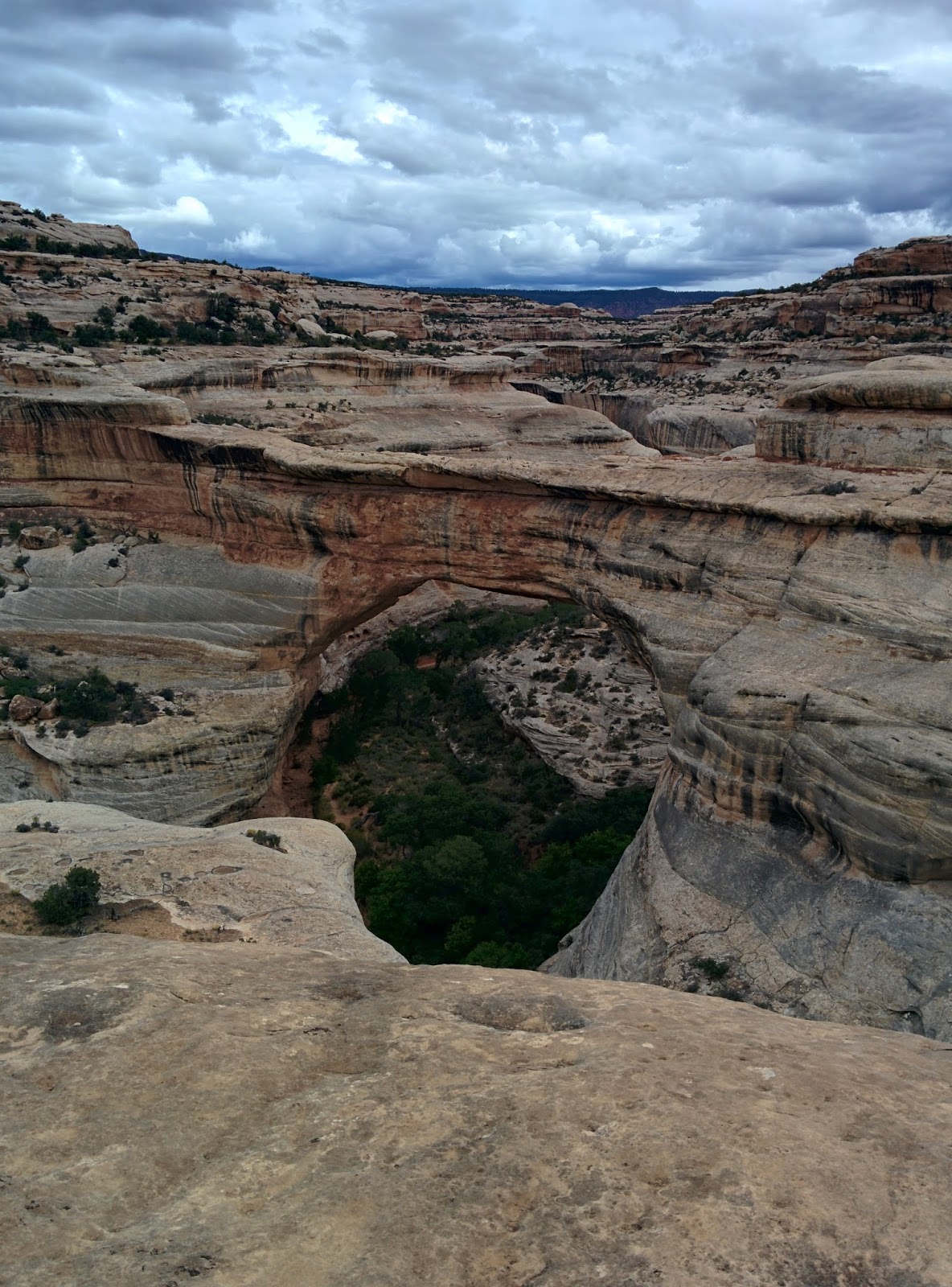
We forged our way up stream, eastward bound for Natural Bridges National Park. Any minute we were expecting to see a road runner and a coyote balancing rocks on cliff edges. Meep Meep!
 The views of rose colored cliffs, buttes, standing rocks, rock walls with hanging caves (sometimes called arches) continued to draw gasps of amazement from us such that our conversation for miles upon miles seemed to be a continued exchange of “Wow!” “Look at that!” and at one point “Oh God , I can’t stand it anymore – it’s too beautiful!”

We made it to Natural Bridges around lunchtime which was unfortunate since it didn’t have a restaurant, or even a café. We did manage to buy a couple of granola bars and some trail mix in the gift shop. Luckily, we’d stocked the car with lots of water. We’d hardly starve in an afternoon, but dehydration is a real risk in these dry parts.

There are three bridges to view on a 9 mile loop. At each one you can take a hike down beneath them. This involves step hiking in often extreme temperatures. We chose to hike down to the first one we came to, Sipapu Bridge.
In places, it was so steep the trail was actually a ladder.
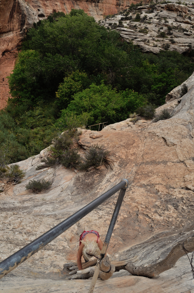
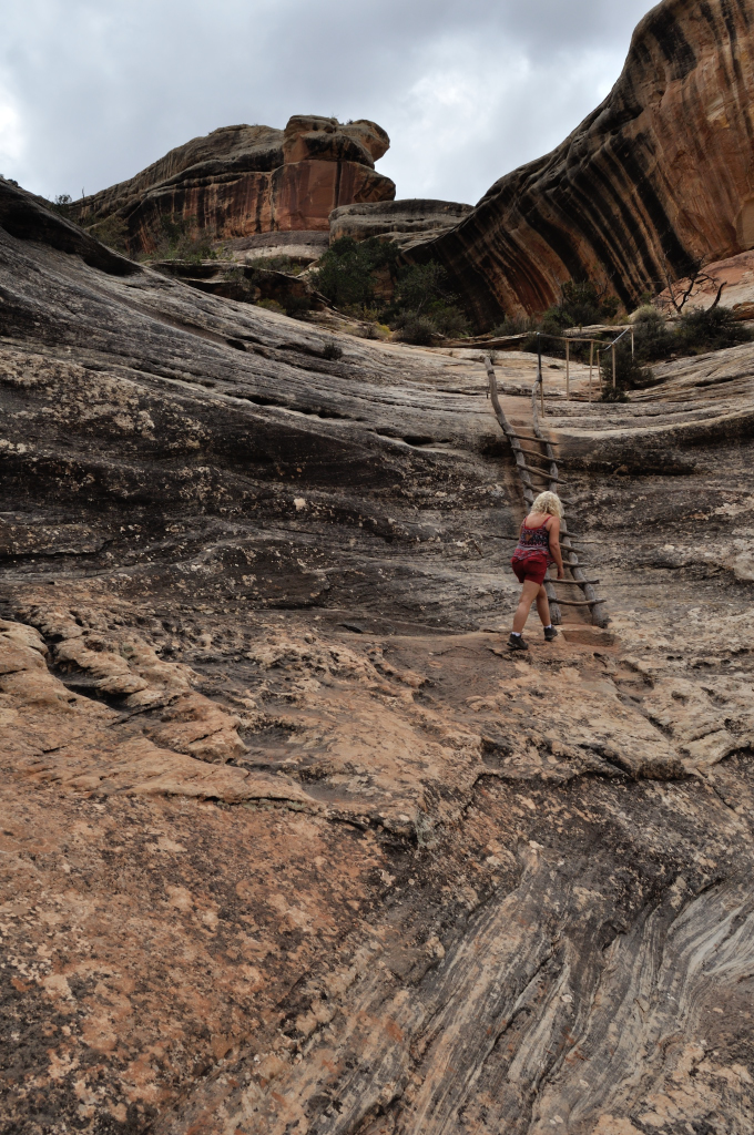
There were steep drop-offs. This trail sign tickled me. If you needed to be told this,you shouldn't be hiking here!
 Sign says, "This is not a trail. Turn Back."I don’t have a good head for heights, but the splendor of my surroundings proved to be a great distraction, and I made it down to the bottom. (Going up was actually easier mentally, if not physically.)

From here you could hike along an unmaintained trail to the other two bridges, better still if you had a second driver and set up a shuttle.
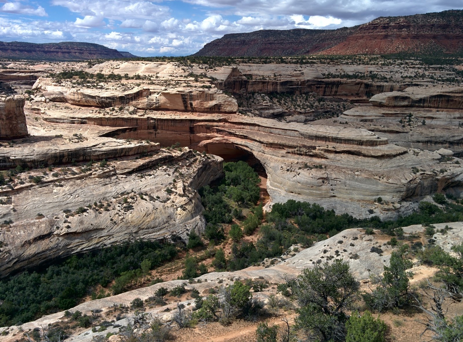 Kechina Bridge
We hope to come back and focus more on hiking this area than driving next time!
 Owachomo Bridge
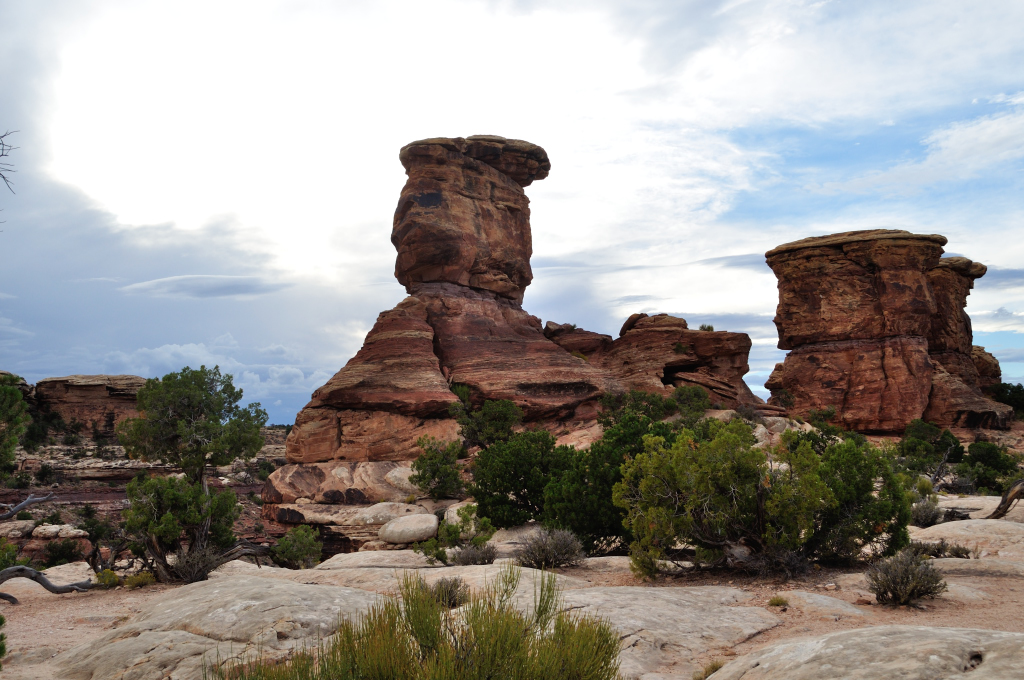
From Natural Bridges we headed to the Needles, a more remote section in the southern area of Canyonlands National Park. This part of the park got its name from the rock pinnacles banded in red and white, with sculptured rock spires, arches and canyons.
We had earmarked this as a possible camping night, but as we approached the park, leaden clouds gave a stunning backdrop to the terracotta red walls of rock we drove between. We’d watched the clouds all day, as fascinated with their shapes and colors as we’d been with the land they rolled across. Yesterday, we’d wished we were geologists, today we wished were meteorologists! Especially when we noticed that the undersides of the clouds reflected the red earth below, turning them pink even before sunset.
The most special moment in a day that had already set the bar high for special, was when a double rainbow sprung up, contrasted perfectly against pewter clouds above a gigantic red wall of rock. By the time we’d screeched to a halt (the road was empty so we just stopped right in our tracks) and gotten out, the double rainbow had merged into one with more vivid colors than I’d ever seen before.

The storm clouds on the horizon swallowed what was left of the evening, leaving us without the sunset we had hoped for. Sprinkles of rain made us think twice about camping. Besides, we’d no food. It felt like we were on the “Drive Yourself Thinner” diet!
 So we decided to break our “no road tripping in the dark” rule (well, rules are made to be broken!) and blasted the 81 miles straight to Moab. Once there, we’d have made up the miles we’d lost the day before and even have gained some, since that was our port of call the next evening as well. Two nights in the one spot! That’s a commitment, next thing we’d be checking out real estate…
As night fell, a bolt of lightning on the horizon lit up the sky in a yellow flash! What a treat. We continued to reel in natures splendor as another bolt cracked open the sky on the other side of us. Rain lashed the car, and the windscreen wipers got the best work out ever. We were so glad we weren’t camping! Another cloud, white and billowy, unlike the others lit up in a golden glow. This, My Husband told me, was an electrical discharge within the cloud. I’d never seen anything like it, more used to sheet lightening in Ireland and rarely seeing any in California.
We felt especially blessed to have witnessed this on the one evening we choose to drive in the dark.***Please see footnote.
As we approached Moab, described in the guide books as a happening hub for the National Parks in the area, the roadside motels all displayed a sign that struck dread into my heart. “No Vacancy”s all the way into town. My Husband got on the phone and began calling ahead too. Three in a row full – I could over hear the third one telling My Husband that the entire town was booked out. Would we have to camp after all? Would our tent even be waterproof enough? The next town, 50 miles away might be full too.
The forth call – the Riverside Inn said, yes, they had a room for $119 + tax. My Husband reserved it there and then, and five minutes later we pulled up outside it. It looked nice from the outside…but looks can be deceptive.
The lobby smelled strongly of “pine fresh” cleaner. I wasn’t sure if that was a good thing. We found our room and went back to the car for our luggage and noticed that the “No Vacancy” sign was now lit. We decided that if we were a Wild West outlawed gang our name would have to be the Last-Room-Lee Gang.
It might have been better than camping in the thunder storm, but the room was dirty, very dirty. The carpet felt tacky against bare feet. The sideboard was covered in food crumbs and there was some spilt liquid, now dried to a translucent syrup. And the bathroom – ewgh! Earlier, on the way out to the car I’d noticed not just a laundry room but also a bottle on Clorox on the shelf above the sink. I sacrificed one of the facecloths and set too cleaning the room. It’s amazing what a half cup of Clorox down the loo can achieve! It’s not the first hotel room I’ve cleaned before – I’ve done this in France, India, and Canada (but at least I got paid to do it in Canada!) and quite possibly it won’t be the last.
We settled in for the night, trying not to think about bed bugs and fleas and vowing to reform the Last-Room-Lee Gang.
Byddi Lee
***Footnote – by the time I got a chance to post this account, we’d learned that as a result of this same storm there had been a flash flood in Zion that killed at least 4 people, and 3 are still missing as of time of writing. 16 people died in a town called Hildale, just south of there in another flash flood. It’s hard not to feel guilty about enjoying the spectacle of the storm having now learned of its devastation. It makes you realize that nature really is (to steal a phrase from W.B Yeats) a “terrible beauty.”
I'd like to dedicate this post to the victims of the flash floods in Utah. May they rest in peace.

September 14, 2015
Driving Through a Gigantic Geology Book
Day 4 Bryce Canyon to Hanksville
Mileage 159 Miles, States – Utah
Behind schedule by 126 miles!
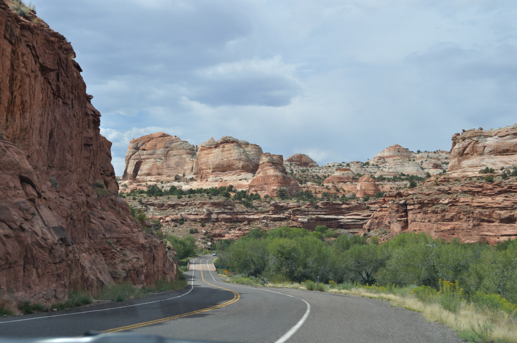
Another fight this morning to get Jane to route us the way we wanted, but I was determined to take Hwy 12 on our way to Capitol Reef National Park. I was glad I persevered with the navigation – Hwy 12 is one of the most spectacular roads we have ever traveled on…and to think we might have missed it if we’d just followed Jane’s navigation!

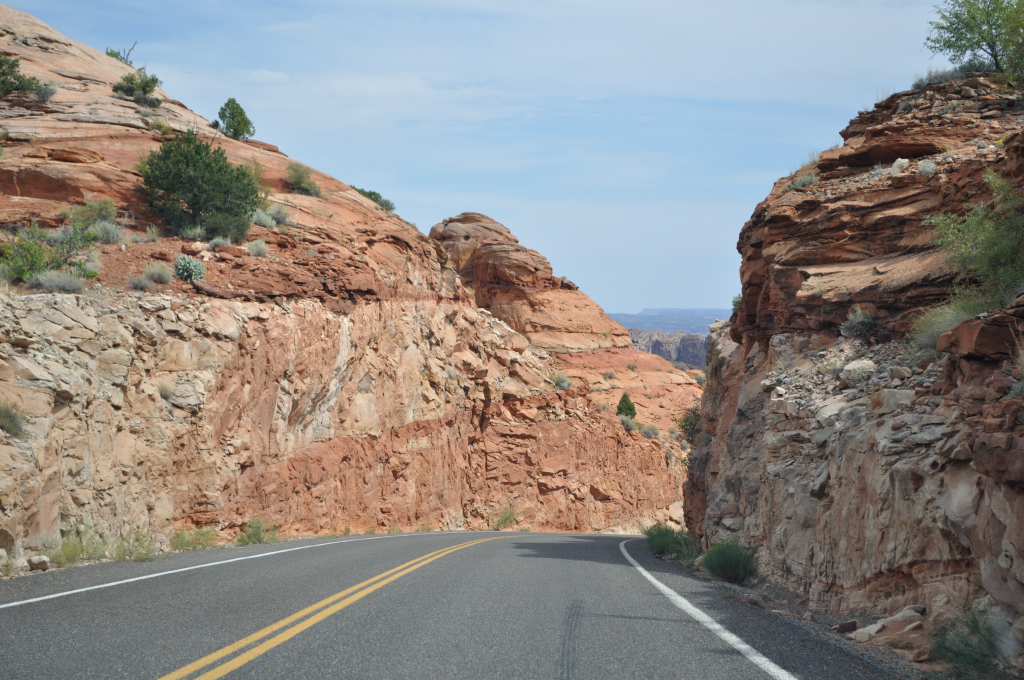
One stretch of the highway ran along the ridge with steep drops in either side – incredible! I wonder if how fast the erosion is and how long before the road is gone.

That said, we only made half the mileage we’d intended to today…each viewing point needed stopped at, exclaimed over, and photo graphed. Just when we thought it couldn’t get better the sky decided to join the act and chugged out some moody clouds.
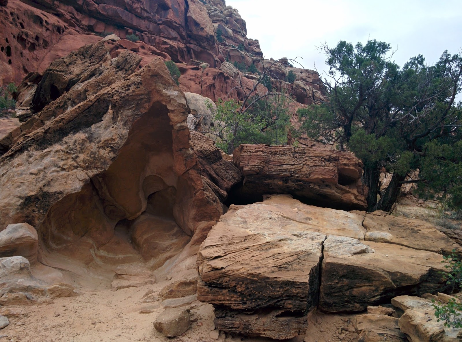
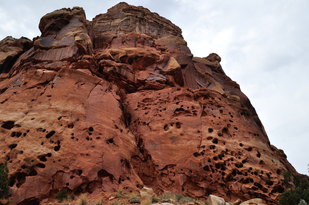
When we finally made it to Capitol Reef we decided to explore a little, rather than shoot straight through, and ended up taking our faithful little Prius down some dirt tracks! It felt like we were taking her hiking with us – lazy hiking, since she did all the work.

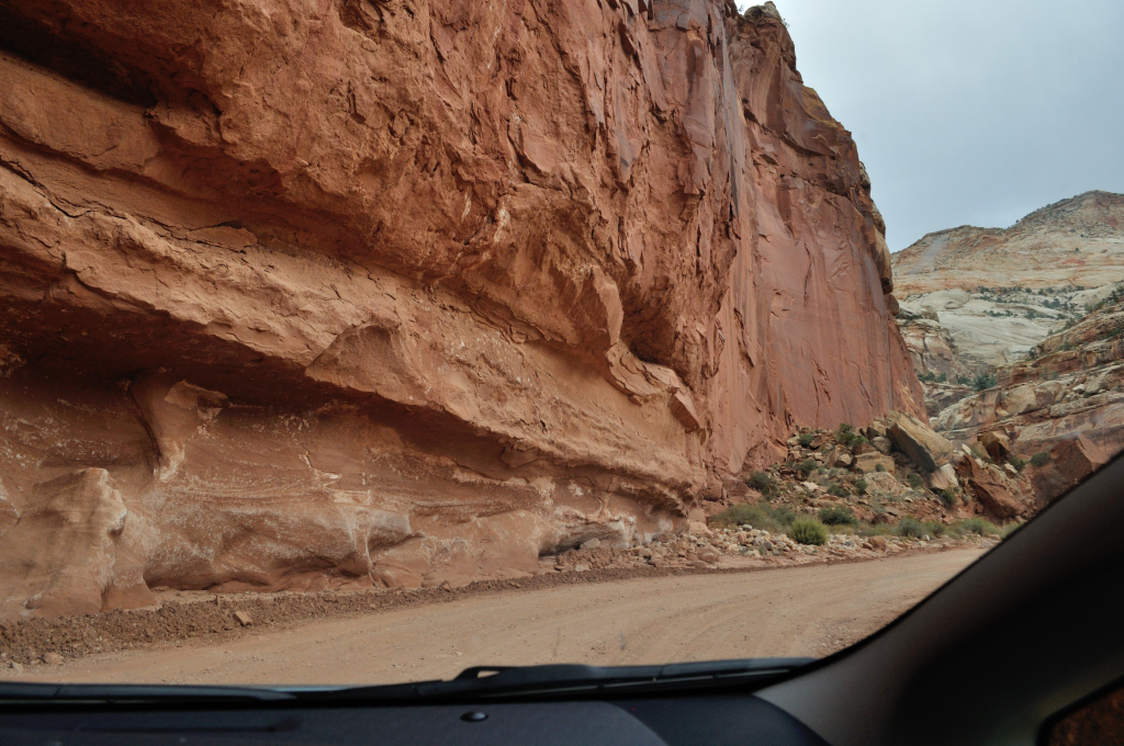

Some of the features reminded us of highly carved furniture. It certainly was a skilled craftsman who turned this out.

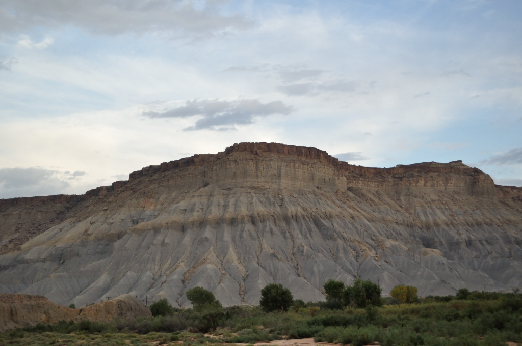
There were all kinds of rocks along today’s route.
Red rocks

Cream rocks
Rocks that look like castles

Rocks that look like giant snake heads

Stripey rocks
Holey rocks
 We spent the day wishing we had studied Geology at university.
Sunset was demure, secreted behind the clouds. As we lost light, we realized that we wouldn’t make it to Natural Bridges National Park as we’d planned and began looking out for towns, villages, heck, at this point it was so remote and off the beaten track, we even got excited at seeing a barn!
 It was nearly full on dark when we reached Hanksville, the next town on the road. No point driving in the dark and missing anything. One thing I found interesting about Hanksville is that it is only 7 miles from the Mars Desert Research Station. Not hard to imagine what inspired them to base themselves here. The landscape sure did look pretty Martian at times.
Hanksville is a town with too motels. One had a "No Vacancy" sign, but the other, the Hanksville Inn (the less salubrious looking place,) hadn’t. We went into the office of the Hanksville Inn and asked if they had any rooms left. The guy asked if we had a reservation. My heart sank. Next town was 130 miles away…
“No,” we said, mournfully.
“That weren’t very smart now was it?” he asked, grinning.
“No,” I admitted. “But this place is just so gorgeous, we had to stop at every single viewpoint.”
“Yep,” he said,rubbing his chin. “I can see how that would take a while.” He took a breath. “Do me a favor,” he continued. “Could you flick that switch over there.” He directed me to a light switch on the wall near me.
I turned the switch. Nothing happened.
My Husband pointed outside. The “No” on the vacancy sign had just lit up.
 “Ya got the last room!” Motel Guy said.
 My Husband and I whooped like he’d offered us the penthouse suite in the Ritz Carlton for free! Ah price…
“What’s the damage?” My Husband asked.
Motel Guy said, “Well, isn’t that the thang?”
We held our breaths. He could name his price really… He drew the moment out like those reality TV shows do when they are announcing who’s about to be evicted. We waited…
“$75 dollars, $65 if you only use one of the beds.” (Motel rooms usually come with two double beds in the US.)
“Deal,” My Husband said.
“Thanks a million,” I gushed – I’m great at gushing!
“Well,” Motel Guy said, smiling. “Ya made my day. I get to go home early, if I’ve less work to do!”
It turned out it wasn’t the Ritz Carlton, but it did the trick. We were exhausted after another astounding day’s scenery and colorful characters to boot. We’d make up the miles tomorrow…maybe…
Byddi Lee

Canyons, Mesas and Hoodoos
Day 3 Zion National Park to Bryce Canyon
Mileage 111 Miles, States - Nevada, Utah
What a spectacular day! This post is all about the photos because no amount of describing stupendous red rock gorges and amazing geological structures can do the day justice. Last night we managed to get the second last room in the Quality Inn and judging by the “No Vacancy” and “campsite full” signs possibly one of the last places to crash in Springdale. Hardly surprising since it was a Friday night and 7pm. Springdale, Utah, was a happening little place with a really nice vibe that we had not expected to find so close to a National Park. (We are used to the remote snobbery of Yosemite!)
We began Saturday by taking the shuttle bus into Zion Canyon. Cars are not permitted into the canyon from March to October (Sounds like a title of a book, right?). Our trip is more of a scouting mission. If we like a place we’ll try to make it back to do the detailed stuff such as longer hikes, (and chilling out) but for now it was the glance and click tour – for the most part.
Zion Canyon was beautiful - kind of a smaller and redder version of Yosemite. The buses were really regular, and we were very impressed with how organized the place was.
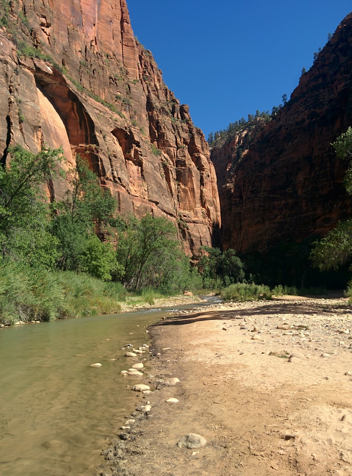 Top of Zion Canyon at the beginning of The Narrows
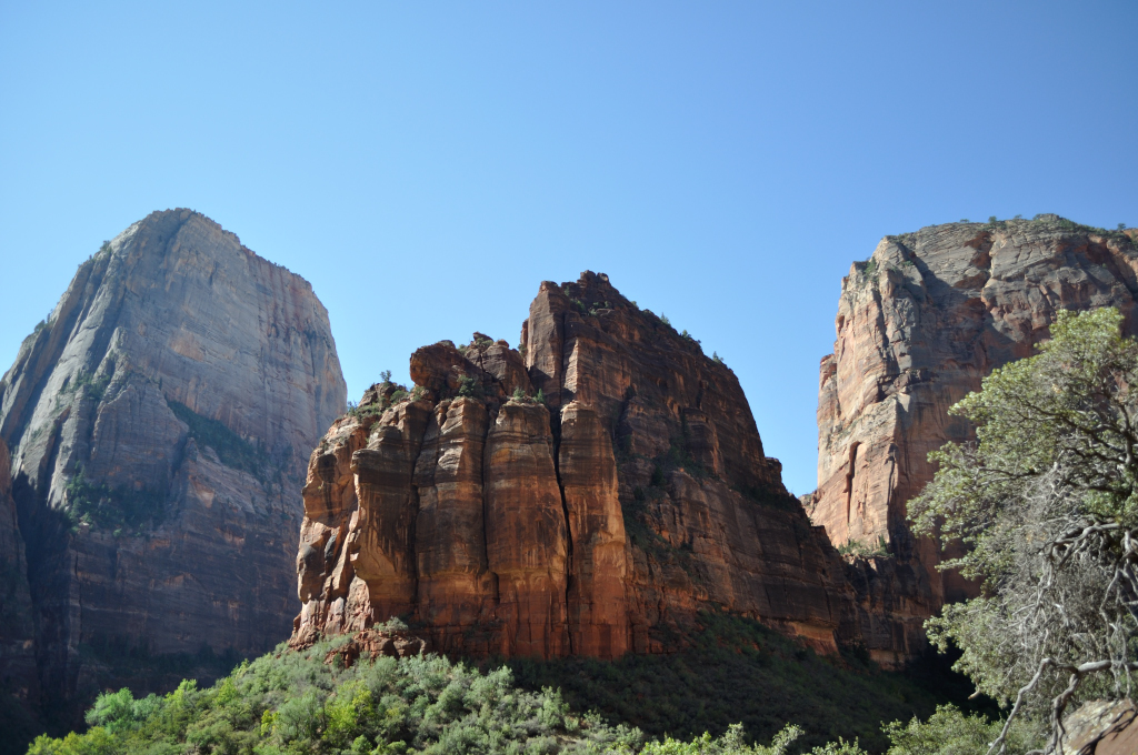
 By 1pm we were back on the road for the relatively short hop to Bryce Canyon. The drive continued to thrill us with its scenery. I don’t know how My Husband managed to actually concentrate on the driving.
 Zion-Mt Carmel Tunnel
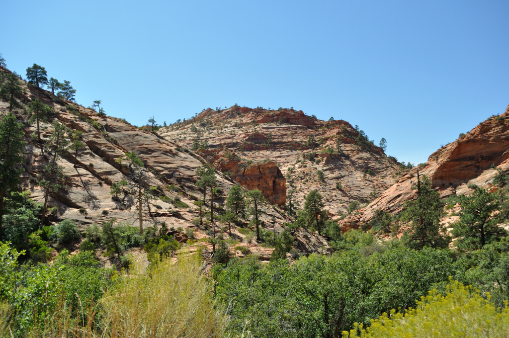


Mesas are elevated areas of land with a flat top and sides that are usually steep cliffs. Mesa is Spanish for table.
Basically, they are the little cousins of plateaus, complete with meadows, and what looked liked nice farmland. Once up here you couldn’t see the canyons below and it looked like a different world.
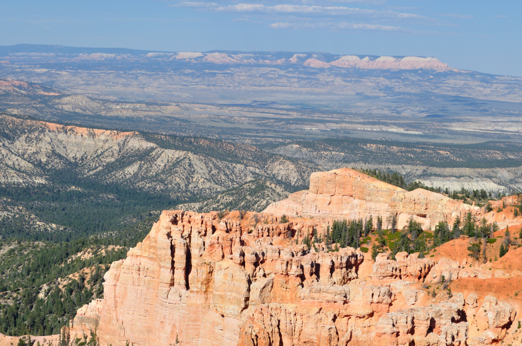
I’d heard great accolades of this Bryce Canyon, claims that it was better than the Grand Canyon, claims I’d found hard to believe, but, oh boy, this big ole hole in the ground did not disappoint! Actually, it isn’t really a canyon, rather the eroding edge of a plateau. However, as literature at the visitor center points out, Bryce Eroding Edge of Plateau doesn’t fit easily on a Tee Shirt, so Bryce Canyon it is.
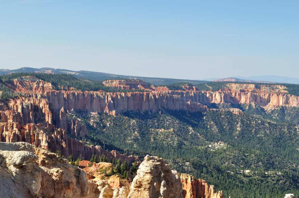 It allowed us to get up close and personal to the hoodoos.
 One legend tells the story of the Legend People who lived here long before any people, in the time of Gods, when Coyote ruled the land. The Legend People were greedy and used up all the resources of the land. So the Coyote invited them to a huge feast ,and they all turned up in all their finery. Then Coyote turned them to stone as punishment. Its easy to see the Legend People to this day!
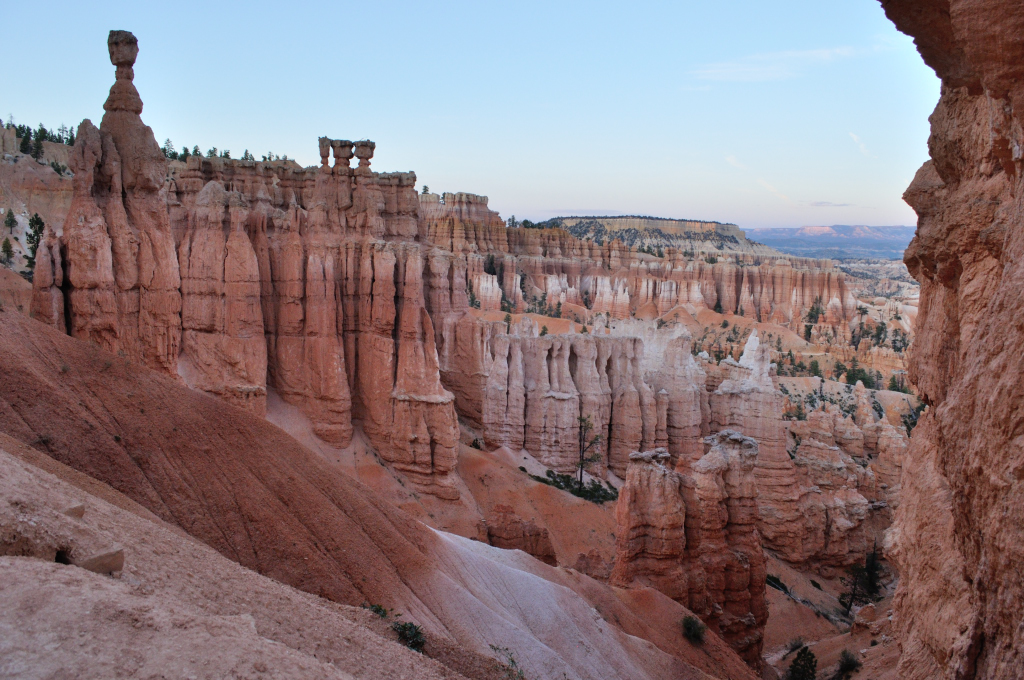 At 4pm we got one of the last campsites in Sunset Camp, actually in the park. The whole tourist industry here seems much “kinder” than in California, where it feels like the top spots are always full, and there are fewer places to stay in the places you most want to. Here everything flowed into place, even though we did not make a single booking. Traveling in September helped.
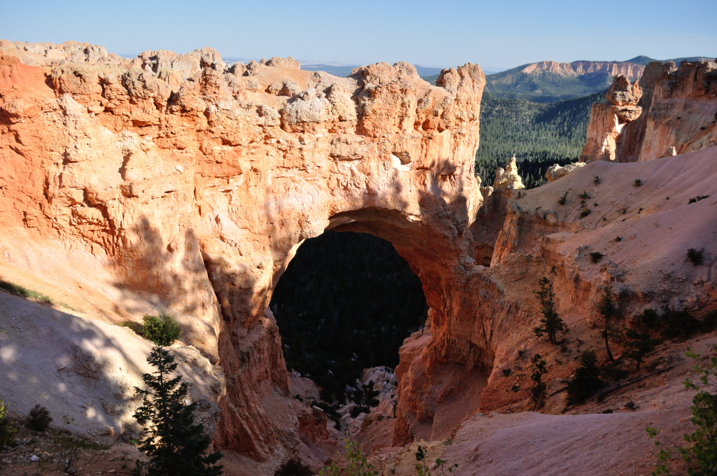
 Then we went exploring! We drove the length of the canyon rim all the way to Rainbow Point then stopped at the various viewing points on the way back. This works well, since you are now on the right side of the road for the stops. When we return I think a nice thing to do would be take the shuttle to Rainbow Point then work back via the various trails.
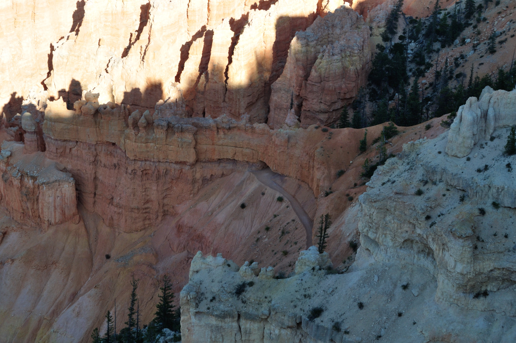 At certain points you can reconnect with the shuttle and stop there, returning the next day where you left off. This might take a week or more!
 We ended up at Sunset Point for sunset.
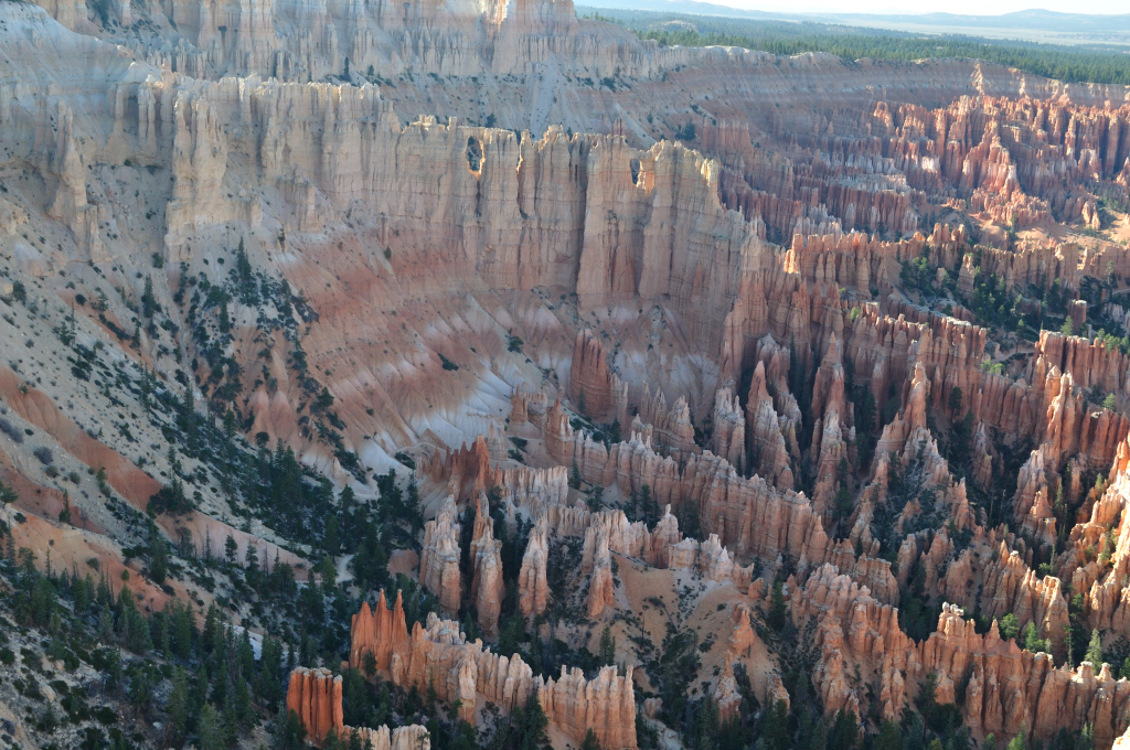
 One short trail beckoned. “The Navajo Loop Trail – 1.6 miles.” The sign pointed straight down into the red canyon below.
 “Let’s just go down it a little bit, get a taste of it!” We told each other. So off we went, no food, water nor map! (Typical Lee hiking adventure…) At least I wasn’t wearing flip flops and a pink mini-skirt this time…like that time in Death Valley, in July 2005…but that’s another story!
This canyon went straight down for a half mile (and obviously straight up for the same.)
 It was glorious, like nothing I’ve ever seen before.
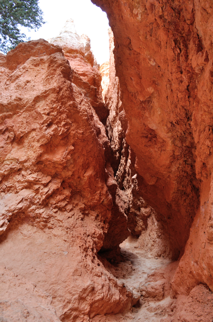 I officially declare that the Navajo Loop Trail is a MUST DO. Take it slowly if you need to, and do bring water, and maybe you shouldn’t embark upon it as the sun is setting!
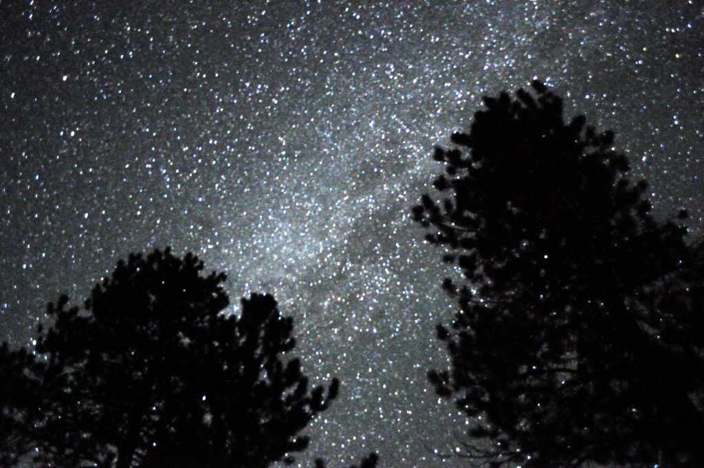
It was a very happy couple that sat watching the Milky Way outside our tent before we hit the hay.
 As I drifted off to sleep, I looked forward to more exploring tomorrow and gave thanks for having the chance to do trips like these.
Byddi Lee

September 12, 2015
Ailiens and Moonscapes
Day 2 Tonopah, Nevada to Zion National Park, Utah
Mileage 347 Miles, States - Nevada, Utah
I don’t know what AT&T did to Tonopah, but someone took the hump, and now it’s the only Cell phone provider that does not have service there. Bummer for us, but luckily the Mizpah had WiFi, and the car has its own navigation. It’s a bit dopey and somewhat grumpy. It doesn’t speak to us like Jane does, but it gets us there!
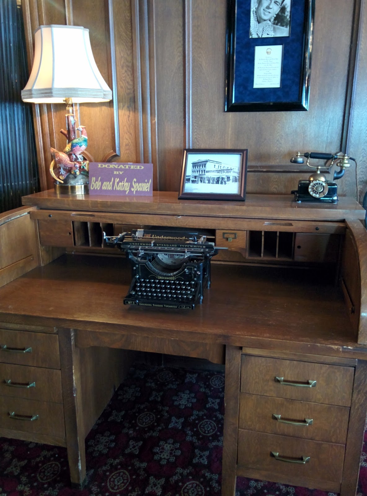
The Mizpah was beautiful inside – I mentioned this already in my last post, but I only took the photos this morning.
This is the business center! Just kidding. They had lots of beautiful old furniture and "olden days technology" on display everywhere.
 The Cafe where we ate dinner and breakfast.
 The Lobby.
The casino

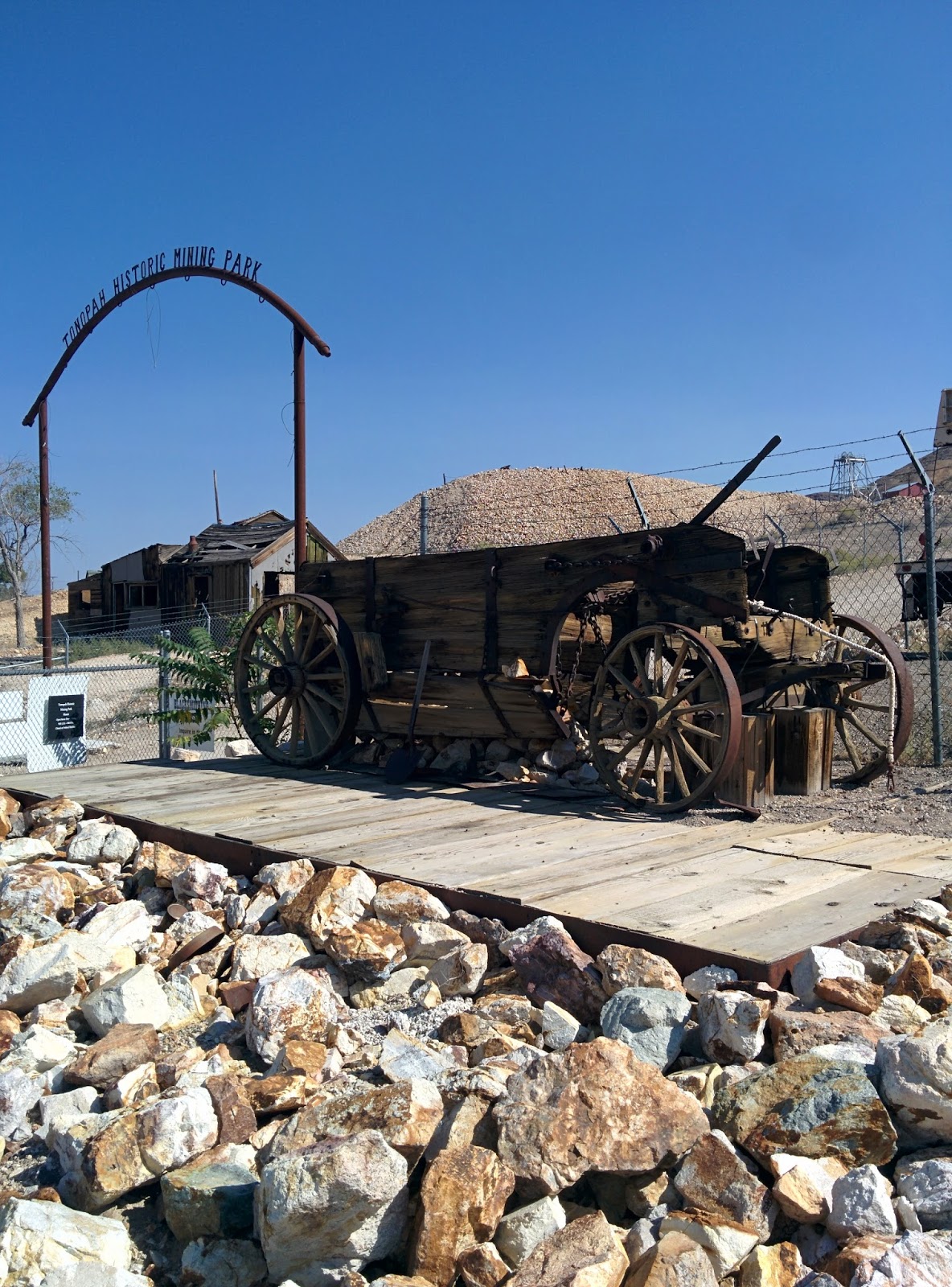
We couldn’t leave town without having a mosey about. There isn’t much to Tonopah, but it’s cute. A nice stop on a long journey.
There’s is a mining museum with tours…
A fire station…that didn’t really inspire confidence…but at least they're next door to the water company. That should come in handy.

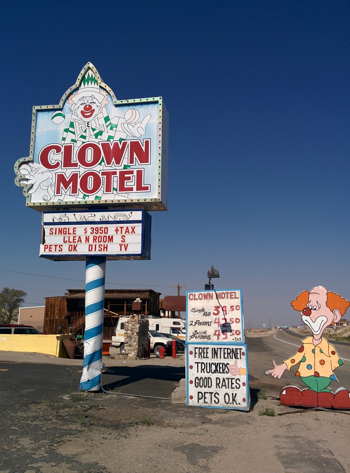
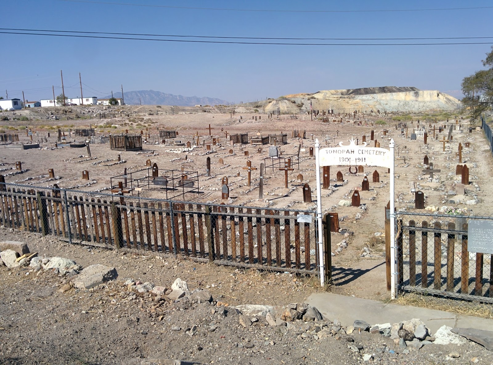
And we just had to visit the Clown Motel…

…and right next door we could pay our respects at the Miners Graveyard, which is harder than you’d think what with having all those crazy clowns at your back.
 When we’d checked out of the Mizpah, the receptionist had explained to us that Nevada is the most desolate state because so much of it is owned by the Government/US Military. That was why there was so few civilian settlements and so much distance between the ones that existed.
 As we drove east along Hwy6, we could appreciate this sense of desolation. The scenery alternated between this…
 …and this
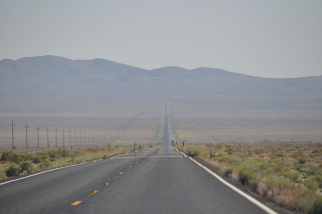
 Long straight stretches with short hops over hills to the next long straight stretch.
We saw a sign that told us we were in the Toiyabe National Forest. This is the forest...
 Now, I’ve heard of not being able to see the wood for the trees, but not being able to see the forest for the lack of trees is a new one on me.
Approaching junctions was pretty exciting, though ultimately anticlimactic – but it was a break in the monotony.
And then we were on the Extraterrestrial Highway 375.
 The first thing we saw was this.
 I think it was okay since we’d been warned for miles that we might see one.
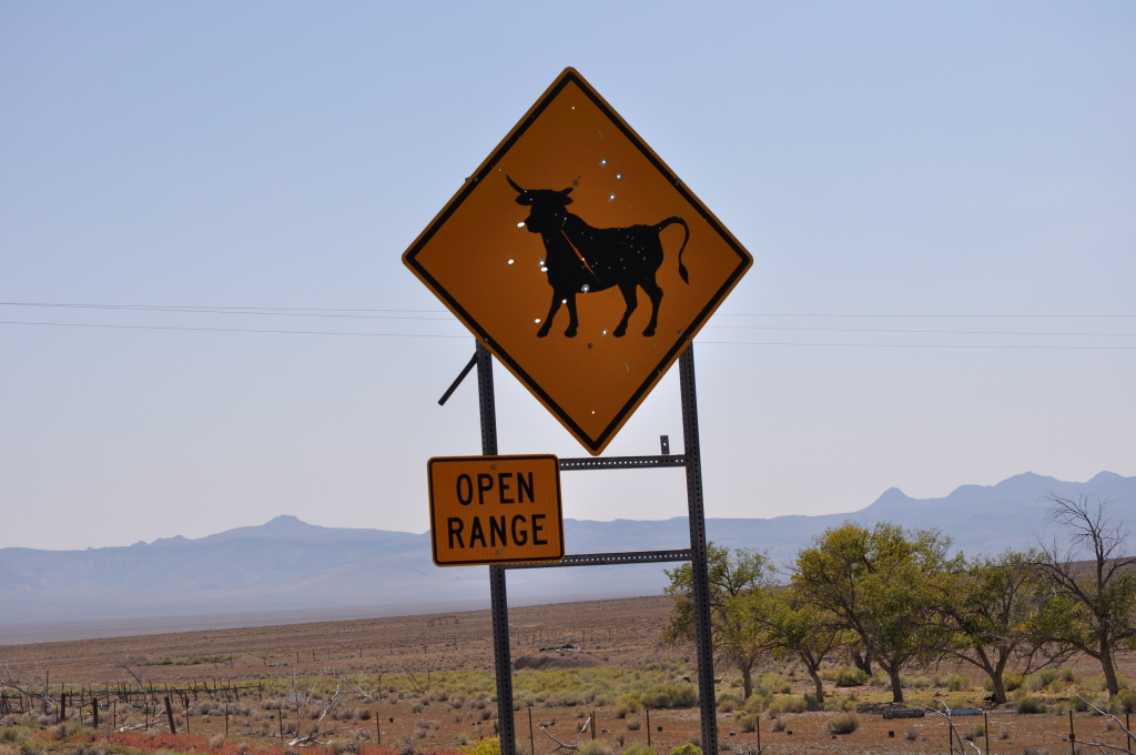 My Husband had great concerns about the dangers of cattle on the highway. My view was that it wasn’t like you’d turn a bend and bang one would be standing in front of you. There were simply no bends in the road! His comeback, “It’s a 70 miles an hour highway!”
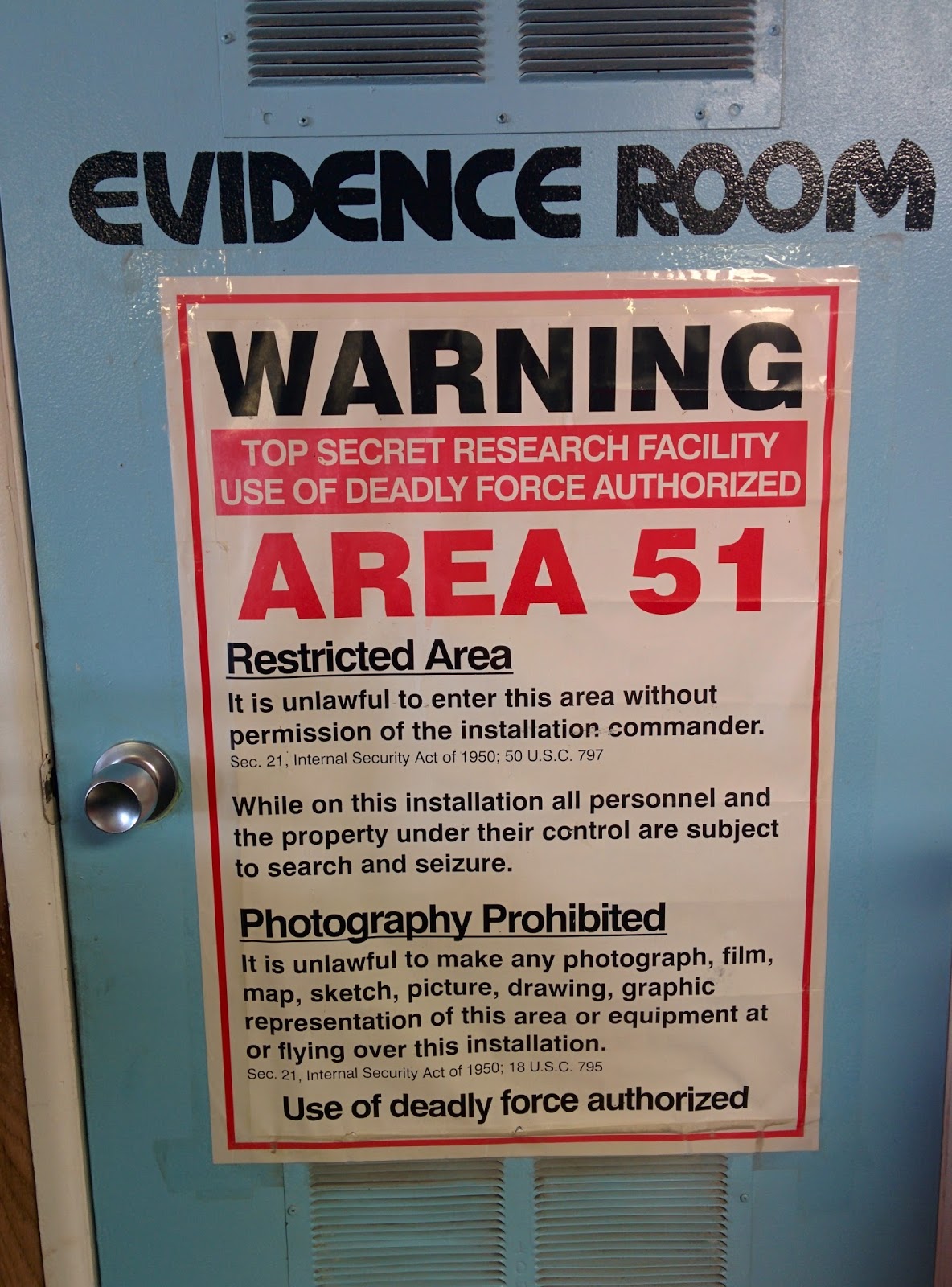
We stopped for lunch in Rachel, a tiny town with a permanent population of 84. Area 51is nearby and the restaurant was themed around it and aliens.
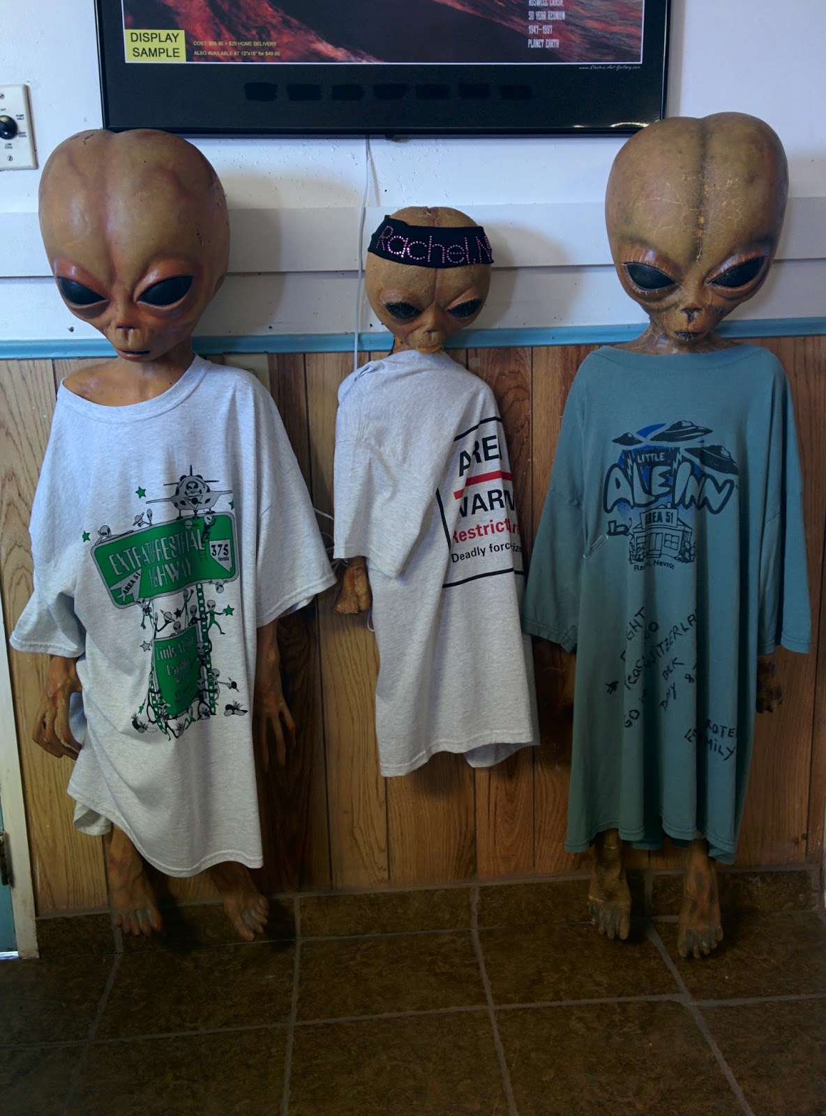 On the way out of Rachel, heading south, we saw two dead cows by the side of the road. My Husband reckons they were hit by cars, but I'm thinking those aliens in the restaurant looked pretty dodgy!
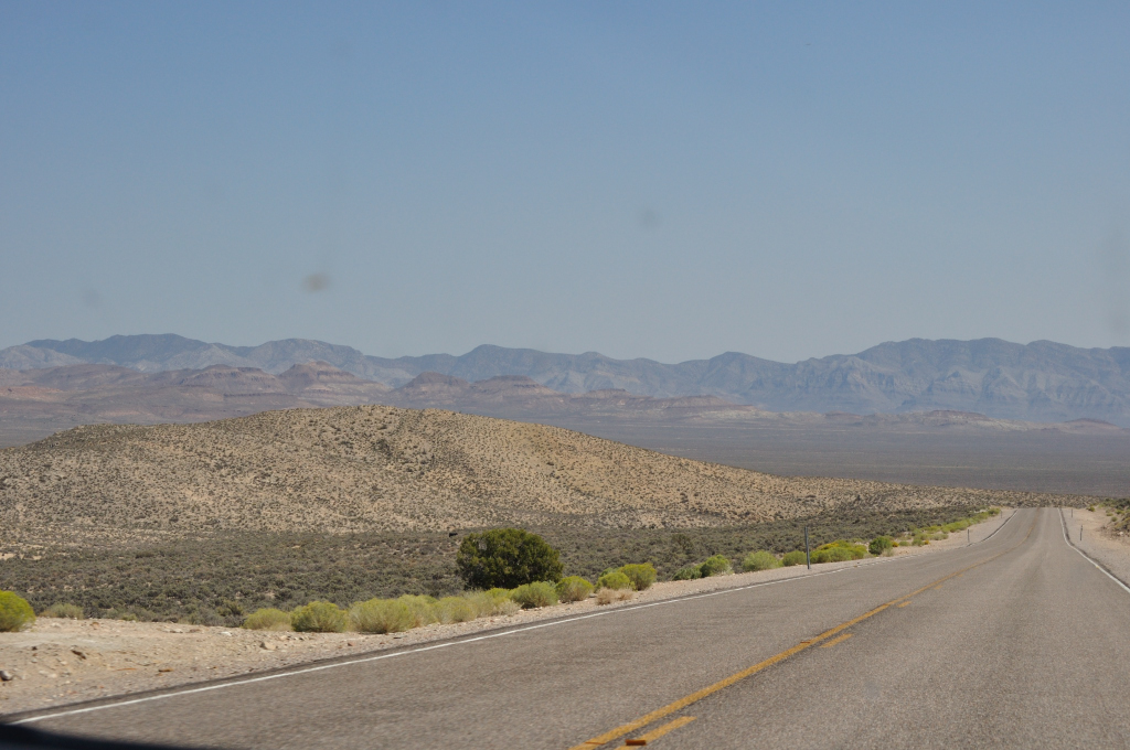
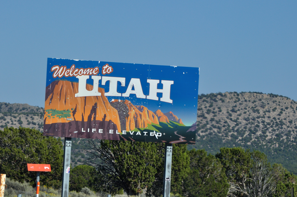
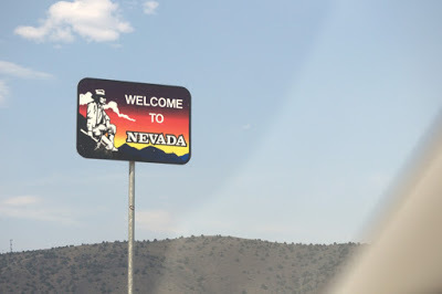
As Nevada merged into Utah, the flat pans became more undulating and green, the mountains more craggy and pinker.
Cedar City, Utah, the biggest town we’d seen since we’d left the bay area, was dwarfed by the huge red hills that rose up behind it.
 We headed from there to Kolob Canyon Visitors Center only to discover that the Visitors Center was closed. The sign on the door said it closed at 6pm. I checked my watch. It was only 5pm. And then My Husband said, “I think we’ve crossed into a different time zone.”
Our smart phones confirmed this – they’re smart, you see! We'd driven all the way forward an hour.
Luckily, the road was still open, and we got the first taste of the truly spectacular, jaw dropping vistas that we are expecting from this area.
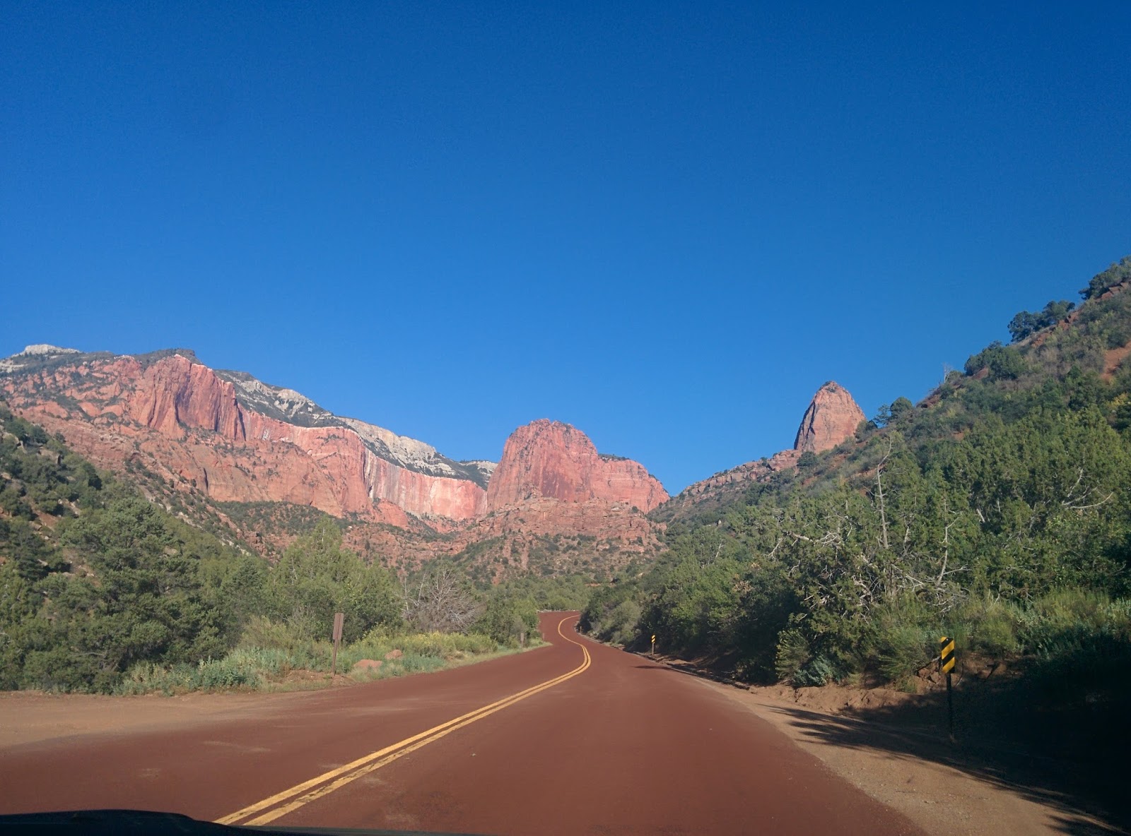 I particularly liked the way the road was colored red too.
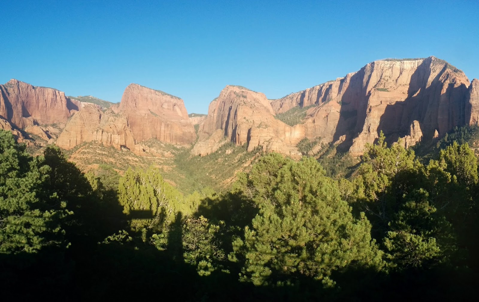 We approached Springdale, Utah with the hills turning deeper and deeper shades of read as the sun dropped below the horizon. Tomorrow, we intend to spend the day just exploring canyons. It may be a pictures only blog, because I'm running out of words to describe how gorgeous everything is!
Byddi Lee

September 11, 2015
The Ebbetts Pass and off the beaten track in Nevada
Day 1 San Jose, California to Tonopah, Nevada
Mileage 430 Miles, States - California, Nevada
I nearly had to bribe Jane* our GPS into routing today's portion of the road trip. We needed to cross the Sierras. We've done the Tioga Pass, through Yosemite, many times and traversed the Sonora Pass, the next pass to the north, a few times as well. We were out to explore America, not drive the same old roads all over again, though they are stunning. We set off intending to find additional stunning!
Having forced Jane to map us along Hwy 4 and the Ebbetts Pass, we hit the Western Sierra foothills and were met with poor visibility and the stench of smoke. We checked the Cal Fire website and saw a few fires come up on their map, but they were miles away. Aware that the smoke can travel a long way, it was still disconcerting that we were traveling on a road that we knew nothing about with patchy connectivity, in fire country, in fire season, and during a massive drought. Most of the pictures were taken from a moving car - apologies for the less than perfect composition - though I did have a chuckle at the beer can that showed up in this one!
 Even though Jane had gotten past the please-take-a-U-turn stage by the time we got to Copperopolis we needed to stop for gas.
 Yes, that's what it's called, and I don't know how to say it - I just say it how it looks - Copper-op-polis! (Okay, so maybe I stick an extra "p" in there - it's still a really fun name to say.)
There were two girls working in the gas station. When they greeted me with a cheery welcome, I asked them if they knew where the fires were. They said that the smoke was from the Butte fire further north and that there were also some burning in Yosemite. They asked me which way we were traveling. I told them I was taking the Ebbetts Pass. They said they would check the road conditions for me. Then, as I stood there, one of them lifted the phone and called the sheriff. In a few short minutes she had the answer - all clear. I was extremely impressed at their willingness to help keep a total stranger safe. That's what I call a full service station!
 The air cleared as we climbed over the pass. There were plenty of warnings at the beginning of the pass about steep gradients and winding roads, but for someone used to roads on the West Coast of Ireland these roads were totally fine...
 Okay, so many some of the turns were a bit full on...
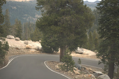 But the views were worth it!

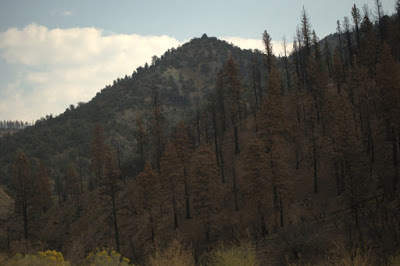
 Sections of the road told the story of the aftermath of the blistering fire season we've had in California.This went on for several miles, often on both sides of the road. A part of the natural cycle, it was still bleak to look at.
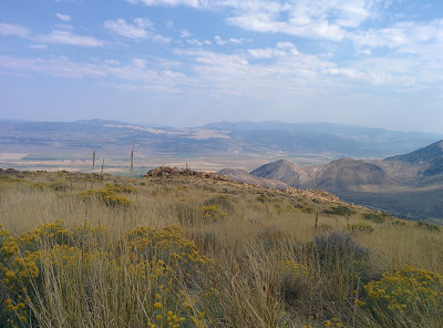
 The Eastern Sierras did not disappoint. I love the wide open vistas. The barren landscape tugs at me in a way I find difficult to explain - a mixture of awe and terror. Despite its beauty, I can't help trying to imagine having to survive in this harsh and unforgiving terrain without the modern conveniences!
 Once through the Sierras, we hit my favorite highway (so far!) in the US - Highway 395. Wanting to explore, we once again bullied Jane into taking us along the road less traveled and insisted on going via Smith Valley to Tonopah rather than through Lee Vining.
 Nevada seems to be vast desert salt pans separated by jagged peaks. There is no in between - it's either step sides or flat flat flat.
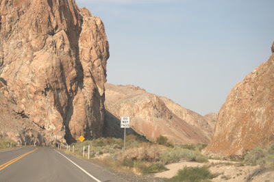
However, this route delivered several surprises. We loved the Wilson Canyon on Route 208.
 The mining industry reared it's ugly head in Yerrinton (I think!)

This heap of gravel was beside a huge (I mean gigantic!) pit right beside the road. It was the size of the nearby hills. If it wasn't for it's flat top and perfect symmetry, one might think it was another mountain or cinder cone.
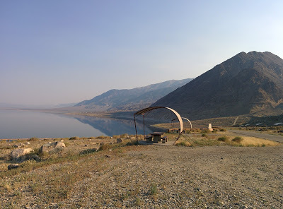
Just when all the desolation was starting to overwhelm, a shimmer appeared in the distance. A mirage maybe? Not this time. Walker Lake is a 50 square mile natural lake. I liked the shade provided for the picnic tables - not a mission of getting a tree to grow here!
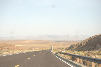
 And of course, you wouldn't be in Nevada if you didn't have the the long straight roads all the way into forever...
 Color was draining out of the day and pooling in the Western sky as we approached our destination - Tonopah. We drove past the Clown Motel, contemplated it for a brief second. I was caught between thinking it could hilarious or horrendous (It was very very cheap - and not necessarily in a good way.) My Husband, having more refined tastes, suggested we push on to see what else the town had to offer. We settled on The Mizpah, opting for an economy queen room. It was small but very very plush.
 The Mizpah is right in the center of town. It reminded of the type of old hotels you had in small towns in Ireland. The kind of establishments Maeve Binchy would have referred to in her novels, places that served as the pivot point for the town and its community.
 It's interior is like the posh old Western saloons that you see in the movies. The kind of place Scarlette and Rhett would have stayed had they come this far (though it wasn't around in their day having been only built in 1908). It is a listed historical building and even has a resident ghost - the Lady In Red - who is said to roam the hotel and leaved pearls at random. I hope she's quiet because I'd like a good nights sleep, but I'd be happy to get a pearl!
It's a been a long and interesting day and tomorrow we are set for Zion via the Extraterrestrial Hwy - not sure how much excitement I want along that road - find out if I meet ET in my next post.
Byddi Lee
*Click here to find out why we call our GPS Jane
Mileage 430 Miles, States - California, Nevada
I nearly had to bribe Jane* our GPS into routing today's portion of the road trip. We needed to cross the Sierras. We've done the Tioga Pass, through Yosemite, many times and traversed the Sonora Pass, the next pass to the north, a few times as well. We were out to explore America, not drive the same old roads all over again, though they are stunning. We set off intending to find additional stunning!
Having forced Jane to map us along Hwy 4 and the Ebbetts Pass, we hit the Western Sierra foothills and were met with poor visibility and the stench of smoke. We checked the Cal Fire website and saw a few fires come up on their map, but they were miles away. Aware that the smoke can travel a long way, it was still disconcerting that we were traveling on a road that we knew nothing about with patchy connectivity, in fire country, in fire season, and during a massive drought. Most of the pictures were taken from a moving car - apologies for the less than perfect composition - though I did have a chuckle at the beer can that showed up in this one!
 Even though Jane had gotten past the please-take-a-U-turn stage by the time we got to Copperopolis we needed to stop for gas.
  Yes, that's what it's called, and I don't know how to say it - I just say it how it looks - Copper-op-polis! (Okay, so maybe I stick an extra "p" in there - it's still a really fun name to say.)
There were two girls working in the gas station. When they greeted me with a cheery welcome, I asked them if they knew where the fires were. They said that the smoke was from the Butte fire further north and that there were also some burning in Yosemite. They asked me which way we were traveling. I told them I was taking the Ebbetts Pass. They said they would check the road conditions for me. Then, as I stood there, one of them lifted the phone and called the sheriff. In a few short minutes she had the answer - all clear. I was extremely impressed at their willingness to help keep a total stranger safe. That's what I call a full service station!
 The air cleared as we climbed over the pass. There were plenty of warnings at the beginning of the pass about steep gradients and winding roads, but for someone used to roads on the West Coast of Ireland these roads were totally fine...
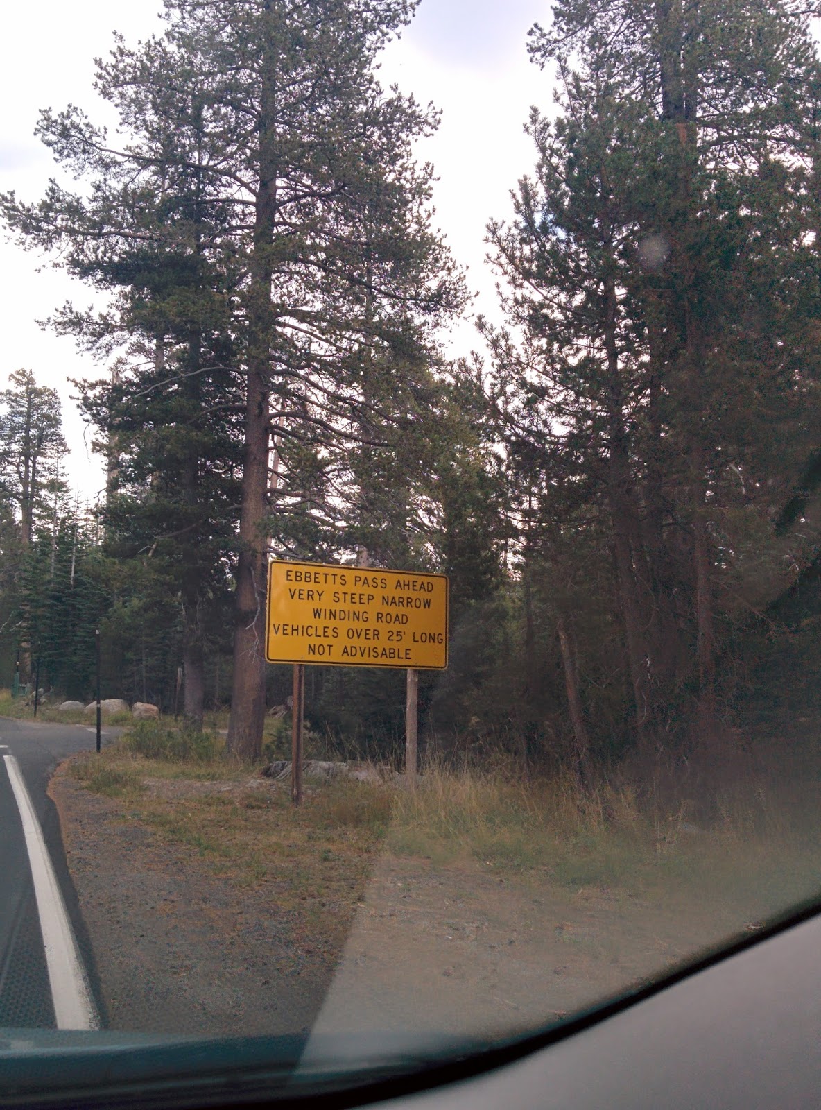 Okay, so many some of the turns were a bit full on...
 But the views were worth it!
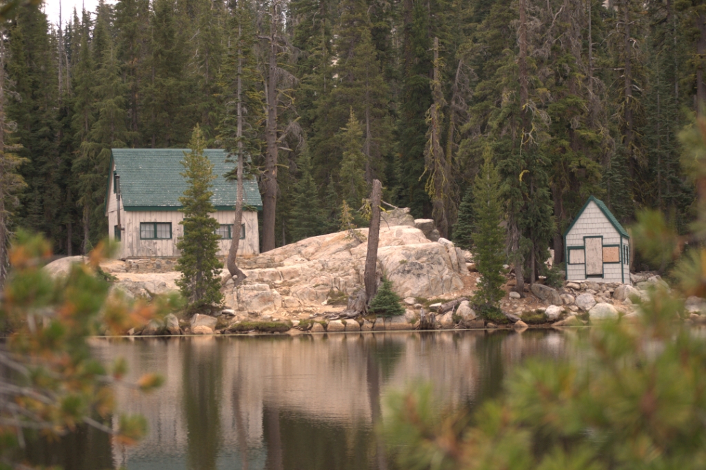
 Sections of the road told the story of the aftermath of the blistering fire season we've had in California.This went on for several miles, often on both sides of the road. A part of the natural cycle, it was still bleak to look at.
 The Eastern Sierras did not disappoint. I love the wide open vistas. The barren landscape tugs at me in a way I find difficult to explain - a mixture of awe and terror. Despite its beauty, I can't help trying to imagine having to survive in this harsh and unforgiving terrain without the modern conveniences!
 Once through the Sierras, we hit my favorite highway (so far!) in the US - Highway 395. Wanting to explore, we once again bullied Jane into taking us along the road less traveled and insisted on going via Smith Valley to Tonopah rather than through Lee Vining.
 Nevada seems to be vast desert salt pans separated by jagged peaks. There is no in between - it's either step sides or flat flat flat.
 However, this route delivered several surprises. We loved the Wilson Canyon on Route 208.
 The mining industry reared it's ugly head in Yerrinton (I think!)
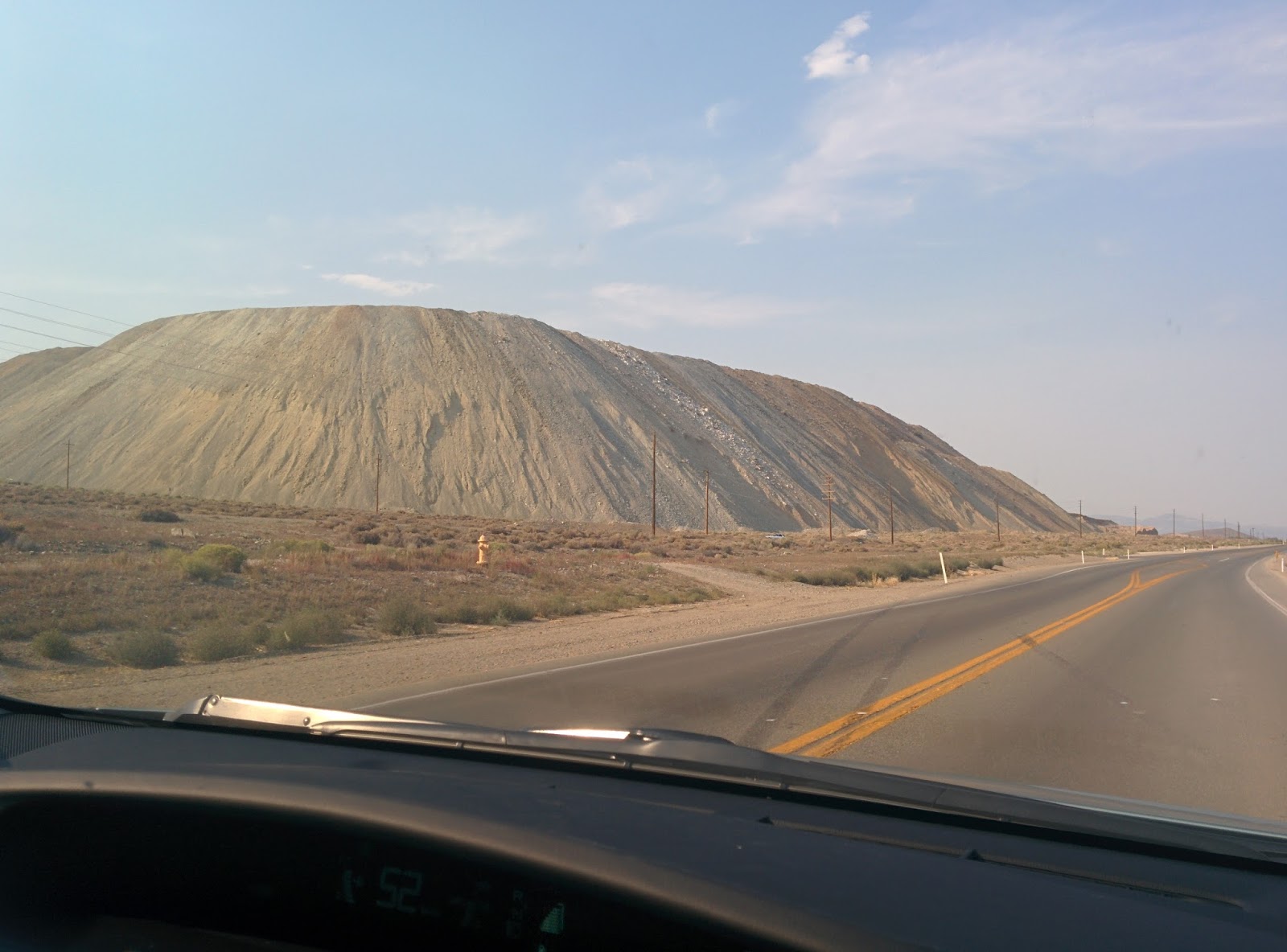
This heap of gravel was beside a huge (I mean gigantic!) pit right beside the road. It was the size of the nearby hills. If it wasn't for it's flat top and perfect symmetry, one might think it was another mountain or cinder cone.
Just when all the desolation was starting to overwhelm, a shimmer appeared in the distance. A mirage maybe? Not this time. Walker Lake is a 50 square mile natural lake. I liked the shade provided for the picnic tables - not a mission of getting a tree to grow here!
 And of course, you wouldn't be in Nevada if you didn't have the the long straight roads all the way into forever...
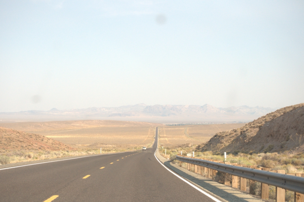 Color was draining out of the day and pooling in the Western sky as we approached our destination - Tonopah. We drove past the Clown Motel, contemplated it for a brief second. I was caught between thinking it could hilarious or horrendous (It was very very cheap - and not necessarily in a good way.) My Husband, having more refined tastes, suggested we push on to see what else the town had to offer. We settled on The Mizpah, opting for an economy queen room. It was small but very very plush.
 The Mizpah is right in the center of town. It reminded of the type of old hotels you had in small towns in Ireland. The kind of establishments Maeve Binchy would have referred to in her novels, places that served as the pivot point for the town and its community.
  It's interior is like the posh old Western saloons that you see in the movies. The kind of place Scarlette and Rhett would have stayed had they come this far (though it wasn't around in their day having been only built in 1908). It is a listed historical building and even has a resident ghost - the Lady In Red - who is said to roam the hotel and leaved pearls at random. I hope she's quiet because I'd like a good nights sleep, but I'd be happy to get a pearl!
It's a been a long and interesting day and tomorrow we are set for Zion via the Extraterrestrial Hwy - not sure how much excitement I want along that road - find out if I meet ET in my next post.
Byddi Lee
*Click here to find out why we call our GPS Jane
August 29, 2015
Stranger than fiction
This began as a Facebook post that started to run on a bit, and I decided to simply turn it into a blog post.
I originally began by saying (in my little Facebook voice!), "So, I've been researching stop off points for our upcoming trip to Yellowstone. We will have to stay in Nevada and rather than do the run-of-the-mill Reno or Vegas thing, I was looking at stopping in a town called Tonopah. It looks like it's completely in the middle of nowhere (just the way I like it!) But having just read Stephen King's book Desperation set in a (fictional - I hope) forgotten Nevada town..."
Well that's when I screeched to a halt and realized that this all really began when I read Desperation!
And that it needed to be a blog...
Cue new beginning.
I've always been fascinated by the Wild West, the empty spaces, the lonely barrenness in the landscape and the tumble weed (which is actually not even native to that area! It's Russian thistle brought in from Eastern Europe/Russia in a bag of grass seed!) When I mention driving through Nevada to my American friends many of them pull a face of disgust like, who'd want to do that? But when you were brought up on a tiny lush island with winding roads, the Nevada-scape is exotic by comparison. There's just something about those long, straight roads disappearing into a pinoint on the horizon that awe me to almost speechlessness. Almost, not completely but even so, it might be why My Husband finds those road trips appealing too!
Even reading Desperation didn't put me off, though I sure hope I don't get pulled over by a cop on highway 50. The stretch through Nevada is known as "The Loneliest Road in America"! I thought it prudent to stay away from Highway 50 altogether, and with the help of Google maps, I discovered Tonopah. What really cemented the deal for this stop was that it will be a great jumping off point for State Route 375. Why this road? Well, here's what it says in Wikipedia about it...
At least it's not lonely, right? You know, especially not with all those aliens...
So okay, Tonopah... the pictures aren't very inspiring on Bing Images, so I had a look at the town website which conveniently has a lodging section. All very well and good, until I noticed the second one down - The Clown Motel! As if staying in a tiny town in the middle of Nevada wasn't scary enough they have a Clown Motel as in horror-movie-creepy-ass clowns!
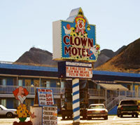 This picture of Clown Motel from the Town of Tonopah website
Upon further investigation, I came across this blog, Atlas Obscura (what a find by the way!) only to discover that if the clowns weren't freaky enough for you, that the motel is sited beside an old miners cemetry! Go read this short blog - I'm just bummed they got there before me, but I'm not one to reinvent the wheel - they've written pretty much what I would have.
And while I'm directing you around the inter-web-thinggy, check out the comments on Trip Advisor about this place - hilarious!
Comments like, "...The clowns in the office were a bit scary..." and another said, "...Gotta admit, the clowns scared me...." and my favorite, "...I was here alone for a ghost hunt in a nearby town..." Like, seriously? Alone? For a ghost hunt and staying in a freaky Clown Motel? Fair play to ya mate - it takes all sorts, and I'm guessing we'll meet most of them on this upcoming trip!
So will we stay here? You'll just have to read the next installment in a few of week when we hit the road. But here's a clue...My Husband says "NO way!" This is the man who wouldn't buy a house near railroad tracks because he saw an episode of Criminal Minds that had a serial killer traveling on freight trains and murdering people who lived near the tracks!
We intend to hit up some of the big parks in Utah (Zion, Bryce Canyon, Arches, Canyonlands and more if possible) before heading north for Yellowstone. I have a vague intention of posting daily...That is if the Big Cop from Desperation, the ailens and the clowns don't get us first!
Byddi Lee

I originally began by saying (in my little Facebook voice!), "So, I've been researching stop off points for our upcoming trip to Yellowstone. We will have to stay in Nevada and rather than do the run-of-the-mill Reno or Vegas thing, I was looking at stopping in a town called Tonopah. It looks like it's completely in the middle of nowhere (just the way I like it!) But having just read Stephen King's book Desperation set in a (fictional - I hope) forgotten Nevada town..."
Well that's when I screeched to a halt and realized that this all really began when I read Desperation!
And that it needed to be a blog...
Cue new beginning.
I've always been fascinated by the Wild West, the empty spaces, the lonely barrenness in the landscape and the tumble weed (which is actually not even native to that area! It's Russian thistle brought in from Eastern Europe/Russia in a bag of grass seed!) When I mention driving through Nevada to my American friends many of them pull a face of disgust like, who'd want to do that? But when you were brought up on a tiny lush island with winding roads, the Nevada-scape is exotic by comparison. There's just something about those long, straight roads disappearing into a pinoint on the horizon that awe me to almost speechlessness. Almost, not completely but even so, it might be why My Husband finds those road trips appealing too!
Even reading Desperation didn't put me off, though I sure hope I don't get pulled over by a cop on highway 50. The stretch through Nevada is known as "The Loneliest Road in America"! I thought it prudent to stay away from Highway 50 altogether, and with the help of Google maps, I discovered Tonopah. What really cemented the deal for this stop was that it will be a great jumping off point for State Route 375. Why this road? Well, here's what it says in Wikipedia about it...
"The top-secret Area 51 government base is near SR 375 and many travelers have reported UFO observations and other strange alien activity along this road. Such stories prompted the state to officially designate the route as the Extraterrestrial Highway in 1996. The small town of Rachel, located near the center of the highway, caters to tourists and UFO seekers with alien-themed businesses. Although the area receives some tourism due to alleged extraterrestrial activity, SR 375 remains a lightly traveled route."
At least it's not lonely, right? You know, especially not with all those aliens...
So okay, Tonopah... the pictures aren't very inspiring on Bing Images, so I had a look at the town website which conveniently has a lodging section. All very well and good, until I noticed the second one down - The Clown Motel! As if staying in a tiny town in the middle of Nevada wasn't scary enough they have a Clown Motel as in horror-movie-creepy-ass clowns!
This picture of Clown Motel from the Town of Tonopah website
Upon further investigation, I came across this blog, Atlas Obscura (what a find by the way!) only to discover that if the clowns weren't freaky enough for you, that the motel is sited beside an old miners cemetry! Go read this short blog - I'm just bummed they got there before me, but I'm not one to reinvent the wheel - they've written pretty much what I would have.
And while I'm directing you around the inter-web-thinggy, check out the comments on Trip Advisor about this place - hilarious!
Comments like, "...The clowns in the office were a bit scary..." and another said, "...Gotta admit, the clowns scared me...." and my favorite, "...I was here alone for a ghost hunt in a nearby town..." Like, seriously? Alone? For a ghost hunt and staying in a freaky Clown Motel? Fair play to ya mate - it takes all sorts, and I'm guessing we'll meet most of them on this upcoming trip!
So will we stay here? You'll just have to read the next installment in a few of week when we hit the road. But here's a clue...My Husband says "NO way!" This is the man who wouldn't buy a house near railroad tracks because he saw an episode of Criminal Minds that had a serial killer traveling on freight trains and murdering people who lived near the tracks!
We intend to hit up some of the big parks in Utah (Zion, Bryce Canyon, Arches, Canyonlands and more if possible) before heading north for Yellowstone. I have a vague intention of posting daily...That is if the Big Cop from Desperation, the ailens and the clowns don't get us first!
Byddi Lee
August 3, 2015
The Mount Whitney Trail
Continued from the last post...
One week to the day before the ascent up Mount Whiney, My Husband was diagnosed with shingles! So much for my spider bite diagnosis - note to self - leave doctoring to the doctors! The Doc said he was over the worst of it and provided he'd trained, there was no reason he should not do Whitney...
We were good to go...
In the run up to Whitney we Flintstones watched the weather closely. Wonder Woman and Superman where used to rough conditions and the Incredibles - well their incredibleness would bring them through it. But I knew we needed perfect conditions to pull this off - I'm way too much of a softie. A few days beforehand the area was bombarded with thunder storms and hailstones. Wildfires had sprung up left, right and center. We'd taken a couple of close friends, who were visiting on honeymoon from Ireland, to the high country that week, and we'd had a mad dash for the car during a thunder and lightning episode on Sentinel Dome - only a 2 mile hike.
But the departure day dawned clear and blue in Lone Pine, California. The rising sun blasted into our hotel room as I put the finishing touches to my backpack. Sunsets remind me of my Mummy - she always loves to watch them, but sunrises are for my Dad. Tears gathered and emotion tugged in my throat. He'd always loved daybreak and had died minutes before sunrise. I think he knew that the rising sun would give us hope at our bleakest moment. He had taken me up my very first mountain - the Sugar Loaf in Wicklow, and right then I felt him with me and knew he'd stay with me all the way.
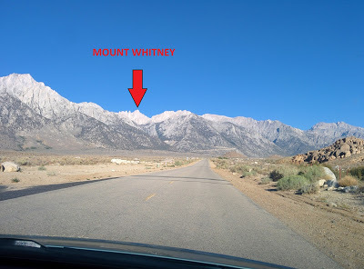
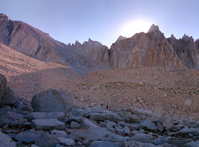
The eight of us left the hotel at 7.20am and headed for Whitney Portal. Mt Whitney looked a long way up and I found it hard to believe that I might actually be standing on that distant peak within the next couple of days.
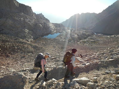
 Driving to Whitney PortalWe parked and stashed any food and toiletries in a bear proof locker and hit the trail by 8.30am. The weather was perfect, thank God, and we set our own pace. The Incredibles took off, led by the Incredibles girl (11) whose pace never faltered for a moment. The Incredibles Boy (8), though irritated by an uncomfortable pack belt, never wavered and plugged up the slope, the bravest little soldier I've ever seen. With that for motivation, how could we give up? Thankfully our training kicked in and we felt comfortable at our chosen pace. We decided that we would try not to get out of breath once we hit higher altitudes - getting out of breath lead to too many complications.
 Whitney Portal to Trail CampOur pace was steady, if slower than the Incredibles and Wonder Woman, though I think Superman enjoyed the craic at the back as he often waited for us, on the pretense that he needed a break...he wasn't fooling us, and we loved him for the attempt!
By lunchtime we'd reached outpost camp at 10,000ft. You could feel the effect of the altitude in your lungs. Simply moving was enough to have you out of breath.
 Nearly at Trail Camp...Laughing was arduous - a pity because we were never far from it - especially when the conversation turned to the use of our poop bags or WAG bag (Waste Alleviation & Gelling). There were bets placed as to who'd go first, who go most often and who might go on poop strike altogether!
 Instructions posted at the trail head
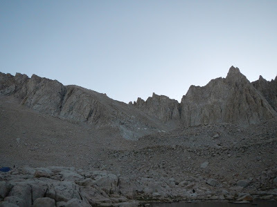
For a while conversation tapered and eventually we reached Trail Camp (12,00ft) around mid afternoon. Poor Wonder Woman's wheels fell off as a piercing migraine and nausea send her to her tent and filled the rest of us with feelings of empathy and helplessness. We ate dinner and watched the shadow of the mountains to the west creep up the sides of the mountains in the east,

until the sun suddenly dipped below the ridge and the valley filled with a chilled shadow.
 We raced for our warm clothes and snuggled into puffa jackets and settled in for the night - all of us in bed for 8pm.
We slept a little - at least there was a time period of about 2 hrs that we couldn't account for. The moon was nearly full and we were luckily pitched in a moonlight shadow cast by an outcrop of nearby rocks. Even so it didn't prevent the stars from glittering fiercely undeterred by the deep blue background they were set in.
At 4.30am I decided to take advantage of the predawn darkness and use my WAG bag behind a nearby rock - suffice it to say, it was not as bad as I'd thought it might be- quite handy in fact - but still doesn't beat having a nicely plumbed en-suite! Though you'd be hard pushed to find a toilet with as nice a view...
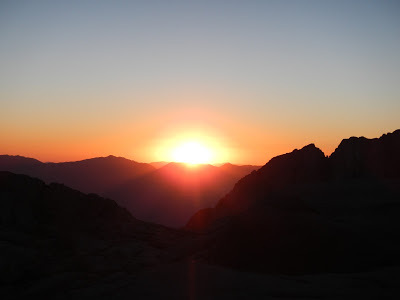
By 5am the sun was glowing its entrance to the eastern sky as a red ball of light.
 Wonder Woman had recovered and was raring to go. We ate quickly and were on the trail for the summit by 6am.
 We'd been looking up at those switchbacks since we'd arrived at Trail Camp and though I know it took us hours to get up them, for us one slow step at a time, sucking as much air into our lungs as possible, I think one of the side effects of altitude is how it affects memory.
 When I look back, I feel like it didn't take that long to get up to that first ridge. At Trail Crest, where you go over the ridge and slide in behind the sky-piercing peaks, Superman - now firmly established as our mountain guru, advised us to don a thin fleecy and a wind proof jacket.
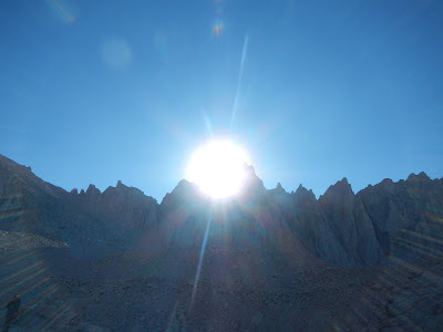
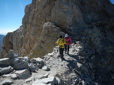
 We took his advice and began the next bit which I can only describe as the Valley of the Shadow of Death.
 I don't know why I hadn't considered the fact that we'd have steep drop-offs and "scary" bits. Denial, I suppose. I'm just not great with heights if I'm freestanding - I get woozy and sway...vertigo sets in.
 So this next section was arduous but stunningly beautiful, and I just focused on breathing because that had become the biggest challenge. My hands had swollen with fluid and looked awful but weren't painful, so I didn't pay much attention to it.
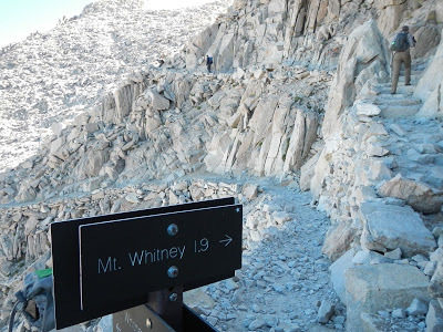 The hardest 1.9 miles ever! Again, we were behind the others but they waited for us shy of the top, so that the Incredibles, Superman, Wonder Woman and the Flintstones all reached the summit at the same time. It was amazing!
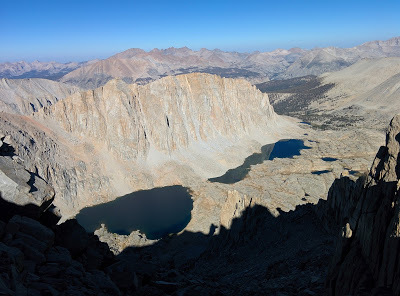
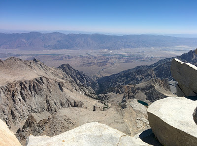 View from the summit of Mt Whitney looking down at Lone PineRemember where the big red arrow pointed in the first photo? That's where we were standing!
We chilled out a bit, took photos, and drank in the scenery.
 Then another climber reached the top and roared out in a booming voice for all to hear, "This is not the day we die..." followed by some probably famous motivational quote, which because of the altitude none of us can quite remember but ...it was good! So good that everyone cheered and clapped. It was really Hollywood.
As our wee Irish group looked at each other bemused, I said, "Well, we're on the top of the highest mountain in continental USA. You wouldn't expect anything less!"
"Yes," said Mrs. Incredible, “But where did he get the breath for that?"
We laughed, quiet little breath-conserving guffaws...
I was looking forward to the way down.
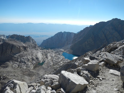 Looking down at Trail Camp from Trail Crest after leaving the Shadow of the Valley of Death! All downhill - I thought it couldn't be easier but at about 13,000ft my wheels fell off. I got a splitting headache and then needed to pee every 10 minutes - nowhere had I read anything about that as a side effect of altitude. It was a good job I'd taken a spare (clean) Wag bag with me too. I needed it - twice! Then nausea kicked in. I still had about 2 or 3 miles to go. I could see the lake we were camping by. If I walked anymore than a dozen paces, I had to sit down and catch my breath. Getting out of breath made me actually retch. It was a slow descent. I remember the thought I had at the time, "This is hell. When will it end?" But as I look back the memory of it is blurred, as if looking through a soft focus lens.Was this another effect of altitude?
I walked into camp looking like a White Walker (this told to me by Mr. Incredible later during the postmortem!) My Husband put me to bed and Superman gave me an electrolyte drink after which I started to rally and soon had returned to the land of the living, thank God.
Dinner was more jolly, and we chatted about our day as we watched the sun head towards the peaks.
 This time we were prepared with our warm clothes as nature's lights switched out.
 Bed by 8pm and up the next day at 4.30am. I was starving and Mrs. Incredible had some leftover freeze-dry dinners which I gratefully accepted. Himalayan lentil and rice - a true breakfast of champions!
The trek out was easy and enjoyable, and the higher oxygen content most welcome. We had to strap our WAG bags to the outside of our packs, so there wasn't much conversation as we'd to stay well back to avoid each others WAG bag smell! There was plenty of toilet humor, of course, commenting on who had the biggest bag, who'd filled their bag and had been forced to use another person’s bag, who lost a bet and had to carry the entire Incredibles family collection down the hill... but we agreed that what happens on Whitney stays on Whitney - except the actual poop of course!
These challenges (I've also done the Alcatraz swim and the Grizzly MetricCentury in the recent past) are, for me, less about the fitness and all about the interpersonal relationships. I enjoyed watching My Husband bond with and really get to know these friends I've had for 20 years. Seeing the Incredibles children rise to such a huge challenge with the gusto and the determination gave us all something special that you don't get in ordinary circumstances.
As a metaphor for life, Whitney has it all. Getting to the top is just half way there. You aren't done until you are back down and for someone who feels that they are half way through life, like myself, it's okay if its "downhill" from here. Downhill is not a bad thing. Downhill is where the breathable air is, the place where you can reflect on the journey uphill and what it's like at the peak. It's were the vineyards, flushing toilets and ice dispensers are too. For some, climbing high may indicate success, but I'm not sure I agree - it's by no means comfortable up there. Lushness and beauty lie in the lower slopes. High up, the peak is exposed and the rocks bare. Success is enjoying wherever you are, high or low. And remember, no matter when or where it happens, you still have to carry all your shit with you, uphill or down.
Byddi Lee
Photos by Helen Cassidy
One week to the day before the ascent up Mount Whiney, My Husband was diagnosed with shingles! So much for my spider bite diagnosis - note to self - leave doctoring to the doctors! The Doc said he was over the worst of it and provided he'd trained, there was no reason he should not do Whitney...
We were good to go...
In the run up to Whitney we Flintstones watched the weather closely. Wonder Woman and Superman where used to rough conditions and the Incredibles - well their incredibleness would bring them through it. But I knew we needed perfect conditions to pull this off - I'm way too much of a softie. A few days beforehand the area was bombarded with thunder storms and hailstones. Wildfires had sprung up left, right and center. We'd taken a couple of close friends, who were visiting on honeymoon from Ireland, to the high country that week, and we'd had a mad dash for the car during a thunder and lightning episode on Sentinel Dome - only a 2 mile hike.
But the departure day dawned clear and blue in Lone Pine, California. The rising sun blasted into our hotel room as I put the finishing touches to my backpack. Sunsets remind me of my Mummy - she always loves to watch them, but sunrises are for my Dad. Tears gathered and emotion tugged in my throat. He'd always loved daybreak and had died minutes before sunrise. I think he knew that the rising sun would give us hope at our bleakest moment. He had taken me up my very first mountain - the Sugar Loaf in Wicklow, and right then I felt him with me and knew he'd stay with me all the way.
The eight of us left the hotel at 7.20am and headed for Whitney Portal. Mt Whitney looked a long way up and I found it hard to believe that I might actually be standing on that distant peak within the next couple of days.
 Driving to Whitney PortalWe parked and stashed any food and toiletries in a bear proof locker and hit the trail by 8.30am. The weather was perfect, thank God, and we set our own pace. The Incredibles took off, led by the Incredibles girl (11) whose pace never faltered for a moment. The Incredibles Boy (8), though irritated by an uncomfortable pack belt, never wavered and plugged up the slope, the bravest little soldier I've ever seen. With that for motivation, how could we give up? Thankfully our training kicked in and we felt comfortable at our chosen pace. We decided that we would try not to get out of breath once we hit higher altitudes - getting out of breath lead to too many complications.
 Whitney Portal to Trail CampOur pace was steady, if slower than the Incredibles and Wonder Woman, though I think Superman enjoyed the craic at the back as he often waited for us, on the pretense that he needed a break...he wasn't fooling us, and we loved him for the attempt!
By lunchtime we'd reached outpost camp at 10,000ft. You could feel the effect of the altitude in your lungs. Simply moving was enough to have you out of breath.
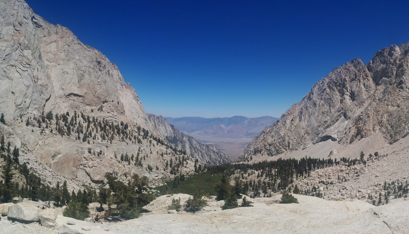 Nearly at Trail Camp...Laughing was arduous - a pity because we were never far from it - especially when the conversation turned to the use of our poop bags or WAG bag (Waste Alleviation & Gelling). There were bets placed as to who'd go first, who go most often and who might go on poop strike altogether!
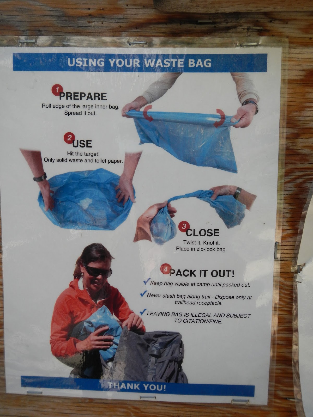 Instructions posted at the trail head
For a while conversation tapered and eventually we reached Trail Camp (12,00ft) around mid afternoon. Poor Wonder Woman's wheels fell off as a piercing migraine and nausea send her to her tent and filled the rest of us with feelings of empathy and helplessness. We ate dinner and watched the shadow of the mountains to the west creep up the sides of the mountains in the east,
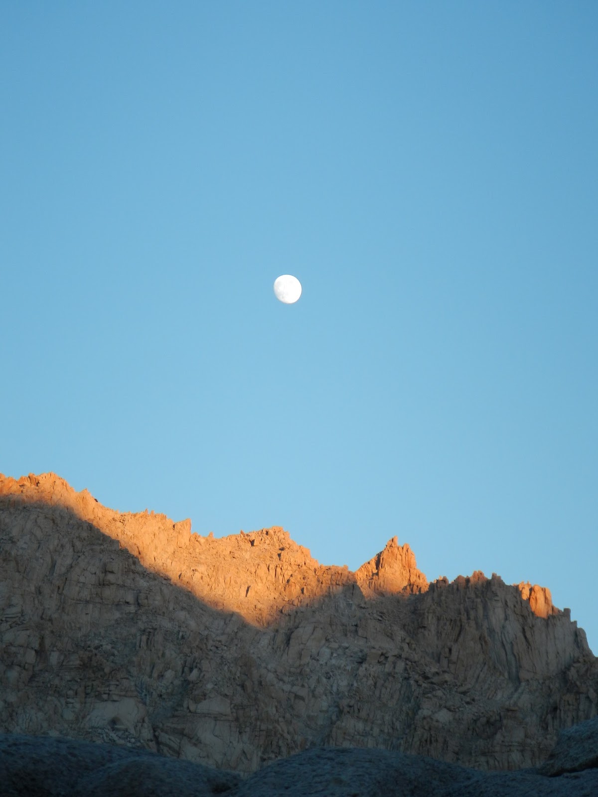
until the sun suddenly dipped below the ridge and the valley filled with a chilled shadow.
 We raced for our warm clothes and snuggled into puffa jackets and settled in for the night - all of us in bed for 8pm.
We slept a little - at least there was a time period of about 2 hrs that we couldn't account for. The moon was nearly full and we were luckily pitched in a moonlight shadow cast by an outcrop of nearby rocks. Even so it didn't prevent the stars from glittering fiercely undeterred by the deep blue background they were set in.
At 4.30am I decided to take advantage of the predawn darkness and use my WAG bag behind a nearby rock - suffice it to say, it was not as bad as I'd thought it might be- quite handy in fact - but still doesn't beat having a nicely plumbed en-suite! Though you'd be hard pushed to find a toilet with as nice a view...
By 5am the sun was glowing its entrance to the eastern sky as a red ball of light.
 Wonder Woman had recovered and was raring to go. We ate quickly and were on the trail for the summit by 6am.
 We'd been looking up at those switchbacks since we'd arrived at Trail Camp and though I know it took us hours to get up them, for us one slow step at a time, sucking as much air into our lungs as possible, I think one of the side effects of altitude is how it affects memory.
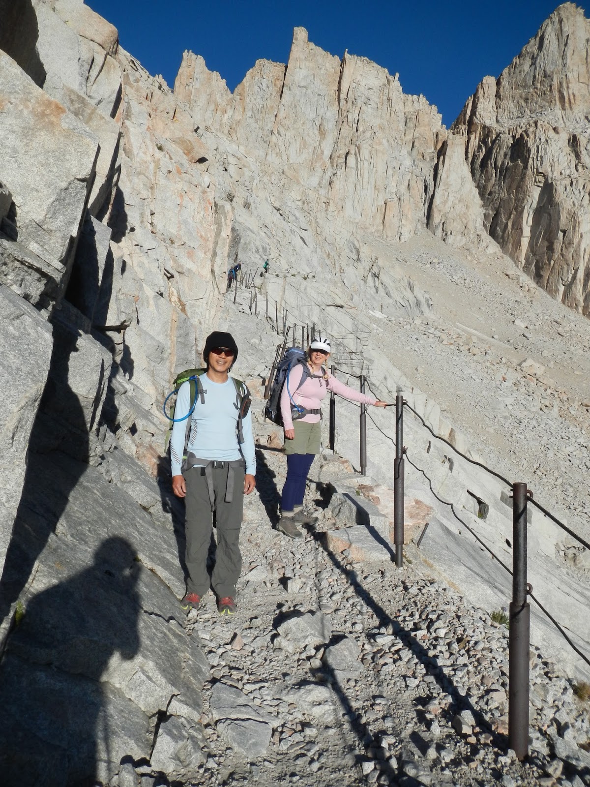 When I look back, I feel like it didn't take that long to get up to that first ridge. At Trail Crest, where you go over the ridge and slide in behind the sky-piercing peaks, Superman - now firmly established as our mountain guru, advised us to don a thin fleecy and a wind proof jacket.
 We took his advice and began the next bit which I can only describe as the Valley of the Shadow of Death.
 I don't know why I hadn't considered the fact that we'd have steep drop-offs and "scary" bits. Denial, I suppose. I'm just not great with heights if I'm freestanding - I get woozy and sway...vertigo sets in.
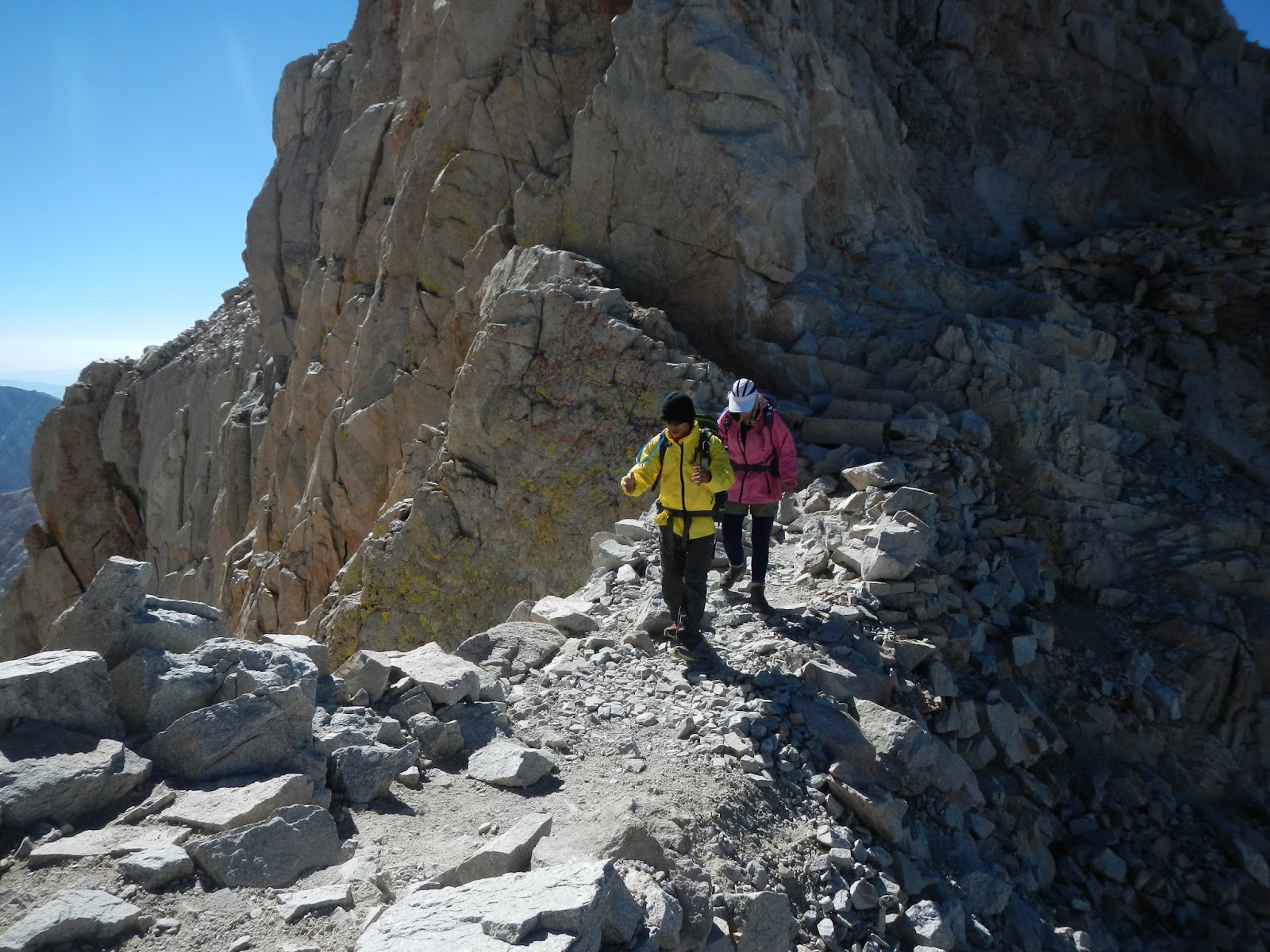 So this next section was arduous but stunningly beautiful, and I just focused on breathing because that had become the biggest challenge. My hands had swollen with fluid and looked awful but weren't painful, so I didn't pay much attention to it.
 The hardest 1.9 miles ever! Again, we were behind the others but they waited for us shy of the top, so that the Incredibles, Superman, Wonder Woman and the Flintstones all reached the summit at the same time. It was amazing!
 View from the summit of Mt Whitney looking down at Lone PineRemember where the big red arrow pointed in the first photo? That's where we were standing!
 We chilled out a bit, took photos, and drank in the scenery.
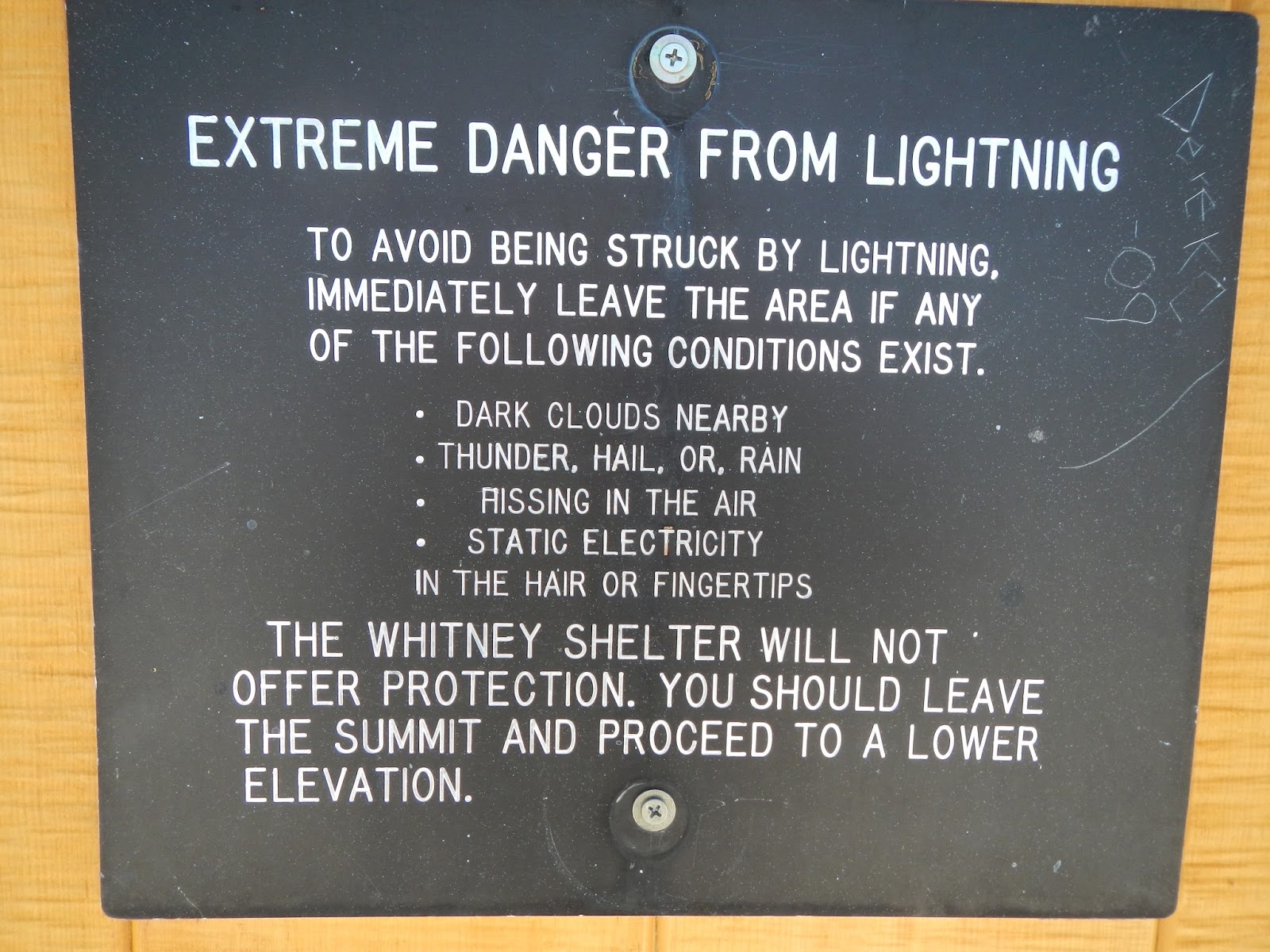 Then another climber reached the top and roared out in a booming voice for all to hear, "This is not the day we die..." followed by some probably famous motivational quote, which because of the altitude none of us can quite remember but ...it was good! So good that everyone cheered and clapped. It was really Hollywood.
As our wee Irish group looked at each other bemused, I said, "Well, we're on the top of the highest mountain in continental USA. You wouldn't expect anything less!"
"Yes," said Mrs. Incredible, “But where did he get the breath for that?"
We laughed, quiet little breath-conserving guffaws...
I was looking forward to the way down.
Looking down at Trail Camp from Trail Crest after leaving the Shadow of the Valley of Death! All downhill - I thought it couldn't be easier but at about 13,000ft my wheels fell off. I got a splitting headache and then needed to pee every 10 minutes - nowhere had I read anything about that as a side effect of altitude. It was a good job I'd taken a spare (clean) Wag bag with me too. I needed it - twice! Then nausea kicked in. I still had about 2 or 3 miles to go. I could see the lake we were camping by. If I walked anymore than a dozen paces, I had to sit down and catch my breath. Getting out of breath made me actually retch. It was a slow descent. I remember the thought I had at the time, "This is hell. When will it end?" But as I look back the memory of it is blurred, as if looking through a soft focus lens.Was this another effect of altitude?I walked into camp looking like a White Walker (this told to me by Mr. Incredible later during the postmortem!) My Husband put me to bed and Superman gave me an electrolyte drink after which I started to rally and soon had returned to the land of the living, thank God.
Dinner was more jolly, and we chatted about our day as we watched the sun head towards the peaks.
 This time we were prepared with our warm clothes as nature's lights switched out.
 Bed by 8pm and up the next day at 4.30am. I was starving and Mrs. Incredible had some leftover freeze-dry dinners which I gratefully accepted. Himalayan lentil and rice - a true breakfast of champions!
The trek out was easy and enjoyable, and the higher oxygen content most welcome. We had to strap our WAG bags to the outside of our packs, so there wasn't much conversation as we'd to stay well back to avoid each others WAG bag smell! There was plenty of toilet humor, of course, commenting on who had the biggest bag, who'd filled their bag and had been forced to use another person’s bag, who lost a bet and had to carry the entire Incredibles family collection down the hill... but we agreed that what happens on Whitney stays on Whitney - except the actual poop of course!
These challenges (I've also done the Alcatraz swim and the Grizzly MetricCentury in the recent past) are, for me, less about the fitness and all about the interpersonal relationships. I enjoyed watching My Husband bond with and really get to know these friends I've had for 20 years. Seeing the Incredibles children rise to such a huge challenge with the gusto and the determination gave us all something special that you don't get in ordinary circumstances.
As a metaphor for life, Whitney has it all. Getting to the top is just half way there. You aren't done until you are back down and for someone who feels that they are half way through life, like myself, it's okay if its "downhill" from here. Downhill is not a bad thing. Downhill is where the breathable air is, the place where you can reflect on the journey uphill and what it's like at the peak. It's were the vineyards, flushing toilets and ice dispensers are too. For some, climbing high may indicate success, but I'm not sure I agree - it's by no means comfortable up there. Lushness and beauty lie in the lower slopes. High up, the peak is exposed and the rocks bare. Success is enjoying wherever you are, high or low. And remember, no matter when or where it happens, you still have to carry all your shit with you, uphill or down.
Byddi Lee
Photos by Helen Cassidy
August 2, 2015
Preparing for Mount Whitney
When my mountaineering friends from Ireland suggested we climb Whitney together when they came to visit, I agreed on one condition - My Husband had to come with me. I guessed the camping element would put him off, he'd say "no" and I'd explain that I couldn't go with him etc etc. We still had to "win" a permit in the permit lottery. I guessed the whole deal would flop, and they'd find a marathon or triathlon to do with another crazy-fit mutual friend who lives here too.
To get some perspective on how fit these guys are compared to us, let me put it this way. The visiting mountaineers are like Wonder Woman and Superman, the mutual friend and her fitness fanatic family are The Incredibles (without Jack Jack - unless you include their dog who also goes running with them!) By comparison, My Husband and I are the Flintstones - and I'm not even Wilma or Betty, oh no - I'm Fred and he's Barney!
But I never win raffles and things like that, so I was quietly confident that we'd be grand - there'd be a road trip to somewhere nice and we'd have a great time, as it's impossible to not have a blast with those guys.
Mrs. Incredible applied for the permit back in February and waited for the results. I completely forgot about it and was pretty engrossed in organizing my Irish Book tour for March to November, starting around Easter. I was actually in Ireland when she sent me an email. We'd won the lottery and gotten the damn permit!
I hoped at this stage that My Husband would still say no, but to my shock (and horror) he said, "Sure why not?"
There were lots of reasons why not, but ultimately, I had no excuses...I had committed to it, and if I say I'm going to do something, I do it (or at least give it my best shot!)
We were set for Whitney at the end of July 2015 with 13 weeks to train for it from pretty much a standstill! So I found a 12 week training plan, printed it out and put it on the wall. I need to do the "crossing off "thing to inspire me. We had a week to stand and look at the plan before we began...
Then we started the training together...
There are so many elements to Whitney...
There's the distance - 22 mile round trip.
There's the elevation gain. You start at about 8000 feet (2400m) and need to gain 6500 feet (2000m)
There's the camping. We got a permit to camp two nights halfway up.
There's the carrying all your food and gear for 2 nights/3 days. We'd never hiked with heavy packs before but now we needed to buy the right kind of pack and get used to "mountain food".
There's the lack of plumbing. We needed to filter the water that we'd get from streams and lakes.
There's the lack of plumbing (part 2). There were no toilet facilities on the mountain so we'd have to pack out our solid waste - yes, that meant carrying our poo out in a bag!
And finally there's the lack of oxygen... Mt Whitney is 14,505 feet (4,421 m) high. We'd be hiking higher than a Cessna airplane can fly. It's the highest mountain on continental USA (lower 48 States) and the air is pretty thin up there. Altitude sickness was the big unknown. You can train and prepare for everything else, but not that...at least, not in the time frame (3 days) available to us.
Training for distance was fine - we followed our chart - ticked off our training schedule and basically had sore muscles for a solid three month period. At one point I wondered was it better to not train and just suffer the once! I hated the runs that had been scheduled. I learned to use the step machine while ironing and critiquing for my writing group - training is just so time consuming and hell, I have a life!
But My Husband and I found that we enjoyed the hikes, having hiked smaller easier hikes a lot, we liked expanding on this. It brought us closer too and we found we worked well as a team. The Incredibles were training too. The kids, 11 and 8, were getting some experience with backpacking and we kept up with their progress on social media, engrossed as we were on our own schedule.
It was hard to find high enough hills locally, but we did have a couple of hikes that had elevation gains of 3000-4000 feet. Since in any one day on Whitney we'd have no more than 4000 feet, we were happy to consider that as a good yardstick.
On April 26th we began with a loop of our local park clocking up an easy 3 miles and 630ft elevation gain.
 Looking at our house from Santa Teresa Park.As the weeks went on we donned packs, filled them with heavy stuff from our cupboards (the cans of soda exploded so we switched to bags of rice) and increased our hike length and elevation accumulation. By May 23rd we'd hiked the longest trail we'd ever hiked - El Sombroso - 11.8 miles and 3,083ft.
 Mt Umhamum as seen from El Sombroso peak. It was half the distance of the Whitney Trail and nearly half the total elevation we would need...we were making progress.
Then we attempted Murietta Falls - a "butt kicker" as described by the trail book, leaving from Del Valle Lake along the Ohlone Trail. We had 20lb packs and started off strong, but the steep descent of 500ft into a valley and ascent up the other side broke our spirits. We'd not been mentally prepared to descent mid-hike, and we worried that we'd run out of steam to make the 500ft ascent on the way home. So we turned back, a 1.5 miles short of our goal.
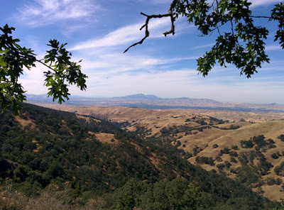 The turn around point on way to Murietta Falls.Two weeks later, we struck out for Mt Sizer in Henry Coe with 35lb packs and did the full loop - a whooping 15 miles and 4200 ft accumulated elevation.
 Mt Sizer hike.Yes, we'd arrived back at the car in pitch darkness, hearts pumping because we let ourselves worry about mountain lion attacks, falling down steep ravines and axe murderers - things that rarely happen but just might in the dark - well, maybe not the axe murderers, but we do watch too much TV!
Yes, we were nearly crippled the following day with aching legs, backs, arms ... well, everything, but we knew that as far as distance and elevation gain went, we were well on course for Mt Whitney. We just had to figure out the camping, the food, and the plumbing!
The hikes that followed that were fun and easily knocked off the list - Mission Peak,
 Me pointing at Mission peak summit were we'd just visited.
Mount Montara,
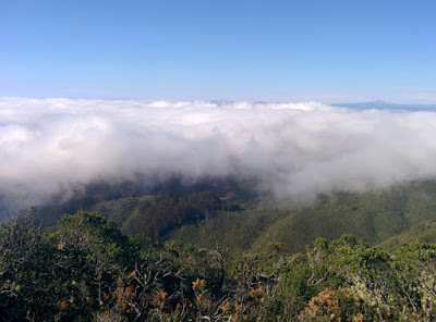 View from Mt Montara, near Pacifica, CA and a few blasts around Santa Teresa Park.
We decided to return to Henry Coe to practice backpacking. We only hiked far enough to find a campsite (1 mile!) and set up camp with a gorgeous view.
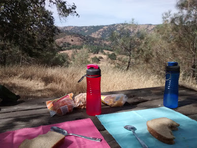 Campsite at Henry CoeThere were toilets too - so the plumbing was sorted out...or was it!
The pit toilet (called a long drop in some places) hadn't been used in a while and there were spiders everywhere. They'd strung their webs right across the opening of the toilet. We found big sticks and put on our head lamps. As I looked down the toilet, the light bounced on something in the pit, in a flash of horror, I thought it was a toddler standing down there about three feet tall. (I do read far too much Stephen King!) I forced myself to look and saw that it was a tower of turds! What with the drought and the ultra dry conditions, waste moisture was being wicked away immediately but the poops were landing roughly in the same spot each time and staying there without a cesspit to slough about in. The turd tower was building up like a stalagmite in a limestone cave, except this was a stalagshite!
Over the weeks we'd been experimenting with the freeze dried food packs and had selected our favorites. My Husband had thrown himself into the tech side of the project buying a Garmin, a personal locator beacon and most importantly a Jet Boil stove. This thing can boil water in a matter of minutes and it proved to be amazing.
 The JetboilTo filter water, he got us a gravity fed micro fiber filter but all the springs in Henry Coe had dried up so we practiced using the tanked-in water they provided.
Everything worked like clockwork, except for the sleeping bit - our foam mats were not soft enough and we couldn't get comfortable. We didn't sleep a wink and got up just before sunrise, packed up camp and headed for home.
After some research we decide to buy some ultra light backpacking thermarests. Our pack's weights were at their limit. We didn't want to carry any more than 35lbs. The thermarests were pricey but still less expensive than a night in a hotel. My Husband, not a fan of camping, refused to go backpacking just to try out our new sleep system, so we decided to put the tent up at home for one night. Embarrassed to be seen by our neighbors emerging bedraggled in the morning, we put the tent up on the bedroom floor.
We needed to make a pillow too. It reminded me of that scene in Apollo 13 when the guy says "You need to make this work with this using that." Only using what we were bringing, we shoved our spare clothes (there was very little to spare actually) and our puffa jackets into the stuff bags from our sleeping bags. The new mattresses worked well and by 1am we were both sound asleep in our tent on our bedroom floor. I awoke at 5am needing to pee. Getting out of the tent, I woke up My Husband. Since the purpose of the experiment was to determine if we could go to sleep on those mattresses and we'd proved that we could, we decided mission accomplished - it was okay to sleep in our own bed again. It didn't take us long to scramble into the real bed!
Two days later we attempted Murietta Falls again. And failed! My Husband wasn't feeling well. He'd developed a rash or been bitten by something on his hip. We suspected a spider bite... the wee monster had seemed to chow down, walk about and then chomp a little more. So my husband was feeling weak and sore, and we turned back, this time only one mile short of the falls.
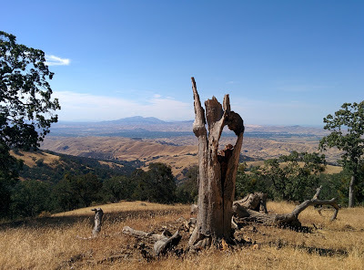 The turnaround point for the 2nd Murietta Falls attempt
Would we ever make it up to the Falls and was this an omen for the Mount Whitney Hike in less than three weeks?
To be continued....
Byddi Lee

To get some perspective on how fit these guys are compared to us, let me put it this way. The visiting mountaineers are like Wonder Woman and Superman, the mutual friend and her fitness fanatic family are The Incredibles (without Jack Jack - unless you include their dog who also goes running with them!) By comparison, My Husband and I are the Flintstones - and I'm not even Wilma or Betty, oh no - I'm Fred and he's Barney!
But I never win raffles and things like that, so I was quietly confident that we'd be grand - there'd be a road trip to somewhere nice and we'd have a great time, as it's impossible to not have a blast with those guys.
Mrs. Incredible applied for the permit back in February and waited for the results. I completely forgot about it and was pretty engrossed in organizing my Irish Book tour for March to November, starting around Easter. I was actually in Ireland when she sent me an email. We'd won the lottery and gotten the damn permit!
I hoped at this stage that My Husband would still say no, but to my shock (and horror) he said, "Sure why not?"
There were lots of reasons why not, but ultimately, I had no excuses...I had committed to it, and if I say I'm going to do something, I do it (or at least give it my best shot!)
We were set for Whitney at the end of July 2015 with 13 weeks to train for it from pretty much a standstill! So I found a 12 week training plan, printed it out and put it on the wall. I need to do the "crossing off "thing to inspire me. We had a week to stand and look at the plan before we began...
Then we started the training together...
There are so many elements to Whitney...
There's the distance - 22 mile round trip.
There's the elevation gain. You start at about 8000 feet (2400m) and need to gain 6500 feet (2000m)
There's the camping. We got a permit to camp two nights halfway up.
There's the carrying all your food and gear for 2 nights/3 days. We'd never hiked with heavy packs before but now we needed to buy the right kind of pack and get used to "mountain food".
There's the lack of plumbing. We needed to filter the water that we'd get from streams and lakes.
There's the lack of plumbing (part 2). There were no toilet facilities on the mountain so we'd have to pack out our solid waste - yes, that meant carrying our poo out in a bag!
And finally there's the lack of oxygen... Mt Whitney is 14,505 feet (4,421 m) high. We'd be hiking higher than a Cessna airplane can fly. It's the highest mountain on continental USA (lower 48 States) and the air is pretty thin up there. Altitude sickness was the big unknown. You can train and prepare for everything else, but not that...at least, not in the time frame (3 days) available to us.
Training for distance was fine - we followed our chart - ticked off our training schedule and basically had sore muscles for a solid three month period. At one point I wondered was it better to not train and just suffer the once! I hated the runs that had been scheduled. I learned to use the step machine while ironing and critiquing for my writing group - training is just so time consuming and hell, I have a life!
But My Husband and I found that we enjoyed the hikes, having hiked smaller easier hikes a lot, we liked expanding on this. It brought us closer too and we found we worked well as a team. The Incredibles were training too. The kids, 11 and 8, were getting some experience with backpacking and we kept up with their progress on social media, engrossed as we were on our own schedule.
It was hard to find high enough hills locally, but we did have a couple of hikes that had elevation gains of 3000-4000 feet. Since in any one day on Whitney we'd have no more than 4000 feet, we were happy to consider that as a good yardstick.
On April 26th we began with a loop of our local park clocking up an easy 3 miles and 630ft elevation gain.
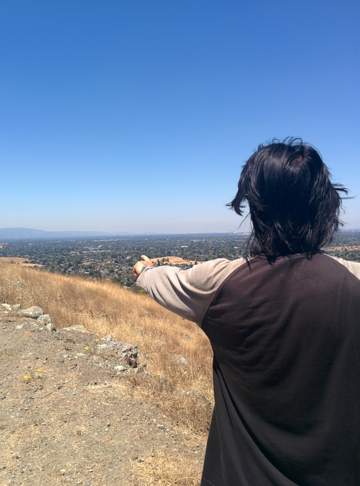 Looking at our house from Santa Teresa Park.As the weeks went on we donned packs, filled them with heavy stuff from our cupboards (the cans of soda exploded so we switched to bags of rice) and increased our hike length and elevation accumulation. By May 23rd we'd hiked the longest trail we'd ever hiked - El Sombroso - 11.8 miles and 3,083ft.
  Mt Umhamum as seen from El Sombroso peak. It was half the distance of the Whitney Trail and nearly half the total elevation we would need...we were making progress.
Then we attempted Murietta Falls - a "butt kicker" as described by the trail book, leaving from Del Valle Lake along the Ohlone Trail. We had 20lb packs and started off strong, but the steep descent of 500ft into a valley and ascent up the other side broke our spirits. We'd not been mentally prepared to descent mid-hike, and we worried that we'd run out of steam to make the 500ft ascent on the way home. So we turned back, a 1.5 miles short of our goal.
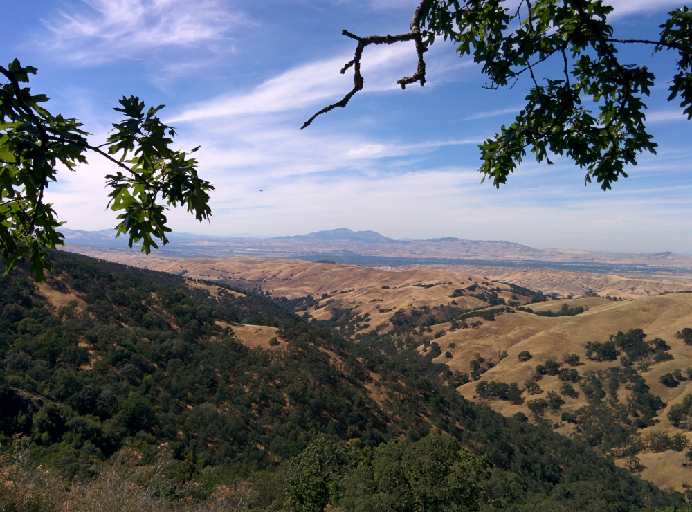 The turn around point on way to Murietta Falls.Two weeks later, we struck out for Mt Sizer in Henry Coe with 35lb packs and did the full loop - a whooping 15 miles and 4200 ft accumulated elevation.
  Mt Sizer hike.Yes, we'd arrived back at the car in pitch darkness, hearts pumping because we let ourselves worry about mountain lion attacks, falling down steep ravines and axe murderers - things that rarely happen but just might in the dark - well, maybe not the axe murderers, but we do watch too much TV!
Yes, we were nearly crippled the following day with aching legs, backs, arms ... well, everything, but we knew that as far as distance and elevation gain went, we were well on course for Mt Whitney. We just had to figure out the camping, the food, and the plumbing!
The hikes that followed that were fun and easily knocked off the list - Mission Peak,
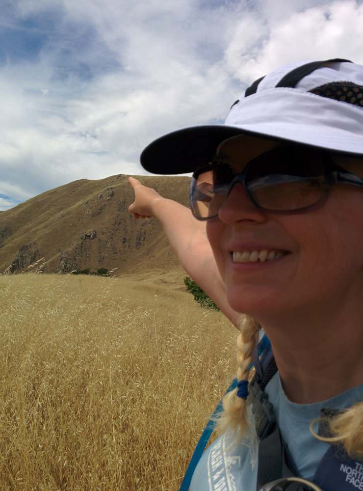 Me pointing at Mission peak summit were we'd just visited.
 Mount Montara,
 View from Mt Montara, near Pacifica, CA and a few blasts around Santa Teresa Park.
We decided to return to Henry Coe to practice backpacking. We only hiked far enough to find a campsite (1 mile!) and set up camp with a gorgeous view.
 Campsite at Henry CoeThere were toilets too - so the plumbing was sorted out...or was it!
The pit toilet (called a long drop in some places) hadn't been used in a while and there were spiders everywhere. They'd strung their webs right across the opening of the toilet. We found big sticks and put on our head lamps. As I looked down the toilet, the light bounced on something in the pit, in a flash of horror, I thought it was a toddler standing down there about three feet tall. (I do read far too much Stephen King!) I forced myself to look and saw that it was a tower of turds! What with the drought and the ultra dry conditions, waste moisture was being wicked away immediately but the poops were landing roughly in the same spot each time and staying there without a cesspit to slough about in. The turd tower was building up like a stalagmite in a limestone cave, except this was a stalagshite!
Over the weeks we'd been experimenting with the freeze dried food packs and had selected our favorites. My Husband had thrown himself into the tech side of the project buying a Garmin, a personal locator beacon and most importantly a Jet Boil stove. This thing can boil water in a matter of minutes and it proved to be amazing.
 The JetboilTo filter water, he got us a gravity fed micro fiber filter but all the springs in Henry Coe had dried up so we practiced using the tanked-in water they provided.
Everything worked like clockwork, except for the sleeping bit - our foam mats were not soft enough and we couldn't get comfortable. We didn't sleep a wink and got up just before sunrise, packed up camp and headed for home.
After some research we decide to buy some ultra light backpacking thermarests. Our pack's weights were at their limit. We didn't want to carry any more than 35lbs. The thermarests were pricey but still less expensive than a night in a hotel. My Husband, not a fan of camping, refused to go backpacking just to try out our new sleep system, so we decided to put the tent up at home for one night. Embarrassed to be seen by our neighbors emerging bedraggled in the morning, we put the tent up on the bedroom floor.
We needed to make a pillow too. It reminded me of that scene in Apollo 13 when the guy says "You need to make this work with this using that." Only using what we were bringing, we shoved our spare clothes (there was very little to spare actually) and our puffa jackets into the stuff bags from our sleeping bags. The new mattresses worked well and by 1am we were both sound asleep in our tent on our bedroom floor. I awoke at 5am needing to pee. Getting out of the tent, I woke up My Husband. Since the purpose of the experiment was to determine if we could go to sleep on those mattresses and we'd proved that we could, we decided mission accomplished - it was okay to sleep in our own bed again. It didn't take us long to scramble into the real bed!
Two days later we attempted Murietta Falls again. And failed! My Husband wasn't feeling well. He'd developed a rash or been bitten by something on his hip. We suspected a spider bite... the wee monster had seemed to chow down, walk about and then chomp a little more. So my husband was feeling weak and sore, and we turned back, this time only one mile short of the falls.
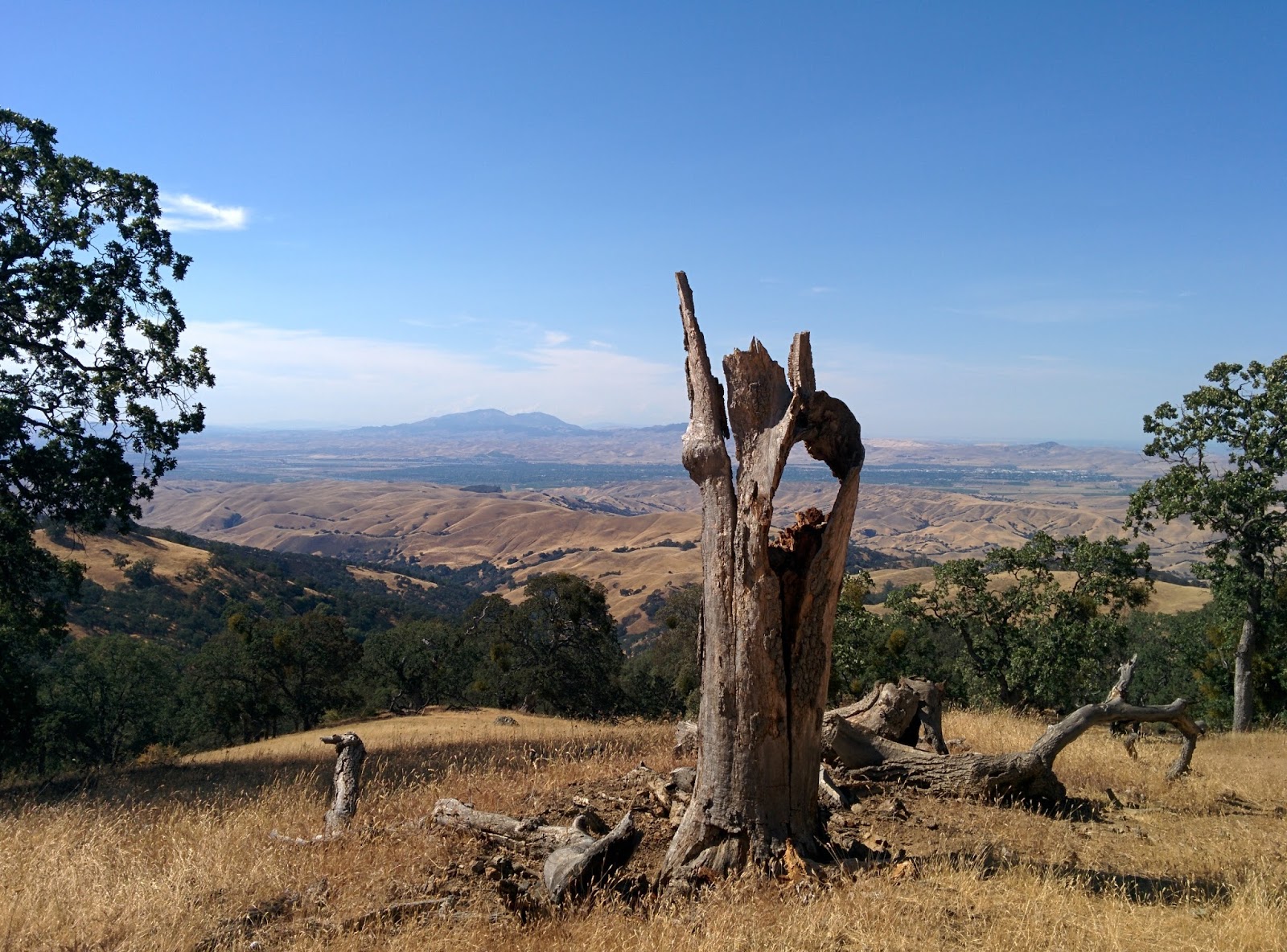 The turnaround point for the 2nd Murietta Falls attempt
Would we ever make it up to the Falls and was this an omen for the Mount Whitney Hike in less than three weeks?
To be continued....
Byddi Lee